

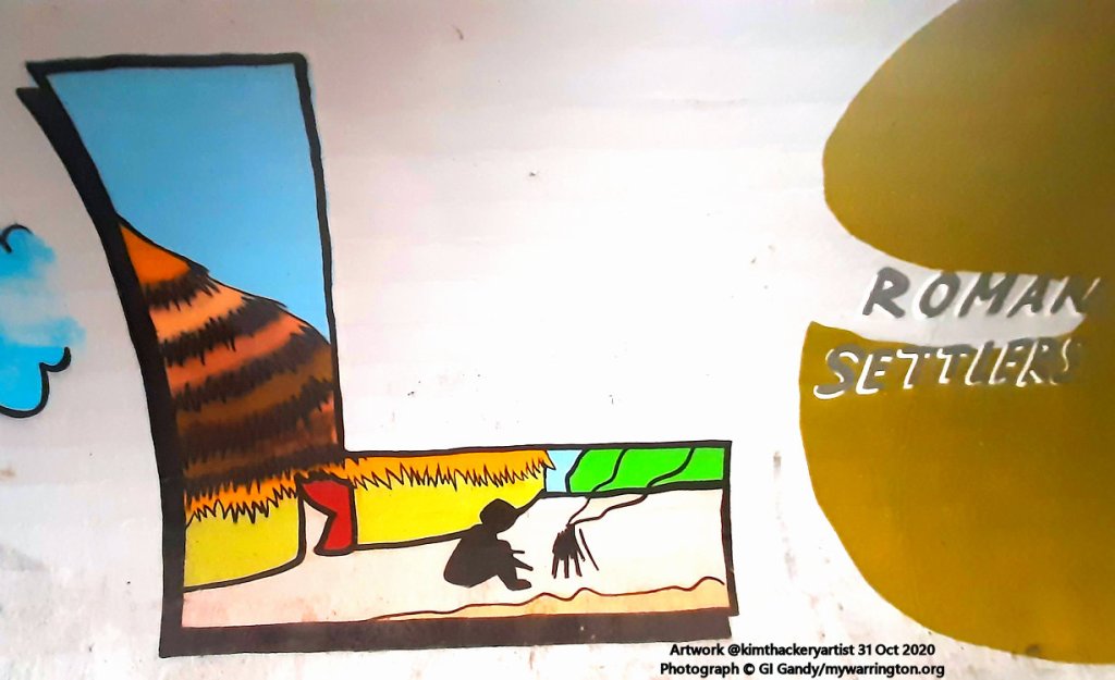
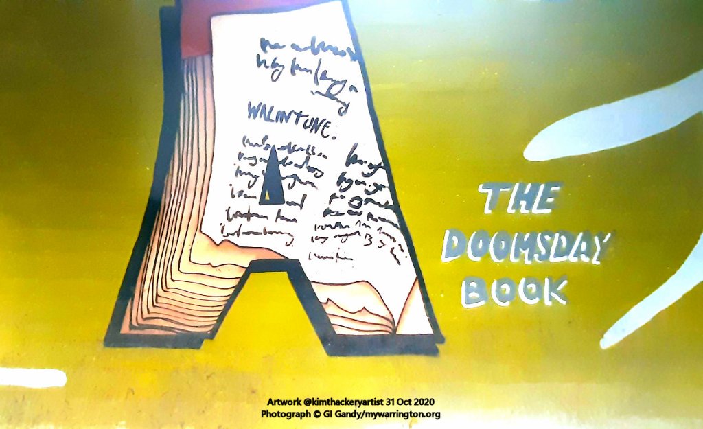
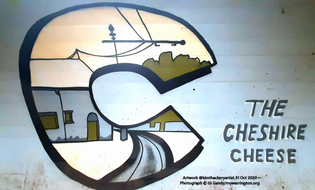
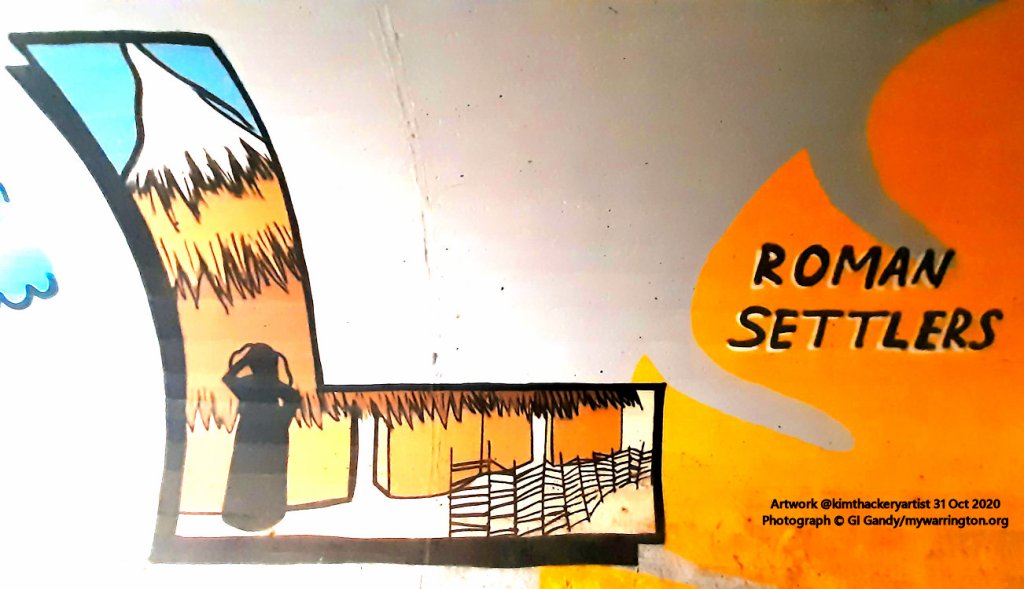
- Introduction
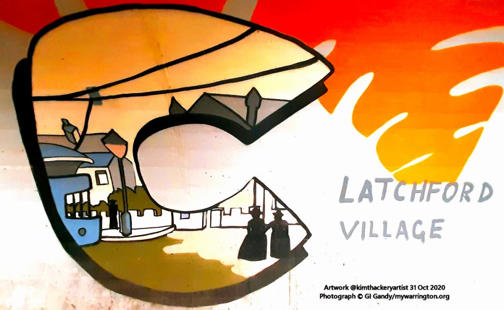
- The Village Name
- The Family Names
- The Ancient Ford
- The Feud over the Ford
- 14th Century Latchford
- 15th and 16th Century Latchford
- 17th Century Latchford
- 18th Century Latchford
- 19th Century Latchford
- Village Life
- Trans Pennine Trail
- Cantilever Garden Centre
- Church Life
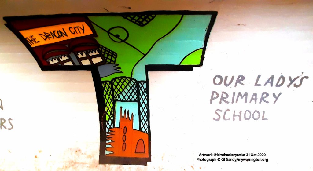
- School Life
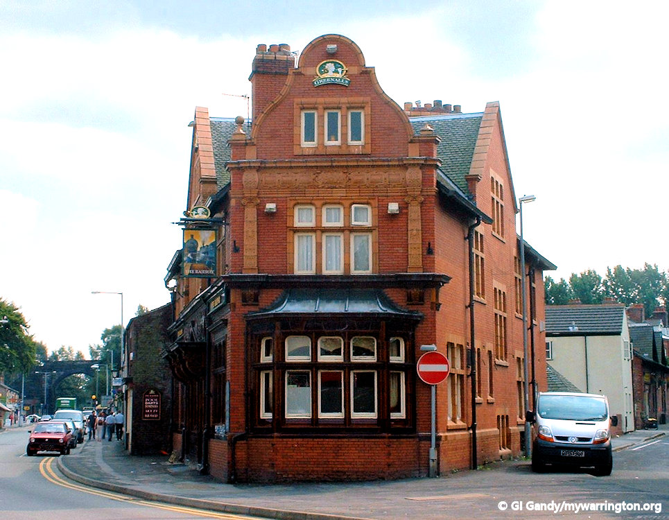
- Pub Life
- Warrington Town F.C.
- Westy


Introduction
In 1870-72, John Marius Wilson’s Imperial Gazetteer of England and Wales described Latchford like this:
LATCHFORD, a village, a township-chapelry, and a sub-district, in the district of Warrington and county of Chester. The village stands on the river Mersey, at the boundary with Lancashire, adjacent to the Bridgewater and the Old Quay canals, near an intersection of railways, 1 mile SE of Warrington; is partly within Warrington borough; communicates with Warrington by a stone bridge over the Mersey; and has a station on the Manchester, Lymm, and Warrington railway.—The chapelry comprises 1,010 acres, and is in Grappenhall parish. …
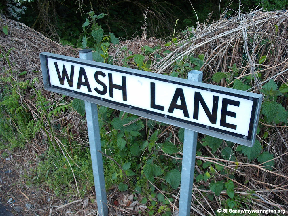
Post-town, Warrington. Real property, £8,872; of which £205 are in gas-works. Pop. in 1851,2,542; in 1861,2,885. Houses, 573. The land is divided chiefly among five. Cotton manufacture, hair manufacture, tanning, brush-making, wire-working, and pin, file, and tool-making are carried on. The living is a p. curacy in the diocese of Chester. Value, £111. Patron, the Rev. T. Greenall. The church stands on Wilderspool causeway; is a good edifice, in the pointed style; and comprises nave, three aisles, and chancel, with a tower. A chapel of ease to Grappenhall stands in Wash-lane; was built in 1861; and consists of nave and chancel, with a spire. There are chapels for Baptists and Primitive Methodists, and two infant schools.—The sub-district contains also the rest of Grappenhall parish, and a township of Runcorn parish. Acres, 3,967. Pop., 4,054. Houses,
GB Historical GIS / University of Portsmouth, History of Latchford, in Warrington and Cheshire | Map and description, A Vision of Britain through Time. URL: https://www.visionofbritain.org.uk/place/5017.
Date accessed: 12th August 2024
The Village Name
The name Latchford comes from Anglo-Saxon Læccford, meaning “Boggy-stream ford”, or “a ford over the laecc or stream”. The stream in this case is the river Mersey, which was crossed at this point by a ford before the first wooden bridge was built.
Latchford is a suburban district and electoral ward in south Warrington, lying between the River Mersey at Howley and the Manchester Ship Canal at Stockton Heath. A swing bridge, a high-level road bridge and the disused Latchford railway viaduct cross the Manchester Ship Canal here.
Latchford was originally a township in the ancient parish of Grappenhall, in Cheshire. It was also part of Bucklow Hundred, and was close to the border with Lancashire, the border between Lancashire and Cheshire here being the River Mersey.
The Family Names
So important was the village of Latchford that it gave his name to a local family, one of whom, was Robert de Lacheforde, of Cockersand abbey, who lived about the year 1267. He earned a title to be gratefully remembered by monastic antiquaries as the compiler of the valuable coucher book of that house, and one of the witnesses to a grant to William de Sonkey of landing Kenion was Robert de Clerk of Lacheford. A Henry fitz John de Lacheforde occurs as a landowner in Warrington in one of the Boteler deeds in the 32nd year of the reign of Edward III (1362). John de Lacheforde released lands in Chester to Randall Warburton in the 16th year of Henry VI reign (1438). A John de Lacheforde of Warrington and Ibota his wife, appeared to have been land owners in Chester in 1391. A Thomas de Latcheford rented a fish yard in Warrington under Sir Thomas Boteler in 1532.

Part of Latchford and a small part of Thelwall became part of Warrington when the town became a Municipal Borough in 1847. Between 1894 and 1974, part of the village was placed within the County Borough of Warrington, and the registration [?] county of Lancashire, whilst the rest of Latchford became a civil parish named “Latchford Without” (in Cheshire) and transferred from Cheshire to Lancashire in 1898. With the local government reforms of 1974, Latchford was transferred back to Cheshire, as part of the newly formed Cheshire borough of Warrington. See www.ukbmd.org.uk for more.
The Ancient Ford
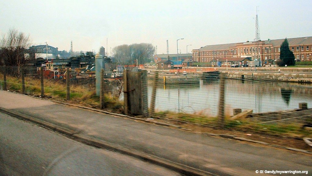
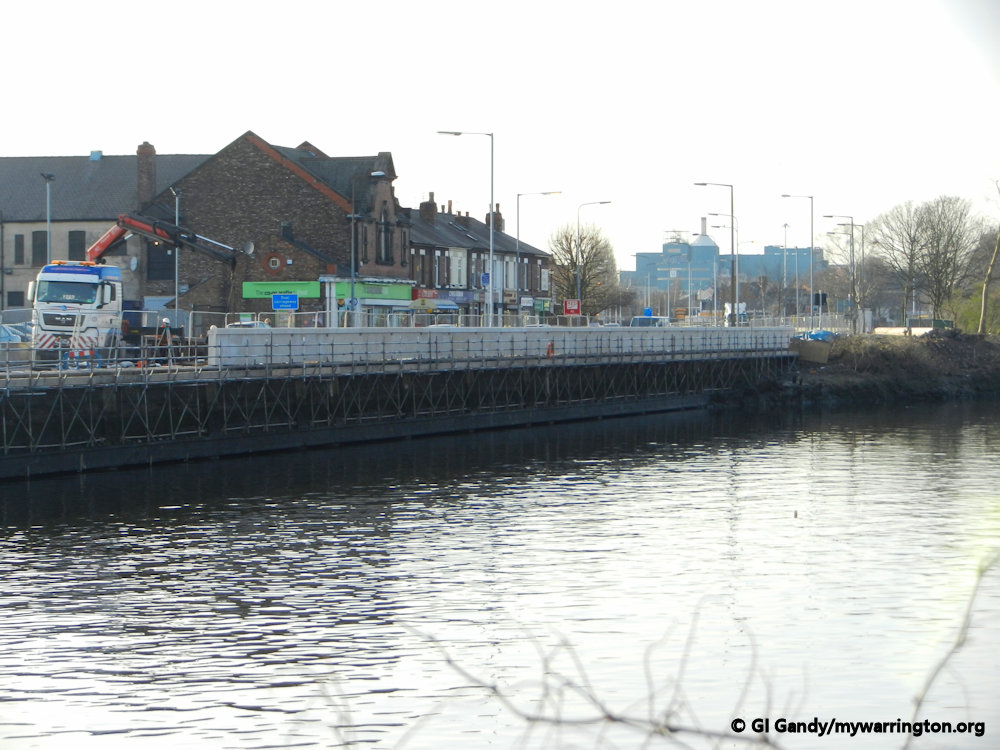
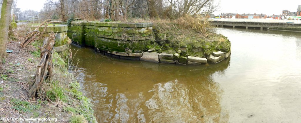
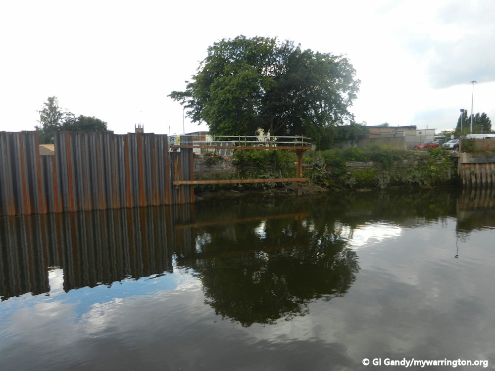
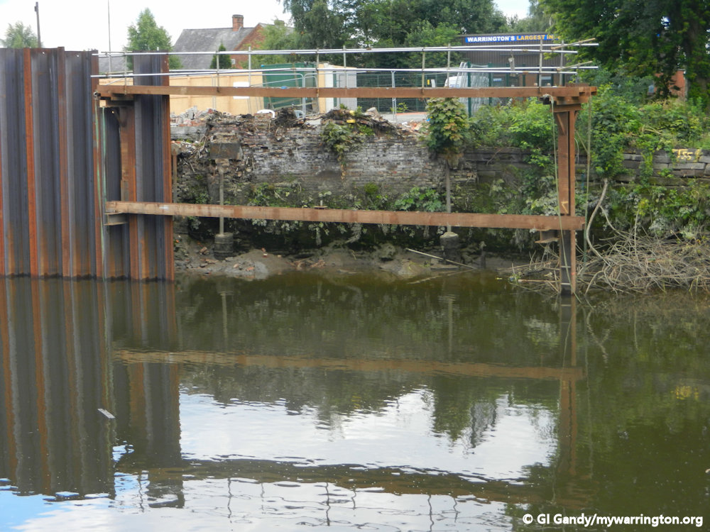
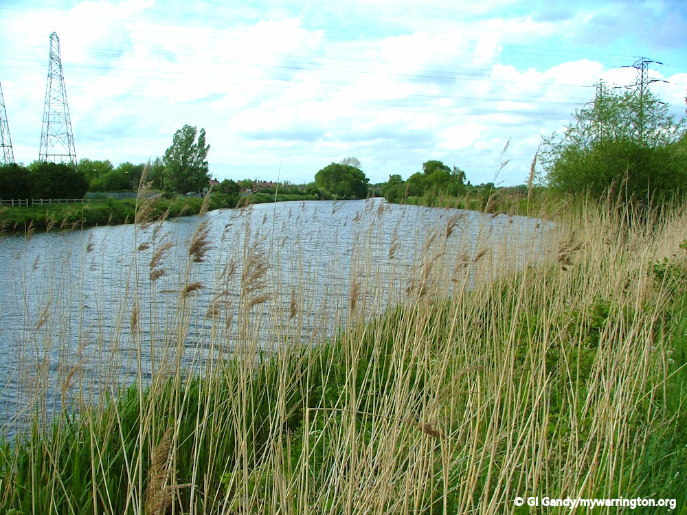
The position of the ford is marked ancient ford on the Ordnance Survey map of 1875 to 1877 (Cheshire sheets XV1.8) although the loop of the river on which the ford was situated disappeared in the early 18th century following alterations to its course to suit industrial needs.
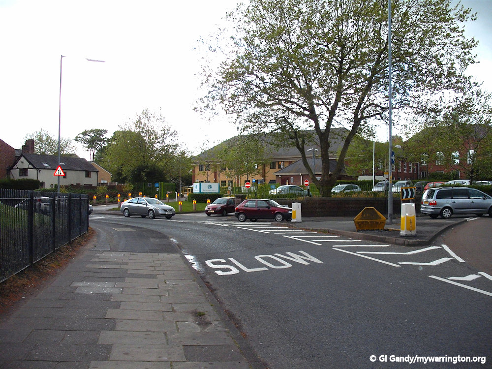
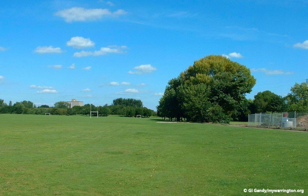
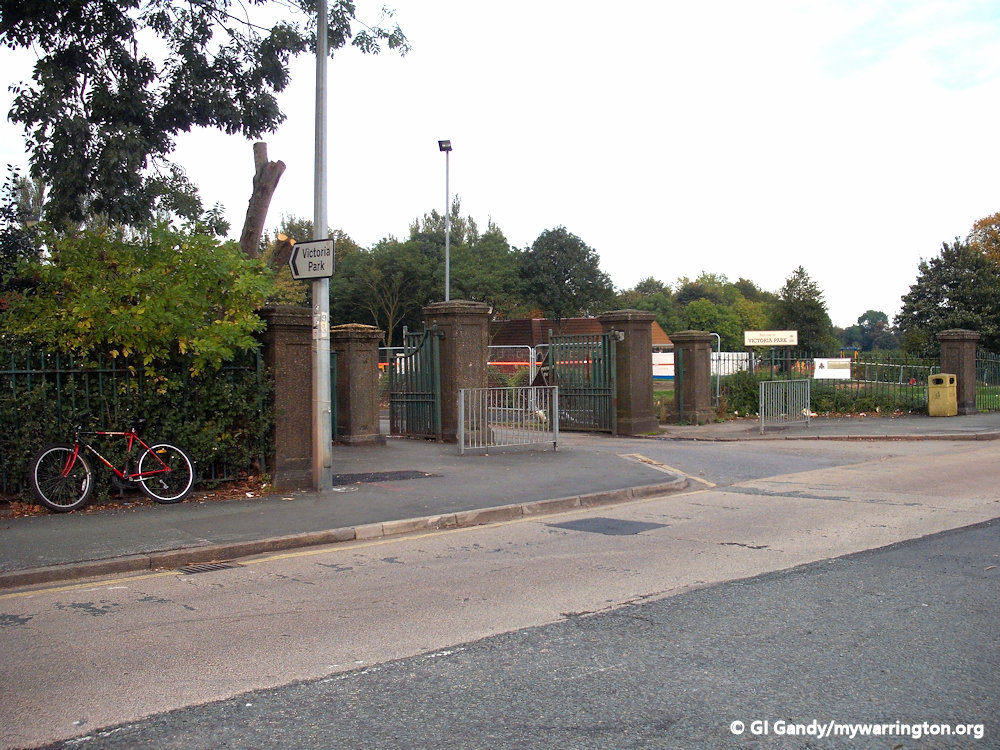
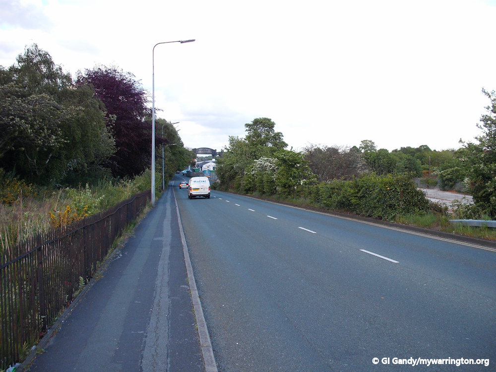
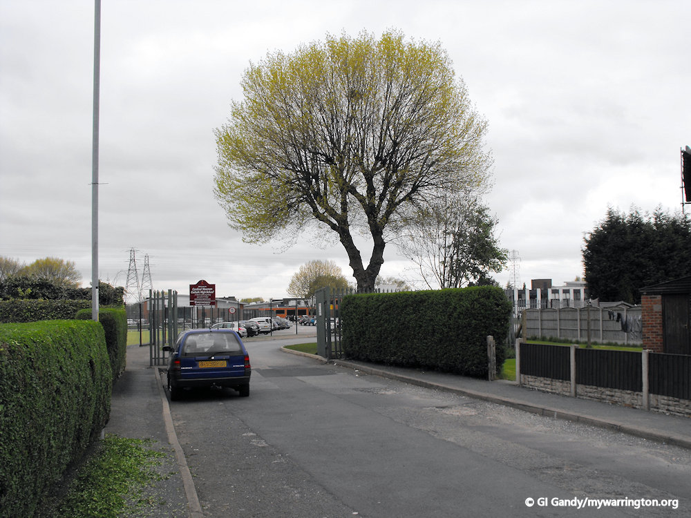
One of the reasons that Warrington became so important in the early days is because it was the only place west of Manchester where you could actually cross the river Mersey and this was by way of the ford at Latchford. This ford is said to originate close to where Black Bear Bridge is now north of Wash Lane and on land owned by the Boydell Family of Grappenhall and Latchford. The Boydells charged a toll for crossing the ford, which as we shall see later, caused issues for another local family, the Botelers of Lancashire.
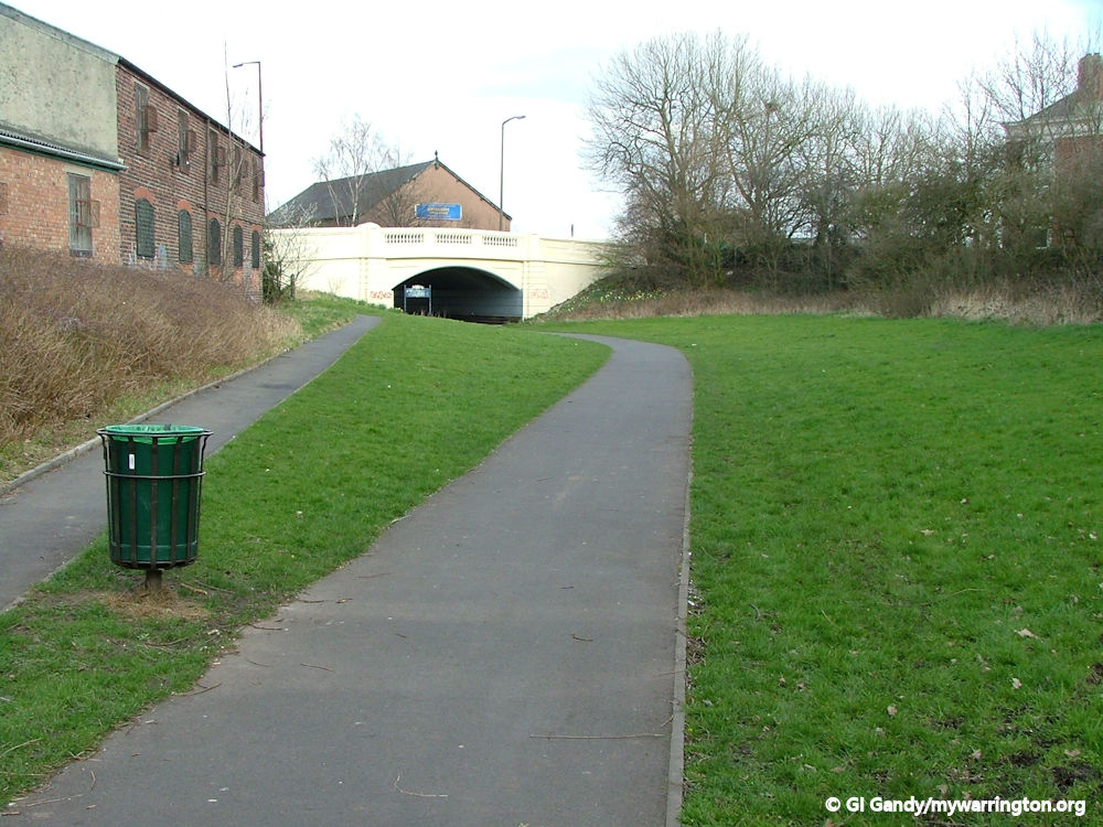
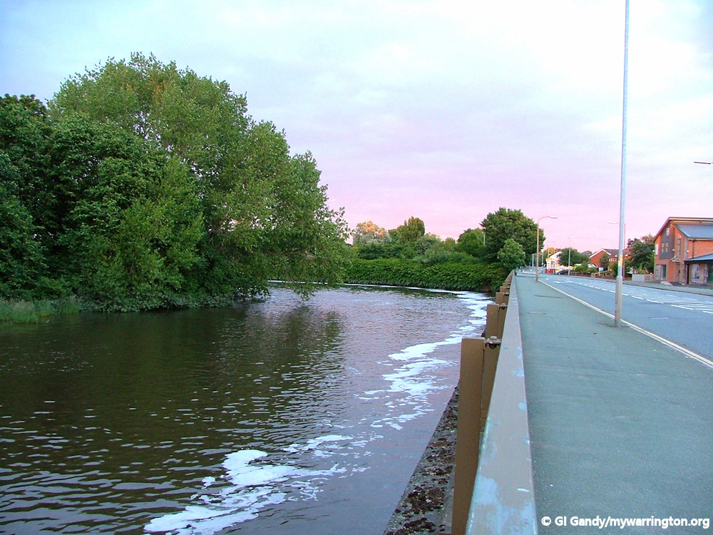
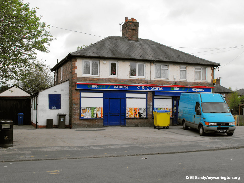
The ford was located close to the building on the left of the photograph.
The ford was essential for people settling in Warrington and north Cheshire. As early as the Middle Bronze Age (c1500 – 1000 BC) men and women lived here, but they tended to reside in the Grappenhall and Winwick areas. Evidence of this can be viewed in Warrington Museum with items including cinerary urns which were found around the Stanney Lunt Bridge area of Grappenhall.
William Beamont in his history of Latchford Cheshire Township on the South Side of the Mersey quotes a Manchester historian who, after referring to traces of the Roman roads near Warrington, wrote in 1771 that “All these roads around the area must have met at the old ford over the Mersey. There the northern and southern routes almost meet and there was always the way into the town of Warrington from Cheshire even to the days of our 7th Henry and the erection of the present bridge; and the roads in Stretton which points out the course of the southern road near Warrington, lies directly in line betwixt the old ford and the angle that the road now forms in order to reach the bridge.

A boggy patch of land close the where the original ford was located north of Wash Lane close to Black Bear Park.
“Here, therefore, just upon the ford of the Mersey was a Roman station though equally overlooked by antiquaries and forgotten by tradition. The ford was at the extremity of some flat pastures and led directly into a village, which from it is denominated Latchford. It was formed by a shoal of gravel upon a bed of marl, was about 30 yards in width, and had frequently in a dry summer not more than two feet of water upon it. The road of access to it was by the lane at the angle of Church Street across the level fields which are called the Broad Howley, or low grounds, and along the margin of the river.
“Upon a stream whose largeness has made it frequently the boundary of kingdoms and whose rapidity and deepness must ever have made it formidable to passing armies, this ford, the only certain passage over the river from the mouth of its channel to the shallow at Thelwall (where, near the old warps, there was very early a weir and a salmon fishery, but I find that in high tide the water rises three or more feet above the weir at Woolston, which is two or three miles higher up the river then that at Howley) must necessarily have been a post of some importance in war”.

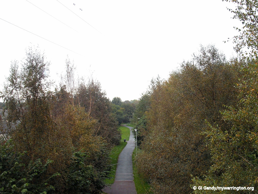
Here is another angle showing the proximity of the ford location to Black Bear Park, this time beyond the trees to the left of the path.
The Feud over the Ford
Soon after the Norman conquest and long before a bridge had been built at Warrington the right across the Mersey by afford or ferry I been granted to hue the Boydell in the reign of Richard the 1st 1089 to 1099 by Randall D blunder Ville the six rail of Chester by a charter which gave the Boydell family: the way in Latchford, with the passage of the water of the Mersey, between Runcorn and Thelwall so that no wain (waggon) of two horses shall pass the said way and passage except by the allowance of the said Hugh and his heirs.
This meant that the Boydell family were entitled to collect tolls from all those people crossing the river between Runcorn and Thelwell and the most lucrative crossing being the ford at Latchford with its access to the growing markets on the north bank and a river in Warrington.
For almost two centuries the growing source of income remained vested in the Boydell family until a bridge was erected around about 1285 in that year the Butler family of Warrington and Lancashire were granted pontage for four years on goods passing over Warrenton bridge this reference to Warrington bridge in the calendar of patent rolls 1281/92 is the first reference to a bridge at Warrington and this bridge must have been newly erected about this time.
Obviously, a royal concession to a Lancashire family to collect tolls from the crossing of the river at Warrington was obviously going to cause some friction for the boy dells who had the rights to the forward at Latchford so much so that the Boydell family in 1328 were called before the Sheriff of Cheshire to ask them why they had blocked certain roads on the Cheshire side of the river which gave access to the Warrington bridge.

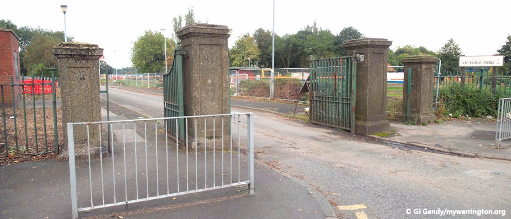
A view towards Knutsford Road from Black Bear Park, with Victoria Park on the right.
In another of his works, “Walks About Warrington Towards the Beginning of the Present Century”, Beamont says “By some old agreement, the origins of which may have risen out of the right to take toll from all persons who use the highway between the Golden Lion Tavern and the Black Bear Bridge, in right of which they [the Boydells] held certain land on the south side of the highway they were bound to maintain the highway at their own charges, but only of the width of about 12 or 14 feet an arrangement which, by agreement with the county of Chester, was finally put to an end by the county taking on it to make and maintain the road of the sustainable width of 30 feet.
By 1364 the first Warrington bridge have been washed away or broken down (we don’t know what happened there) for Edward deferred gave his royal protection to Sir John Le Boteler, Geoffrey de Werburton and Matthew de Rixton and whilst they were engaged in construction while they were engaged in constructing afresh the bridge at Warrington.

A view north of Knutsford Road with the ford site to the right and Wash Lane to the left
Incidentally the name of the river Mersey as we now call it, originated in the year 1002 when the Saxon Wulfric endowed the monastery of Burton with his lands between Ribble and “Merse” that we found our noble river first appearing under a name we would recognise today. It means “boundary river” and originally separated the two kingdoms of Mercia and Northumbria. You might have asked yourself why the first bridge at Warrington wasn’t built at the same location as the ford.
The easy answer is because the land there was low and liable to flooding. Also, the ground on each side was soft and marshy and therefore unsuitable for foundations to support a bridge.
You can read more about Warrington’s bridges in the river Mersey section of On the Waterfront G.A. Carter’s book, Warrington Bridges 1285-1985.
See also the Grappenhall section of Downtown for more on the Boydell family.
14th Century Latchford
In 1305, probably because the population of Latchford was then pressing too closely on its enclosed and cultivated lands, Sir John fitz William Boydell entered into an agreement with David, son of Patrick D Barton, that the Commons in Latchford should be divided, and that free parts of the land of all kinds there should be the rights and inheritance of sir john comma and the 4th part should be the inheritance of the said David D Barton.
In 1308 Sir John Fitz William Boydell, wishing to secure spiritual benefits for himself and dame Margaret his wife, which were highly esteemed at the time, made a charter to the hermit Friars of the order of Saint Augustine at Warrington, a young religious house then struggling to establish itself in the popular favour in that neighbourhood (it’s where the Friar Penketh pub stands today).
The charter said:
“To all the sons of holy mother church John Boydell Lord of Gropenhale and Latchford wishes health. Know ye that for the health of my body and the safety of my soul, the soul of Dame Margaret, my wife, and the souls of my heirs, and my parents living and dead, and of all the faithful dead, I have given to God and the blessed Virgin Mary and the blessed Augustine, at Warrington, a free passage through the village of Latchford, for their wains, by what name soever they may be called, so that every priest brother of the convent celebrate mass on the day of my anniversary for my soul and for the souls of my parents and of all the faithful dead”.
This charter was meant to save the friars from paying tolls on passing the ferry or ford, or through the Boydell lands.
The records tell us that some persons had made encroachments on the established rights and franchises of the owners of the fords and ferries over the river. On 11 October 1366, the sheriff of Cheshire Richard de Whyteleigh and others had a commission to arrest the men and boats of all such persons as made passage across the Mersey in places not before accustomed.
By the middle of the 14th century, the Latchford population had increased so much that Sir John Daniels and Dame Joan his wife, who by the death of William Boydell had succeeded to part of the inheritance, applied to the Black Prince, who had before shown himself their patron and friend, to grant them his charter to hold fairs and markets there.
The charter, dated 3 March 1387, granted two yearly fares – one on the eve, the day and the morrow of St John Before the Latin Gate (possibly on 5 and 6 May), and the other on the eve, day on the morrow of St Luke the Evangelist (17 and 18 October), with two markets weekly on Wednesday and Friday. Beamont states there is no evidence the markets in Latchford actually took place. Warrington had already been granted its market and fair charter in 1255.
15th and 16th Century Latchford
In some ways during the 15th century life in Latchford basically stayed the same. Along with Grappenhall the village of Latchford would remain predominantly based on farming and agriculture which stayed like that really until the 19th century but other things were starting to happen. Warrington bridge for instance was a toll free bridge, and under the reign of Henry the eighth the Friary Zen monasteries were dissolved but also we had the beginnings of the Butler grammar school which was eventually moved Latchford, and we’ll be discussing that in much more detail later on.
One of the things that didn’t change quickly in those times were the roads and this would have been noted by King Henry VII, the first monarch to passed over Warrington bridge on the 28th of July 1495. Regarding agriculture, corn was one of the products that was ground at the Latchford or Stockton Mill and sometimes called the Lumbrook Mill. This was a water mill, powered by the water from the Lumb Brook and was situated in the vicinity of Ackers Pit in modern-day Stockton Heath. According to the records, in 1628 this mill (which was mentioned in the Legh survey of 1495) was leased by Thomas Marbury, together with a field in Latchford called Lumbrook Field to John Middlehurst and the same mill was leased by the same owner 28 years later in 1656 to one William Baker with no difference in rents are terms from the earlier lease to John Middlehurst.
17th Century Latchford
The 17th century was the time of the English Civil War and in the early stages of that conflict (3 April 1644) a royalist supporters from Warrington under the command of James Stanley, 7th Earl of Derby, had marched through Latchford to inflict a heavy defeat on parliamentary forces under the command of William Brereton in a first engagement in Stockton heath I’m within a few weeks Warrington was again under attack from parliamentary forces under Colonel Assheton and Sir George Booth and after a siege lasting 5 days the Royalist governor of Warrington Colonel Norris gave up the town on 27 May 1643 which thereafter was garrisoned for parliament with Colonel John Booth as governor.
The second conflict in the English Civil War was five years later 16th of August 1648 Warrington bridge was the scene of another running battle from Preston to Warrington between a Scottish army under the Duke of Hamilton and Oliver Cromwell, which resulted in a complete defeat of the Scots and the presence of Oliver Cromwell in Warrington for a few days.
After Charles the first had been beheaded in 1649 his son was crowned king in Scotland on 1st of June 1651 and in August that year a fight took place at Warrington bridge when the royalist forces supported Charles II succeeded in crossing the Mersey and passing through Latchford an into Cheshire and eventually to Worcester where they were cut to pieces on September the third. Dale of Derby was captured in Cheshire after this battle, sentenced to death Chester and lead over Warrington bridge for execution in Bolton on 15 October 1651.
18th Century Latchford
The 18th century saw massive changes across the whole country, and Latchford was no exception. The Industrial Revolution was to alter the way most people worked as much of the manual work was now starting to be done my machines. Thomas Patten had improved the transport links between Liverpool and Manchester by making the Mersey navigable. This was achieved by the Mersey and Irwell Act of 1721. This was when the loop in the Mersey at Latchford was created and the ford disappeared as the river was re-routed to cope with bigger boats. In 1724, a series of weirs were built on the Mersey at Latchford and in 1777 the first steam engine was installed in a Warrington factory, Peel’s cotton mill in Latchford. It was designed by James Watt.
Two horse-related stories about Latchford come from the 18th century. The first is about horse racing Latchford Heath. This event, on 19 and 20 July 1750, was advertised in the Manchester Magazine. The second concerns an advert in “Eyres Weekly Journal” or “Warrington Advertiser” regarding the postboy blowing his horn as the stagecoach thunders over Warrington Bridge to Latchford on its journey south to London.
In 1769, we have a notice of Latchford by a traveller who then visited the place which makes us wish that the river was pure, and the fish is abundant at our doors now. Here he says I caught great quantities of fine salmon and smelts, uncommonly large, which in the spring you sent to London three times a week by the stages. By weirs and locks the river is made navigable to Manchester, to and from which place much merchandise is carried, in barges of about 60 tons burden, and on its banks are pepper mills, gunpowder mills, and slitting mills.
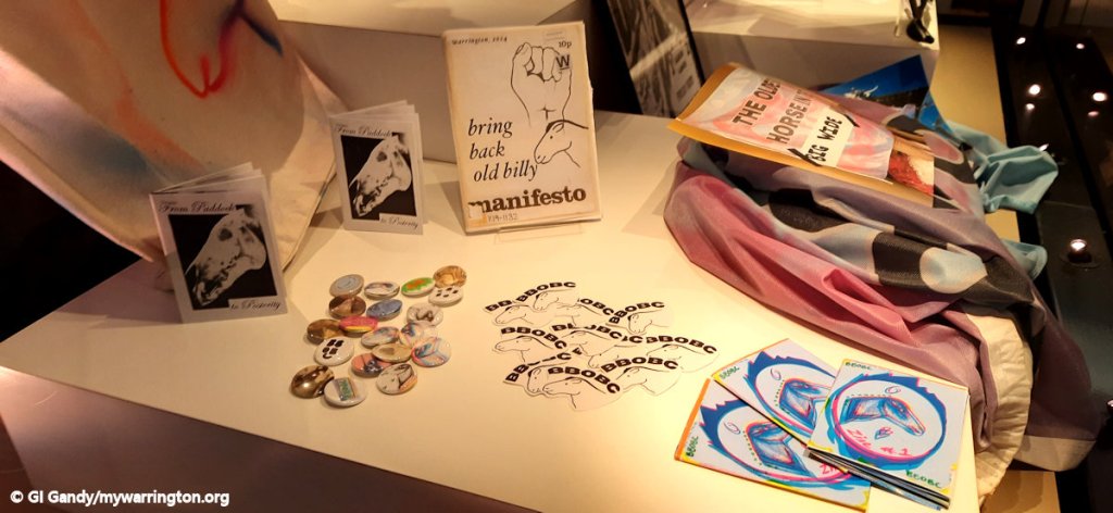
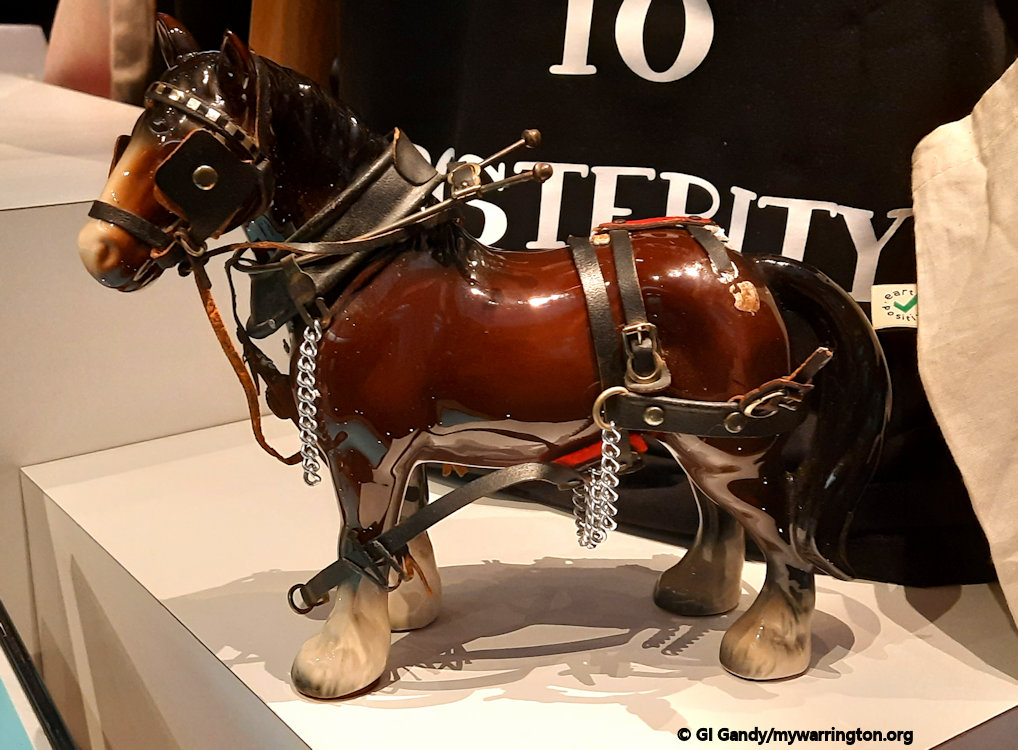
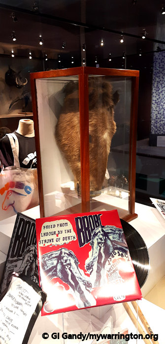
Old Billy
Old Billy (AKA: Billy Boy or Billy) was born in England in 1760 and he lived as a barge horse that pulled barges up and down the river and canals. He was foaled at Wilgreave Farm in Woolston where he learned to pull a plough. He worked for the Mersey & Irwell Navigation Company for 57 years before retiring to a farm close by. Part of his daily duties including lifting heavy loads in and out of boats and pulling other horse-powered machinery. But don’t make him hungry – you wouldn’t like him when he was hungry. Apparently he had quite a temper at those times.
Old Billy was said to look like a big cob/shire horse. He was brown with a white blaze. Old Billy died on 27 November 1822 at the age of 62. His lithograph was published, showing Old Billy, with Henry Harrison, who had known the animal for fifty-nine years.
Billy’s skull is currently displayed in the Manchester Museum, but the taxidermy of his head-skin has been at Bedford Museum since 1932. In the summer of 2024 Warrington Museum, working with children in the town, created an exhibition about Old Billy, which included the revisit of his skull to Warrington. The project was down to the effort of over 20 visual artists, musicians, writers, teachers and performers from the north west of England in addition to children at Westy Community Centre Youth Group and Penketh South Community Primary School.
My favourite line from the notes on his life at the exhibition was the information that said Billy worked for the Mersey and Irwell Navigation Company pulling boats from 1793 until his retirement since 1819. He lived out his last years at Old Warps, a large house and farm at Latchford, which is now part of Victoria Park. During Billy’s retirement, he was asked to take part in king George IV’s 1821 Coronation, but on the day he refused to leave his stable! It is said that his body is buried on Victoria Park, but I haven’t come across a memorial to him in any of my visits there.
(Some information from Wiki Wikipedia).

Here are some photos from the Warrington Museum exhibition (19 July – 20 November 2024). Click the first image for a manual slide show.


See also the Warrington Guardian story.
The Old Quay Canal Company
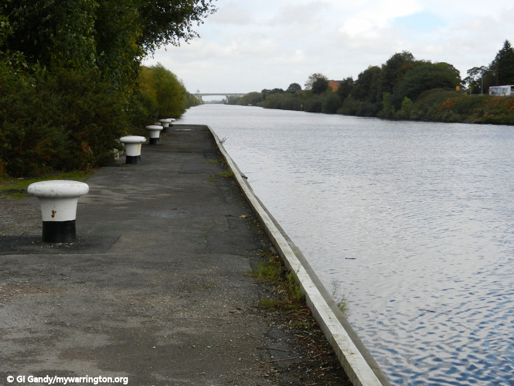
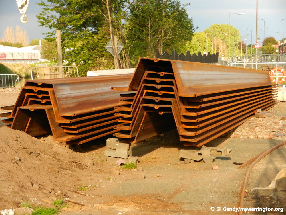
In 1794 the Old Quay Company, having obtained an Act of Parliament to build a canal from the river Mersey at Latchford to Runcorn, built a lock at Latchford as the starting point of a seven mile (11km) waterway.
The route was chosen to avoid the shallow stretches of the Mersey at Fiddler’s Ferry and the Old Quay Canal, also known as the Latchford and Runcorn Canal, opened in 1804.
The construction of the Manchester Ship Canal, which opened in 1894, cut off most of the section between Stockton Heath and Runcorn. This resulted in the construction of a new lock called Twenty Steps Lock, which served the tanneries at Howley by shipping Argentinian hides, which continued until the 1960s.
When it fell into disuse. Warrington Borough Council bought the land and, after the death by drowning of a local boy in the late 1960s, it was converted into parkland in 1981.

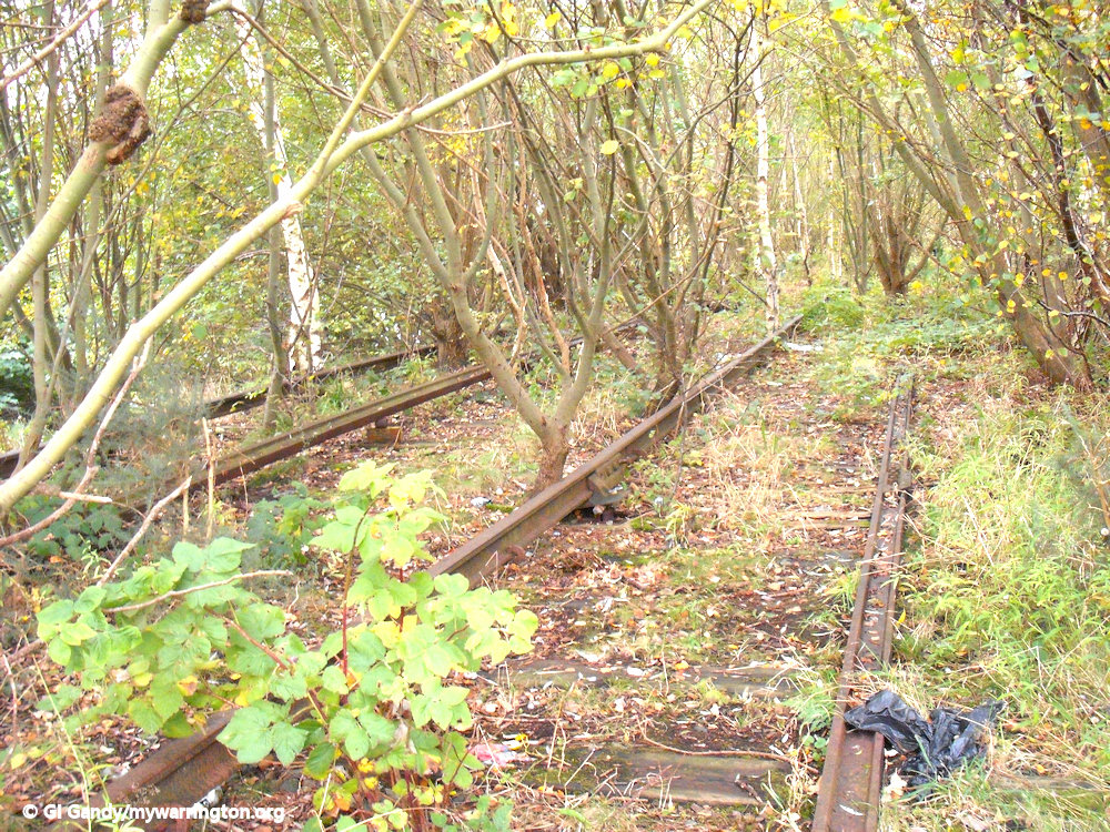
Remains of the Old Quay Canal in Black Bear Park close to the River Mersey lock
The park forms a line from Victoria Park and the banks of the River Mersey, through to Stockton Heath. (The park also forms part of the Trans Pennine Trail).
The canal also became known as the Black Bear Canal because it ran close to the Black Bear Inn on Knutsford Road. The building still exists, but not as a public house.
The Black Bear Inn is seen here in its most recent years.
Click the first image for a manual slide show taking you from the Mersey to the old railway bridge halfway through Black Bear Park.


Read more about the canal and photos to Twenty Steps Lock on the Manchester Ship Canal in On the Waterfront
Beyond mywarrington, see also Runcorn History website, where you can see photos of the canal in use. There is also the Daresbury District Heritage Group, where you take a virtual walk along part the route. final for now, see DJ Johnny’s video on the canal. mywarrington is not responsible for the content of external websites.
19th Century Latchford
Times were a-changing! The 19th century saw the reduction in lords of the manor and the start of town and district councils elected by the people. Beamont tells us in his A History of Latchford; a Cheshire Township on the South side of the Mersey, that by an act to amend the representation of the people of England in Parliament, which received the royal assent on the 7th of June 1832, the privilege of sending a member to represent them in the House of Commons was for the first time confirmed upon the inhabitants of the ancient town of Warrington.
On the 12th of December of that same year the town exercised its right for the first time, and after a severe contest between two gentlemen of opposing politics, during which party feeling rose to fever height, Edmund George Hornby, Esquire, (Liberal Party) was the successful candidate.
The Reform Act having made the new borough to comprise the respective townships of Warrington and Latchford, and also those two detailed portions of the township of Thelwall which lie between the boundary of Latchford and the river Mersey, the Borough of Warrington, Latchford, and that place were now united in parliamentary bonds, and Latchford as well as Warrington whilst, therefore, disturbed by the commotion of the election.
In 1837 the fifth bridge between Warrington and Latchford at Bridge Foot opened, and as it was the first year of Queen Victoria’s reign, the bridge was called Victoria Bridge. This bridge stayed in place until 1915 when a wider bridge was built.
Warrington and Altrincham Junction Railway
In 1853, Latchford received its first railway station when the Warrington and Altrincham Junction Railway opened. That station was known as Latchford and Grappenhall Road station and opened on 1 November 1853. It was renamed Latchford Station in June 1854.
With the opening of the Manchester Ship Canal in 1894, the railway line was raised on an embankment at Latchford to create the necessary 76 feet (23 metres) clearance for ships passing underneath the viaduct. It also resulted in a new station, which opened on 10 July 1893.
Read more about the railway in Making Tracks.
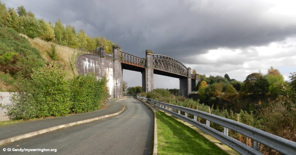
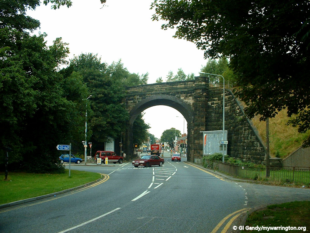
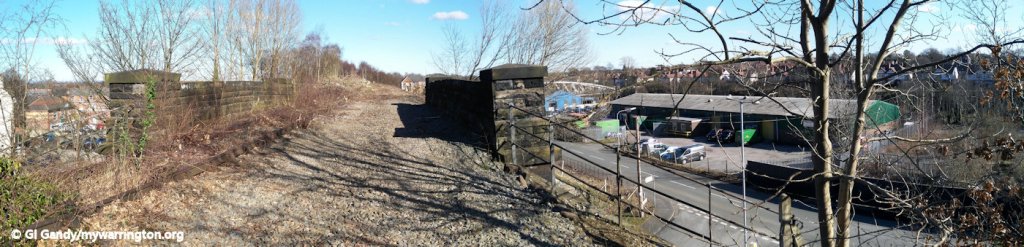
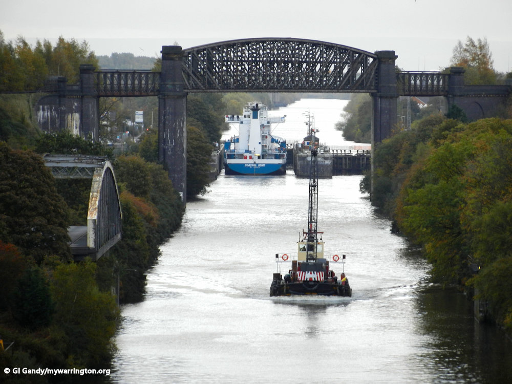
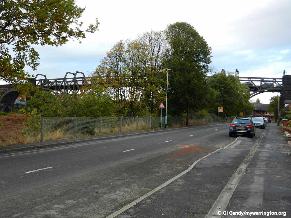
The railway viaduct over the Manchester Ship Canal by Latchford Locks
Latchford Railway Viaduct
Latchford railway viaduct was opened on 8 July 1893 to carry the former LNWR Warrington and Stockport Railway over the Manchester Ship Canal. The railway was formerly the Warrington and Altrincham Junction Railway (created by an Act of Parliament on 3 July 1851). The viaduct has a span of 250 feet and weighs about 1,200 tonnes.
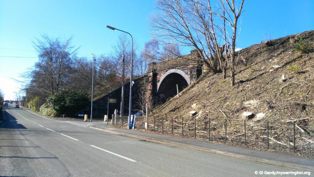
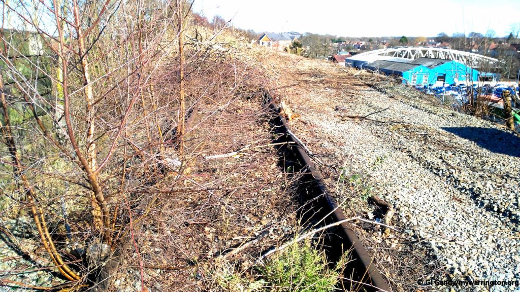
The line saw its last passengers in 1962 but continued to carry freight until July 1985. A suggestion was made in late 2006 to divert the Trans Pennine Trail over it, which currently runs via Latchford Locks. The viaduct is in a poor state and estimates indicate that it would cost as much to demolish it as it would to repair it. Shame really, because it would have made a great viewpoint over the whole town.

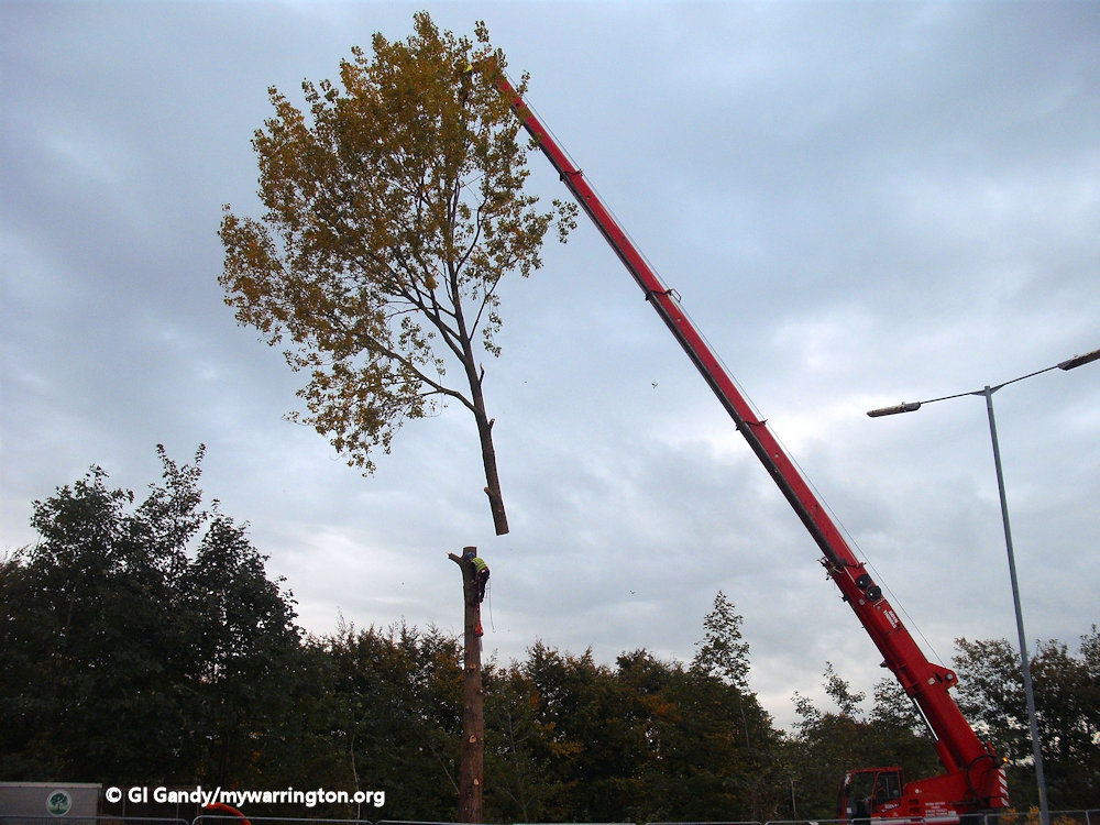
In recent years there was talk of removing the railway embankment for redevelopment in the area. Locals believed the cutting down of trees was the beginning of this work (see photos below), but since then nothing else has happened, apart from Mother Nature claiming the land back for herself.
Also, the government has announced plans for a new railway line from Liverpool to Manchester Airport via Warrington Bank Quay low level line with new station platforms and waiting rooms.
Locals have wondered whether the route will once again use the Latchford railway viaduct, and if so, how will that impact on the Trans Pennine Trail which currently occupies the route of the old railway?


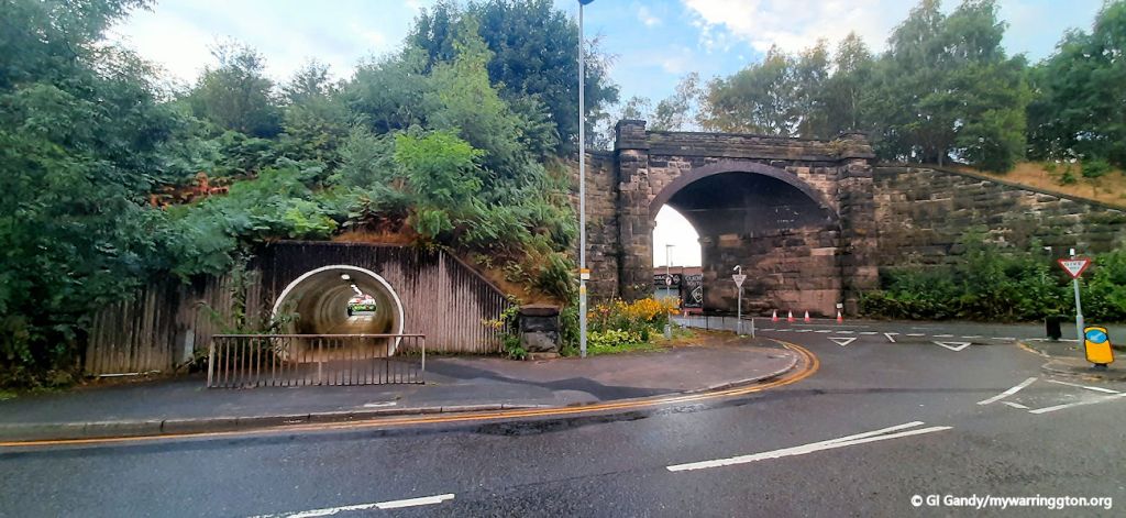


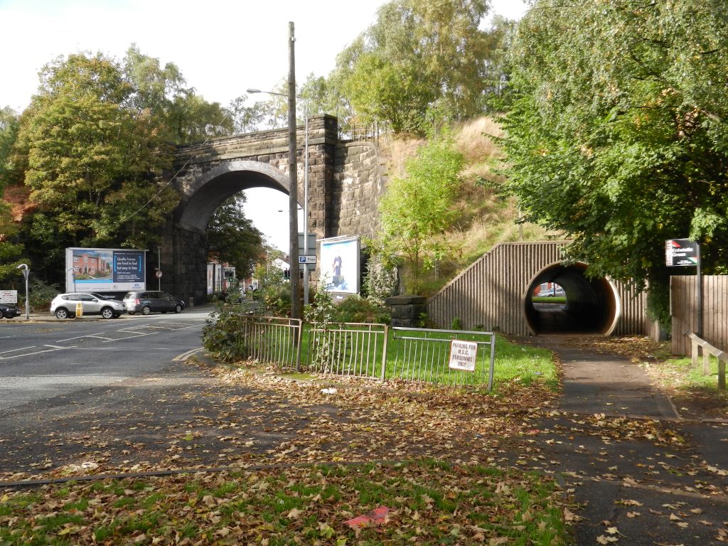


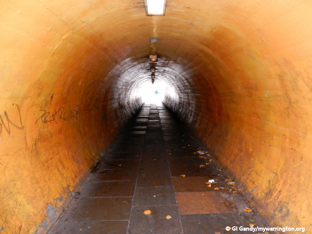
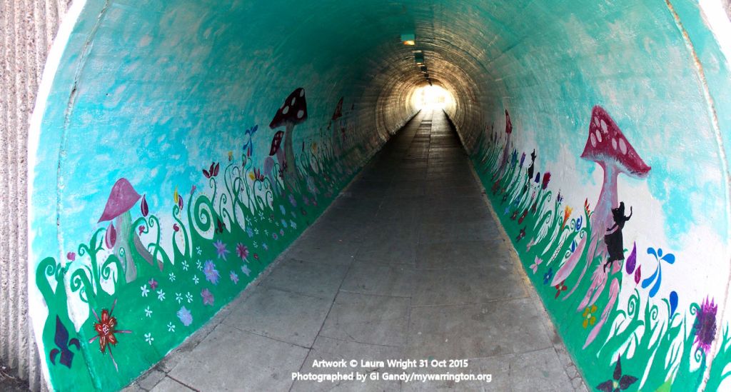
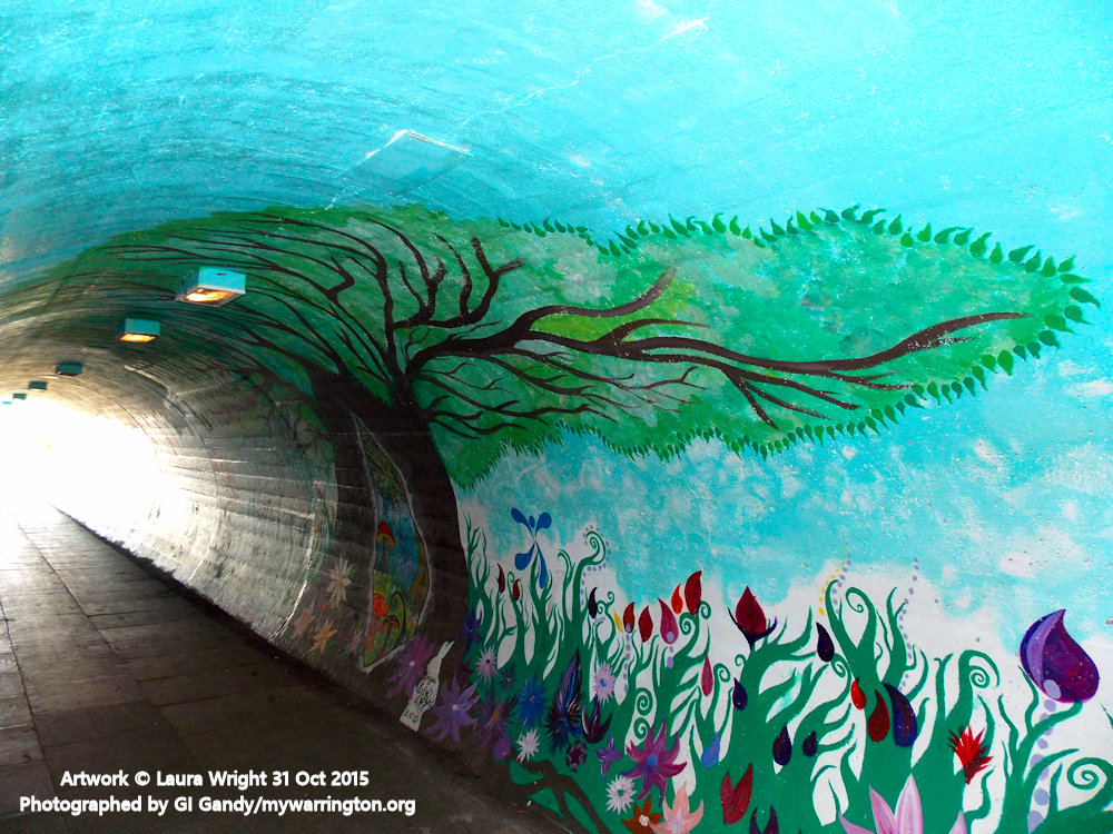
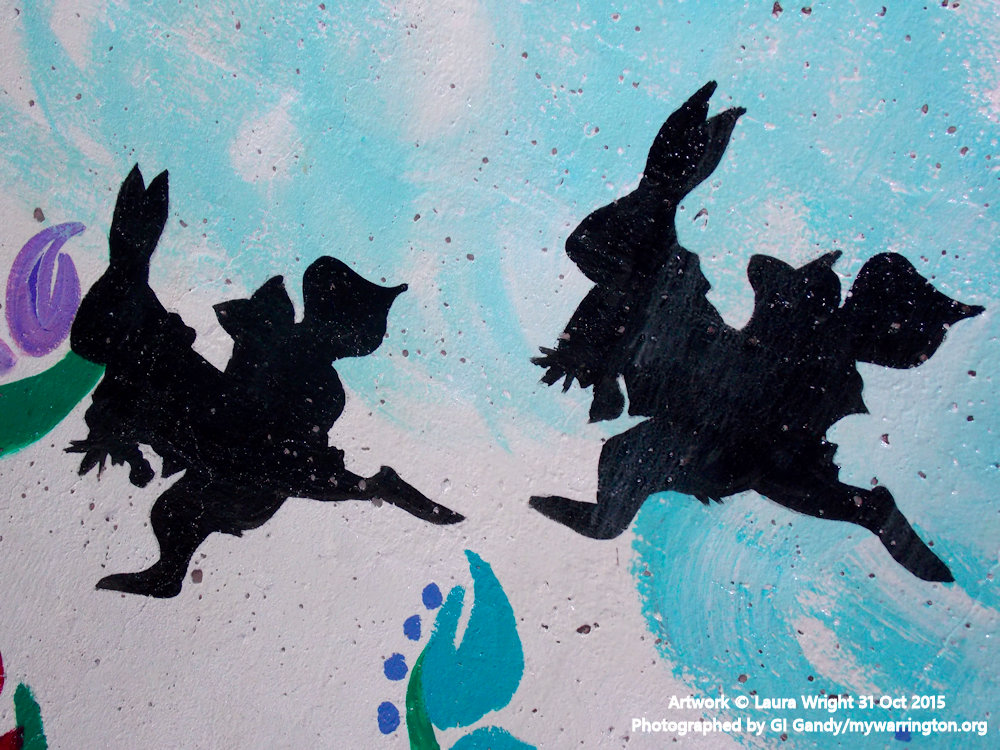
Pedestrian Tunnel Artwork
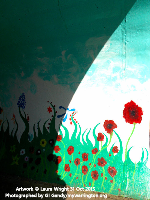
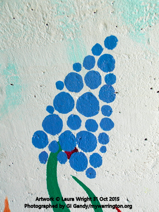
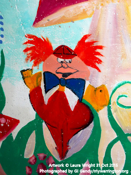
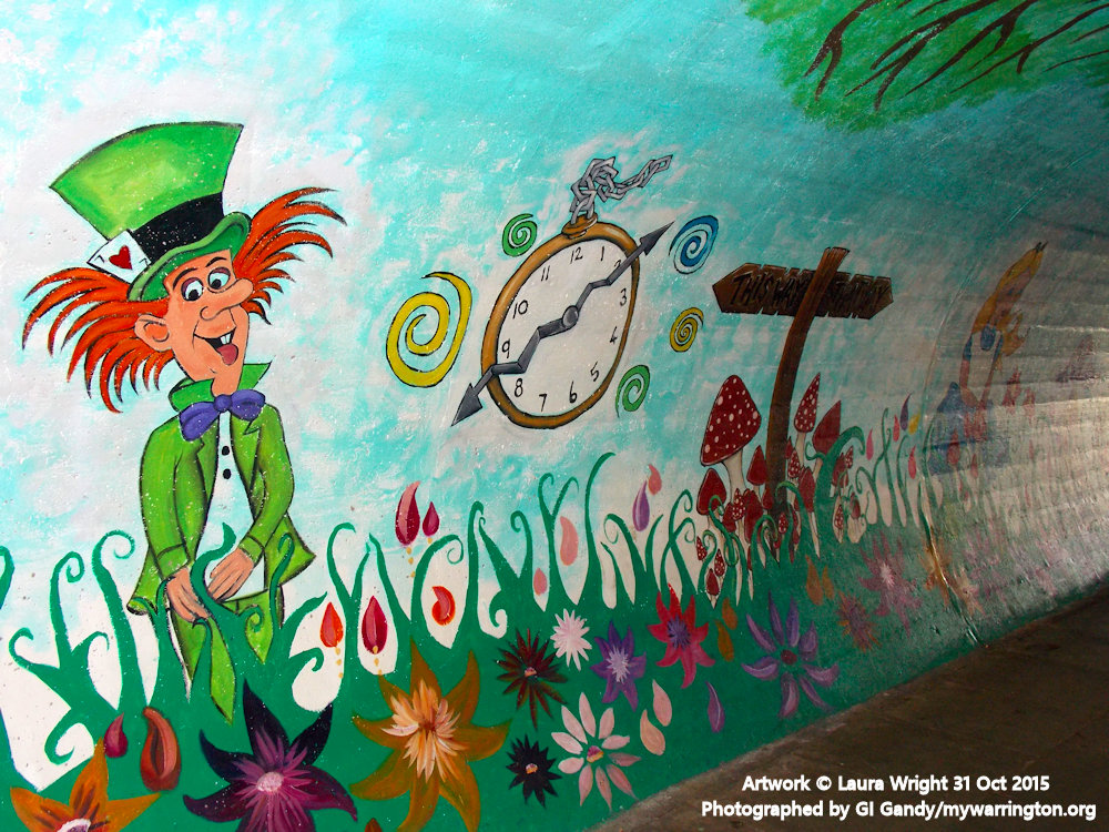
In the 1960s two much needed pedestrian tunnels were cut into the railway embankment in the centre of the village. In 2015 local artist Laura Wright spruced one of them up with an Alice in Wonderland feature. Charles Lutwidge Dodgson, AKA Lewis Carroll, was born at Daresbury just outside Warrington and was a regular visitor to the town, including the Greenall family at Walton Hall Gardens. Laura’s colourful representation of the classic story was completed on 31 October 2015 and unveiled to the public. My photos were taken on 7 March 2016 on my visit to the village.


Tunnel Artwork Phase Two
Latch Ford Big Local Partnership recently commissioned a former local resident artist to undertook a piece of work entitled ‘Latchford Through the Ages’. It captures all that’s great about Latchford through a series of stencils. The art work has been created in the tunnel passageway as you enter Latchford Village, Knutsford Road and is the second piece of work on the Latchford tunnel passageways. The renovation project is part of the Latchford Big Local’s community and health plan. It follows tireless efforts from members of the Latchford Big Local, local community residents, schools and in partnership with Warrington Borough Council who provided good sound advice and support throughout. The completed tunnel was officially opened on 30 October 2020.


See photos of the official opening here.
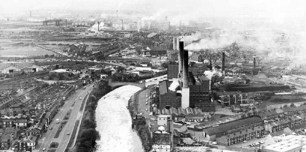
Manchester Ship Canal
The 36-mile-long Manchester Ship Canal came about because Manchester businessmen were not happy with the shipping trade going to Liverpool and so petitioned Parliament for a route into their own city. Royal Assent was granted on 6 August 1885.
So began the construction of the waterway from Manchester Docks at Salford to Eastham Locks at Runcorn. It took six years to complete at a cost of just over £15 million (£2.1 billion in today’s money).
The canal was purchased by Peel Holdings in 1993 and from 2014 by the Peel Ports Group.
You can read a more detailed history of the canal (with more photos) in the On the Waterfront.

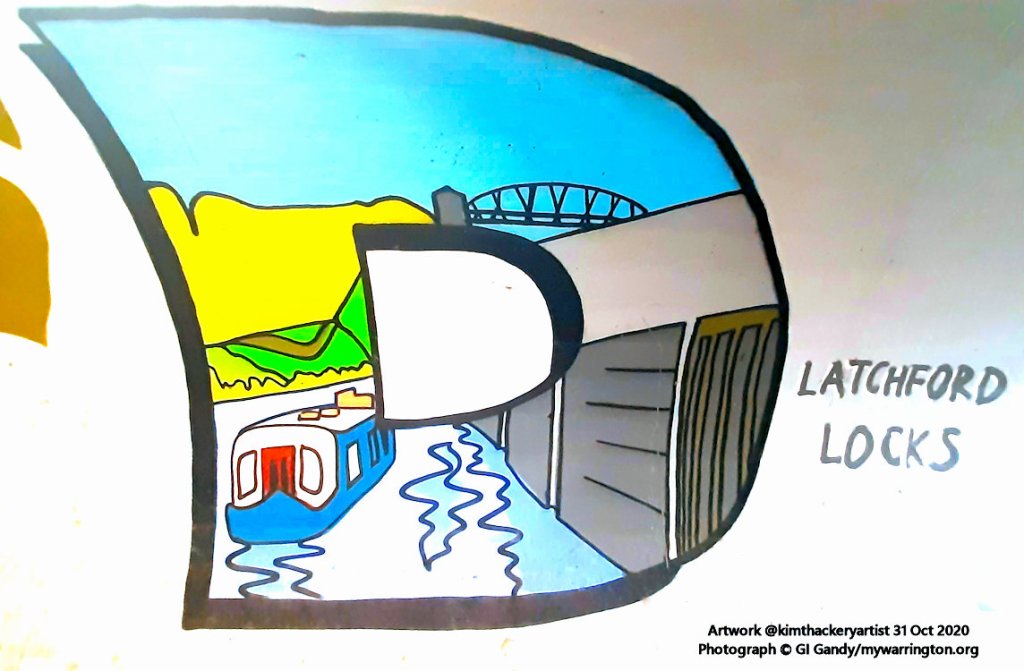
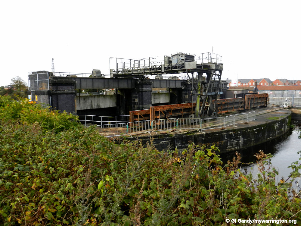
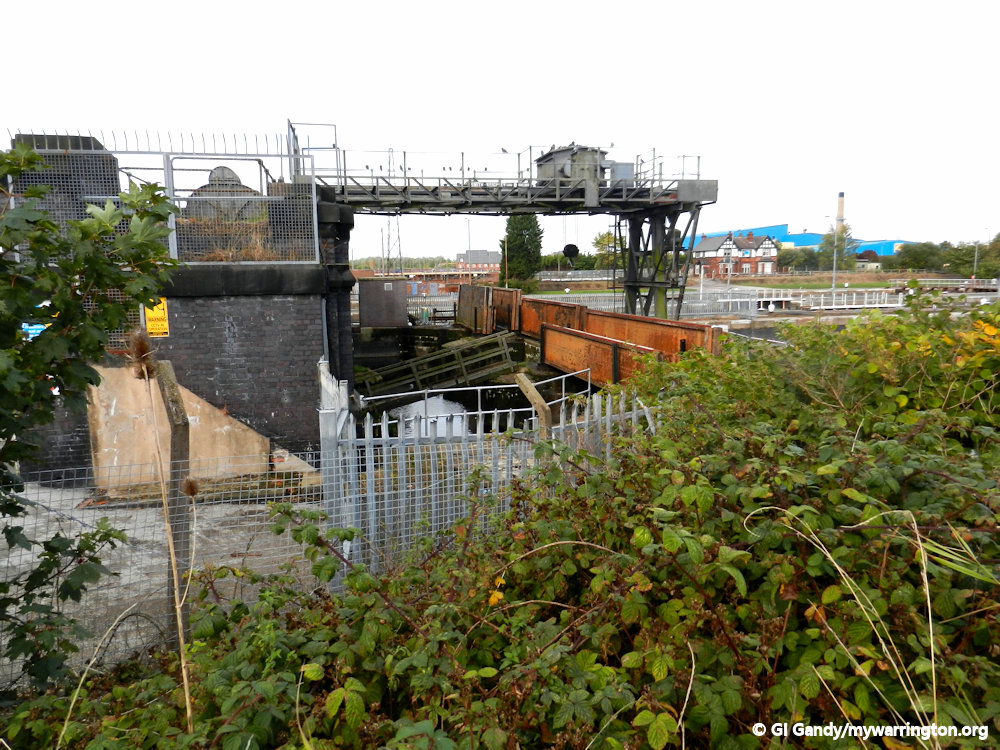
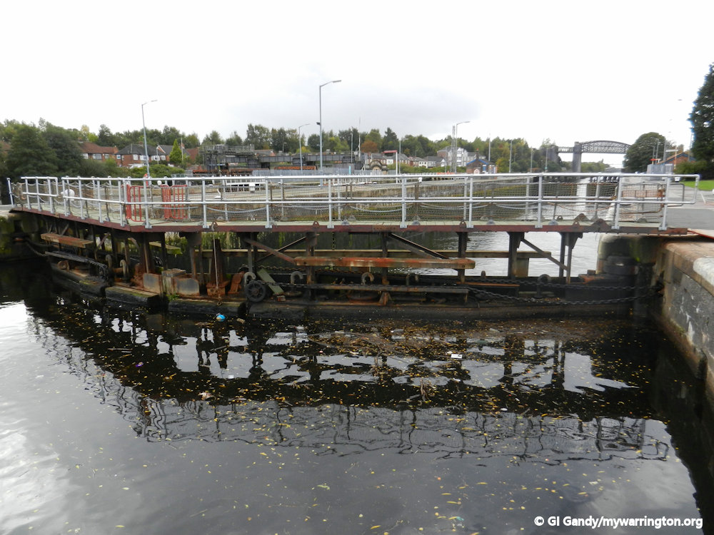
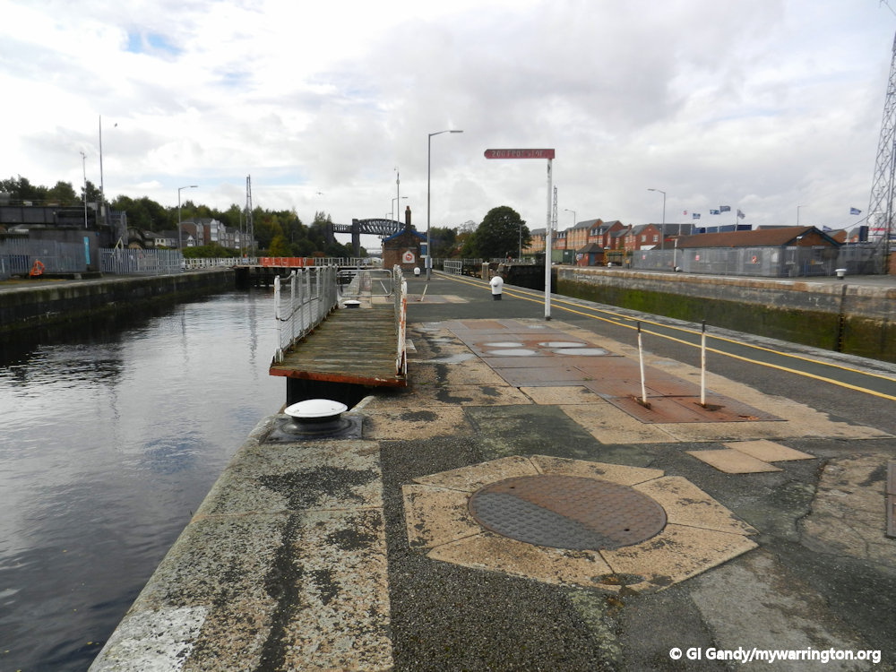
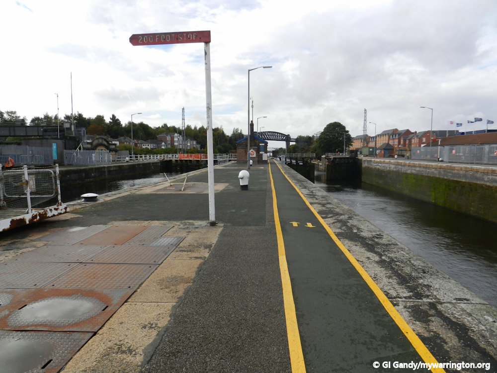
Latchford Locks
Latchford was chosen as the location of intermediate locks on the Manchester Ship Canal. These comprise a large lock for ocean-going vessels and a smaller lock to its south for coasters, tugs and barges.
A ship-mooring area was provided on the canal’s south bank which enabled two large vessels to pass each other at this point. The locks are still in use and managed by Peel Ports Group.


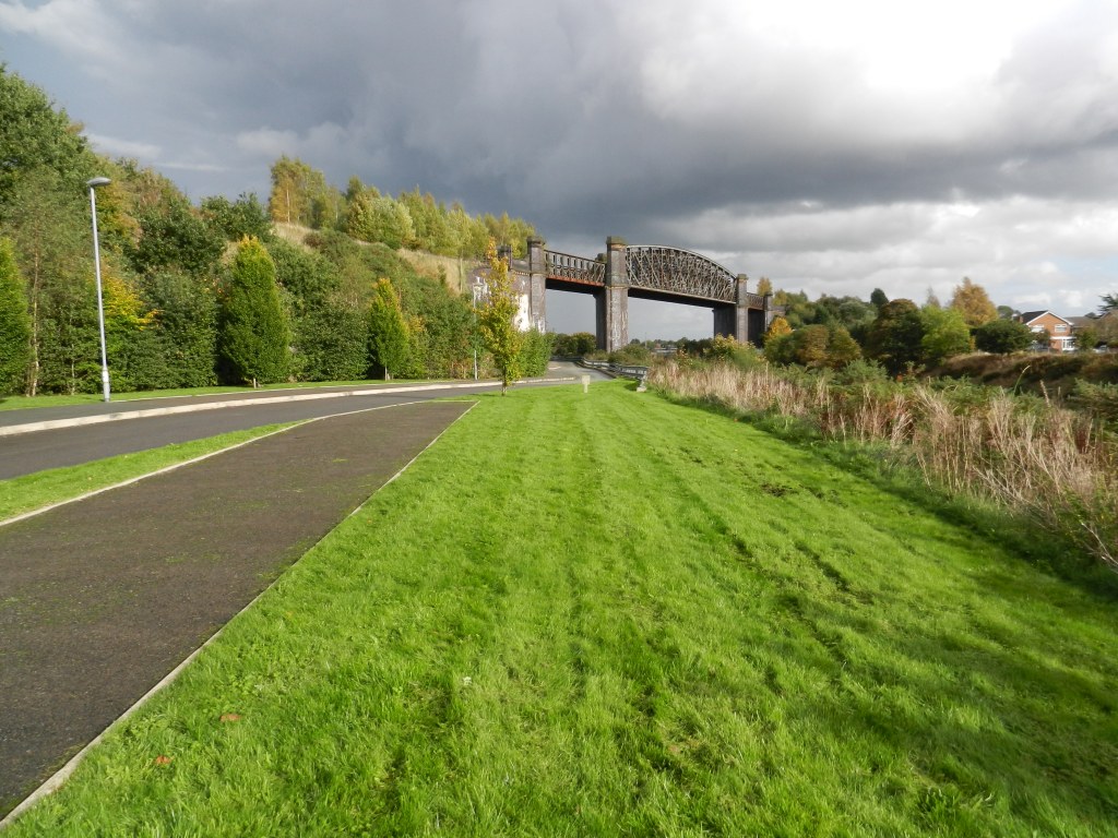
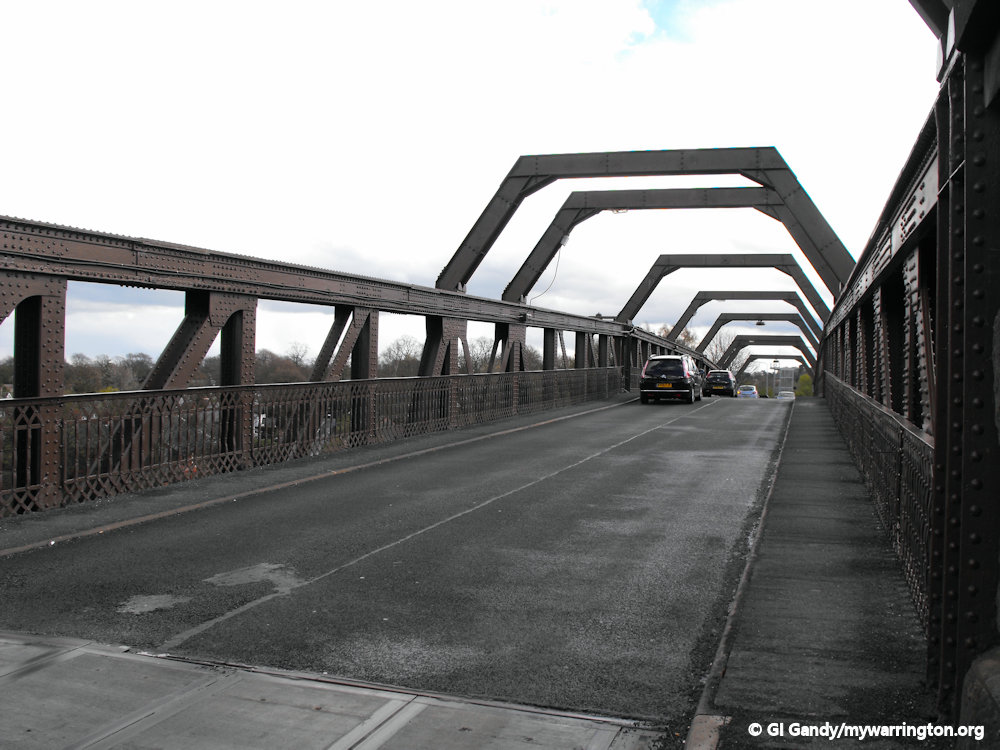
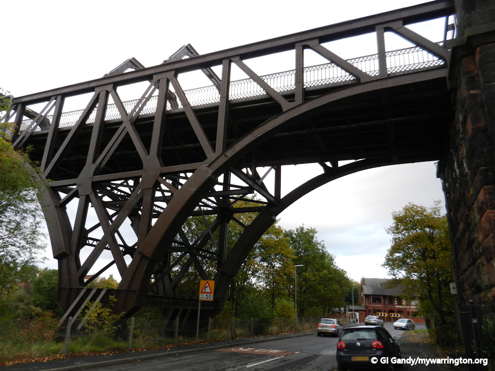
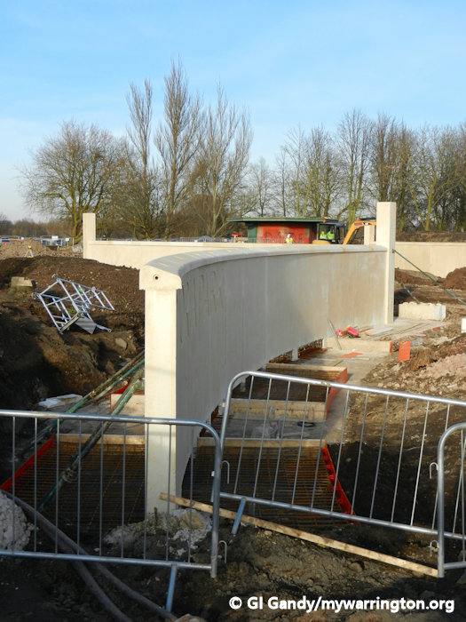
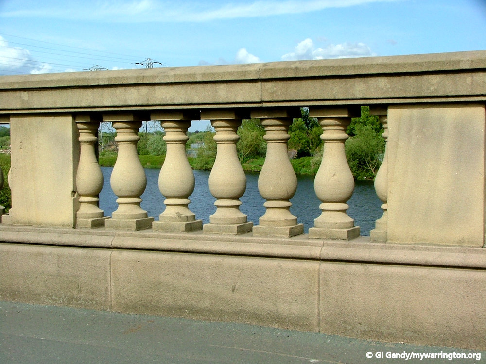
Latchford High Level Bridge
The Cantilever Bridge weighs about 783 tonnes, has a span of 206 feet and is 75 feet above the water to allow for clearance of ships passing beneath. Its official name is Latchford High Level Bridge – the cantilever name comes from the design. A cantilever bridge is built using cantilevers, structures that project horizontally into space, supported on only one end.


See the Manchester Ship Canal section of On the Waterfront for a journey back to the 19th century in photos of the construction of the canal.
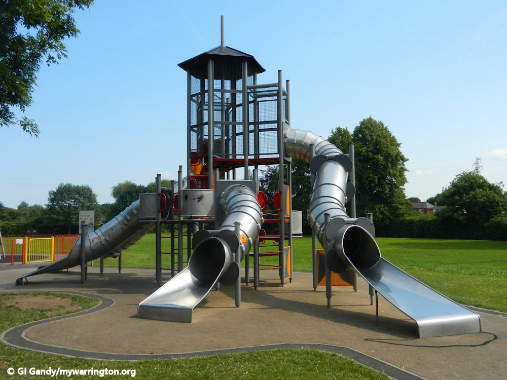
Village Life
Let’s now take a virtual tour of the village past and present. If after you have read through the following notes you get a feel for more, then Latchford History Group is for you. They meet every Wednesday morning at St Hilda’s Mission on Slater Street. They have produced a series of books on the history of the village featuring photos that are not available to mywarrington.
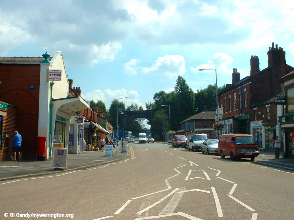
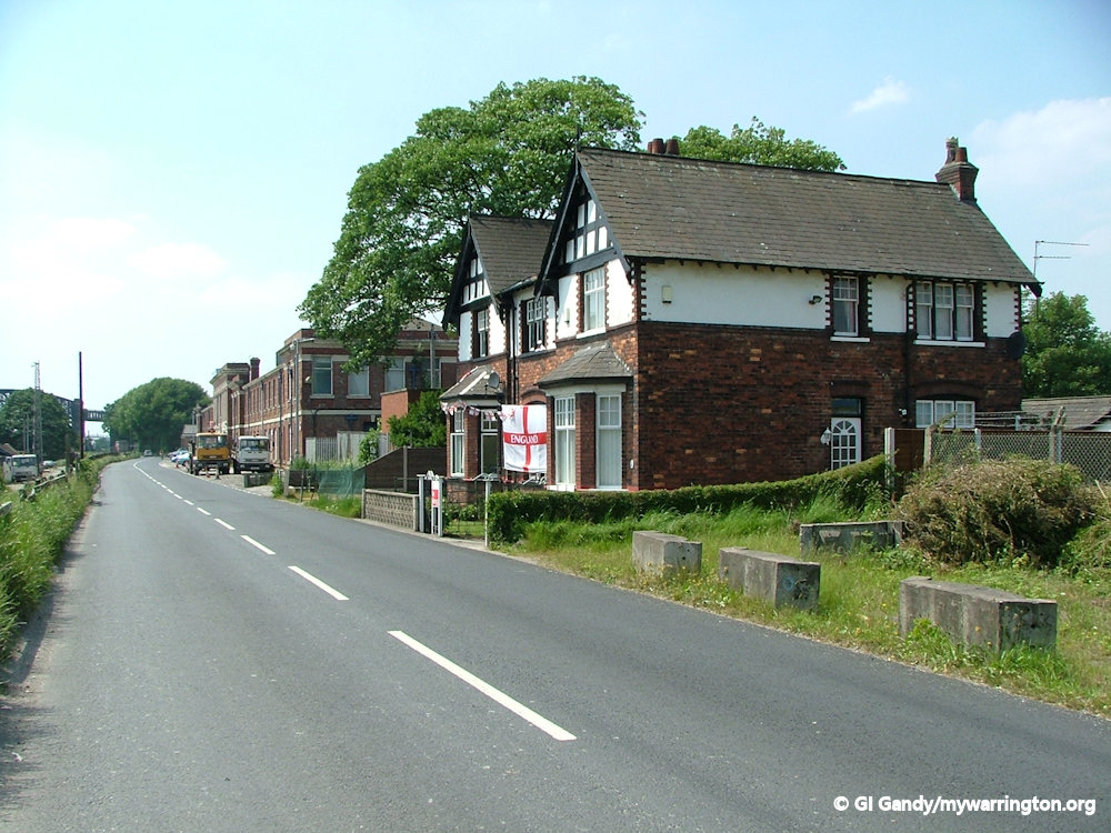
Knutsford Road
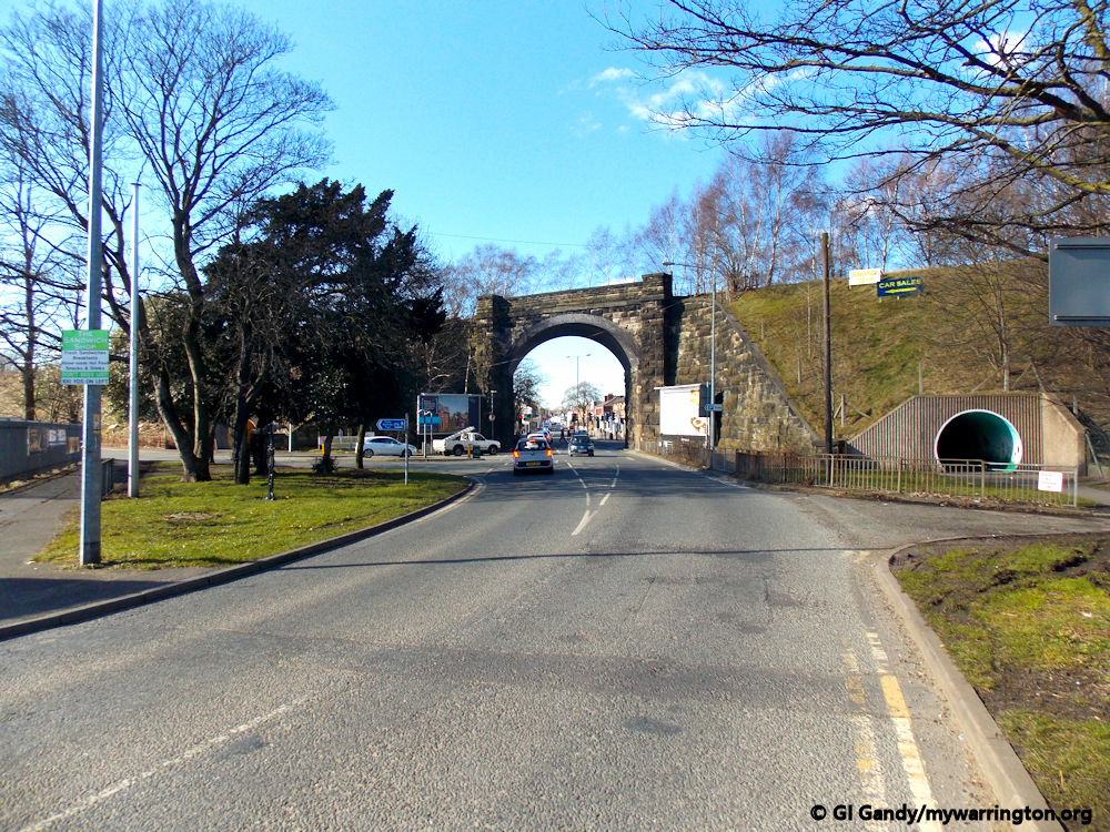
The first thing I am going to show is an aerial photo of Knutsford Road, the River Mersey and Howley. It dates to 1972 and was sent to me some years ago for use on the mywarrington website.
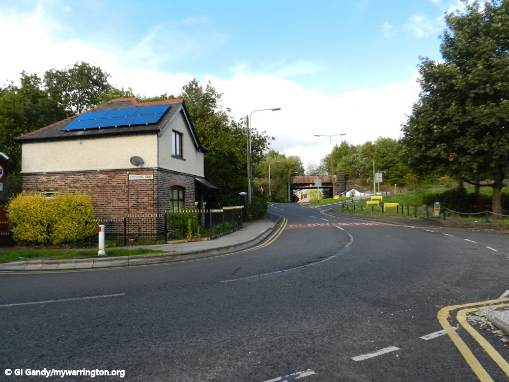
Until I did my research, I assumed Knutsford Road has only ever been called by that name. I was wrong! in fact, it has had FOUR different names in its lifetime. It dates back to 1285 when the first bridge over the Mersey was built by the Boteler family. At the time of the Civil Wat it was known as Latchford Causeway.
By 1777 when the first St James Church was built (in Latchford before it was rebuilt and moved to Wilderspool Causeway) the road was known as Chapel Street, which was later changed to St James Street. Until 1965 the road was a single carriageway; from then onwards a dual carriageway was required to cope with the congestion on sections of the route.
From 1902 to 1935 Knutsford Road was one of five tram routes operated by the council.
So let’s take a virtual walk from Warrington Bridge to the village centre with photos from my collection. Some of the photos not shown here are included in the themed sections elsewhere in this web page (such as the Golden Lion pub in Pub Life). I don’t cover every building, simply because I don’t have photos to illustrate them, but my friends at Latchford History Group have an excellent book “Bridge to Bridge” and its companion for Wilderspool Causeway “Causeway Connections”.
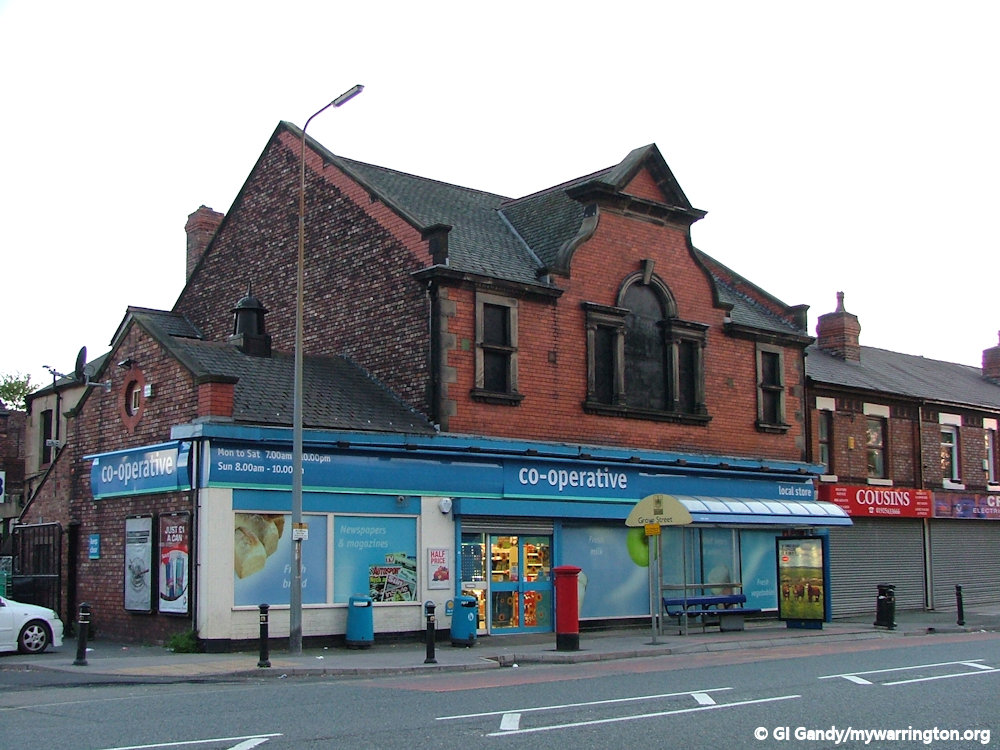
First of all, the section of Knutsford Road between grove Street and St Mary’s Street were widened to its current state in 1965. The three photos below show the old Co-op dairy and shop. Before we had supermarkets, most of us got our milk delivered to the door. A large part of it in Warrington would come from the Co-op dairy on Knutsford Road. In the early days it would have been delivered by horse and cart. If you haven’t seen the Norman Wisdom film The Early Bird then it is something to see. He and his boss Mr Grimsdale are in competition with a big dairy and still use a horse and cart rather than the electric milk floats that were coming in during the 1950s (see my photo, right – from the collection at St Helens Transport Museum).
Another comic scene regarding milk deliveries comes in an episode from BBCs Dad’s Army where they borrow a horse and cart for a training exercise. Captain Mainwaring asks why the horse keeps stopping outside every house as they walk down the street, to which he is informed the horse worked at the local dairy before he retired and this was his old milk delivery route, hence he knew which houses to stop at. Apparently, that scene was echoed in real life during the world wars.
The buildings in my photos below are no longer used by the Co-op. The dairy closed some years ago and the shop has relocated to a new unit just up the road.


We continue along Knutsford Road, passing Victoria Park.

Just like William Lever, who provided homes for his workers at Port Sunlight close to the soap factory, so Sylvanus Reynolds provided houses for his staff close to Latchford Tannery in the village of Latchford.
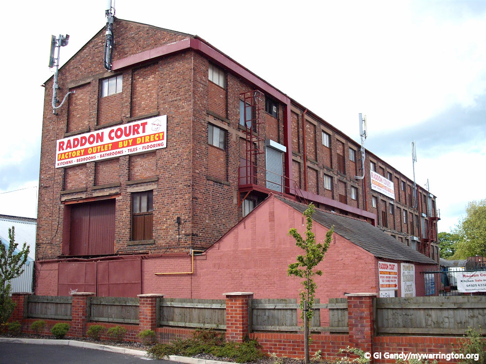
One such row of houses is seen here in the photo. It is called Raddon Place and the house in the foreground is called Raddon House. The now-demolished Raddon Court was the family home for Sylvanus Reynolds.
Raddon Place, a row of homes provided for Latchford Tannery workers.
Alongside Raddon Place is a row of house facing the main road (above photo). Although it doesn’t have a name it has ben here since Victorian times. In the later part of the 19th century the end property now name Fairway was occupied by a grocers shop run by a Mr Hartley.
Raddon Court
Raddon Court was a large house on Knutsford Road, next to the site of Raddon Court DIY store. It was built by a tannery owner, Sylvanus Reynolds, who moved from Devon to Warrington in 1846. He became a partner in Latchford Tannery by 1868 and eventually the sole owner. Latchford Tannery was on Thelwall Lane – the site is now occupied by an apartment block. He was also a local magistrate and chairman of various companies and died after a shooting accident on Peasfurlong Moss at the age of 57. Reynolds Street is named after him.
The house was used as a Red Cross hospital during the First World War, the first military hospital in Cheshire. The hospital closed in 1919 and the house was demolished in 1940.
The next set of photos show Osborne Terrace on Knutsford Road. The row of houses were built during Queen Victoria’s Diamond Jubilee year of 1897. We can also see a sundial halfway along. The right-hand side of the white building with the blue trim on the roof was a former Temperance Hall, which was used before Latchford Methodist Church opened on Thelwall Lane close by. See the Church Life section further down the page for more.


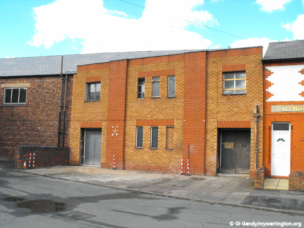
Here are two photos of The Bridge Shopping Centre from different times


Two views of the area from The Bridge Shopping Centre. The first looks out towards Knutsford Road and Powell Street, with the former Premier Cinema on the far left in the distance. The second image looks along Knutsford Road towards Warrington town centre along Knutsford Road.
The Plague House
The Plague House once stood on Wash Lane opposite Christ Church. It was built in 1650 by Richard Warburton and demolished in 1964. It was a private house during the 17th century when plague was rife in the country, and it is believed the occupiers were victims of the disease. The inmates of the house were isolated in this house because of the plague and had placed money for provisions left outside for them in a square hollow of coping stones situated in the garden wall. This hollow space was first filled with vinegar and water to act as a disinfectant to the money placed therein. Evidence of the plague was found in fields behind the house where human remains, buried under stone slabs and not in coffins, were discovered. In June 1647 the House of Commons ordered collections to be made in the churches and chapels of London to relieve the distress caused by the plague in the city of Chester and the town of Warrington.


The Hollies
The Hollies was a large house set in 30 acres of land opposite Raddon Court on Knutsford Road, owned by the Broadbent family. Within the grounds there were staff cottages, stables, an orchard and meadows. The Rev William Broadbent was a Unitarian minister and the first to live at the house in 1791. Later a nephew, also called William Broadbent, lived there and this William founded Latchford Tannery in 1828. The house was demolished in 1965 to make way for the dual carriageway of Knutsford Road.
Telford’s Road Proposal
Engineer Thomas Telford was asked by the secretary to the Post Office on 25 March 1825 to examine the road from London to Liverpool to ascertain what improvements could be made to accelerate communications between the two cities. In 1929 Telford recommended three routes, including an addition road bridge close to the present St James’s Church in Warrington. His suggestion was never put in place because in the year following his report the Liverpool and Manchester Railway was opened and very quickly became part of the Grand Junction Railway to London.
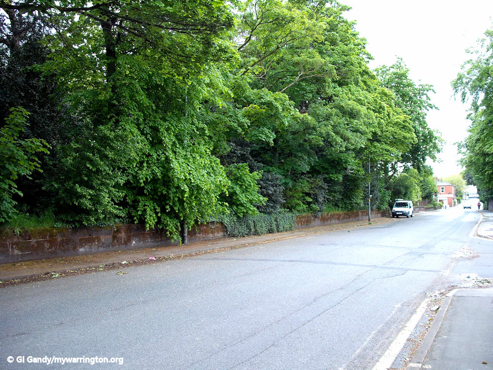
Thelwall Lane
Thelwall Lane in the village was originally a country lane that linked Latchford with the village of Thelwall but was cut off with the construction of the Manchester Ship Canal.


Richmond Gas Stove and Meter Company
Richmond Gas Stove and Meter Company of Academy Street, Warrington; often referred to as Richmond Gas Stove Co.
In 1889, the company was known as Unsworth and Richmond, having been started up by E. W. T. Richmond in that year.
On 26 September 1890 the company was registered as Unsworth and Richmond, to take over the business of gas stove manufacturers of the firm of the same name. In August 1891 the name of the company was changed to Richmond and Co.
At the start of the 20th century the company went public and amalgamated with two other companies: first in 1901 with George Glover and Co. Ltd. of Chelsea and then in 1902 when George Newton Ltd. of Oldham joined.

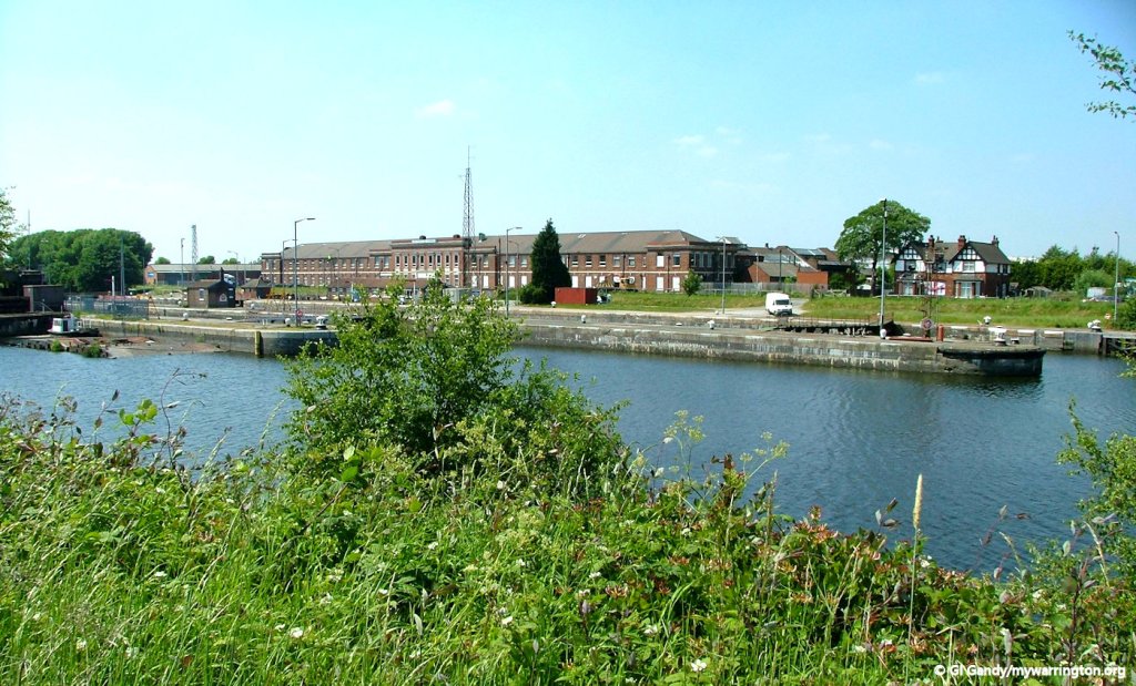
Latchford Locks on the Manchester Ship Canal in 1950 with Richmond’s in the background. Image by RuthAS from Wikimedia used under the Creative Commons Attribution 3.0 Unported license.
On the death of the founder, Edmund Richmond, Horace Moore Thornton became the managing director. In 1909 the company amalgamated with Clarks Syphon Stove Co. Ltd. By 1914 the company employed 1,000 workers and they were manufacturers of all kinds of gas apparatus. One of their specialities was Richmond gas stoves and George Glover’s gas meters.
Radiation Ltd was formed in 1919 to acquire any or all of the shares of Richmond Gas Stove and Meter Co and carry on the business of gas stove and gas appliance makers and dealers. Many Warrington workers would tell you they worked for “The Radiation”.
In April the company issued a catalogue on Rotoflam high-speed steel-hardening furnace and Richmond natural draught gas-heated crucible and muffle furnaces. Another name change in 1929, this time to Richmond Gas Stove Co.
The Latchford site became known as Grappenhall Works. Rather confusing, as Grappenhall was on the opposite side of the Manchester Ship Canal. In the directories it was listed as Grappenhall Works, Warrington, Cheshire. Telephone: Works – Warrington 412 (3 lines). Telegraphic Address: Works – “Gastoves, Warrington”. Click this link to see a 1934 aerial photographs of the works alongside the Manchester Ship Canal by Latchford Locks.
At the British Industries Fair of 1937, the company was a listed exhibitor with the following products: New World “Regulo” Controlled Gas Cookers. “High Beam” Self-lighting and “Stowe” Gas Fires. “Newlyn” Sink Water heaters. “Don” Geysers. “Equator” Multi-point Hot Water Circulators and “Fairy Prince” Gas Irons. (Stand Nos. Ca.603 and Ca.502).
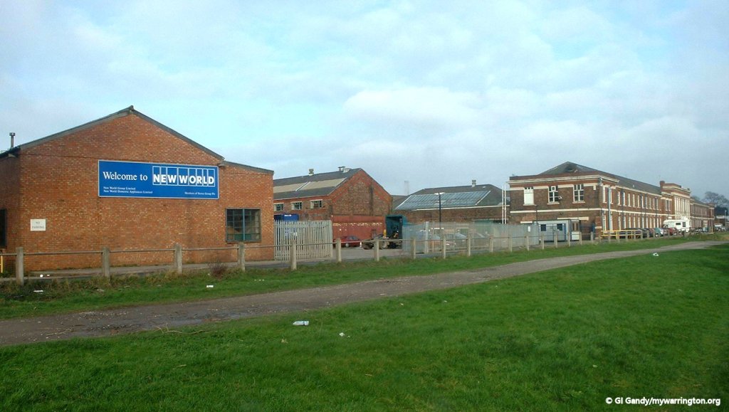
The New World model was first introduced in the late 1940s as the company increasingly became a worldwide name, helped by its location next to the Manchester Ship Canal. The company was later renamed New World. In 1961 the company was described as manufacturers of heating and cooking apparatus, water heaters and fires.
Richmonds cookers were exported across the world with markets in place as far flung as the US and South Africa.
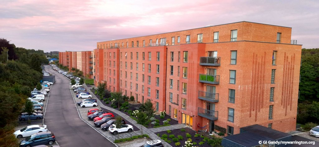
The New World company was taken over by the Glen Dimplex group in 2001. The site at Latchford closed in 2006 and housing now occupies the site. Richmond’s Social Club was established on Richmond Street for the workers but it has closed in recent years.

Here are two photos of what was built on the site of Richmond’s/New World.


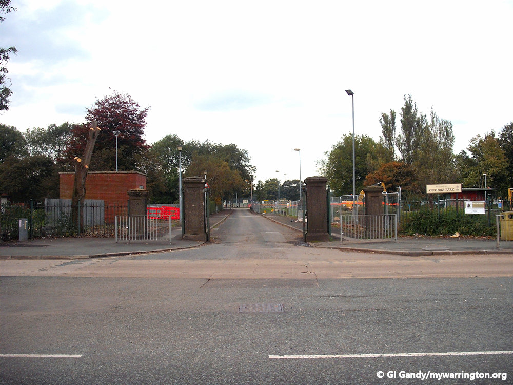
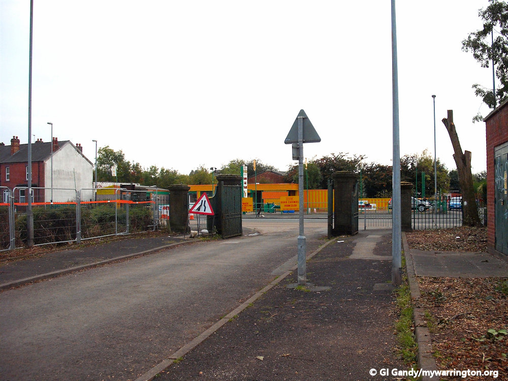
Victoria Park (The Old Warps)

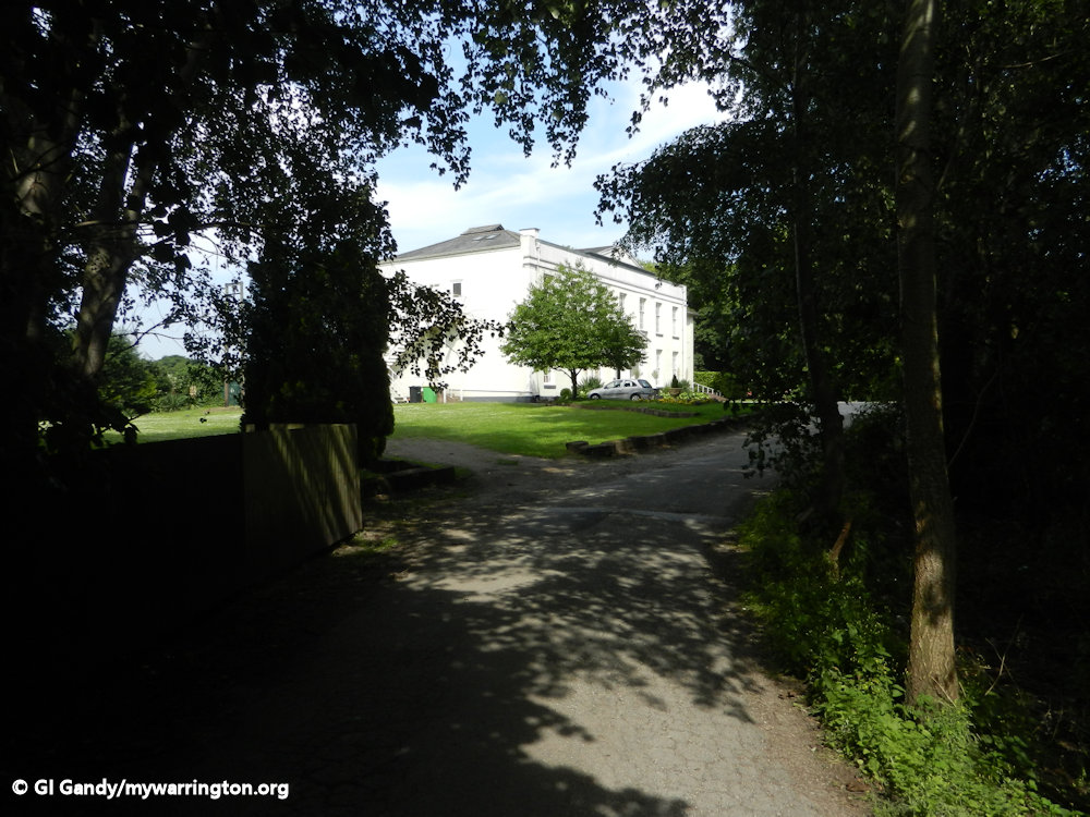
Victoria Park is an area of open space beside the Mersey. It contains a large Georgian manor house, the Old Warps and farm, which was used as a maternity hospital until about 1981.
The 16th century manor house is Grade II listed and the maternity unit was later converted into flats. It is now Spirit restaurant. Nearby is an elegant narrow Victorian suspension bridge, Howley Suspension Bridge, which provides pedestrian access between Howley and Latchford. Originally this was meant to be a road bridge, but funding restricted it to pedestrian use only. Read more in the Howley section.
In the 18th century the course of the River Mersey was slightly different near Latchford, creating a “hell hole” that even the most experienced seamen considered dangerous.

In 1724 various weirs were built along the course of the Mersey due to its often-treacherous nature. The course of the Mersey was then altered, and the land was converted into the Old Warps Estate. A weir was built and is still monitored 24 hours a day by a “weir man” from a wooden building situated alongside the weir.
In 1896 the local council bought the Old Warps estate from the owners and converted it into a park to try and improve conditions for the local working-class people of the terraced housing of industrial Latchford. To mark the Diamond Jubilee of Queen Victoria the park was named Victoria Park.
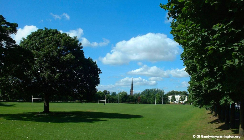
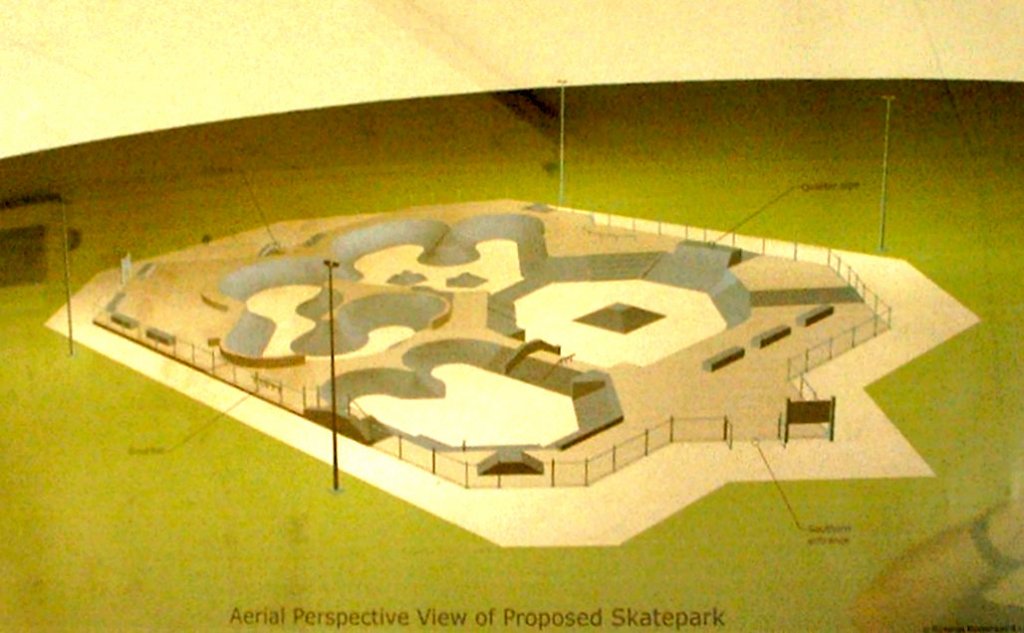
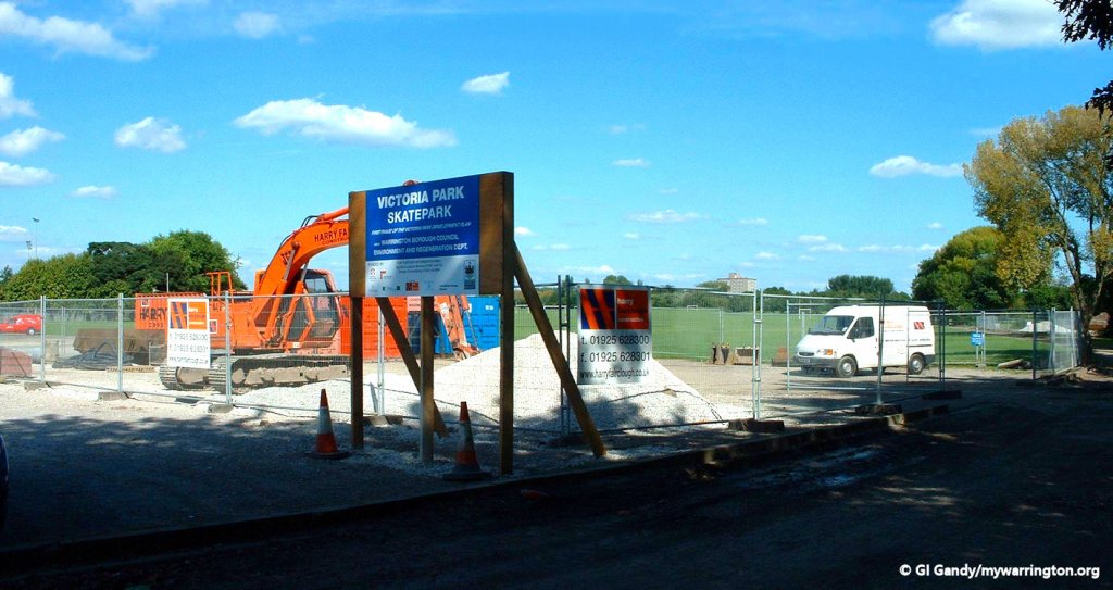
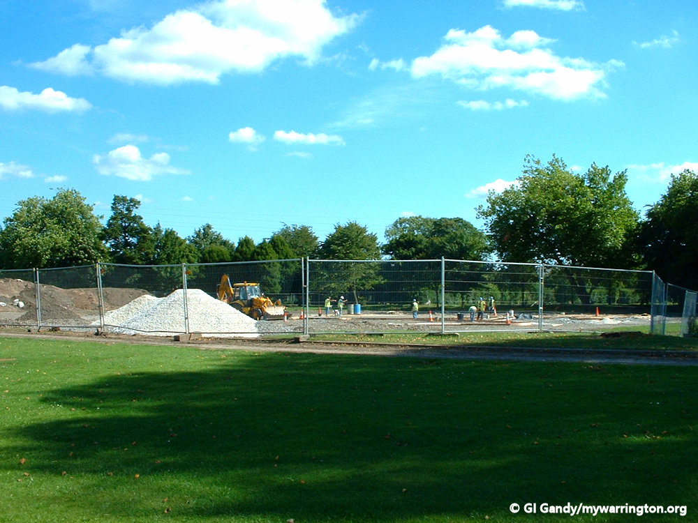
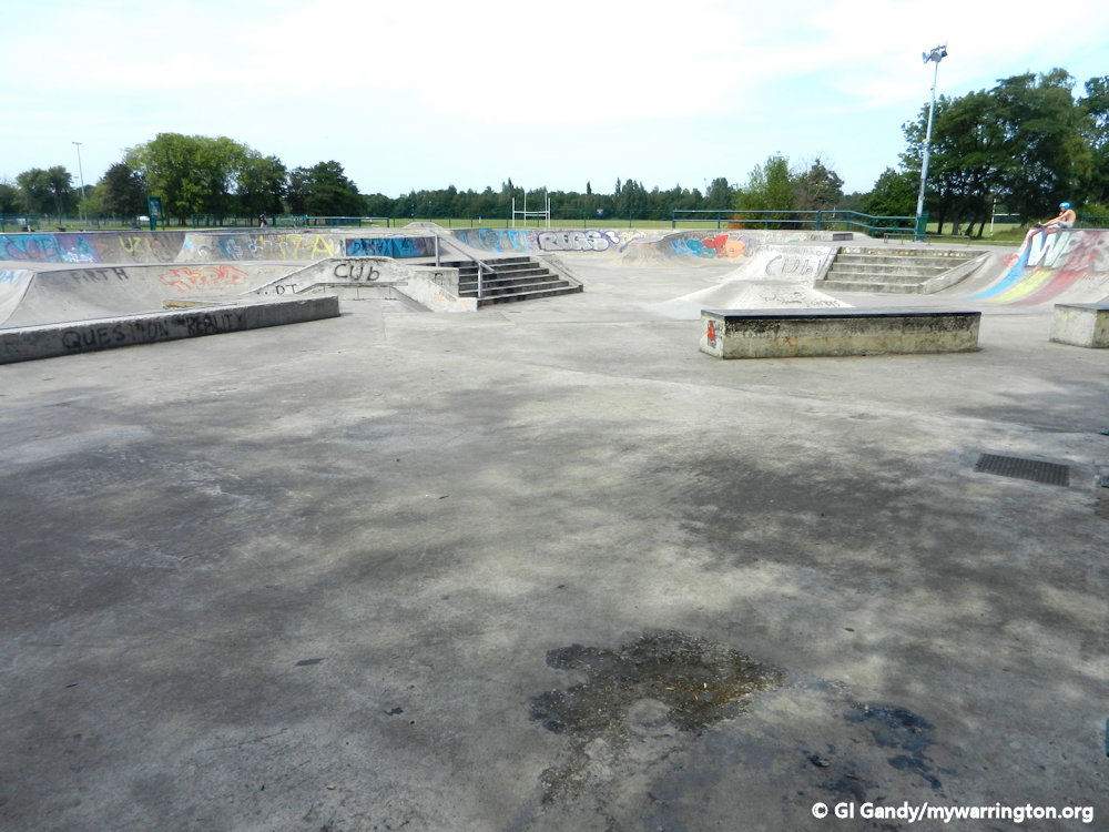
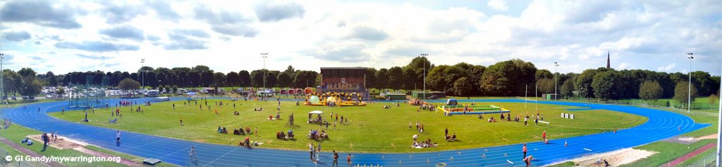
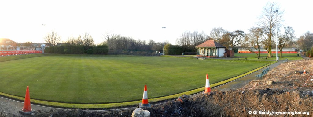
Victoria Park is the home of Warrington Athletic Club and features a large running track. Skateboarders, roller-skaters, BMX riders and mountain bikers use the skate-park within the grounds. It houses one ramp of approximately 10ft, which is mainly used by inline-skaters.
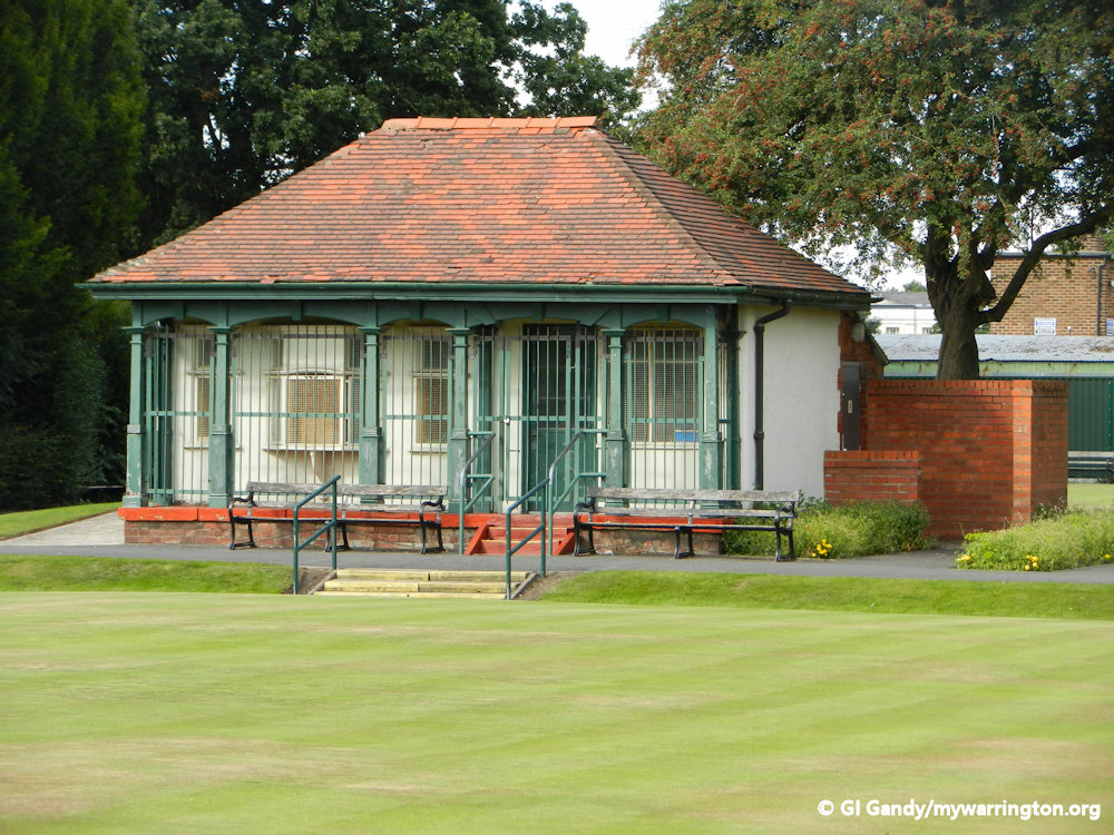
There are crown green bowling areas and a children’s park. Old Manor Lock marks the northern boundary of the park.
Victoria Park Arena, seen here in the photo, not only features an outdoor seating area, but space indoors for events and sports training. A National Lottery grant helped to spruce it up a few years ago.
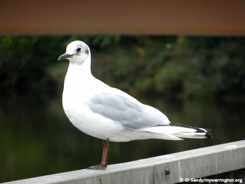
The Mersey is so improved now that salmon and trout are often seen, as are herons, kingfishers and cormorants, especially in the wide pool on the river bend below the weir.

Victoria Park Arena is a great venue to see athletics and other sporting activity.
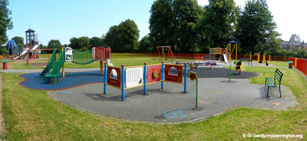
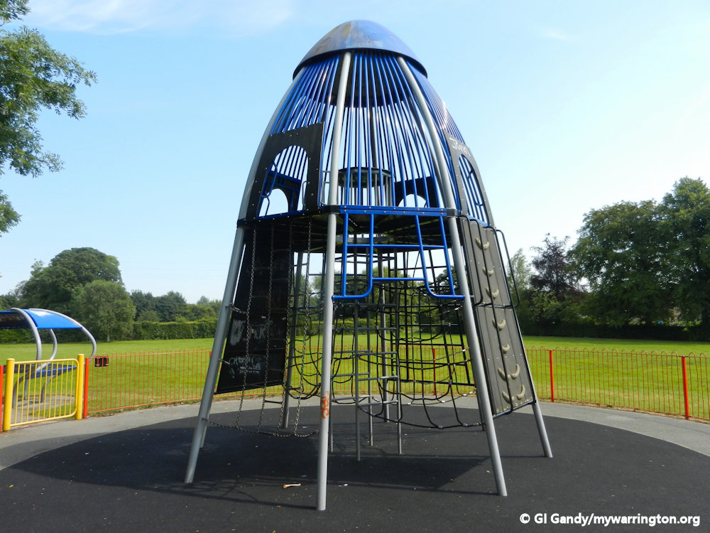
Children’s play areas have been upgraded in recent years. The space now includes a skatepark.


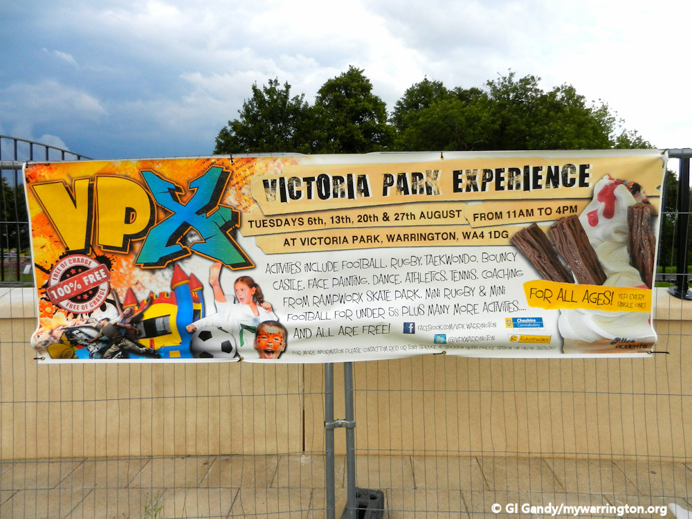
Victoria Park Experience (VPX) was a summer event for children organised by the borough council. I worked for Radio Warrington at those events, providing information and commentary on a range of activities for younger people. Events including sports (football, athletics, tennis coaching, rugby and martial arts) as well as creative activities like face painting, dance and music. Apart from keeping children occupied during the summer, it was also a chance for young people to learn new skills and make new friends in a safe environment with help and advice from local professional bodies.
For those wanting a more relaxing atmosphere, crown green bowling is available at the park.

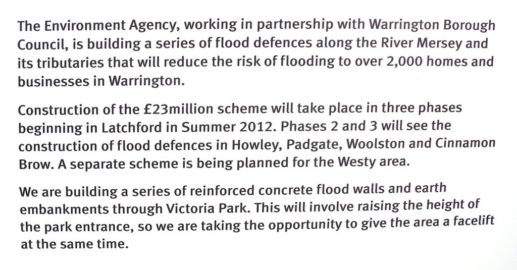
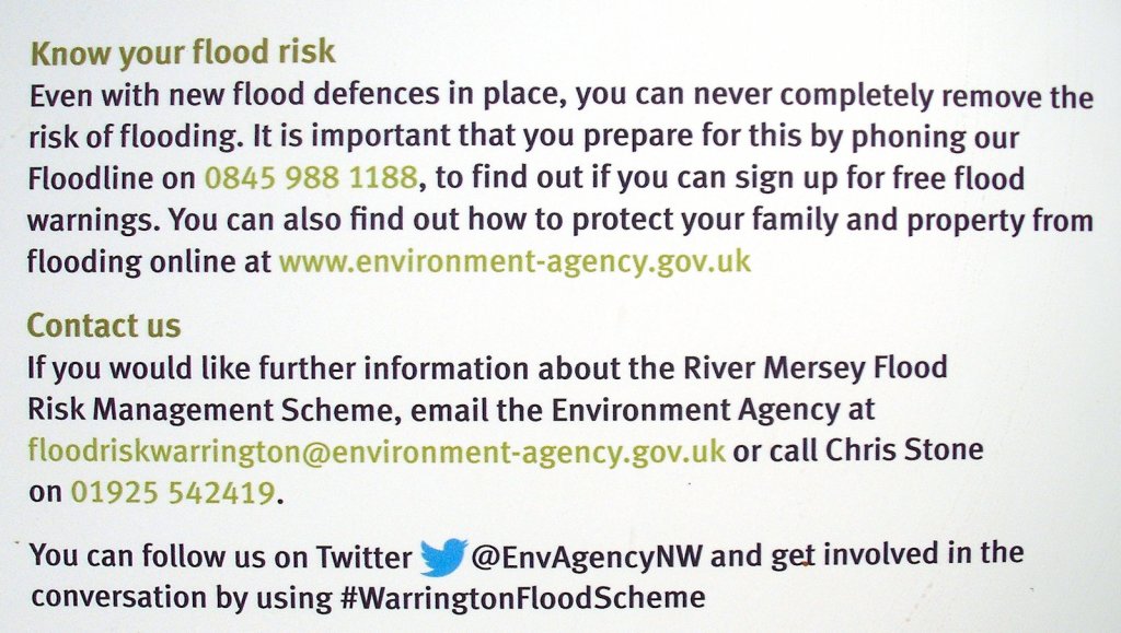
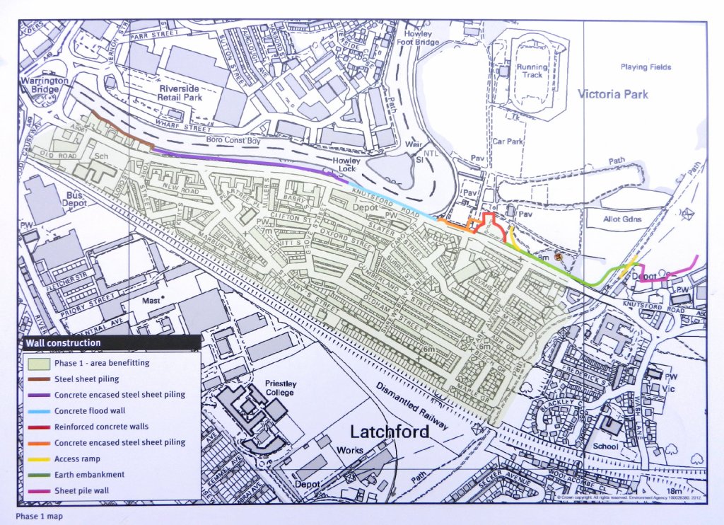
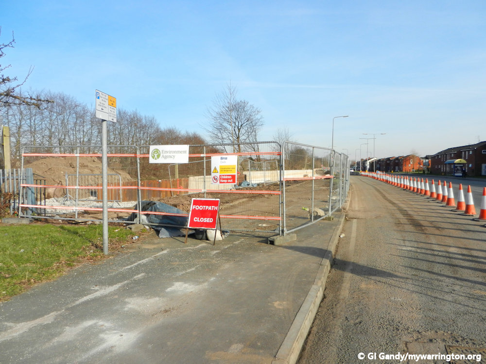
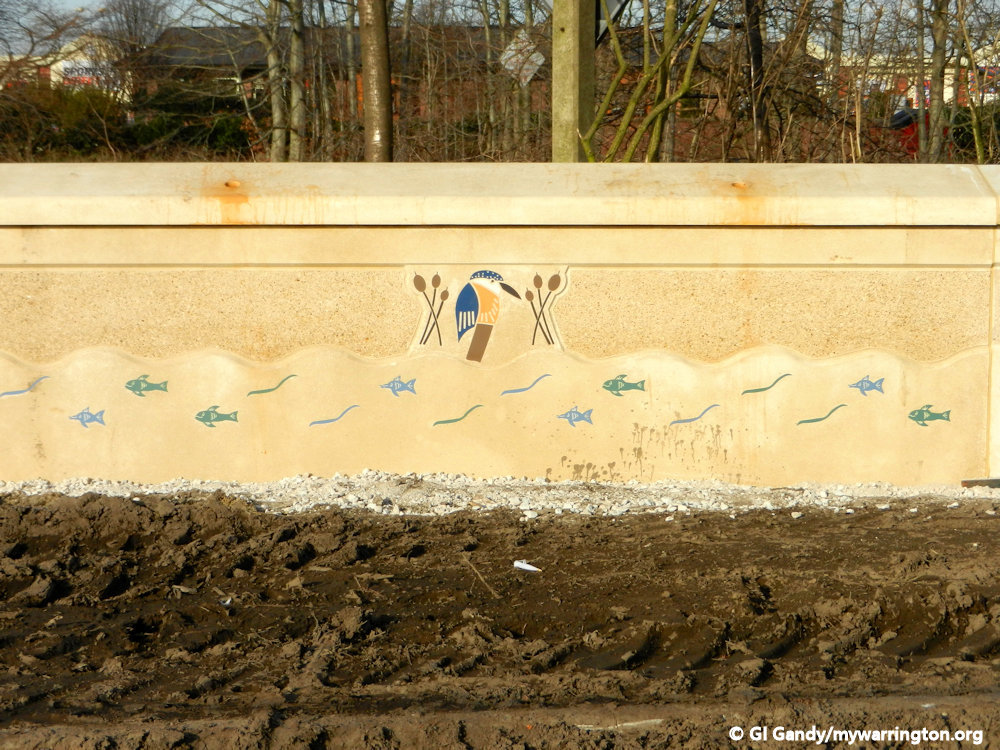
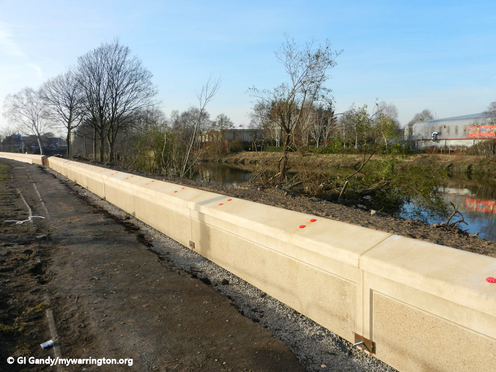
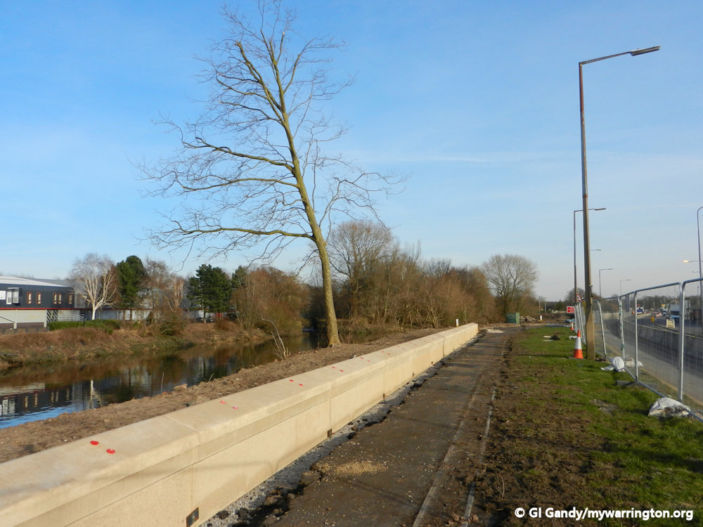
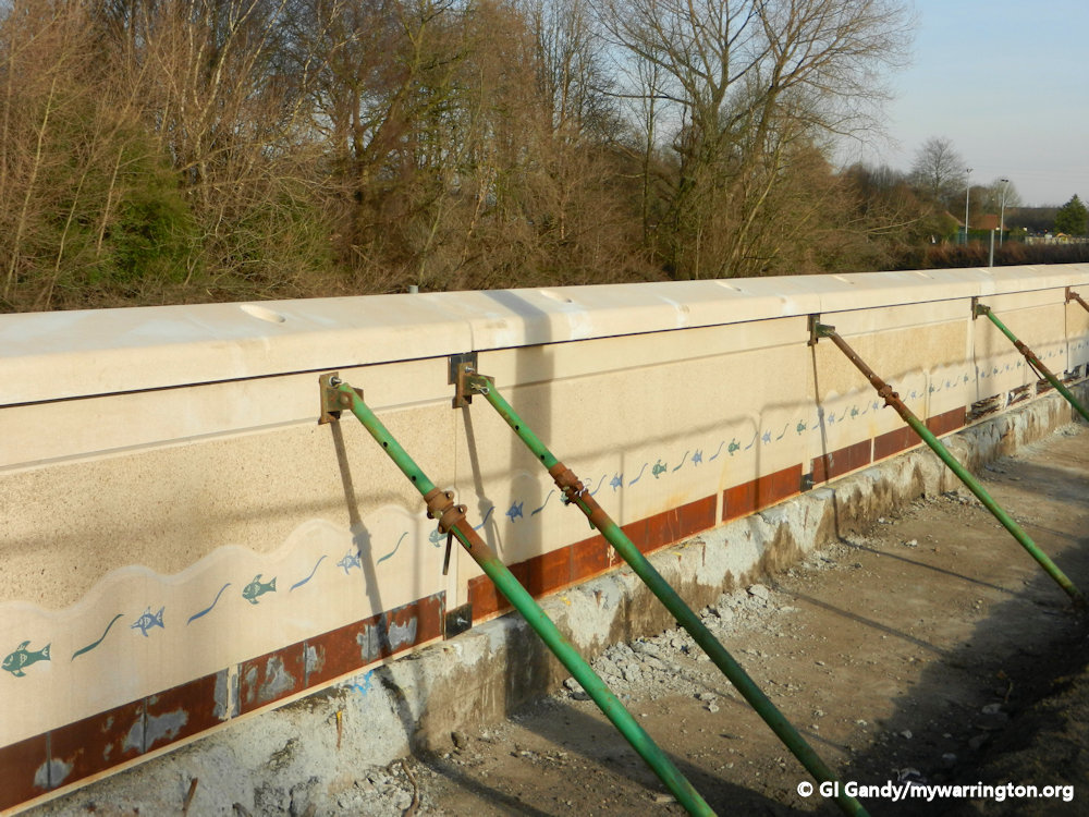
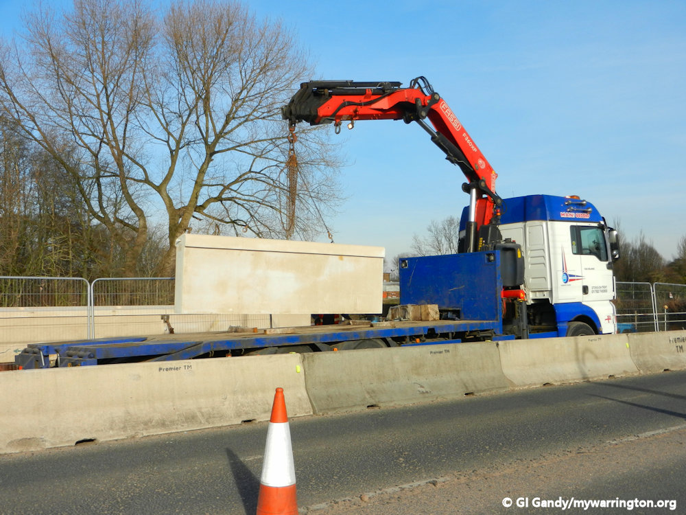
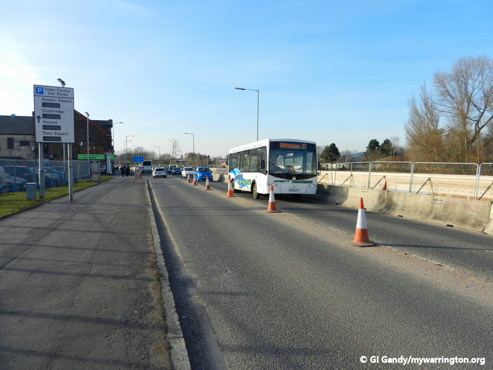
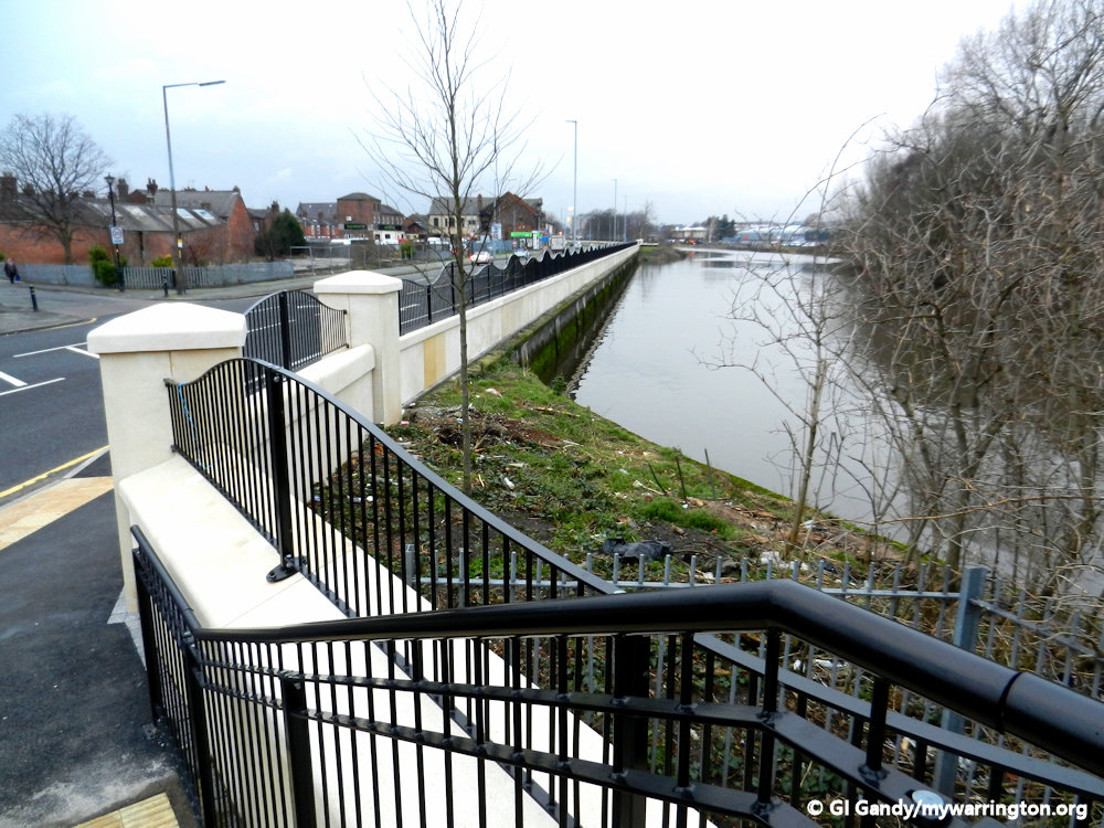
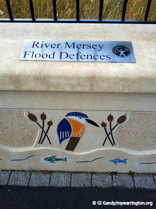
River Mersey Flood Defence Programme
In 2012, the Environment Agency took upon itself to plan for the future in a scheme to help prevent flooding along the areas surrounding the river Mersey. At the same time, the council worked with the Environment Agency to upgrade Victorias park with as remodelled entrance on Knutsford Road. The two slide shows here show the development of each scheme. I have left them as manual slideshows so you can take your time reading the information.
Victoria Park Entrance


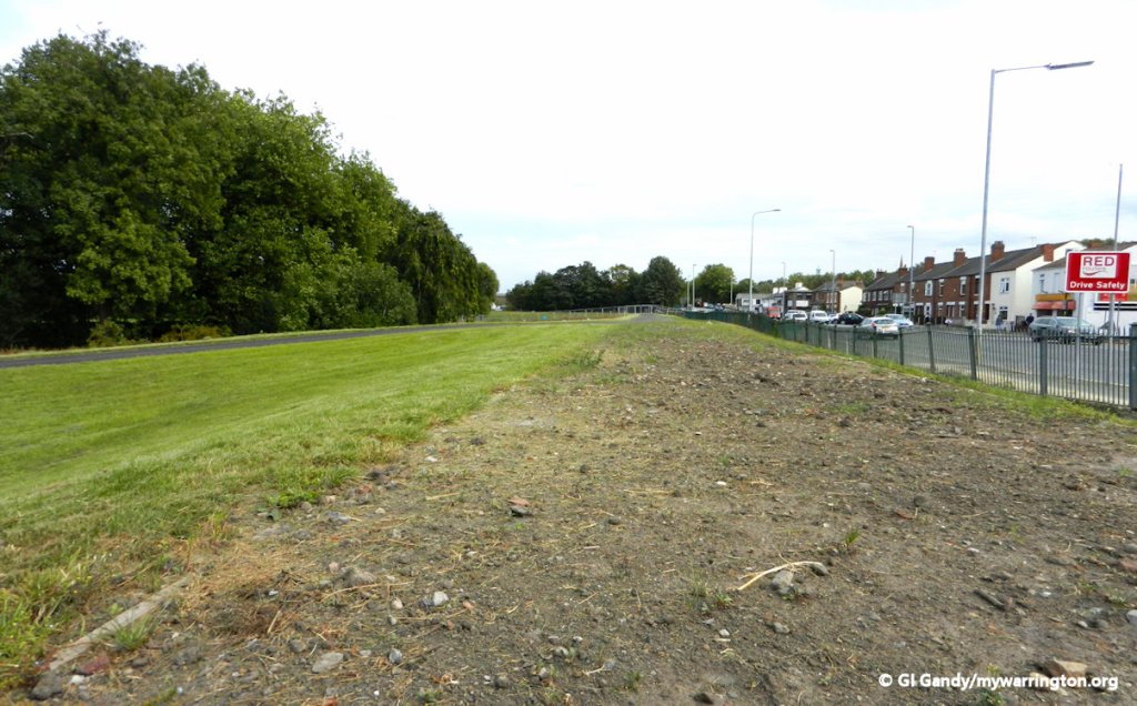


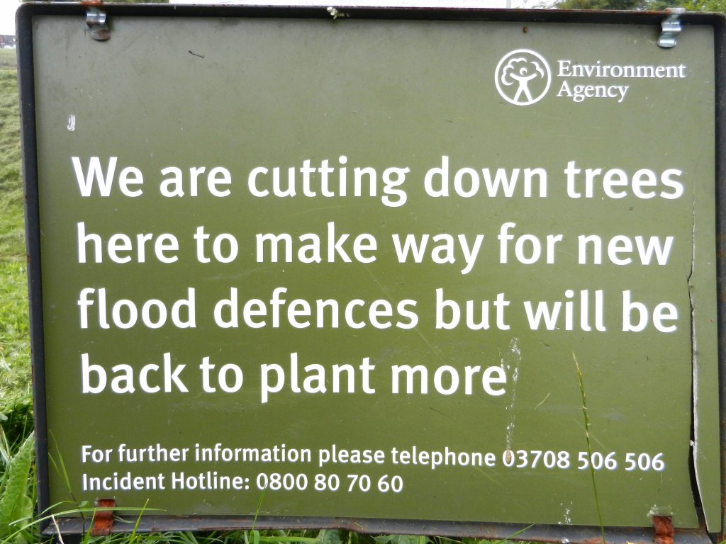
River Mersey Flood Defence


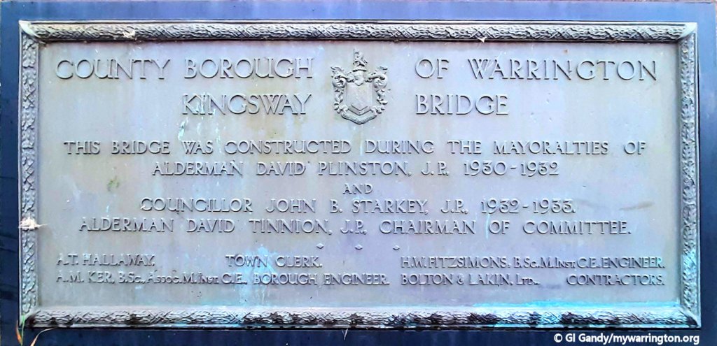
Kingsway Bridge
As time moved on, the need for a second road crossing of the Mersey was raised again. The first idea was a road crossing between Howley and Latchford, the design of which would have cost more than budgets would allow, so a footbridge, the Howley Suspension Bridge, was built instead, as discussed in the Howley section of Downtown.
The second place in Warrington where a road bridge crossed the Mersey was Kingsway Bridge, which officially opened on 5 December 1934. Work had started in August 1931 and was completed in March 1933. The reason for the delay in opening was due to the roads on either side of the bridge not being ready. It was named the Kingsway bridge after King George V gave permission for the name, which sounds strange to me – I can understand it if they wanted to called it the King George V Bridge, but Kingsway could apply to any king, like Kingswood on the west side of the town. Ah well…


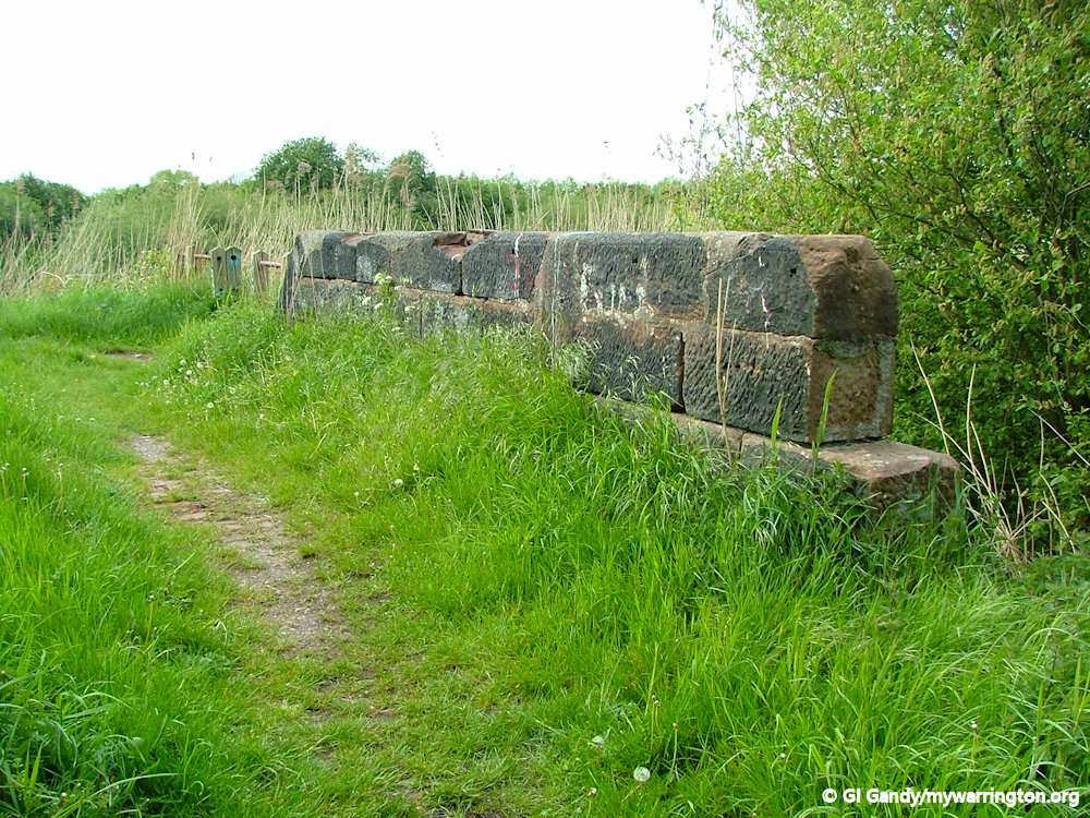
And from my revisit on 15 Aug 2024


Close to Kingsway bridge is a smaller bridge over a dried up stream. This was a feeder for the Black Bear Canal. The canal had a higher water level than both the Mersey and Manchester Ship Canal which were connected to it. Latchford History Group’s book “Latchford Within” tells us in order to maintain the higher level , water was fed to flow from Paddington Lock on the Woolston Cut across an aqueduct, then along the feeder until the water emptied into the Black Bear Canal. This was made simple by using the slight gradient in the stream bed between the Woolston Cut and the Black Bear Canal. There was a sluice gate at the Manor Lock end, to control any overflow of water from the feeder into the canal. On the OS 25 inch map (1892-1914) the area alongside the river Mersey at this point is named Bye Wash.


Kingsway


With a new bridge came a new road leading to it. Like the bridge, it was called Kingsway, Kingsway North on the northern side and, not surprisingly, Kingsway South on the southern side.
The road linked Manchester Road with Knutsford Road and became an alternative route to by-pass the town centre when the A57 was still a single carriageway.
However, at the end of Kingsway South in the village there was a road called Forrest Street. This was renamed Kingsway South in 1934. Why, you might ask? Well, it was named after Mr Forrest, a resident of Latchford House on Knutsford Road and owner of a mill in the Lymm area. Latchford House was built in 1806 and stood in open fields until the village of today was built. Another former resident was William Reynolds, who, along with his nephew Sylvanus Reynolds, became the joint owner of Raddon Court tannery. Forrest Street is remembered in the street name sign at its junction with Thelwall Lane.

Latchford House is now surrounded by Latchford village centre, but once stood on open land. mill owner Mr Forrest lived here and had the former Forrest Street named after him.

Kingsway South now occupies the former Forrest Street.
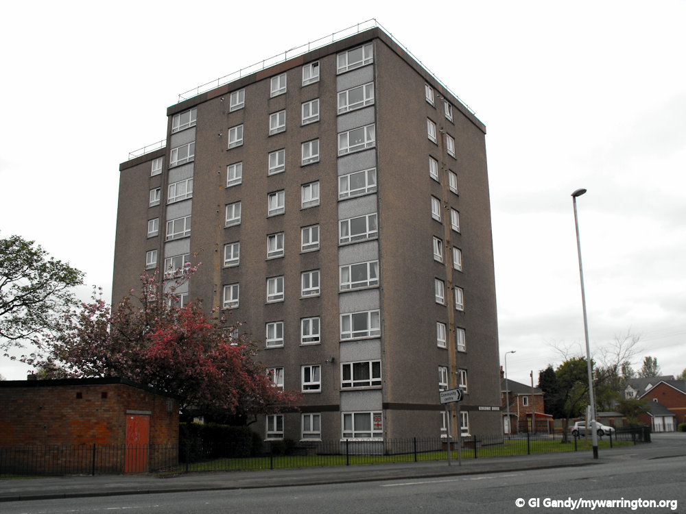
In the photos below we see some views along Kingsway South. The first and second images shows Kingsway House in 2012 and 2024, one of only two council house blocks owned by the council unil Golden Gates Housing Trust (now Torus) took over ownership. The other block is on O’Leary Street in Orford.


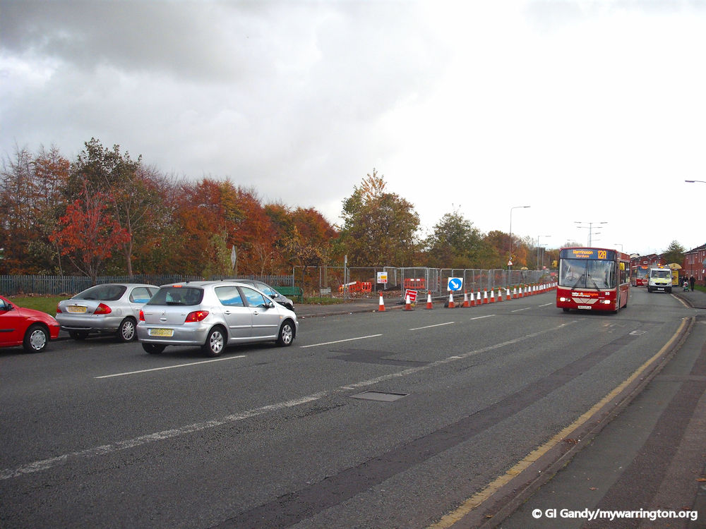
Trans Pennine Trail
The Trans Pennine Trail is is an exciting route for walkers, cyclists, wheelers and horse riders linking the North and Irish seas, passing through the Pennines, alongside rivers and canals and through some of the most historic towns and cities in the North of England. including Warrington.
The Trail from coast-to-coast between Hornsea and Southport is 215 miles (346km) long. The trail enters Warrington at Lymm in the east of the district and travels west along the former route of Warrington and Altrincham Railway via Thelwall, Grappenhall, Latchford and then via country paths through Stockton Heath, Great Sankey and Cuerdley.
The signposts for the trail in Latchford village by the Manchester Ship Canal are really stylish.
Two photos from the trail at Latchford from my walk in 2008.
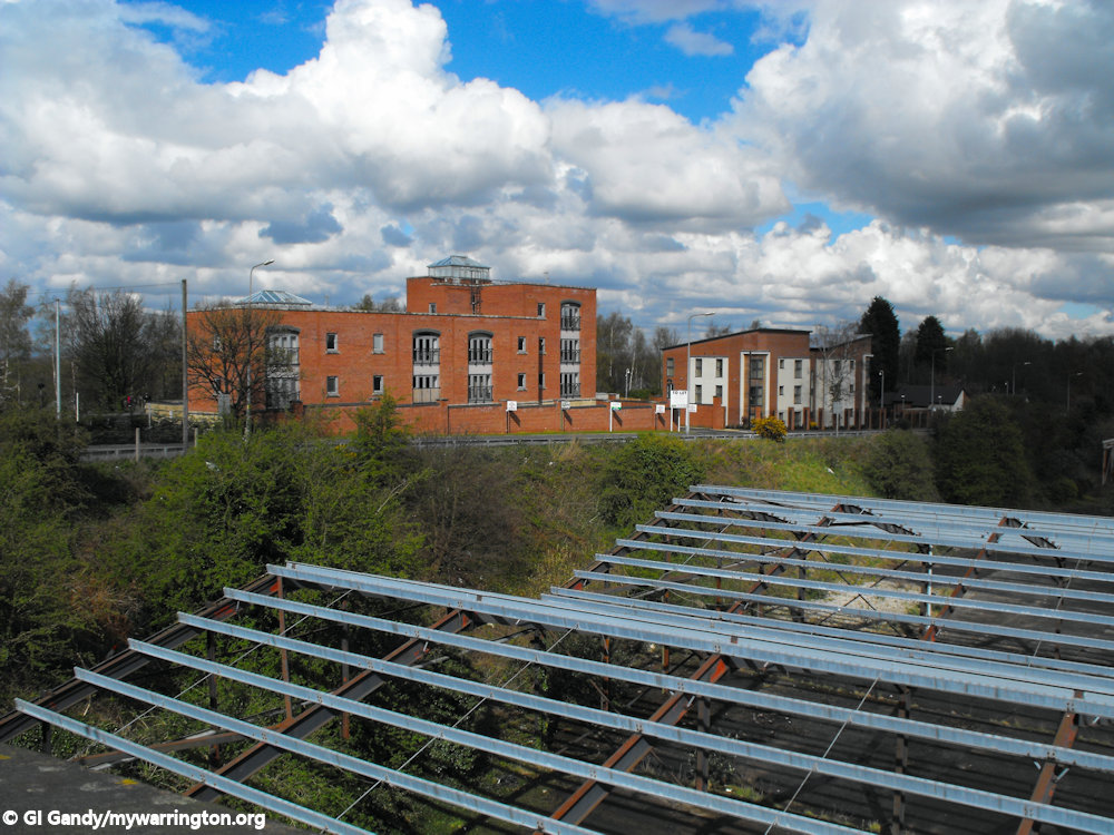
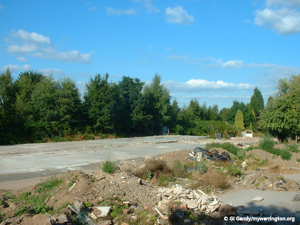
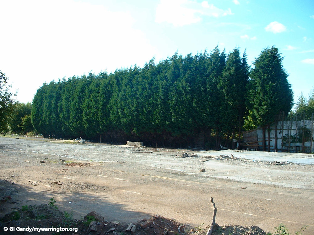
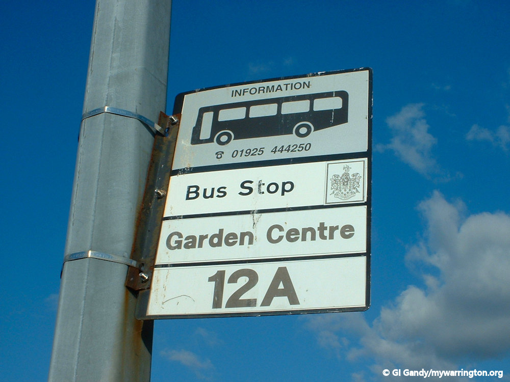
Cantilever Garden Centre
Cantilever Garden Centre was opened in 1965 by the late TV presenter/gardener Percy Thrower. It was located on Station Road close to the Latchford High Level Bridge (the Cantilever, as locals called it).
It was a popular choice for the green fingered public, but as competition grew fierce, a decision was made to close the centre in January 2003.
A Warrington Guardian story in November 2002 said bosses have found that they have been unable to expand and meet demand.
Land owned by the former Railtrack, next to the old Warrington-Lymm line would have been ideal but the company refused to sell.
And the area itself was once affected by planning blight for many years as part of the controversial north-south expressway scheme.
Until the proposals were shelved in the mid-90s, a small part of the garden centre would have been lost to the Cheshire County Council backed link road.
For years the site was vacant until apartments were built. My photos of the deralict site are from 2003 and the apartment photos are from 2012 and 2013.
I do not have any photos of the garden centre itself. If any reader does have some I would love to display them on this page of the website. Email me (please ask for permission if they are not your own pictures).

Here are some photos of the opposite side of Station Road before the new apartments were built.


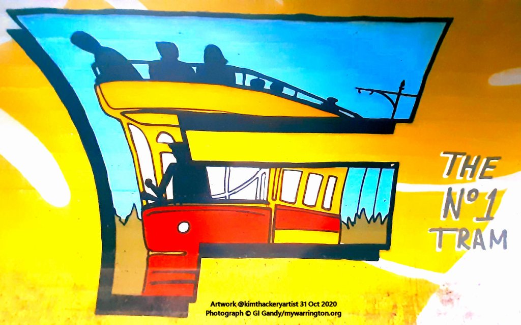
Tramlines
The first electric tramcar route from Warrington opened on 21 April 1902 (at 7.40 a.m. from Rylands Street to Latchford). The tram service linked the town centre with five destinations (Latchford, Longford, Sankey Bridges, the Cemetery Gates on Manchester Road and Wilderspool/Stockton Heath). The Latchford route ran from Station Road to The Sloop Inn at Sankey Bridges, which at that time was the borough boundary. According to the records, 5,875 passengers used the tram on the first day and takings amounted to £24-9s-7d. The service ended on 29 August 1935 when the route was taken over by motorbuses. When trolley buses took over in 1935 the tramlines were left in place on Knutsford Road and tarmac was applied over the top of them. I know this from when road maintenance was undertaken on 7 Oct 2012 when the lines were once again visible (as my photos here show).


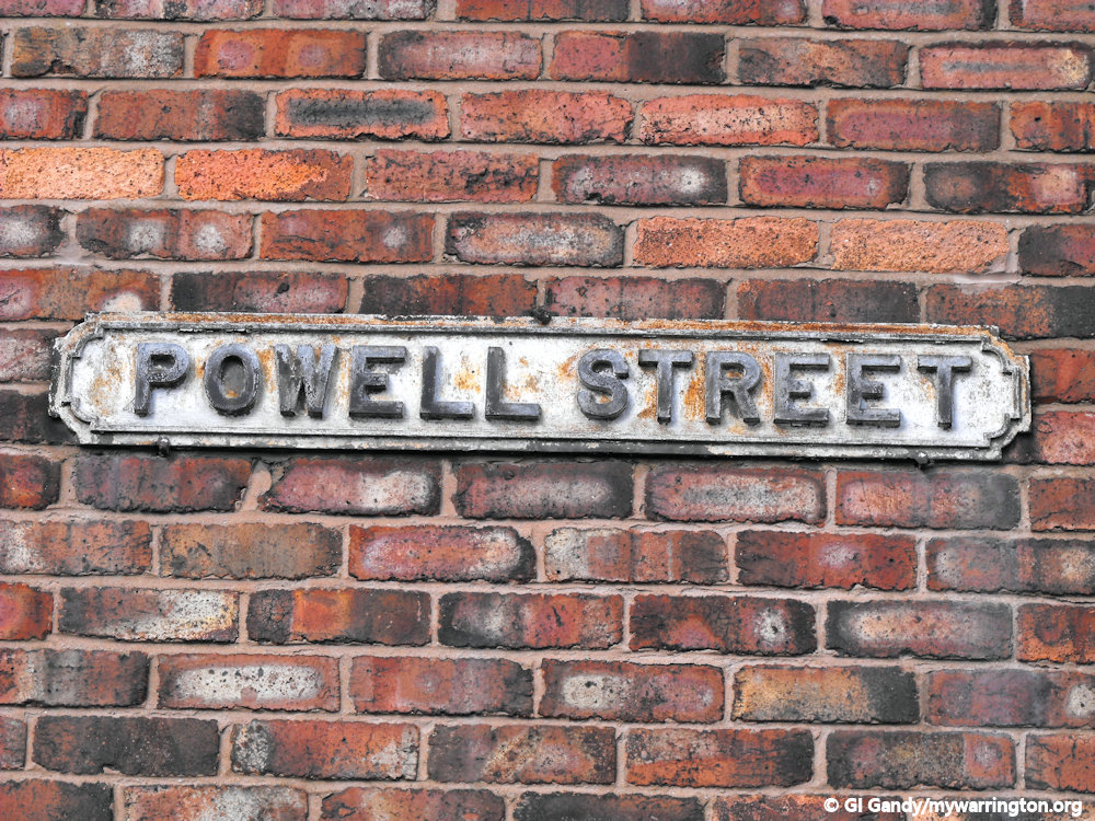
The Premier Cinema
The Premier cinema opened in 1924 and stood on Powell Street. The building is still there to this day and currently vacant (March 2013).
Read more about the cinema on the At the Flicks page.
Church Life
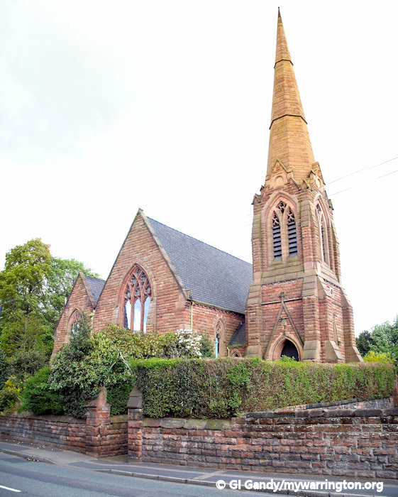
St James Church, Latchford
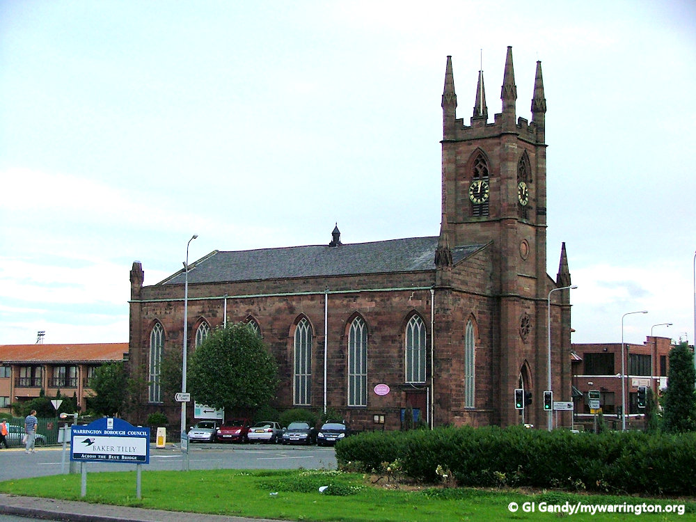
St James Church, now rebuilt on Wilderspool Causeway, originally stood close to Warrington Bridge on Knutsford Road (known as Chapel Street at the time) opposite the Royal Oak Branch and was opened on 2 June 1777. The first minister was the Reverend James Glazebrook who inaugurated one of the first Sunday Schools in England on 4 April 1779. The relocation took place in 1829.
The four-faced clock was originally destined for the Parish Church of St Elphin on Church Street in Howley but was deemed too heavy. Latchford History Group’s excellent book Causeway Connections tells us a deal was struck between the two churches and the clocks were exchanged in 1866.
Close to the original church on Knutsford Road was the Peel Ainsworth cotton factory. A Boulton & Watt steam engine was installed there in 1787 to become the first cotton factory in the north of England to be powered by steam.
See also the Wilderspool section for additional notes.
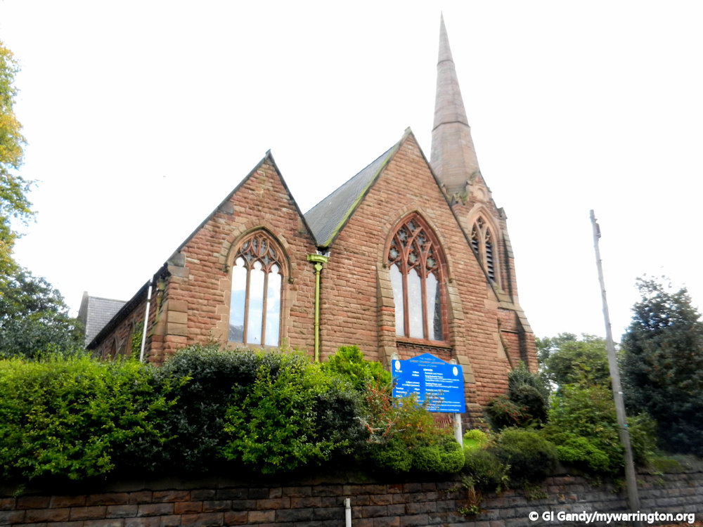
The current St James Church on Wilderspool Causeway.
Christ Church Latchford
In 1844 Thomas Greenall donated land for the building of an infants school on Wash Lane. As the population of Latchford grew, a new church was needed.
When Greenall died in 1848 a new church was built in his memory and opened as Christ Church on 16 July 1861, standing close to the estate of the Broadbent family.
I am told stained glass windows in Christ Church are dedicated to various local people.


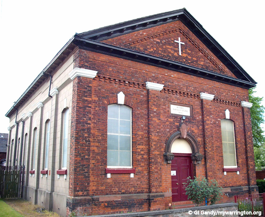
Latchford Baptist Church

Latchford Baptist Church is on Loushers Lane and was originally set up as a breakaway church from Hill Cliffe Baptist Church at the private house of Joseph Williamson on Ackers Lane in 1849.
He later became the pastor of the church. Ackers Pit was used to baptise believers in the early days. (Baptists believe in total immersion in water to symbolise a complete washing away of sins.)
The Loushers Lane foundation stone shows it as Bethel Baptist Chapel 1860, the ceremony taking place on 10 July that year. A memorial to Joseph Wilkinson stands in the grounds of the current church building. The Sunday School building was opened in 1878.


Latchford Methodist Church
Methodism in Latchford goes back to the 1700s where it is said meetings took place above a wheelwright’s shop and later in a house on Wash Lane.
As the congregation grew, so did the need for bigger premises. These include the Old Barn in Thelwall Lane (1876) and the Temperance Hall opposite the Railway Inn on Knutsford Road from 1879 until 1894 when Latchford Methodist Church was built on Thelwall Lane.
The land upon which it is built was purchased for £250 and the church cost £2,000. A Sunday School was added in 1906 at a cost of £1,000 and the chapel was enlarged in 1932, with seating now for 230 worshippers.


Our Lady & St Augustine of Canterbury
The first Catholic Mass in Latchford was led by Father Alcock in 1869. St Mary’s Church opened on St Mary’s Street in 1871 and was dedicated to Our Lady of the Assumption by Bishop James Brown in 1873. The change in name was due to confusion with St Mary’s Church on Buttermarket Street. Originally a church and school stood on the same site on St Mary’s Street and the church building we see today was erected in 1903 adjoining a school.

It was registered as a Grade II listed building on 17 March 2005. It was later known as Our Lady & St Augustine of Canterbury (see the next section for an update)

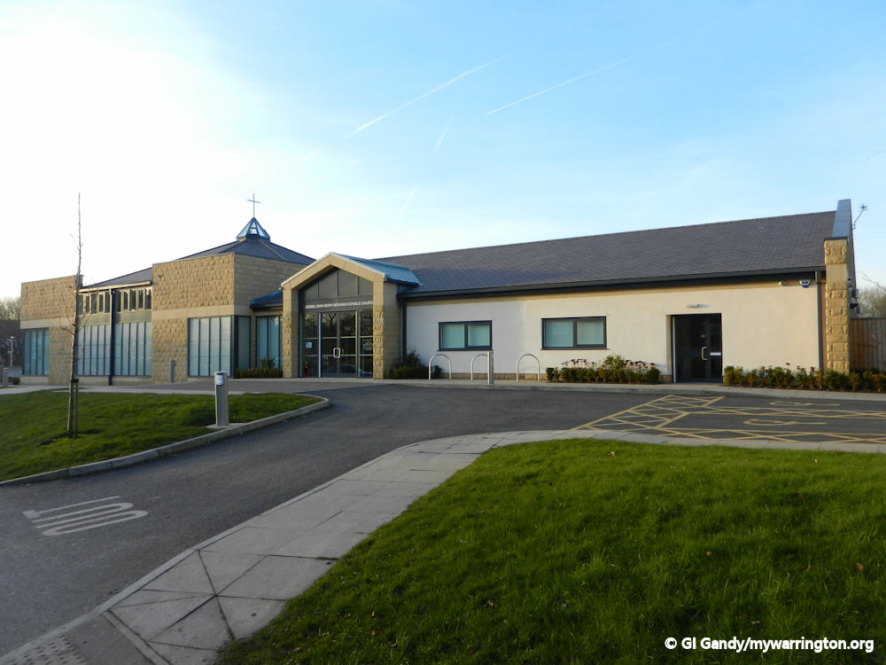
Blessed John Henry Newman Church
A new church building was opened in 2010 on Knutsford Road, close to Wash Lane, and was the first Catholic church built in the village for about 50 years.
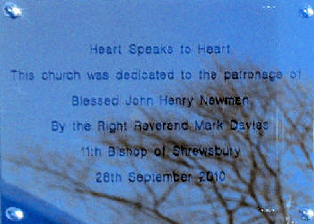
The foundation stone was laid in 2009 and it was named the Blessed John Henry Newman Church. A plaque on the building says it was dedicated by the Right Reverend Mark Davies, 11th Bishop of Shrewsbury, on 28 September 2010.
The congregations from St Mary’s Street and the now-demolished St Augustine’s in Latchford use the new building. The St Mary’s Street building will be kept for community use.


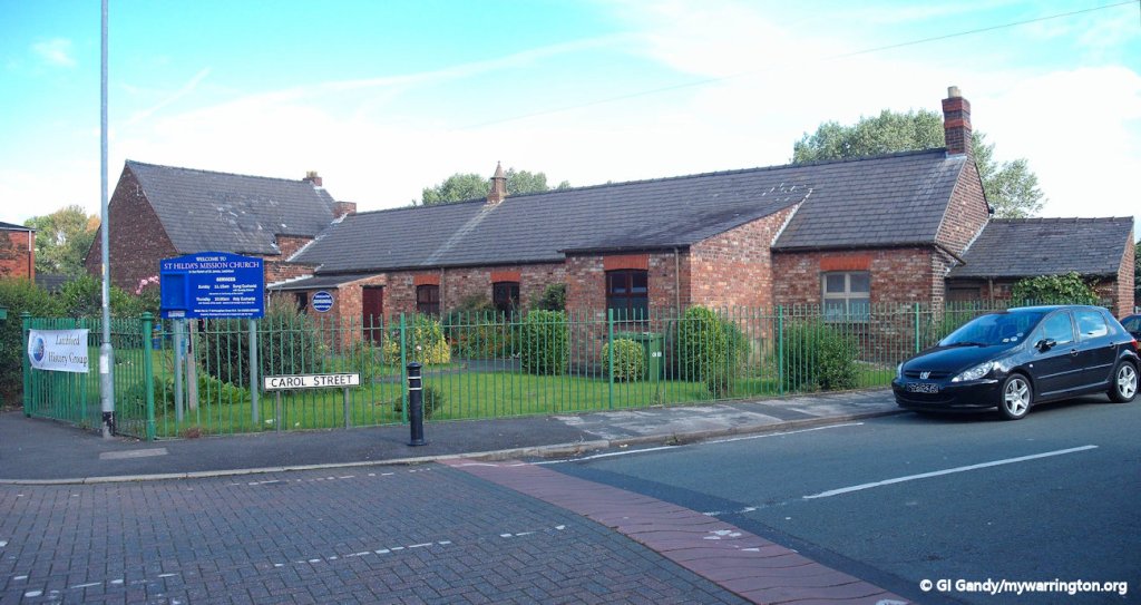
St Hilda’s Mission
St Hilda’s Mission church is on Slater Street. The building we see today was erected in 1915 to replace the previous building.
It is also the home of Latchford History Group who meet there every Wednesday morning.
Formed in 1996, their aim is to research and promote the history of Latchford – from its architecture and geography to its community and the story of their lives and livelihoods over the centuries. Read about the group here.
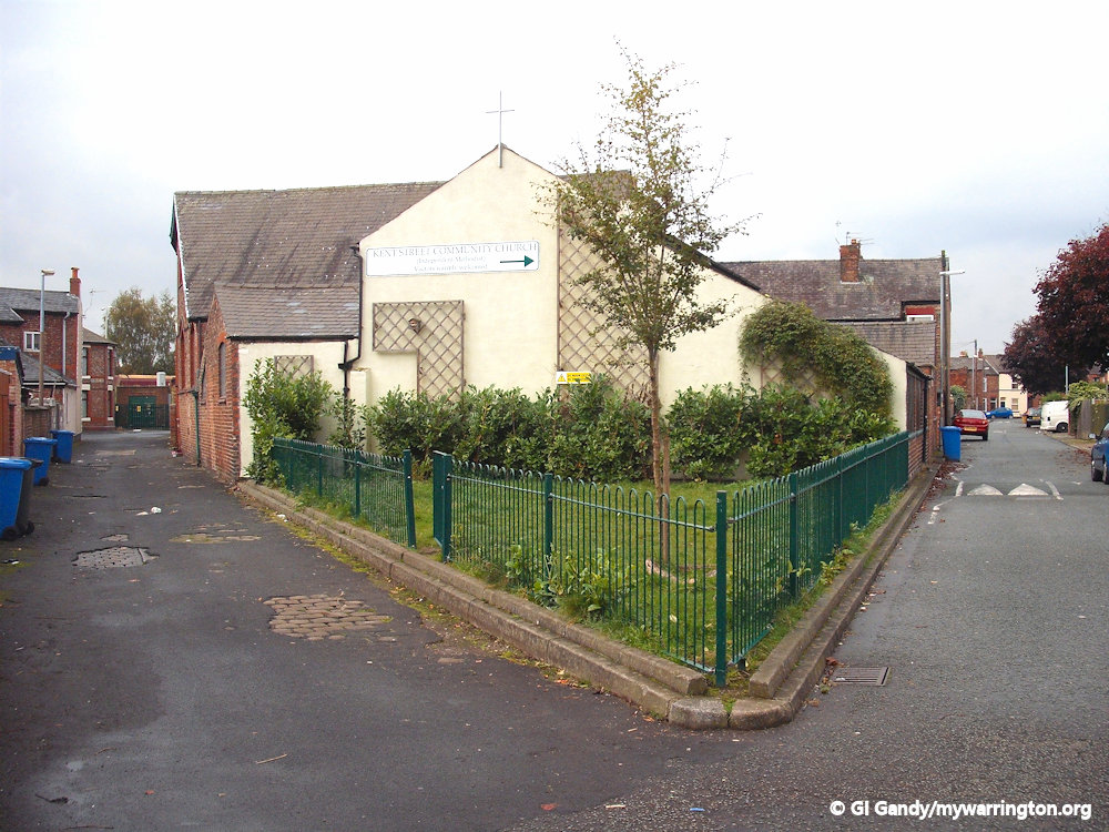
Kent Street Mission
Latchford Within, a great publication from Latchford History Group tells us Kent Street Mission was originally called Wright’s Mission, named after the local man who built the mission. The chapel opened in 1907 and closed in 2010. The building was then handed over to Westy Christian Fellowship and renamed ‘Kent Street Community Church’ who have used it ever since.
Sikh Temple
The Sikh temple in Latchford is known as The Guru Nanak Gurdwara. The Punjabi word gurdwara literally means “the residence of the Guru” or “the door that leads to the Guru”. In modern Sikhism, a gurdwara is any building that contains the Guru Granth Sahib, the book of Sikh scriptures, which is considered the Guru. The Guru Granth Sahib is a collection of songs, poems, and other writings from the gurus, as well as from Hindu and Muslim sources. It’s also known as “the Last Guru” because the line of 10 human gurus ended with Guru Gobind Singh in 1708. The group in Warrington is a registered charity.

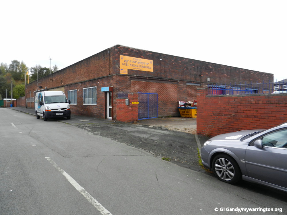
See Warrington-Worldwide for a story of one aspect of their work in the community. During the Covid-19 pandemic, the group cooked over 600 meals for NHS staff who had worked long shifts and found the shelves empty at supermarkets at the end of their shift. See the Warrington Guardian for a report on their wonderful efforts to support our keyworkers.
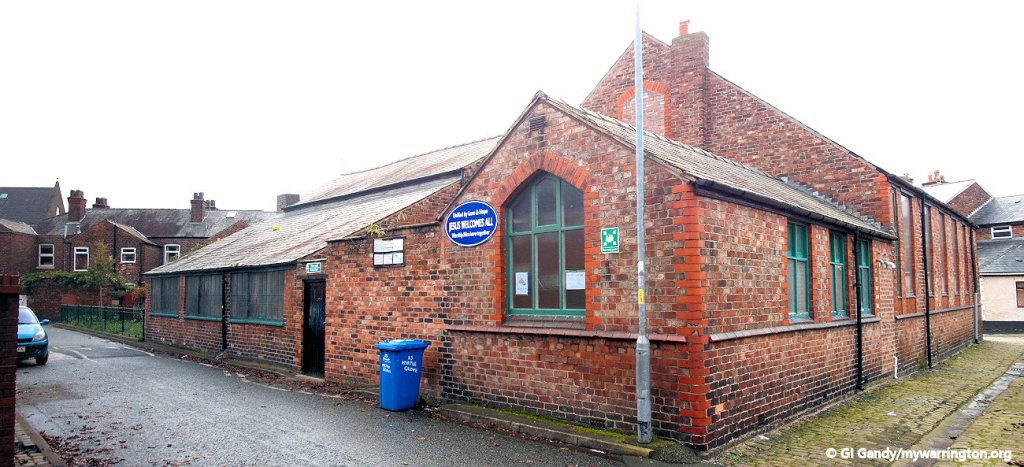
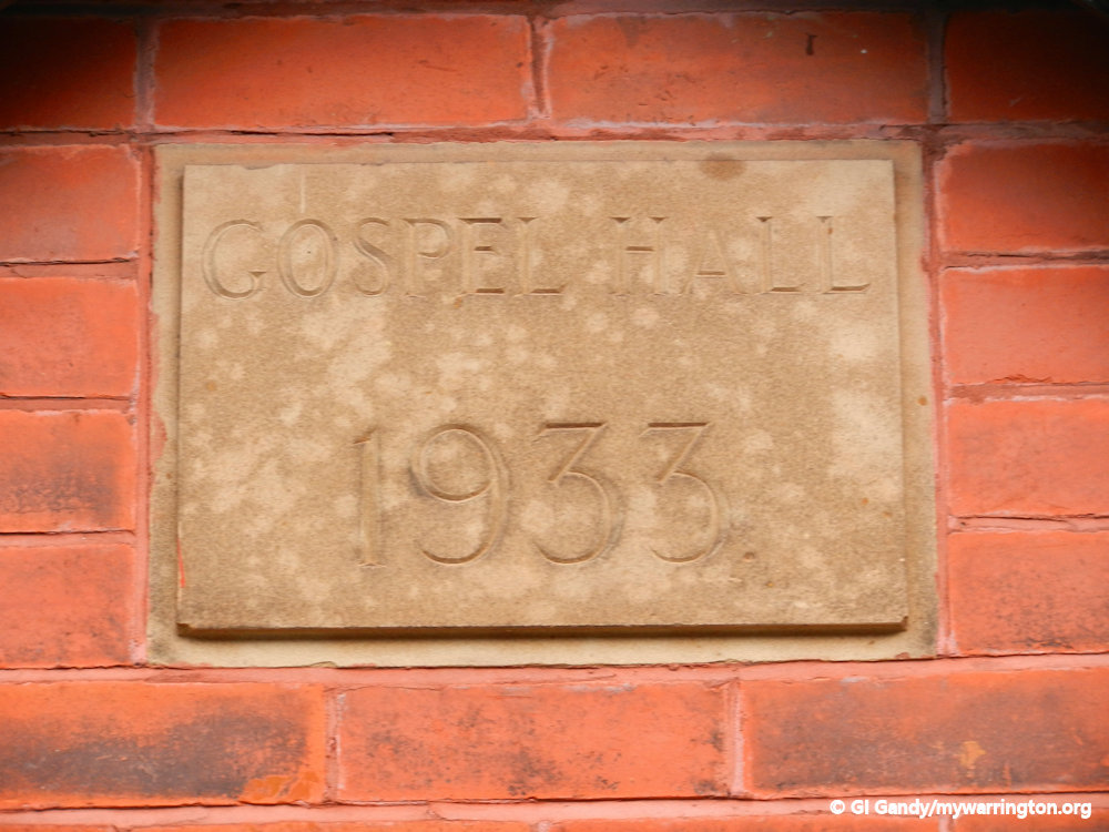
Former Gospel Hall
Gospel Hall opened in 1933 on Dover Road in the district. In 2016 a planning application was presented to the council for a new use a the building when it closed as a mission. However, that plan was rejected. The building has now been converted into a private residence.


School Life
Sir Thomas Boteler Grammar School

Sir Thomas Boteler Grammar School was moved from School Brow in Fairfield to Knutsford Road, Latchford in 1940.
It was founded in 1526 by Sir Thomas Boteler, later to be the High Sheriff of Lancashire, in 1535. He left a legacy to pay for the education of six “poor boyes of the parishe” and it later became the Boteler Grammar School for Boys, serving the whole of Warrington.
The original school was located in the town centre and the nineteenth century building survived at School Brow as a council depot until 2005 when it was demolished to make way for a housing estate.

In 1936 there were plans for a new school at Latchford, built by the Warrington Education Committee. The school relocated to its current site in 1940, becoming a boys’ school. Girls were to be educated at the former site but were later moved to the High School for Girls (now Priestley College on Menin Avenue, Wilderspool).
From April 1974 the schools were administered by the Cheshire Education Committee. Boteler became a mixed comprehensive school in 1979 and merged with Richard Fairclough Secondary Modern School in 1983 to become Warrington Victoria Park County High School. In 1988 the two schools split up: the Richard Fairclough building was closed and the Boteler school was renamed Sir Thomas Boteler High School in 1988.” Many readers will remember the Richard Fairclough school was known as Dickie Flourbags.

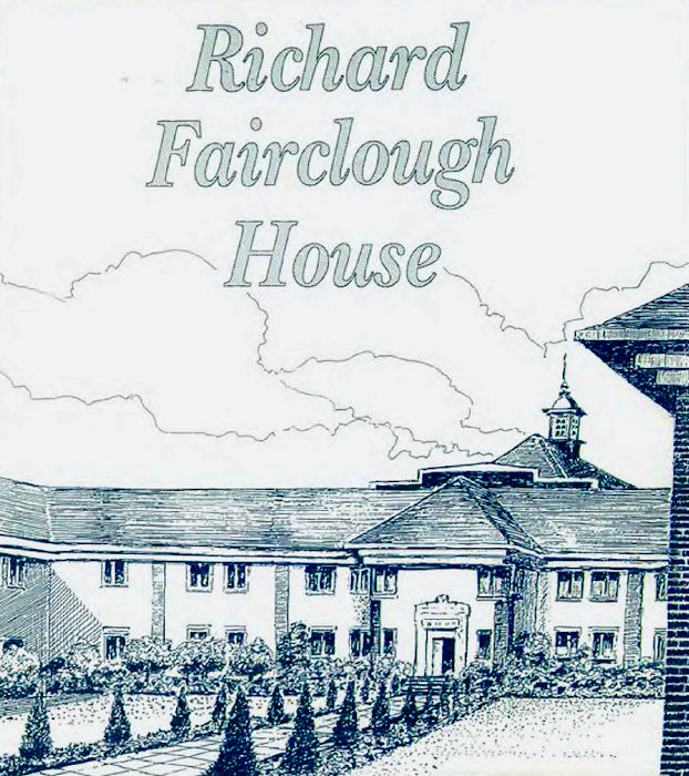
The Richard Fairclough school building was later taken over by the Environment Agency and is now known as Richard Fairclough House.
This is an edit report on the history of the school. For a more detailed version, see the Education section of the website.


Richard Fairclough School
Richard Fairclough’s was, without doubt, a school ahead of its time. Architects Hamlett design S. White and E. H. Hamlett designed the classrooms with an emphasis on light and airy conditions.
The school opened in 1934 and offered excellent facilities especially for subjects like domestic science, woodwork and chemistry but as the times dictated, there was strict segregation between the boys and girls schools, a fact which explains the outstanding symmetry of the original building. Indeed, one of the main school rules was no fraternising with members of the opposite sex. Segregation even went as far as two portraits of Richard Fairclough, one for the girls and one for the boys!

The first headmaster of the boys school, Robert Hunman, took his role very seriously indeed. He regularly stressed the importance of the training of teachers and demanded total commitment from his staff saying: “It is a tremendous responsibility that we have on our hands, the sacredness of human personality – never let us betray that trust.”
Reginald Maddock replaced Robert Hunman as head in 1957 and not only mirrored the high standards of his predecessor but introduced new and innovative ideas. He believed firmly in breaking down the barriers which existed between the school and the local people, pioneering community oriented education which became known as The Fairclough Tradition’.

But it is as an author of boys adventure books that he is perhaps better known. The Corrigan series, which started with ‘Corrigan and the White Cobra’ in 1956, not only met with great success in this country, but was published in several different languages.
No school would be complete without its ghost story, and Richard Fairclough is no exception. Former caretaker Harold Fogg often talked of the time he spotted a mysterious lady looking at him from the staff room window when he knew there was nobody else in the building. Add to that the stories of sounds and smells such as the shuffling of feet along one of the landings when nobody was about, the smell of cooking bacon and tobacco that appear from nowhere, and the famous room 20 where banging noises were heard and the water boiler came on with the help of no human hand and you have enough mystery and intrigue to ensure that late nights at the office are definitely not something to look forward to. But think positively. At least you will never be lonely.
- I am grateful to the Environment Agency for permission to use extracts from their documentation in this report. This section is repeated in the profile of Richard Fairclough in Warrington People, where you can also read more notes on Warrington’s early history from the Latchford area.
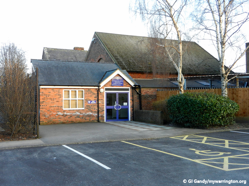
Latchford St James Church of England Primary School
Latchford St James Church of England Primary School began in 1814 on the corner of School Street and Knutsford Road. Prior to this, lessons were conducted in St James’ Church itself. The church was built on Chapel Street (later called St James Street and now Knutsford Road) near Warrington Bridge in 1777, and was consecrated in 1781. The first Sunday School opened in 1779 but the church building proved inadequate to hold classes, so funds were raised to build a school. The school is now based on Old Road. Visit their website.

Bolton Council School
Bolton Council School was opened in 1908 on Longdin Street and named after Alderman William Bolton, Mayor of Warrington from 1903 to 1906. He was born in 1852, the son of Thomas and Elizabeth Bolton and educated at the People’s College on Arpley Street, Warrington.
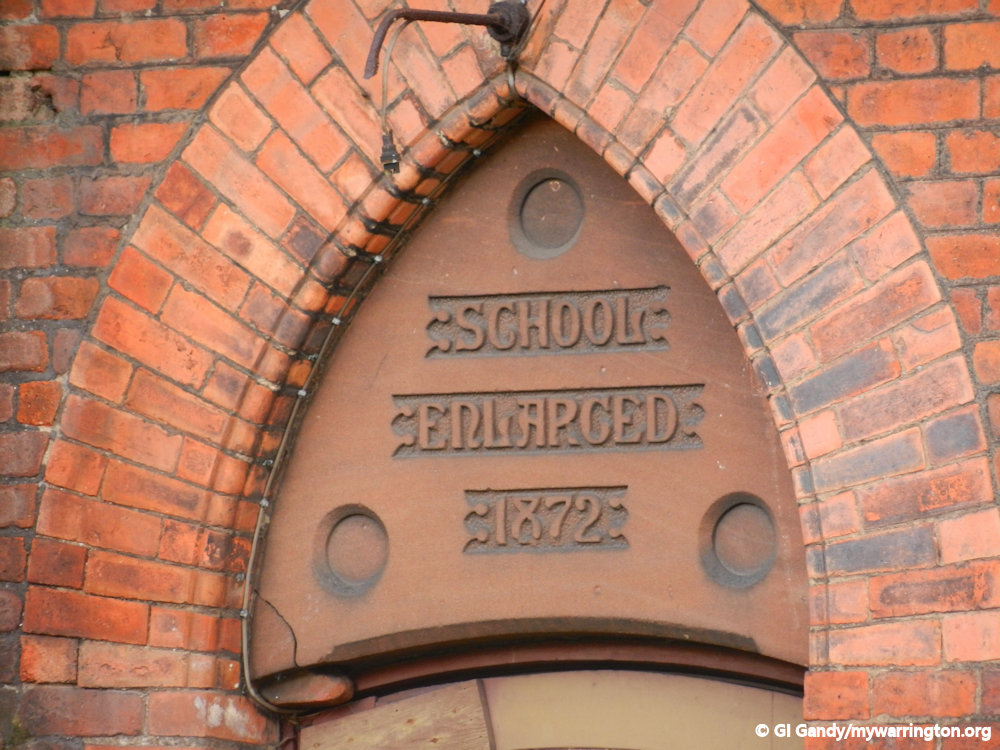
The origins of the school go back to 1844 when the village of Latchford became more populous and an infants school was built on Wash Lane. The school was enlarged in 1872 and in 1889 a new building was erected on Grappenhall Road, now known as Grammar School Road.
The foundation stone for the Longdin Street school was laid on Friday 5 July 1907.
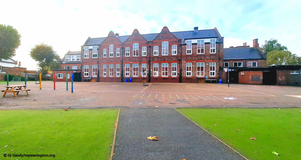
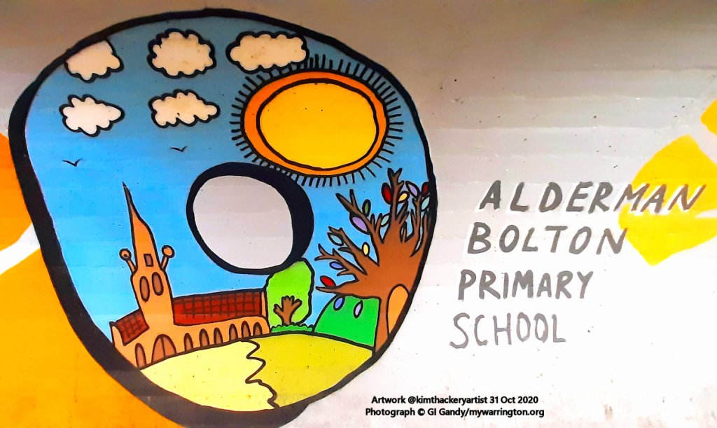
The school is now known as Alderman Bolton Community Primary Academy and has 430 places for five to 11 year olds, and 30 full time equivalent places in its nursery. The school received a five-star ‘excellent’ rating for its food hygiene in February 2011. Visit their website.
St Augustine’s Catholic Primary School
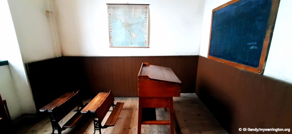
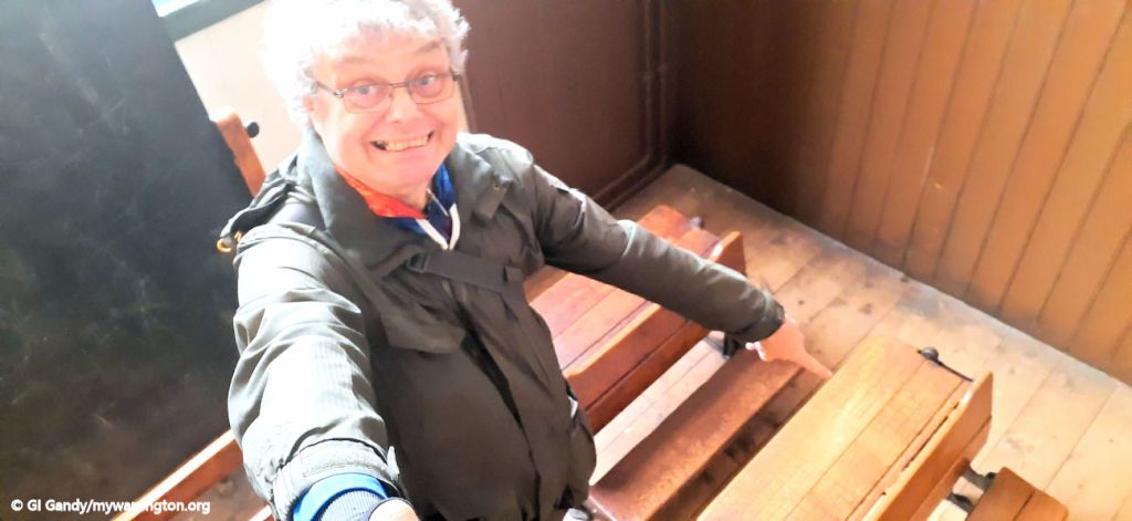
St Augustine’s Catholic Primary School was opened on 17 August 1936, three years after the St Augustine’s Catholic Church. Bishop Moriarty of Shrewsbury performed the opening ceremony. Latchford History Group’s publication about the school, “Top Class”, highlights the weekly ritual that every pupil from the day would recall – the filling of the inkwells before Laslo Biro invented the ballpoint pen. In fact, my main photos here show life before the ink wells – slates and chalk. Those desks don’t seem to have spaces for inkwells.
Little Johnny says, “Sir, can I get into trouble for something I haven’t done?” Teacher says, “No. Why?” little Johnny replies, “Good. Cos I ain’t done me ‘omework.” For that the teachers asks him “What is the Capital of England?” “E” he replied. Boys will be boys!


Photos from my visit to Verdant Works Museum in Dundee in 2023
Pub Life
Grange Sports and Leisure Club
The Grange on Grange Avenue (now the Grange Sports and Leisure Club) was built in 1647 as the home of John Earle. It is named on some old maps as the Old Manor House and later Latchford Grange. The Earle family were wealthy merchants and ship owners and John Earle’s descendants supplied goods to Horatio Nelson.The British Aluminium Co. took over the buildings in 1951 to make a social club for its employees and sold them in 1994 for their current use. The stables of the Grange were where Old Billy, the oldest horse in the world retired. Old Billy was aged 62 when he died.
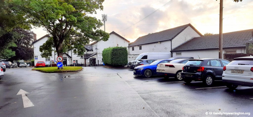
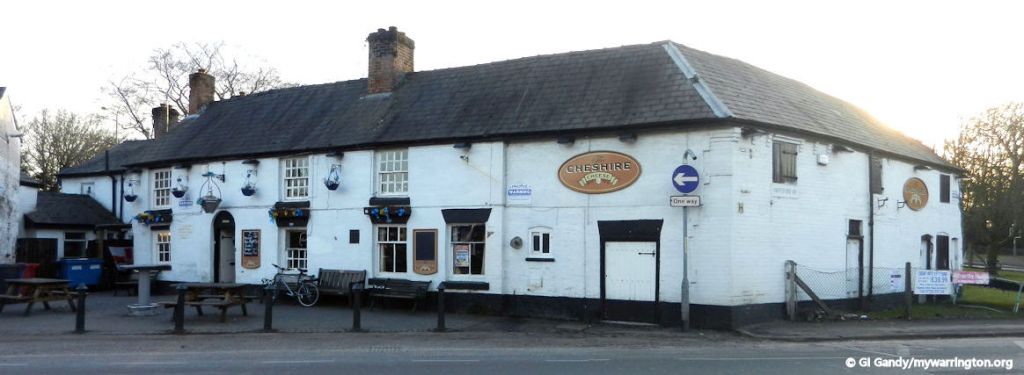
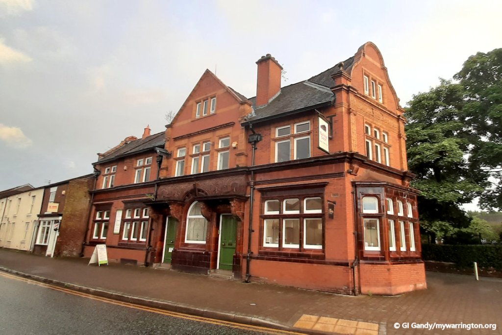
The Cheshire Cheese
The Cheshire Cheese pub is the oldest pub in Latchford and is mentioned in a document dated 1735, but not as a public house – it is first mentioned as a public house in 1750.
It had various owners until 1812 when it passed to the Pierpoint family. In 1869 the land was leased to Greenall Whitley for 999 years.


15 Aug 2024

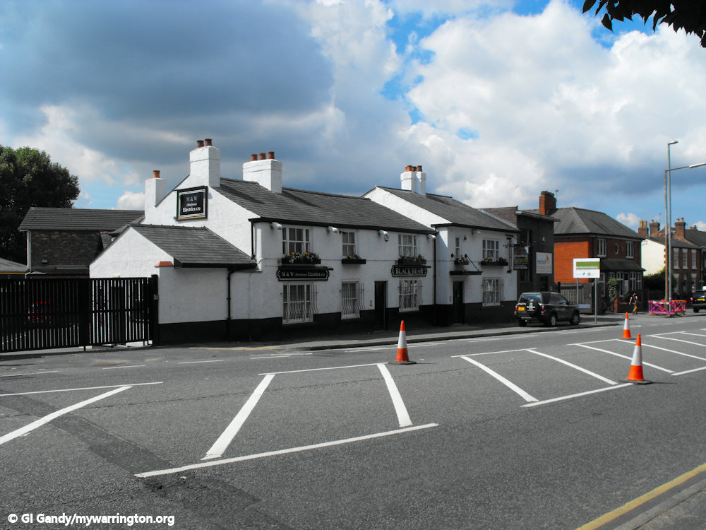
The Black Bear Inn
The Black Bear Inn was built in 1748. The building was extended in 1929. A Daniel Johnson ran a business there for years making basketware from willow grown in The Twiggeries in Howley. See Warrington Green 2 for more on The Twiggeries.
It is no longer a pub, but the building still stands and is occupied by an electrical business, M & W (Woolston) Electrical Ltd.

The Railway Inn
The Railway Inn was built on land on Latchford Heath and the first mention of a beerhouse on the land was in 1882. The current building dates to 1904 when the local authority purchased land to make road improvements at the junction of Knutsford Road and Grappenhall Road (now Grammar School Road).
In recent years it closed as a public house and was put up for let. The building was called Railway Court from that point forward.
In 2012 part of the building was opened up as Station Coffee, serving snacks and drinks. In 2022 the cafe was called Toast. In Aug 2024 the cafe had gone and is now Allure Beauty salon. At the opposite end of the building there is Gym and Tonic fitness training.


Kings Club
Kings Club on St Mary’s Street was Latchford Conservative Club from 1911 to 1990, but before that it was a house called Mary’s Villa. It was built sometime before 1854, the year the railway opened, which runs alongside.
The 1881 Census tells us a Charles Lervarus, a draper born in Lincolnshire, lived there. The name Mary’s Villa is possibly linked to the name of the street on which it stands.

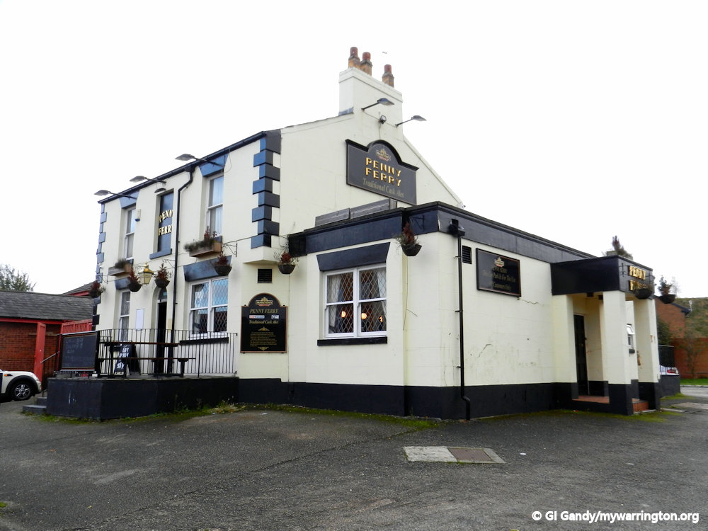
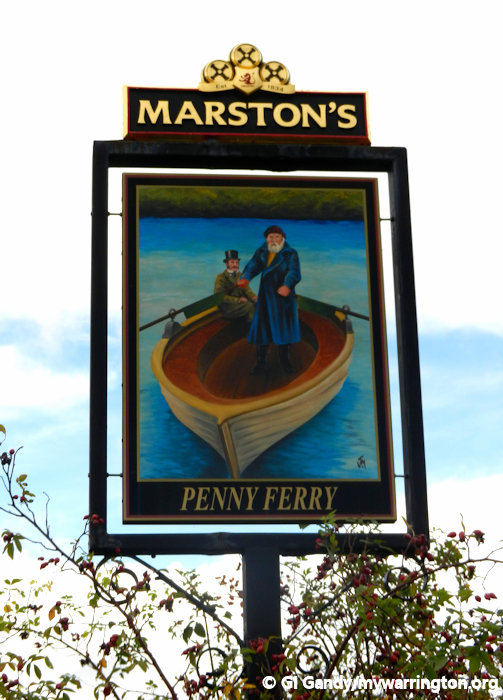
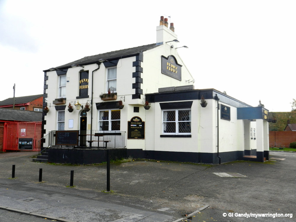
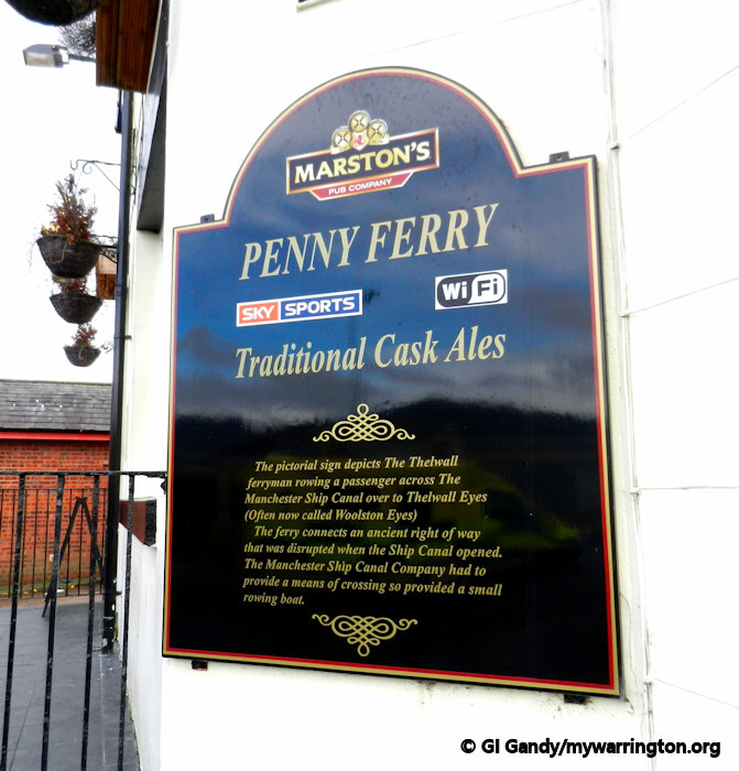
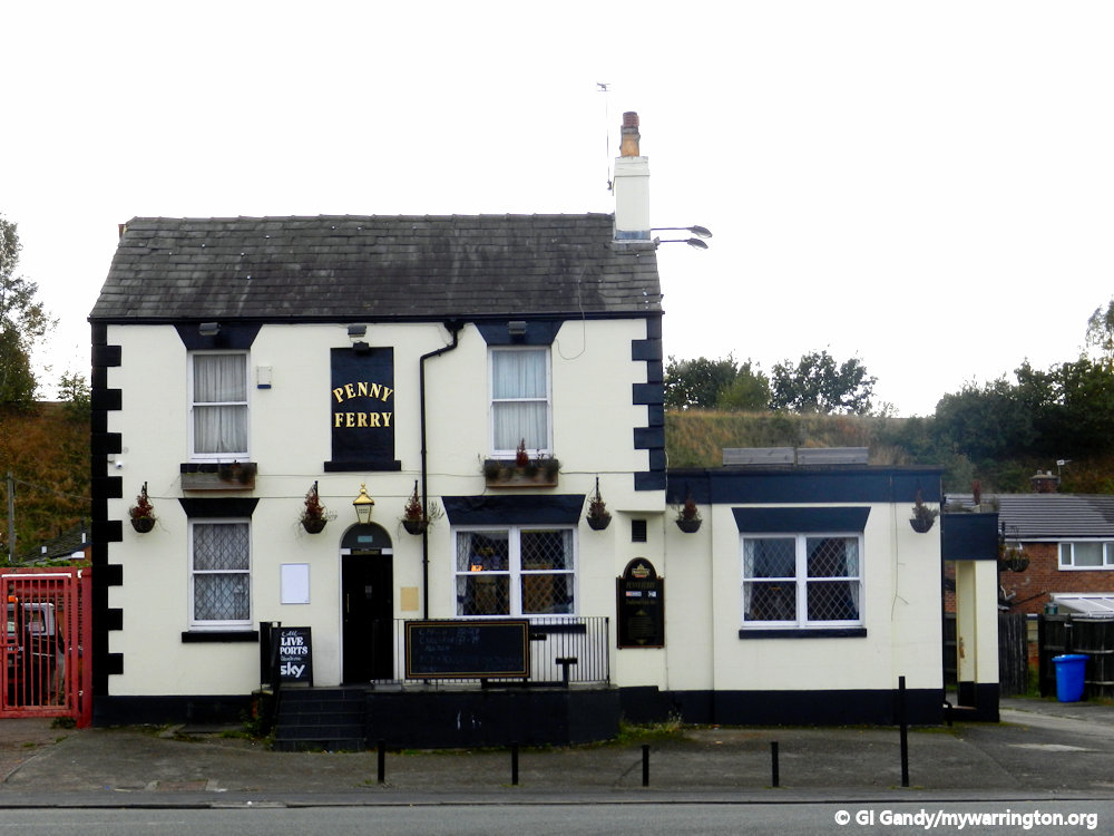
The Penny Ferry
The Penny Ferry pub was on Thelwall Lane. The sign outside the pub in my photo shows the Thelwall ferryman rowing a passenger across the Manchester Ship Canal over to Thelwall Eyes (now called Woolston Eyes, a Site of Special Scientific Interest).
The ferry connects an ancient right of way that was disrupted by the opening of the Manchester Ship Canal. The canal company was obliged by law to provide a river crossing at this point, hence the ferry.
The pub has now been demolished and houses stand on the site.


Pierpoint & Bryant Social Club
The pub was built for its factory workers sometime after the tanning factory was set up in 1872. In later years, Canadian firm Eagle Ottawa occupied the site running the same type of business. I came across the following piece of information during my research:
There used to be a tannery called Pierpoint and Bryant tannery in Latchford Warrington it closed down a few years back. There is still a club called the Pierpoint and Bryant Social Club. I am pretty sure that this tannery was set up by the Pierpoint family.
The tannery used to be situated at Latchford locks it stunk in the summer my Grandad used to take me for a walk down there (the locks) in the summer and when the wind picked up there used to be a huge que waiting to cross the Manchester Ship Canal on the penny ferry to escape from the smell to the other side to Thelwall / Grappenhall. Source: British Genealogy.com.
In 2021 a planning application was put to Warrington Borough Council for houses to be built on the site of Pierpoint & Bryant Social Club. Earlier plans were rejected and for the time being at least the club is still open (as of August 2024). However, homes were built on the site of the tannery itself and are known as Ottawa Gardens.


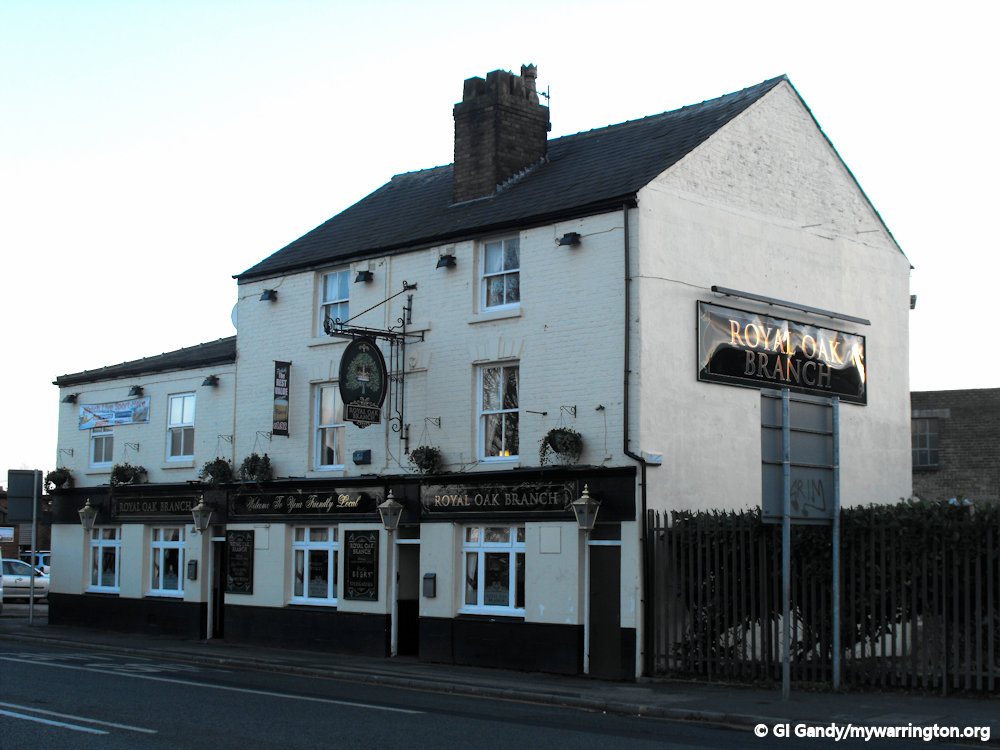
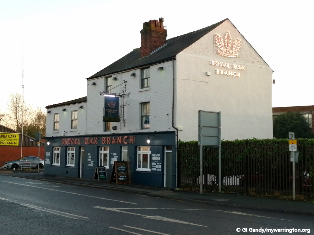
Royal Oak Branch


Golden Lion
The pub was opened in 1898. It closed as a pub in 2006 and became home to a fireplace and kitchen showroom.


Warrington Town F.C.
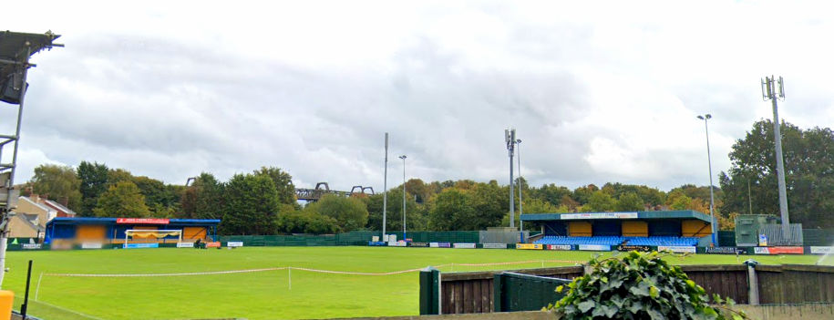
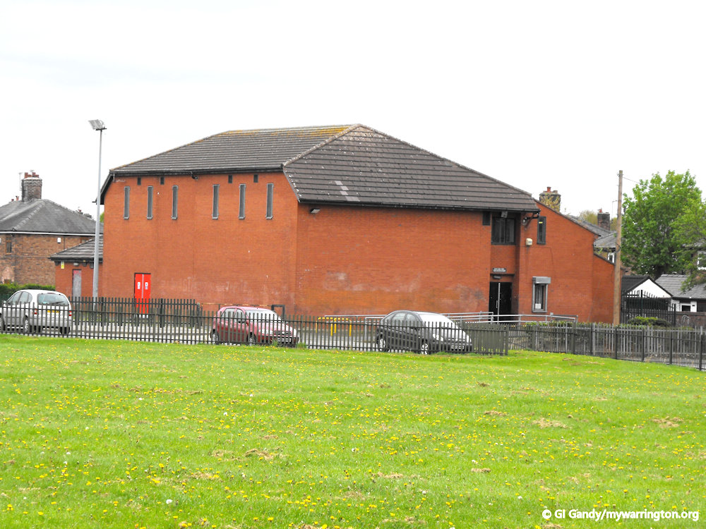
Warrington Town Football Club is based at Common Lane in Latchford. They were established in 1949 under the name of Stockton Heath, adopting their current name in 1961. They currently compete in National League North and play at Cantilever Park.
Formed in 1949 by Jimmy Drinkwater, the club was initially named Stockton Heath Albion and competed in the Warrington and District League until 1953, when they moved to the Mid Cheshire League. Freddie Worrall became manager at the same time, and during a 13-year spell in charge, the club won the league in 1959–60 plus the League Cup in three consecutive seasons during the 1950s.
During his thirteen years at the helm, Heath were one of the most feared sides in Cheshire football, winning a string of honours including the Mid Cheshire League Championship in 1959–60, the League Cup in 1953–54, 1954–55, 1955–56 and made several appearances in the Cheshire Amateur Cup Final. Several players from this successful period went on to join Football League clubs, including Ian Weir, John Green, Alan Foster and Roger Hunt, later a World Cup winner with England in 1966.


The club’s ground from Latchford High Level Bridge on 14 Aug 2003
At the club’s 1961 AGM, it was decided to change the name to Warrington Town. In 1978 the club were founder members of Division Two of the Cheshire County League. When it merged into the North West Counties Football League in 1982, the club were founder members of Division Three. They finished as runners-up in the first season, earning promotion to Division Two. In 1985–86 Warrington reached the semi-finals of the FA Vase, losing 6–3 to Halesowen Town in a replay. After finishing as runners-up in Division Two in 1986–87, the club were promoted to Division One. In the same season they reached the FA Vase final, where they lost 3–2 to local rivals St Helens Town.


In 1989–90 Warrington Town won Division One, and were promoted to the Northern Premier League. In 1992–93 they reached the quarter-finals of the FA Trophy, eventually losing 2–1 at Sutton United, and also became the first Division One club to reach the final of the League Cup, losing on penalties to Winsford United. The season also saw the club sell Neil Whalley to Football League Third Division side Preston North End for a £25,000, equalling the record fee paid for a Northern Premier League player. A few weeks later Warrington also sold Liam Watson to Preston for a record £60,000.
After finishing second bottom of the league in 1996–97, the club were relegated back to Division One of the North West Counties League. The following season they were demoted, failing ground grading. In the 1998–99 season, teenage striker Damien Whitehead set a new club record of 52 goals in just 42 appearances, before signing for Football League Division Three side Macclesfield Town at the end of the season.

The ground entrance 20 Oct 2013
The 1999–2000 season saw Town win the Second Division Trophy beating Tetley Walker 2–0 at Prescot Cables, with two goals from Neal Holden. The following season they won Division Two and were promoted back to Division One. They finished fifth in 2003–04, and were moved to Division One of the Northern Premier League as part of the restructuring that led to the creation of the Conference North and Conference South. When Division One was split into northern and southern sections in 2007, the club were placed in the southern division, but were moved to the northern section the following season.
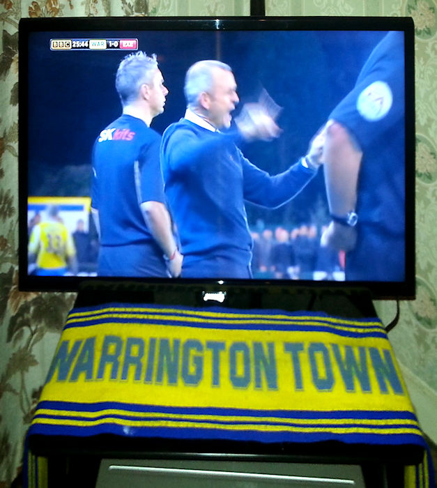
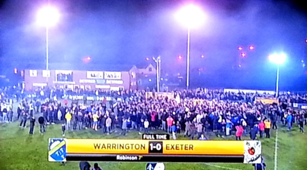
In 2013–14 the club finished third in Division One North, qualifying for the promotion play-offs, where, they lost 1–0 at home to Bamber Bridge in the semi-finals. Former Director of Football, Toby Macormac, became the new club chairman and took the club from strength to strength and started by reaching the first round proper of the FA Cup for the first time in their history in 2014–15, where they beat League Two club Exeter City 1–0 with a 7th-minute header from Craig Robinson, in a giant-killing at Cantilever Park shown live on BBC Two. In the second round they lost 0-2 at Gateshead, televised live on BT Sport. Later in the season the club lifted its first trophy in 14 years by defeating Farsley Celtic on penalties in the final of the Northern Premier League Challenge Cup, held at Edgeley Park.
During the 2015–16 season the club set many new club records including scoring over 100 league goals and also winning over 30 league games in one season. Attendances at the club increased with a seasons average of 418 per game, including two crowds of over 1,000 for the games against Northwich Victoria and Prescot Cables. The Club Chairman decided to part company with manager Shaun Reid by mutual consent in February 2016, replacing him with Stuart Mellish and Lee Smith. Mellish and Smith led Town to the league title, finishing 15 points clear and setting division records of 106 points and 121 goals scored, and gaining promotion to Northern Premier League Premier Division.
Back to the story shortly, but first here are more images from that televised match on 7 November 2014.


NPL Premier Division (2016-17)
At level seven in the English football league system, the Northern Premier League Premier Division was the highest level that Warrington had ever reached. After 16 games of the 2016–17 season, while sixth in the table, management duo of Stuart Mellish and Lee Smith left by mutual consent and Chairman Macornac brought in Paul Carden. Carden lead the team to a tenth-place finish in their first season in the division. In the 2017–18 Northern Premier League season Warrington improved on the previous campaign and ended up with a highest ever finish of third in the NPL Premier Division qualifying them for the play-offs, where they lost in a home semi-final against Grantham Town.

Warming up for a game against Mickleover Sports at home on 7 March 2017. Warrington Town won the game 1-0. I was there as part of DJ Kenny’s Radio Warrington show.
They followed this up in 2018–19 with another third-placed finish, in a season made more complicated by the expulsion of North Ferriby United who went out of business partway through the campaign. In the play-offs Warrington beat Nantwich Town 4–1 in a home semi-final, and then won 2–1 against South Shields in the final. Normally this would have resulted in promotion to National League North. However, as a one-off for the 2018–19 season, Town had to play a “super playoff” game against the play-off winners of the newly-formed Southern League Premier Central Division. In this game Warrington lost 3–2 to King’s Lynn Town after extra time.
As a result of the COVID-19 pandemic, the 2019–20 season was formally abandoned in March 2020, with all results from the season being expunged. After another abandoned season in 2020–21 and a play-off final defeat in 2021–22, it took more investment from the chairman which ensured Warrington finished the 2022–23 season as runners-up and were promoted to the National League North for the first time in club history, beating Bamber Bridge 1–0 in the play-off final at Cantilever Park.

Westy
The district of Westy is a suburban area, itself unofficially a suburb of Latchford. The area features mainly inter-war council housing, some of which are now privately owned.
Westy Point is a peninsular in the north of the district. Its location on the bend of the river Mersey is across from Paddington Bank and is a nice spot for dog walkers, anglers and nature lovers.

Westy Park is a large green space at the end of Bridgewater Avenue with Westy Community Centre alongside. Westy Community Centre is run by Warrington Borough Council and has a large multi-function room suitable for almost any activity and can accommodate 30+ people seated & 60+ Theatre style. In addition, there is one medium sized room which can accommodate 10-20 people.
The main hall is suitable for a variety of sports, dancing or exercise activities. I worked at the centre one day a week in the late 1980s/early 1990s as part of the social services community day care project for the elderly. East of the park and across from Morris Brook is Westy Woods.


Westy Lane on the opposite side of Kingsway South from Westy Park is shown on the Ordnance Survey map of 1975 as an east-west country lane running from Latchford Grange to Morris Brook. Its name comes from the simple fact that it originally ran from a westerly direction. Nowadays, Westy Lane runs from Grange Avenue to Kingsway South with a variety of businesses at either end.
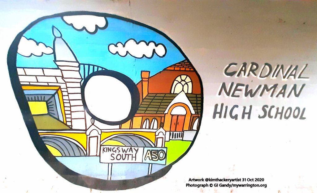
Also in the area is Cardinal Newman Catholic High School on Bridgewater Avenue.


See the Friends of Westy Park and Green Spaces website.
