
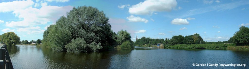
The River Mersey flows from the meeting of three other rivers in Stockport and flows through Manchester, Warrington and Liverpool on its way to the Irish Sea.
The River Mersey name is derived from the Anglo-Saxon mǣres, ‘of a boundary’ and ēa, ‘a river’
The river may have been the border between the ancient kingdoms of Mercia and Northumbria and for centuries it has formed part of the boundary between the historic counties of Lancashire and Cheshire.
The start of the Mersey is at the confluence of the River Tame and River Goyt in Stockport. It flows westwards through the suburban areas of south Manchester, then into the Manchester Ship
Canal at Irlam, becoming a part of the canal and maintaining the canal’s water levels. After 4 miles (6.4 km) the river exits the canal, flowing towards Warrington where the river widens. It then narrows as it passes between the towns of Runcorn and Widnes.
From Runcorn the river widens into a large estuary, which is 3 miles (4.8 km) across at its widest point near Ellesmere Port. The course of the river then turns north as the estuary narrows between Liverpool and Birkenhead on the Wirral Peninsula to the west, and empties into Liverpool Bay. In total the river flows 70.33 miles (113 km).
The Mersey is formed from three tributaries: the River Etherow, the River Goyt and the River Tame. So lets briefly look at them in turn.
River Etherow
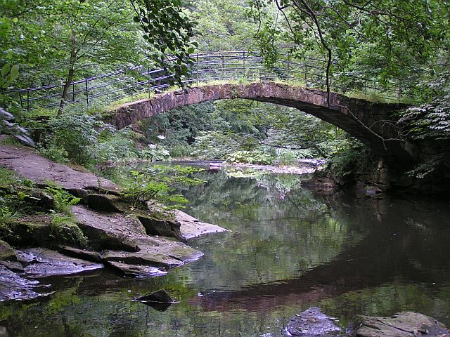
The River Etherow rises at Featherbed Moss in South Yorkshire, then broadens into the Longdendale Chain of reservoirs in the Peak District National Park. It emerges again in Tintwistle, Derbyshire, at the foot of Bottoms Reservoir dam. At Melandra Castle, Gamesley, it is joined by the Glossop Brook (which takes in waters from Shelf, Yellowstacks and Chunal). It enters Tameside at Hollingworth in the foothills of the Pennines. It passes through Stockport and the Etherow Country Park, then joins the River Goyt.
River Goyt
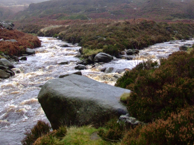
The River Goyt begins in Derbyshire. It rises at about 1,600 feet (488 m) on the moors of Axe Edge, near the River Dane and the Cat and Fiddle Inn. The area is known as the Upper Goyt Valley.
The Buxton to Macclesfield road crosses the river at Derbyshire Bridge, which was the old boundary between Derbyshire and Cheshire. The river then reaches an old packhorse bridge which was moved when Errwood reservoir was built in the 1960s.
River Tame
licensing.
The River Tame rises on Denshaw Moor near the West Yorkshire/Greater Manchester border, and flows south through Delph, Uppermill, Mossley, Stalybridge, Ashton-under-Lyne, Dukinfield, Houghton Green, Denton and Hyde.
It joins the River Goyt at Stockport to form the River Mersey. The Greater Manchester borough of Tameside is named after it.
Like the River Goyt, it rises at about 1,600 feet (490 m).
Stockport to Warrington
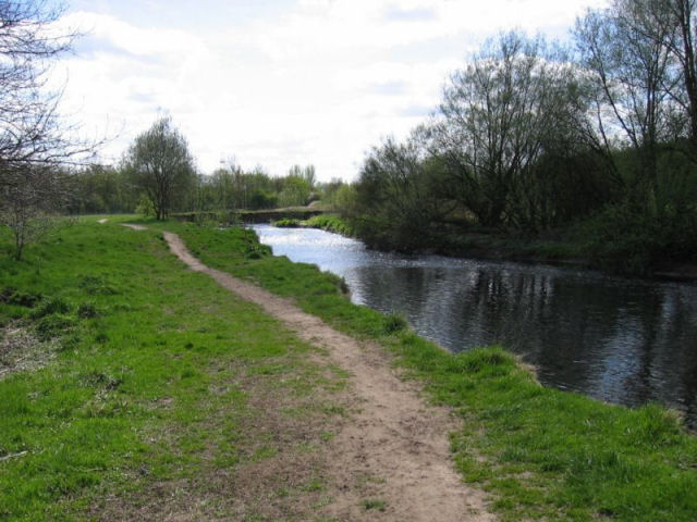
From Central Stockport the river flows through or past Heaton Mersey, Didsbury, Northenden, Chorlton-cum-Hardy, Stretford, Sale, Ashton on Mersey, Urmston and Flixton, then at Irlam flows into the Manchester Ship Canal, which is the canalised section of the River Irwell at this point. The old course of the Mersey has been obliterated by the canal past Hollins Green to Rixton although the old river bed can be seen outside Irlam and at Warburton. At Rixton the River Bollin enters the canal from the south and the Mersey leaves the canal to the north, meandering through Woolston, where the ship canal company’s dredgings have formed the Woolston Eyes nature reserve, and on to Warrington. The river is tidal from Howley Weir in Warrington, although high spring tides often top the weir. Before construction of the ship canal, work to improve navigation included Woolston New Cut, bypassing a meander, and Howley Lock for craft to avoid the weir; the new cut and lock are still evident.
The island formed between the weir and the lock is known locally as “Monkey Island”
The Mersey at Latchford and Howley taken from the Latchford side on Knutsford Road. Monkey Island is the area covered by the large tree. Not sure why it is called that.
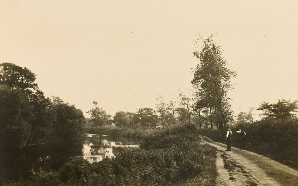
The River in Warrington
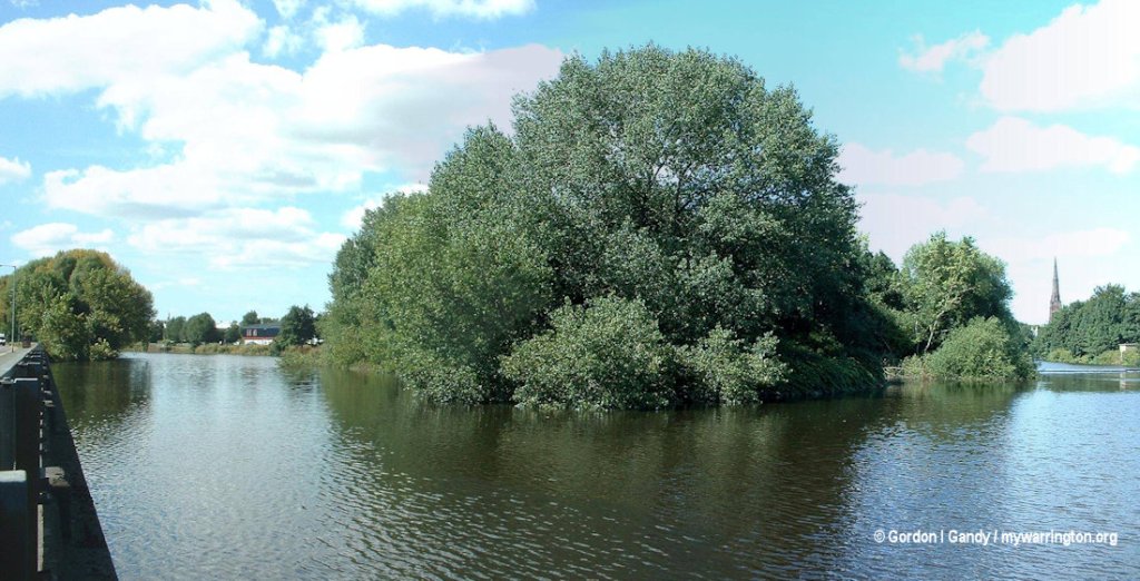
Statham – View on Old Mersey
This bend on the old course of the river is typical of much of the scenery through which the Manchester Ship Canal has been cut. The valley of the Mersey is very rich in hedgerow timber, which gives to the landscape a well-wooded and park-like character. And the first great change due to the contractor’s inroad on the district was the clearing of a broad alley right through this timber along the line of the new work.
I don’t know which year the photo was taken, but it must have been taken between 1887 and 1894 during the preparations or construction of the Manchester Ship Canal.
Butchersfield Canal
Two cuts were made to bypass a large loop in the River Mersey near Lymm. The first, dating from around 1760, had one lock in it, which became known as Old Lock.
The second, dating from 1829, had a double lock (side-by-side) at its lower end and the long section, measuring 360 yards, was known as the Butchersfield Canal. Its location is the stretch of the Mersey that passes the northern approach to Thelwall Viaduct.

Butchersfield and Butchersfield Canal
east of the M6 by Thelwall Viaduct
Woolston New Cut
The Woolston New Cut was a short canal built in 1821 to avoid the bends in the River Mersey. It was abandoned in the 1950s although it continued to supply water to the nearby Black Bear (Old Quay) Canal. The area of the New Cut is bordered nowadays by a nature reserve, Paddington Meadows, and is accessed from Larkfield Avenue, off Manchester Road in Woolston. Read about Paddington Meadows in Warrington Green.
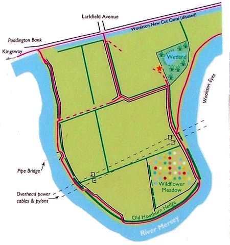
Woolston New Cut by Paddington Meadows
Road Bridge over Mersey on Chester Road
So many main roads are severed by the Manchester Ship Canal between Walton and Latchford that it has been found necessary to entirely re-arrange the system, with a view of constructing as few bridges as possible. The Warrington and Chester high road has been diverted to a line parallel with the new river Mersey course, leaving the Wilderspool Causeway at the head of the new dock basin. The bridge shown here carries Chester Road road over the old course of the Mersey at Walton and connects it with a swing bridge over the canal at Stag Inn. The design of this Mersey bridge is distinct from the other viaducts on the work as the footpaths are carried on the outside face of the main girders.

Road Bridges over Mersey by Eastwood Road, Walton
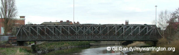
Old Walton Arches over Mersey
This viaduct was built by George Stephenson in 1836 to carry the Grand Junction Railway over the river Mersey and the Latchford and Runcorn Canal south of Warrington. As an example of early railway engineering it is most interesting; and it speaks volumes for the design and workmanship of the structure that the whole of the North Western Scotch traffic, with its heavy loads and high speeds, has used the bridge all these years without any detriment to the stonework.
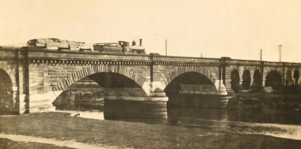
Walton New Viaduct, half across
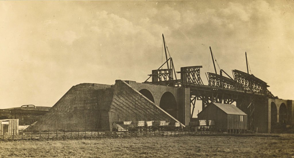
The abutments are here finished, and the wing-walls are complete and ready for the tipping up of the earth embankment. The steelwork is being pushed forward, so that tip wagons bringing spoil from the canal cutting may be run through the new bridge, and the embankment carried northward to meet the old line at Bank Quay station. The general design of the girders, and the method adopted for erecting them, are similar to the bridge over the Manchester Ship Canal at Acton Grange. The span of the Walton bridge here is 160 ft.
Walton New Viaduct, Abutment
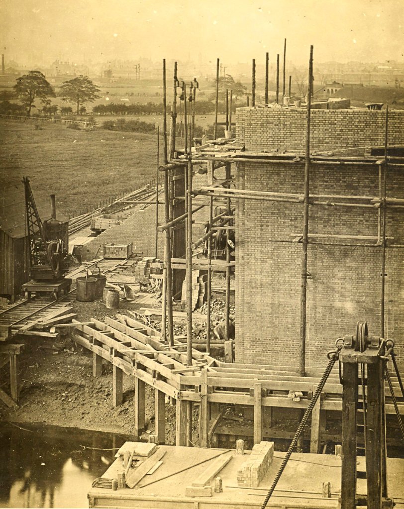
In order to gain the necessary height above the Canal for the railway viaduct shown at Plate 19, the line had to be diverted for some distance on either side of the new waterway. The bridge in the preceding view has therefore been abandoned so far as main line traffic is concerned, and a new viaduct built over the Mersey, downstream of the old one, at a clear height of 44 ft. above water level. The present is a view of the north abutment during construction; and beyond, in the distance, is the town of Warrington.
River Diversion, Arpley Meadows
The Manchester Ship Canal passes to the south of Warrington close to the old course of the Mersey where it winds round the Arpley Meadows. By constructing a new straight cut from Arpley Station to Walton Arches the progress of vessels up to Warrington by the river is much facilitated, and flood water more quickly passed forward. The old channel round by Stockton Heath will be widened and deepened and will become one large dock, with ample quay space and splendid railway approaches. This view is taken at the Walton end of the diversion, looking upstream, and the Bridgewater tug is steaming down the old river course.

The Bronze Age
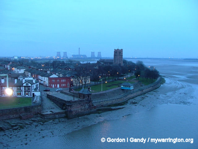
Warrington plays a very important part in the history of the region. From 8,000 BC until the 13th century it was the only crossing point of the Mersey, by way of a ford at Latchford. Since then, six bridges have been built over the Mersey at Bridge Foot, Warrington, and the course has been altered to cater for new industrial developments, especially around the Bank Quay and Atherton’s Quay areas.
In those early days settlers lived on the north bank of the river in the area close to the ford and in the Bronze Age they lived at Winwick and Grappenhall over 3,500 years ago.
Later the Romans built an industrial settlement on the north bank of the river at Wilderspool. Later still the area around the Parish Church of St Elphin at Howley became the centre of town, again close to the river on the north bank.
The approximate site of the ancient ford near Black Bear Bridge in Latchford on the A50. The course of the river has changed since those early times, mainly due to industry.
Warrington Bridge
Before any bridges were built over the Mersey, the right to cross by ford or ferry was granted to Hugh de Boydell during the reign of Richard I (1089-1099). This arrangement remained for two centuries until a bridge was built in 1285 at the location we called Bridge Foot today. But the rights for this bridge were given to the Boteler family, which created friction between the two opposing families. At one point the Boydell family were called in by the authorities for blocking road access to the bridge. This was in 1328 where they had to answer to the Sheriff of Cheshire.
2nd Bridge
For whatever reason the first bridge was either broken down or washed away. At a later date, a second bridge was built out of wood. The records show that in 1369 a Hermit Friar called Brother John was licensed to celebrate divine office in a chapel at the foot of the bridge. This bridge was built in the reign of Edward III and like the first bridge, the second bridge too was lost.

Warrington Bridge today
3rd Bridge
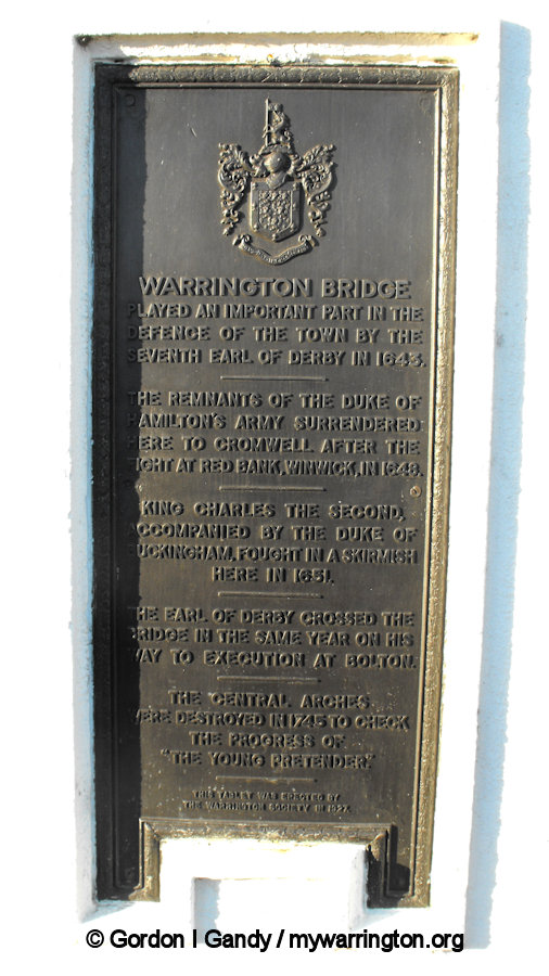
The third bridge, with four stone arches, was erected by the first Earl of Derby for the visit of King Henry VII to Knowsley in 1495. The remains of the Duke of Hamilton’s army surrendered to Cromwell at Warrington Bridge after the Battle of Red Bank near Winwick in 1648. King Charles II, accompanied by the Duke of Buckingham, fought in a skirmish here in 1651. The Earl of Derby crossed the bridge in the same year on his way to execution at Bolton. The central arches were destroyed in 1745 to prevent another army crossing the Mersey by use of the bridge.
4th Bridge
The fourth bridge was built by Thomas Harrison and William Cole in 1815. It stood for 21 years. This was a wooden arch bridge of 150 feet which had to be supported by a central pier after a couple of years to support the weight of horses and carts. He had visited Europe, in particular Norway and Sweden and liked the designs for bridges there, which influenced him on the design for Warrington.
5th Bridge
The fifth bridge was opened in 1837 and appropriately called the Victoria Bridge as this was the first year of Queen Victoria’s reign. This was built of stone and had three arches.
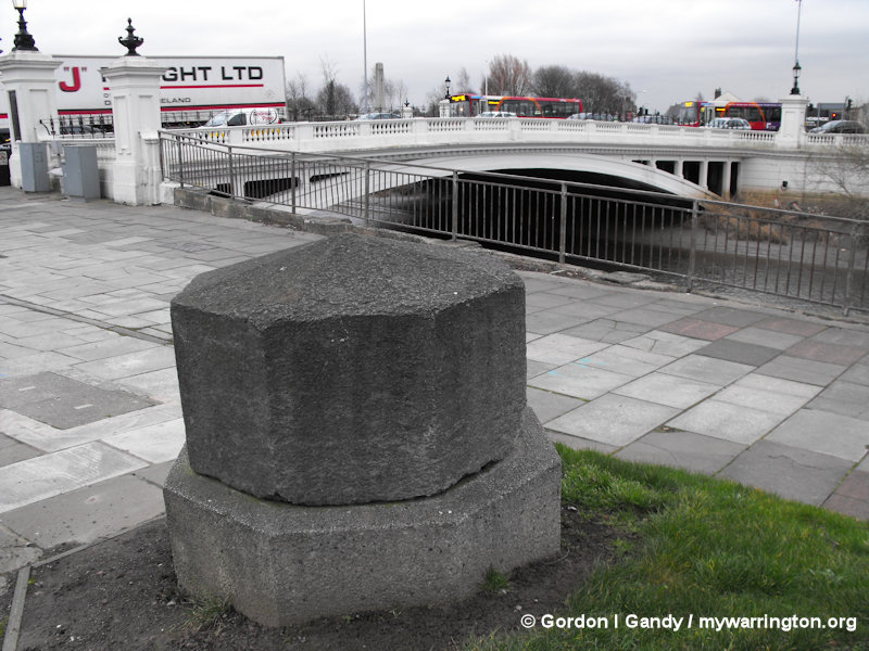
The bridge was built by a Mr Gamon of Knutsford and stood until 1913. Two of the capstones from the bridge are still in the town – one at Paddington House Hotel on Manchester Road and the second stands beside the current bridge.
Opposite: one of four information panels telling the story of the bridges in this area.
6th Bridge
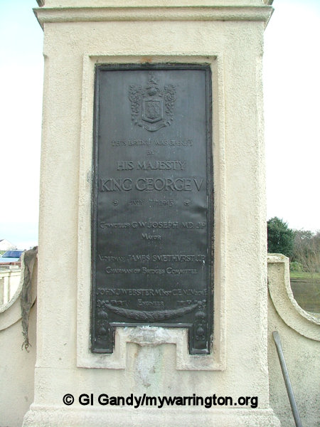
At Bridge Foot today, the main crossing point of the river in modern times, we have the magnificent single-arched road bridge, Warrington Bridge. This is the sixth bridge on this site. It was opened on 7 July 1913 by King George V, but wasn’t completed until 1915. The bridge was built in two halves to keep traffic flowing through the town – yes, congestion was a part of daily life in those days too. The carriageway was constructed alongside the Victoria Bridge while traffic continued to use the old bridge and when that was opened in 1913, the Victoria Bridge was demolished and the second half of the new bridge was built, which opened fully in 1915.
To test the weight of the bridge, two trams and a steamroller were driven onto the bridge and in the late 1970s/early 1980s it operated with a nine ton weight limit (12 tons for buses) while structural repairs were completed.
One of the capstones from the Victoria
Bridge beside the current bridge

So how many bridges do you think there are across the whole borough of Warrington? Well I was surprised when I learned the number – altogether there are 231 bridges across the borough. This includes bridges across the Bridgewater Canal, Sankey Canal, over railways, etc.
Modern Times
In the latter part of the 20th Century, two more bridges have been added near Bridge Foot. The first opened in 1986, and forms part of a large roundabout junction to ease traffic flow over the 1913 bridge, which now has one-way traffic northbound in four lanes.
The 1986 bridge was officially opened by His Worshipful The Mayor, Councillor E. Bowden, on 25 July, 1986.
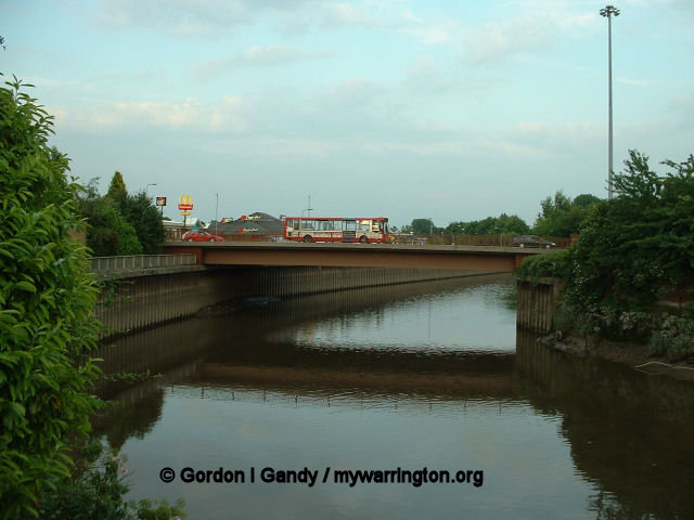
The most recent bridge links Chester Road with Centre Park, a commercial estate, opened on 21 September, 1990. Centre Park is built on the site of Thames Board Mills and Arpley Meadows. At 5.03 p.m. on 14 September, 1940, a lone German plane dropped two bombs on the site, killing 16 men, women and children, and injuring many others. On that day, 2,500 people were enjoying a summer gala. A commemorative plaque is on display in the middle of Centre Park, surround by a lake and nature reserve.
The final bridge in the area of Bridge Foot is the railway bridge (below) on the old Warrington and Altrincham Junction Railway of 1851 (see Making Tracks for more). One more crossing point of the Mersey close to town centre is Kingsway Bridge near Westy, about a mile from Bridge Foot. This bridge was opened on 5 December 1934 after King George V gave his permission for it to be so-named.
The 1986 bridge to ease traffic flow.
The blue bridge link to Centre Park.
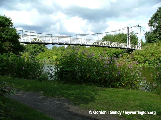
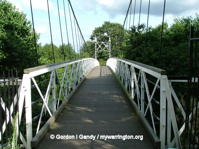
Howley Suspension Bridge
Howley suspension bridge links the district with Victoria Park. It was built in February 1912 by David Rowell & Co., who were prolific builders of many similar steel suspension footbridges, and it was officially opened on 2 August 1912. It is a Grade II listed monument (listed on 4 April 1975). Each end has 2 tapering square piers of open ironwork, with round arches across the pathway. It was originally meant to be 60 feet wide and 150 feet long to help with traffic congestion at Bridge Foot.
It was originally meant to be 60 feet wide and 150 feet long to help with traffic congestion at Bridge Foot. The original proposed bridge was to be made out of cast iron and designed by Thomas Telford (who built the Menai Suspension Bridge that connects Anglesey to mainland Wales). Telford’s bridge at Warrington would have cost £12,000, but due to lack of funds, only a footbridge was built, costing just £600. The footbridge was officially opened on 2 August 1912. Victoria Park was built on the Old Warps estate.
Warrington Transporter Bridge
Work started on construction of the bridge in 1913, but delays due to the start of the First World War meant it didn’t open until 1916. The bridge was owned by Crosfield soap works and although was originally designed for road vehicles, railway wagons were carried over it from the 1940s. It has a span of 187 feet (57 metres), a width of 30 feet (nine metres) and a height of 76 feet (23 metres). It was designed by William Henry Hunter and constructed by Sir William Arrol to take up to 18 tons in weight. It has not been used since 1964 and is now a Grade II* listed Scheduled Ancient Monument on the English Heritage At Risk Register.
Warrington Transporter Bridge.
The photo were taken on 23 January 2007
On 19 March 2015 I interviewed Margaret Ingham on Radio Warrington about her idea to save the transporter bridge from decay. She announced a public meeting later that evening at the Waterside Inn on Centre Park to drum up support for her campaign. She later published a summary of the meeting on her Facebook campaign page. Here is that summary in her own words.
The meeting was well attended by 30 people, sadly some who wanted to be there could not make it on the night. We had a great mix of skills present, civil engineer, heritage consultant, historical researcher, web designer, publicist, activist, health and safety, illustrator and film maker to name a few. There was a lively discussion with a great many very useful ideas. We formed a committee for what will be the Friends of Warrington Transporter Bridge (FOWTB). We agreed that we will become a formal constituted society in order to make credible advances to WBC, Grant Authorities and so on. The meeting formally selected Margaret Ingham as Chairman. The next stage will be a committee meeting at which we will draft a constitution and plan strategy. Keep watching.
Margaret later published some extracts from the Warrington Guardian.
Good work by Guardian reporter Aran Dhillon see below ‘Cllr Steve Parish (LAB – Bewsey and Whitecross) has raised the possibility of securing a grant to set maintenance work underway’ and former council leader John Gartside says ‘Anything that can help the town is great and I am sure it could be a good thing for Warrington.’, although like Andy Farral he thinks the new bridges must come first. Hopefully WBC will now agree to let us seek grants to get the job done, so that the money need not come from WBC coffers.
The campaign also received interest from BBC Northwest Tonight.
To join the campaign, see the Facebook page, Save Warrington Transport Bridge
Industry has dominated Bank Quay for hundreds of years with companies like Crosfields and Fairclough’s flour mill
(23 Jan 2007).
The arrival of the railways provided competition to the shipping trade, now superseded by road.
(23 Jan 2007)
Part of the River Mersey as it flows towards the railway bridge and Bank Quay. Close by are the remains of the Old Quay Canal
(20 Mar 2007)
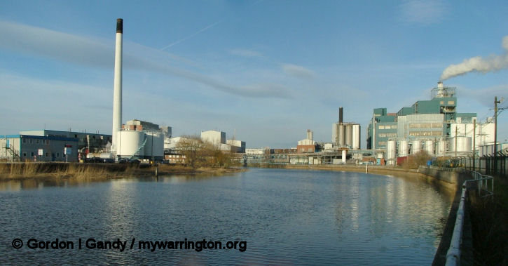
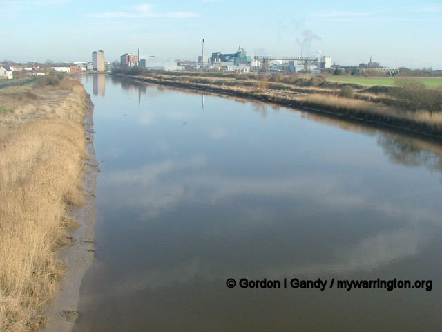
Improvements to the Mersey contributed to the town’s wealth during the Industrial Revolution (18 Feb 2007)
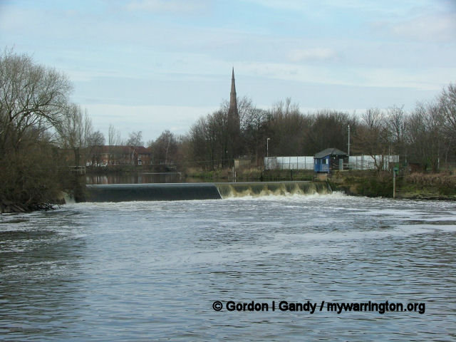
Fiddler’s Ferry
The Fiddler’s Ferry area is located in part of the 15-mile Sankey Valley, which follows the course of the oldest canal in England since the Industrial Revolution, the Sankey Canal (originally known as the Sankey Brook Navigation and later the St Helens Canal), opened in 1757.
Between the river and the Sankey Canal you can rest at the Ferry Tavern, an 18th century pub.
For more on the Fiddler’s Ferry area see the Fiddler’s Ferry section of Downtown and the Warrington Museum’s website where you can learn why the area is called Fiddler’s Ferry.
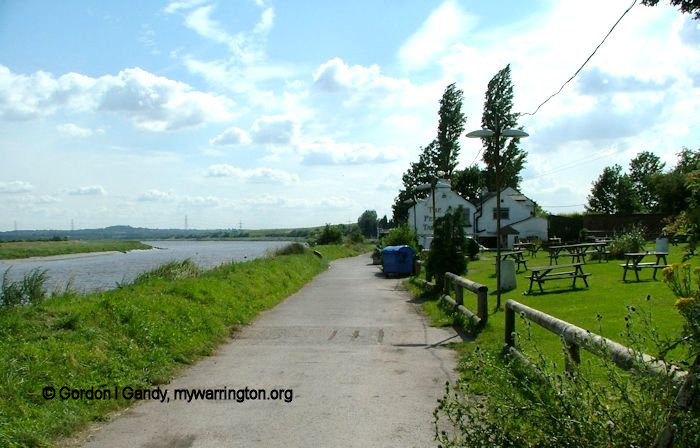
The Ferry Tavern today

A view of Penketh Reach on the River Mersey (28 Apr 2007)
Runcorn Gap
Time to set sail again now on our journey along the Mersey. West of Warrington the river narrows, and passes between the Cheshire towns of Runcorn and Widnes, through the Runcorn Gap. The Manchester Ship Canal also flows through the Gap, along the southern bank of the river.
From the Runcorn Gap, the river widens into a large estuary, which is seven miles wide at its widest point near Ellesmere Port. The course of the river then heads north, with Liverpool to the east and the Wirral Peninsula to the west. The Manchester Ship Canal continues along the Cheshire bank of the river as far as Eastham Locks, where it enters the river. The eastern part of this estuary is much affected by silting, and part of it is marked on modern maps as dry land instead of tidal. These wetlands are of importance to wildlife, and are listed as a Ramsar site.
The Convention on Wetlands, signed in Ramsar, Iran, in 1971, is an intergovernmental treaty which provides the framework for national action and international cooperation for the conservation and wise use of wetlands and their resources. There are presently 154 Contracting Parties to the Convention, with 1,674 wetland sites, totalling 150 million hectares, designated for inclusion in the Ramsar List of Wetlands of International Importance. See more at www.ramsar.org
View to Fiddler’s Ferry looking over Spike Island and showing the location of the old Transporter Bridge.
18 Feb 2007.
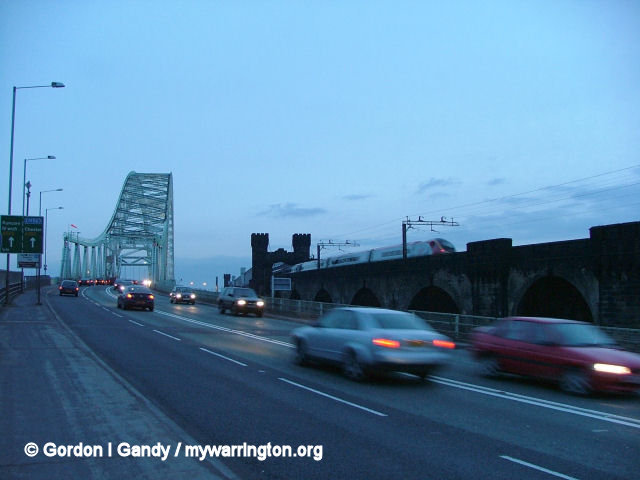
The approach to the Silver Jubilee Bridge from Widnes with the railway bridge alongside. 18 Feb 2007.
The estuary then narrows to flow between Liverpool and Birkenhead, where it is constricted to a width of 1.2km (0.75 miles), between Albert Dock and the Woodside ferry terminal. It then flows into Liverpool Bay on the Irish Sea, after a total course of around 70 miles. The conurbation on both sides of the river in this area is known as Merseyside.
In recent times the areas alongside the Mersey were turned back into nature reserves to enable wildlife to flourish and also to provide facilities for the general public to enjoy that nature. With funding by Halton Council, The Mersey Waterfront and Groundwork Mersey Valley, this haven on the marshes stretches alongside the Widnes section of the Mersey. It includes a viewing platform and illustrated information panels.
River Crossings
The first crossing point of the River Mersey has been mentioned already, by way of a ford at Latchford, Warrington.
For centuries it was the only point west of Stretford, Greater Manchester, where a bridge could be built over the Mersey. Several pub names in Warrington had a connection with the waterways – The Ship, the Mermaid and the Packet House Inn; the latter is said to be the ticket office for boats travelling from here to Liverpool.
Two road tunnels run under the Mersey at Liverpool: the older Queensway Tunnel (opened 1934) connecting with Birkenhead, and the Kingsway Tunnel (opened 1971) connecting with Wallasey.
There is also a railway tunnel dating back to the 1880s, which carries passenger services on the Wirral Line of the Merseyrail franchise.
The Mersey Ferry runs between the Pier Head at Liverpool and the Birkenhead terminals at Seacombe and Woodside.
The Runcorn Gap, mentioned earlier, is currently bridged by Runcorn (Jubilee) Bridge and Runcorn Railway Bridge. A project known as the Mersey Gateway, to build a new road bridge over the Mersey east of the existing bridges, is currently under consideration and has received some government support.
Widnes – Runcorn Transporter Bridge
The Widnes-Runcorn Transporter Bridge crossed the Mersey and the Manchester Ship Canal linking Runcorn and Widnes. It was completed in 1905 and was Britain’s first transporter bridge. It remained in use until 1961 when it was replaced by the Silver Jubilee Bridge (discussed later). The transporter bridge was then demolished.
The view from Runcorn in 1959 showing the bridge in action over the Mersey and Manchester Ship Canal.
Photo Copyright © P Spilsbury
This view was taken from the Widnes side in 1961, the year the bridge closed. Photo Copyright © P Spilsbury
At the beginning of the 20th Century the only means of crossing the River Mersey at Runcorn Gap were by rail on the Runcorn Railway Bridge (which also had a footpath) or by using the ancient ferry (which was a rowing boat).
In the 1890s the Manchester Ship Canal had been constructed and this meant that the journey by ferry had to be made in two stages, with a climb over the wall of the canal between the stages.
A road bridge was clearly needed but it would have to pass high enough over the canal to allow the passage of ocean-going ships. The cost of doing this was felt to be prohibitive.
In 1899 the Widnes & Runcorn Bridge Company was established under the chairmanship of Sir John Brunner to investigate the options.
Their decision was to build a transporter bridge. This would be cheaper than an orthodox type of bridge and the passage of the transporter car could be timed to allow the passage of the ships. An Act of Parliament was obtained in 1900 giving approval for the bridge, and the Act also allowed for the formal ending of the ferry. It was designed by John Webster and John Wood. Construction began in December 1901. The two towers were 180 feet high and the distance between them was 1,000 feet.
A ticket for passage over the Widnes-Runcorn Transporter Bridge. For young readers who don’t know what a perambulator is, read pram, buggy, push chair! The cost of 1/9 is 9p in today’s money.
Photo Copyright © P. Spilsbury
The weight of the cables suspending the girder was 250 tons. The underside of the girder was 82 feet above the high water level. The transporter car was 55 feet in length and 24 feet 6 inches in width, and was designed to carry 4 two-horse farm wagons and 300 passengers. A shelter was provided for the passengers.
The bottom of the car was 12 feet above high water level and it cleared the Ship Canal wall by 4.5 feet. It was suspended from a moving trolley 77 feet in length.
In conditions of reasonable weather and load the journey took 2½ minutes. The driver was sited in a cabin on top of the car from which he had an uninterrupted view in all directions.
In order to provide power for motors on the trolley, a power house was built within the tower on the Widnes side. Approach roads of 320 feet on the Widnes side and 470 feet on the Runcorn side were built.
Construction was completed in 1905 at a cost of £130,000 (equivalent to £12.89 million in 2023 – Bank of England inflation calculator). The transporter bridge was opened (in the absence of King Edward VII who was indisposed) by Sir John Brunner on 29 May 1905.
During the following years there were problems both with the functioning of the bridge and with its financing. The Company could not make it pay and in 1911 it was sold to Widnes Corporation.
A number of improvements were made to the bridge over the years. In its later years it made 49,000 journeys annually, carrying 280,000 cars, 145,000 commercial vehicles and over 2 million passengers.
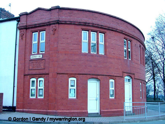
The old Transporter Bridge office building still stands on Mersey Road in Widnes, seen here on 18 February 2007.
However it was inadequate for the growing needs of the region and its physical condition was deteriorating. A fixed high-level bridge was needed and this was eventually opened in 1961, after which the transporter bridge was demolished. (some information from Wikipedia).
The scene on 18 February 2007 from the Widnes side.
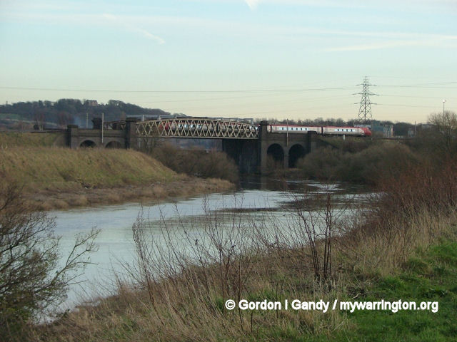
Runcorn Railway Bridge
In 1846 the Grand Junction Railway Company obtained an Act of Parliament to build a bridge to cross Runcorn Gap. A time limit of 7 years was imposed. Shortly after obtaining the Act, the Company amalgamated with other companies to form the London and North Western Railway. Other projects took precedence, the 7 years time limit passed, and so the powers to build the bridge lapsed.
In 1861 Parliamentary approval for a bridge was again obtained as part of building a line from Aston, to the south-east of Runcorn, where it joined the line from Crewe to Warrington at Weaver Junction, to the west of Widnes. Here it joined the line from Warrington to Garston at Ditton Junction. Work commenced in 1863 and the first stone was laid in 1864.
The bridge was completed by 1868 and on 21 May there was an introductory opening when the contractor’s locomotive ‘Cheshire’ drew 20 wagons over the bridge. It was formally opened for traffic on 10 October.
The first goods traffic crossed it on 1 February 1869 and the first passenger train crossed on 1 April of that year.
The bridge consists of three wrought iron spans of 305 feet each on two sandstone abutments, with foundations at a depth of about 45 feet below water level.
The railway bridge with the road bridge behind.
Photo used under Creative Commons licensing.
It carries a double line of tracks, and a footpath for pedestrians was built on the east side of the bridge. It has a clearance of 75 feet above the high water mark to allow sailing ships to pass beneath it. There are 6 lattice girders, two to each span. Each girder contains 700 tons of iron and is fastened by 48,115 rivets. From the north side of the river the bridge is approached by a viaduct of 49 arches, then a short piece of embankment, followed by 16 more arches. From the south it is approached by a viaduct of 33 arches.
The bridge is named after Aethelfleda because the southern abutments and pier were built on the site of the Saxon castle erected by her in 915 AD. Parts of the bridge are castellated (battlement design) to reflect this. There are three shields above the footway, showing,
from the southern end, the Coat of Arms of the City of London, Britannia (from the crest of the railway company) and the Liver Bird of Liverpool. Because of the crest the bridge is also known as the Britannia Railway Bridge.
There are three shields above the footway, showing, from the southern end, the Coat of Arms of the City of London, Britannia (from the crest of the railway company) and the Liver Bird of Liverpool. Because of the crest the bridge is also known as the Britannia Railway Bridge.
The footway was closed in 1965 and the bridge is still in use as part of the West Coast Main line between Liverpool and the south via Crewe. (based on a Wikipedia article).
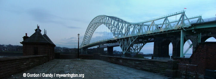
Widnes – Runcorn Silver Jubilee Bridge
The Silver Jubilee Bridge is a compression arch suspended-deck bridge built in 1961, linking Widnes to Runcorn over Runcorn Gap. It is a grade II listed building.
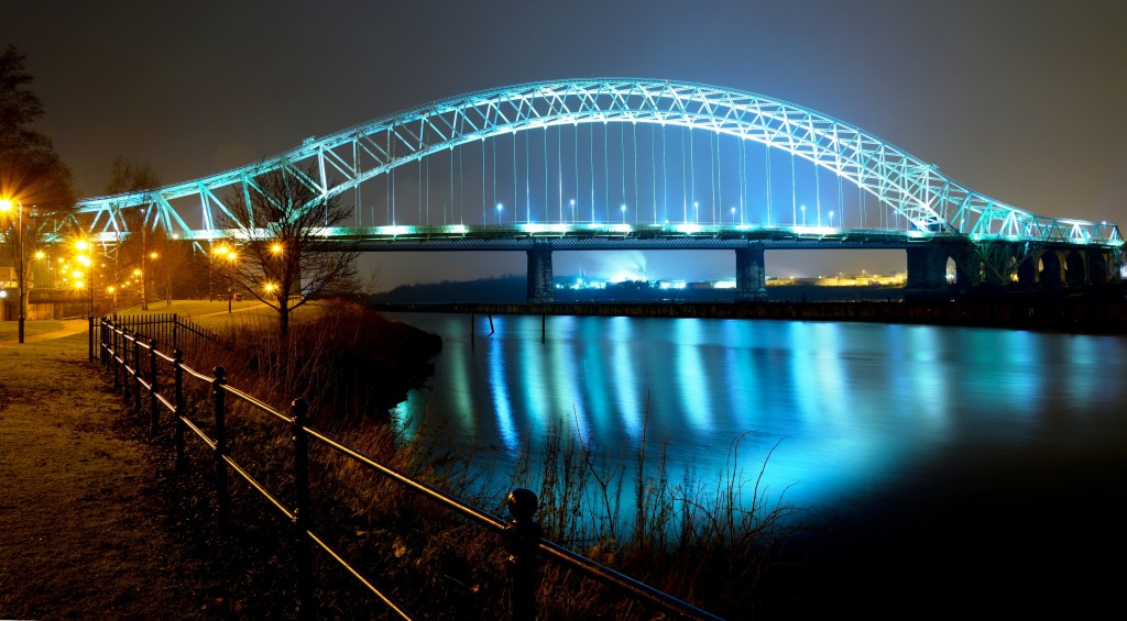
Silver Jubilee Bridge in Runcorn at night
This file is licensed under the Creative Commons Attribution-Share Alike 2.0 Generic license.
Attribution: Geoff Wynne. Source: geograph.org.uk
Ferry crossings have been recorded at this spot as early as the 12th century.
Construction work on the bridge started in 1954. The bridge was opened to the public by Princess Alexandra of Kent in 1961. The bridge was designed by Mott, Hay and Anderson and built by Dorman Long. (The old Redpath Dorman Long factory in Hawleys Lane, Warrington is now the Warrington base for the Eddie Stobart road haulage company.)
The original construction was a two lane road traffic bridge built to replace the Runcorn-Widnes Transporter Bridge mentioned earlier. In 1975 the bridge was widened to four lanes to cope with increased traffic demands. Until 1977 it was known as the Runcorn-Widnes Bridge, but was renamed the Silver Jubilee Bridge in honour of Queen Elizabeth II’s Silver Jubilee. In the past, this bridge was never known solely as ‘Runcorn Bridge’ except by those who were mis-informed. However, ‘Runcorn Bridge’, over time, has come into common usage, especially by residents on the Widnes side.
Construction
The ‘Silver Jubilee Bridge’ is built from approximately 6,000 tonnes of steel, but in combination with all the other building materials, including the vehicle deck and the approach viaducts, its total weight approaches 10,000 tonnes. At the time of its construction it cost nearly £3 million to build.
The bridge is one of the largest of its kind in the world with a main span of 330m, with its crown being approximately 86m above sea level. It is the largest bridge of its type in the United Kingdom and its proportions are approximately 2/3rds the size of the world-renowned Sydney Harbour Bridge.
The bridge is lime green in colour and is continually being painted. It takes on average five years to paint, end to end. To fully repaint the bridge from scratch would use anything up to 50,000 litres of paint.
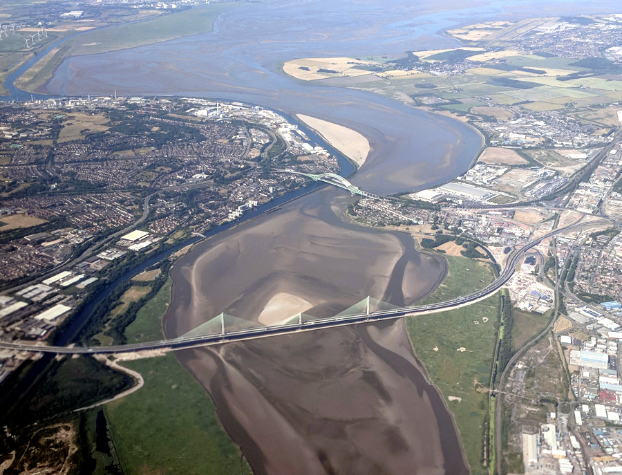
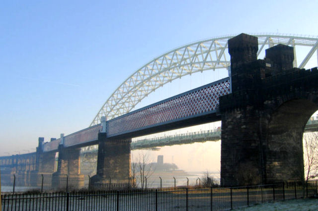
Aerial shot of the Mersey showing the two bridges at Runcorn.
Used under the Creative Commons Attribution-Share Alike 4.0 International license. Owned by Parrot of Doom Fade correction filter applied by G. Gandy.
Mersey Environment
Water quality in the River Mersey has been severely affected by industrialisation in the region. In 1985 the Mersey Basin Campaign was established to improve water quality and encourage waterside regeneration. In 2002, oxygen levels were high enough to support fish along the entire length of the river.
Salmon are now found in the river. They can be viewed on the Salmon Steps at Woolston between the months of September and November. They were always to be found in the river before the Industrial Revolution. (Some information from Wikipedia)
Some information from Wikipedia

.jpg)