
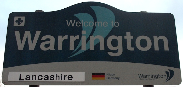
A brief introduction to the town of Warrington.
Includes extracts from Cheshire Archaeology pdf document and used with permission.
I recommend you read the full document. Similar accounts for Lymm and Thelwall are available here.
In 1887, John Bartholomew’s Gazetteer of the British Isles described Warrington like this:
Warrington.– parl. and mun. bor., market town, par., and township, SW. Lancashire, on river Mersey, midway between Liverpool and Manchester, and 182 miles from London by rail – par., 12,954 ac., pop. 44,352; township, 2887 ac., pop. 40,957; parl. bor., 3783 ac., pop. 45,253; mun. bor., 1442 ac., pop. …
41,452; 3 Banks, 4 newspapers. Market-days, Wednesday and Saturday. (The bor. extends into Grappenhall and Runcorn pars., Cheshire.) The Mersey is here navigable for vessels of 100 tons, and Warrington has communication, by water and by rail, with all the principal places of Lancashire and Cheshire. The mfrs. comprise wire-work, pins, files, edge-tools, cotton, glass, soap, &c. Warrington is noted for its ale. There are many fine public buildings, and a public park and gardens. Warrington is an old town (mentioned in Domesday Book as “Wallintun”), and has still some quaint timber houses. The parish church stands on the site of an ancient Saxon church dedicated to St Elphin. An Augustinian friary was erected in 1379, but no trace of it remains. The bridge was built in 1496; being the principal passage over the river from Cheshire to Lancashire, it has been the scene of many conflicts. Warrington was made a parl. bor. in 1832, and a mun. bor. in 1847; it returns 1 member to Parliament.
http://www.visionofbritain.org.uk/place/658
Date accessed: 19th November 2025
Warrington is located at the lowest fordable point of the River Mersey and accordingly it has been of importance since prehistoric times. In fact, for centuries it was the only possible crossing point of the Mersey west of Manchester, by means of a ford at Latchford.
It is located at the crossroads of the A49 and A57 and is roughly equidistant from Liverpool and Manchester (19 and 21 miles away respectively), with Chester 37 miles to the southwest and Preston 30 miles to the north.
Warrington was the head of the hundred of the same name, which included the parishes of Warrington, Prescott and Leigh. A hundred was the division of a shire for administrative, military and judicial purposes under the common law. Originally, when introduced by the Saxons between 613 and 1017, a hundred had enough land to sustain approximately one hundred households headed by a hundred-man or hundred eolder.
It was a seigneurial borough until 1847, when it was incorporated as a Municipal Borough. For those who may not know, a seigneurial borough is one which did not have a mayor and corporation, but which had a measure of independence from the local lord of the manor. The town lay in Lancashire until 1974, apart from the area to the south of the Mersey, chiefly the townships of Stockton Heath and Latchford, which lay in Cheshire.
In the local government reorganisation of 1974 the whole of Warrington was assigned to Cheshire. In 1998 the town and its surrounding area, including those parts to the south of the Mersey, became a unitary authority. However, it retained the services of Cheshire Police and Cheshire Fire, with ambulance service provision coming from North West Ambulance Service.
However, it must be stated the original county boundaries did not change in the 1974 changes, so groups like Friends of Real Lancashire are keen to state that Liverpool, Manchester, Warrington and Southport, among many others, are still within the county boundary of Lancashire. Royal Mail say it doesn’t matter whether you address your mail as Lancashire, Cheshire, Cumberland, etc as long as you use the post code.
The Warrington Name
The place name occurs in the Domesday Book (1086) as Walintune, which Ekwall suggests denotes either the settlement of Waer’s people or the settlement at a weir (Ekwall 1922). Carter (1971, 9) suggests that the place name means ‘ford town’ from werid (ford) and ton (town) and this is quoted in a number of recent reports on the town. More on Domesday later.
It is thought the Romans called their settlement at Wilderspool Veratinum when they moved to the area in about AD 79, although there is no absolute evidence for this name.
Mark Olly in his book, Celtic Warrington and Other Mysteries (Book 2) (Churnet Valley Books) says that Walintune is made up of three Old English words:
WALH, WEALD OR WAL(L) – “Welshman, Briton, foreigner, serf or slave”
IEG or EG – “Island, peninsula, dry area in a fen, well-watered land”
TUNE or TUN – “enclosure, enclosed dwelling, farmstead, hamlet, village, estate and manor”.
But there are other theories on the Warrington name.*
“Waer” is the personal name of a local ruler or chieftain, combined with “tun” a homestead or settlement. This then gives “Waerstun” or Waer’s settlement. Charles Wynne Hammond is his English Place Names Explained has this: it is of Saxon Origin; Waer (a personal name), ‘inga’ (people) and ‘tun’ (farmstead) – hence the settlement of Waer’s tribe. This version is supported by the Oxford Dictionary of English Place names by A. D. Mills.
Another theory is based on the Anglo-Saxon word “Waering” meaning a weir or dam. “Waering” combined with “tun” gives us “Waeringtun”, the settlement of the weirs on the river.
Warrington townsfolk are known as “Warringtonians”.
But according to information I was given in connection with my show on www.radiowarrington.co.uk in 2012, there is another theory – connected to the Vikings. You can read more at http://wire-lect.blogspot.co.uk. In particular we have “Vǫrr–ing-tun” “Place to moor the boats”.
It is interesting to note that the village of Warrington in Buckinghamshire was known as Wardingtone in c. 1175. A. D. Mills in his Oxford Dictionary of Place Names says it is probably an ‘estate associated with a man called Wearda or Waerheard, an Old English personal name + ing + tun.
*Please note that I am no expert in language or word origins and present these theories for reference (and there may be others).
Prehistory
It was often thought that people didn’t live in Warrington until the Romans came. But archaeological evidence in Warrington museum shows a Bronze Age settlement existed in Grappenhall around 1,000 BC.
Early Medieval
Roman Occupation
The Roman occupation of Britain lasted from 43 AD to 410 AD approximately. The first evidence for the Romans in the area was revealed during the construction of the Bridgewater Canal in 1770 and in the cutting of the Latchford and Runcorn Canal thirty years later. The Romans had a manufacturing and repair centre at Wilderspool which covered the area now occupied by Morrison’s supermarket, the Manchester Ship Canal and parts of Stockton Heath. It is also suggested they resided in parts of the modern town centre area where Warrington Friary once stood. The convenience of the ford crossing point at Latchford was no doubt one of the reasons they stayed here.
The Dark Ages
The concept of a “Dark Age” originated in the 1330s with the Italian scholar Petrarch, who regarded the post-Roman centuries as “dark” compared to the “light” of classical antiquity. It covers the period from 410 AD to the Norman Conquest of William I in 1066. The land was occupied first by the Anglo-Saxons and later by the Danes. The Saxons didn’t reside at the Roman site at Wilderspool. Instead they set up a new community on the north bank of the River Mersey around the area we now call Howley.
St Elphin’s and St Oswald’s
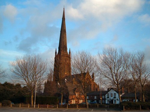
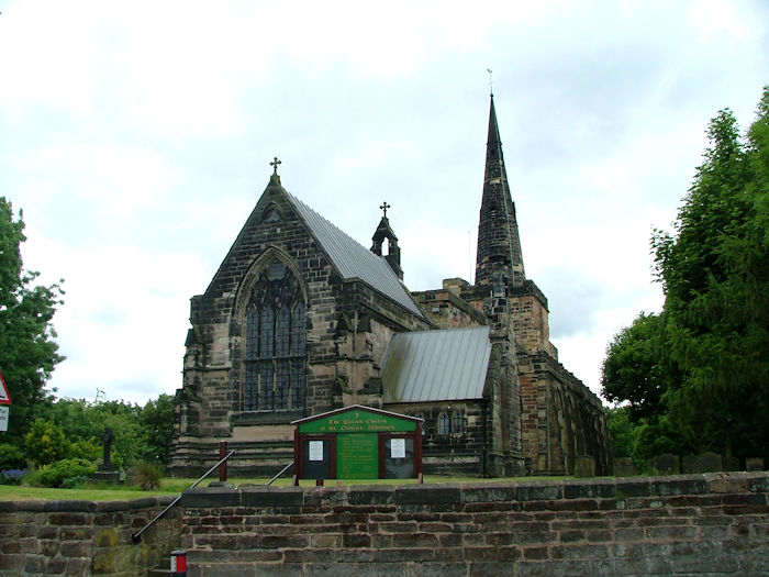
The Parish Church of St Elphin on Church Street and St Oswald’s Church at Winwick were both established around 634 AD.
Warrington was evidently the focus of an important estate. However, it is difficult to establish when this was founded, particularly since the dedication of the church to St Elphin is so unusual. It has been suggested that there was a religious centre located here before the church was constructed, based upon a sacred well.
St Elphin’s well is known to have been located close to the church. However, excavations in 1971 by Hill demonstrated that the core of the well was medieval in origin (Grealey 1976, 42).
Both churches would have been made of wood and later rebuilt in stone and Oliver Cromwell based himself at Winwick after the battle of Red Bank close by. Read more about St Elphin’s and St Oswald’s in the Howley and Winwick sections respectively of Downtown.
Medieval Period
Domesday (1086)
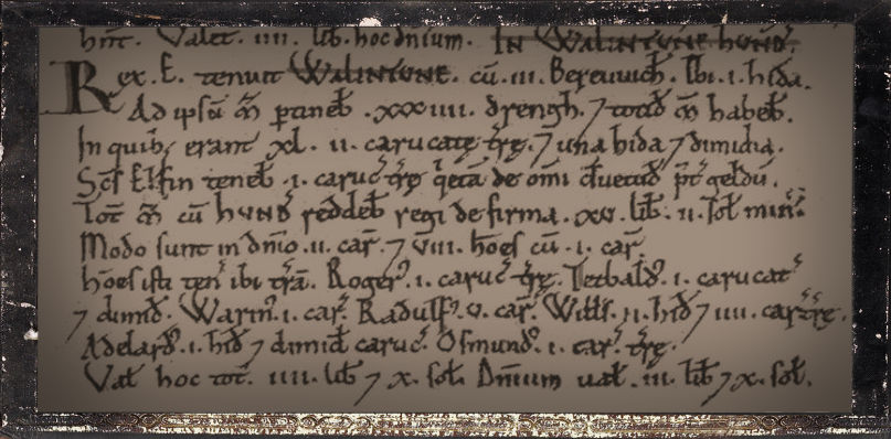
Warrington’s Domesday Entry
The Domesday reference to Warrington shows that there was a settlement on the north bank of the River Mersey by the time of the Norman conquest.
At this time Warrington was the focus of Warrington Hundred, which included the parishes of Warrington, Prescot and Leigh, as well as a number of outlying manors (Grealey 1976, 18). Three smaller manors, namely Little Sankey, Orford and Howley are also named in the document.
William the Conqueror rewarded his followers with grants of land, one of whom was Roger de Poitou, who was given land in the north of England including Warrington. Roger, finding these tracts of land more than he could manage, subdivided his possessions among his friends and granted the manor and hundred of Warrington to Paganus de Vilars. Thus de Vilars became the first lord of the manor of Warrington.
The second lord of the manor was Matthew de Vilars, who built the first Norman church in Warrington about the year 1150. his heir, Beatrix de Vilars, married Richard Pincerna who took his name from the office of butler, which the family held under the Earl of Chester. They later changed the family name to Boteler.
The Domesday Book recorded that:
In Warrington hundred King Edward held Walintune with 3 outliers. 1 hide. To the manor itself belonged 34 drengs and they had as many manors, in which there were 42 carucates of land and 1½ hides.
St Elfin’s held 1 carucate of land exempt from all customary dues except tax. The whole manor with the hundred paid £15 less 2s in revenue to the king. Now 2 ploughs in lordship; 8 men with one plough.
These men hold land there: Roger 1 carucate of land; Theobald 1½ carucates; Warin 1 carucate; Ralph 5 carucates; William 2 hides and 4 carucates of land; Aethelhard 1 hide and ½ carucate; Osmund 1 carucate of land.
Total value £4 10s; value of the lordship £3 10s.
Definitions:
dreng – a free tenant especially in ancient Northumbria who held under a partly military and partly servile form of tenure antedating the Norman conquest.
hide – a former measure of land used in England, typically equal to between 60 and 120 acres, being the amount that would support a family and its dependants.
carucate – a medieval unit of land area approximating the land a plough team of eight oxen could till in a single annual season. Approximately 120 acres.
Markets and Charters
The earliest date for holding a fair in Warrington is 20 October, 1255, when the 7th Baron of Warrington, Sir William Fitz Almeric le Boteler, was granted a Royal Charter by King Henry III to hold a three-day fair every year on the eve, day and morrow of St Thomas the Martyr. The Charter also granted permission for a market on Wednesdays. The town in those days was known as Wherington.
Charters were granted by the Crown as rewards to barons and landowners for services rendered to the Sovereign. In 1292 he granted the town Borough status (Carter 1947, 15; Farrer and Brownbill, 1907, 35). The charter was held by the lords of the manor until the town council purchased them from John Henry Ireland Blackburne in 1852. Until the 1830s the markets were held on Church Street, the original ‘town centre’. There was also a market in Latchford.
Manorial Home of the Botelers
The Boteler family resided at Mote Hill, the location of Warrington castle. See the Mote Hill section of Howley in Downtown for more (when available). Sometime between the years 1256 and 1259 the castle burned down and the seventh lord of the manor built a new home in Burton Wood (now Burtonwood) called Bewsey Hall.
By 1310, the eighth lord of the manor of Warrington, Sir William Fitz Henry le Boteler, was empowered to collect tolls on Warrington Bridge, which lasted until the 16th century. By this time, the town had paved streets. The Boteler family died out by 1593.
The next owner of Bewsey Hall was Thomas Ireland, who was knighted by King James I when he stayed the night in 1617.
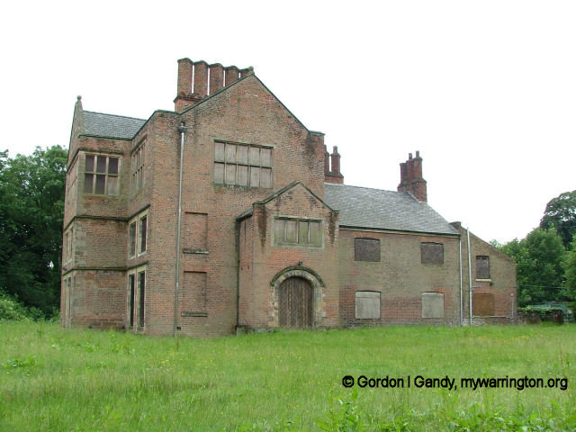
Bewsey Old Hall
Medieval Settlement
Warrington’s position at the centre of a major estate, at a fording point of the River Mersey and on a north-south route, made it an attractive trading centre and stopover point.
Originally the urban centre was focussed around St Elphin’s church and the castle and along Church Street.
Initially the Mersey was crossed via the ford at Latchford, but a new bridge was perhaps built in the 13th century when William le Boteler created the Borough.
In 1285 the Boteler family was granted ‘pontage’ (a toll) for four years on goods passing over Warrington Bridge.
This bridge soon became the principal means of communication between north and south England, and the street leading from it was called Newgate (now Bridge Street) as late as 1465.
The town continued to flourish, and a survey of the property of Sir Peter Legh (who owned around one third of the town) in 1465 shows a large and thriving town (Beamont 1849).
The survey recorded that houses extended from the church westwards as far as the market, a little way down Sankey Street and south from the crossing down Newgate.
On the north side of the market was a row of houses called Pratt Row, whose long back gardens ran to the great heath upon which stood a windmill.
Leland visited the town around 1535 and described it as ‘…a paved town; one church (and) a freres Augustine at the bridge end. The town is of a pretty bigness. The parish church is at the tail of all the town. It is a better market than Manchester’ (Toulmin-Smith 1964, 41).
Boteler Grammar School was founded around 1526 by Sir Thomas Boteler who left in his will 500 marks in gold “therwithe to founde a free grammar scolle in Weryngton to endure forever”. The foundation charter granted a house in Warrington and an adjoining croft as a schoolhouse.
The Old Grammar School seen in February
1996 when used as a council storage depot
The schoolmasters house was in Bag Lane. The premises were rebuilt in 1688 and again in 1757. A new school was built in 1829 but was demolished, together with the master’s house, in 1862.
The Economy in Medieval Times
Much of Warrington’s wealth was no doubt based on agriculture. The town was surrounded by arable fields, heathland and meadows by the River Mersey. The markets and fairs were another source of income. Fourteenth century charters give an idea of the variety of goods entering the town: customs were imposed on salt, bacon, cheese, butter, fish, pelts, cloth, wool, leather, wine, honey, tin, brass, dyeing agents and pigments, copper, iron, lead, onions, garlic and many other commodities (Beamont 1849, lxxiii-lxiv).
The 1465 survey records that there were a number of trades and professions in medieval Warrington: chaplain (capellanus), priest (presbyter), clerk (aquae bajulus), lawyer (juris peritus), arrowsmith, shoemaker (sowter), glover, weaver (webster), cook, fuller, nailmaker (le nayler), miller, thatcher, fisherman, harper (citherator) and piper. There is also reference to a number of shops and the market (forum) (Beamont 1949, lxxiv-lxxv).
Religious Life During Medieval Times
Two places of religious worship, still active during this time, have already been mentioned, so let’s look at another.
Warrington Friary
A house of Augustinian Friars was founded in Warrington at Friar’s Gate, close to the bridge across the Mersey, by William Fitz Almeric le Boteler, probably before 1272 (Knowles and Hadcock 1971, 240, 244; Farrer and Brownbill, 1907, 305). The friary was suppressed in 1539 when Henry VIII dissolved them but the friary church remained in use until c. 1650.
The arch of a doorway apparently remained standing into the 18th century. Nothing survives of the friary above ground but excavations have partially revealed its plan (Grealey 1976, 19).
Excavation in this area dates back to 1886, when Beamont, Worsley and Owen undertook an excavation during the widening of Bridge Street. This work revealed the corner of a building complete with the foundation of a stone staircase, which the excavators suggested may have been the friary infirmary.
They also revealed the foundations of the friary church, including a well preserved choir, a fine tiled floor and an oblong crossing. The less well preserved remains of the nave and large north transept were also recovered, along with the discovery of ‘interesting burials’.
In 1978 excavations were carried out by the North Cheshire Archaeological Group, which revealed 28 graves with multiple burials, along with a burial in the wall of the aisle and another beneath an incised grave slab.
In 1982 Liverpool University investigated an area at Bridge Foot, which also revealed evidence of the friary including a ditch and mosaic floor tiles.
This was followed by an excavation in 1984 on the site of the former Co-op building on Bridge Street, which exposed a robber trench of a former friary wall and revealed evidence of various phases of demolition.
In 1995 an archaeological evaluation was carried out by Gifford and Partners (1995), which revealed substantial remains of the friary (walls, drains, demolition debris etc) c 1m below the modern ground surface. An archaeological watching brief carried out at the site by Gifford and Partners in 1996 exposed further areas of the friary, including a possible walkway connecting the friar’s accommodation with the friary church.
In 1998 an evaluation was carried out on part of the friary site by Oxford Archaeological Unit (OAU), which concluded that structural remains of the Friary site survived c 1m below ground level and internal features c 600mm. This work was followed by an excavation carried out by the Lancaster University Archaeological Unit (LUAU) in 2000, which revealed the north wall of the nave and internal column bases.
The Friar Penketh pub now stands on the site of the main building.
Post-Medieval Period to Modern Times
The Manor of Warrington
The manor of Warrington was purchased by Thomas Ireland in 1597 but was sold to William Booth in 1630. It remained in the hands of the Booths of Delamere until 1758 when it was sold to John Blackburne. Thereafter it stayed in the hands of the Ireland family until 1851 when it was purchased by Warrington Corporation (Farrer and Brownbill, 1907, 319).
Civil War and the Siege of Warrington
Warrington was strategically placed as a bridging point on the main road from London to Scotland, and hence played an important part in the Civil War. It was adopted in 1642 as the headquarters in the north-west of the Royalist leader, the Earl of Derby, who fortified the town with earthworks. He set up his headquarters at the Marquis of Granby pub on Church Street.
James Kendrick in Warrington Siege (viewable online) tells us that at the outset of the Civil War (January, 1641-42) when King Charles I withdrew from his Parliament and repaired to York, the eyes of his Council were directed to Warrington, in the county of Lancaster, as the most fitting rallying-point for the royalist adherents.
It was therefore selected as the spot where the first open declaration of war, the raising of
the King’s standard, should take place, and that “all but royal subject” James, Lord Strange (shortly afterwards by the death of his father, seventh Earl of Derby) was dispatched to Warrington, as the centre of the loyal counties of York, Cumberland, Westmoreland, Chester, Lancaster, Salop, and Nottingham, and of North Wales. The Earl is said to have speedily raised twenty thousand men, well armed and loyal to their Sovereign. But enemies amongst the courtiers who remained with the King at York, poisoned the ear of his Majesty with unjust suspicious of his lordship’s truth and loyalty, and this led to the royal standard being first displayed at Nottingham, on the 22nd of August 1642.
The Earl of Derby, however, still made Warrington his headquarters, and it was from thence that on the 24th of September following, he led 4000 foot, 200 dragoons, 100 horsemen, and seven pieces of ordnance to the siege of Manchester, then a stronghold of the Parliament. It is well known that his attempt was unsuccessful.
Leading his discomfited forces to join the King at Shrewsbury, they formed part of the Royalist army at the battle of Edge Hill on the 23rd of October following. The Earl himself had unwillingly returned to Warrington to raise, at his own expense, new levies, and with these in the early part of November he laid siege to Birmingham, but again he was unsuccessful. The end of the month finds him with his troops in garrison at Warrington.
The Earl of Derby, during his sojourn at Warrington, is traditionally said to have occupied a low thatched house on the south side of Church Street. It is still standing, and known as ” The Earl’s Lodgings,” and until 2022 was known as the Marquis of Granby public house. Read the plaque on the front of the building.
During the winter months of 1642-43 we find him personally engaged, and with somewhat better fortune, in the capture of Blackburn, Lancaster, and Preston.
During the same winter the Earl of Derby is said to have strongly fortified the town of Warrington, but in what its military defences consisted we have no record. In a Puritan tract entitled “Manchester’s Joy for Derbie’s Overthrow, 1643,” it is styled “a town of great strength”.
The “outer walls” of the town are expressly mentioned by Edward Burghall in his diary entitled “Providence improved” and Mr Ormerod in his ” Civil War Tracts” speaks of mud walls being thrown up at Warrington, as at Manchester, Bolton, Liverpool, and Lancaster.
Moreover, one of the precepts found at Houghton Green, requires the attendance of six carts with horses and drivers, and of ten able bodied men with spades, for the repair of the works of Warrington garrison, after the siege which is the subject of our present enquiry. They cannot, however, have been of great extent, since they have left no obvious remains to the present day.
But be this as it may, the possession of Warrington was considered of such importance by Sir William Brereton, one of the most successful of the Parliamentarian leaders, that in the spring of 1643, being at Northwich, in Cheshire, he requested Col. Assheton to send him 500 of the Manchester forces from Wigan to aid his own troops in gaining the town of Warrington from the Earl of Derby. On the morning of Easter Monday, the 3rd of April, a small advanced body of Brereton’s forces, under the command of Captain John Arderne, of Alvanley, approached the town on the Cheshire side. The Earl of Derby, perceiving that their force was small, at once sallied out to attack them, and encountering them on Stockton Heath, about a mile to the south of Warrington, a severe engagement took place
in which many of the Parliamentarians fell.
The timely arrival of Sir William Brereton, with the remainder of his forces, alone prevented a total rout, for the Earl judged it best to draw off his troops, retiring to the town with many prisoners and several of the enemy’s colours.
Under the guise of these colours the Earl contrived at four o clock in the afternoon of the same day, to push forward a considerable body of his men, who crossing the Mersey at the ancient Ford at Latchford, advanced, by the route of Ackers Common, unsuspectedly upon the right flank of the Cheshire troops, and he himself leaving the town by the bridge and causeway at Wilderspool, assaulted them so furiously in front, that with trifling loss on his own part, he completely routed them, as the account states “with greate slaughter and little labor.”
It is traditional that such of the Puritans as fell in the battle of Stockton Heath, many in number, were interred in the burial-ground of the chapel at Hill-Cliff. Others, probably disaffected Churchmen, were buried at Budworth, five miles south of Stockton Heath, as can be seen in the register of burials there.
The town was besieged in 1643 and despite resistance surrendered at the end of May 1643.
In conclusion, Kendrick says, “I may remark that the surrender of the town of Warrington by Colonel Norris was expediated by intelligence of the surprise, defeat, and capture of Lord Goring at Wakefield by General Fairfax on the 21st of May. It was followed by a summons to all the Earl of Derby’s Lancashire forces to join the Queen at York, and the vanquished garrison of Warrington doubtless joined the retreating body”.
Settlement of Post-Medieval Times
Despite suffering in the Civil War the town remained prosperous and was described in 1673 as ‘a very fine and large town, which hath a considerable market on Wednesdays for linen cloth, corn, cattle, provisions and fish, being much resorted to by the Welshmen, and is of note for its lampreys’ (Farrer and Brownbill 1907, 307). In fact, another translation of the name Warrington is “town of Welshmen on a river bend”.
Education in Post-Medieval Times
Blue Coat School
A school for poor children, Warrington Blue Coat School, was founded after 1665 and became an educational charity in 1711. It was first located behind Holy Trinity Church but a new school, the Blue Coat Hospital, was opened in Winwick Street in 1782. The town’s first elementary school, the National or Parochial School, was opened in Church Street in 1833. See www.hslc.org.uk for a more detailed account of the region.
Warrington Academy
Warrington was, for a time in the second half of the 18th century, a major cultural centre. This reputation was largely based upon the Warrington Academy, which was founded in 1757 as a college for the sons of Protestant Dissenters who were excluded from the universities.
Dissenters or English Separatists were Protestant Christians who separated from the Church of England in the 17th and 18th centuries. A dissenter is one who disagrees in opinion, belief and other matters. It established a high reputation as a centre of scientific and literary activity.
The original academy was at Bridge Foot and later moved to premises behind Bow Street in 1762 but was closed in 1786. At the time of the academy in that area of town, academy Street didn’t exist.
Buildings were later demolished to create a passage from Buttermarket Street to Mersey Street and it was named Academy Street in memory of the important education establishment.
Between 1760 and 1802, an early printing press, Eyres Press, was used to produce many booklets and papers. One such beneficiary was the writer and prison reformer John Howard, who had his book published while he resided above a shop on the site of today’s Warrington Market. The Bridge Street premises are called the Howard Buildings in his memory.
One other important establishment was the Warrington Circulating Library, which was established in 1760. The combination of printed material and learning gave Warrington the accolade of “The Athens of the North”.
Economy and Manufacturing
Agriculture was probably the major economic activity in the Warrington area until the 18th century when manufacturing became dominant, and the largest industry in the 18th century was probably the manufacture of sail cloth. Fourteen sail cloth manufactories in Warrington are listed in Bailey’s Northern Directory of 1781 and Aikin, writing in 1791, estimated that ‘half of the heavy sail-cloth used in the navy has been computed to be manufactured here’. With the advent of steam power, however, the demand for sail cloth diminished and by 1855 there were no sail cloth manufacturers remaining in the town (Carter 1947, 49).
Thomas Patten had established a copper works at Bank Quay by 1697 and had improved the navigation of the Mersey specifically to enable him to import copper ore for his works. By 1795, however, the works were said to be disused (Carter 1947, 47-8). Bank Hall was built for Patten in 1750. It is now our town hall.
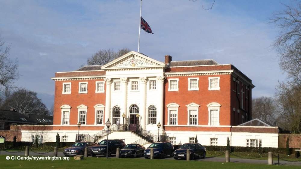
The Town Hall began as Bank Hall in 1750.
One noted local industrialist was Peter Stubs who supplied files and hand tools to home workers, based at a workshop behind the White Bear Inn on Bridge Street, of which he was the landlord. In 1802 set up a major manufactory in Scotland Road (Carter 1947, 48; Ashton 1939). Stubs eventually operated from a new site in Wilderspool between 1873 and 2020, the later name of the factory being “Erasteel Stubs” under its French owners from 2001. Read more about the company on the Culture Warrington website.
In 1781 there was a single glass manufacturer in the town, whose manufactory at Bank Quay is shown on a map of 1772. By 1828-9, however, there were five listed in Pigot’s National Commercial Directory. These included Perrin, Geddes & Co, Mersey Flint Glass Works and Robinson’s.
A soap works was founded at Bank Quay by Joseph Crosfield in 1814. One of his most successful products was Persil in 1909. By 1911, however, the company was ailing and was absorbed by Brunner, Mond and Co of Northwich, who sold the company in 1919 to its old rivals Lever Brothers of Port Sunlight.
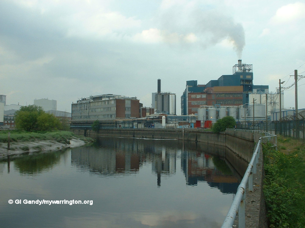
Bank Quay industrial area on 22 Apr 2003
Wire-drawing came to Warrington early in the 19th century and was developed on a large scale by Nathaniel Greening and John Rylands, who began as partners in 1805 but eventually split to head their own companies. Ryland had sites on Church Street and Battersby Lane, while Greening opened his Britannia Works on Bewsey Road. Before 1840, iron was obtained from Staffordshire and Shropshire but in 1840 a local forge was opened at Dallam Lane. Other industries included cotton manufacture, fustian or velvet cutting, pin-making, engineering, tanning, flour milling, brewing, canvas manufacturing, linen making, watchmaking, sugar refining and shoe-making.
Religious Life in Post Medieval Times
Warrington was a major centre of Nonconformity. The Rector of Warrington refused to subscribe to the Act of Uniformity of 1662 and was ejected from his living. He obtained a licence to hold Presbyterian meetings at the Court House in the market square in 1672. The first nonconformist chapel built in Warrington was the Cairo Street Chapel, opened in 1703. This was followed by a Quaker Chapel in Buttermarket Street opened in 1720 (and rebuilt in 1830).
Chapels for the Methodists in Upper Bank Street and for the Congregationalists in King Street (Stepney chapel), both opened in 1779 (Holman and Sellers 1972, 28). Adherence to the Catholic church remained strong in Warrington. A room in Dallam Lane was used as a chapel from 1771-8 until it was replaced by a chapel in Bewsey Street, and in 1823 St Alban’s church was built in Bewsey Street.
Population Statistics
The town’s population at the time of the first market charter in 1255 was around 600 persons. By the 1600s it is estimated at around 1,000 to 1,500 (Crosby 1996, 62), in 1772 at around 7,000 (Holman and Sellers 1972, 46) and in 1781 as 8,791 (Aikin 1795).
The first national census was taken in 1801 and revealed a figure of 10,567 residents in the town. A hundred years later it was 64,242 and in 2021 the population was recorded as 210,900.
Local Government
from the 19th Century
The town was incorporated as a borough in 1847 and William Beamont became the first mayor. He was also a historian and philanthropist and served on the council alongside industrialist like Peter Rylands, Thomas Lyon, John Greenall, William Allcard and Joseph Perrin. In 1848 the council set up the first rate-assisted library and museum in the country. The population in the town was estimated at 20,000. Today it is ten times as big.
Transport and Communications
The development of communications was vital to Warrington’s success as an industrial town. The main road north to Wigan and beyond was turnpiked in 1726, the east-west route to Liverpool and Manchester in 1752, the road to Knutsford and the south in 1753, and the road to Chester in 1786 (Holman and Sellers 1972, 34).
The Stagecoach
In the 18th and 19th centuries the town was important as a coaching stage post, particularly en route to the north. Baines (1825, 590) estimated that around 60-70 coaches passed through the town every day. I make the assumption that was the total for both directions. One of the main staging posts was the Old Lion Hotel on Bridge Street, which still stands today as Babylon Retro Bar.
Water Transport
As early as the late 17th century the navigation of the River Mersey as far as Warrington was improved by Thomas Patten, to enable him to transport copper ore direct to his works at Bank Quay, where he had constructed a wharf. In 1720 the Mersey and Irwell Navigation Act allowed the improvement of the river system as far as Manchester.
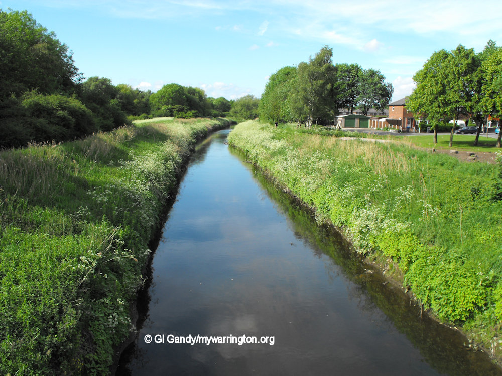
The Sankey Canal (also known as the St Helens Canal) still passes through Dallam as seen here on 18 May 2011
Warrington was the focus of an early canal system. The Sankey Canal, which was started in 1757 to bring coal from the St Helen’s coalfields to Warrington, was the first true modern canal in England.
My next door neighbour remembered the Mersey flats passing along the Sankey Canal at Dallam – she could see them from her home in Boulting Avenue before Hodgkinson Avenue houses had been built in the 1950s.
This successful venture was followed by the Bridgwater Canal, which commenced in 1758-9 and passed through Stockton Heath a few miles to the south of Warrington. It cut the cost of transport between Liverpool and Manchester by around 50% (Carter 1947, 48).
The Latchford and Runcorn Canal (also known as the Old Quay Canal or Black Bear Canal) was cut in 1801 and allowed vessels to pass between Runcorn and Warrington without waiting for the tide. Finally the construction of the Manchester Ship Canal, opened in 1894, had a drastic effect on the topography of Warrington to the south of the River Mersey. The initial plans for the Ship Canal included docks at Wilderspool but these were never constructed. Read more in On the Waterfront.
Railways
The Warrington and Newton connection with the Liverpool and Manchester railway was opened in 1831.
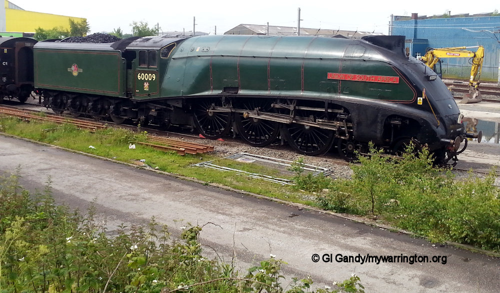
Union of South Africa passing through Warrington on 13 June 2015. Apparently it had broken down and was held here overnight.
A branch line of the Grand Junction Railway from Birmingham, which joined the Warrington and Newton line at the north end of Warrington, was opened in 1837.
The Cheshire Junction opened a line from Chester to Walton Junction, south of the river, in 1850 but shortage of money meant that it was never brought into Warrington itself.
In 1853 the St Helens and Runcorn Gap Railway opened an extension to Warrington. Additionally in 1853 further lines, the Warrington & Altrincham Junction and the Warrington & Stockport line were opened. Finally, the Cheshire Lines Committee built a fast line between Manchester and Liverpool between 1873 and 1874 and opened the present Warrington Central station in Warrington. Read more in Making Tracks.
The Motor Car, Trams and Buses
With the invention of the motor car in 1896, the Benz Patent-Motorwagen by Carl Benz, and the mass-produced Model T in 1908, Warrington once again became an important crossing location of the River Mersey, especially with the A49 and A57, and later the M6, M62 and M56 roads.
Trams were introduced in 1902, with trolleybuses following in 1935. See On the Buses for more on the town’s tram and bus history.
Air Transport
On the west side of the town, a site close to the village of Burtonwood was taken over by the government in 1939 to be used as RAF Burtonwood. During the Second World War, RAF Burtonwood served as a repair centre for planes and was eventually taken over the United States when they entered the war in 1942.
In 1965 plans for a Burtonwood International airport failed to get off the ground when the Ministry of Aviation decided against a third regional airport there.
The site is now a location for the housing estates of Westbrook, Callands and Old Hall. The urban village of Chapelford in the 21st century and the Omega business park alongside the M62 motorway followed later.
After World War Two, Warrington, like most other places, benefitted from better health care and medicines, especially after the NHS began in 1948. Warrington was designated a new town in 1968, making use of the space formerly occupied by the Royal Ordnance Factory site at Risley to build the district of Birchwood.
Many people still hold Warrington as belonging in Lancashire. In 1974 the administrative boundaries were changed, meaning Warrington came under Cheshire County Council for services such as the police and fire departments, but the original county boundaries never changed.
A good website for keeping the original Lancashire intact is The Friends of Real Lancashire (www.forl.co.uk). Another website you might find useful on the subject is The Association of British Counties www.abcounties.co.uk.
Having said all that, this website concentrates on events that happen within those extended 1974 boundary changes.
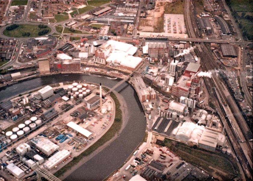
Bank Quay industrial area
The local press often feature stories about Daresbury and Lewis Carroll, but Daresbury is administered by Halton Council, not Warrington – and that is why Lewis Carroll is not featured in Warrington People, even though he often visited Walton Hall estate and the Greenall family. The same goes for Moore village: it is outside the boundary of Warrington, but Moore Nature Reserve is within it, and therefore featured in Warrington Green. If the boundaries ever changed again I will reflect those changes on this website.
My thanks to cheshirearchaeology.org.uk for permission to use extracts from their archaeological report, which have been incorporated into my own notes. I recommend your read the full document, which is in pdf format and therefore downloadable.
So that’s a taster. Delve into the rest of the website and learn about The Town of Many Industries that was known as The Athens of the North.
