
The Warrington and Altrincham Junction Railway was a railway line that was in operation from 1 November 1853 to 7 July 1985. The railway was created by an Act of Parliament on 3 July 1851 to build a line between Timperley Junction on the Manchester, South Junction and Altrincham Railway (MSJAR), to provide a through route to Manchester, and Warrington Arpley on the St Helens and Runcorn Gap Railway providing a link with Liverpool.
Contents
- Warrington and Altrincham Junction Railway
- St Helens and Runcorn Gap Railway (1833)
- Warrington Stations on the Low Level Line (from West to East)
Warrington and Altrincham Junction Railway
On 4 August 1853 the W&A changed its name to the Warrington and Stockport Railway (W&SR).
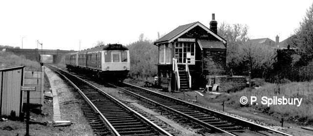
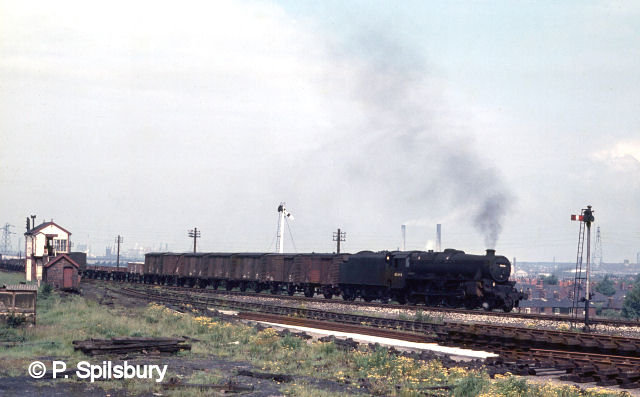
It was known locally as the Bank Quay Low Level Line because it ran under the north-south LNWR line at Bank Quay station and had its own platforms.
The Warrington and Stockport Railway (W&SR) was opened on 1 November 1853 from a temporary station at Wilderspool in Warrington to a station at Altrincham which later became Broadheath. Delays in the delivery of iron work for the bridges over the Mersey and Bridgewater Canal meant that the line was initially isolated from the rest of the railway network.
The line was opened throughout from 1 May 1854 although passenger trains terminated at Broadheath until the W&SR and MSJAR could agree on charges for passengers travelling beyond there to Manchester via Timperley.

Railway Junctions in Acton Grange, Walton & Warrington pre grouping. Image by Railway Clearing House is in the public domain because its author died more than 70 years ago. It is used under Creative Commons licence.
A link with Stockport was achieved when the Stockport, Timperley and Altrincham Junction Railway (ST&AJ) opened its line on 1 February 1866 from Broadheath Junction on the W&SR to Skelton Junction on the newly opened line from Deansgate Junction to Stockport. The LNWR operated the line from opening and on 1 January 1861 bought it. On 9 July 1893 the line was re-routed to allow for the Manchester Ship Canal, which would open in 1894, the canal being crossed by the high level Latchford Viaduct.
47323 at Bank Quay on 14 Sep 1983. When Factory Lane was open under Bank Quay Station, There was a footpath on one side of it. At the other side one crossed over to a footbridge over the Low Level railway lines, where I took this photo. The path from the bridge led to British Aluminium. The path and bridge closed after the ‘Alla’ closed.
Passenger trains on the line ended on 10 September 1962. The line to the east of Latchford closed completely on 7 July 1985. The line was still busy at this time but extensive (and costly) repairs would have been needed to the Latchford Viaduct for continued operation – these were deemed not to be economically justifiable given that the remaining freight traffic could be diverted via alternative routes and there was no desire to extend the Manchester tram system to Warrington.
The trackbed between Latchford and Broadheath now forms part of the Trans Pennine Trail. Current plans for HS2 show it may cross the line between Heatley and Carr Green.
In March 2015 a planning application was submitted to build up to 280 homes on the former route in Latchford. This would involve levelling the railway embankment to the west of Latchford viaduct. However as of 2022, nothing has been approved nor planned to continue due to the line being protected by the council.

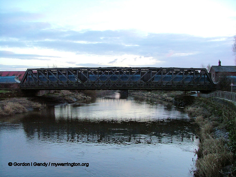
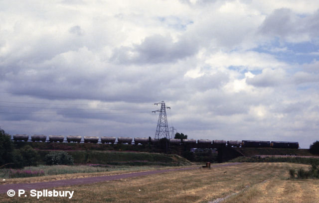
Latchford viaduct was opened on 8 July 1893 to carry the London and North Western Railway’s Stockport to Warrington line over the Manchester Ship Canal. The wrought iron viaduct, with a span of 250 feet (76 m), weighed more than 1,200 tonnes. The image shows 47490 approaching Latchford Viaduct on 28 Apr 1985. Photo © P. Spilsbury
In August 2019, the town council announced they were looking to build a mass transit network which would involve crossing the canal and have identified but yet to confirm it will go ahead.
They also have announced in their proposal that any disused rail corridor in the borough is protected from development so it may be used again for either rail or different transport.
In March 2020, a bid was made to the Restoring Your Railway fund to get funds for a feasibility study into reinstating the line between Warrington and Stockport. This bid was unsuccessful. Personally, I can’t see a local railway of this type being able to pay its way. Also, parts of the route have been designated for the Trans Pennine Trail. Having said that, the Metro Link has been very successful in the Manchester area and in an eco-friendly world, it could be made to work.
Information from Wikipedia

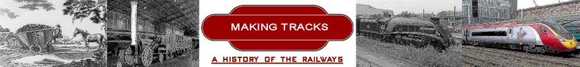
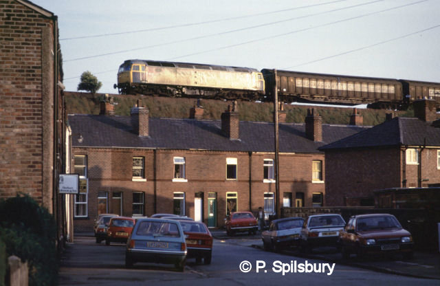
Class 56 56093 on Wilderspool bridge with a merry-go-round (mgr) train of empty coal wagons from Fiddler’s Ferry Power Station on 28 May 1982. Photo © P. Spilsbury.
We’ll look at the stations in the Warrington area shortly, but first let’s complete the story of the western end of the line that eventually became one of three routes from Liverpool to Manchester via the Warrington district.
St Helens and Runcorn Gap Railway (1833)
St Helens and Runcorn Gap Railway, later known as St Helens Railway, was an early railway company in Lancashire, England, which opened in 1833. It ran originally from the town of St Helens to the area which would later develop into the town of Widnes.
As the Industrial Revolution took off in the north of England, the first solution for transporting goods was to build the Sankey Canal which opened in 1755 and ran from the Blackbrook canal via Parr to Sankey Bridges, to the west of Warrington. It was extended to the west, to Fiddlers Ferry, five years later. Encouraged by the success of the Stockton and Darlington Railway which opened in 1825, in 1829 a group of local businessmen arranged for a survey for a line from Cowley Hill Colliery, north of St Helens, to Runcorn Gap on the River Mersey.
At this time the Liverpool and Manchester Railway, which ran to the south of St Helens, was being built and its surveyor, Charles Blacker Vignoles, was commissioned to undertake the survey; he was later appointed as the engineer. An Act of Parliament was obtained on 29 May 1830.

Crossing the Sankey-St. Helens Canal at Sankey Bridges. The original bridge could swing to allow barges to pass. Photo © P. Spilsbury.
The St Helens and Runcorn Gap railway was primarily a freight line, designed to take coal traffic from near St Helens south to the River Mersey.
It opened in 1833, engineered by Charles Blacker Vignoles who had previously worked on the Liverpool and Manchester line. There was also an east/north junction just to the east between the two lines, called St Helens Junction.
Branches were opened to Garston, Warrington and Rainford. The company was taken over by the London and North Western Railway in 1864.
The new company then set about planning branch lines and connections. The company bought land at Garston with the intention of building a dock and linking it with a line to Runcorn Gap. This opened as a single line on 1 July 1852, although the dock was not opened to shipping until 21 July 1853.
A view of the Intersection Bridge where the St Helens and Runcorn Gap Railway crossed over the Liverpool and Manchester Railway near Sutton, St Helens, the first bridge of one railway over another in the world.
Image used under Creative Commons licence.
On 21 May 1851 a sharp curve connection had been made on this line from the main line at what was to become known as Widnes Dock Junction. The following year a new Runcorn Gap station was opened nearer to the rapidly growing town of Widnes. The next project was to build a branch line to Warrington. This was opened on 1 February 1853, extending to a temporary station at White Cross, Warrington. In the following year it was extended to meet the Warrington and Stockport Railway. A station on this branch was opened at Cuerdley but this closed in January 1858. The creation of these branch lines created an unusual feature on British railways, a flat crossing. In the 1860s people could travel eastwards from Runcorn Gap to Warrington and, from there, to Manchester, London and many other places. They could also travel west to Liverpool by taking a ship at Garston.
The line from St Helens to Widnes and the branch to Rainford are now closed, the latter terminating at the Pilkington Glass’ Cowley Hill works siding near Gerard’s Bridge, but part of the lines to Garston and to Warrington are still in operation.
Information from Wikipedia.
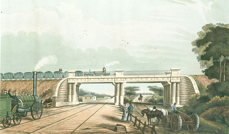
Runcorn Railway Bridge
The Runcorn Railway Bridge, Ethelfleda Bridge or Britannia Bridge crosses the River Mersey at Runcorn Gap. The bridge is recorded in the national Heritage List for England as a Grade II* Listed building.
In 1861, Parliamentary approval for a railway crossing the Mersey was obtained by the London and North Western Railway (LNWR). The design for a bridge and viaducts was produced by William Baker, the company’s chief engineer. In 1863, preparatory work for the bridge and approach viaducts commenced.
The bridge was completed in 1868 and was opened for traffic on 10 October. The first goods traffic crossed the bridge on 1 February 1869 and the first passenger train on 1 April.
An aerial shot of the Mersey showing the three bridges at Runcorn Gap. It shows just how difficult it must have been to build a railway bridge across this waterway. The railway bridge is slightly obscured by the Silver Jubilee Bridge (the ‘Coathanger’). The railway bridge now forms the route from Liverpool to London.
Image by Parrot of Doom is used under Creative Commons licence.

A close-up of the railway bridge at Runcorn Gap.
The official name of the bridge has been a subject of debate. Locally, it has been called the Queen Ethelfleda Viaduct, but is also called the Britannia Bridge. It has been claimed that it was named after Ethelfleda, a ruler of the historic Anglo-Saxon kingdom of Mercia, and that the southern abutments and pier of the bridge have been built on the site of the Saxonburh that had been erected by her in 915. This connection is alleged to be the reason why LNWR had opted to have elements of the bridge castellated.
There are three shields above the footway showing, from the southern end, the Coat of Arms of the City of London, Britannia (from the crest of the railway company) and the Liver Bird of Liverpool Because of the presence of the crest, the bridge is also known as the Britannia Railway Bridge, and has also been referred to as “Tueller’s Girder”.
Information from Wikipedia.
Warrington Stations on the Low Level Line (from West to East)
Cuerdley
The station was situated on the Garston and Warrington railway which was opened by the St Helens Canal & Railway Company (SHC&RC).
The Garston and Warrington line was half-a-mile south of Cuerdley (a small farming community) and paralleled the Sankey Canal, on its north side, for much of its route between Runcorn Gap and Warrington. The canal had been owned by the same company as the railway since 21 July 1845.
From Cuerdley, Taylors Lane connected the hamlet to the River Mersey which lay just to the south of the canal. It crossed the railway by means of a level crossing, and the canal by a swing bridge.
The SHC&RC had no intention of providing a station for the inhabitants of Cuerdley as they did not think it would be remunerative. The nearest stations were two miles to the west at Runcorn Gap (From 1 September 1864 renamed Widnes) and one mile to the east at Fiddler’s Ferry & Penketh. The residents of Cuerdley lobbied the railway company for a railway station and eventually, in November 1855, one was provided.
As predicted by the railway company Cuerdley station proved to be unremunerative, as only a handful of passengers used it, and they closed it completely on 5 January 1858. The site reverted to being simply Taylors Crossing.
Fiddler’s Ferry Power Station is now built over Taylor lane which led to the station.
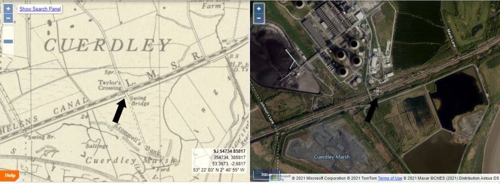
Dual map showing the suggested location of Cuerdley railway station, south of Fiddler’s Ferry Power Station. The map is available at the National Library of Scotland website. A selection of maps from different periods are available and are great for research. Google Maps are also acknowledged here on mywarrington.

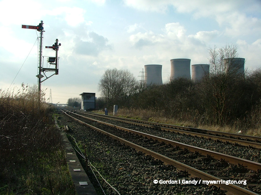
Fiddler’s Ferry Power Station in April 2012. The electricity generating station went live in 1971 and was decommission on 31 March 2020. Although it is called Fiddler’s Ferry Power Station, it is actually in Cuerdley.
Some text in this section is courtesy of Paul Wright. See more of Paul’s work at www.disused-stations.org.uk (see also www.subbrit.org.uk) Other information from Wikipedia.
Fiddler’s Ferry and Penketh
The station was situated on the Garston and Warrington railway which was opened by the St Helens Canal & Railway Company (SHC&RC) in two stages, between Runcorn Gap and Garston on 1 July 1852, and between Runcorn Gap and a temporary station at Warrington White Cross on 1 February 1853.
So why is the area called Fiddler’s Ferry? Who was the fiddler? well, soon after the Norman invasion of 1066, Adam le Vieleur was the Lord of the Manor of Penketh. Vieleur is a French name and translated as ‘viol-player’ or ‘fiddler’. The lord owned the rights to the ferry, so it was ‘Fiddler’s Ferry’.
In modern times the railway station site is at the southern, canal end of Station Road in Penketh. The Ferry Tavern is close by. The station opened on 1 February 1853 and as the Sankey (St Helens) Canal was close by only a small waiting shelter was provided on the south platform, with a single story station building and booking office located on the north platform. There was a signalbox on the east side of the Warrington-bound platform.
The 1922 timetable uses “Fidler’s Ferry and Penketh” as the name of the station. It shows twelve “Up” (towards Manchester) trains calling on “Weekdays” (Mondays to Saturdays.) Ten called at almost all stations between Liverpool Lime station and Manchester London Road (Piccadilly now), a journey of over 2 hours for the 37 miles via Warrington Bank Quay Low Level. Of the other two, one terminated at Warrington and the other at Altrincham. “Down” services were similar. No trains called at the station on Sundays.
The station was closed to passengers on 2 January 1950 and closed completely on 2 December 1963. The station was demolished step by step over the following years. The line through the station continued in normal passenger use until 10 September 1962 when the Liverpool Lime Street to Warrington via Widnes South service was withdrawn. By 2013 only the base for the crane in the former goods yard and the station master’s house survived, the latter as a private residence.
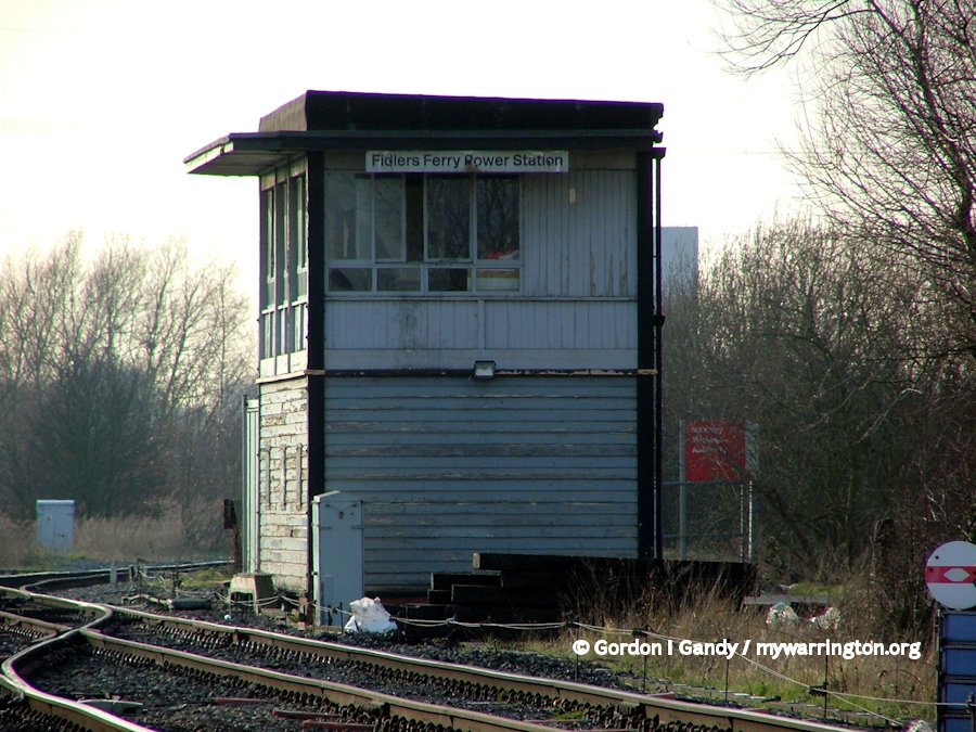
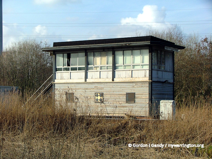
Even though it was called Fiddler’s Ferry power station, it was actually in Cuerdley. The signalbox was close to Fiddler’s Ferry and Penketh railway station.
Some text in this section is courtesy of Paul Wright. See more of Paul’s work at www.disused-stations.org.uk (see also www.subbrit.org.uk). Paul’s specific page for the station shows photographs supplied by his readers of the station during operational times. See also the Wikipedia written account.
Sankey Bridges
Sankey Bridges railway station was in southwest Warrington. It was located immediately west of a swing bridge over the Sankey Canal. The station site is to the south of Old Liverpool Road, Warrington.
The station was built and operated by the St Helens and Runcorn Gap Railway, which was absorbed into the London and North Western Railway from 1 August 1864. The line and station duly passed to the LMS at grouping and to London Midland Region of British Railways at nationalisation in 1948.
The 1922 timetable shows ten “Up” (towards Manchester) trains calling on “Weekdays” (Mondays to Saturdays.) Eight called at almost all stations between Liverpool Lime Street and Manchester London Road, as it then was, a journey of over 2 hours for the 37 miles via Warrington Bank Quay Low Level. Of the other two, one terminated at Warrington and the other at Altrincham. “Down” services were similar. No trains called on Sundays.
The station closed on 26 Sept 1949.
The station was demolished step by step over the following years. By 2010 only the eastbound platform was in place, under long grass.
The line through the station continued in normal passenger use until 10 September 1962 when the Liverpool Lime Street to Warrington via Widnes South service was withdrawn.
A DMU at Sankey in 1971. Photo © P. Spilsbury.
The remains of Sankey Bridges station on 6 July 2004.
However, a lone late night Liverpool to York Postal continued to use the route until 9 September 1963, when it was diverted via Earlestown to reduce operating costs. Warrington Bank Quay Low Level remained open until 14 June 1965 but it is unclear what traffic this served along the route after the Postal was diverted. In 2015 the tracks through the station site remained heavily used, primarily by trains to and from Fiddler’s Ferry Power Station, though a few other booked freights and occasional diversions used the line through to Ditton Junction.
However, as Fiddler’s Ferry Power Station has now closed and the site is been cleared (which is expected to be finished by 2023), I see no reason for the railway. I wonder what will be built on the site of the power station? Housing is an option, but as soon as you mention that, somebody shouts out “greenbelt!” However, this a Brown Field Site, so that shouldn’t be an issue.
Information from Wikipedia
Whitecross
Whitecross railway station was in the Whitecross area of Warrington. It was built and operated by the St Helens and Runcorn Gap Railway as a temporary terminus on its line pushing east from Widnes to join with the Warrington & Stockport Railway pushing west from Altrincham.
Its exact location is open to debate, as no trace remains, so we simply do not know where it was. Tolson cites the line’s inspector, Captain Wynne, as giving the Whitecross to Arpley extension as the very precise 45.75 chains (0.920 km), but as the location of the Arpley datum point is unclear then the location of Whitecross station is also precisely unclear. Tolson concludes that the station was probably ‘just east of Litton Mill Crossing’.
The map reference and co-ordinates used in the station data above are based on an interpretation of the map repeatedly used in the Disused Stations UK website, although that site does not include a prose section on Whitecross station.
The admirably frank 8D Association site concludes
“The site of this station has been completely lost with the building works that have occurred in the area we do not believe any pictures exist or that the site of the station can be located.”
If Tolson was wrong, and it was further east, my suggestion would be between Fairclough’s Flour Mill (the ‘Pink Eye’ building today) and the bend close to the Bank Quay soap works. My reasoning? The area west of this location is Little Sankey and further west it is Sankey Bridges. The Whitecross area is named after a White Cross, said to be either a preaching cross or a traveller’s rest, which was located close to the modern day roundabout at its junction with Priestley Street by National Tyres on Green Street. Draw a line south from this point and you come to Pink Eye (Fairclough’s) building.
Information from Wikipedia
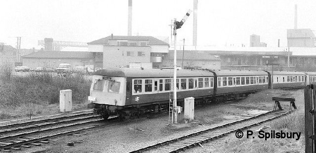
Warrington Bank Quay (Low Level)
Until 1965 the west-east oriented platforms, 6 and 7, were situated on what had been the St Helens Railway lines which pass beneath the station and the north-south West Coast Main Line. (The West Coast Main Line had been elevated to pass over the west to east line when the current station was opened on 16 November 1868). Although it was not the official title, this part of the station was referred to as Bank Quay Low Level.
The original location of the West Coast Main Line station was on the corner of Parker Street and Liverpool Road where the Poundstretcher store is today. When the London and North Western Railway (LNWR) gained control of the east-west St Helens Canal and Railway Company, they relocated the station to its current site so that both lines could be served from one location.
The north-south line had been raised to travel over the east-west line, hence the local name of Bank Quay Low Level station. The two sets of platforms were connected by a subway.
Most services that used the low-level station were local services, but occasionally long distance services passed through and stopped there.
DMUs were introduced onto the line in 1958. By this time the railway company had been absorbed into the British Railways Midland Region (from 1948 onwards) and the company began to reduce services.
Passenger services were scrapped for good on 10 September 1962, although a service to York ran from the station at midnight until 17 July 1965 when it too was withdrawn.
The line remains for freight use only and there are no longer any passenger platforms on the low level station and the line closed as a through route on 7 July 1985.
Some text in this section is courtesy of Paul Wright. See more of Paul’s work at www.disused-stations.org.uk (see also www.subbrit.org.uk). Paul’s specific page for the station shows photographs supplied by his readers of the station during operational times. See also the Wikipedia written account.
The Staffordshire Ranger DMU at Bank Quay Low Level 1960s/70s. Photo © P. Spilsbury.
And the same scene in 2006.
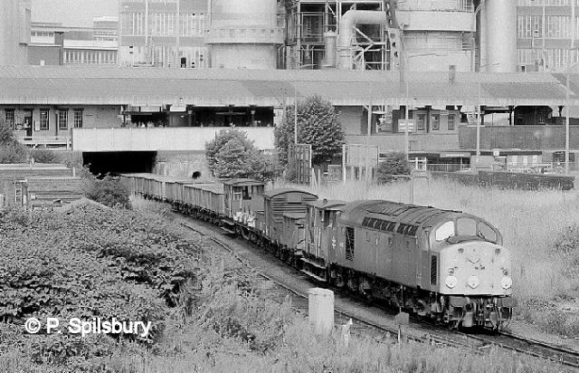
A Class 40 leaves Bank Quay on the Low Level for Sankey. Photo © P. Spilsbury.
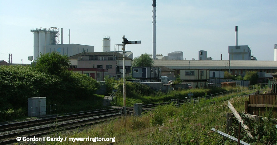
Warrington Arpley
Warrington Arpley station was a joint railway of the Warrington & Stockport Railway (W&S) and the St Helens Canal & Railway Company (SHC&RC), located on the south side of Wilson Patten Street.
A bridge was completed over the Mersey in early 1854 and the W&S opened to Warrington Arpley, the location of its headquarters, on 1 May 1854. On the same day the line was extended to Timperley Junction where it connected to the MSJAR.
In the other direction, the SHC&RC had reached a temporary station at Whitecross on 1 February 1853, which was extended to Warrington Arpley for the opening of that station on 1 May 1854.
It was a grand building, prompting a local paper to suggest you could let off one end to the Corporation baths, baths as large as St George’s Pier Head at Liverpool! Of course, it was a working building for passengers and the headquarters of the company, so one might expect something on a large scale.
Paul Wright provides a description of the building in Disused Stations, where you can read an extended version of these notes. Unfortunately, I don’t have a licenced photo of it to show you.
At the rear of the station building were two platforms separated by four tracks. Passengers reached the south platforms by crossing the tracks at the east end of the platforms. There was no footbridge or tunnel.
In April 1858 a Crimean War memorial was unveiled opposite the station entrance. The memorial included Russian canons that had been taken at the siege of Sebastopol on 8 September 1855.
The canons were presented to the Mayor of Warrington by the Government in recognition of the sufferings of British soldiers who took part in the war. During World War Two the canons were taken away and melted down for use in weapons in that war. There is a memorial to the canons in Queens Gardens on Palmyra Square in the centre of the town.
As the line from Arpley passed underneath the north-south main line at Bank Quay, the LNWR decided to built a station on the Low Level Line to make connections with that line.
Once it was built and opened on 16 November 1868, the LNWR closed the Warrington Arpley station as they felt Warrington needed just one station. But the townsfolk objected strongly as it was closer to the town centre than Bank Quay and after a campaign Warrington Arpley was reopened on 2 October 1871.
On 1 January 1923 Warrington Arpley became part of the London Midland & Scottish Railway (LMS). By the 1930s the station forecourt was being used as a bus terminus for local and regional services. The first Warrington interchange you might think, but in reality there was duplication of routes and the LMS lost passenger business. When war broke out in 1939, passenger numbers reduced and didn’t return to their pre-war levels after the war.
On 1 January 1948 Warrington Arpley became part of the British Railways (London Midland Region) and in the 1950s, services reduced further. By this time there were only eight trains in one direction and six in the other from Arpley during weekdays and none on Sundays.
Another issue for the railways was that Crosville had started bus services from Warrington to Liverpool, passing through places like Widnes, which the trains did not. So even though it was a slower journey by bus, it took passengers where they wanted to go. So much so that on 15 November 1958 British Railways closed Warrington Arpley station.
Regular passenger services still passed through Warrington Arpley until 8 September 1962 when they were withdrawn between Ditton Junction and Broadheath and all remaining stations, apart from Warrington Bank Quay Low Level, closed to passengers. The station was demolished in 1968.
Once Fiddler’s Ferry Power station is demolished, I would love to see the railway route handed over to the Trans Pennine Trail. It would be nice if they could route it over Latchford Viaduct, but the condition of the bridge is poor and would be costly to repair. But there is also talk of using it for the HS3 route.
45305 at Arpley on 4 Aug 1968, three months before the station closed. Photo © P. Spilsbury.
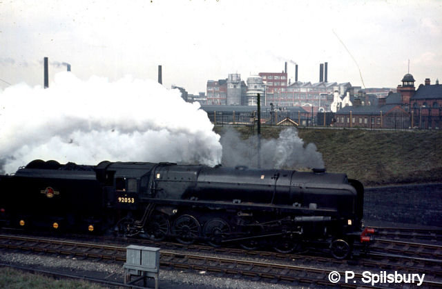
92053 at Arpley. Photo © P. Spilsbury.
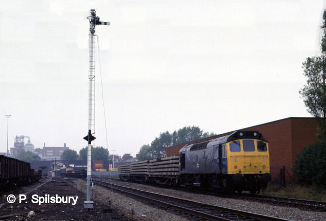
25307 on 27 Oct 1985. The old tall London & North Western signal stands proudly in this scene at Arpley Junction. Photo © P. Spilsbury.

56063 at Arpley signal box on 9 Sep 1985. Photo © P. Spilsbury.
The Railway bridge at Arpley, For many years it advertised Walker’s Warrington Ales. The photo was taken on 4 March 2005.
Warrington Wilderspool
Warrington Wilderspool was the temporary western terminus of the Warrington & Stockport Railway (W&S) when it opened on 1 November 1853.
Wilderspool station was on the east bank of the River Mersey, in Cheshire; the town of Warrington was on the other bank in what was, at that time, Lancashire. The temporary station was required because the bridge over the Mersey was incomplete in November 1853. The station was east of Wilderspool Causeway level crossing. Maps from the mid 1850s show that the station’s single platform was south of the line. Although the railway was double-track, the single platform would have been adequate at the time of opening.
A bridge over the Mersey was completed in the early months of 1854, and the W&S opened to Warrington Arpley station, where its headquarters were located, on 1 May 1854.
On the same day the line was also extended to Timperley Junction where it connected to the MSJAR. With the opening of Warrington Arpley the simple facilities at Wilderspool closed.
The station location was right next to the bridge where I took the photo from. This is how it looked in August 2008. The line going off to the right follows the course of the original Warrington & Stockport Railway. The main line seen here was a deviation of the original route made necessary because of the construction of the Manchester Ship Canal where ships need 75 ft clearance under a bridge.
Some text in this section is courtesy of Paul Wright. See more of Paul’s work at www.disused-stations.org.uk (see also www.subbrit.org.uk). Other text from Wikipeida.
Latchford
The first station at Latchford was called Latchford and Grappenhall Road and opened on 1 November 1853 and was located on It was located on the west side of what was then Hill Top Road which crossed the line on a level crossing. It was renamed Latchford Station in June 1854.
The main facilities were on the up (Manchester direction) platform and included a booking office, waiting rooms, toilets and a house for the stationmaster. A signalbox controlled the level crossing.
In 1855 the Manchester Ship Canal Company (MSCC) obtained an Act of parliament to build a shipping route from Salford Docks to the River Mersey. Originally a swing bridge had been proposed to carry the railway over the waterway. The railway company objected to this as it would disrupt their train services. This meant there had to be an adjustment to the railway line to accommodate the 75-feet high masts for shipping. So instead a bridge was built over the canal at Latchford which needed to be high enough to accommodate the 75-feet high masts for the ships.
This was at the expense of the canal company – and rightly so; why should the railway pay out for a bridge when they occupied the site first. This included a deviation to the original line. This deviation was built to the north of Latchford station. It started at Wilderspool and took the line up to the required 75ft above the canal.
A new station for Latchford was built on the deviation. Once this was operational, the original station was closed. This happened on 10 July 1893. The Manchester Ship Canal itself opened on 1 January 1894, with the official opening performed by Queen Victoria on 21 May 1894.
The second station was opened on the north side of Station Road. Paul Wright on the Disused Stations website tells us the station had goods facilities in the form of three sidings, a goods shed, weighing machine and 3-ton lifting crane located on the south side of the line to the west of the passenger station. At the western end of the goods yard, also south of the line, was an LNWR all-timber signal box which controlled the connection to the goods yard and traffic on the main line. Services on the line over the years amounted to an average of 15 up trains (Manchester direction) and 14 down trains (to Liverpool). During World War Two these services reduced to passengers and increased for freight to transport essential goods around the region.
Passenger services ceased on the line on 10 September 1962. Latchford closed to goods on 1 July 1965. The station was demolished shortly afterwards, but the signalbox continued to be used to manage the remaining services on the line. British Rail stopped all services between Latchford and Skelton Junction on 7 July 1985 and the track was lifted three years later.
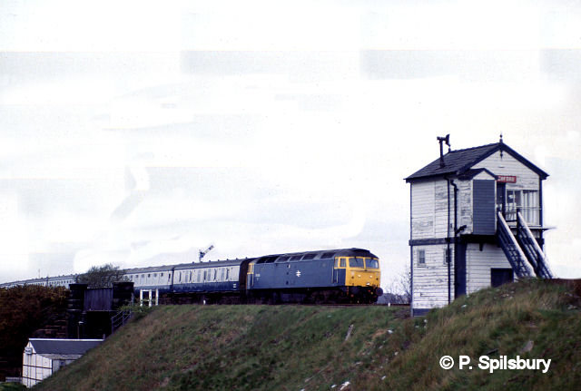
47530 at Latchford signal box on 28 Apr 1985.
Photo © Peter Spilsbury.
47490 at Latchford Bridge on 28 Apr 1985.
Photo © Peter Spilsbury.
47117 at Latchford on 4 Jul 1984. Photo © P. Spilsbury
Some text in this section is courtesy of Paul Wright. See more of Paul’s work at www.disused-stations.org.uk (see also www.subbrit.org.uk). Paul has two pages for the First and Second Latchford Stations, showing photographs supplied by his readers of the station during operational times. See also the Wikipedia written account.
45446 at Latchford. © P. Spilsbury
31163 at Black Bear Park 12 Jul 1984. © P. Spilsbury
Thelwall
Thelwall railway station was a station to the south of Stockport Road (the A56 today). It was opened with the Warrington and Stockport Railway line on 1 November 1853. Access to the station building was across the sidings which were close to the A56 road.
Like other stations on the line, Thelwall station became part of British Railways (London Midland Region) in 1956 the company decided to close the station. The last trains ran on Saturday 15 September 1956 and the station closed completely on 17 September 1956.
The site is now remembered by a company occupying Station Court.
Information from Wikipedia.
For photos of the station in operation, see Paul Wright’s Disused Stations page.
Lymm
Lymm railway station was a station to the west of Whitbarrow Road in the village on the Warrington and Stockport Railway.
It opened with the line on 1 November 1853 and served the village as part of the LNWR from 1859. The LNWR eventually took over the St Helens Canal and Railway Company to form one complete line between Liverpool and Manchester from 1868, the third through the Warrington district, with the Cheshire lines Route and the Liverpool and Manchester Railway stopping at Collins Green near Burtonwood.
When George Bradshaw wrote his railway handbook in 1861 the population of the village was 3,156, the nearest telegraph station was four miles away at Warrington and there was a hotel in the village called The Plough.
Lymm station closed to passengers on 10 September 1962 and the Warrington Borough Council ranger’s centre now stands on the site of the demolished station building.
Information from Wikipedia.
Heatley and Warburton
The station opened with the Warrington and Stockport Railway on 1 November 1853. It was known as Heatley station until 1857 when Warburton was added, a name it retained until the end of service.
The station had its own signalbox on the north side of the line close to the level crossing and passengers crossed the line via a footbridge.
The LNWR was amalgamated into the London Midland and Scottish Railway (LMSR) on 1 January 1923. By July 1946 only eight trains per day in each direction stopped at the station. The LMSR was nationalised on 1 January 1948.
Passenger services along the line were withdrawn and the station was closed by British Railways on 10 September 1962. Goods trains continued to use the line until 7 July 1985, when the need for extensive repairs to the Latchford Viaduct caused the line to be closed.
Information from Wikipedia.
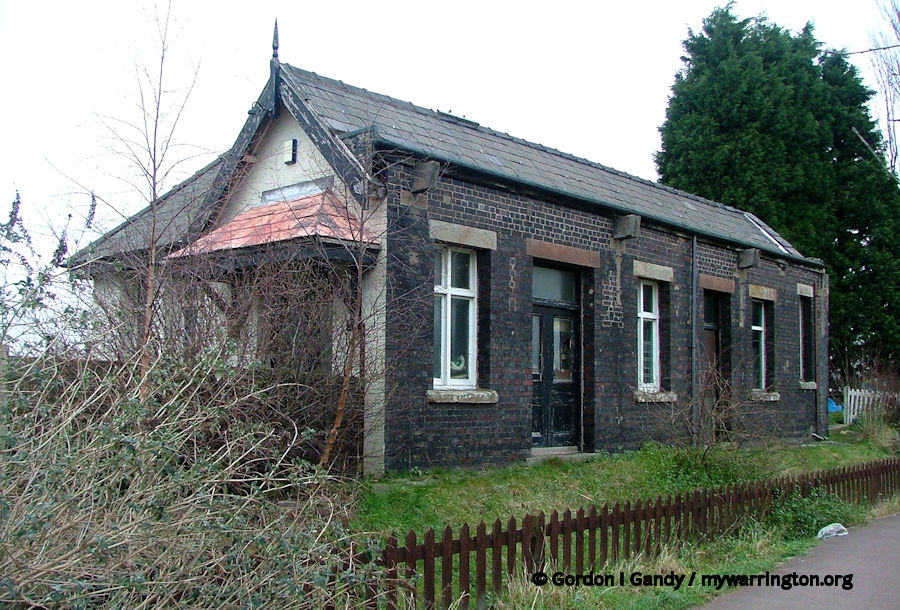
Heatley and Warburton station building on 30 January 2007.
The station building survives in use as a domestic dwelling.
For an extended account of the low-level line between Warrington and Lymm, see Warrington to Lymm – Low Level: 150 Years of Change by Bert Harris. Bert records the history of the railway and illustrates it with his own photographs, as well as sharing some memories of the line.
