
This page features an overview of archaeological findings in Warrington.
Includes extracts from Cheshire Archaeology pdf document and used with permission.
I recommend you read the full document. Similar accounts for Lymm and Thelwall are available here.
Location
Topography and Geology
The town lies at around 15m AOD (Above Ordnance Datum – used to specify heights above mean sea level on General Arrangement and other technical drawings) on the north bank of the River Mersey. The Roman settlement of Wilderspool to the south of the river lies at around 10m AOD.
The surrounding landscape comprises largely low-lying farmland.
The underlying geology comprises Upper Mottled Sandstone. To the north of the Mersey, in the vicinity of the medieval town, the drift geology includes blown sand of the Shirdley Hill Sand Group. To the south, in the area of the Roman settlement, the drift geology comprises fluvio-glacial sand and gravel, as does the area around St Elphin’s church, which is perhaps the original area of Saxon settlement, to the north of the river.
HISTORICAL AND ARCHAEOLOGICAL SUMMARY
Prehistory
It is often thought that Warrington’s history began with the Roman occupation of Wilderspool in the first three centuries A.D. But there is a remarkable concentration of Neolithic and Bronze Age stone and metal axes to the south of the River Mersey which presumably attests to a trade route along the river. There is a similar concentration north of the river around Winwick, which perhaps suggests a crossing point in the Warrington area, although there are no finds in the area of the later town.
There are a number of Bronze Age burial sites to the south of the river and also to the north of the river, east of Winwick
Hinchliffe’s 1974-6 excavations at Loushers Lane revealed a small pit, which was apparently of pre-Roman date and contained a sherd of coarse, gritty pottery, which was possibly Iron Age. Warrington museum has a collection of some of these artifacts and is well worth a visit.
Roman
The Roman settlement was centred in south Warrington, in the suburbs of Wilderspool and Stockton Heath. It is probable, however, that the settlement also extended under the present town centre and excavations on the site of Warrington Friary, on the west side of Bridge Street in 2000, also revealed evidence of Roman settlement.
Part of the site of the Roman occupation between Stockton Heath and Wilderspool
In 1787 while laying the foundations of Wilderspool House, which adjoins Greenall’s Brewery, Mr Edward Greenall found a large number of Roman objects.
However, it was during the cutting of the Old Quay Canal in 1801-3 that the first significant structural discoveries were made, including the foundations of numerous Roman buildings, and the bases, shafts and capitals of columns. Other discoveries included Roman coins and pottery.
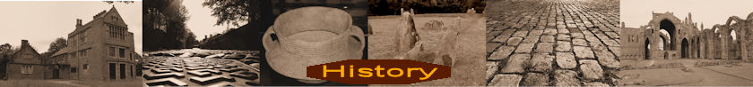
In 1869, in the ‘Long Bank Field’ (south of the Manchester Ship Canal) the lower courses of a stone lined circular well were found, from which a few fragments of Roman pottery was recovered.
Although attempts have been made to link it to Veratinum in the Ravenna Cosmography, there is little evidence to substantiate this claim (Strickland 1995, 13; Grealey 1976, 27).
Roads in Roman Times
A network of Roman roads converged upon Wilderspool. Foremost was King Street, the road which connected Wilderspool with Middlewich, but there were also probably roads from Chester to the south-west and Manchester to the east, as well as a road leading in a north-easterly direction towards Loushers Lane and the ford across the river. The route of King Street through Stockton Heath was traced by Kendrick et al during the 1930s (Harris and Thacker (eds) 1987, 219).
The method of constructing roads varied according to geographic locality, materials available and terrain, but the plan, or ideal at which the engineer aimed was always the same. The roadbed was layered. The road was constructed by filling the ditch. This was done by layering rock over other stones into the ditch was dumped large amounts of rubble, gravel and stone, whatever fill was available. Sometimes a layer of sand was put down, if it could be found. When it came to within 1 yd (1 m) or so of the surface it was covered with gravel and tamped down, a process called pavire, or pavimentare.
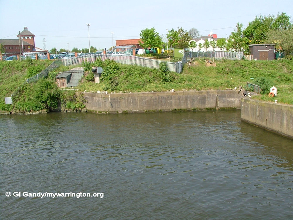
A typical Roman Road. The Streets of Pompeii were paved during Roman times with large polygonal blocks of stone. They are bordered by curbs and pedestrian walkways. On most streets there are raised stones at regular intervals that pedestrians used to cross the streets when water flooded them. Carole Raddato This file is licensed under the Creative Commons Attribution-Share Alike 2.0 Generic license.
Some information, image and photo caption from Wikipedia.
Roman Settlement
The initial Roman settlement at Warrington was probably spread along King Street, and it is in the vicinity of this road that the most substantial buildings have been recovered at Stockton Heath and at the Brewery Site.
It is suggested that settlement at Wilderspool continued throughout the 2nd and 3rd centuries and into the 4th century, the final abandonment taking place sometime after AD 318, and that occupation of the Loushers Lane area began in the late 1st century AD or even earlier and continued into the 4th century and perhaps later.
Carter in His Warrington and the Mid-Mersey Valley (1971) tells us that during pipe laying activity in March 1930 the remains of a Roman house were found in Loushers Lane. This house had central heating by way of underfloor heating.
Part of King Street viewed south from Longwood Road close to Owens Corner roundabout in Appleton. The A49 runs alongside King Street today (off to the right of this view)
Roman Industry
The industrial nature of Wilderspool was not recognised at first, although by the 1870s it was realised that much of the pottery was locally produced (Harris and Thacker, 1987, 195). It was May’s work at the turn of the 19th century, which discovered large numbers of clay working floors, hearths, ovens and furnaces, that revealed the industrial character of the settlement.
Industrial activity is thought to have begun as early as AD 85-90 and industrial buildings, including clay floors and hearths have been found 250m south of the brewery site in Stockton Heath (Harris and Thacker, 1987, 195). This site was excavated by May in 1901-4 where he discovered a life-size human mask, typical of the Stockton Heath kilns. It is usually described as the ‘actor’s mask’ and contained perforations that would have allowed it to be secured to the wearer’s head (Thompson, 1965, 86). The mask is on display at Warrington museum.
Some industrial processes have been identified from the archaeological record and these include shaft and bowl furnaces for iron smelting and smithing, and two furnaces complete with crucibles for producing bronze (Harris and Thacker (eds) 1987, 195).
There is also evidence of copper alloy working, in the form of unfinished copper objects, copper ingots, crucibles, casting moulds and slag (Watkin 1886, 260-73).
A large numbers of iron objects have been recovered, ranging from nails and bolts, to knives, locks, keys and even a carpenter’s plane, and many of these were probably produced onsite. Pottery produced at Wilderspool supplied the Roman forts in the immediate region.
Roman Cemetery
A number of burials have been discovered at Wilderspool, including a lead coffin found in 1976 during repairs to the Ship Canal. Two infant cremations are reported in this vicinity (Harris and Thacker 1987, 198) and May records that a cinerary urn in ‘Upchurch Ware’ was found three feet from the surface in the same area (Hinchliffe and Williams 1992, 116-7).
See also the Wilderspool section of Downtown for more on the Roman occupation in the town.
My thanks to Cheshire Archaeology for permission to use extracts from their archaeological report, which have been incorporated into my own notes. I recommend your read the full document, which is in pdf format and therefore downloadable.
