


Introduction
In 1870-72, John Marius Wilson’s Imperial Gazetteer of England and Wales described Stockton Heath like this:
STOCKTON-HEATH, a village in Great Budworth parish, and a chapelry partly also in Runcorn parish, Cheshire. The village stands on the Bridgewater canal, 1 mile S of Warrington r. station; has a post-office under Warrington, and a police station with lock-up; and carries on extensively a manufacture of spades. The chapelry was constituted in 1838. Pop., 1,763. Houses, 375. The living is a p. curacy in the diocese of Chester. Value, £120. Patrons, Messrs. Greenall. . The church was built in 1826. There is a Methodist chapel.
GB Historical GIS / University of Portsmouth, History of Stockton Heath, in Warrington and Cheshire | Map and description, A Vision of Britain through Time.
URL: http://www.visionofbritain.org.uk/place/2559
Date accessed: 06th September 2025
Stockton Heath is a village, civil parish and electoral ward in south Warrington. Its boundary is the Manchester Ship Canal (Wilderspool) in the north and the Bridgewater Canal (Appleton) in the south. The eastern and western boundaries are Grappenhall and Walton respectively.
The name Stockton Heath comes from two Old English words “Stoc” and “tun” or possibly “Stocc” and “tun”. “Stoc-tun” means the tun or town belonging to a cattle or dairy farm, and “Stocc-tun” means a homestead built of logs. It is thought that the first meaning is the true definition. A local origin of the name says it comes from “Stocks-on-the-Heath”, suggesting the village stocks were located close to a nearby heath. See more in Mark Olly’s book “Celtic Warrington and Other Mysteries Vol. II”, published by Churnet Valley Books.
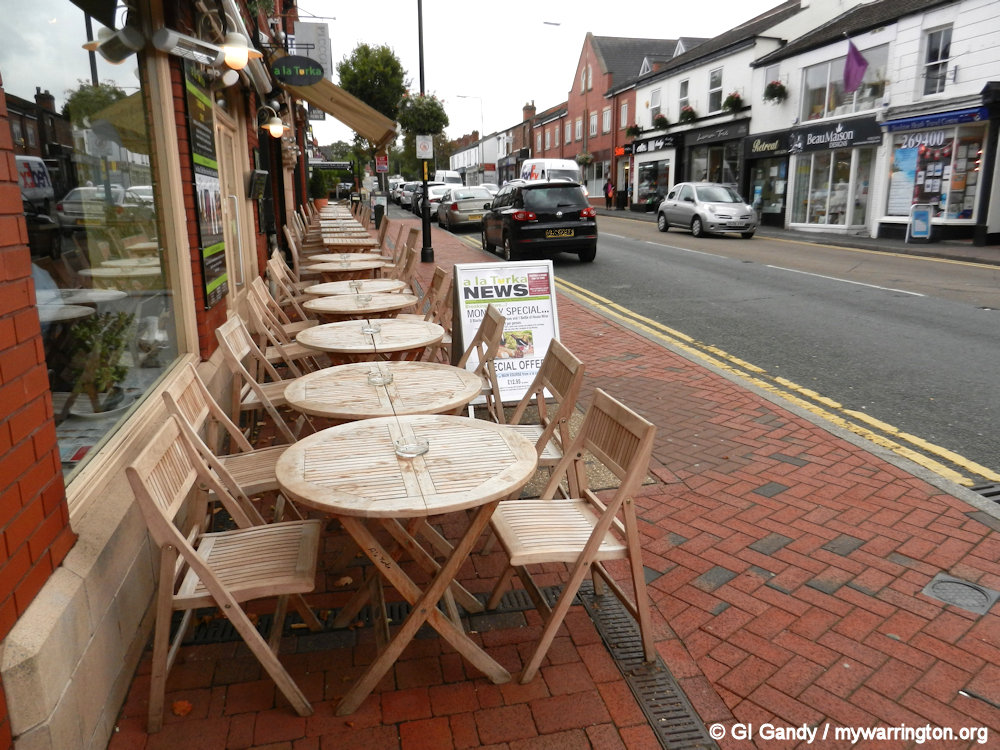
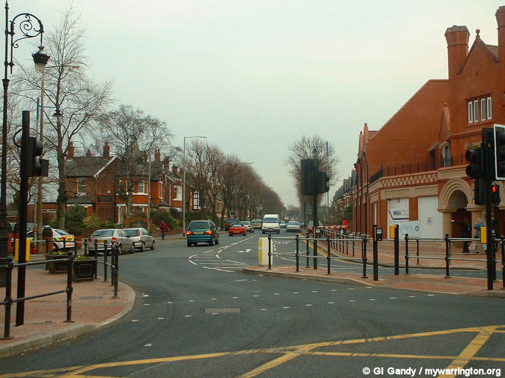
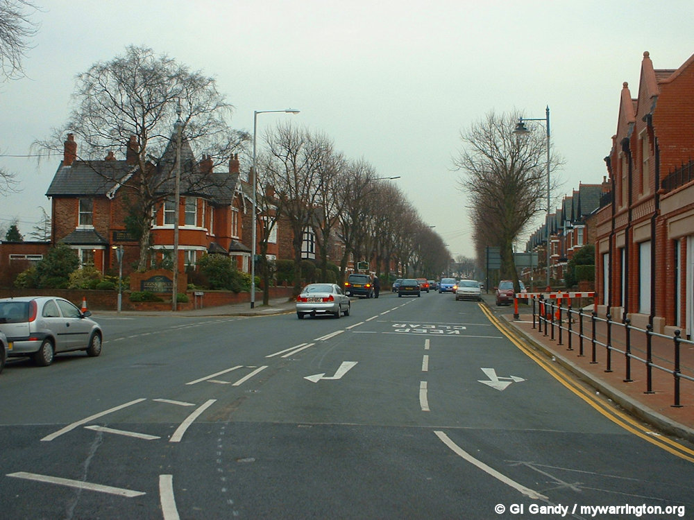
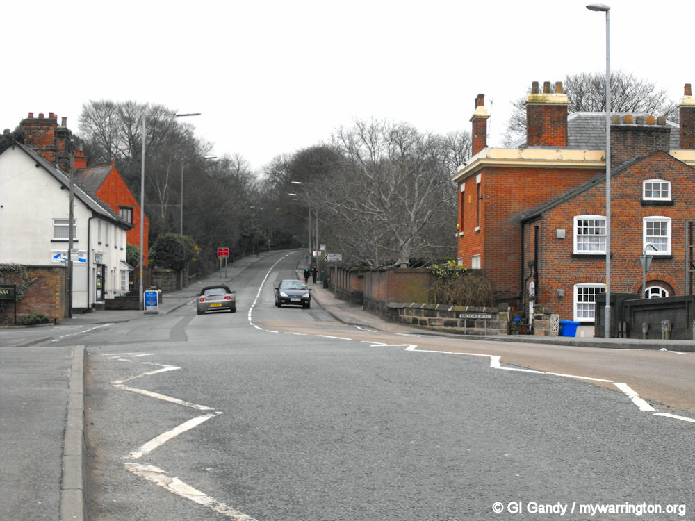
London Road is the main road through the village on the A49. It is viewed south from A La Turka Restaurant in my photo from 11 October 2013)
Back in Time
Moll’s map of Cheshire from 1739 refers to a hamlet by the name of Stoken (or Stocken) where the present village of Stockton Heath now stands. However, more detailed old maps of the area of Acton Grange show a sparsely populated hamlet and refers only to the old buildings and bridges recognisable today in street names in the area, such as Whitefield Cottage.
The Roman road of King Street ran though Stockton Heath. Evidence of a large Roman industrial settlement was unearthed during the early excavation of the Bridgewater Canal in Stockton Heath in 1770. Primary evidence points to a probable temple dedicated to Minerva on the site, a strong focus on pottery and glass bead paste making industries, and a trapezoidal building of unidentified purpose. One author suggests it may have been an auxiliary fort.

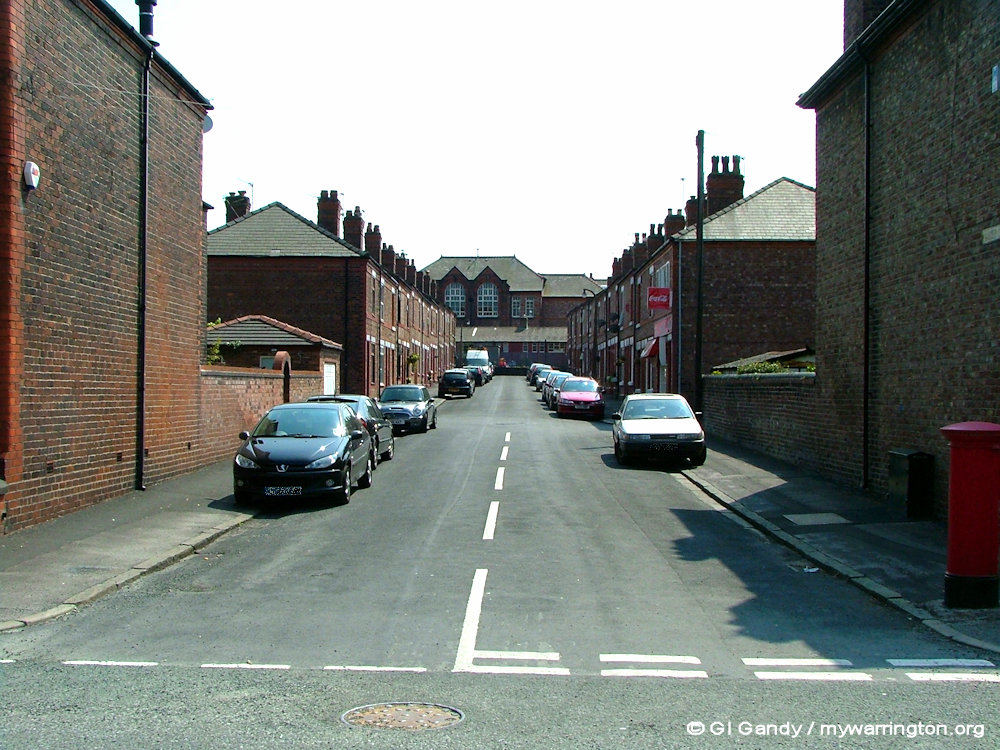
Roman Road is still one of the street names in the district, which is close to the Manchester Ship Canal off Ellesmere Road. Before the canal opened in 1894 the Roman settlement covered this part of Stockton Heath and Wilderspool where Morison’s supermarket stands today.
The Middle Ages
Although the name Stockton Heath appears to have been conferred on the village at a later date (the area itself has been described rather as “a hamlet of little consequence and no development until the 19th century”), other sources state that a family bearing the name Stockton lived in the area from the end of the 13th century until at least the end of the 15th century.
Peter Legh’s Corn Mill
In 1465 the area “Le Akkirs” on Latchford Heath consisted of land with two pools of water. Part of the area now covered by Stockton Heath (in the Ackers Pit area) was known as Latchford Without, with Latchford Within being the area covered by the centre of Latchford village. The land was rented by William Mury from Peter Legh of Lyme (Legh Street in Warrington town centre is named after him). Peter Legh also owned the medieval corn mill on Mill Lane, now the site of St Thomas’ School. The mill was demolished in 1895 and the last miller to grind corn here was Joseph Blinston.

Roman Road off Ellesmere Road (7 Nov 2013)
Here’s more on the story from the Warrington Guardian.
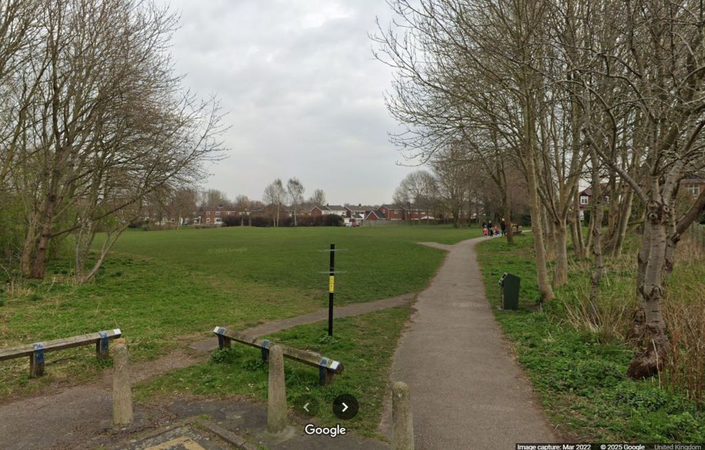
In its heyday, the area at Mill Lane in Stockton Heath was used for rowing, swimming and fishing in the summer and skating and curling in the winter.
And it has had a variety of uses and been known by several names in its past.
Margaret Fellows, local historian, explains.
It was originally the site of a medieval water-powered corn mill, the mill pond being fed by the water from Lumb Brook. It was an undershot mill, and some of the head and tail gate mechanisms being still visible in the late 1970s. On early maps it is show as Latchford Mill, but it has also been known as Lumb Brook Mill, and in later years as Stockton Mill. One of the earliest records of this mill is in the land survey conducted by Sir Peter Legh of Lyme in 1465, the then owner.
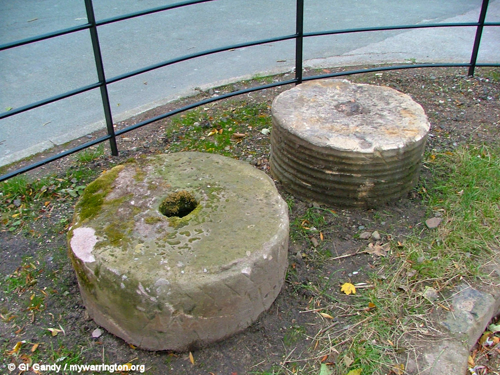
Two millstones alongside Ackers Pit on 10 October 2008.
The Arley Estate records show that by the mid 18th century, it was owned by the Egerton family, and in the 19th century the owner is listed as John Smith Barry. The occupier under the latter ownership was Joseph Blinston.
The Blinston family operated the corn mill and a brew house at the back, from the mid 1830s until the mill closed in the early 1890s. It was then demolished, although the family continued to farm the surrounding land for some years. The Deeds for Latchford Mill are now in the John Rylands Library in Manchester. The mill house had been built early in the 1800s and had a variety of occupiers until it too was demolished early in 1950.
In October 1909, part of the site of the Mill Pond (now the Mill Lane Diamond Jubilee Field) was sold to Greenall Whitley & Co. by Piers Egerton Warburton, but by this time it was already in an overgrown state, and a very unpleasant and insanitary area.

The Egerton family is a British aristocratic family. Over time, several members of the Egerton family were made Dukes, Earls, knights, baronets and peers. It was Francis Egerton, 3rd Earl of Bridgewater, who commissioned the Bridgewater Canal which flows along the edge of the village of Stockton Heath. Egerton Street is alongside Stockton Heath Primary School.
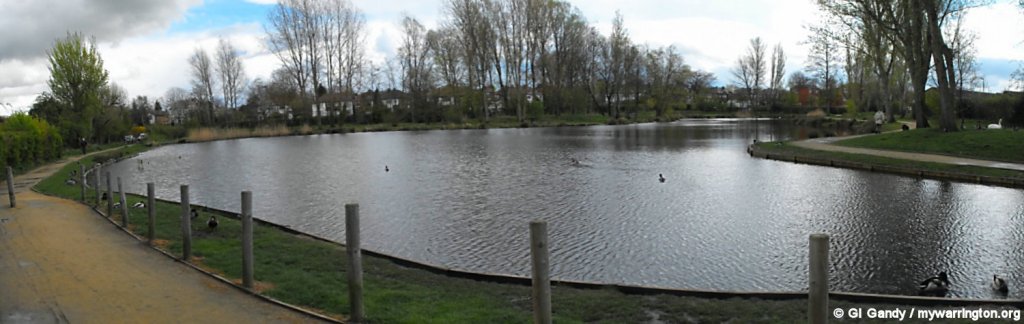
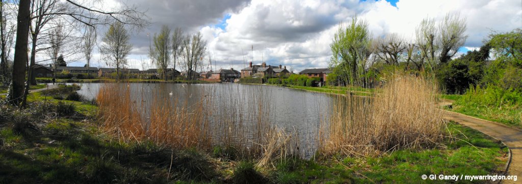
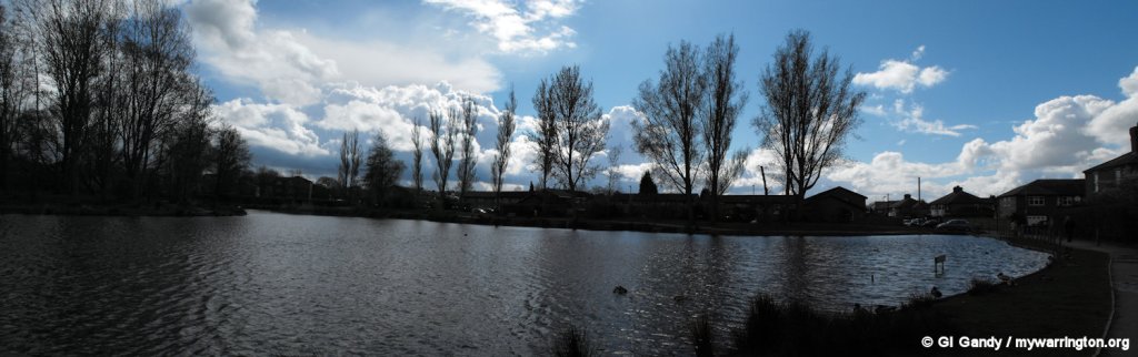
The area was rescued by Dr JS Parker, a Warrington doctor, who requested the owners to improve the area, but with little success. However, not daunted, he campaigned to have the area improved, and formed an association, with the grand title of “The Stockton Heath and District Swimming, Angling and Boating Association”, with the object of raising money to put his ideas into practice.
He again approached the owners and presented a plan to turn the area into a recreational lake. Agreement was reached, and Dr Parker set about raising the money from public subscriptions, with offers of help from Greenall Whitley. So work commenced, the first job being to dredge the pool, ensuring that the bottom was deep enough and cleared of rubbish to be made safe and suitable for bathing.

The swimming lake in its heyday (photo via Warrington Guardian)
The sides were pitched, an island was created in the middle and sluice gates built. On 4 July 1910, the lake was officially opened by Mrs Lyon of Appleton Hall.
A fleet of rowing boats had been purchased, 24 bathing boxes and a diving platform was provided for swimmers, and the pool was stocked with fish for the anglers.
There were a score of seats along 250 yards of concrete footpaths, a refreshment hut had been erected and a band was to play on the tree studded island. In the winter the ice was to be reserved for skating and curling (not encouraged today}.
This enviable facility eventually fell into disrepair, and on 20 October 1936 the land on which the mill had stood was given to Stockton Heath Parish Council by Greenall Whitley. The announcement was later made in December 1970, that a school was to be built on the site.
The parish council bought the Mill Pond land on 9 February 1960 for £750, and spent £2,300 to fence, fill-in and seed the ground where the lake had been. The field was then rented out to Warrington Town Football Club, an arrangement which was short lived.
After this, the field was used only occasionally as the sports field for St Thomas’s Church School, and by local children, and has been one of the venues for the Stockton Heath Festival since 2008.
In 2013 the Mill Lane Field was placed in trust as part of the Queen’s Diamond Jubilee celebrations, and as a result, will be protected from development and preserved as a resource for the community for ever.
My thanks to Warrington Guardian for permission to use their news report and photo.
Queen Elizabeth’s Playing Fields – Google Maps
Ackers Pit
Ackers Pit appears on a document dated 1465 and it is said it was originally a clay pit for brick making. In 1858 a Bronze Age axe of Welsh origin was found in the Ackers Pit area and in 1926 three prehistoric stone hammers were found in the pit itself.
A map of 1873 shows that Ackers Lane once began at Latchford Baptist Church on Loushers Lane and Ackers Pit was used by the congregation for baptism services. One of the first people to be baptised in Ackers Pit was Mr William Wilkinson in 1853, with the last being Miss Helena Elizabeth Grounds in June 1894, the year the Manchester Ship Canal opened. J.R. Ashall sold the pit to the parish council for £1 in 1978.
Ackers Pit and the Bridgewater Canal are the main options for angling in the area. Warrington Anglers Association have owned the rights to fish the lake for over a century. Ackers Pit is today supplied with fresh water via a pipeline overflow from the Bridgewater Canal and surplus water from the pit drains through a culvert into the Manchester Ship Canal.

Ackers Road, originally Ackers Lane, in a view looking towards its approach to the Latchford High Level Bridge (the Cantilever) alongside Ackers Pit on the left in my photo from 10 April 2012.
Click the first image for a manual slideshow.


Scenes of Ackers Pit taken on 10 April 2012


Mil Lane is alongside Ackers Pit. My photos were taken on 10 April 2012.
To connect with Warrington Anglers Association, see their website.
The Civil War
During the Civil War, on 3 April 1643, Parliamentarian forces under the command of Sir William Brereton advanced from Northwich to launch an attack on Warrington, the Lancashire headquarters of the royalist James Stanley, 7th Earl of Derby. Stanley’s troops had marched across the Mersey ford at Latchford at four o’clock in the afternoon and then along Ackers Lane and across Ackers Common en route to the “Battle of Stockton Heath”. The Parliamentarians were defeated and unverified local legend has it that many of the soldiers were buried at Hill Cliffe and Budworth. The battle is referred to in the 1859 novel Hollywood Hall by James Grant:
“A priory, situated in a wooded hollow, ruined and battered as the Royalists had left it in 1643, next caught my eye, when, riding rapidly on, I approached a wide waste common called Stockton Heath, past which the Mersey rolled amid swamps and morasses filled with rushes and willows.”
The same novel frequently refers to Stockton Heath as a “waste” and makes numerous references to swamps nearby.
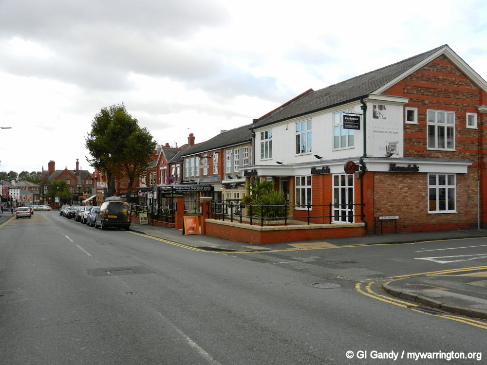
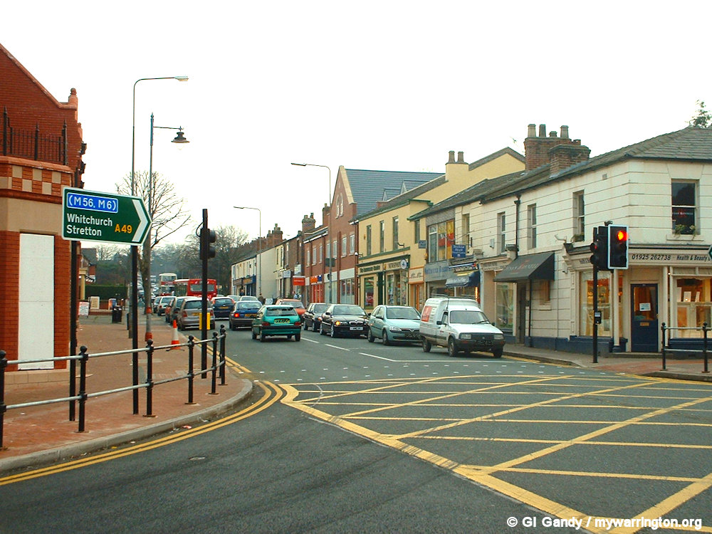
London Road viewed north from East Avenue (11 Oct 2013)
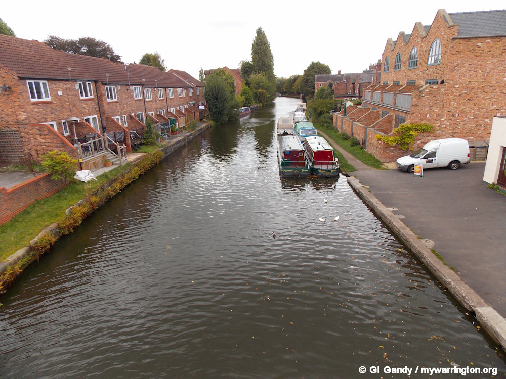
Waterways
Two stretches of water border the village on the north side and on the south. On the north side there is the Manchester Ship Canal, which opened in 1894. Before that, however, came the Bridgewater Canal, which opened in 1761.
The 3rd Duke of Bridgewater, Francis Egerton commissioned the Bridgewater Canal to transport coal from his mines in Worsley to Manchester. He later extended it from Manchester to Runcorn, and then from Worsley to Leigh. The canal has no locks. In Warrington it runs through Lymm, Thelwall, Grappenhall, Stockton Heath and Walton. At London Bridge in Stockton Heath there are some concrete steps outside the London Bridge pub alongside the canal. These are the packet boat steps where the canal bus stops when travelling by road was difficult. Read more about the Bridgewater Canal in On the Waterfront.
The Manchester Ship Canal runs from Manchester to Liverpool via Warrington and Runcorn. It was built to allow Manchester, a port 36 miles inland, to take advantage of the international shipping trade because they didn’t want Liverpool to keep having the monopoly. Read more about the Manchester Ship Canal in On the Waterfront.

Bridgewater Canal at Stockton Heath (11 Oct 2013)

Manchester Ship Canal looking towards Latchford Locks from Northwich Road Bridge by Stockton Heath (8 May 2004)
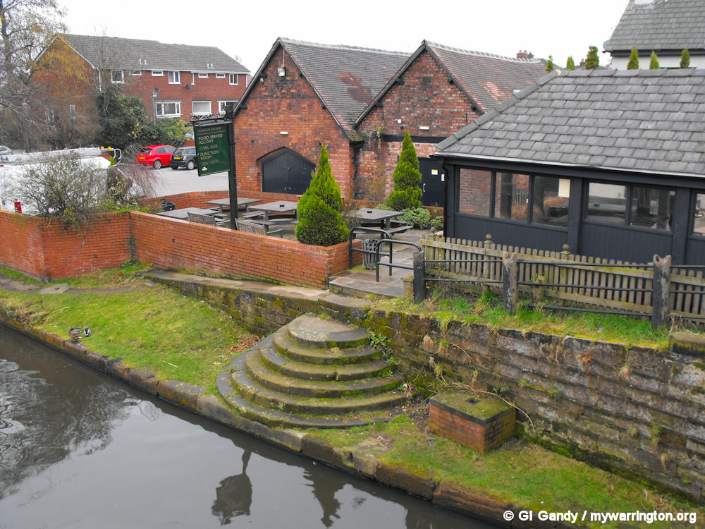
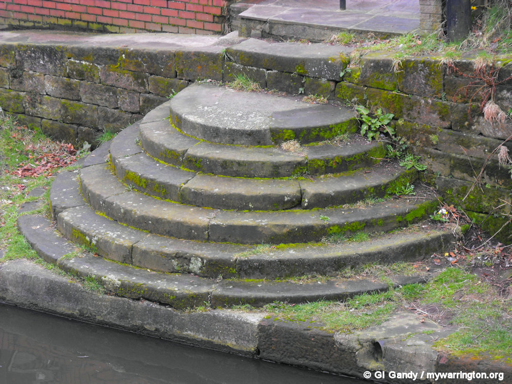
Close-up views of the packet boat steps alongside the London Bridge pub (5 March 2011)


2Lips 2 Lips flower shop is now Luxe Salon and Training in 2025. My photos were taken on 10 April 2012 from Latchford High Level Bridge (known locally as the Cantilever because of its design) on 10 April 2012.


More views from the Latchford High Level Bridge. The bridge was built as part of the construction of the Manchester Ship Canal in 1894.
Victorian Times
Originally, Stockton Heath was a part of the township of Appleton and was formed into an ecclesiastical parish in 1838 from the parishes of Great Budworth and Runcorn. Later it became a separate civil parish by a Local Government Order dated October 1897 (Victoria Square was named in 1897, Queen Victoria’s Diamond Jubilee year).
The previous name for Victoria Square was ‘Stockton Gate’, but known locally as ‘Pigeon Bank’, because pigeon fanciers would travel from Warrington on their bikes to release their pigeons (see more at the Parish Council website.

Victoria Square, previously known as Pigeon Bank was named for Queen Victoria’s Diamond Jubilee (Photo taken 27 February 2003)
The 20th Century
Tramway
Construction of the tramway running from Warrington to Stockton Heath began in 1901, with responsibility for the operation assumed by the Corporation’s Electricity and Tramways Committee under the name of “Warrington Corporation Tramways”.
There were five routes in the town and the Stockton Heath route started on 17 July 2005, an extension of the Wilderspool route which started on 4 October 2002. The terminus was Victoria Square. The trams ran through the village until 17 September 1931.
The manhole cover shown in my photo gave access to the alternative electricity supply when the bridge opened to canal traffic. There was a tunnel under the water to carry the cables that kept the tramway running when the bridge opened.
There was an ambitious plan to extend the route to Northwich, but that never happened. But in 2025 there is talk of the Manchester Metrolink tram system extending to Warrington. I wonder if that idea will disappear like the Northwich plan? Time will tell. See On the Buses for more about the trams in Warrington.

The manhole cover on the Stockton Heath side of the bridge.
George Formby
In the 1900s George Formby Senior moved his young family to Stockton Heath and it was from here that George Formby Junior began his entertainment career.
Born in Wigan, George tried his hand at being a jockey, but after he moved into Hillcrest with his parents and six siblings, he launched his stage and music career, following on from his father’s career on the stage.
Their house, Hillcrest, was converted into a guest house in recent years and a blue plaque remembering the career of George Formby is attached to the wall outside the property.
George Formby Senior died in Stockton Heath in 1921, whilst George Junior died in 1961. Thousands lined the streets of Warrington to wave him goodbye.
They are both buried in Warrington Cemetery. Read George Formby Junior’s profile in Entertaining People.
In 2011 Hillcrest was converted into Amado Boutique Hotel, which occupied the building until 2017.
In 2018 the building was turned into offices. In 2021 Purple Accounts moved into the property and have a replica ‘No 14’ motorbike that Formby rode in his 1939 movie ‘No Limits’ based on the Tourist Trophy (TT) races on the Isle of Man – coincidentally where the first Purple Accounts office opened in 2007. Inside the entrance there are photos of George Junior on the wall. See photos in the Warrington Guardian.

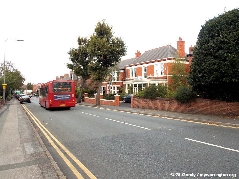
Hillcrest on the right of the photo (No 143 London Road) (11 Oct 2013)

Boundary Changes
In 1974, Stockton Heath, historically part of Cheshire, became incorporated into the borough of Warrington under the Local Government Act 1972. Warrington, historically part of Lancashire, became a Cheshire borough under the Act. Since 1988, much of the centre of Stockton Heath village has been designated a conservation area to preserve its character, but at the same time there has been redevelopment work with several new bars and restaurants moving into the village centre.
Today, Stockton Heath forms part of the Warrington South parliamentary constituency and is a multi-member ward within Warrington borough. It is served by two councillors. Stockton Heath is also served by a parish council, comprising seventeen members, including two borough councillors. Part of its responsibility is to facilitate dialogue with Warrington Borough Council.

Let’s Go Walkabout
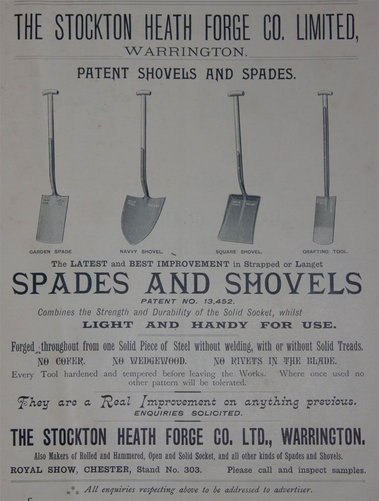
Forge Shopping Centre
The Forge Shopping Centre in the centre of the village is built on the site of The Stockton Heath Forge Co. Ltd. who ran their business at that location from 1770.
The Stockton Heath Forge, in a trade advert from the time, says their products are forged from one solid piece of steel without welding, with or without solid treads.
The adverts also says every tool is hardened and tempered before leaving the works. See the advert on Grace’s Guide.
The company later became part of the Caldwells Group of Companies. Caldwells Ltd. began trading in 1893 as an engineers merchants, while John Chorley & Co. Ltd. were established as steel stockholders in 1860.
The company is now based on Dallam Lane in Bewsey. See the company website, where you view old photos from the company archives.

A trade show advert from 1907
But that’s not the end of the story. In the images here is a relic from our engineering past. It is part of an 1850s billet cutter from the old forge. The forge was used to make spades for use in the First World War trenches.
It disappeared in early July 2006, and at first residents thought it had been destroyed.
Thankfully it has been found and we were promised by the council that it will relocated back in the village from the council storage depot.
At the time of writing (September 2025) I am not sure when this will happen.
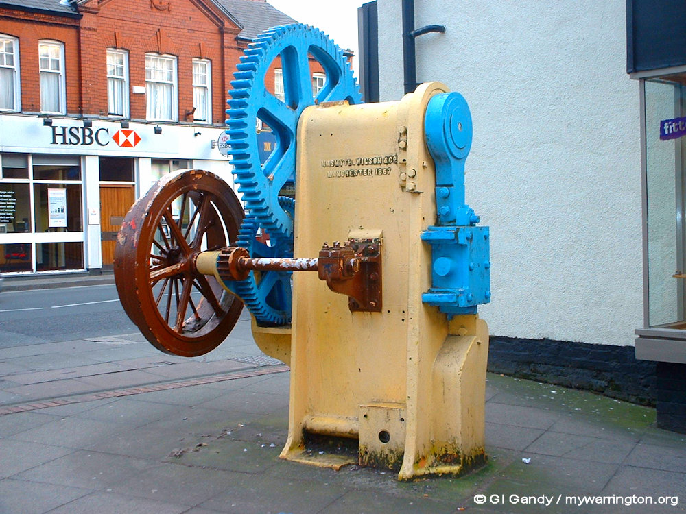


The 1850s billet cutter from the old forge, on display outside The Forge Shopping Centre in my photo here taken on 27 February 2003.

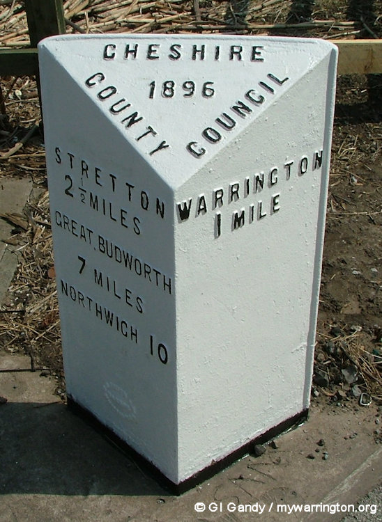
Milestones
There are two milestones in the village, both on London Road. The first two images show the 1896 milestone alongside the Northwich Road swing bridge by Fairfield Road, before and after a splash of paint.
The third and fourth images shows the milestone at the junction of London Road and Grappenhall Road from 1898. Notice the company W H Smith in the close-up photo.
This was an engineering and iron founders firm from Whitchurch in Shropshire, which started in 1837.
See Whitchurch Heritage Centre for more.


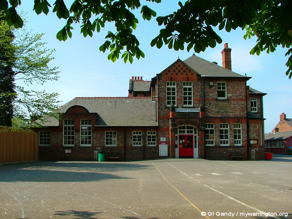
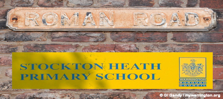
Stockton Heath Primary School
After 97 years on the site along Egerton Street, Stockton Heath Primary School finally said goodbye as a legal battle to save it was dropped. It would have cost £30,000 to fight the closure in the High Court, but solicitors said it would only have a 50/50 chance of succeeding. The council decided to pull the building down in favour of a £multi-million state-of-the-art building on the same spot. Residents and campaigners did not given up the fight, however, and the battle went on to save the Edwardian building, but to no avail.
The foundation stone indicates the opening date of 2 May 1910 for Stockton Heath Council School when administration was under the education section of Runcorn Rural District. I don’t know what happened to the foundation stone after demolition – hopefully it is safe. The school was demolished in 2007.

Stockton Heath Primary School which opened in 2008 (photo 28 Apr 2007)


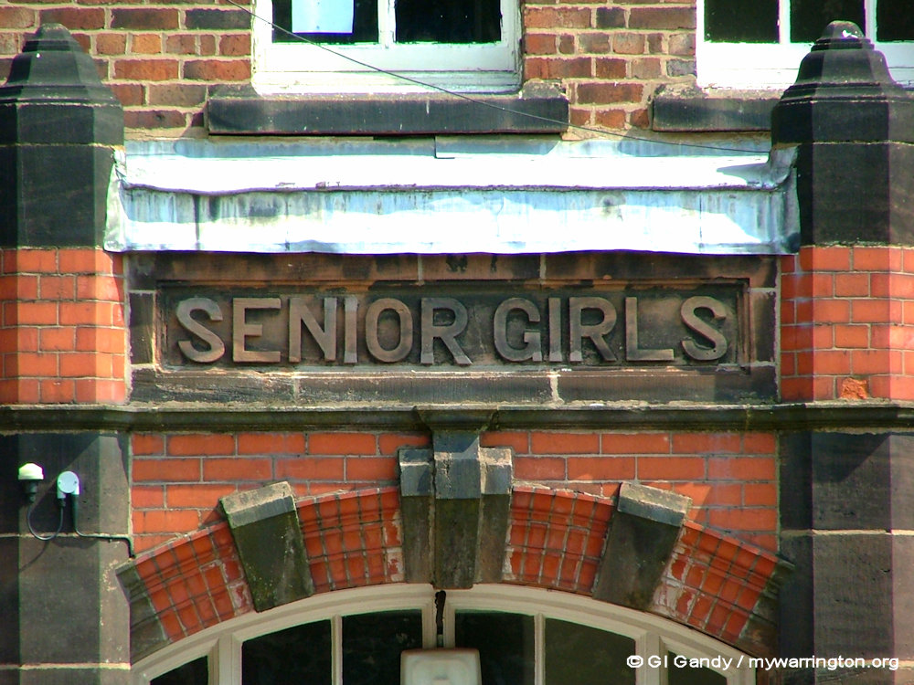

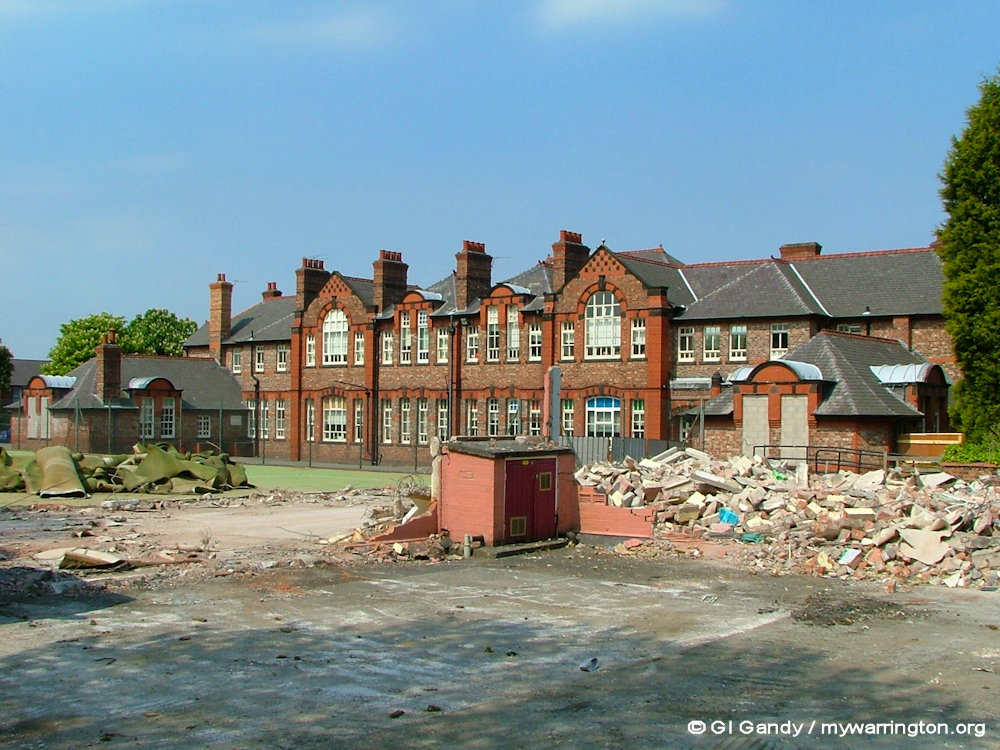

My phots were taken during the demolition of the old building. The school educated boys and girls. I couldn’t get access to photograph the junior or senior boys stonework. And you might be thinking: why was there a ‘senior girls’ section of a primary school. Well, I just don’t know!
The original Edwardian-style building was replaced by a new, state-of-the-art building in 2008. During the construction of the new building, Roman remains, including pots, jugs, and coins were found, which are now displayed at Warrington Museum.
The original Roman Road was also discovered, as was a Roman Well, which is fully preserved and still visible under a hydraulic lid in the school’s Small Hall. These discoveries turned the grounds into a protected archaeological area.
St Thomas’s C of E Primary School
St Thomas’ Church of England primary school is on Alexandra Road. This was opened in 1974 and relocated from its original site opposite St Thomas’s Church.
The original St Thomas’s school was opened in 1833 and the building was eventually demolished (along with a late-Victorian extension) in the late 1970s. A health centre now stands on the site.

St Thomas’s school from Google Maps
St Thomas’s Church
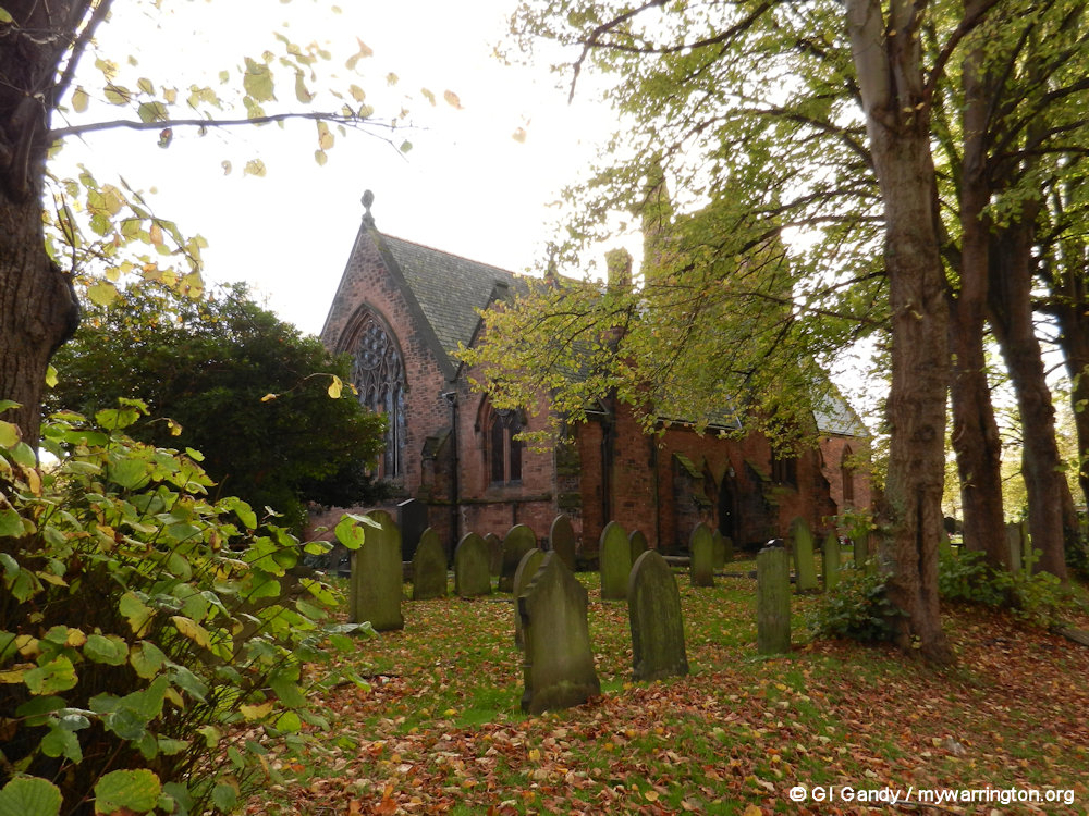
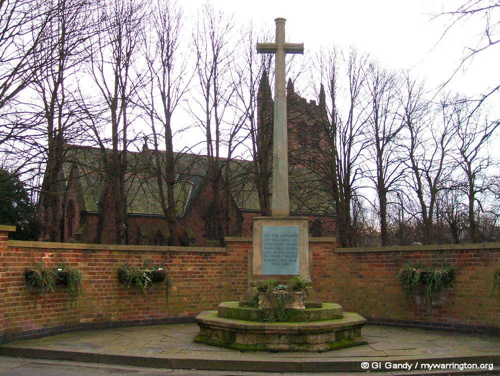
The present church was built in 1868 on the site of a former church that had been erected in 1838. It was designed by the Lancaster architect E.G. Paley, the main benefactor being Sir Gilbert Greenall. The tower was added later although a full set of bells were not installed until 2016. The current ring of 10 bells consists of 8 bells donated from St. John the Baptist, Bollington supplemented with two new trebles cast by John Taylor & Co. A campaign to keep a tolling bell dating from 1883 dedicated to the wife of John Crosfield (son of Joseph Crosfield) took place in an attempt to retain the bell locally. Read more about the bells here, which includes a YouTube video of the casting of the bells. See also this Warrington Guardian report..
The church is recorded in the National Heritage List for England as a designated Grade II listed building, and is an active Anglican parish church in the diocese of Chester, the archdeaconry of Chester and the deanery of Great Budworth.
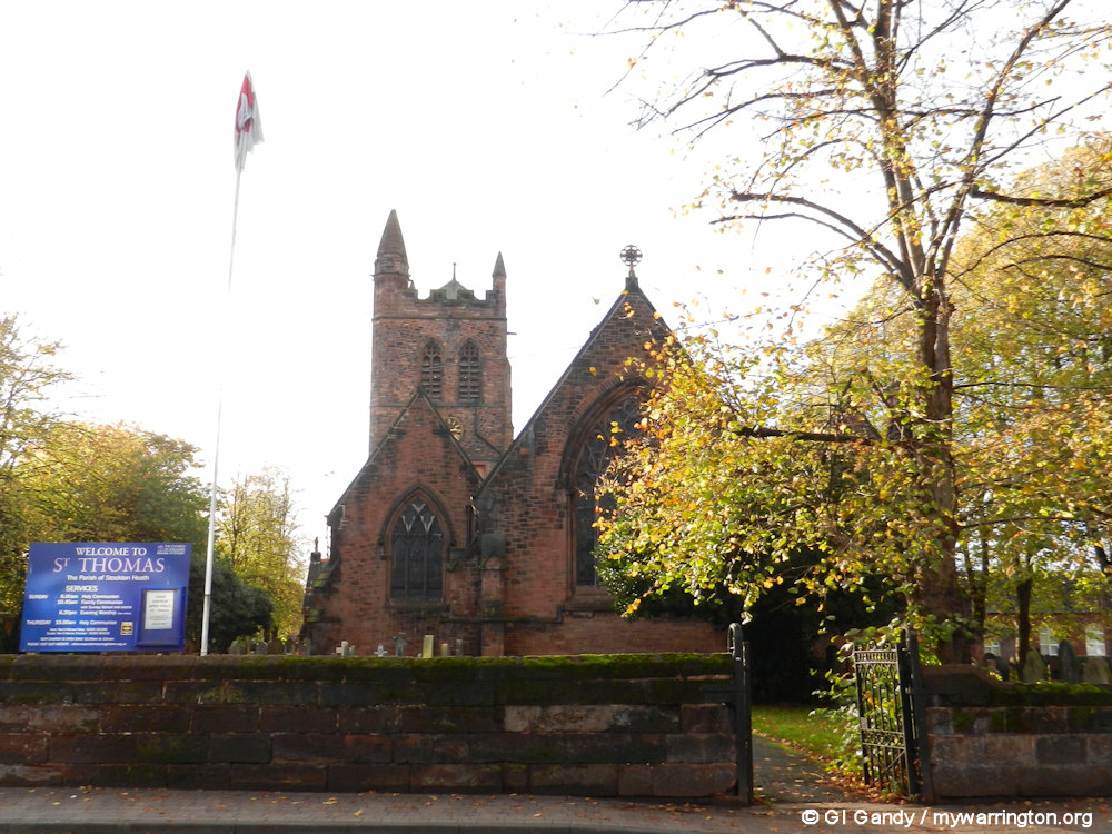
St Thomas’s Church (7 Nov 2011)
The building is constructed in pinkish-red sandstone with Westmorland slate roofs. Its plan consists of a four-bay nave with a south aisle under a parallel ridged roof, a south porch, a north transept, a north vestry, a two-bay chancel and a west tower.
The tower is in four stages with an octagonal southeast turret and embattled parapet. The chancel is decorated with richly coloured patterned tilework and the reredos is of marble and embossed patterned tiles. The organ was built around 1880 by Young and Sons and rebuilt in 1963 by Rushworth and Dreaper of Liverpool.
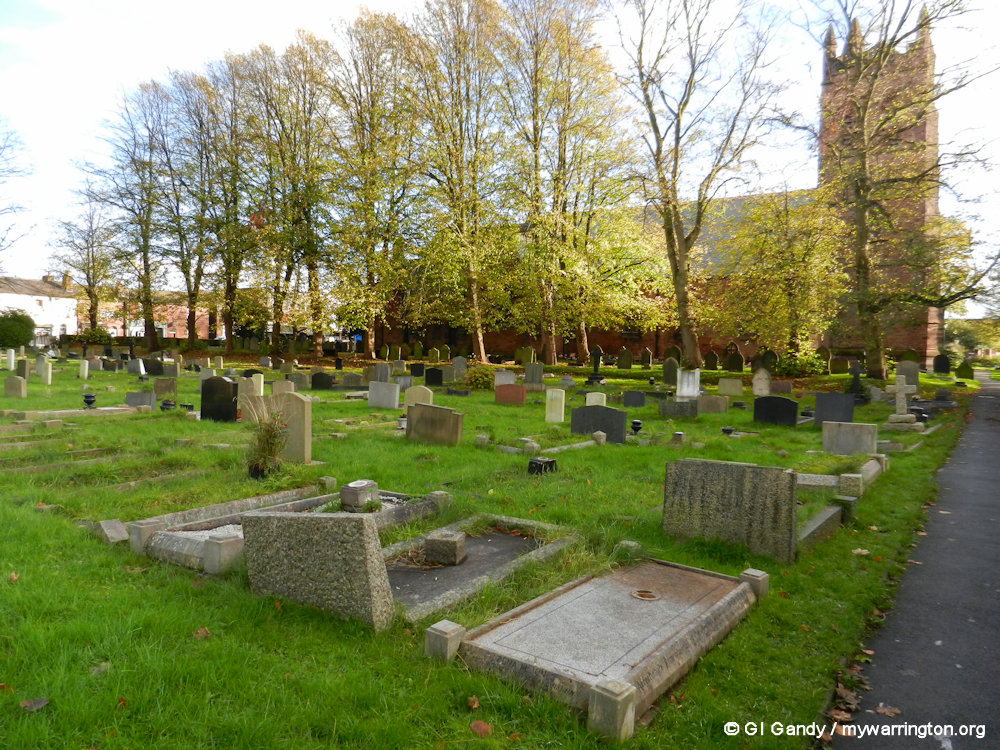
The churchyard contains the war graves of 31 service personnel, 17 from World War I and 14 from World War II. Some information: Wikipedia.

St Thomas’s Church (7 Nov 2011)

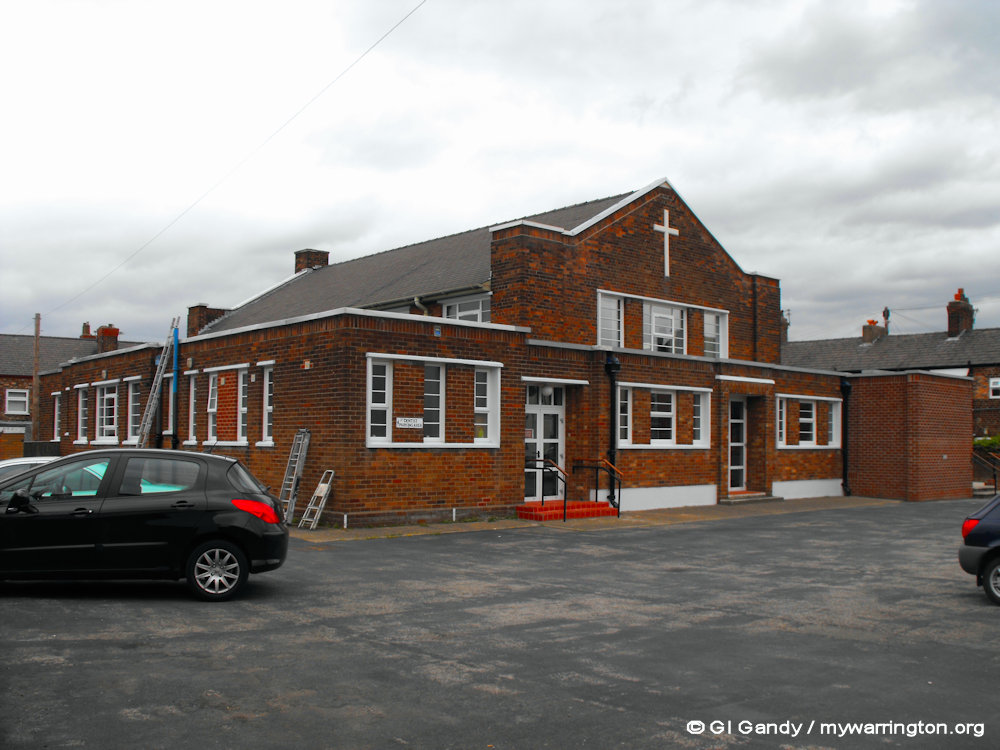
Stockton Heath Methodist Church
The first record of Wesleyan Methodism in Stockton Heath was in 1828.
Stockton Heath Methodist Church is on Walton Road by Heath Road.
For a more detailed account see their website.


Stockton Heath Christian Fellowship
Their church building is on Walton Road.
Independent Methodists were made up of various churches who came together in 1805 in Warrington and agreed to work together.
In 1906, they all agreed to a common name of ‘Independent Methodists’.
Read more at their website.
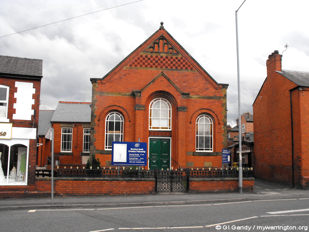
Stockton Heath Christian Fellowship on 20 May 2011
Police Station
The current police station located next to Victoria Square was opened in 1912. It received Grade II listing status on 20 July 1995.
When it opened it was a combined police station and magistrates court but is now just a police station. It is built of red brick in English garden wall bond, with red sandstone dressings, red tiled roof hipped over the north end. See Historic England for more.

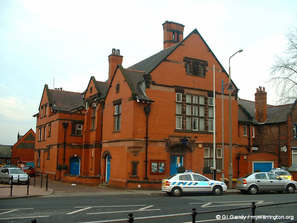
The police station next to Victoria Square on 27 Feb 2003.
Pub life
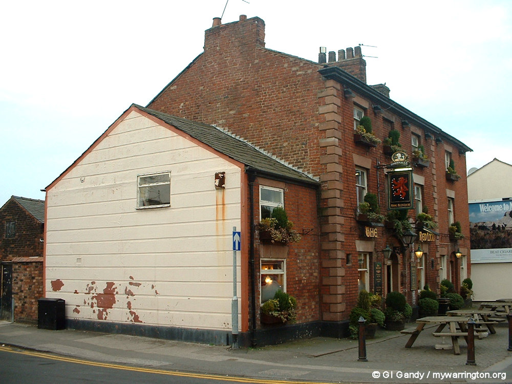
The Red Lion Inn dates back to the early 1800s. It features a bowling green to the rear. See Historic England for more.
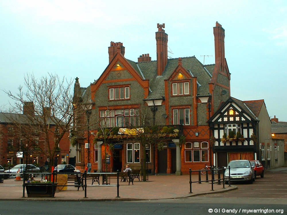
The Mulberry Tree pub was formally opened for business on 19 March 1907 on the site of an earlier building of 1725, also a pub, called The Grapes or White Bear. See also Historic England for more.
Both the Red Lion and The Mulberry Tree are Grade II listed buildings, given on 23 December 1983 and 20 July 1995 respectively.


The Red Lion (left) and the Mulberry Tree pubs in my photos from 27 February 2003.

Note – The London Bridge pub, which is in Appleton (the Bridgewater Canal is the boundary between Appleton and Stockton Heath and the pub is on the south side of the canal), is featured in the next section, Thorne Marine, to tie in with historical notes on the area.
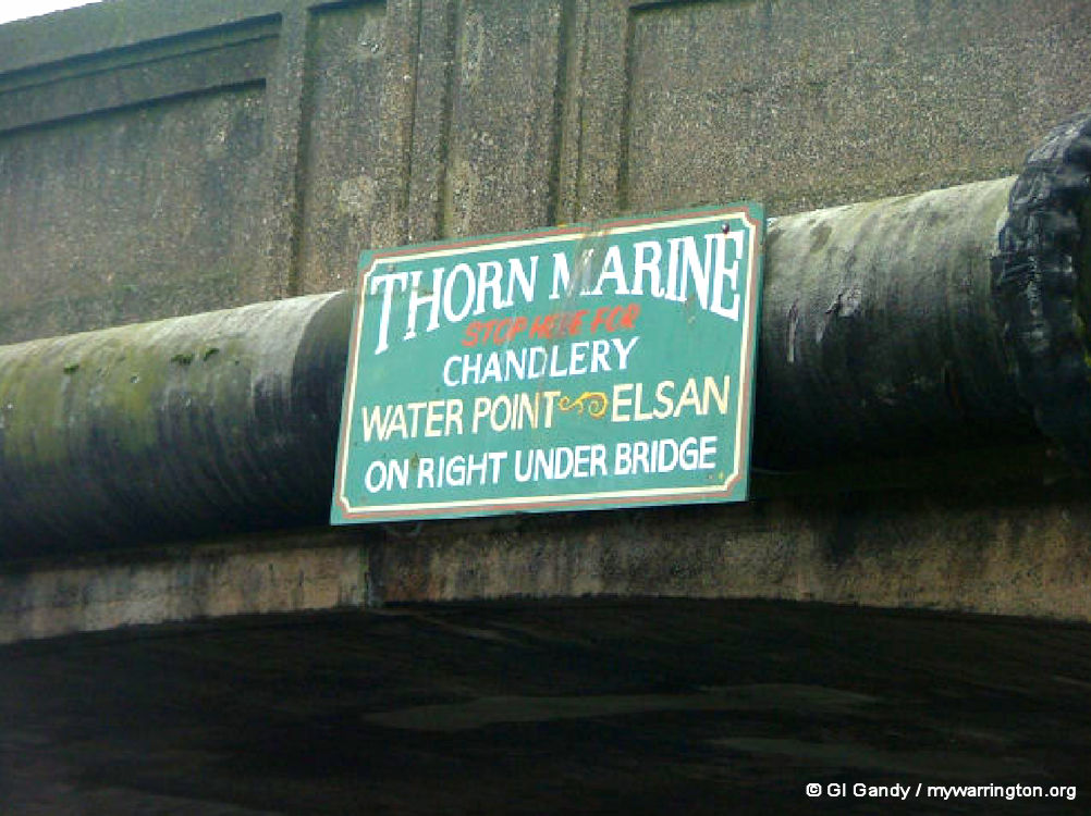
Thorn Marine
Whilst photographing the Bridgewater Canal on 27 January 2007 for On the Waterfront, I paused outside Thorn Marine at London Bridge in Stockton Heath.
Thorn Marine supplies essential materials to the canal boat community and the local community of Stockton Heath. On 29 August 2003 they received notice from the owners of the Bridgewater Canal, Peel Holdings (Manchester Ship Canal Company), that they intended to apply to Warrington Borough Council for planning permission to build 5 houses on the site of Thorn Marine.
The occupiers of Thorn Marine, Mr and Mrs Hamilton, were campaigning against the planning application and received TV and press coverage in 2003.
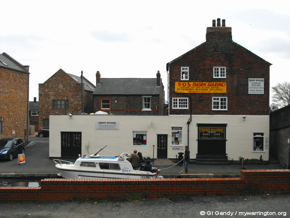
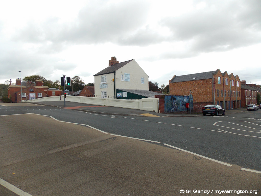
Thorne Marine in a scene from 5 March 2011
Whilst chatting to Mrs Hamilton, she showed me photographs of paintings of Thorn Marine from the days before photography. It is believed the building was erected sometime during the period of the Bridgewater Canal construction (around 1770). She also told me some more about the history of the area, and of the Marine itself.

My artistic impression of Thorn Marine
The objections to the planning application include the following points concerning its history:
The date of construction is very difficult to ascertain exactly, it is on the Ordnance Survey maps of 1870,1898 and 1910, and is also show as a building on the Tithe Map of 1847 and in the associated Apportionment. The Bridgewater Canal (adjacent) was opened in 1761.
The Thorn Marine building we believe was built around this period, the Tithe Apportionment states that the area was a Meadow, Stable and Stack yard, belonging to the ‘The Bridgewater Trustees of the late Duke of’ and for use by ‘Themselves’.
The area on the opposite side of the canal was formerly part of Stockton Quay(s). The wharf which overhung the canal and the sizable warehouse were an important location for the transhipment of goods to and from the canal; the warehouse and wharf were listed buildings (ref LD5R14129758).

Thorn Marine viewed from London Bridge on 11 October 2013.
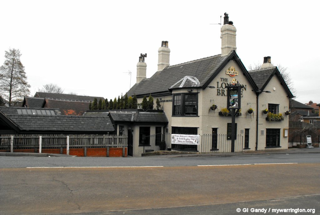
The London Bridge pub was also part of Stockton Quay and served as a passenger transfer location for the Duke of Bridgewater packet boats. They would use the Packet Steps, which can still be seen today, leading down to the canal to board the Duchess Countess to Manchester and Runcorn; the now A49 was then (and still is today) a major route from London. Behind the pub was a smithy and wheelwrights, which served the road and canal. The smithy and pub can be seen on the OS 25-inch map on the National Library of Scotland website.
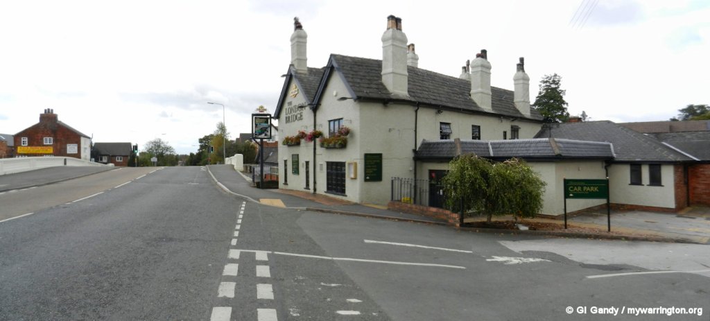
London Bridge pub on London Road (11 Oct 2013)
There is also mention of horse changes being made at Stockton Quay. Both Thorn Marine and the adjacent property (which has now been replaced with apartments at the time of writing – 2025), appear to have been used as stables for this purpose. It is mentioned in the Tithe document as a stable, and it is later in life to be called ‘Bridge Stables’ and also has been used as a ‘Bank Riders’ Cottage.
It would therefore make sense that the building is part of the ‘Stockton Quay’ area, and was as vital as the wharf or the steps outside the London Bridge pub. Evidence of horses can also be seen in the construction of the canal bank outside Thorn Marine – there is a series of steps set in to the bank to enable horses to be helped out of the canal when they fell in.
London Bridge pub on London Road (11 Oct 2013)
That’s the history side of things. What about the modern day? Well, there’s the employment of the people working there to consider when deciding whether or not to keep the Marine. Between 10 and 100 boats call there daily, most of which need services like the post office, banks, grocers, doctors, etc. Thorn Marine is able to direct them to those services in the village, and also supply many unique items not available anywhere else in the town, including repair facilities for boats.
The water point they provide is the only one in the area. The nearest alternative is 2½ hours away if travelling towards Manchester and 8 hours away if going in the opposite direction towards Preston Brook and Anderton. They are the only pump-out station in the local area. They have an Elsan disposal point (for those not familiar with this term, an Elsan is a type of transportable chemical toilet). The nearest ones are Manchester and Anderton (7 and 8 hours away respectively).
Thorn Marine and London Bridge (11 Oct 2013)
Government policy on the transport use of inland waterways is set out in the Transport White Paper and is developed in the Governments policy document Waterways for Tomorrow (June 2000). Local authorities should work with all those concerned in the inland waterways industry – British Waterways (BW) and other navigation authorities, private operators and the voluntary sector concerned with restoring currently disused waterways – to develop the potential of inland waterways.
Tourism is crucial to the area. Thorn Marine is an important information access point for many canal visitors. Without Thorn Marine, this vital facility would be lost. There are currently about 1,000 boats licensed for the Bridgwater Canal and countless numbers of boat visitors from other areas. Security and the general upkeep of the area are monitored by Thorn Marine.
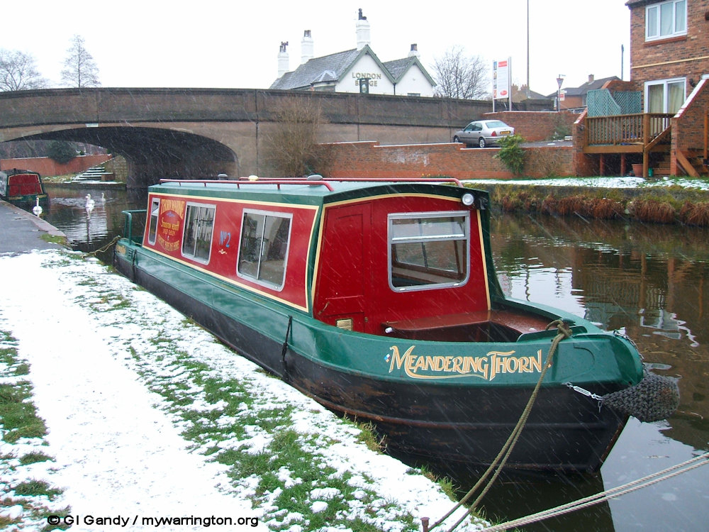
Meandering Thorn moored outside Thorn Marine on 8 February 2007.
So, as you can see, the area is steeped in history and provides a valuable service to the community.
Far too many historic buildings end up being destroyed. I believe, as do the Hamiltons, that Thorn Marine was worth saving. I am pleased to say that at the time of writing (September 2025) Thorn Marine is still trading and has added to its services.
Visit their website www.thornmarine.co.uk, and you can visit Thorn Marine at 164a London Road, Stockton Heath, Warrington WA4 6LE (located right by London Bridge).
I am not connected to the family or the business in any way.
I thank the Hamiltons for allowing me to use extracts from their history on the mywarrington website.

The Bridgewater Canal with Thorn Marine on the extreme right. The residential properties in the centre of the photo have, thankfully, been the only new buildings on the site since the family campaign of 2003.


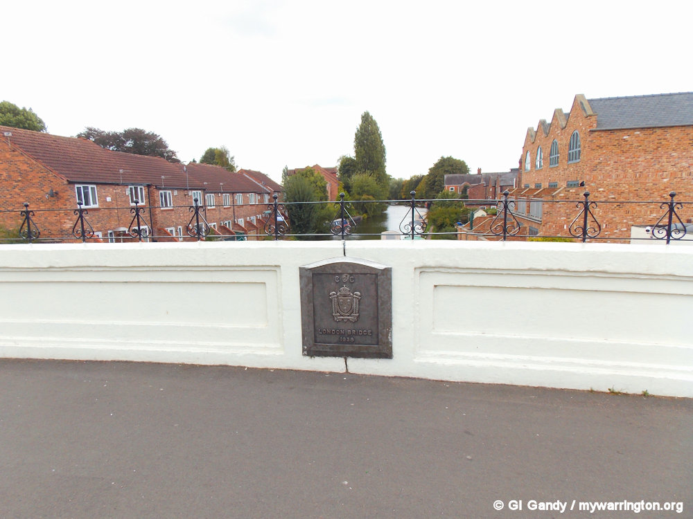
The current London Bridge was opened in 1936 as my photos below show.

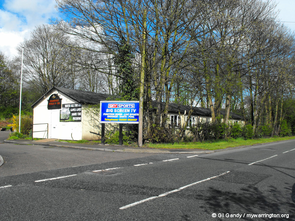
Stockton Heath Fire Station
The current fire station is located on Ackers Road between the two approach roads for the Cantilever bridge. The original fire station was located on London Road. See photos here. In my third photo below we can see Stansfield Public House on Ackers Road which used to stand on land next to the current fire station. In the late 1980s I used to attend one of the community day centres which used the building before it was converted into a pub.


Cartwright’s Field
Cartwright’s Field is a large green space off Montclare Crescent and Chester Road in Stockton Heath. The field has been used by generations of local people for dog walking, BMX cycle riding, quad biking, cricket, football, horse riding, bird watching, farming, hide and seek, blackberry picking, bonfire night parties, picnics, exercise, art and painting.
The BMX track was built by children of the district and the field has always been a very popular recreation area. In recent years, a list of assets owned by Warrington Borough Council (and surplus to requirement) was circulated, with the suggestion of selling them off (the toilets on Winwick Road opposite Tesco were one such asset, which sold for £37,000).

Outside Cartwright’s Field on 10 April 2012
A property at 61 Chester Road, Stockton Heath, which was a derelict, boarded up property, had been a source of concern for many years, providing a target for vandalism and other anti-social behaviour. This property was eventually demolished and it later emerged that a reference to redevelopment of ‘land at’ 61 Chester Road had somewhere along the line become ‘land at the rear of’ 61 Chester Road (Cartwright’s Field). This obviously caused concern for locals because a green site could be lost to redevelopment, specifically the building of 51 social houses on the site.

Cartwright’s Field on 10 April 2012
Planning permission for the redevelopment was granted in 2009. Soon after, a fence costing a reported £18,000 was erected around the whole site, thus preventing anybody from using it. As can be seen in the photos here, taken by me on 10 April 2012, the land has now become overgrown.

Cartwright’s Field on 10 April 2012
The Executive Board documents at Warrington Borough Council state that a successful application to register the land as a village green will stop all development. The Commons Act 2006 is the relevant legislation for registering land as a Green. This act allows residents a period of at least 2 years to prepare and submit such an application.
The Save Our Field action group was formed, resulting in an application for Village Green status, which was presented in 2011 after research and consultation with locals and officials. Later, a public inquiry was called, which took place at The Pyramid on Palmyra Square South, Warrington, between 16th and 19th April 2012.
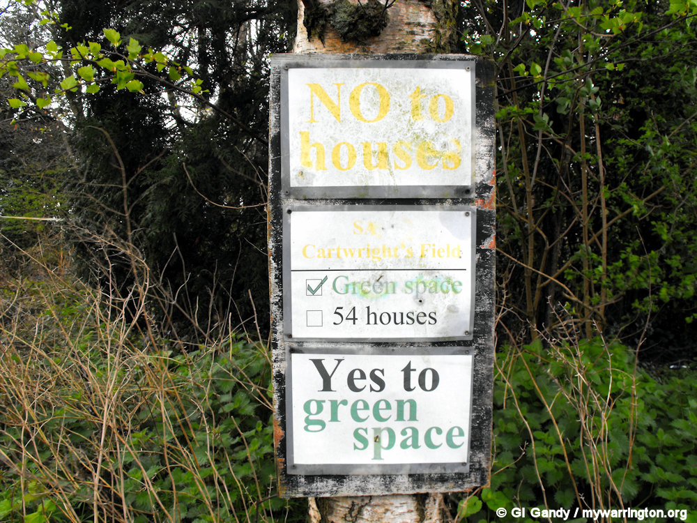
Campaign posters against the redevelopment of Cartwright’s Field (10 April 2012)
I attended that inquiry and I met the group coordinator, his wife and members of the campaign group at the inquiry and I must commend the compassion and effort they have all put in over a three or four year period to save this valuable community asset from redevelopment.
They had completed their enquiries and obtained information with the minimum of legal assistance, for which they must be congratulated. Their professional approach has been second to none and I hoped that the council would agree that they satisfy all the legal conditions for securing Cartwright’s Field as a Village Green.
The inspector informed the inquiry that he can only make recommendations based on the legality of the case, and not on the compassion and commitment that the action group have all put in, for which he gave them enormous credit at the end of the inquiry. I echo those compliments, as indeed I did to Mr McConnell, the group co-ordinator, at the close of the inquiry.
Unfortunately, the group did not succeed in their campaign. See the report in the Warrington Guardian. At the time of writing (September 2025), no housebuilding has taken place on the land.

Cartwright’s Field on 10 April 2012
Montclare Crescent Stockton Heath on 10 April 2012.
Events
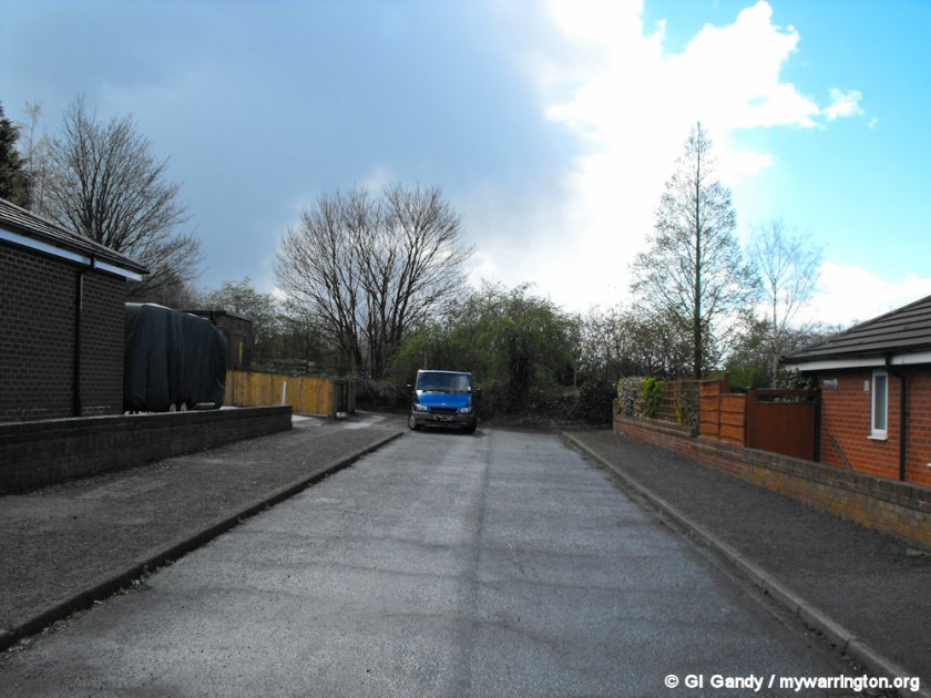
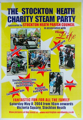
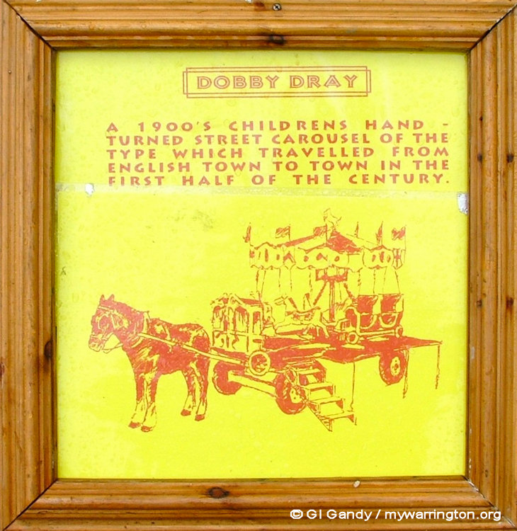
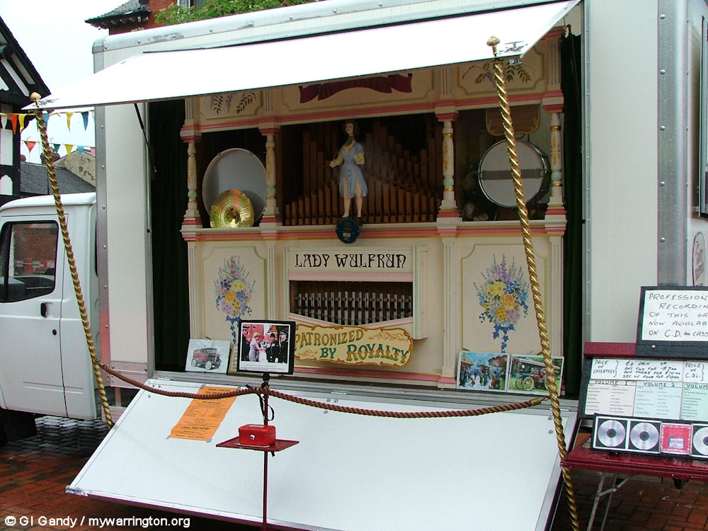
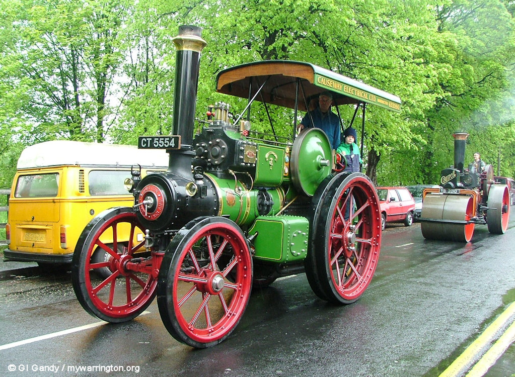
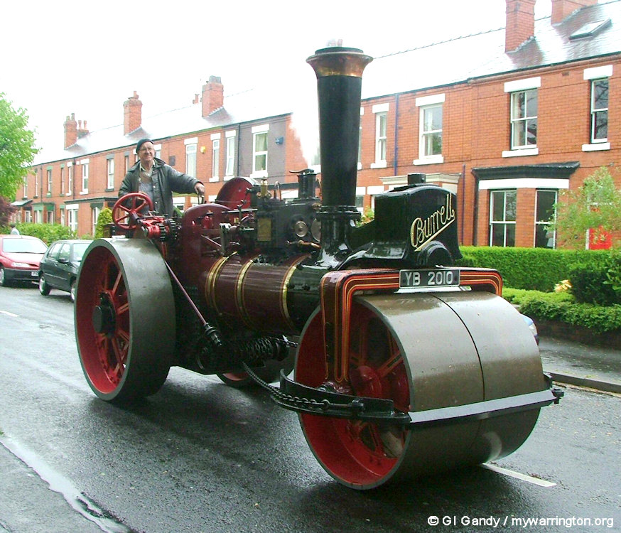
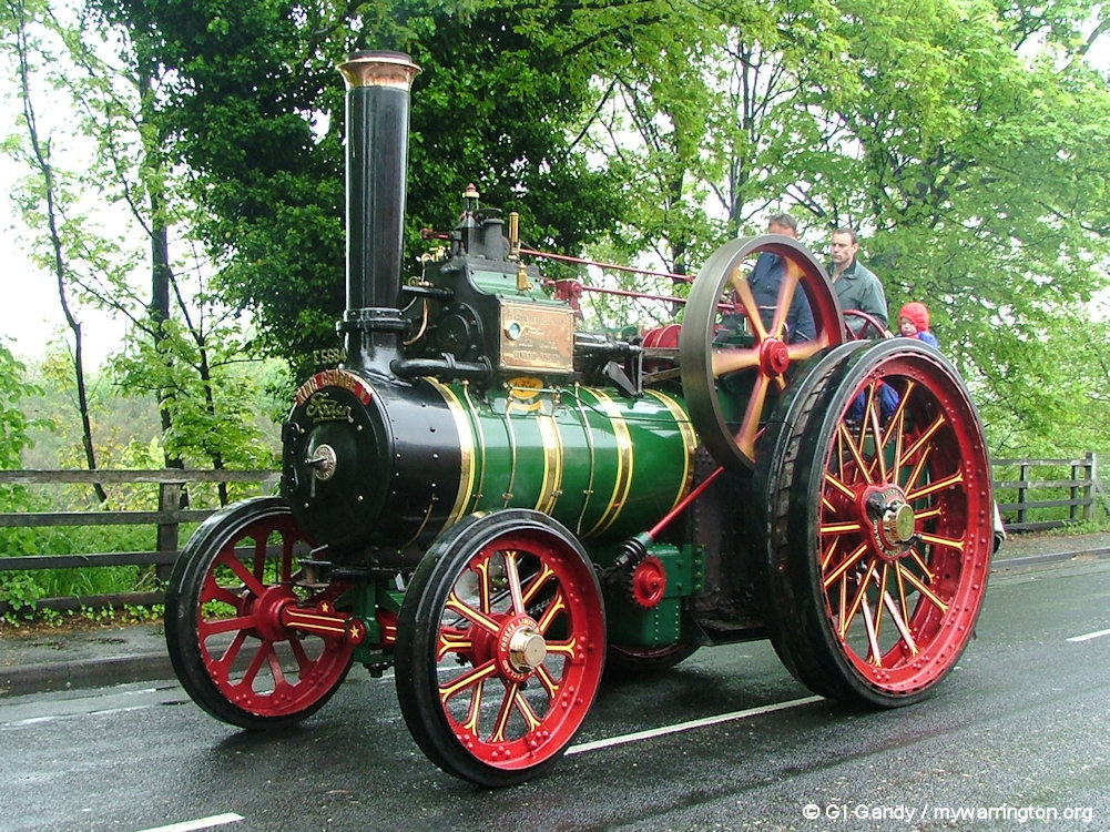
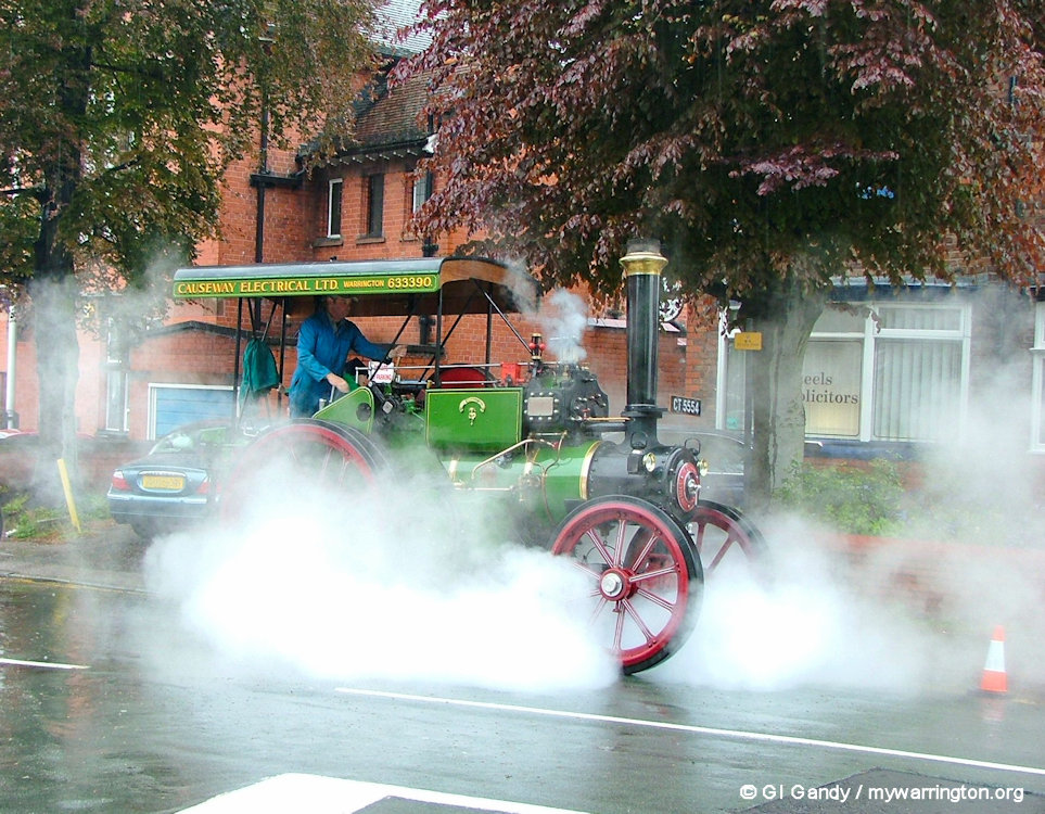
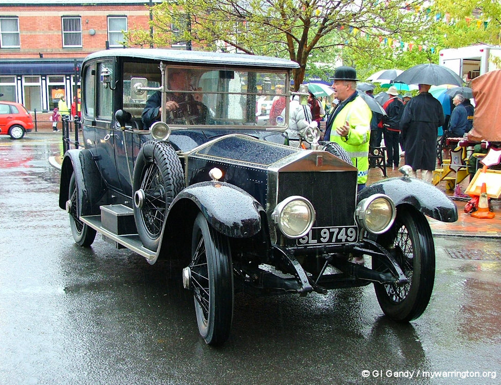
Stockton Heath Charity Steam Party (8 May 2004)


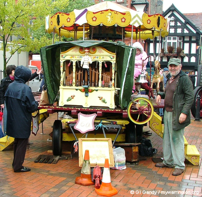
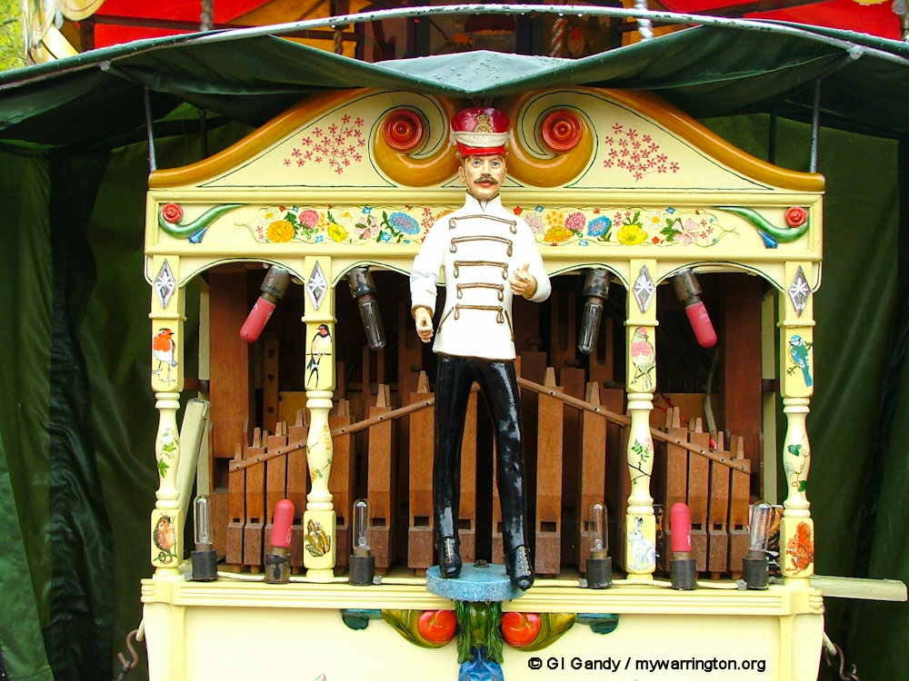


A Musical Evening (21 Sep 2006)
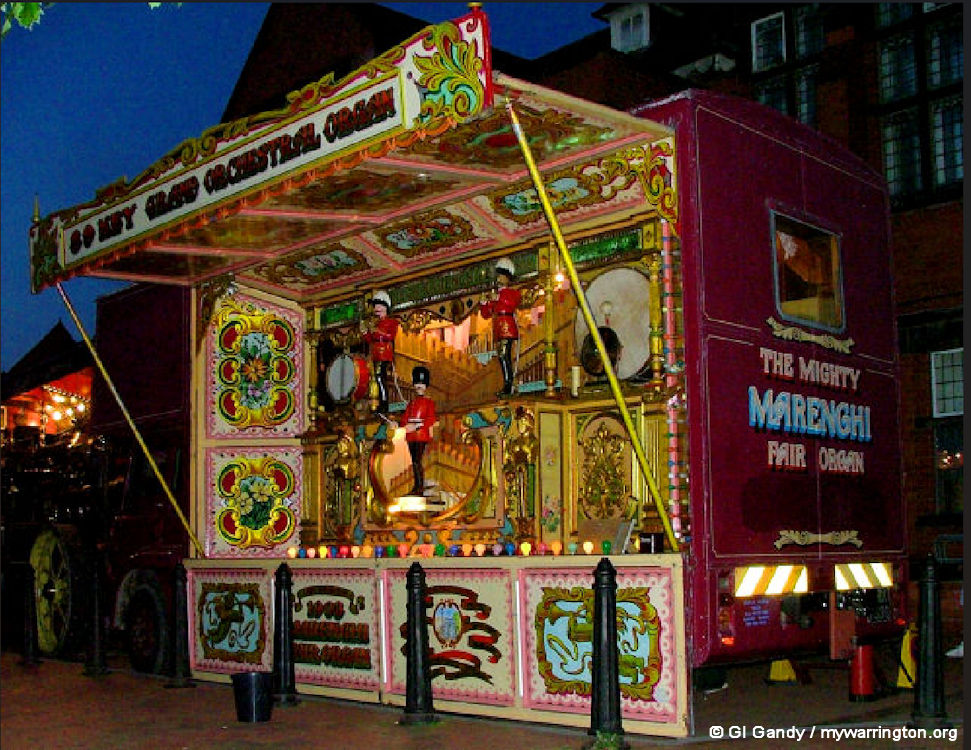
Merenghi 89 Key fairground organ
On Thursday, 21 September 2006, a musical evening with a difference was held in Victoria Square, Stockton Heath. A Merenghi 89 Key Fairground Organ was on display to play well-known tunes in a free ‘concert’. The organ was powered by a 1914 Fowler Showman’s steam engine. Donations on the night were given to the St Thomas’s Church Restoration Fund. It was an excellent evening, attracting lots of attention from curious members of the public, including a delightful baby who was fascinated by the marvellous sounds created.

1914 Fowler Showman’s steam engine
Stockton Heath Festival
Stockton Heath Festival takes place in the village every year. Established on Mill Lane field by Tudor Pole and a small but determined group of volunteers, the independent Stockton Heath Festival takes place each summer over an extended weekend in July with one aim – to bring together the whole community to celebrate art, culture and heritage. It remains a proudly independent charity, fuelled by a strong community spirit! For more information, see their website.
One Last Walkabout
Click the first image to view a manual slideshow


