

- Introduction
- Back in Time
- The Dallam Family
- Sankey Canal
- Warrington and Newton Railway
- Dallam Bridge
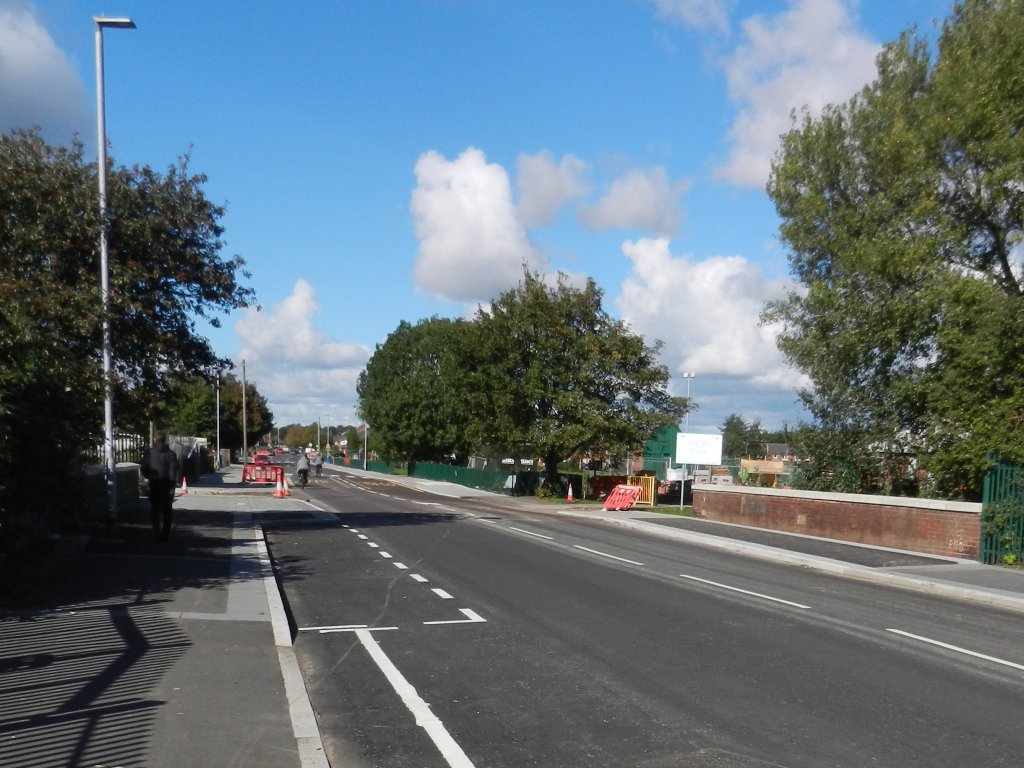
- Walkabout
- Tin Town
- Flooding
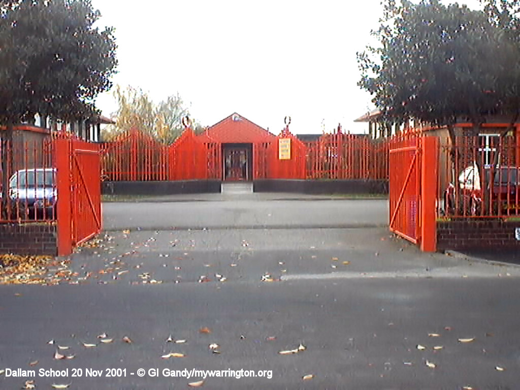
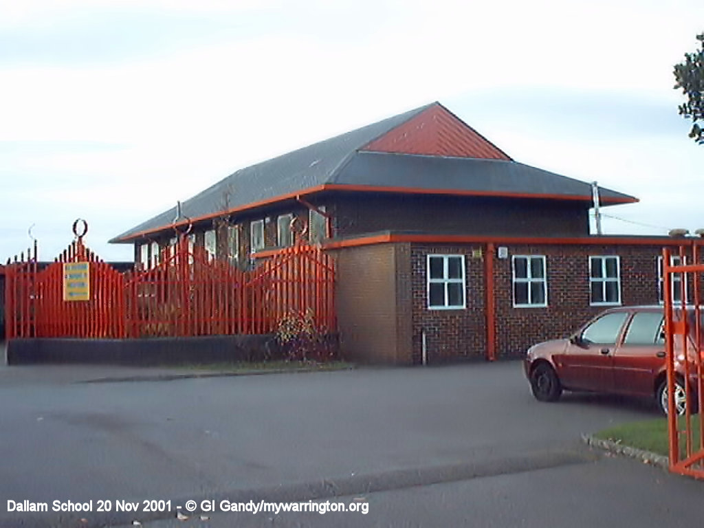
- Dallam Community Primary School
- Church Life
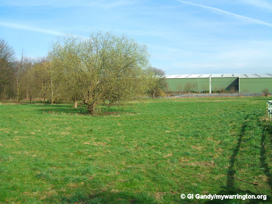
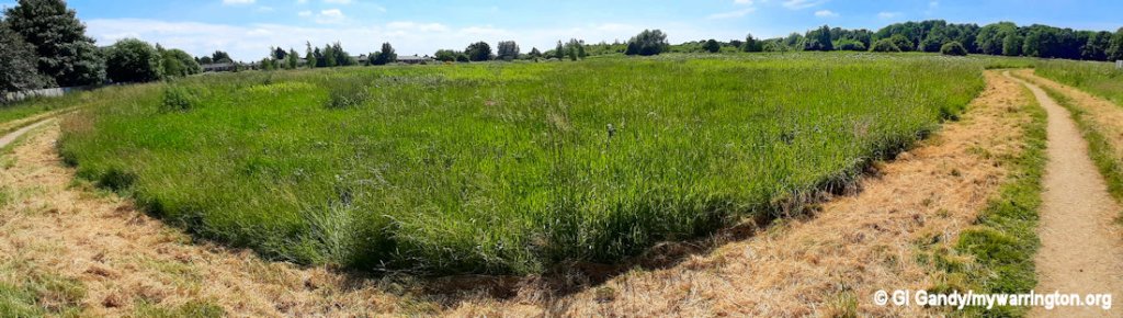
- Dallam Park
- Industrial Past Artwork
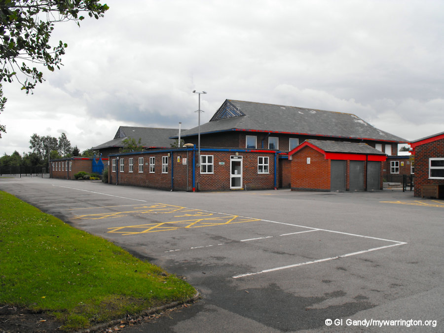
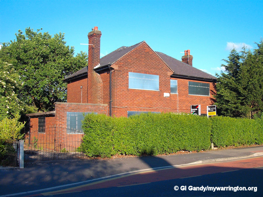
- Community Facilities
- Longshaw Street Flats
- Harrison Square
- Grey to Green
- Bewsey and Dallam Community Hub
- Stanners Pool
- Ordinary Lies
- Conclusions
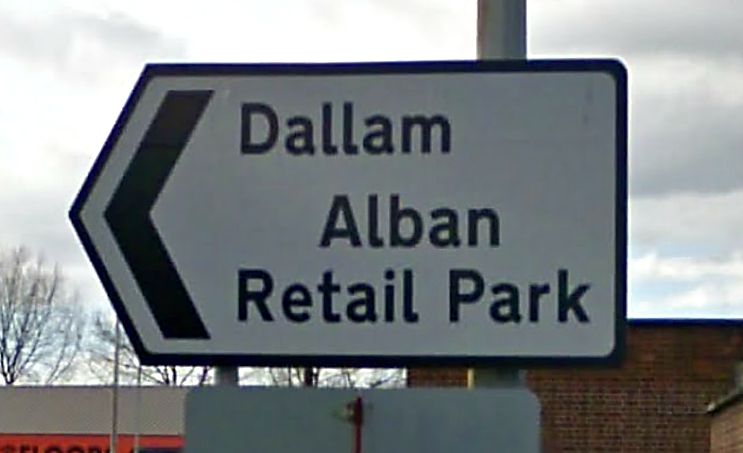
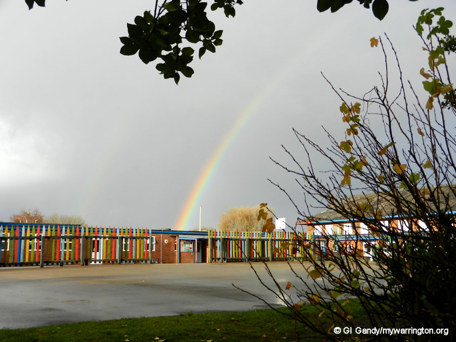
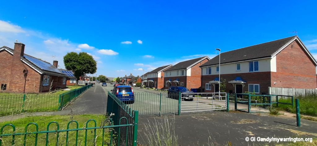
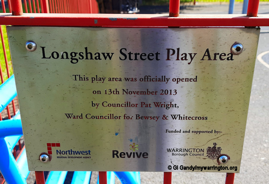
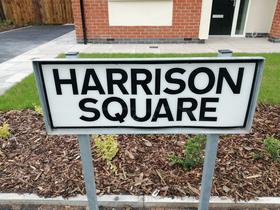
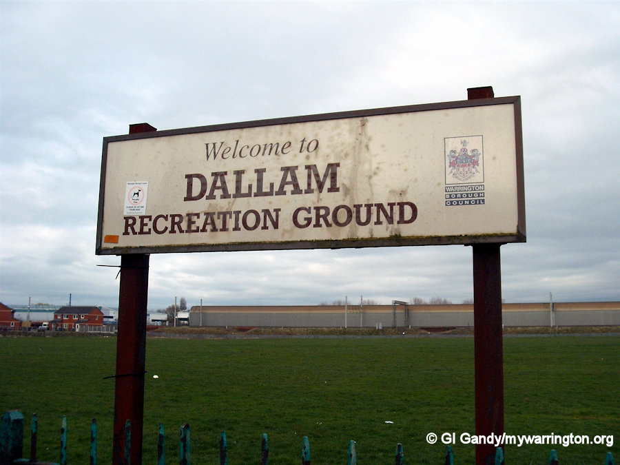
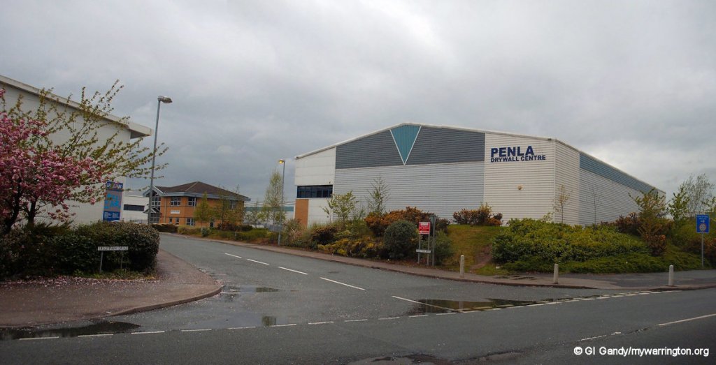
Unlike most other districts in the town, there is no official sign for the district. This is as close as we get, and even Alban Retail Park has changed its name since the sign was erected. Read more on that in the Longford section.
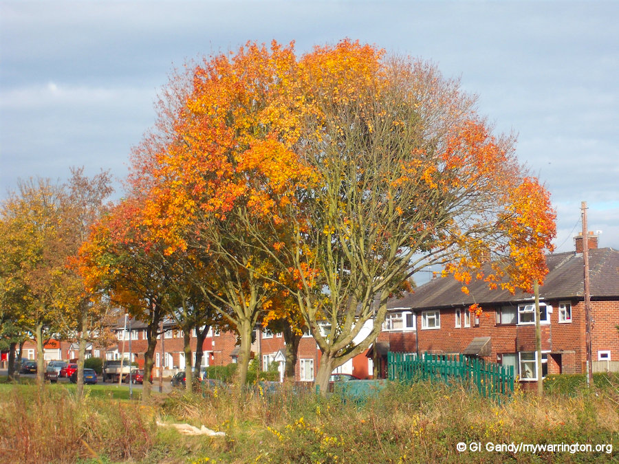
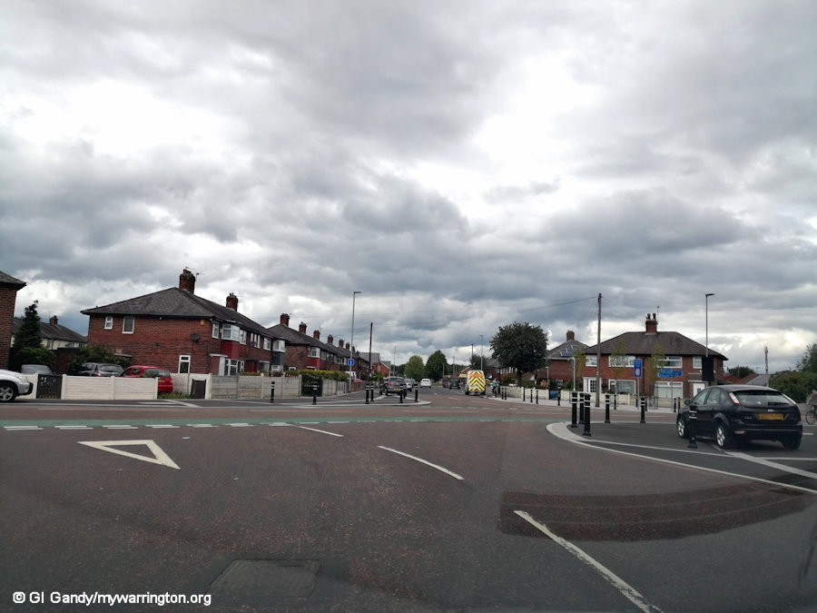
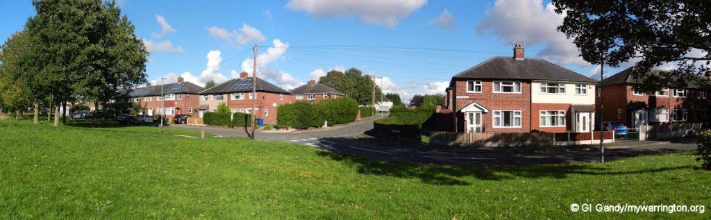
An autumn scene showing Higham Avenue and Hodgkinson Ave on 20 October 2012.
Introduction
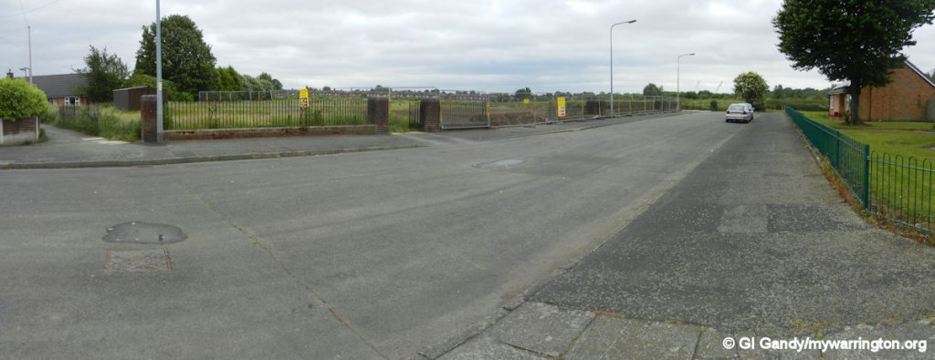
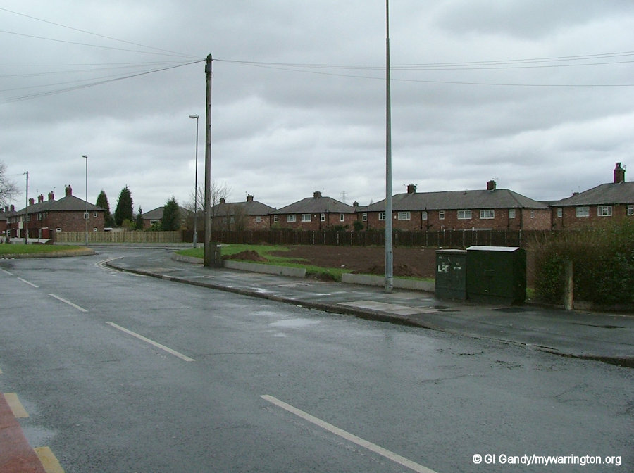
DALLAM is a district in north-west Warrington, located alongside Bewsey and Callands. The name Dallam means ‘valley meadow’, while the street names are named after former town councillors of the town – Higham, Gale, Boulting, etc.
The originally parliamentary boundary shows Dallam to be within an area bordered by the River Atherton on Longshaw Street and Hawleys Lane in the south and east respectively, whilst the western boundary is the Sankey Canal and the northern boundary is Winwick Quay near the footbridge over the railway line.
Dallam is famous for Thomas Dallam, manufacturer of organs, who lived in the area and who, via Queen Elizabeth I, presented an organ to the Sultan of Turkey.
His journey from London to Constantinople (now Istanbul) and return to Dover took place between 1599 and 1600.
More on his story shortly.
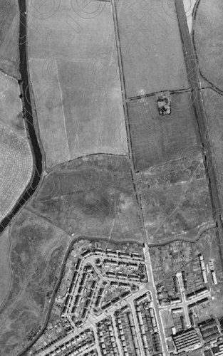
The image here shows the location of the Dallam estate from the air in the 1940s before building of the housing estate began in the 1950s. For reference, the isolated building in the open field is called Ivy Cottage and is the site of a residential home today on Hawleys Lane.
The houses forming the triangle at the centre of the image are Southworth Avenue, Molyneux Avenue and Reid Avenue, which were part of the Bewsey Garden Suburbs programme from 1928.
The Sankey (St Helen’s) Canal can be seen on the left of the image. The canal was used to transport coal from the St Helens area to the new industrial areas of Liverpool and Widnes and to transport sugar from Sankey Sugar Works at Earlestown. Read more about the sugar works here.
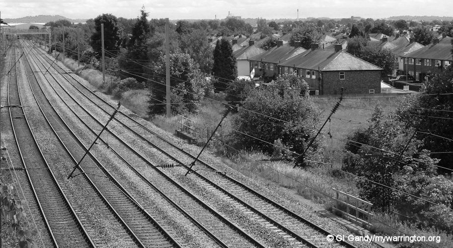
The railways came later and what is now the West Coast Main Line (WCML) can be seen on the right. It is seen in the second image here, photographed from Cromwell Avenue in the north.
Back in Time
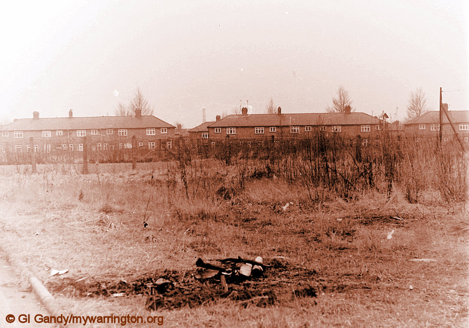
Before any modern housing development took place in Dallam the section of Longshaw Street in the Dallam area was known as Dallam New Road according to the 1914 OS map. On the same map we have Dallam Farm in the north of the district, known as Jones’s Farm in my younger days. The farm has since been demolished. There was also a brick and tile works in the area immediately north of Summerfield Avenue.
Also on the same map (click this link) we can see a road in a similar position to the current Cromwell Avenue. There is also a pedestrian footbridge linking Dallam with Gemini retail park close to the spot today. On the map there was a swing bridge that opened to allow boats to sail along the Sankey Canal.
Location of the brick and tile works near Summerfield Avenue (photos taken 16 Dec 2011 and 20 Jun 2024)
The Dallam Family
Dallam was the surname of a family of English organ builders, active in England and Brittany. The first known member of the family, Thomas Dallam, originated from Dallam in Lancashire.
Thomas Dallam I
Thomas Dallam (born c1570-1575 – died after 1624) was an English organ-builder.
Thomas Dallam was born around 1570-75 in the district of Dallam, although his exact year of birth cannot be confirmed. In those days Dallam Lane ran all the way to Dallam because the railways weren’t here then. And I don’t know if Dallam is named after his family. Dallam was baptised in Flixton, Lancashire.
Little is known of Dallam’s early life, except that he was apprenticed to a member of the Blacksmiths’ Company, later attaining the status of liveryman. He travelled frequently to build organs on site, going as far as Turkey.
It is not known whether he married, but he had three sons, Robert (born c1602), George and Ralph. Between them the family members became the most important organ builders of their time.
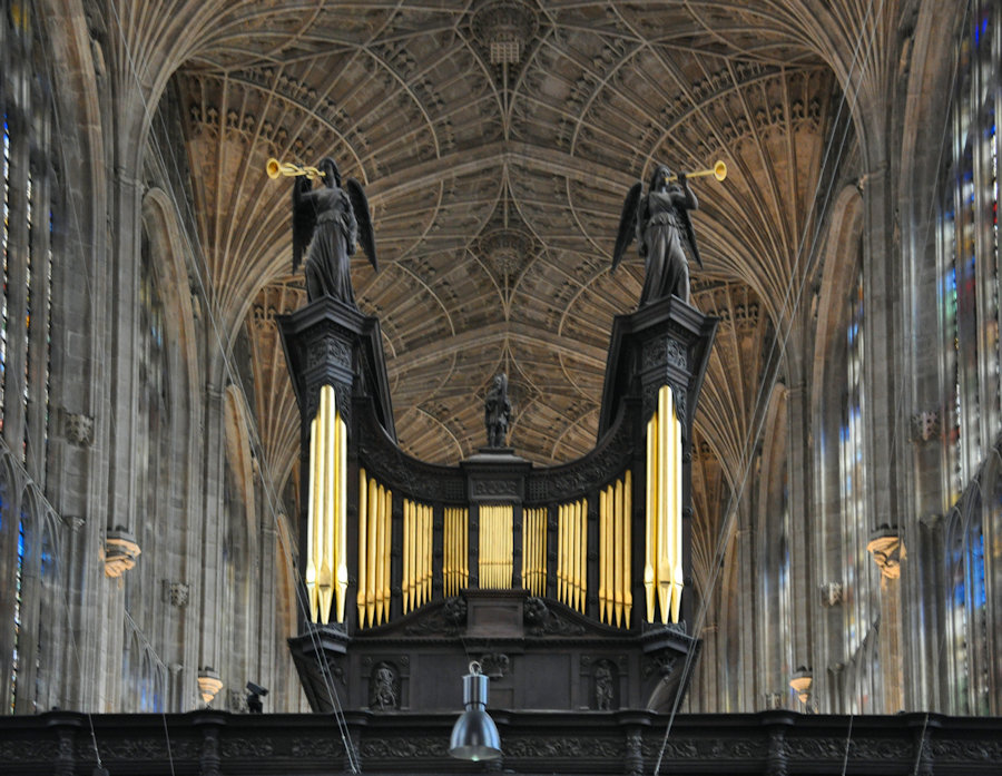
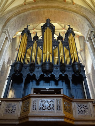
Organ of King’s College. This instrument has been rebuilt since Dallam’s time, but it is believed that some of the case is original. Image is owned by User:FA2010 and is now in Public Domain Wikipedia.org
He was commissioned by Queen Elizabeth I to journey to Turkey and present an organ to Ottoman Sultan Mehmet III, paid for by the merchants of the city of London. In Europe at that time there were a number of powerful nations, all competing against each other to secure the best advantage, and the English wanted help from the Turkish navy against their enemy Spain.
The record of Thomas Dallam’s journey comes from his own diary, which was published in 1893 by the Hakluyt Society. He was in his late twenties when he undertook the journey in 1599.
Like many of the English of that time Dallam had gone to seek his fortune in the capital. He served an apprenticeship with the Company of Smiths as an organ maker, and soon set up in business on his own.
During 1599 and 1600 Dallam went on a voyage from London to Constantinople in order to deliver an organ to the sultan Mehmet III.
The instrument was commissioned as a present from Queen Elizabeth I and could be played normally or by clockwork. On arrival, the organ took many weeks to assemble.
Dallam afterwards built many important organs, including that of King’s College Chapel, Cambridge. Unfortunately, much of his work was destroyed by people hostile to church organs following the outbreak of the English Civil War. In the case of King’s College Chapel, the existing instrument is the product of successive rebuilds, and it is not known for certain whether it contains any of Dallam’s work, but it is believed that some of the casing is his.
Thomas Dallam died sometime after 1614.
Read more detailed accounts of Thomas Dallam at Britannica.com.
theorganmag.com is another source if you like that kind of music.
Robert Dallam
Robert Dallam (born ca. 1602) was an English organ builder active in England and France. He was a member of the Dallam family of organ builders.
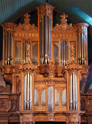
Robert’s father was Thomas Dallam, featured above. The first organ Robert made independently from his father may be the Milton Organ now at Tewkesbury Abbey which was commissioned around 1630 by Magdalen College, Oxford.
Although based in London, he worked on organs around the country in the 1630s, including a new instrument for York Minster. Dallam and his family relocated to Brittany in 1643. During the Civil War and English Commonwealth, when it was impossible to pursue a career as an organ builder in England, he worked on a number of commissions in Brittany including an instrument at Lanvellec. Dallam adapted to the French style of organ building which includes stops not called for in English organs.
In 1660, following the restoration of the monarchy, Robert Dallam and other members of his family returned to England, although his eldest son Thomas remained in France building organs. There was plenty of work in England replacing or repairing organs that had been damaged by Puritans, although the Dallam family faced competition from other organ builders. Robert and his sons Ralph and George built an organ for St George’s Chapel, Windsor Castle, which had been damaged during the Civil War. Robert died in 1665 while work was in progress on a new organ at New College, Oxford. Ralph completed the instrument.
The Milton Organ, Tewkesbury Abbey by Philip Halling Used under the Creative Commons licensing Wikipedia.org
The Latin message on his gravestone translates as: Here lies Dnus Robertus Dallum, the most skilled Artificer of the Pneumatic Instrument (which they commonly call the Organ); the son of Thomas Dallum of Dallum accompanies him. of Lancaster, died on the last day of May in the year 1665, in the 63rd year of his age.
Thomas Dallam II
Robert’s eldest son was called Thomas and was born around 1630. As a child, he moved to France with his family. Although his father returned to England in 1660, Thomas remained in France building organs, several of which have been preserved in more or less their original condition. His children included Toussaint Dallam who was also an organ builder.
Organ by Thomas Dallam II at Guimiliau (1677). image by Tango7174 and used under Creative Commons licensing Wikipedia.org
Main text from Wikipedia
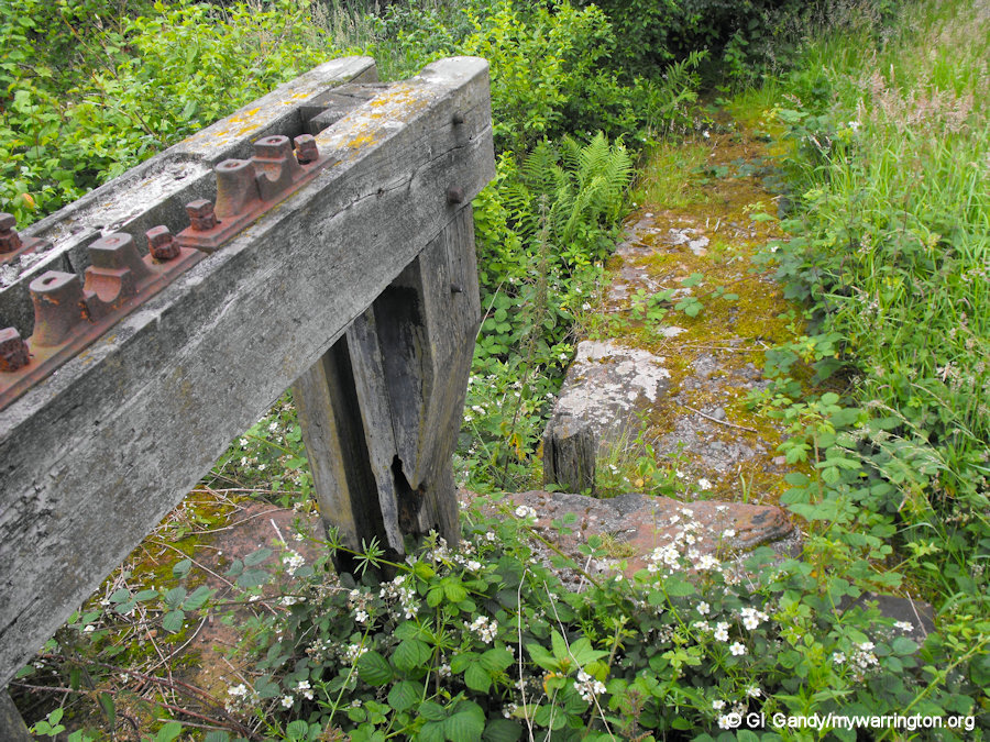
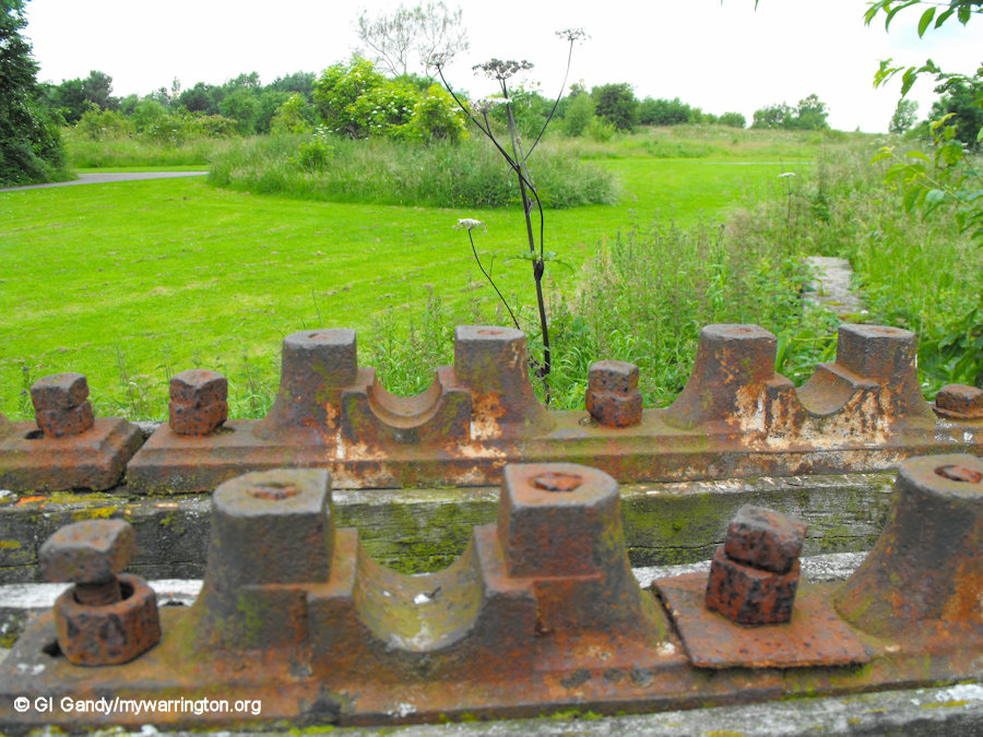
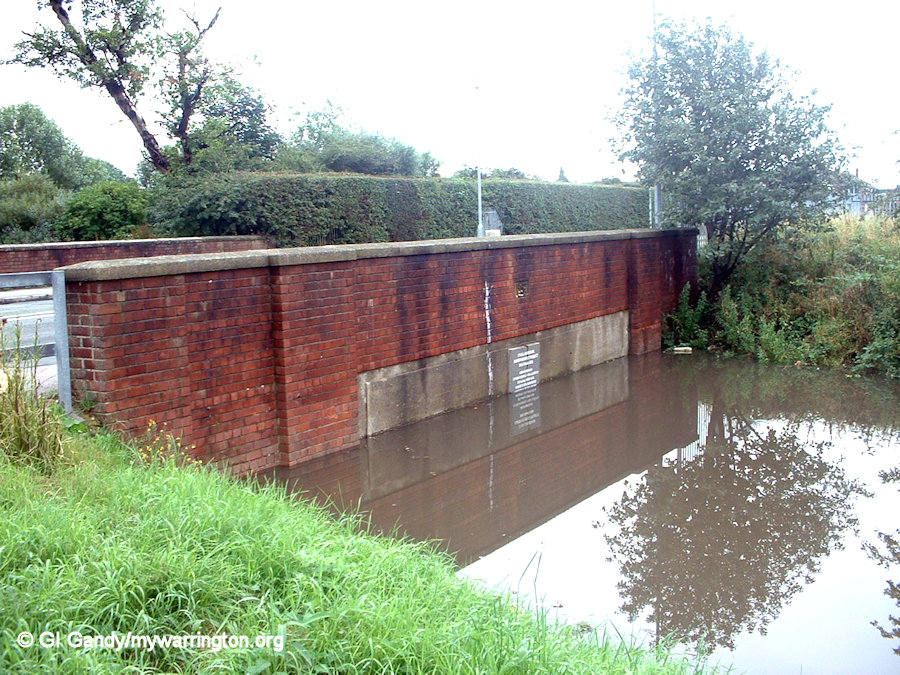
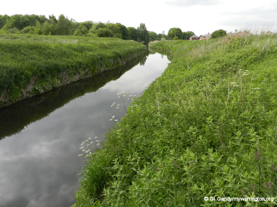
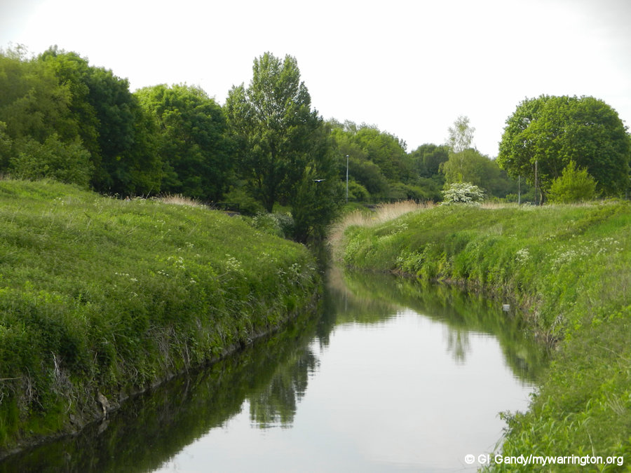
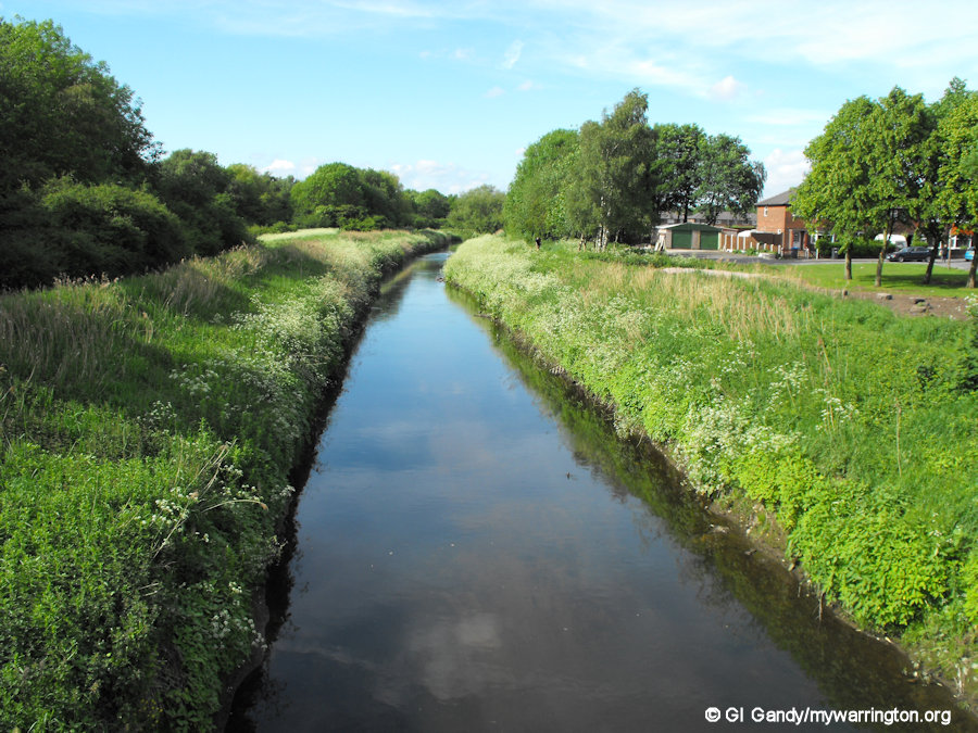
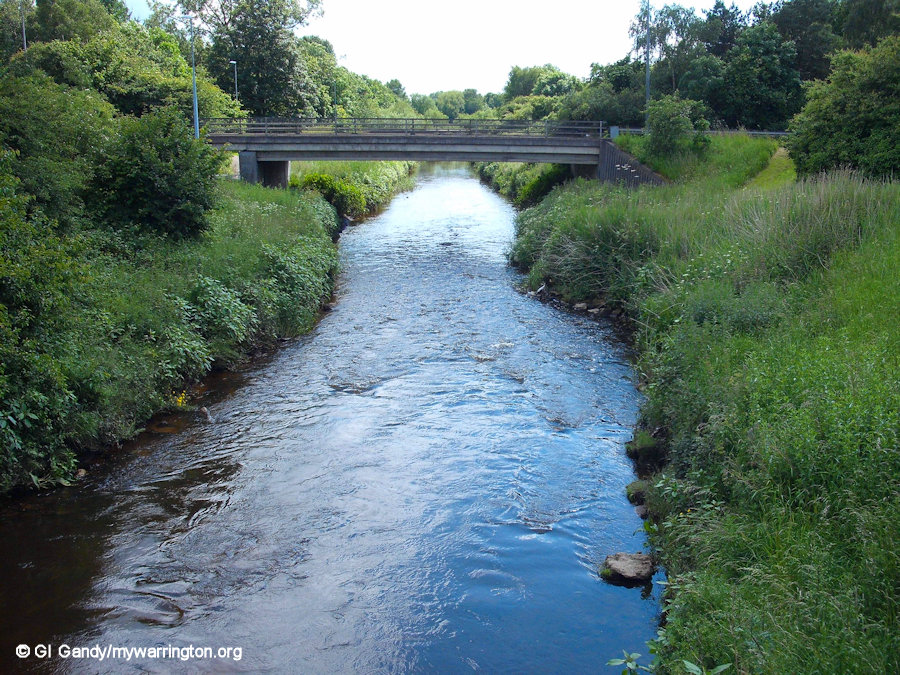
Sankey Canal
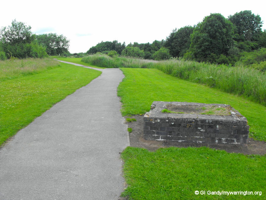
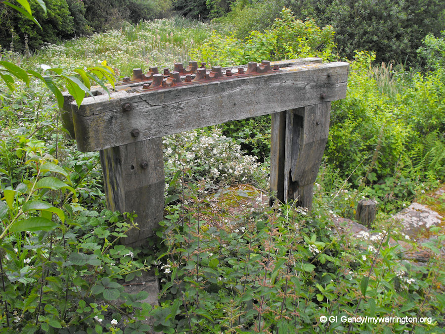
The Sankey Canal, also known as the Sankey Brook Navigation and the St Helens Canal, was opened in 1757 and passed alongside Dallam on its way from St Helens to Spike Island at Widnes. I cover the story of the Sankey Canal in more detail in On the Waterfront and in Warrington Green, but what I wish to show you here in pictures are the remains of the sluice gates used for drainage at Dallam. They are located north of Stanners Pool, which we will cover shortly. The photos were taken on 27 June 2012 and the site has been left to nature, so it might be difficult seeing the sluice gates. But they can be located because the brick feature is alongside the footpath (turn to the right as we look and tread carefully! mywarrington is not responsible for your health and safety).
Warrington and Newton Railway
The first railway into Warrington passed through Dallam on what is the now part of the West Coast Main Line. This was the Warrington and Newton Railway, which opened on 25 July 1831. It linked Newton Junction (now Earlestown) with a station behind the Three Pigeons pub on Dallam Lane via a single railway line.
The line was taken over by the Grand Junction Railway on 31 December 1834, and again by the London & North Western Railway on the 16 July 1846, when the station stop was relocated to Warrington Bank Quay.
As far as I am aware, the original single railway line along Dallam Lane was never removed. It is still under the tarmac to the west of the footpath on the railway side of the footpath. Incidentally, Dallam Lane now ends at its junction with Folly Lane but in former times it stretched right into Dallam roughly to the east of the current railway line.
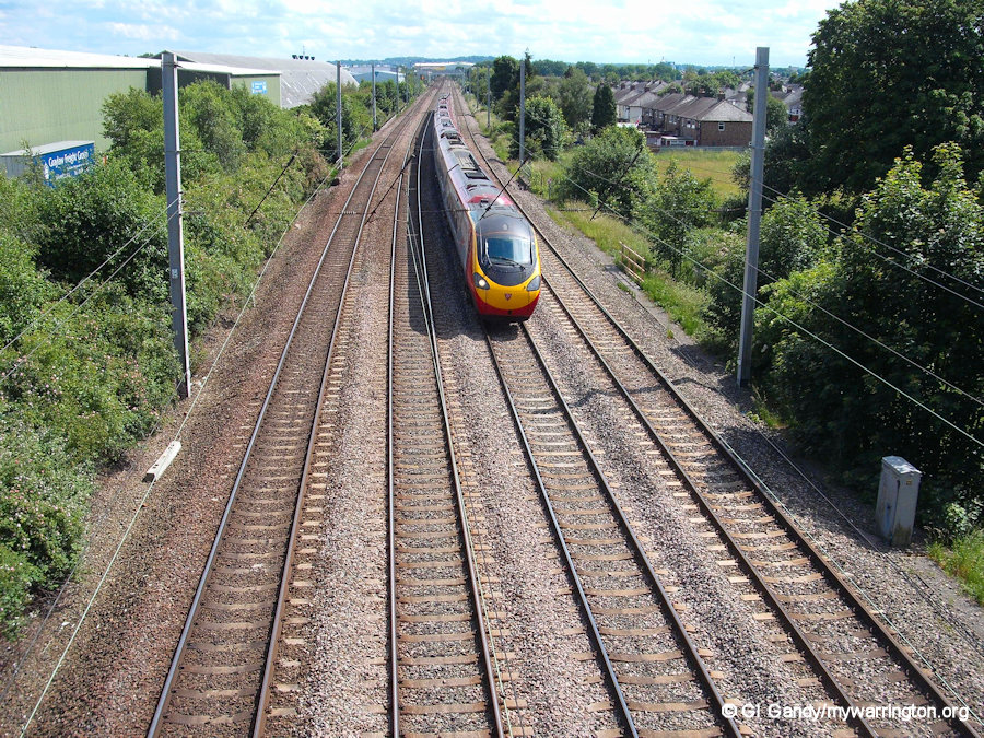
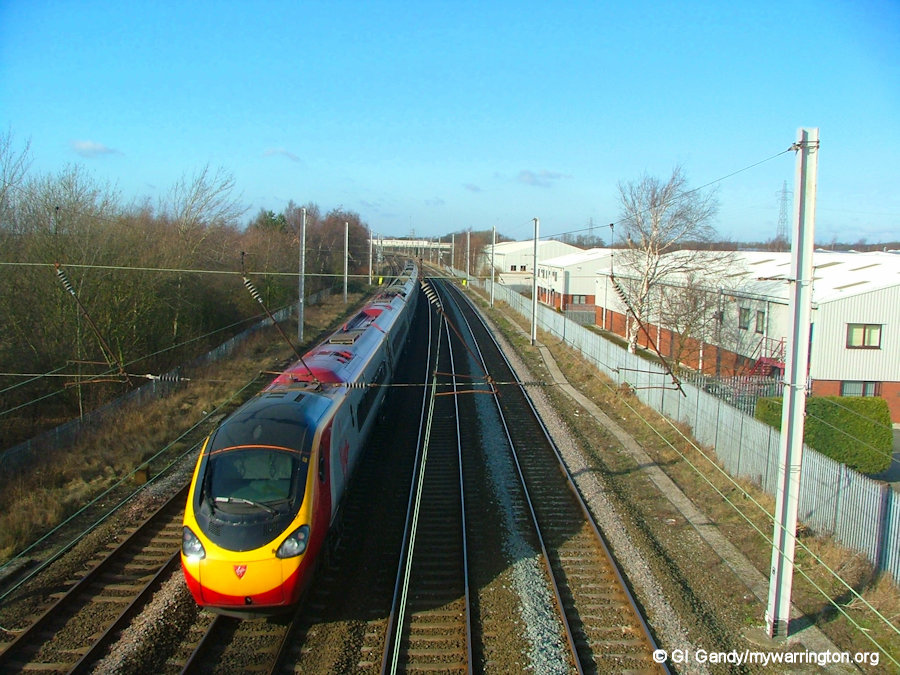
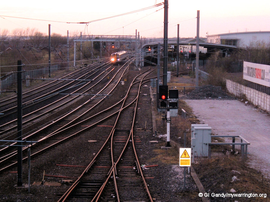
A Virgin Pendolino train travels on the West Coast Main Line through Dallam. The inside track in each direction caters for the modern trains on the route of the Warrington and Newton Railway.
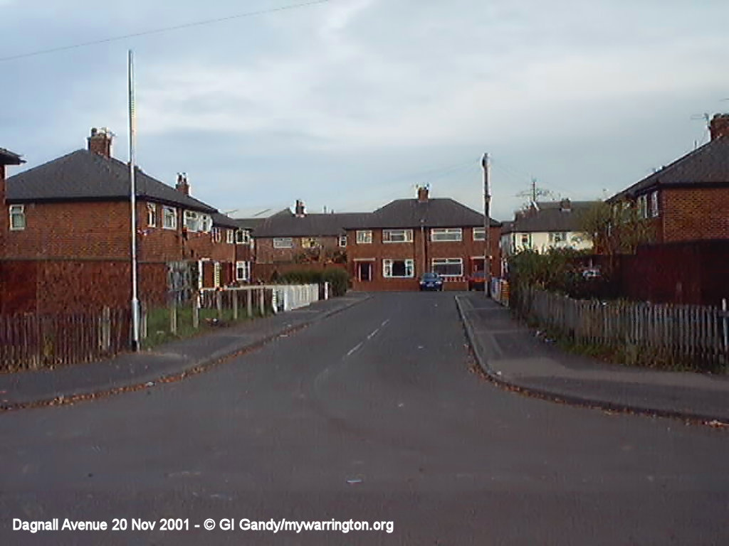
Dallam Bridge
The road bridge over the River Atherton (nowadays called the Dallam Brook) from Bewsey into Dallam was built in 1952, replacing an earlier one, when work started in building the housing estate.
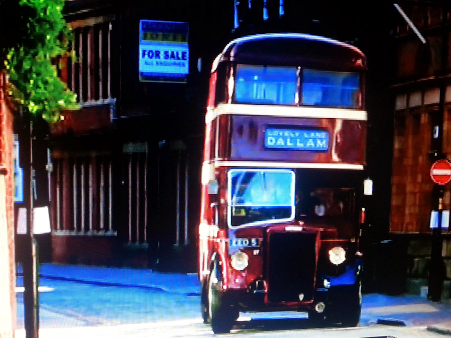
My dad once told me that in those early years, when he drove the buses to Dallam, passengers had to get off before the bridge and get back on again on the other side because of weight restrictions. Since then, the bridge has been strengthened.
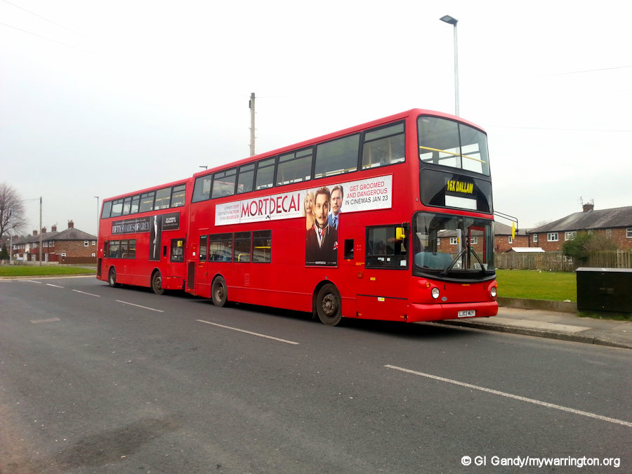
Also, the roundabout at Dallam didn’t exist, so the buses drove to the top of Longshaw Street and turned around by reversing in and out of Dagnall Avenue. The Dallam bus here featured in a TV documentary from another part of the country in 2014.
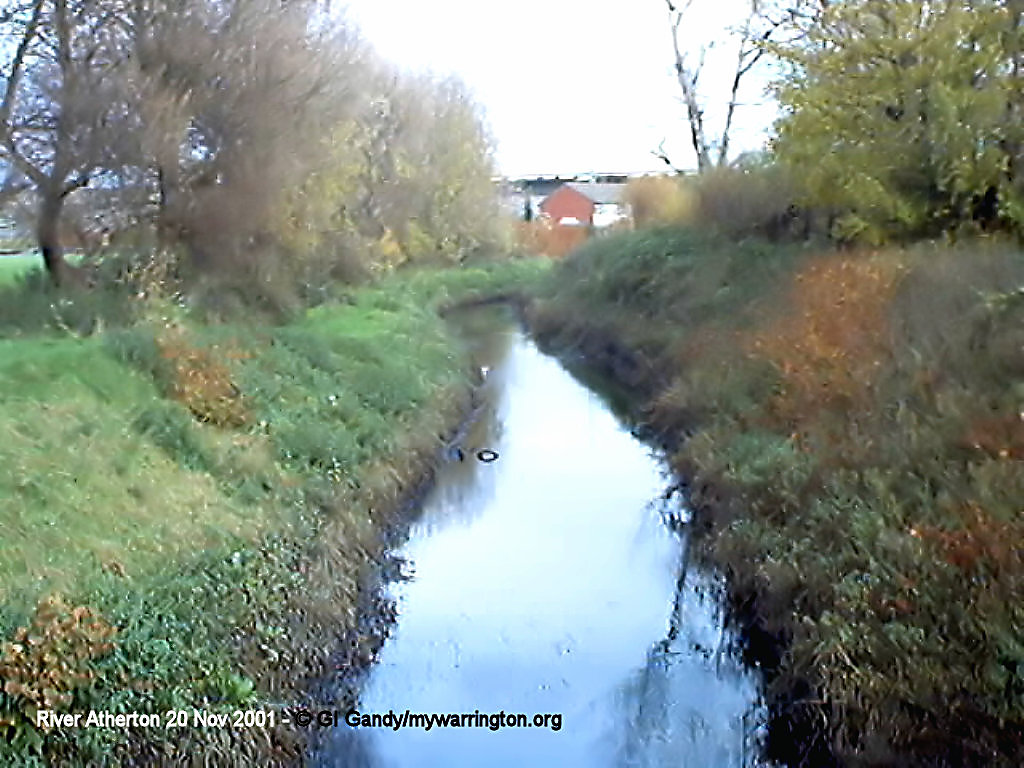
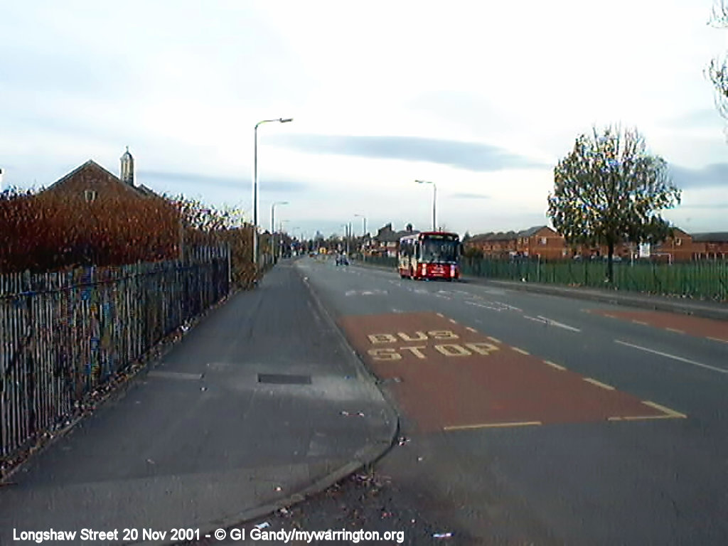
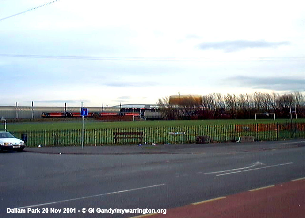
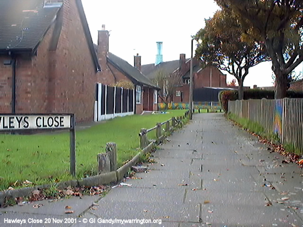
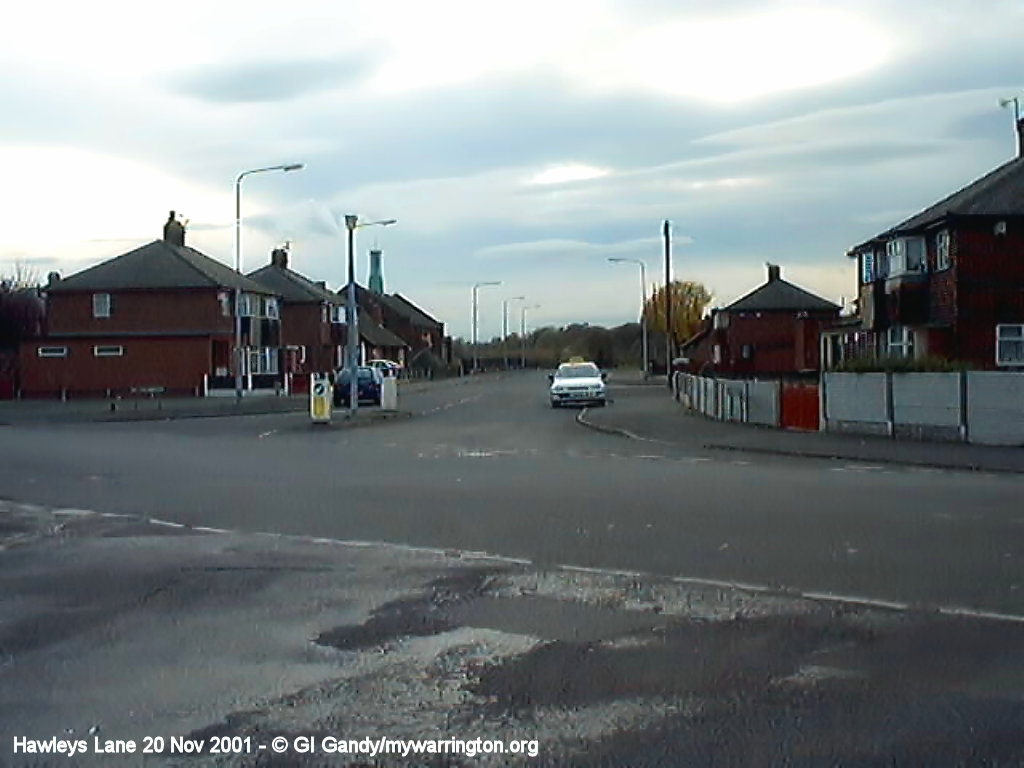
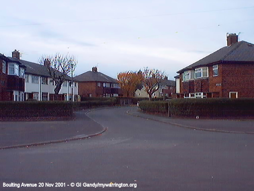
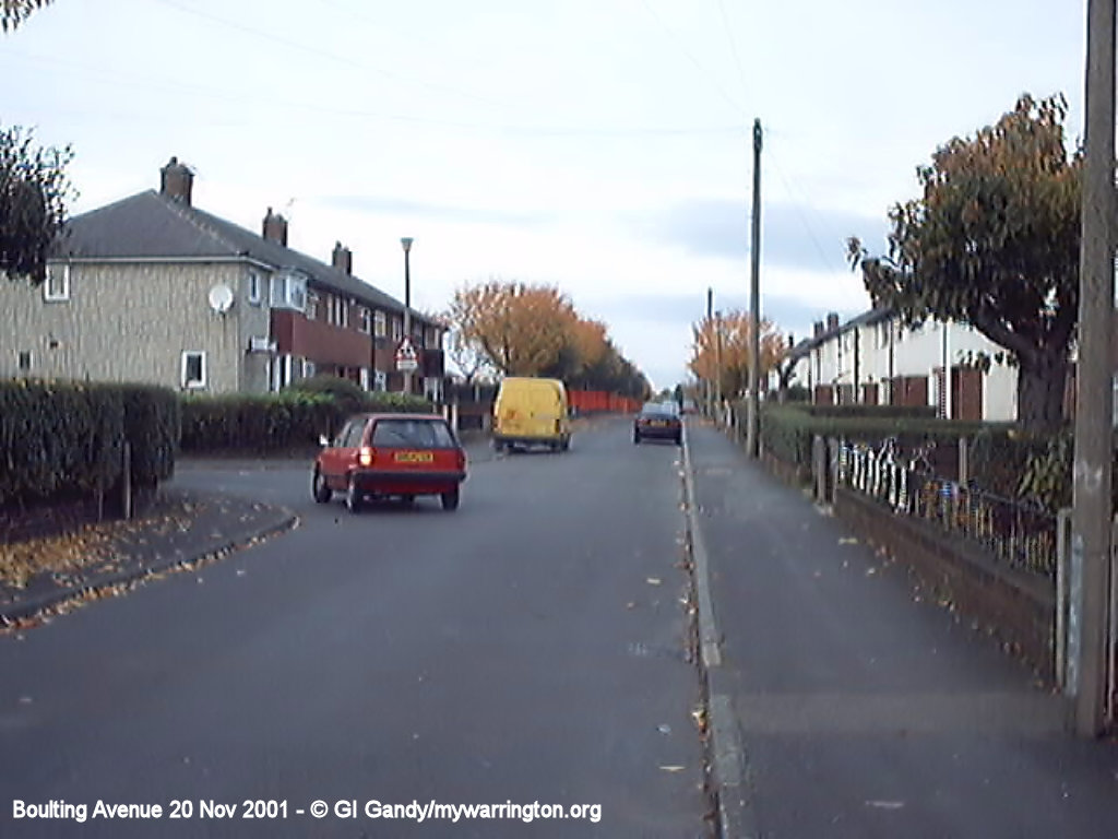
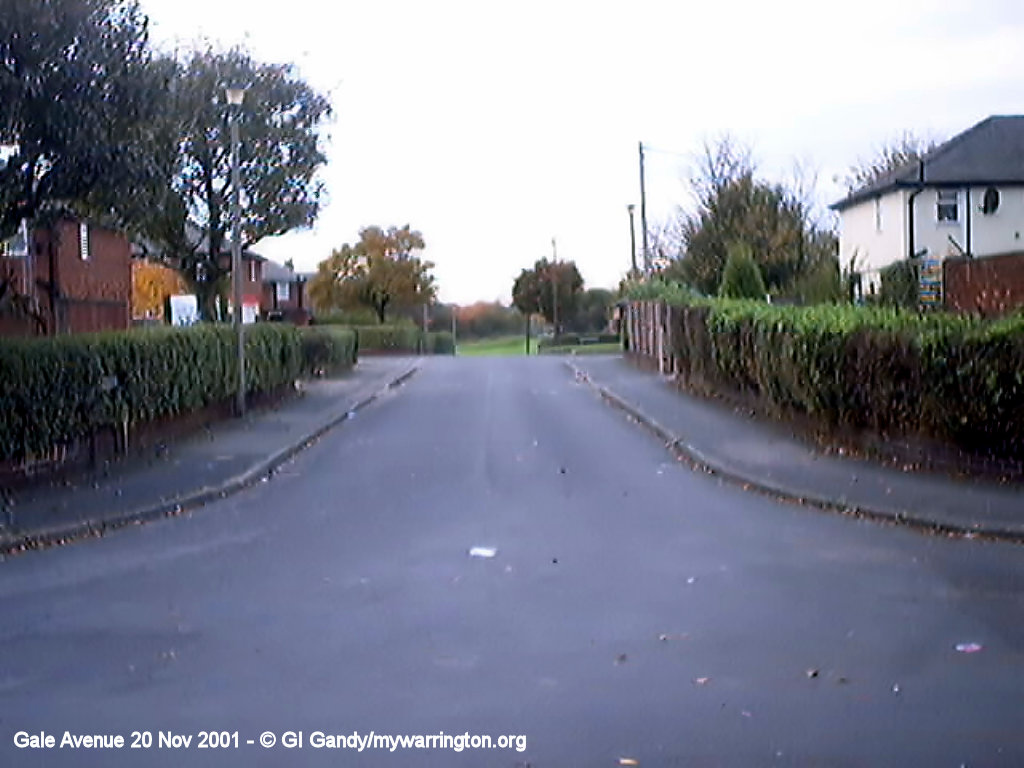
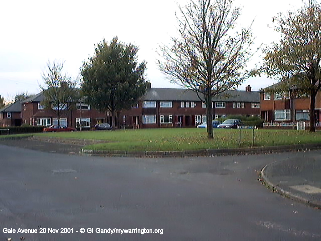
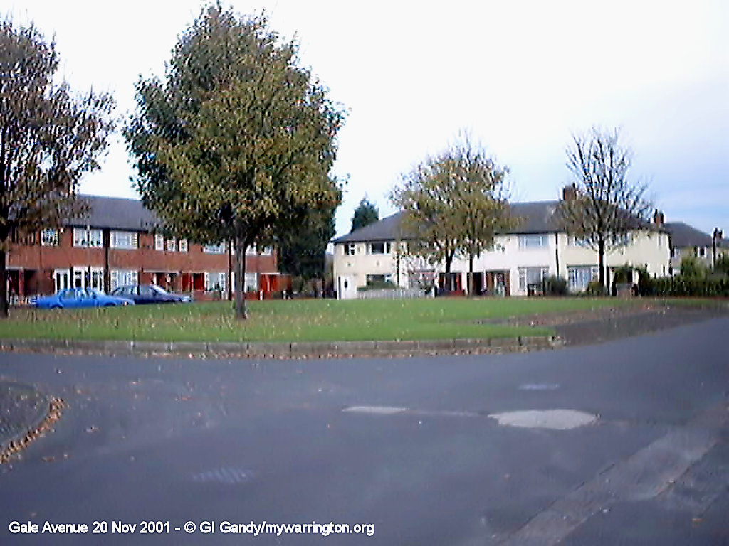
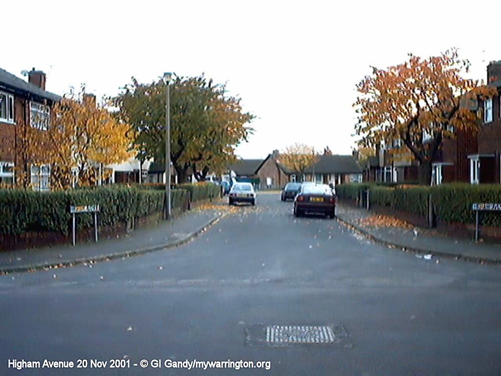
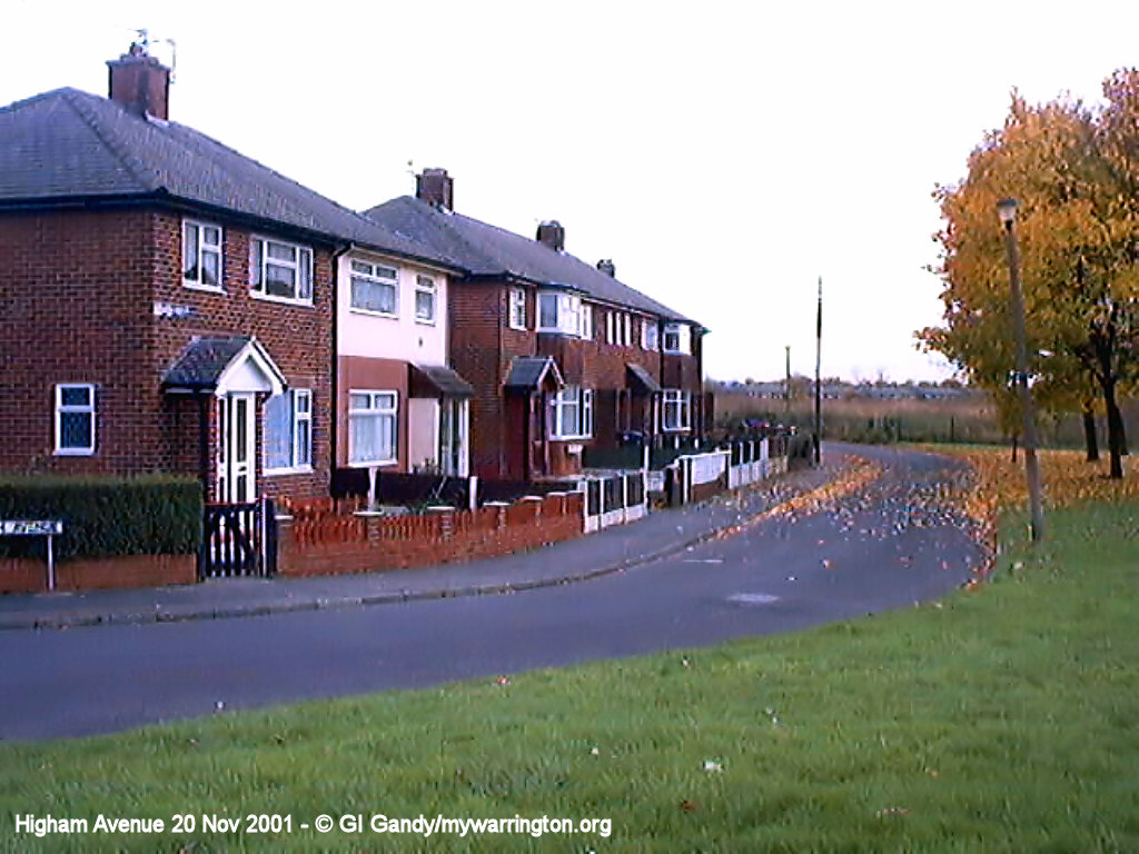
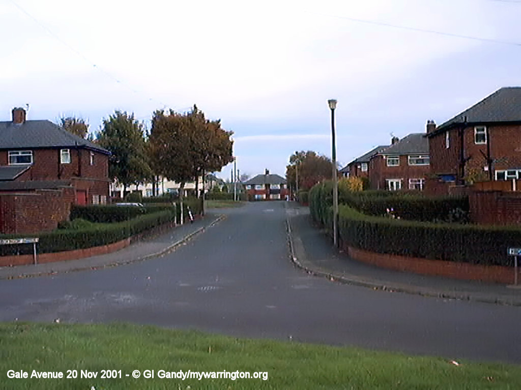
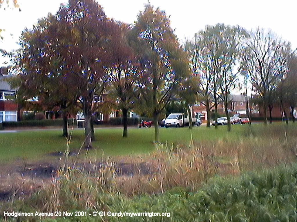
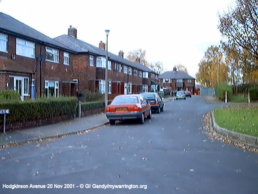
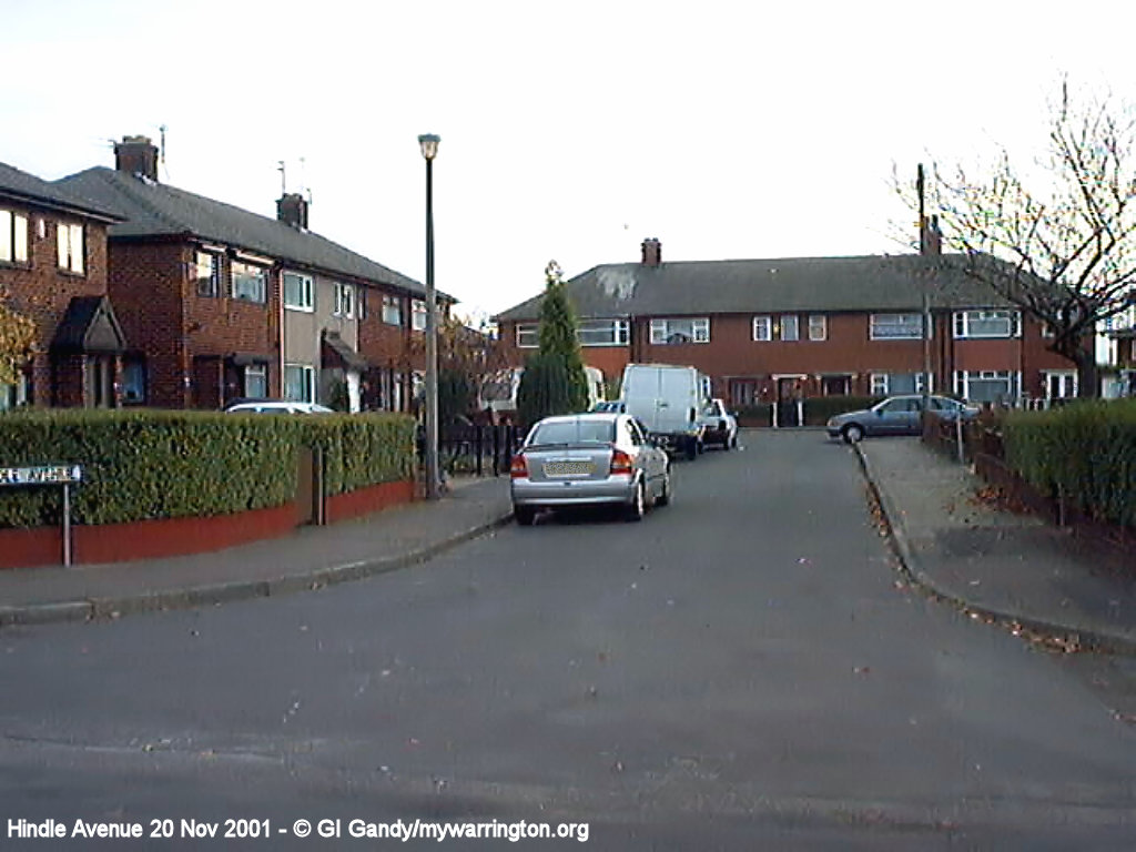
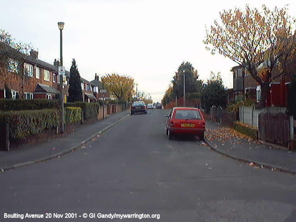
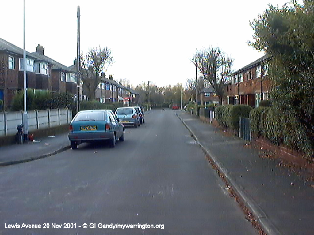
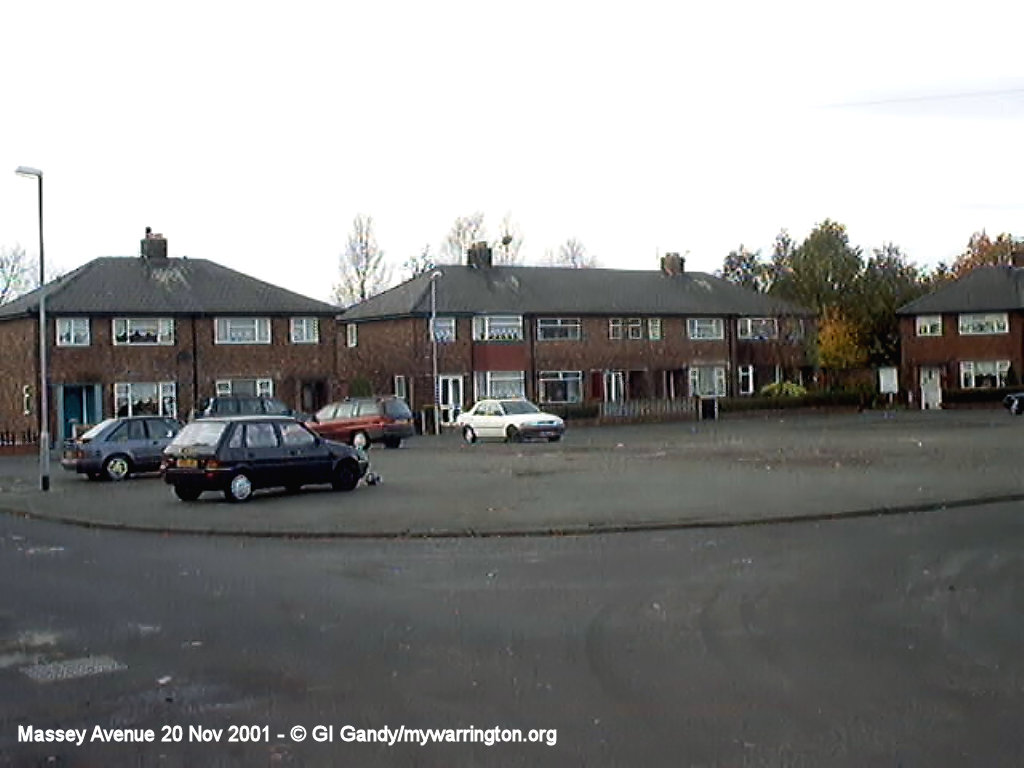
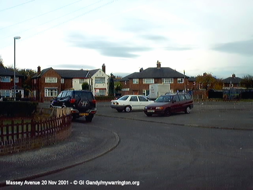
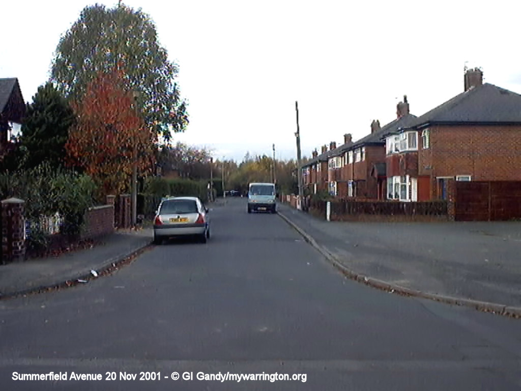
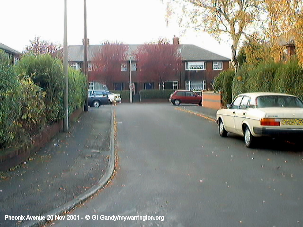
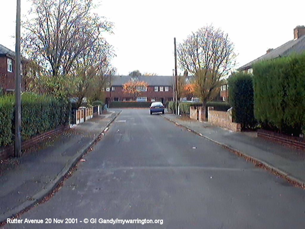
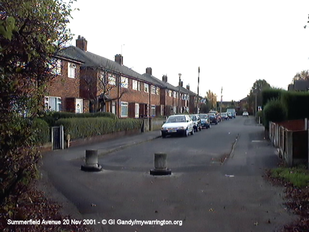
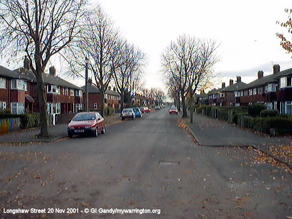
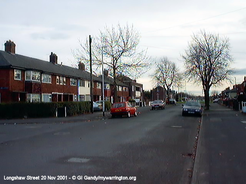
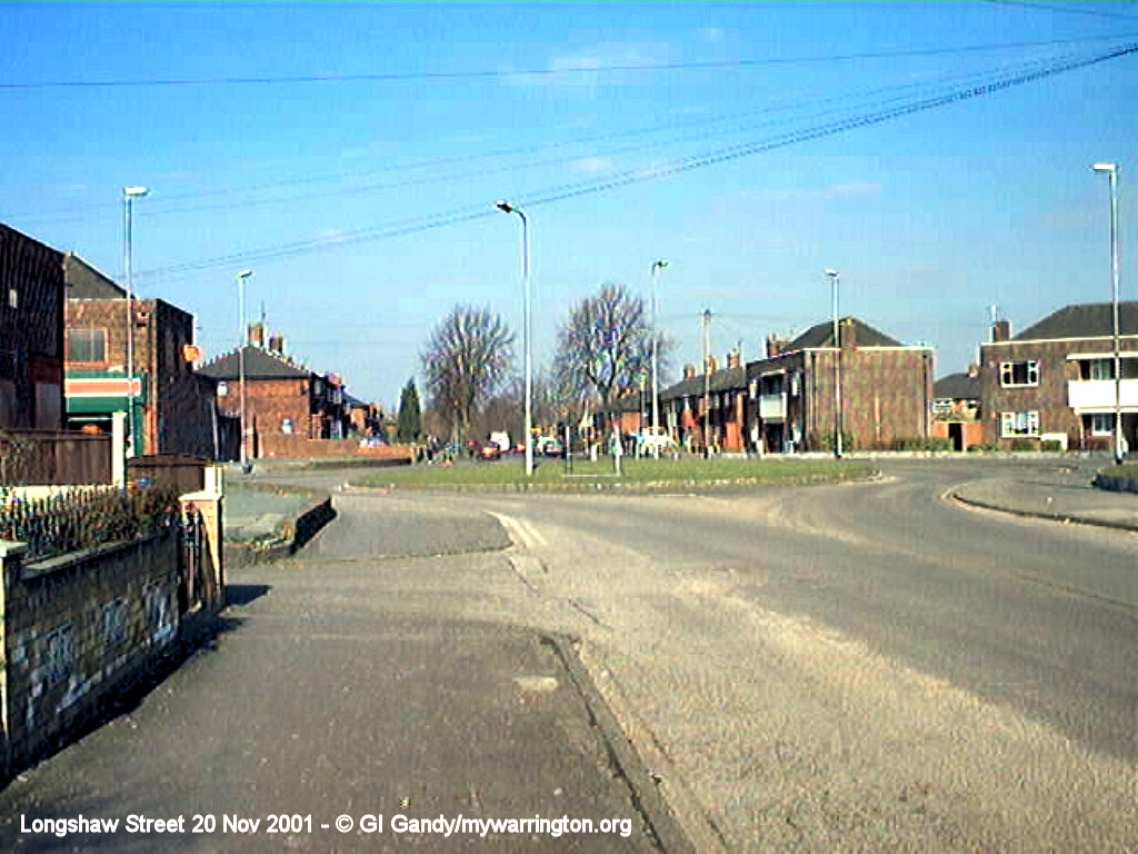
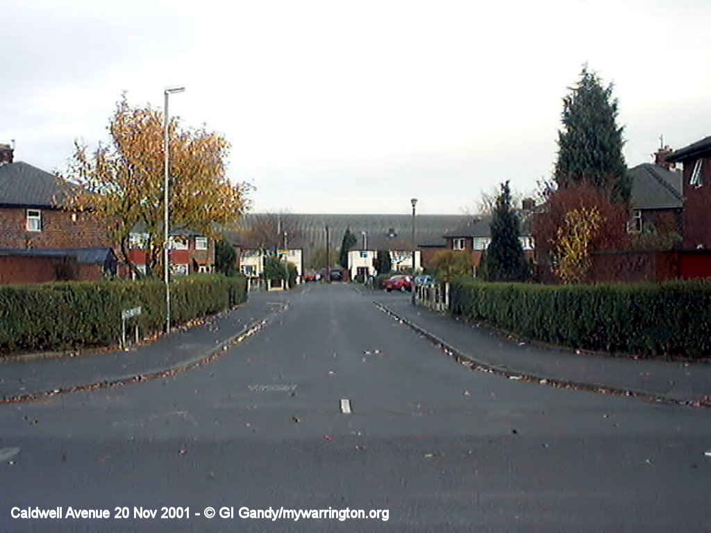
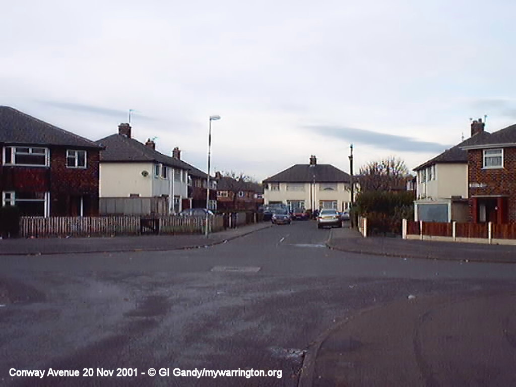
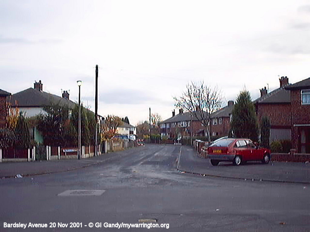
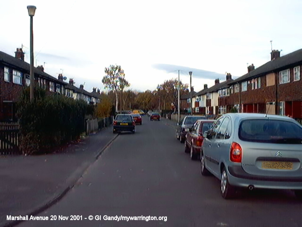
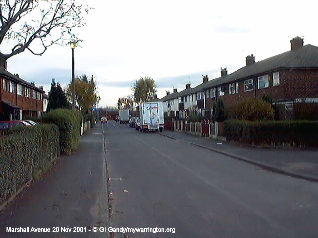
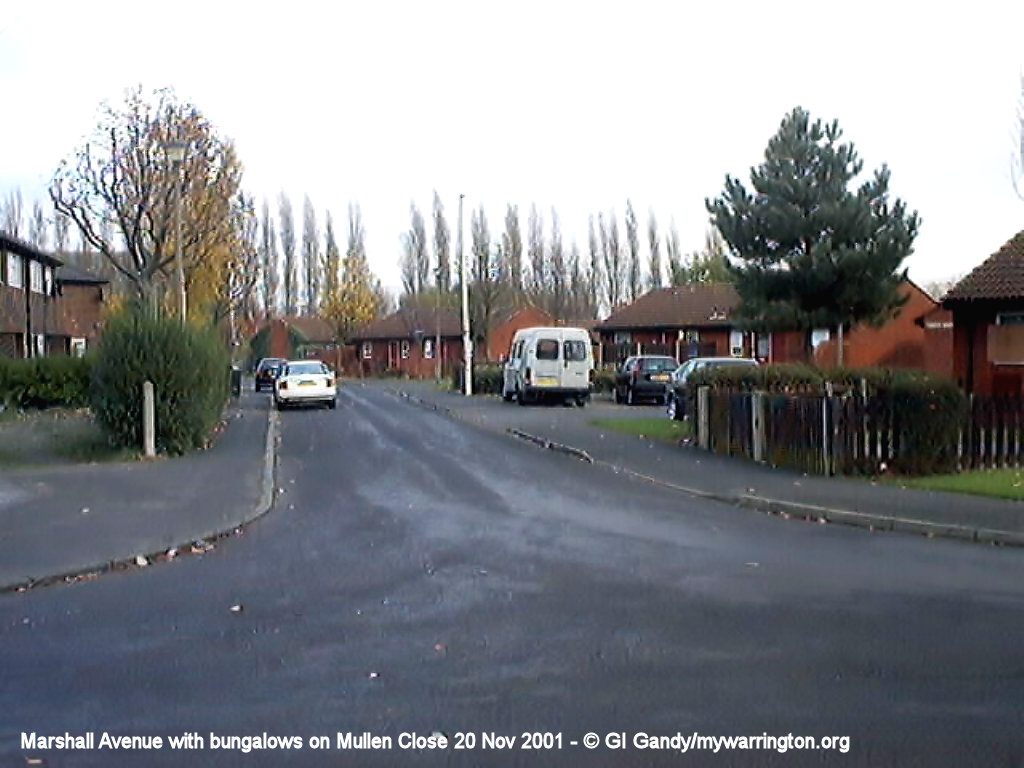
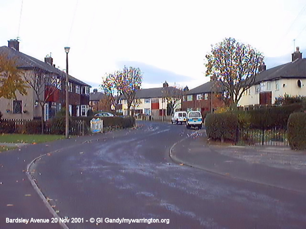
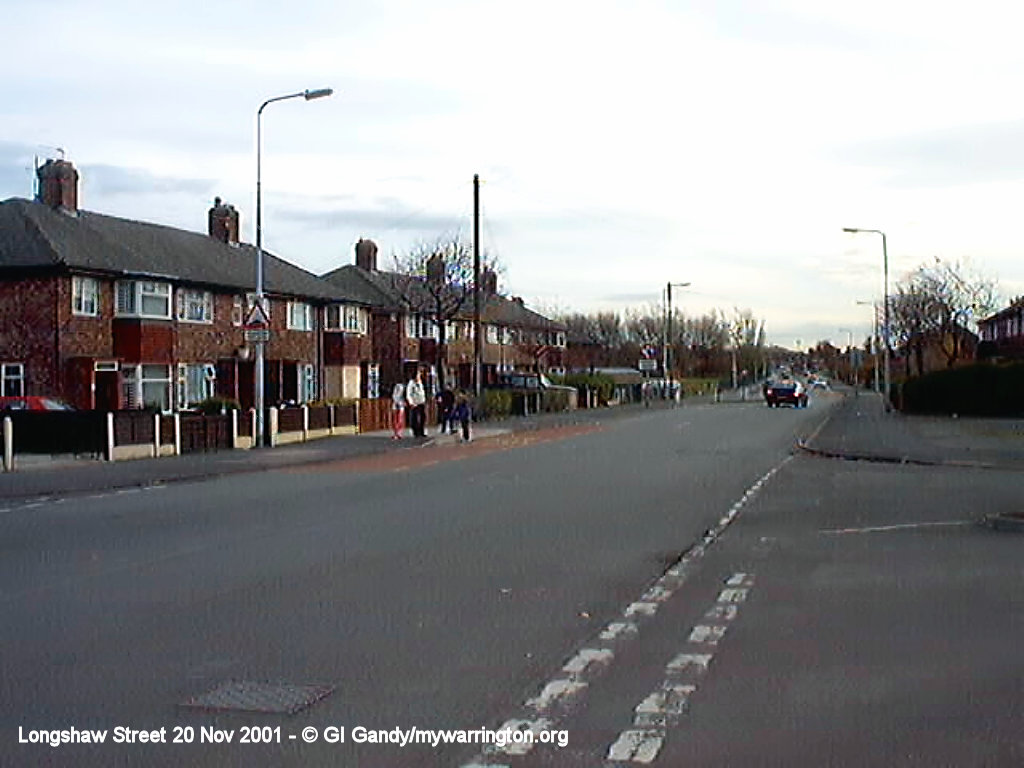
Walkabout
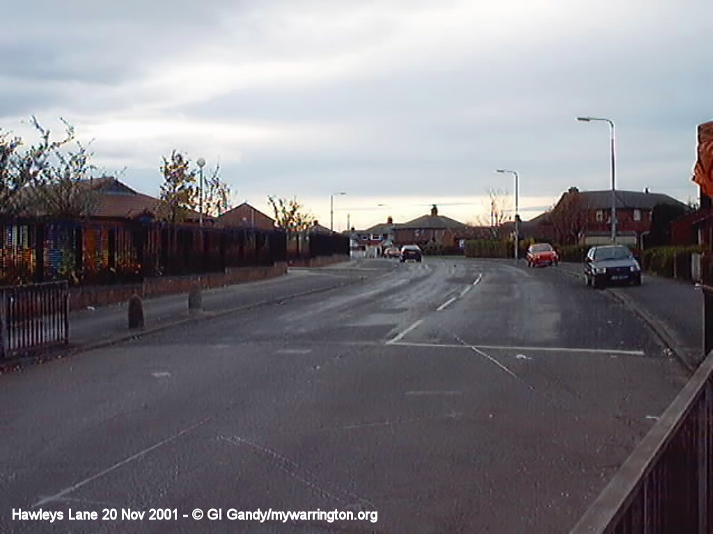
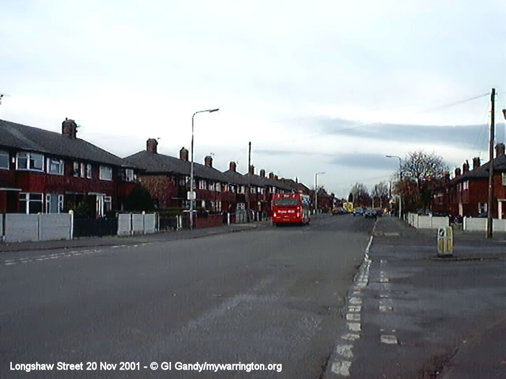
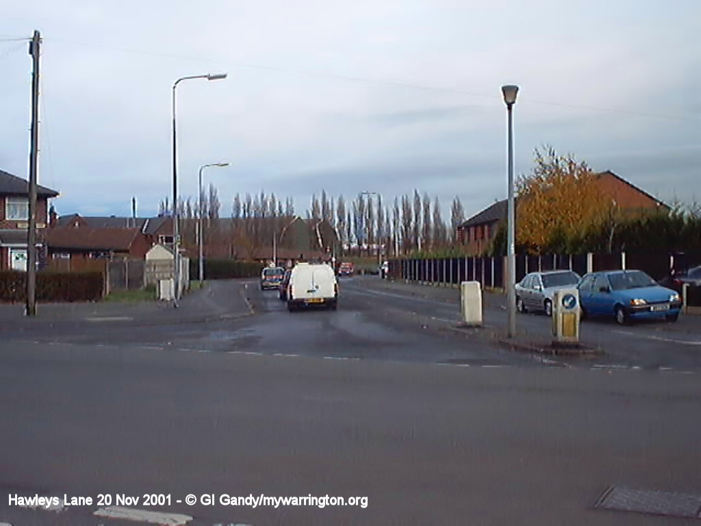
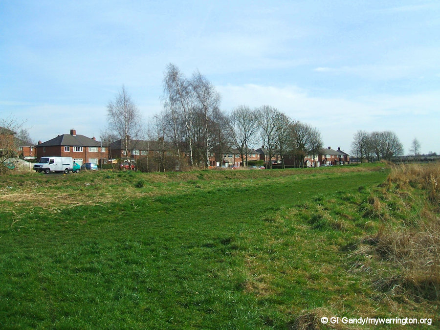
At this point I am introducing a gallery of scenes of the district from a walk I completed on 20 November 2001, with my very first digital camera (technology has moved on since then so apologies for the quality). Imagine walking from Bewsey and taking a circular route. Later we will see how parts of the district have changed with redevelopment.
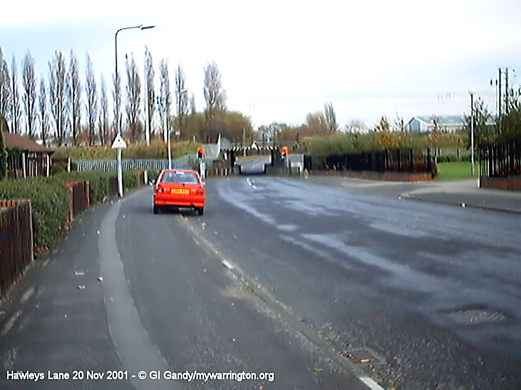
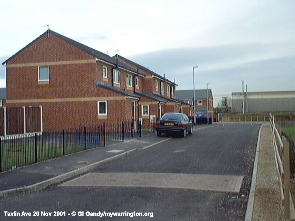

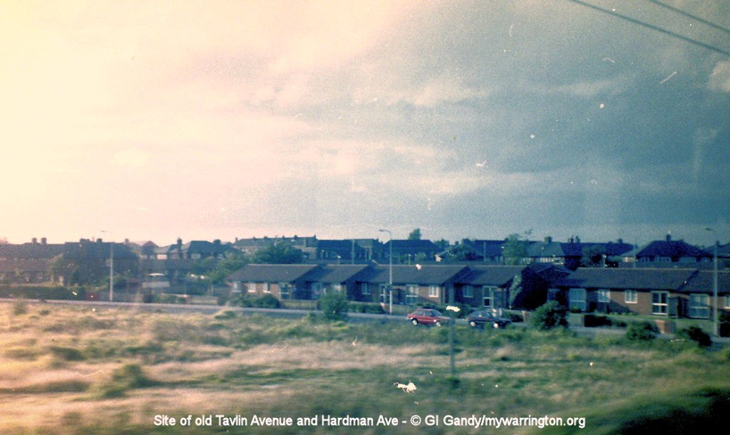
Tin Town
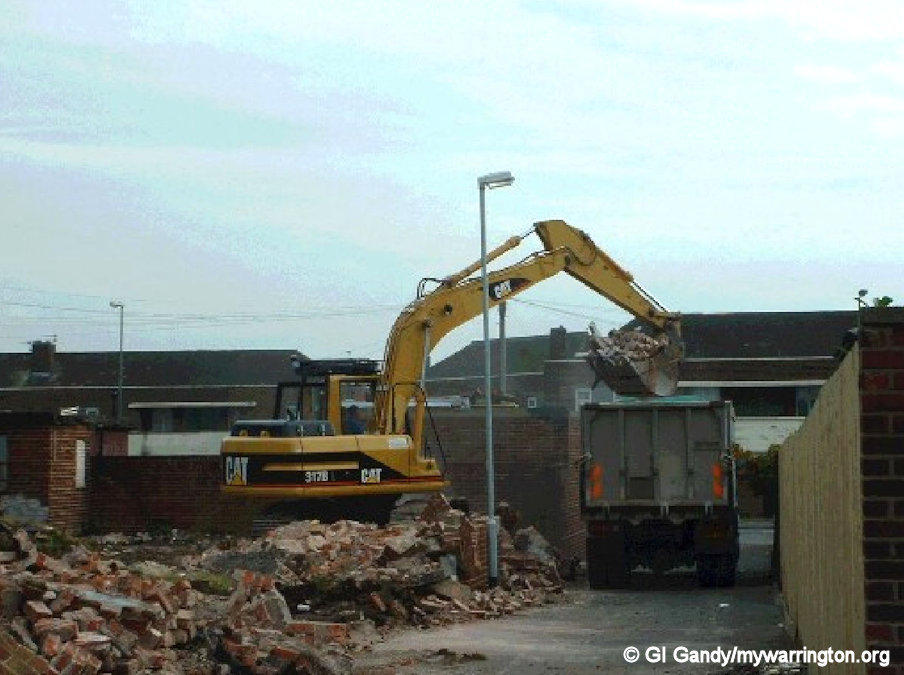
The following two images show the demolition and redevelopment of ‘Tin Town’. Older residents won’t forget ‘Tin Town’. Newer residents might not have heard of it. All shall now be revealed.

To assist with the aftermath of the bombing during the Second World War the council built temporary housing on Tavlin Avenue and Hardman Avenue, Hawleys Lane Bardsley Avenue and Marshall Avenue which have since been demolished.
It became known as “Tin Town” due to the nature of the buildings – metal sheeting and brick. This temporary housing was quite comfortable and lasted well into the 1980s but was the victim of flooding problems due to the low-lying land.
I was part of a mission one year when St Mark’s church served hot soup and meals to residents of Tavlin Avenue after the flooding cut off gas and electricity supplies. I remember one resident reporting bleary-eyed that he saw an inflatable boat passing his front door in the early hours of the morning and thought he was dreaming!
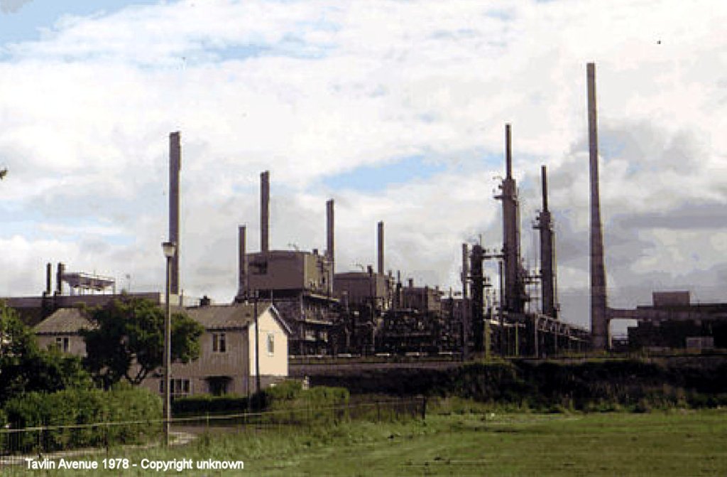
The photo shows two of the house with the gas works behind. I don’t know who the copyright owner is, so please contact me for a credit.
Flooding
Flooding has always been a problem in this part of Dallam, especially on Tavlin Avenue, Hardman Avenue and under Hawleys Lane bridge. The former ‘Tin Town’ houses were demolished towards the end of the 20th century and the land was left alone for a period of time.
In 2001, to assist with the national housing shortage, it was decided to build houses on the vacant land, but with a proviso that the ground was raised by about two metres (six feet) to give the residents a chance of protecting their properties if there was flooding in the future.
Questions have always been asked as to the cause of the flooding, including the historical lie of the land and how often the drains are cleaned out. One resident pointed out that further down Hawleys Lane past the railway bridge there is no flooding in Eddie Stobart’s yard because he has a large tree which soaks up water. One solution, which seemed to work in the beginning, was the construction of a new pumping station at Bewsey to take away excess water by pumping it into the Sankey Canal. But when that became a problem too some people put it down to that old chestnut called global warming.
Hawleys Lane Bridge flooded on 19 Jan 2008
2008
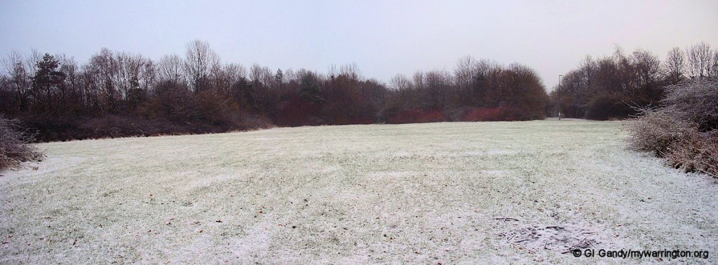
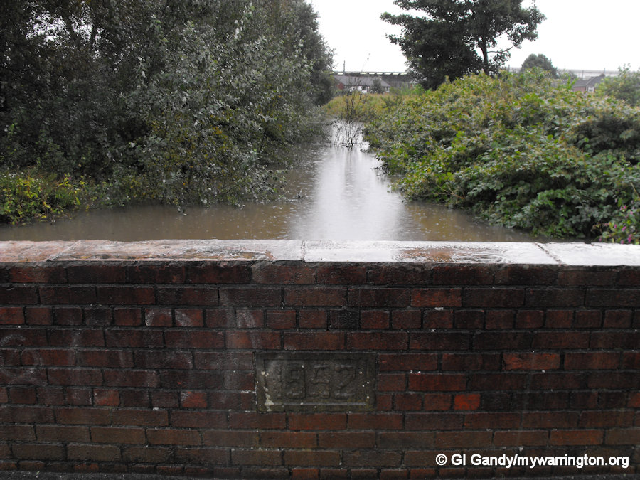
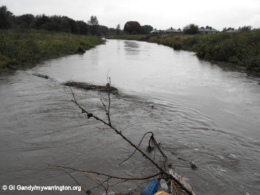
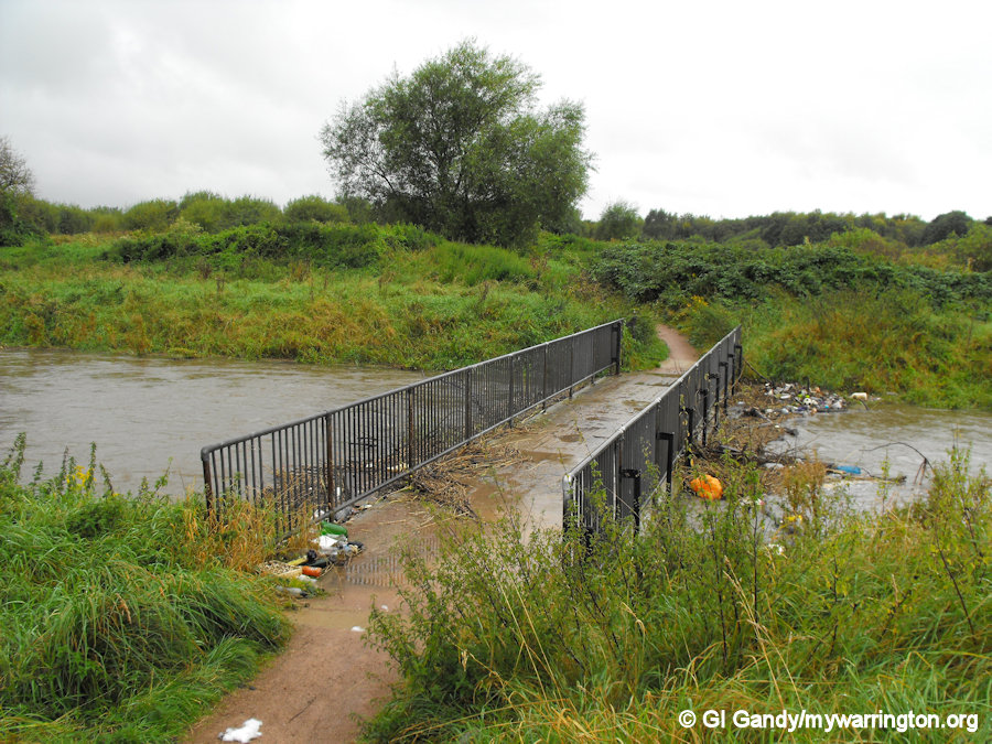
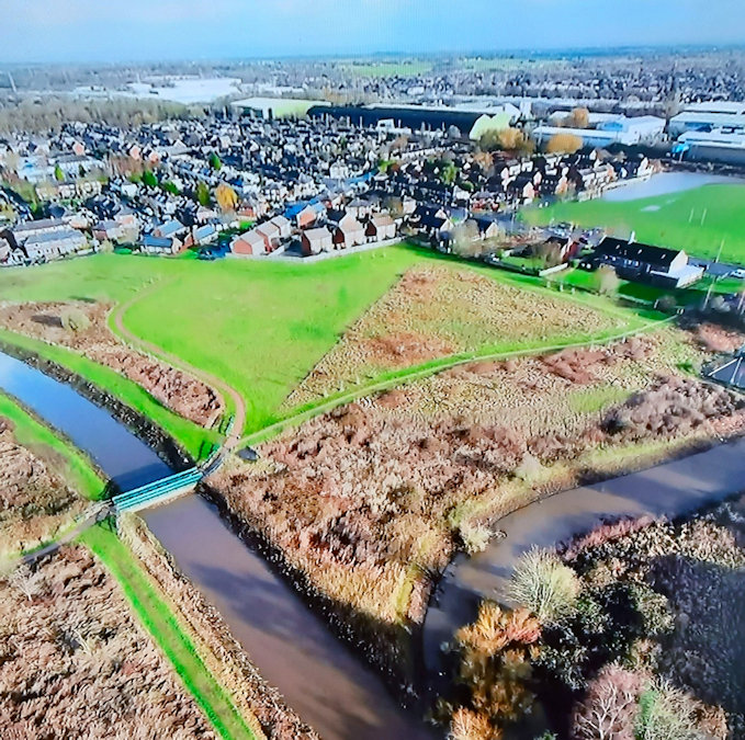
Another part of the district that is affected by flooding is the Sankey Canal between Dallam and Callands, as can be seen in the following images.
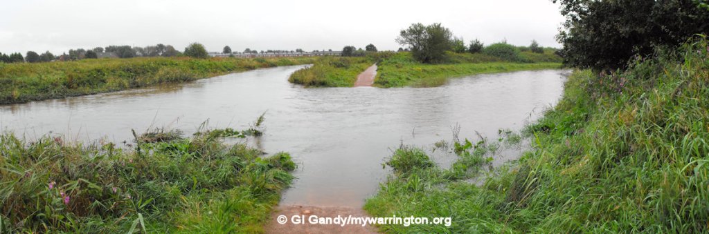
The first two photos, below, were taken on 19 January 2008. The third image is a combination of a photo taken on 19 January 2008 and the same scene on 16 March 2009 showing the water level in normal times. The Sankey Brook and Sankey Canal became one and the same in some areas between 1757 and 1963. On the Callands side we see where the Sankey Canal continued on to Widnes via Bewsey Lock, whilst the Sankey Brook continued south through to the Mersey at Penketh.
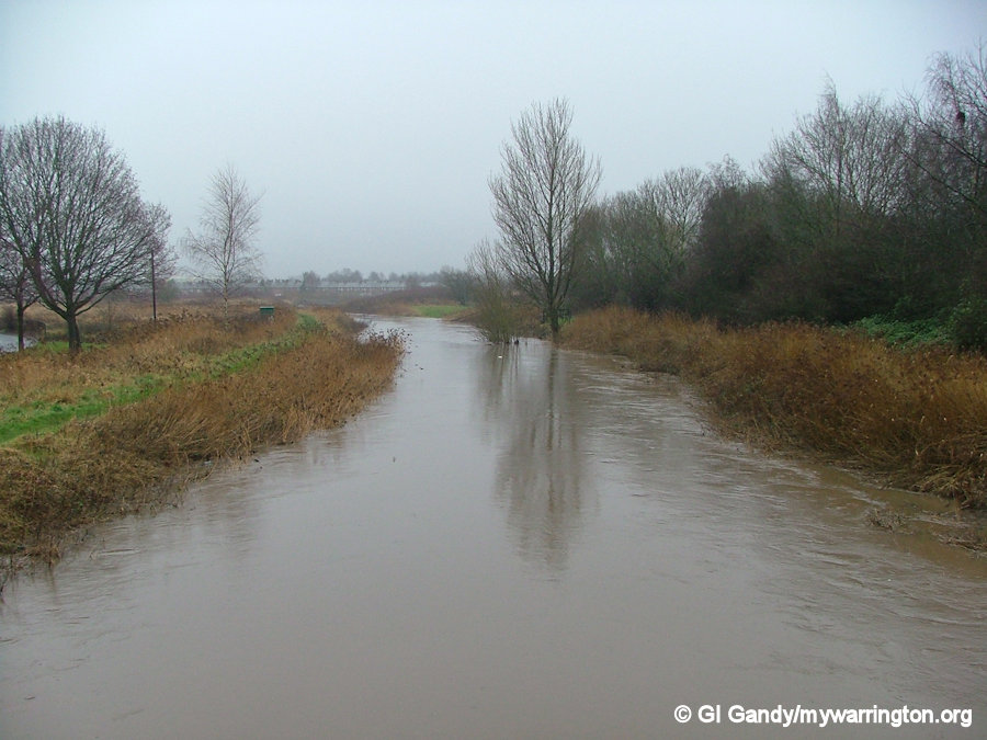
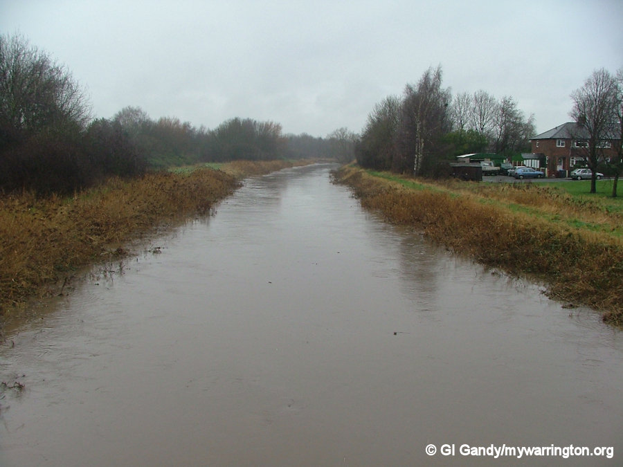
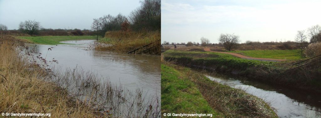
One interesting point about the third image: to prevent flooding of that area beyond the dip in the footpath, might it have been better to raise the footpath beyond the flooded area? It would seem logical to prevent that area flooding and to allow the water to continue into the Sankey Brook at Bewsey. However, there are homes and allotments further down that route, whereas the overspill area has no dwellings and is normally dry between this point and Bewsey Lock. I guess that’s why it was designed like that when they created Bewsey Meadow and the footpath from Callands to link to it. It just means you can’t get to Bewsey Meadows from Callands when it floods without going round to the west.
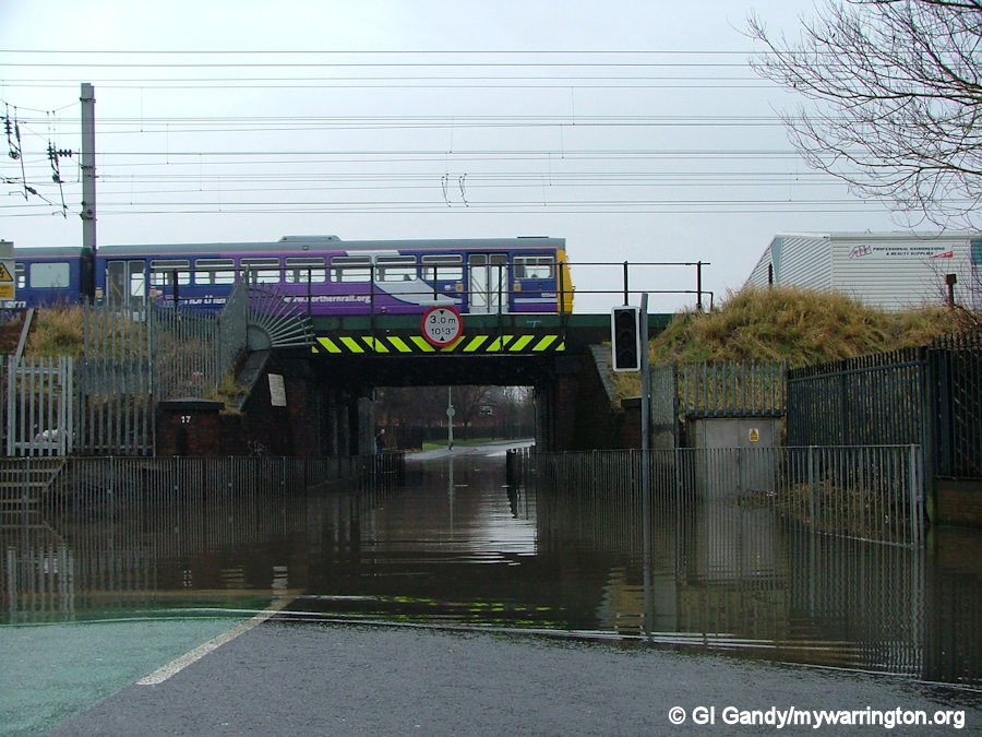
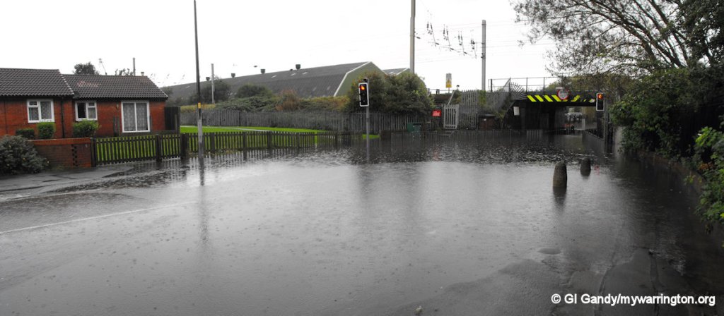
The fourth image is our old friend Hawleys Lane bridge. I say that light-heartedly, but there was a serious point about the bridge being flooded. There have been instances where students attending Winwick Road college or Beamont High School have climbed over the fence to cross over the railway to save them going all the way round. mywarrington would definitely not recommend that practice. Thankfully there were no injuries that I am aware of and the railway company later improved the fencing on both sides of the bridge.
2010
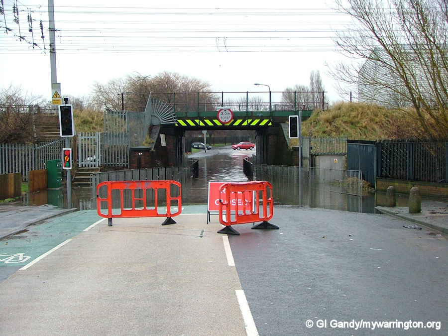
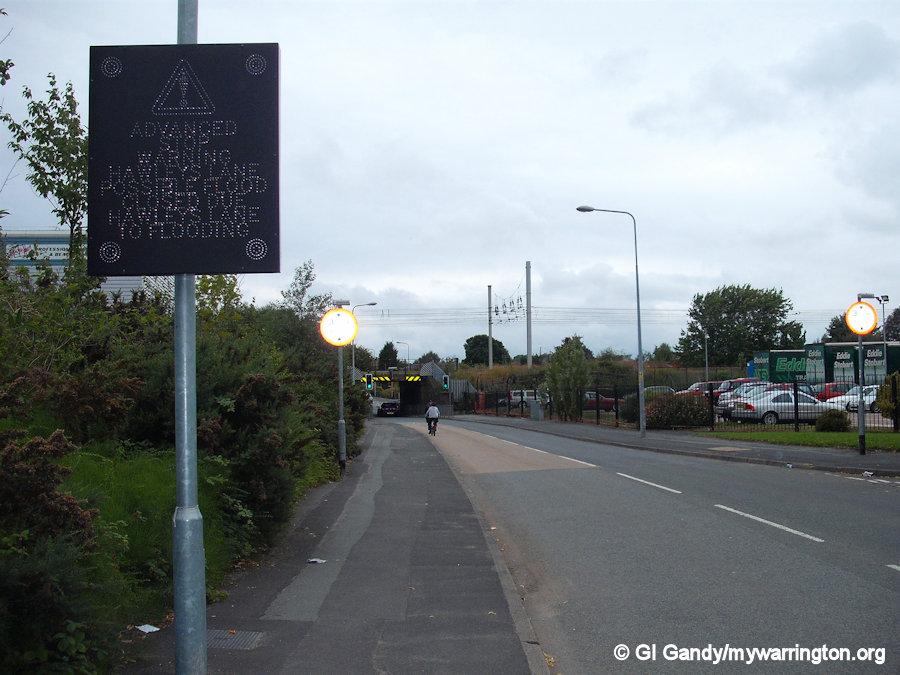
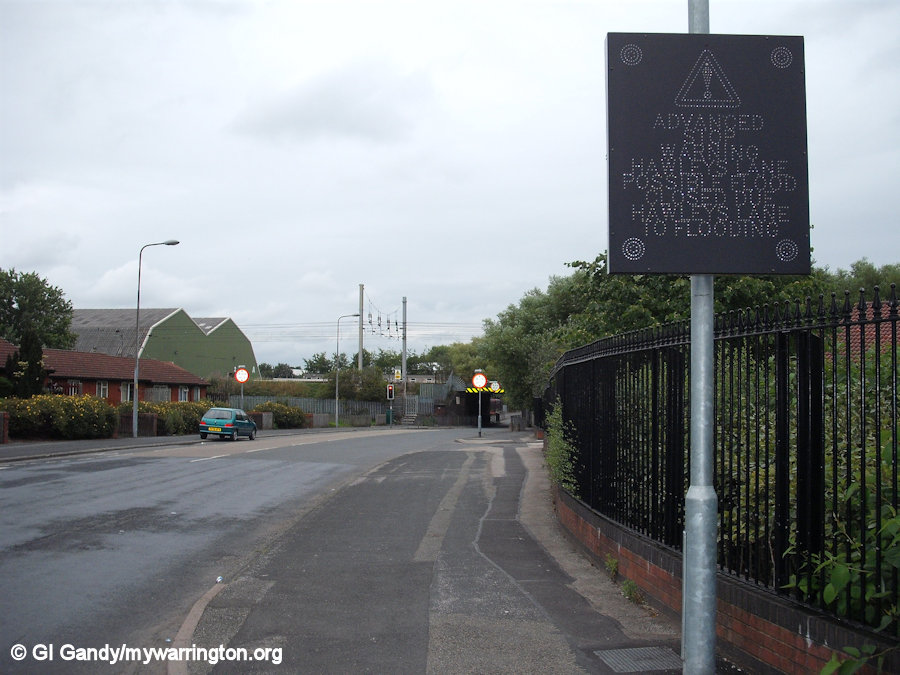
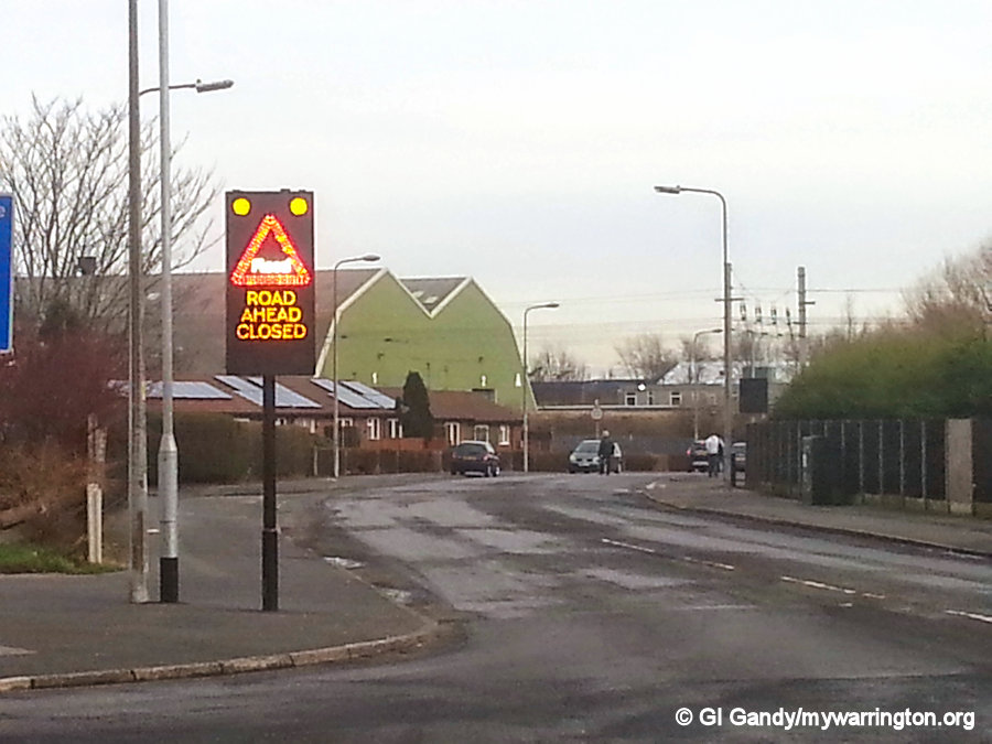
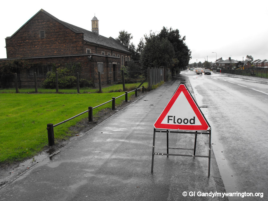
To assist vehicle owners who regularly used Hawleys Lane as part of the their journey, electronic road signs were erected to warn drivers that there was a flooding problem on Hawleys Lane (first and second images). The issue was, drivers only found out about it when they were on top of it, resulting in a reversal and redirection via Longshaw Street, Folly Lane, Kerfoot Street and Winwick Road or vice-versa. Eventually the signs were moved to the southern end of Longshaw Street and the eastern end of Hawleys Lane to give drivers fair warning. Five years later we see a ‘road closed’ sign on Hawleys Lane itself (third image).
2012
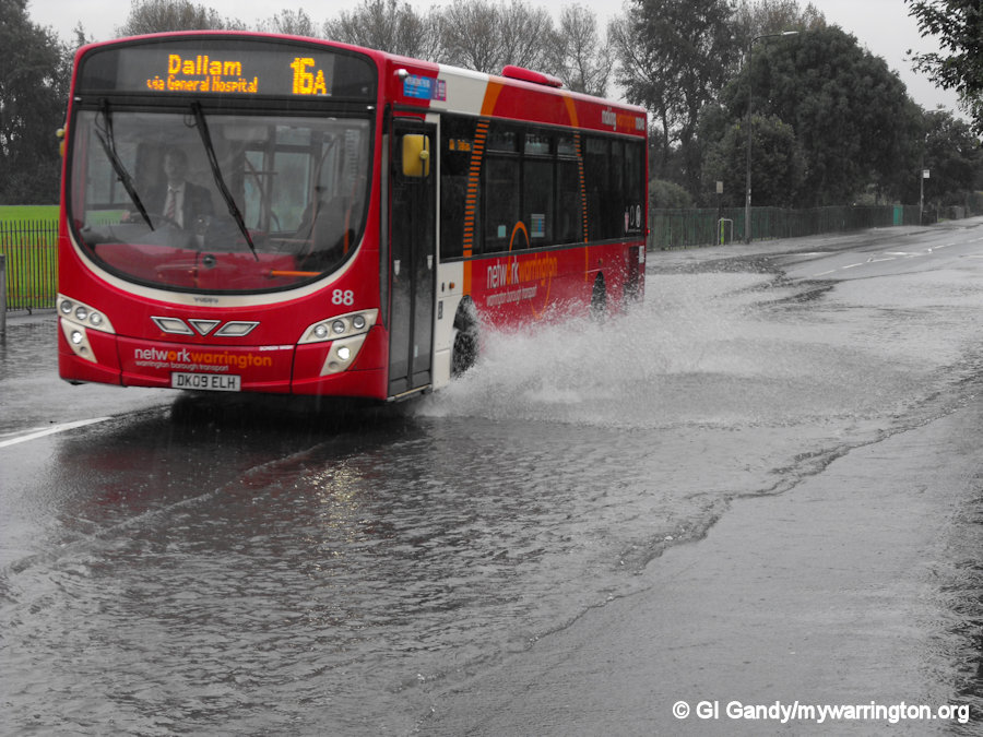
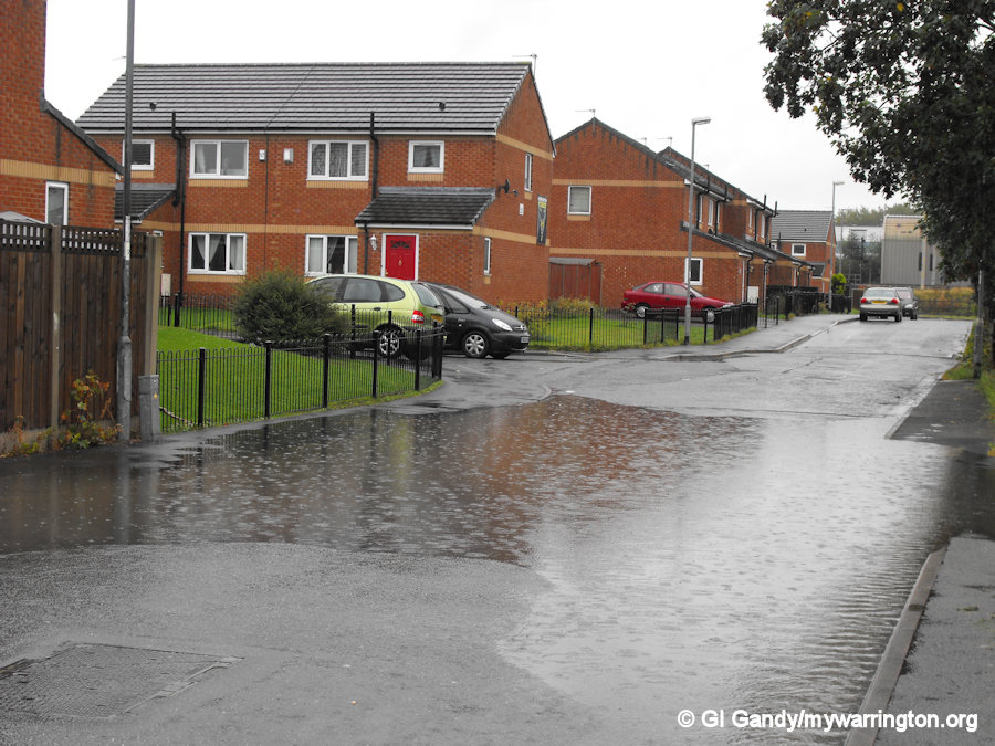
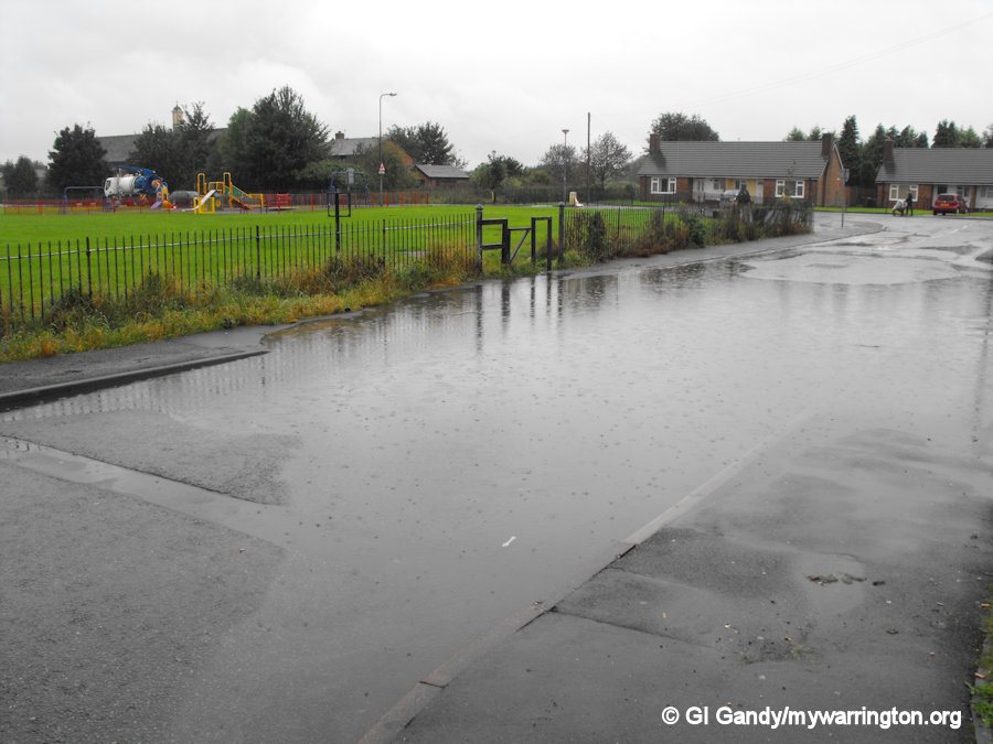
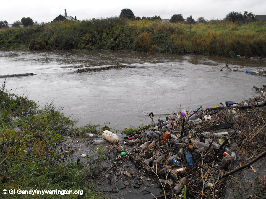
In the 2010 flooding, not only were the Hawleys Lane/Tavlin Avenue and Sankey Canal areas affected, but Longshaw Stret by St Mark’s Church too. We can see the effect in the following photos, including environmental issues with the rubbish in the Sankey Brook being washed up at the bridge near Bewsey Meadows. Shame on the people who throw their waste into our waterways. The photos were taken on 25 September 2012.
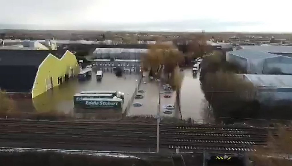
2021 – Storm Christoph
The most devastating flooding for residents of Dallam in 70 years.
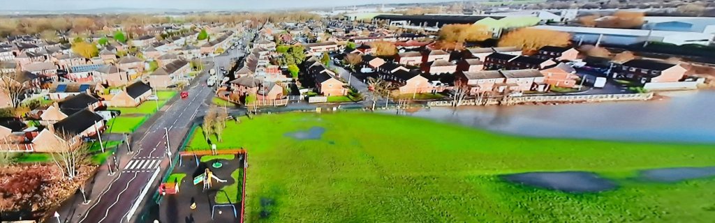
Storm Christoph brought strong winds, heavy rain and snow to the UK between 19 and 21 January 2021. The most intense rainfall occurred over north Wales and northern England, bringing localised flooding to many areas. The Environment Agency (EA) and Natural Resources Wales (NRW) issued flood warnings across much of the two countries including severe flooding warnings on the River Mersey, River Bollin and the English and Welsh River Dee. Approximately 3,000 people were evacuated from their homes.
In Warrington, the Sankey Brook peaked at 5.9m at 4:45pm on 20 January, causing flooding in Dallam, Bewsey and Sankey Bridge, inundating 200 properties. Nearby, the water level on the River Weaver at Northwich peaked at 3.57m at 10:45am on 21 January.
Warrington-Worldwide reported on 21 January 2021 (including links to Adrian Thompson’s drone footage) as follows:
Longshaw Street and Hawleys Lane remains closed to traffic in both directions.
A number of flood warnings remain in place and anyone affected by the warnings is urged to keep up-to-date with the latest news on the Environment Agency website.
Residents are also reminded not to drive or walk through any flood water – this is often deeper than it looks, it may be moving fast and there could be hidden hazards underneath such as raised manhole covers, which can pose a danger.
In total, 80 people from Dallam were evacuated.
Anyone concerned about potential flooding at any time should sign up for free flood warnings on the Environment Agency’s website, follow them on Twitter @EnvAgencyNW for the latest information or you can call the Flood Line on 0345 988 1188.
- Unfortunately, the residents were affected again on 1 January 2025. Not just Dallam, but Bewsey, Callands, Burtonwood, Penketh and parts of south Warrington too. The Bridgewater Canal burst its banks at Little Bollington just outside the Warrington district.
Dallam Community Primary School
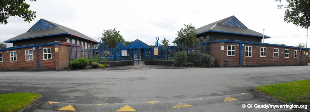
The school was built in 1952 along with the houses of the new estate. Some of the houses were built before the school construction. The school has received excellent Ofsted ratings in recent years and the staff and pupils work really hard to make school life a success. One important aspect of the work is the breakfast club, which ensures pupils who need it get off to a great start each day. See their website for the latest information.
I attended the school for the last two years of my primary school teaching, having moved into the area in 1972 when our old house was demolished and we then had all mod cons like TWO inside toilets, one in the bathroom. I loved school (as you will read in The Bewsian) and I can remember some things from those days as a nine to 11-year-old there.
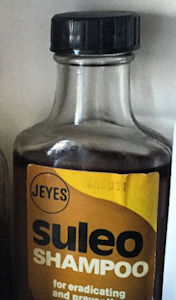
I remember ‘Nitty Nora the Bug Explorer’ coming round and if she found any nits you got that letter to take home for you mum to get a bottle of the dreaded Suleo shampoo.
I bet you’re scratching your heads already!
It wasn’t the shampoo as such, although that was bad enough. No, it was the knowledge that your classmates knew you had nits, or chids as we called them!
After my treatment for them I was in class and one must have stayed hidden somewhere and it fell out on the desk, so Alan Donoghue, a classmate, who is sadly no longer with us, said ‘look, a chid’, and killed it with his finger nail on the desk.
You all remember the crack sound as they died, don’t you?
Alan and his family lived in one of the ‘Tin Town’ houses, in the photo of the gas works seen earlier in this page, before they were demolished.
In fact, it was Alan who taught me how to play matchbox rugby that I mention in Childhood Memories.
The nit nurse’s friend…
a bottle of Suleo shampoo.
One of my memories of playtime (we didn’t call it break time in those days) was the boys who played football in the schoolyard. It didn’t matter who was there, they took over the whole space for their football practice and if you got in the way, hard luck. I always remember a classmate called Graham who was so good that we called him Pele. He could have gone on to play the game professionally in my opinion but became a good motor mechanic instead. If you’re reading this Graham, hi there!
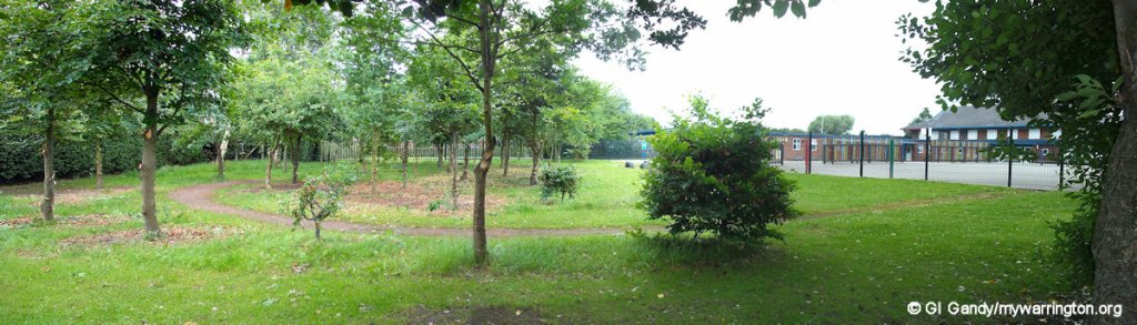
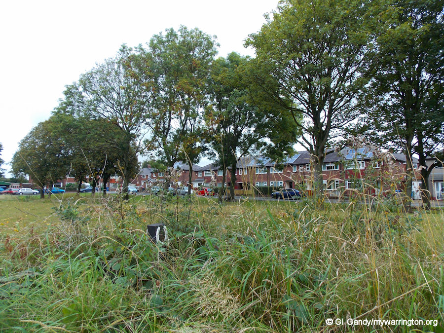
One of the touches in the school’s curriculum is teaching about nature. This is highlighted here in the children’s own nature park in the school grounds taken on 29 June 2012.
My second memory of playtime was when the teachers came out just before the end of break to take us back into class. They would line everybody up in their respective classes and if you were quick you stood at the front of the line. Why?
Because to get the right amount of space between you, you had to stretch out both your arms and rest them on the shoulders of the person in front.
The teachers wouldn’t let anyone move until everybody in every class was lined up perfectly. It could be quite a strain on a young nine year old to keep their arms horizontal for what seemed like a lifetime. That’s why you wanted to be at the front of the line because you could leave your arms down.
The school seen from Hodgkinson Ave on 4 Apr 2013
In my time, there was a very long corridor occupying the centre of the school building. It stretched from the infants, through the juniors and finished at the dining room at the other end. It seemed like a mile long as a kid, but in reality was around 300 yards. If you were in the juniors you had no reason whatsoever to walk into the infants area, so if you got caught you were told off.
Another memory was during the last few weeks leading up to the summer holidays. It was a very hot day (not 1976 as I was already in senior school by then) and while the teacher was out of the room one pupil (who shall remain nameless) decided to use a magnifying glass to burn a hole in the wooden desk with the hot sun. It was only a small hole, but the burning wood didn’t half pong! Smoke was rising from the desk. The kid didn’t half get a telling off from the teacher who had to open all the windows so he could get on with teaching the lesson. But then the flies came in. It was like that scene from Carry on Abroad!
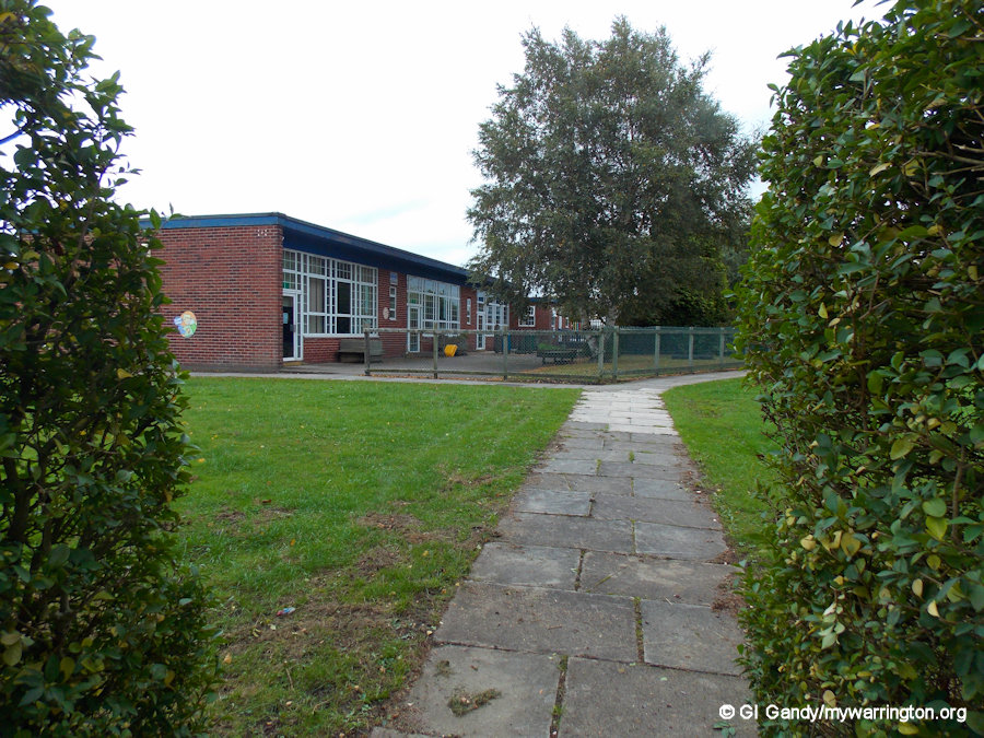
The school on 23 Jun 2012
I always remember end of term when you could bring your own games in or use what was in the teacher’s cupboard. One of the most popular items in that cupboard was a jigsaw puzzle showing all the counties of the UK. Quite a moment really because many of the county boundaries were changed in 1974 to accommodate the new administration areas brought in by the government.
And who can forget ‘Pop Shaw’? Mr Shaw was one of the teachers in my day and didn’t like chatter while he was writing things on the blackboard. If he had his back to you and you spoke out of turn he would turn round and throw the board duster at you. He never missed and he always got the right person. Never me of course. Talk about having eyes in the back of your head. Of course, those reactions are not allowed today.
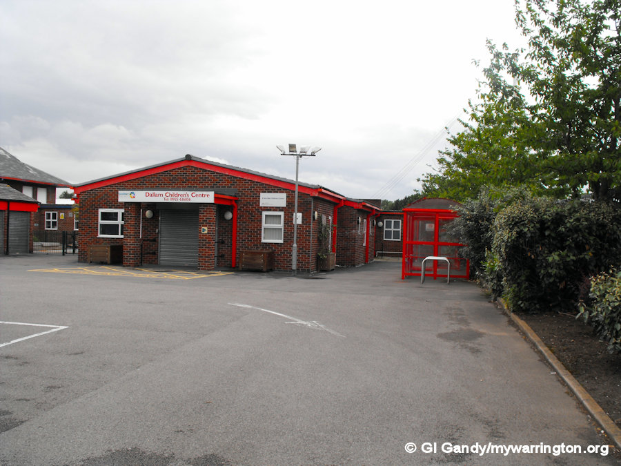
The Children’s Centre on 23 Jun 2012
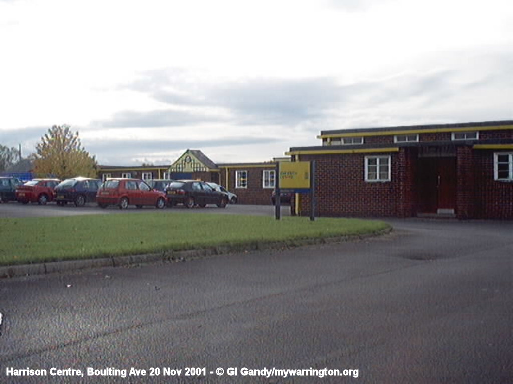
In the late-20th century the school building was split into three sections: the southern section remained as a primary school and the middle section became a Sure Start children’s centre. The northern section, which originally included the dining rooms, was redeveloped into the Harrison Centre, an adult learner’s centre. The Harrison Centre was demolished in 2017.
Church Life
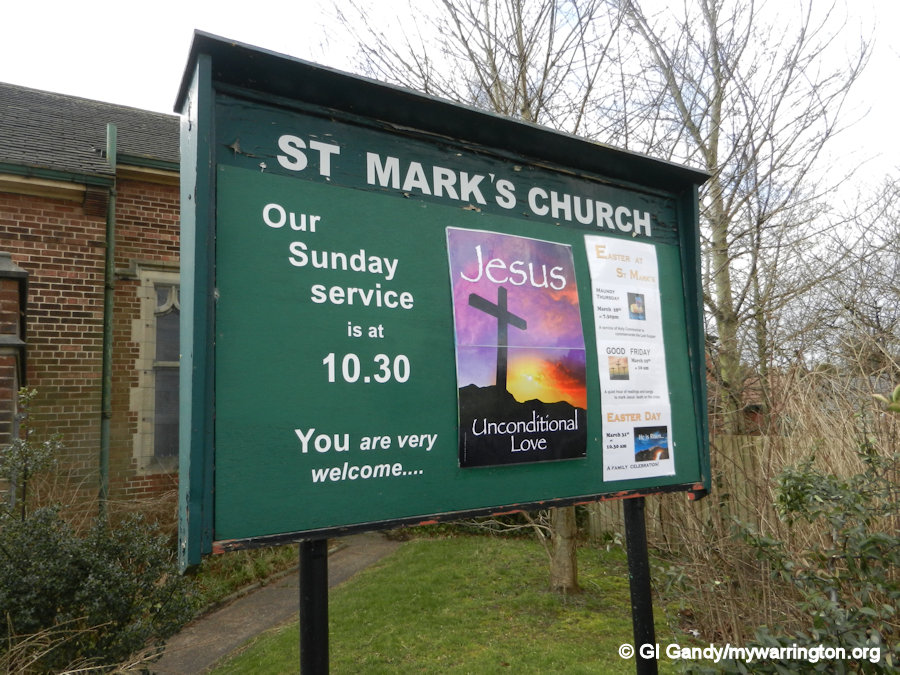
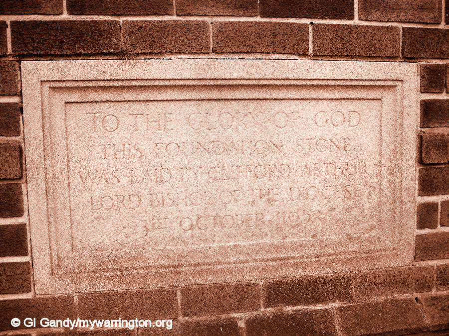
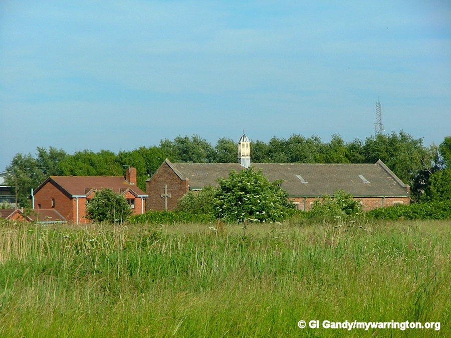
Two churches were opened in the 1950s: St Mark’s Church of England opened on Longshaw Street on 9 September 1954 and St Anselm’s Roman Catholic opened on 12 June 1956 on Hawleys Lane.
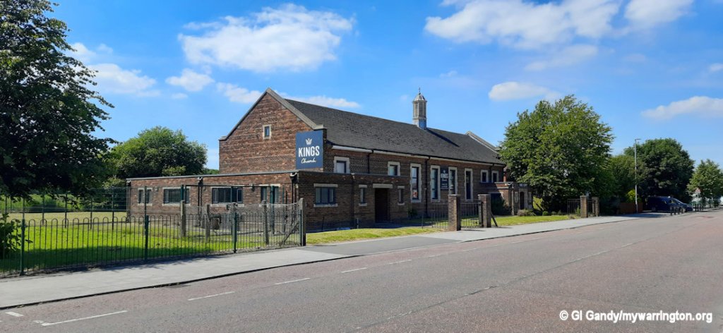
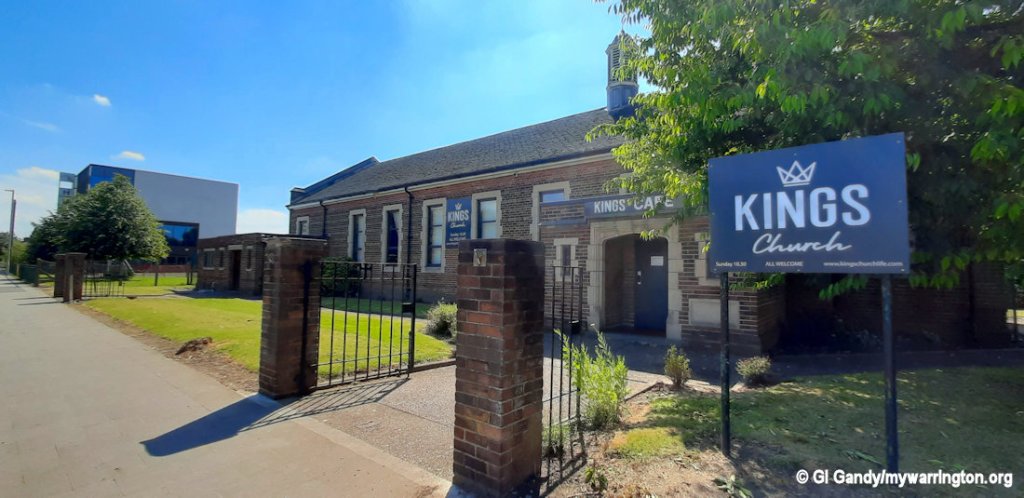
The foundation stone for St Mark’s is dated 31 October 1953, but the church held its services in Dallam Primary School until the church building was ready. After the retirement of Rev Marshall in 2017 the Church of England leased the building to the Oasis fellowship and it became known as St Mark’s Oasis Warrington. It has since been known as Urban church and is currently part of King’s Church. You might find this website useful for information about earlier times of the church.
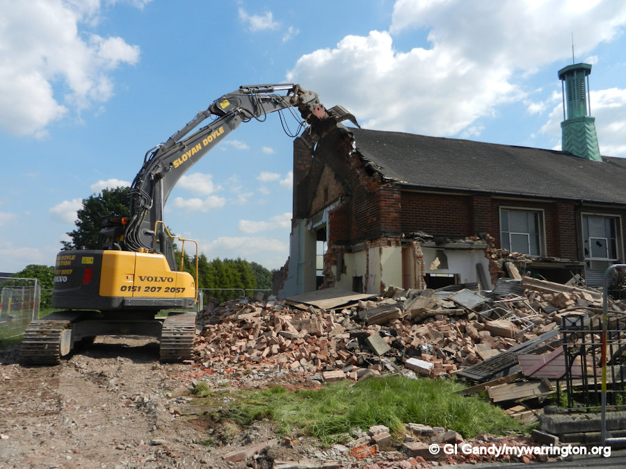
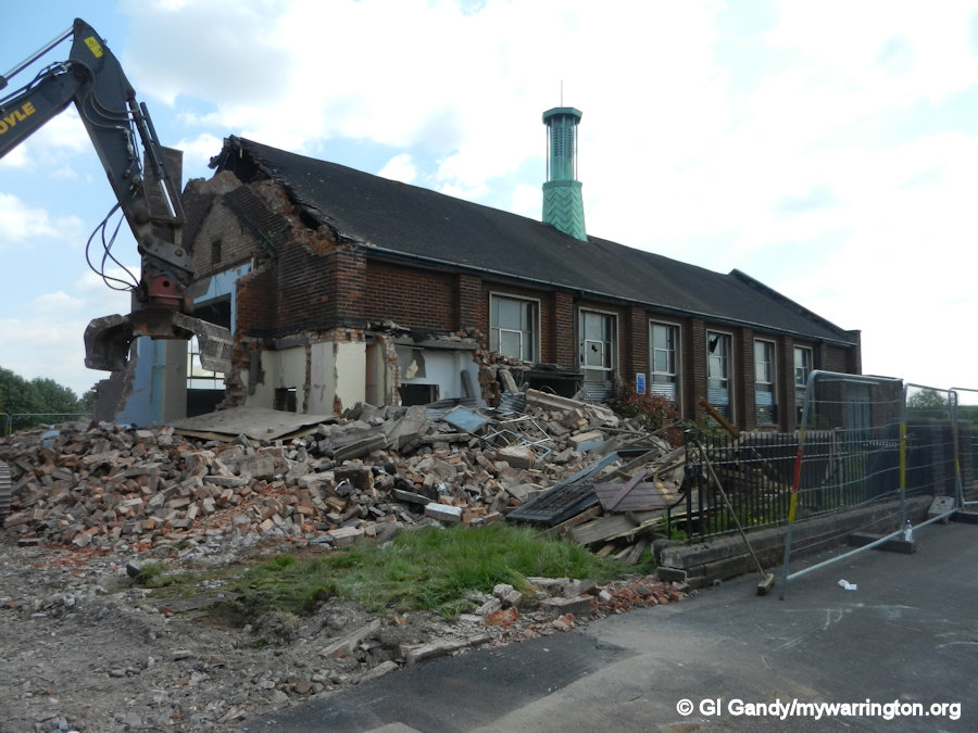
The priest of St Anselm’s also officiated at Sacred Heart church on Bewsey Street, with services from St Anselm’s eventually transferring to Sacred Heart and the Dallam building was given over to community use until it was demolished in June 2013. New houses now occupy the site known as as St Anselm’s Place.
St Mark’s
According to William Lane (1974), an “unbroken tradition” identifies Mark the Evangelist with John Mark, and John Mark as the cousin of Barnabas.
However, Hippolytus of Rome, in On the Seventy Apostles, distinguishes Mark the Evangelist (2 Timothy 4:11), John Mark (Acts 12:12, 25; 13:5, 13; 15:37), and Mark the cousin of Barnabas (Colossians 4:10; Philemon 1:24). According to Hippolytus, they all belonged to the “Seventy Disciples” who were sent out by Jesus to spread the gospel (Luke 10:1ff.) in Judea.
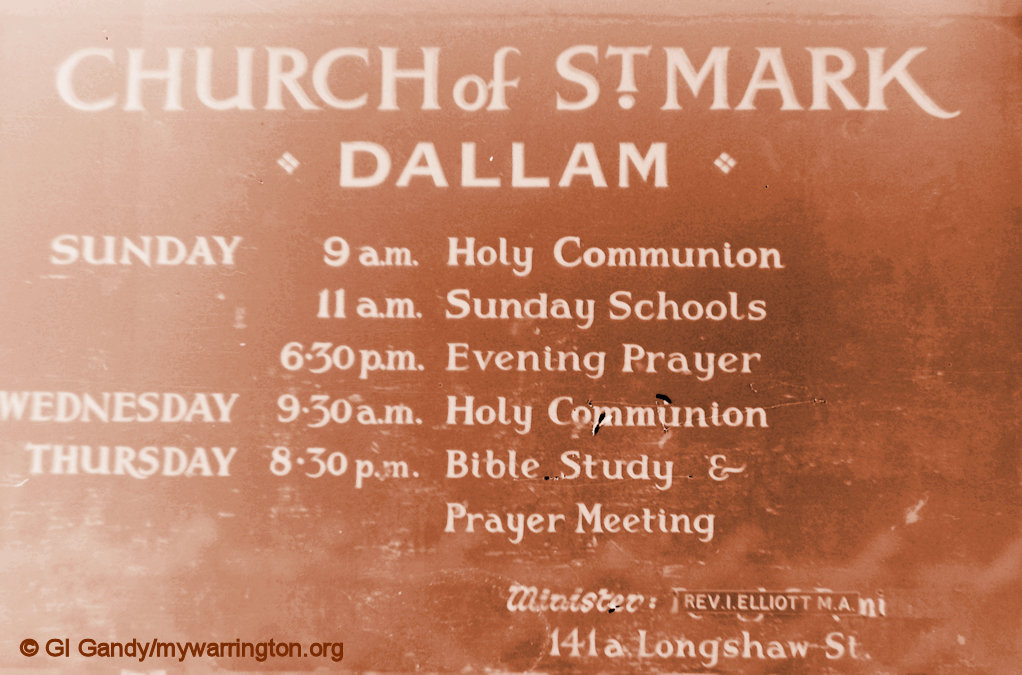
The vicar in charge in 1974 at St Mark’s in Dallam once told me the name St Mark’s was chosen because of the close workings of Barnabas and Paul, the two other Church of England churches close by on Lovely Lane Whitecross and Bewsey Road respectively.
St Mark’s on 12 Aug 2002
I joined St Mark’s church after I was given a Gideon New Testament in my first year of senior school in 1974 and I stayed as part of the youth group and adult group until around 1987. We found out later that the vicar and me both started at St Mark’s on the same Sunday but I cannot remember the exact date, but it was in the autumn.
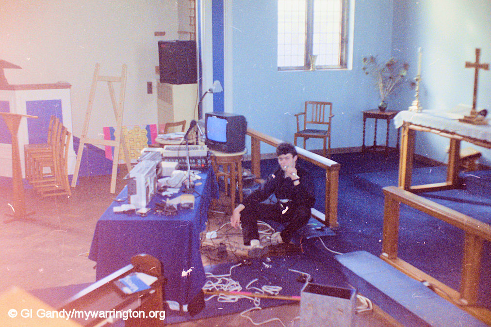
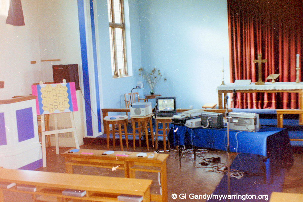
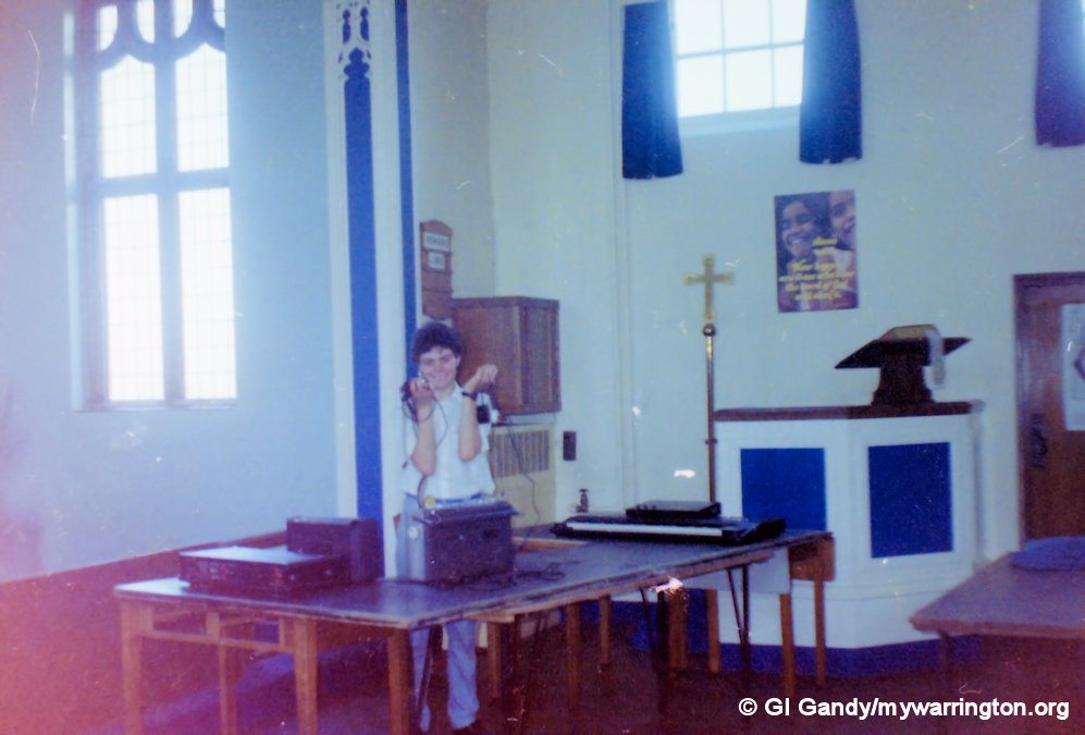
Two of my CSE subjects were Religious Education (RE) and Photography (for which I got Grade 1 in both). They both complemented each other as part of my schoolwork because for our RE exams we had to create a project with a religious connection so I chose the history of the church of St Mark and used my photography skills to take some photos inside the church building.
One of the funniest things about life there was when the kids in the community thought they were insulting us by calling us ‘God Squad’. We soon wiped the smile of their faces when we said we liked name and might get it made into t-shirts.
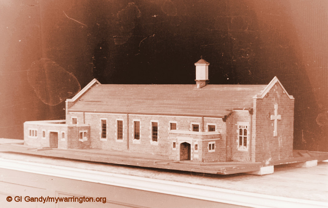
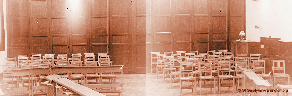
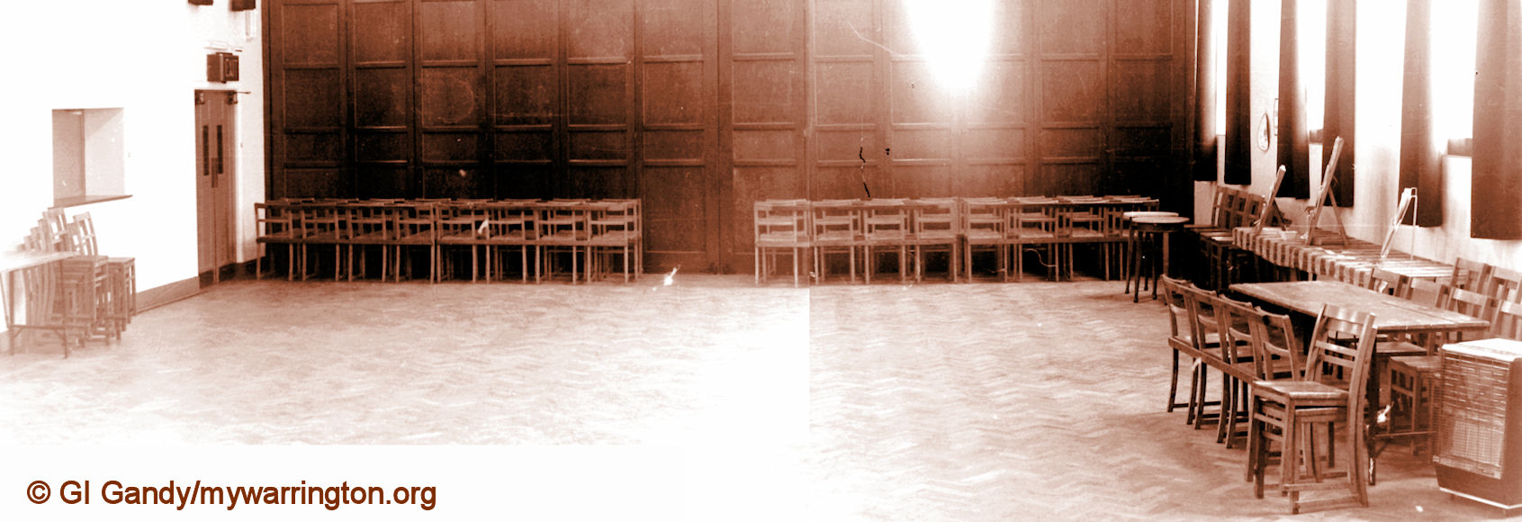
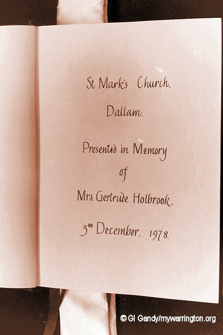
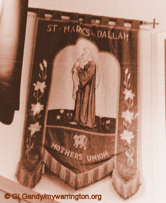
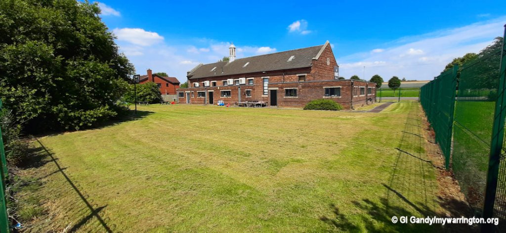
Here are some of the photos from my CSE project. The negatives have seen better days over the past 45 years. The first photo is of a model of the building created by church warden Mal Robertson, a carpenter by trade. The two widescreen shots are in fact two normal photos joined together. The photo of the waste land at the back of the church was once occupied by a large wooden hut where games and functions took place. However, health and safety, as it wasn’t called in those days, decided the hut had seen better days and it was demolished. I can’t remember what year, but I definitely used it from sometime in the late 1970s or early 1980s.

The last vicar, Rev Marshall, retired in 2017. The Church of England didn’t appoint a new vicar. Instead they leased the building to a community church and the former vicarage that stood next to the church was sold to a private buyer.
This wasn’t the first vicarage, however. The first one still stands behind the bus stop near the shop and chemist, again owned by a private occupier.
The second vicarage came about because the vicar and his wife thought it was a long trek down Longshaw Street to the church. Planning permission was granted for a new building and the vicar picked up his bed and walked to his new home. One of the things I did to entertain the youth group was to create my version of the TV game Blockbusters. With permission from Central TV we had loads of fun with it and linked with other youth groups.
A couple more memories.
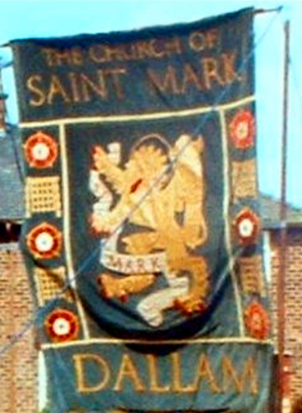
The banner, left, was about 10ft by 6ft and was mounted on wheels for the annual Warrington Walking Day and Parish Walks. The Parish Walk was an annual custom whereby the church walked around the estates in the church’s catchment area of Dallam and Bewsey on the second Sunday after Walking Day. The walk alternated between Dallam one year and Bewsey the next, with an open-air church service at the end if it was dry. If not, inside the church.
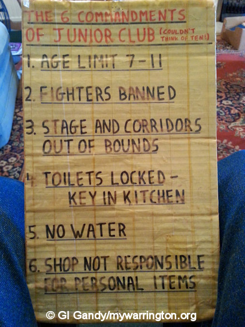
My Six Commandments poster title was a bit of a joke between me and the seven-to-eleven-year-old Junior Club members when we started play activates on a Tuesday evening. The ‘no water’ one meant they had to drink their water at the counter rather than carrying it across the floor and spilling it. At least, I think that’s the reason. It might not even have been my rule.
The poster I don’t have is the one where I had the word WEVVER written on it. I told the kids that was the worst spell of weather we’ve had for ages. Lead balloons came to mind…
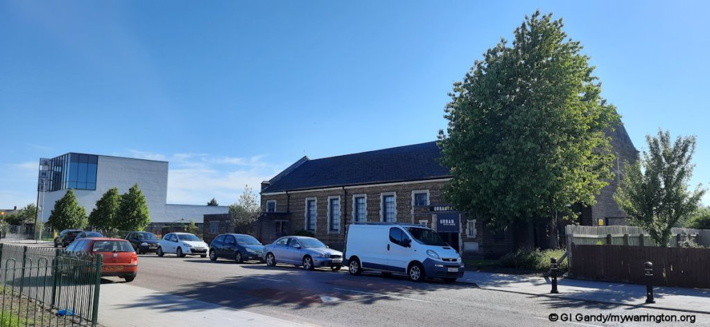
Here are some photos of the church building from June 2024. The building is now occupied by King’s Church fellowship. They run a café there from Tuesday to Saturday between 10.30 am and 2.30pm (at the time of writing) if you fancy a break. You can see the area behind the building where the hut used to stand has now been turned into a play area.
St Anselm’s
Anselm of Canterbury OSB (1033/4–1109), also called Anselm of Aosta (French: Anselme d’Aoste, Italian: Anselmo d’Aosta) after his birthplace and Anselm of Bec (French: Anselme du Bec) after his monastery, was an Italian Benedictine monk, abbot, philosopher, and theologian of the Catholic Church, who held the office of Archbishop of Canterbury from 1093 to 1109.
After his death, he was canonized as a saint; his feast day is 21 April. He was proclaimed a Doctor of the Church by a papal bull of Pope Clement XI in 1720.
At the age of fifteen, Anselm felt the call to enter a monastery but, failing to obtain his father’s consent, he was refused by the abbot. The illness he then suffered has been considered by some a psychosomatic effect of his disappointment, but upon his recovery he gave up his studies and for a time lived a carefree life. Wikipedia gives a more detailed account of his life and work if you are interested.
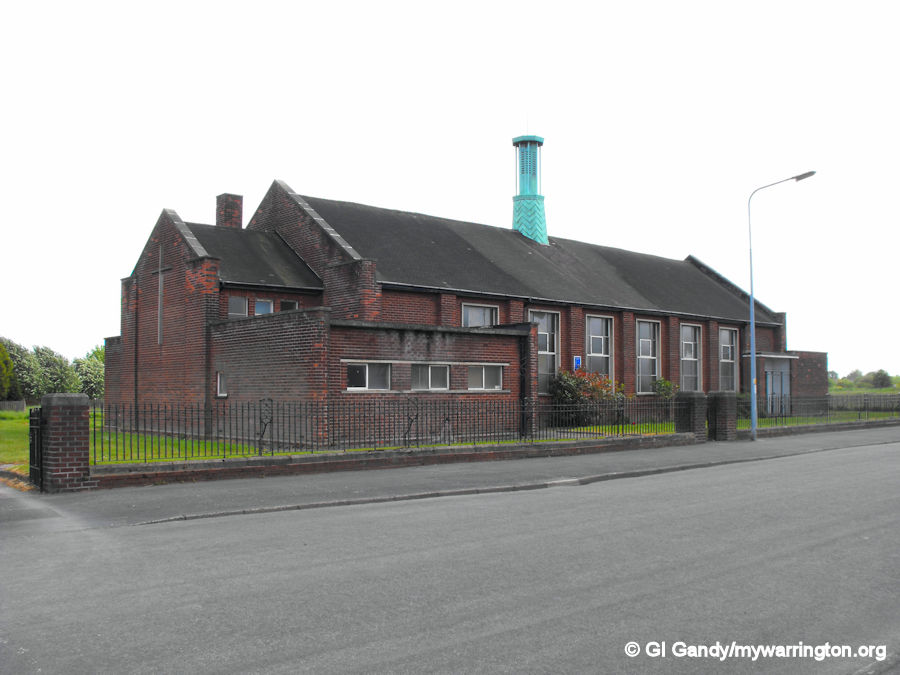


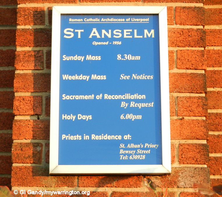
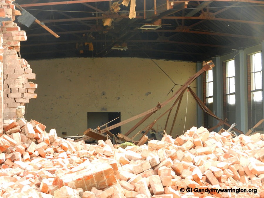
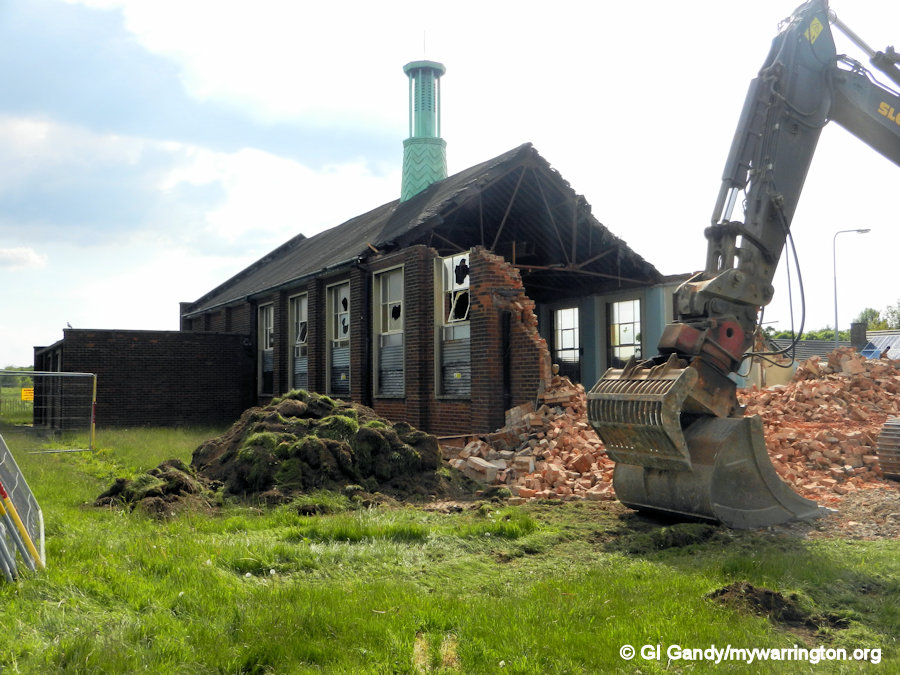
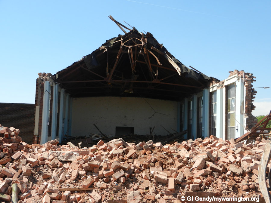
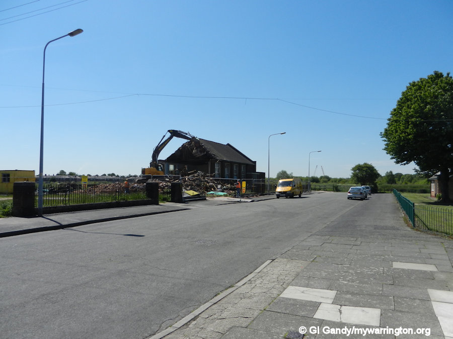
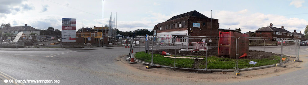
St Anselm’s in Dallam was linked to St Alban’s church on Bewsey Street and the priest there served both churches. Eventually it was decided to concentrate services at St Alban’s only and the Hawleys Lane site was decommissioned. Demolition began on 3 April 2013 and was completed on 5 June 2013. The land was sold off for housebuilding.
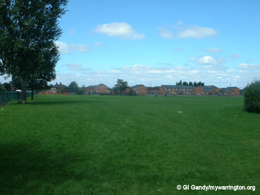
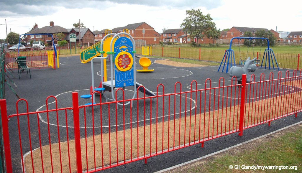
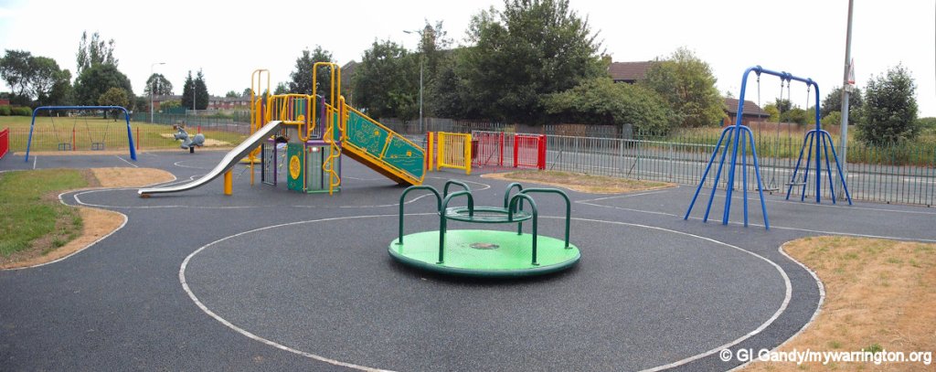
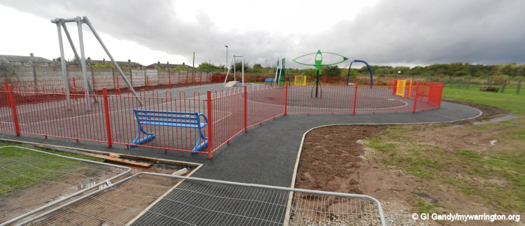
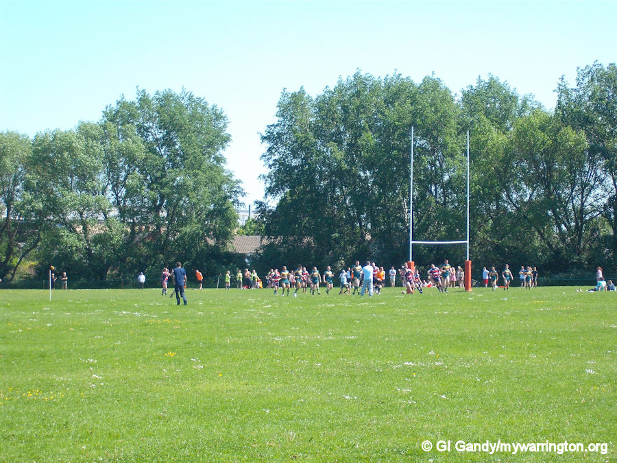
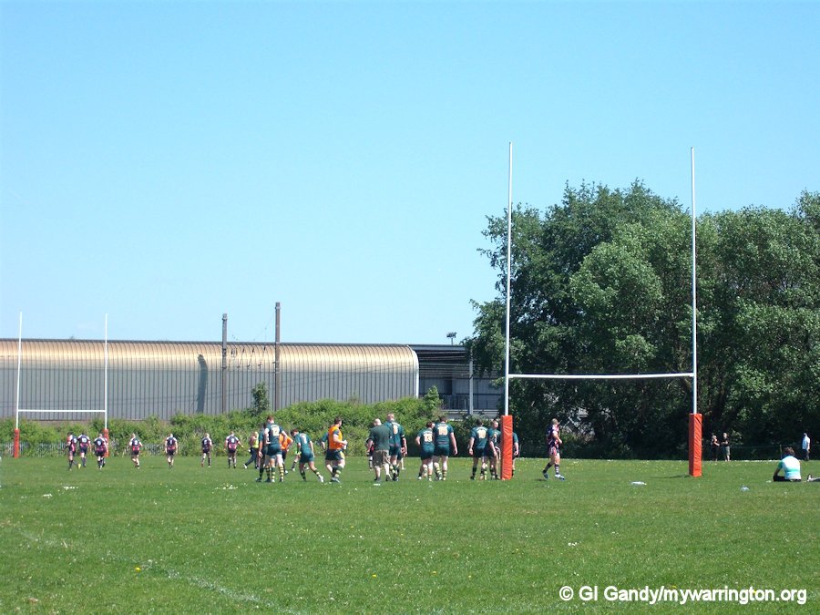
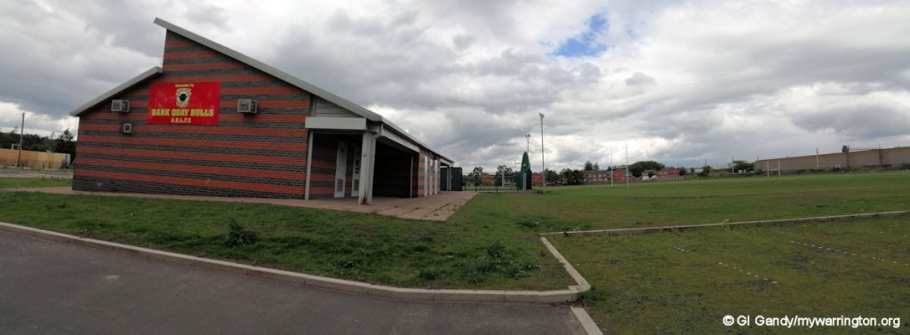
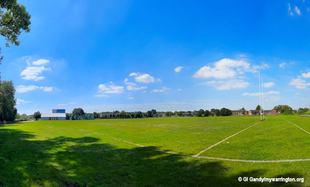
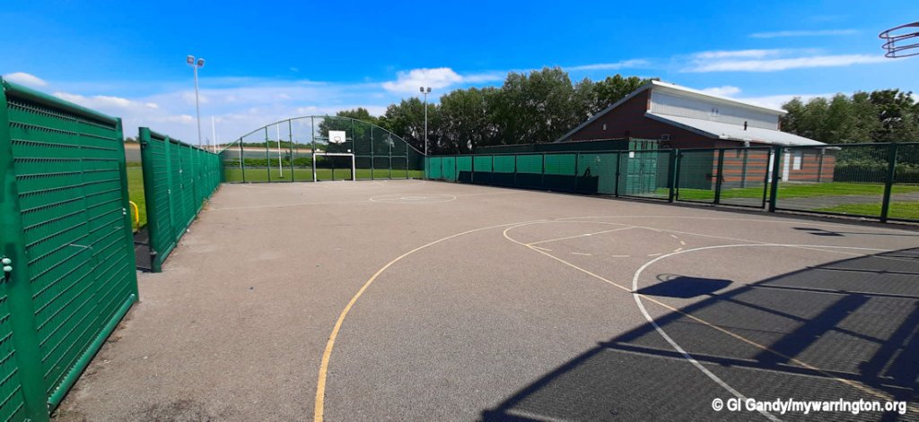
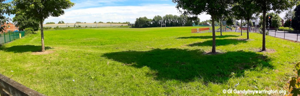
Dallam Park
Dallam Park is a large playing field featuring football and rugby pitches on Longshaw Street. The park also features a children’s enclosed play area with swings and roundabouts, which were replaced on 31 May 2011 and the site reopened in early June 2011. When I was a child, there was a climbing frame in the shape of a rocket (horizontal position), parallel bars, swings and two slides, one about six foot high and the other almost twice as high. In my teenage days we had a bit of a knock about with the cricket bat and ball in the youth club, but there was no official cricket pitch – we made our own – but I was never any good!
We have also had mini-sports days on the field. All this went on the 1980s. In 2010 a small evangelical mission was held on the field, similar to one from Hope Hall at Bewsey in my teenage years. Bank Quay Bulls amateur rugby league club now play their home matches on the field and make use of the changing rooms on site.
Dallam Park on 12 August 2002
A plan to sell off the playing field for a housing development threatened the park in 2012, but the playing field is the only green space in the area. Yes, there is Bewsey Meadows for nature walks, but nowhere to play sports. The plan was to relocate the children’s play area onto land between the two churches and Bewsey Meadow. The idea was later dropped, although the play area was eventually created.
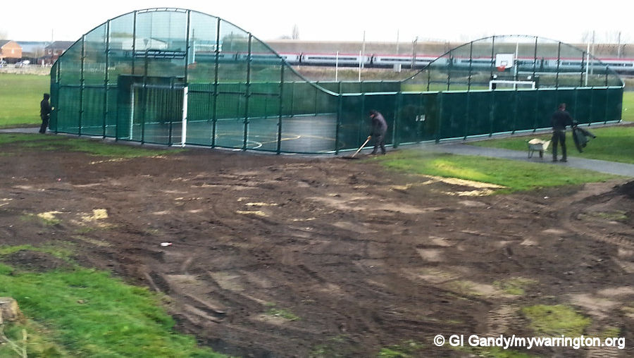
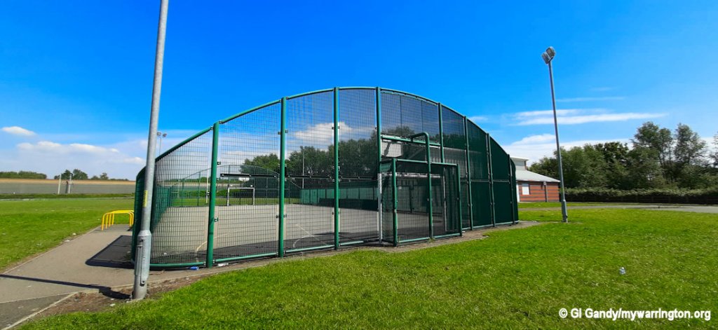
One other facility is a multi-use games area (MUGA) which was built in March 2013 alongside a purpose-built changing facility.
Bank Quay Bulls amateur rugby league club now play their home matches on the park and use the changing facilities onsite.
And just for the record, the Bulls beat Wigan St Cuthbert’s 44-12 in this match on 26 May 2012.
Trophies: Carlsberg Cup winners 2013 and 2015
Here are some photos of my revisit in June 2024.
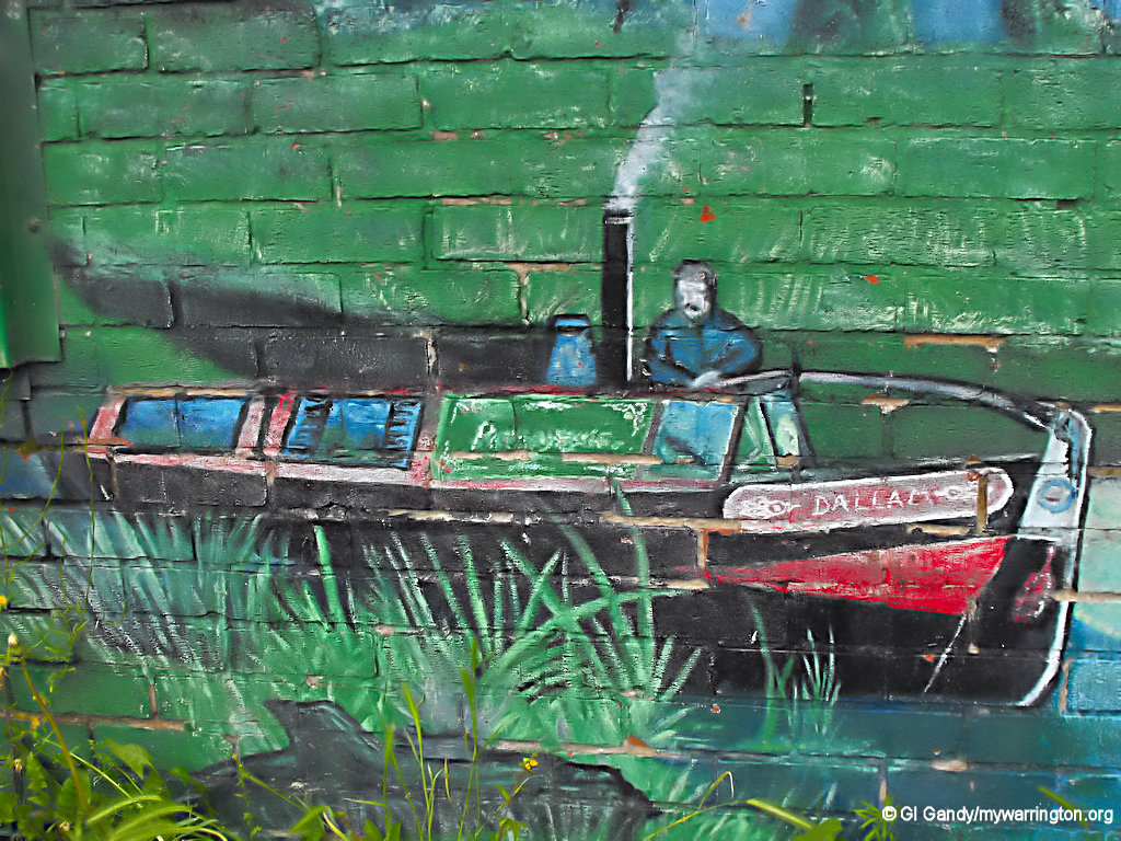
Industrial Past Artwork
The following series of photos show how an artist brought back the memories of industry and community life in and a round Dallam from times gone by. The photos were taken in 20 November 2001 as part of my walkabout and can be viewed as a manual slideshow. I will display the photos first, then continue with the story.
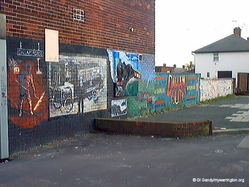
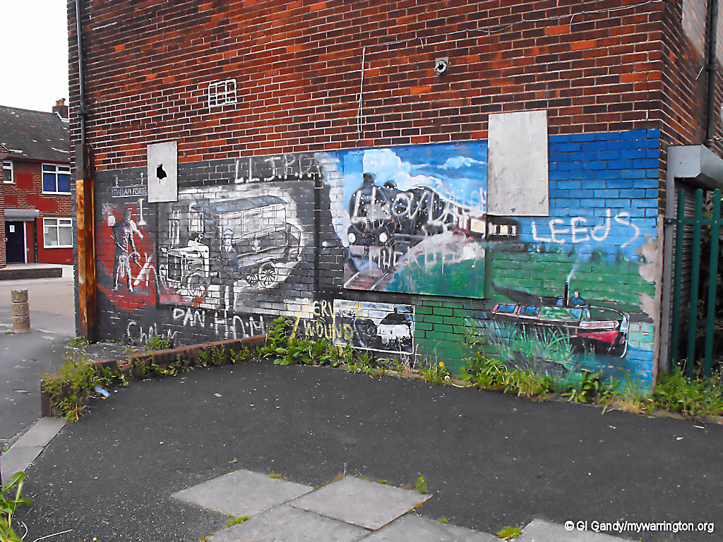
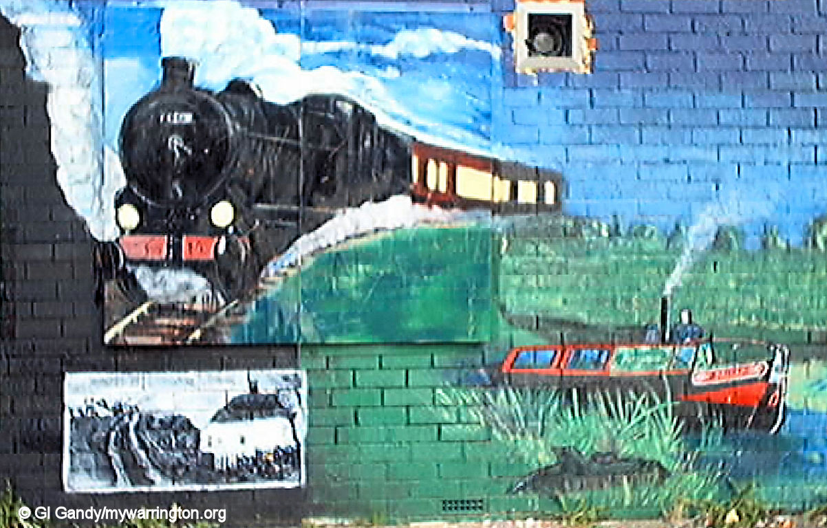
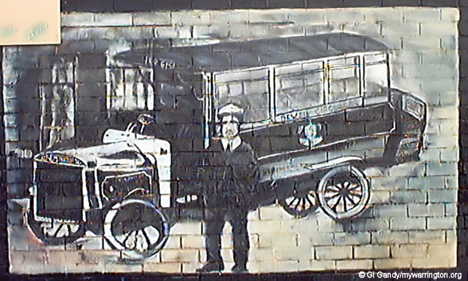
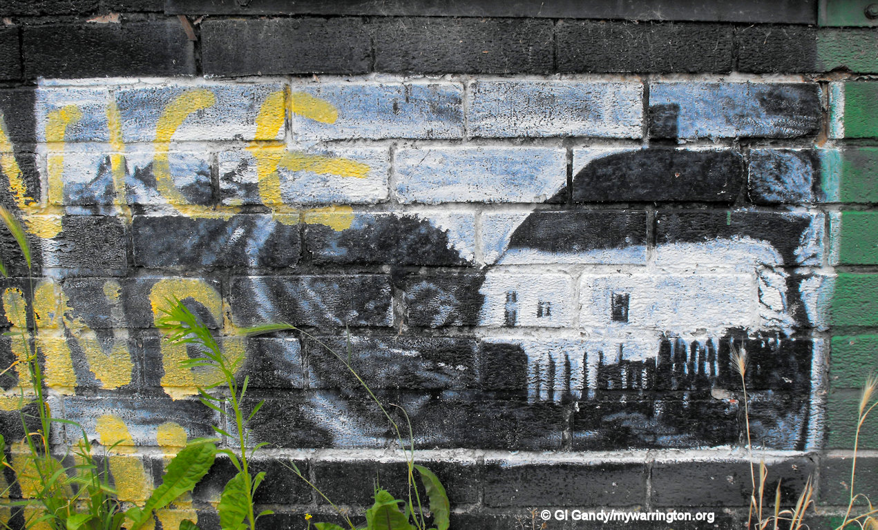
I have not displayed the photos in any particular order but one of the first industries anywhere was farming, which you can see anywhere in the country once parts of the forest covering the whole of the UK was cut down. A quiet farmhouse setting is seen in the black and white painting.
In the 1770s a group of businessmen petitioned Parliament for assistance with the transportation of the growing industries in and around the town. This resulted in the Act of Parliament to create the Sankey Brook Navigation of 1757. It began with coalmining close by at Wigan, St Helens and Newton, and also sugar at Newton.
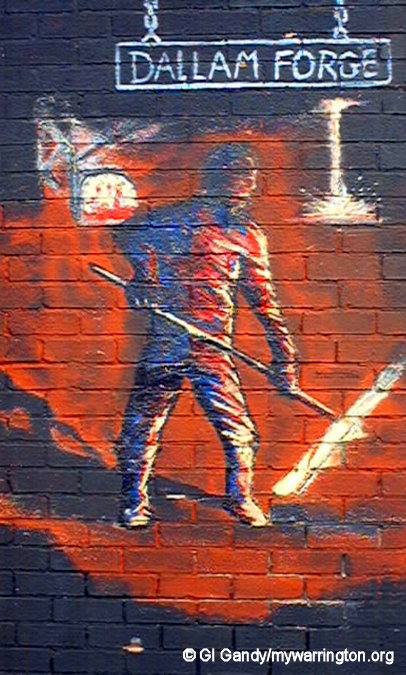
Another industrial site in the town was Dallam Forge. Although outside the district (it is located on Dallam Lane in Bewsey) it is remembered here in the artwork. Dallam Forge opened in Dallam Lane in 1840 as a supplier of merchant Iron. Next came the railway as featured in the Warrington and Newton Railway of 1831, a branch of the Liverpool and Manchester Railway which opened the year before.
When the houses on the estate became occupied from 1952 onwards a new bus service was started to help transport the workers and housewives to and from the town centre. It was basically an extension of the Bewsey Circular route featured in the artwork.
Community Facilities
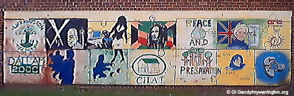
The image below shows the feelings of the residents about the issues of the time, such as the death of Princess Diana and other cultural and community issues at the turn of the 21st century. In fact, the community of Dallam has always fought hard to get facilities for the district. As we will see shortly, there was massive investment in the Dallam (and Bewsey) areas in later years, but it took a very long time to happen.
Help The Needy Charity
Part of the investment in the community was due to the determination of passionate people asking simple questions and making comments to the authorities. One such person was Myles Crozier, who retired from his office manager job at Greenings Wire on Bewsey Road and set up an over sixties charity called Help The Needy Over Sixties Club in 1982. Myles ran the charity with his wife Doris and had a supporting committee of dedicated volunteers.
Myles rented space in St Mark’s church hall to provide a weekly luncheon club for the housebound and activity afternoon of bingo and entertainment for the housebound and able-bodied senior citizens. It also subsidised holidays for members.
Myles recruited me to a volunteer role as an existing member of the church fellowship and set me on a lifetime of care in the community, whether from a secular or spiritual point of view.
Back to those comments, Myles simply stated to the authorities that “nine out of ten areas in Warrington have a community centre, Bewsey and Dallam is the tenth”.
Nine out of ten areas in Warrington have a community centre. Bewsey and Dallam is the tenth.
The original social services survey on the elderly from 1982 that led to Help The Needy found that over 300 seniors in Bewsey and Dallam were housebound and Help The Needy was able to cater for just 10% of that need. In the meantime Myles kept up his pressure on trying to get a community centre built in the area. Sadly, that didn’t happen in his lifetime. in his later years the charity moved out of the church building and ended up in Whitecross Community Centre on Lexden Street, after a brief stay at Bewsey High School, because Whitecross had the facilities for the disabled and infirm (accessible toilets, for example).
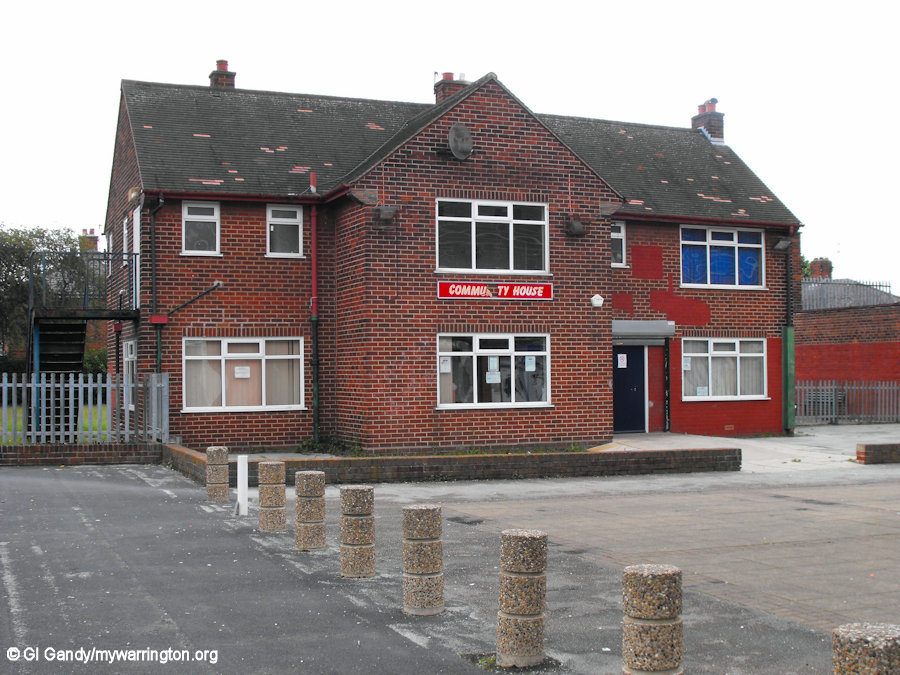
Eventually there were some some small-scale facilities provided in the Bewsey and Dallam area. A small community centre was built on the site of the former ambulance station on Longshaw street in Bewsey. In Dallam the former children’s home on Harrison Square was converted into a community house. But neither of these facilities were big enough to cater for the Help the Needy group, which had 80 members, hence the reason the charity moved it out of the catchment area. The charity had an agreement with Social Services that it would only recruit housebound members from Whitecross on the understanding that priority going to Dallam and Bewsey, the charity’s original catchment area, because Whitecross had its own group on a Friday.
Dallam on Health
Another survey, in the 1990s, more community-wide this time, looked at the needs of the other members of the community of Dallam with a idea of getting more facilities in the area.
Because of my community roles I was asked to take part in sending out and collecting the results of a detailed questionnaire asking the residents what they felt was needed in the district.
The project was called Dallam on Health and covered a wide range of subjects on health and wellbeing. The residents were both excited and nervous about the survey. Excited because they thought things might finally happen at last but nervous because they had been let down previously.
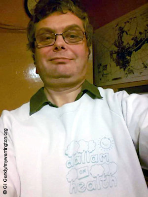
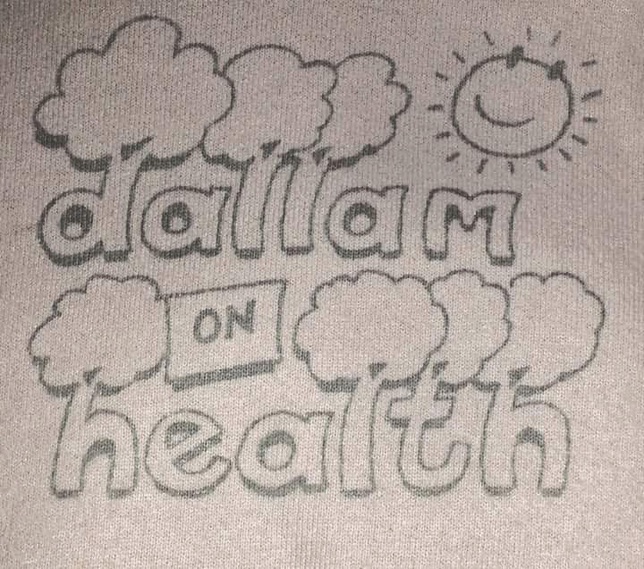
Our sweatshirts not only looked good on us, they were our ID badges too! I have still got mine.
Well, as you can guess, not a great deal happened, due to the old excuse of no funding being available. It was pointed out to the authorities that, as with the Covid-19 situation many years later, unless communities are supported then further down the line the problems would escalate and put even more pressure on a stretched health and social service. One of the gripes with the younger people in the Dallam area in the 1980s and beyond was seeing equipment such as canoes and other outdoor equipment being delivered to the children’s home for recreation. They began to think they are better off being naughty boys and girls so they could get all the facilities and adventure weekends away. You can’t blame them, can you? We’ll see later what happened next…
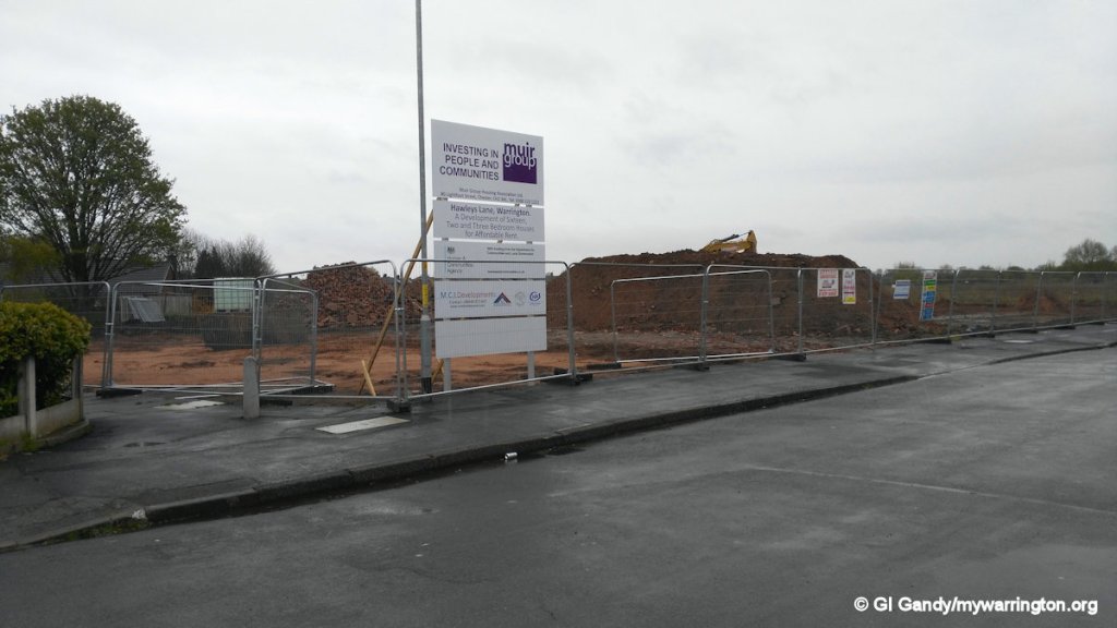
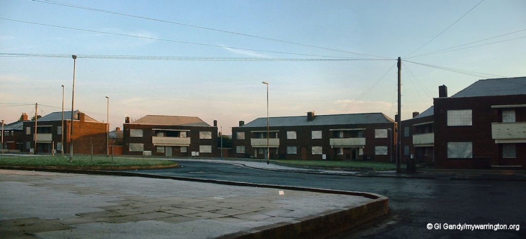
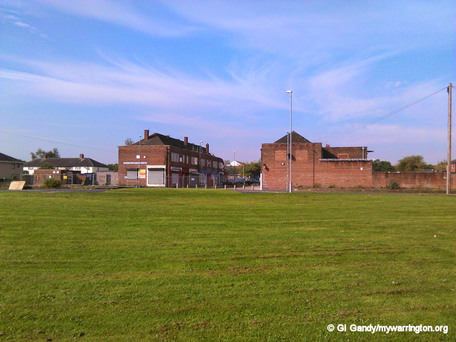
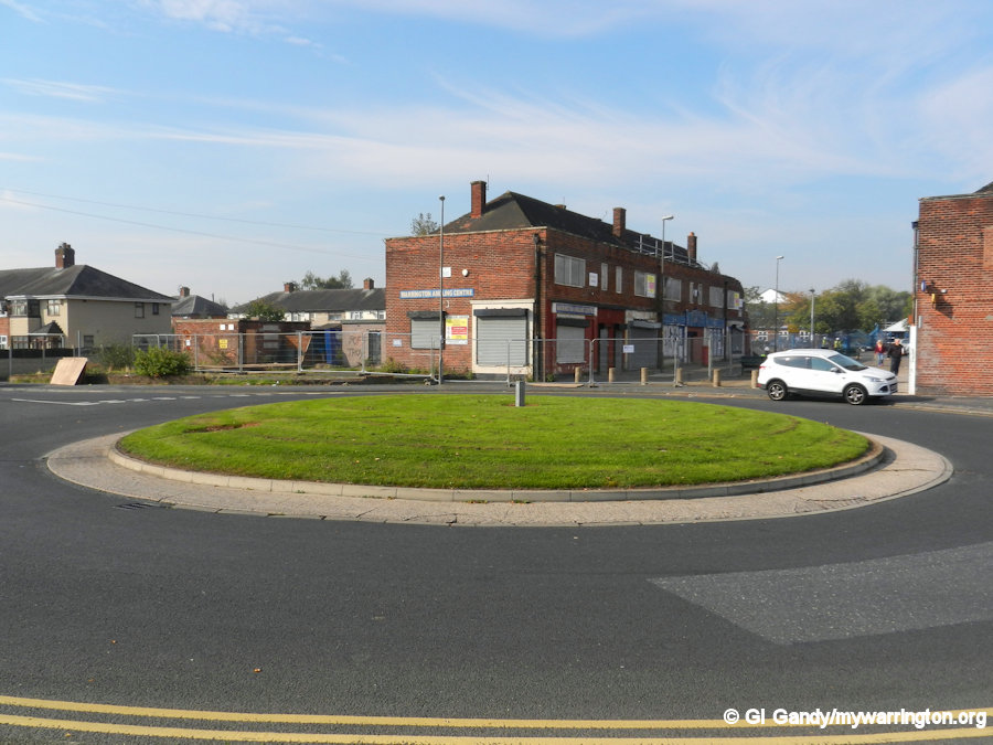
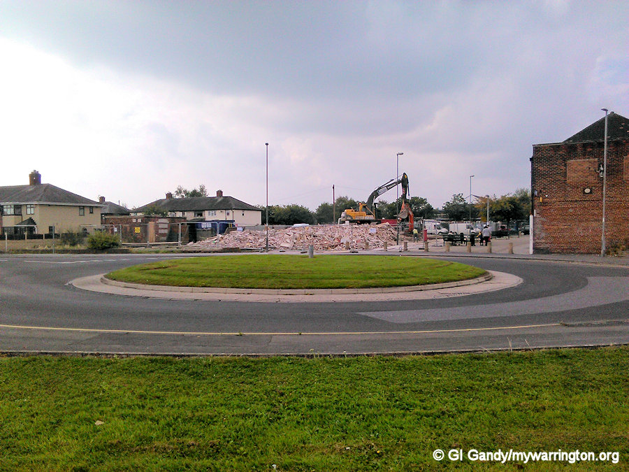
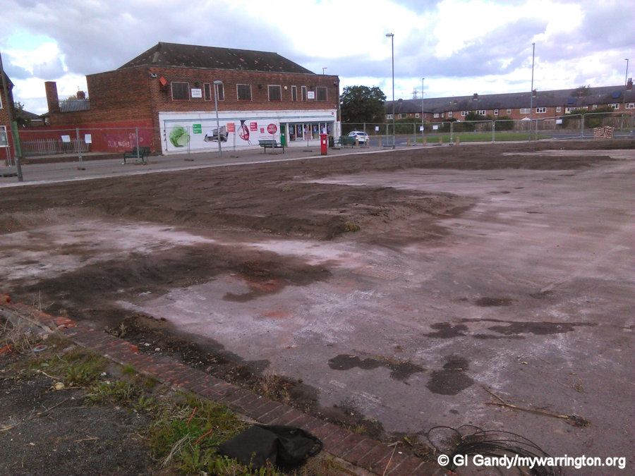
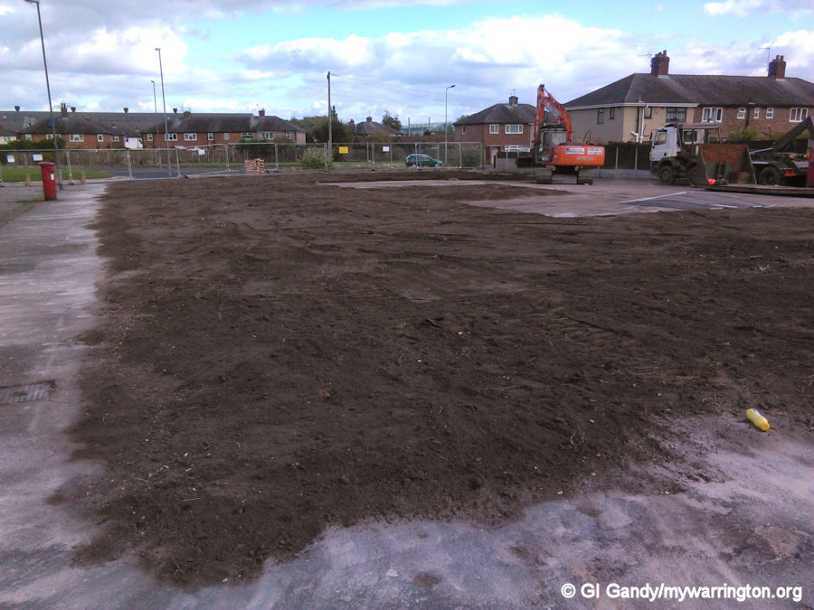
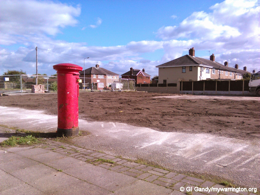
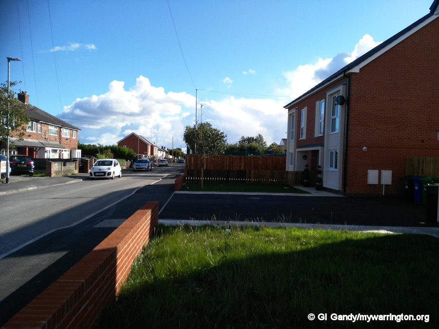
Longshaw Street Flats
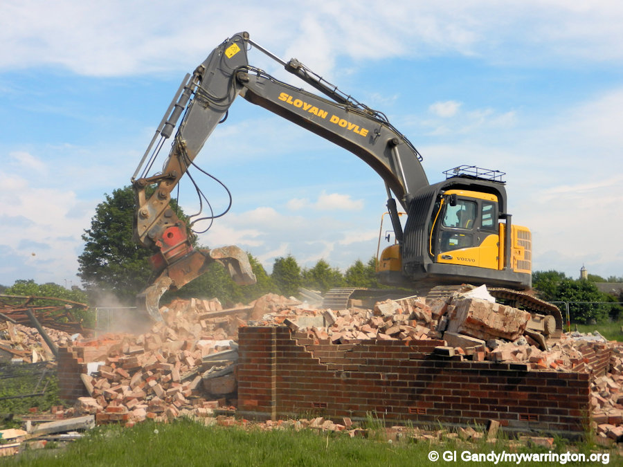
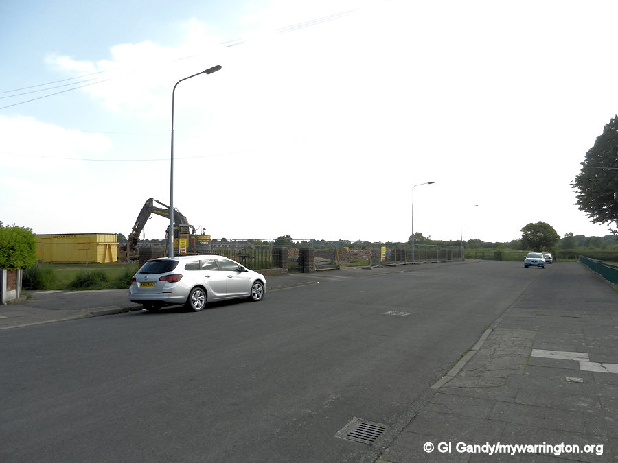
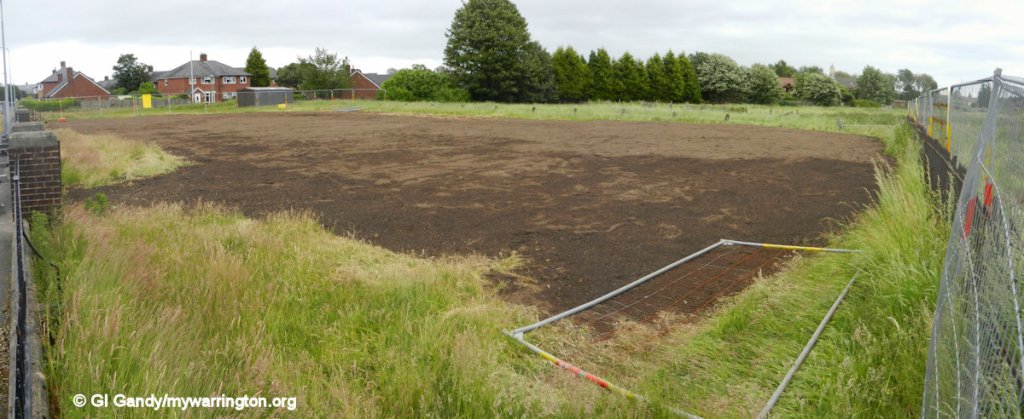
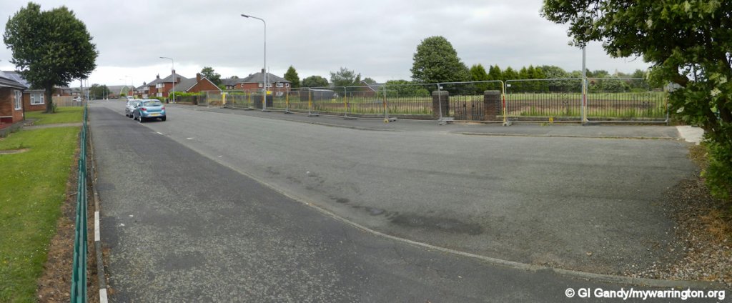
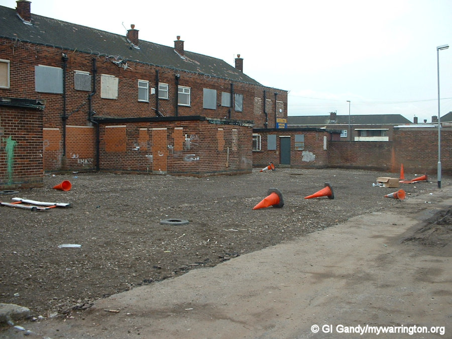
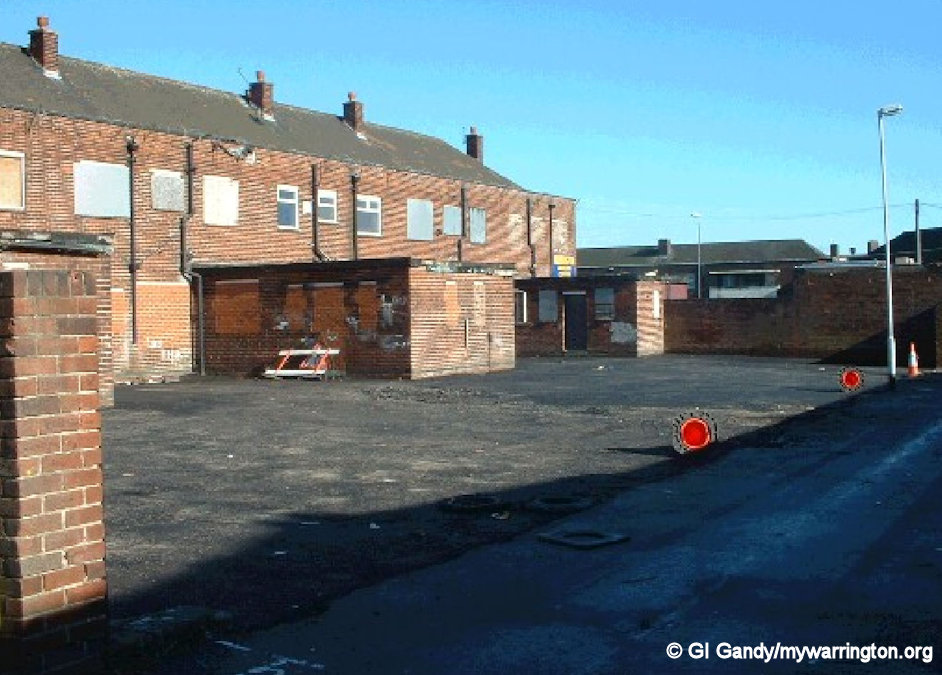
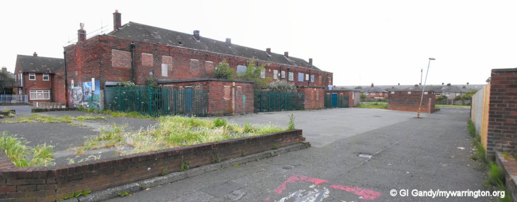
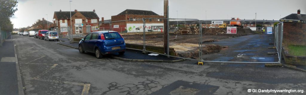
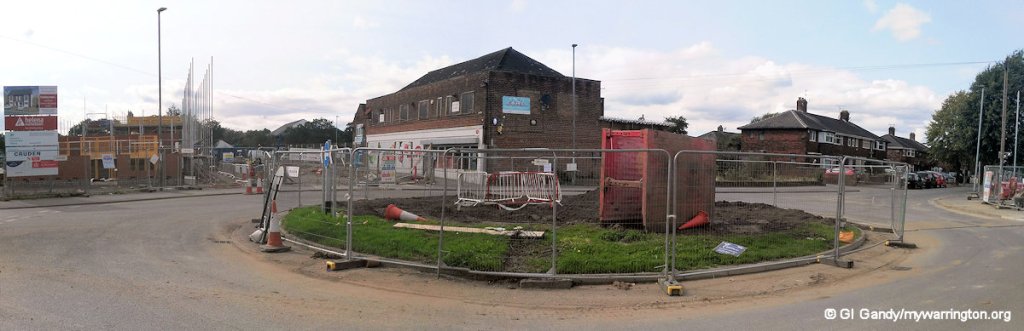
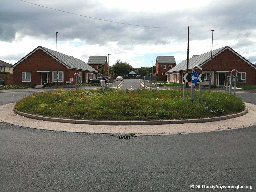
One type of accommodation popular in the early years of the estate were the flats by the roundabout on Longshaw Street. Similar flats exist in Orford and those were renovated in recent years. However, the decision was taken in 2003 to demolish the ones at Dallam. After the demolition the site was turned into a grassed area and it stayed like that until a new idea was proposed in 2015. Keep reading to find out what…
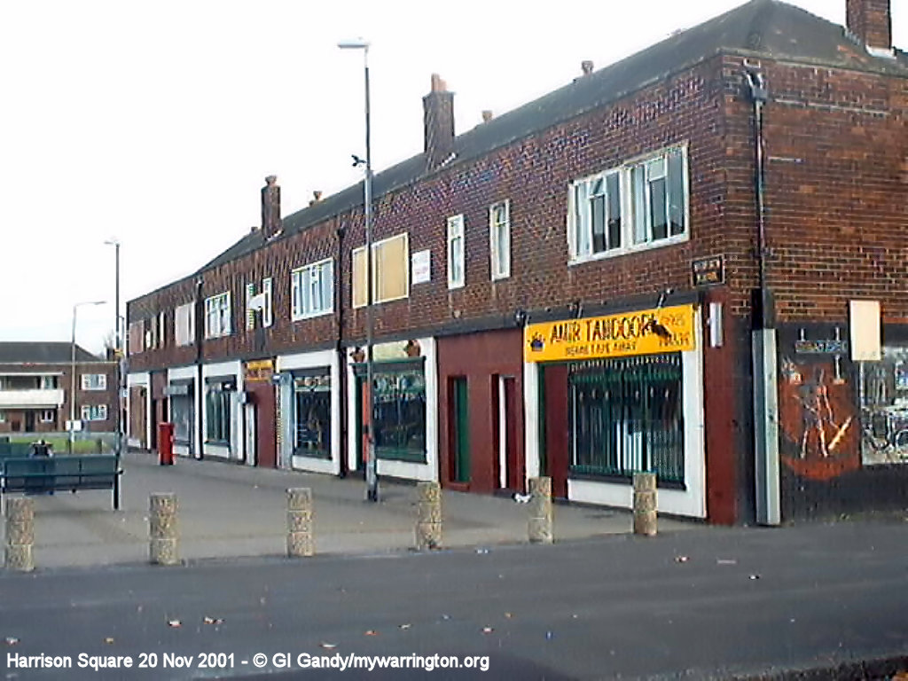
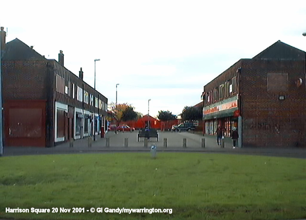
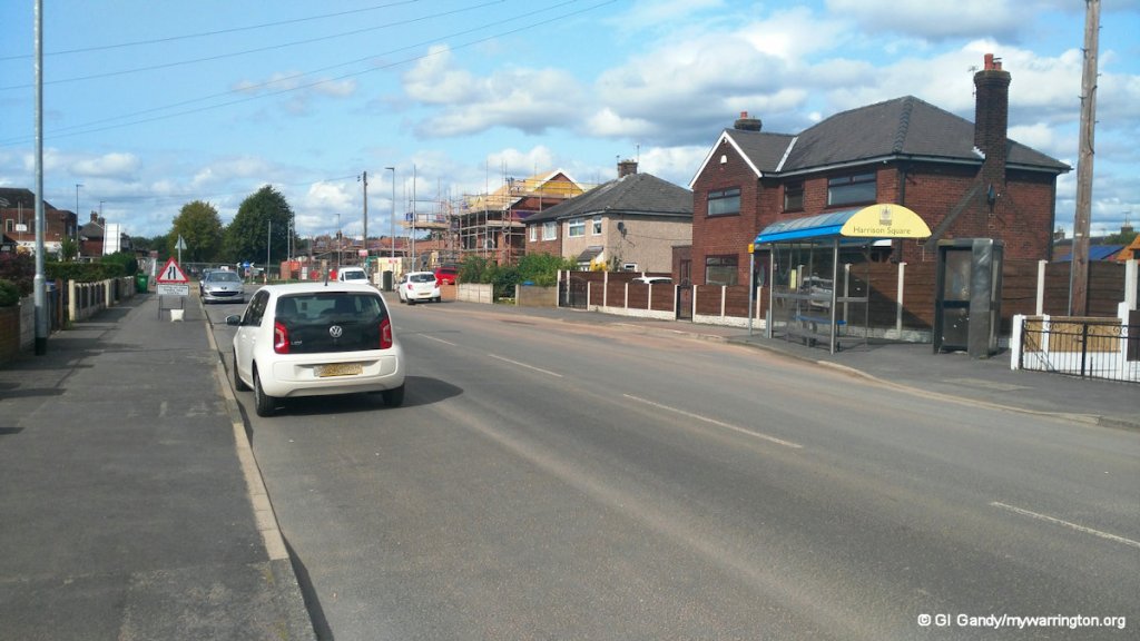
Harrison Square
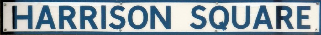
The Old Days
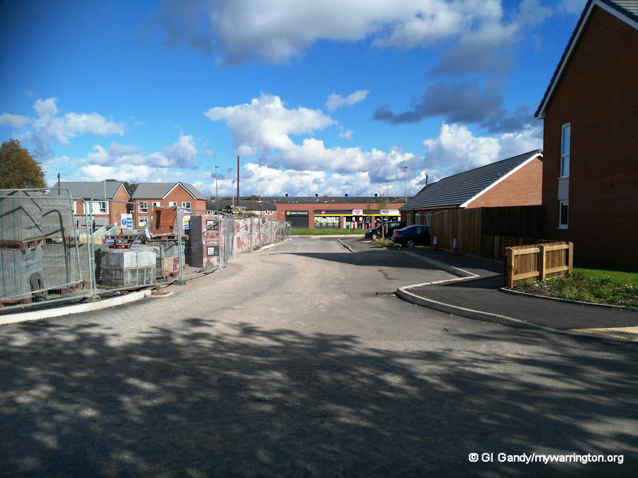
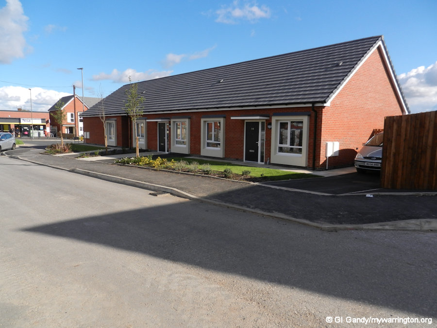
When I first moved into the area in 1972, Harrison Square was the location of all the shops. There was also a children’s home, one of two on the estate. The second one looked similar and was at the north end of Longshaw Street. That has now been converted into apartments.
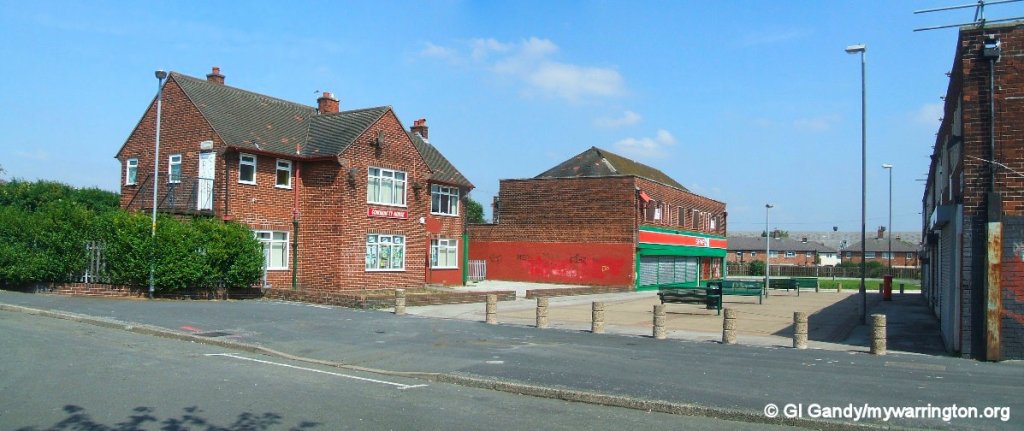
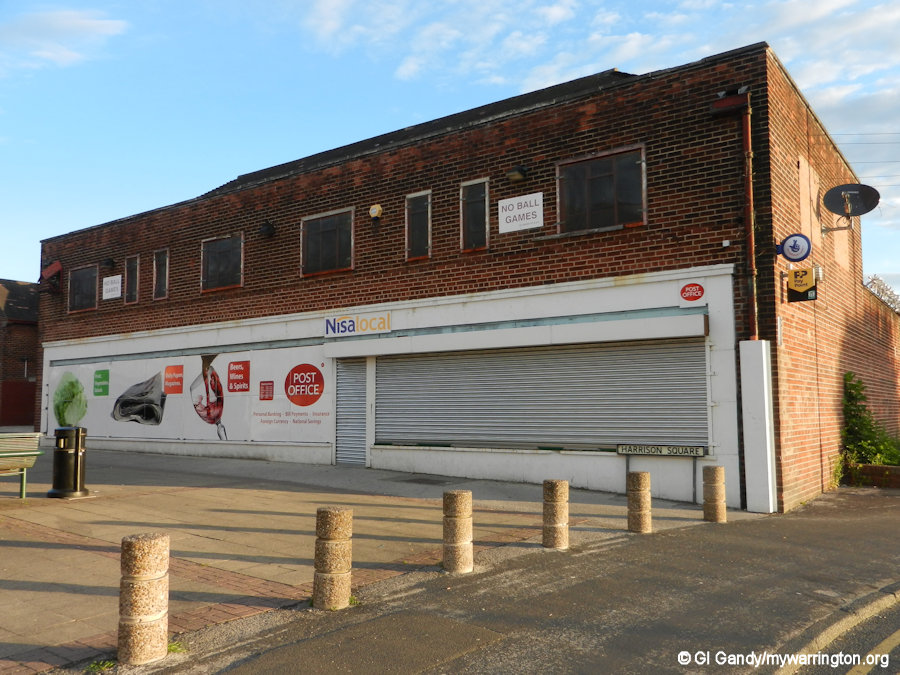
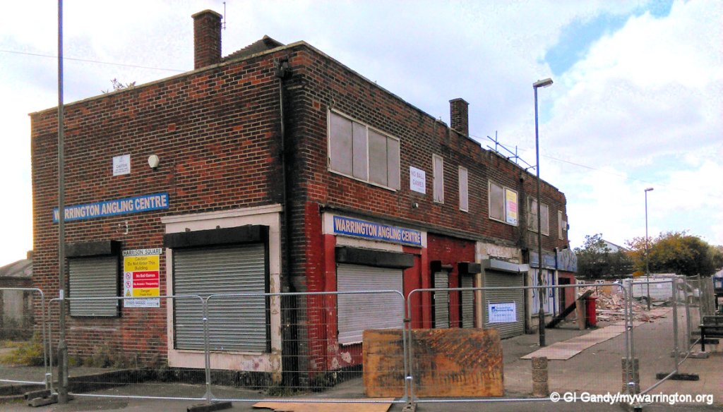
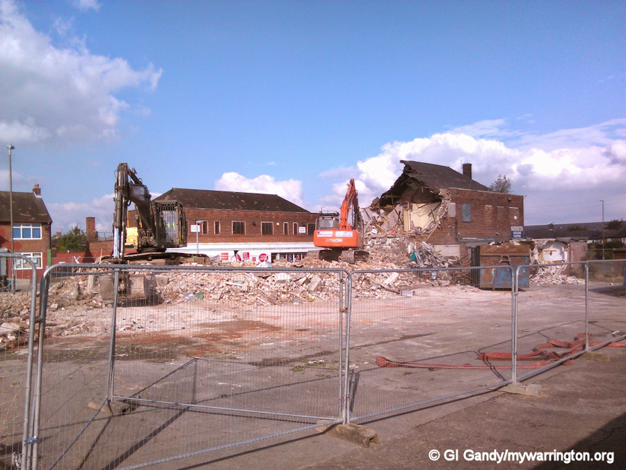
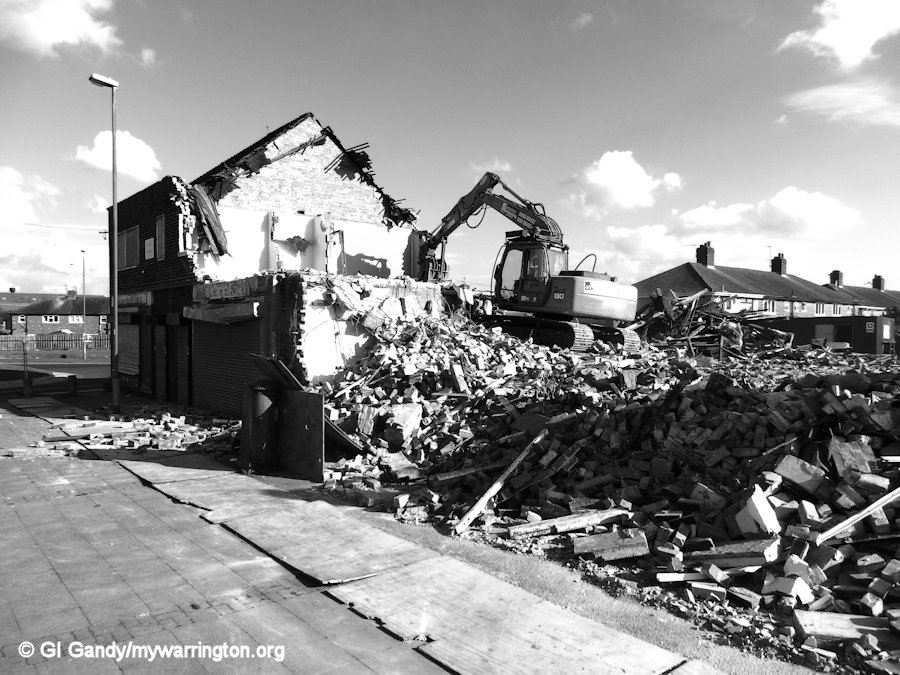
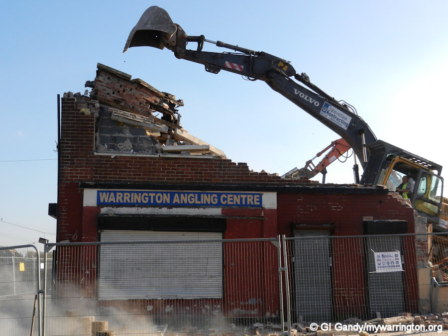
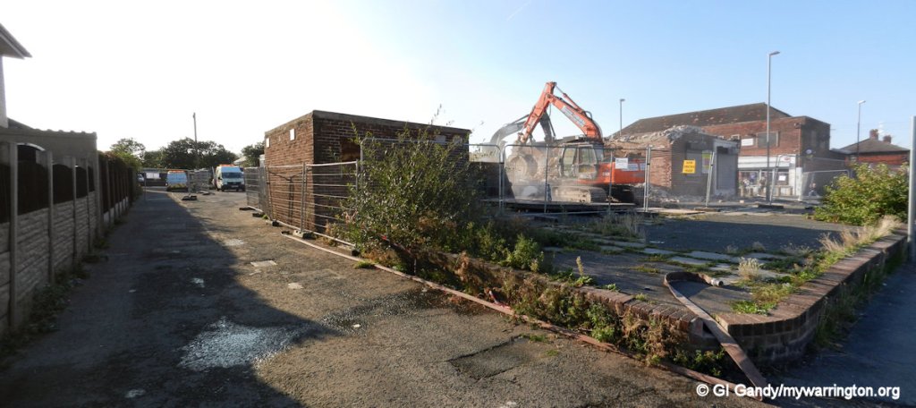
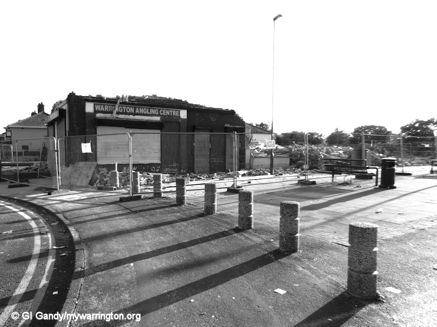
There was a cake shop, Renshaw’s hardware shop, a post office, Beswick’s grocery shop, Condliffe’s hairdresser’s and Mulhall’s chip shop, all housed in a row of six shops opposite the Co-op, which later became a Spar and later still a Nisa supermarket incorporating the post office. In more recent times there was Warrington Angling Centre (in the former cake shop by the roundabout).
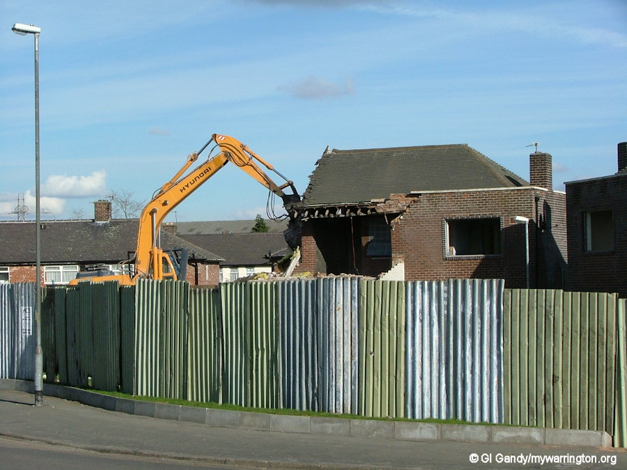
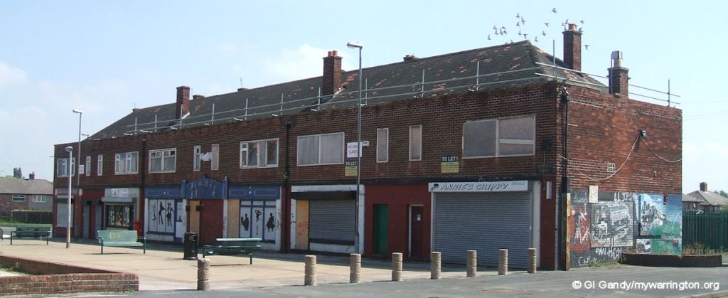
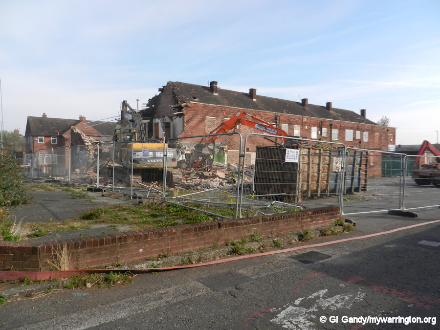
Partial Demolition
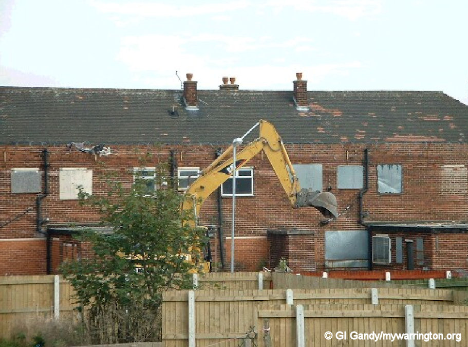
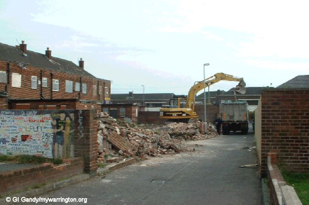
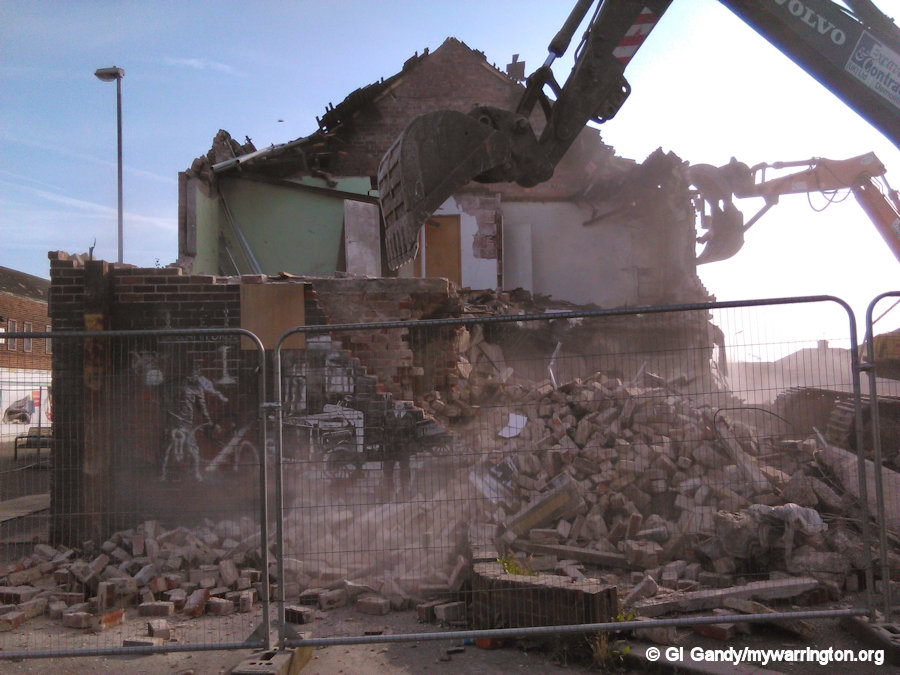
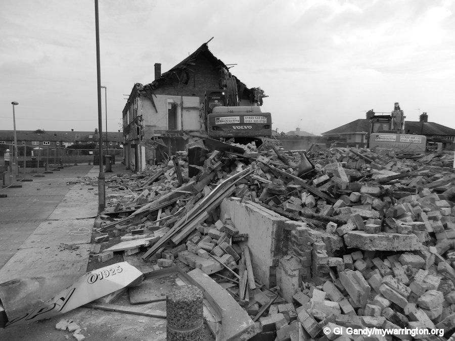
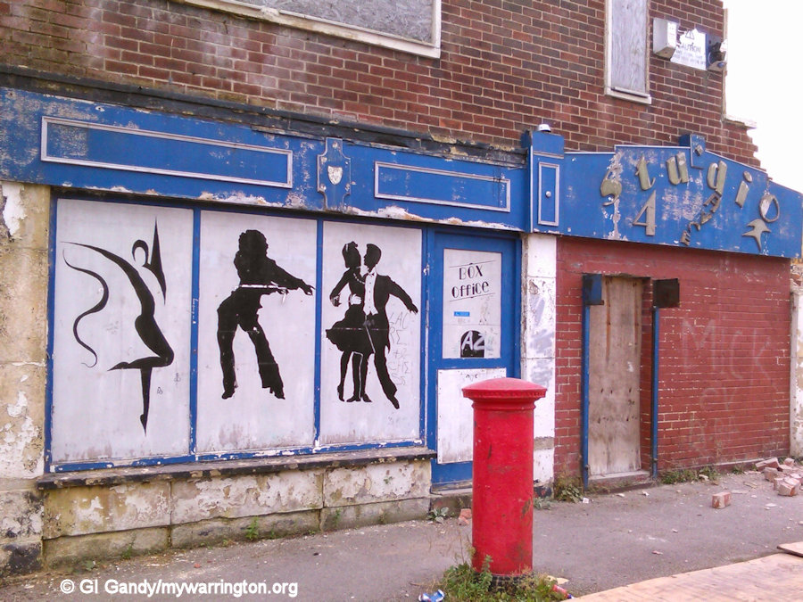
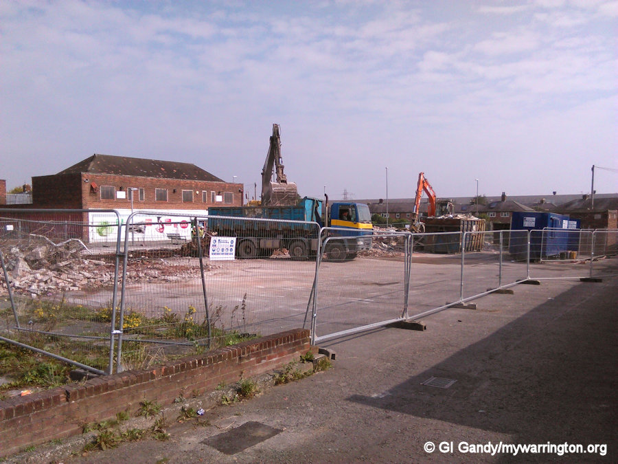
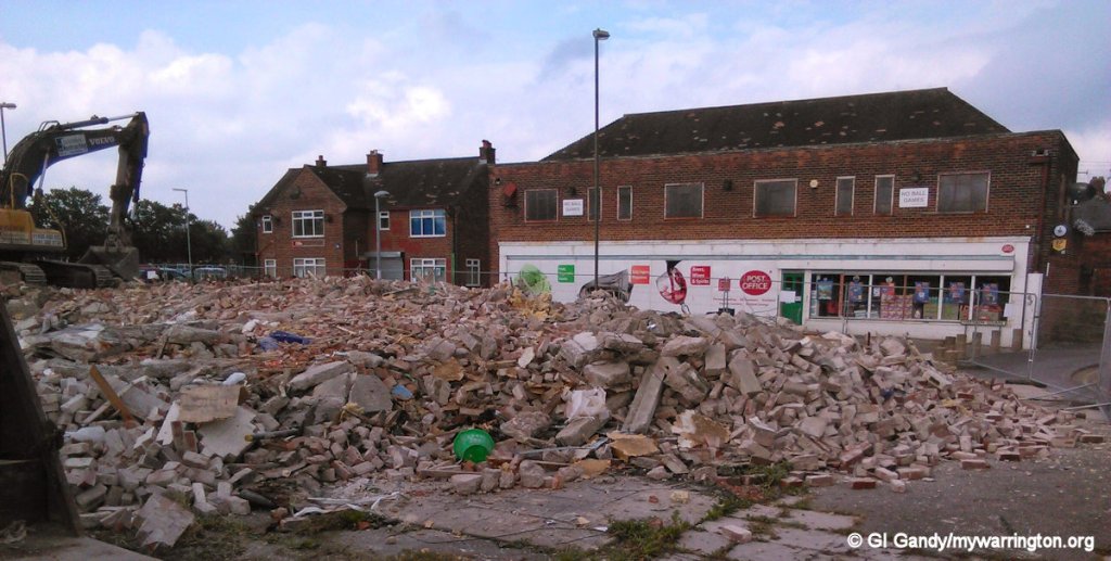
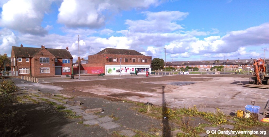
After the shops on the south side of Harrison had long been vacated, the former post office and Beswick’s grocers shop were merged into one large space to accommodate a gymnasium and the Studio 4 Dance group. As the group didn’t need to use the back yards (apart from emergency exits) it was agreed to demolish the yards to make way for much need car parking space during the school run. Boulting Avenue was getting congested, affecting delivery vehicles visiting the school. Of course, yours truly was there to record the demolition for prosperity. The first three photos show the demolition on 7 October 2002. The remaining images show the car parking space as it looked for the next twelve years.
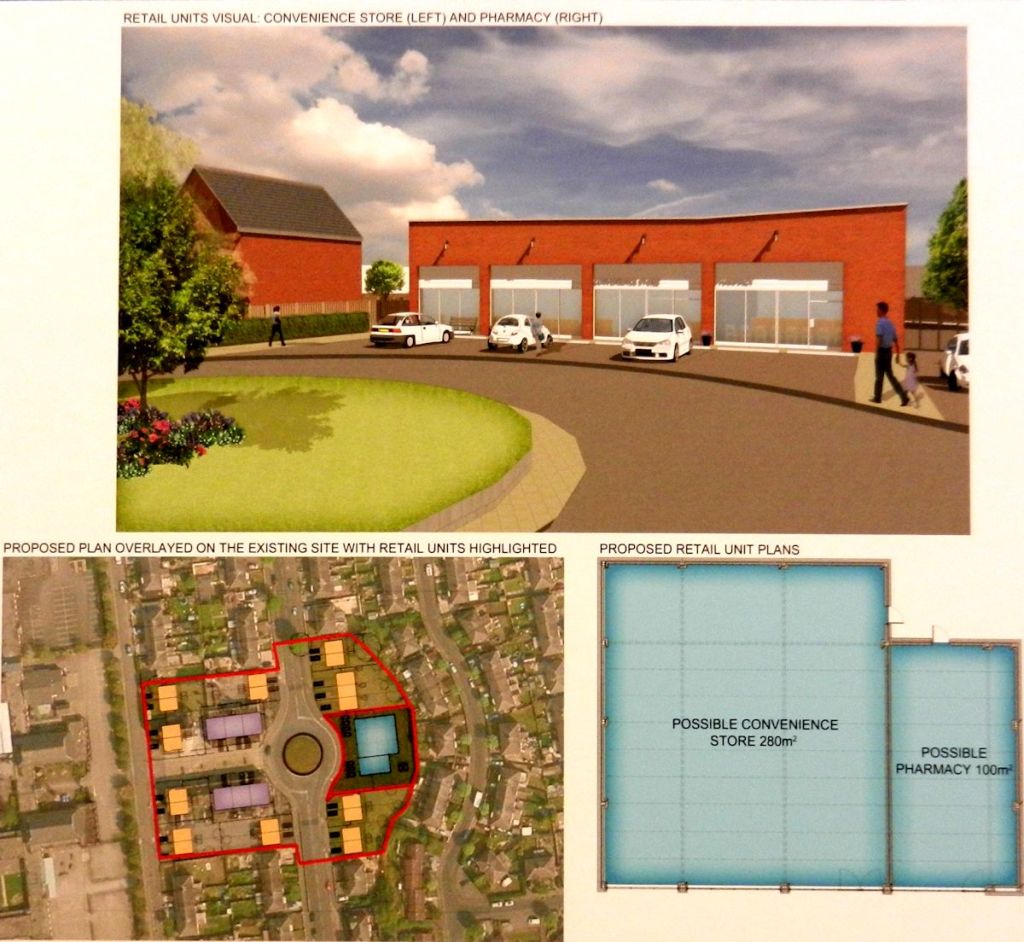
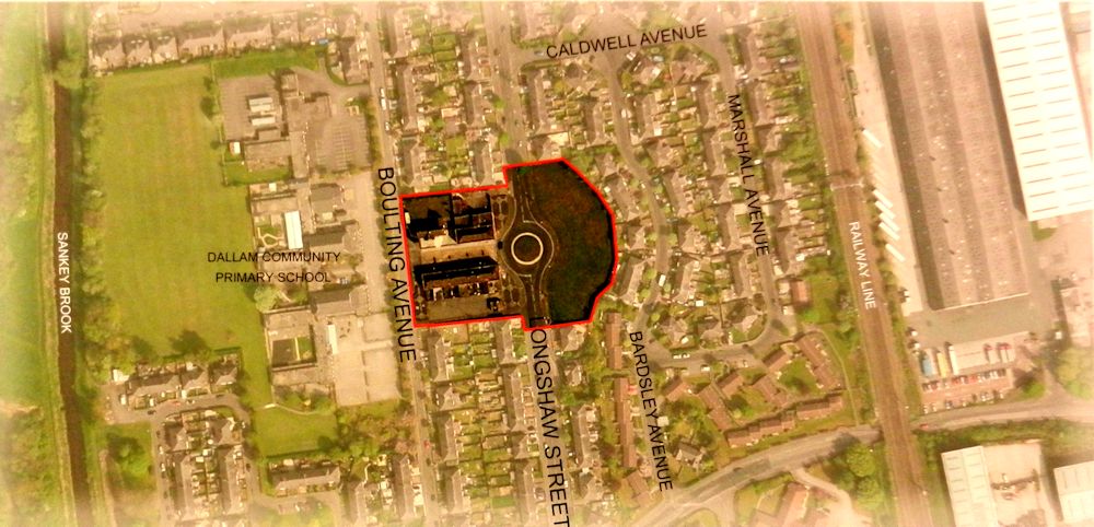
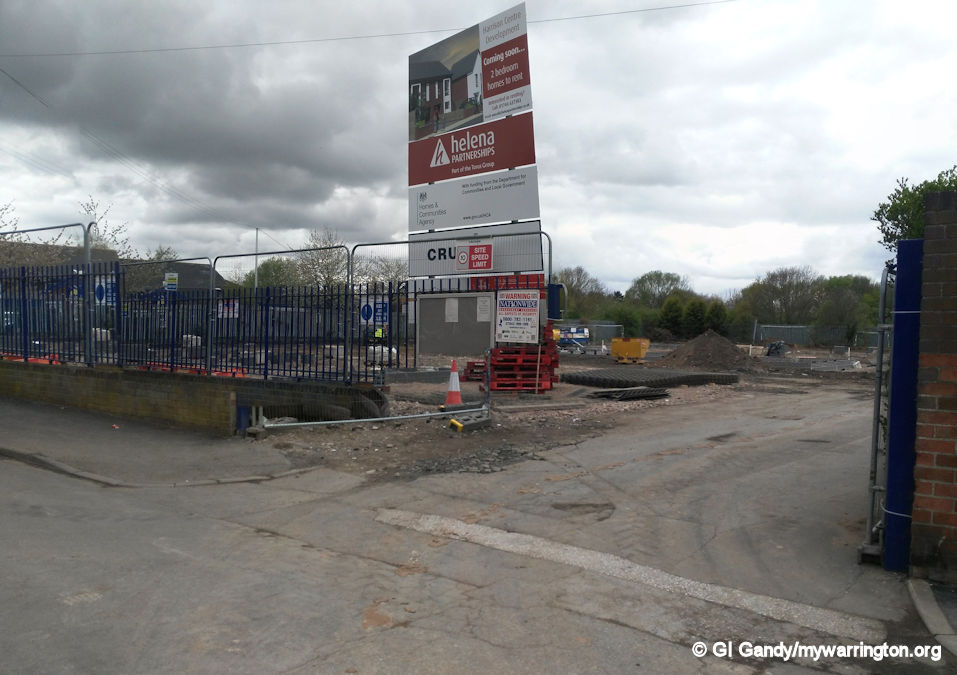
Future Plans unveiled
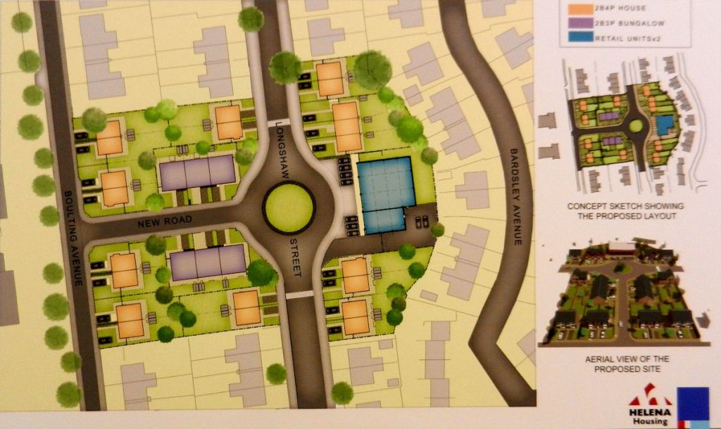
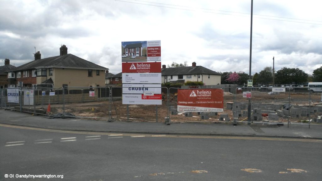
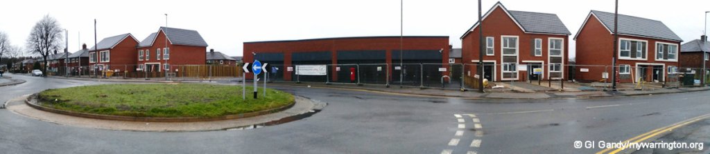
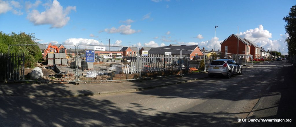
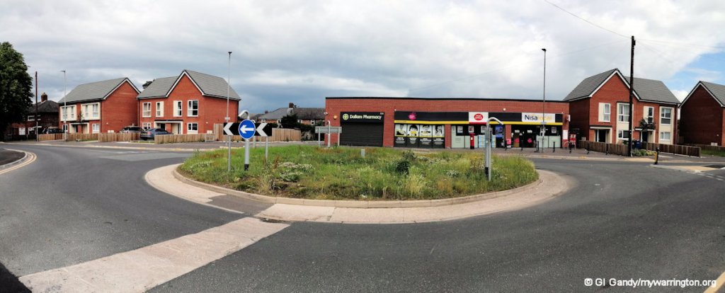
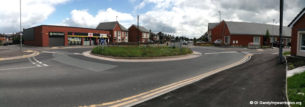
In 2015 Warrington Borough Council held a public exhibition on plans to redevelop the sites of Harrison Square and the Harrison Centre on Boulting Avenue with houses for rent. There was also a plan to build a community hub on the land once occupied by Warrington Transport club on Longshaw Street. Community House on Harrison Square, which started out as a children’s home, would be demolished and the Nisa shop would be moved into a new building on Longshaw Street once occupied by the flats that were demolished in 2004.
The Plans for the redevelopment were on display at Community House during February 2015. The project also included the demolition of the former Harrison Centre that occupied the old school rooms and dining room at the northern end of Boulting Avenue.
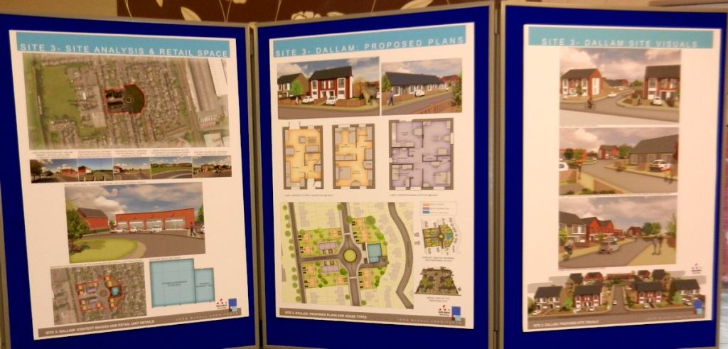
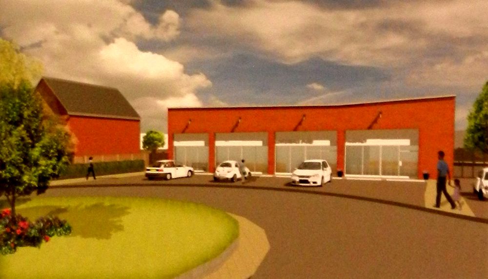
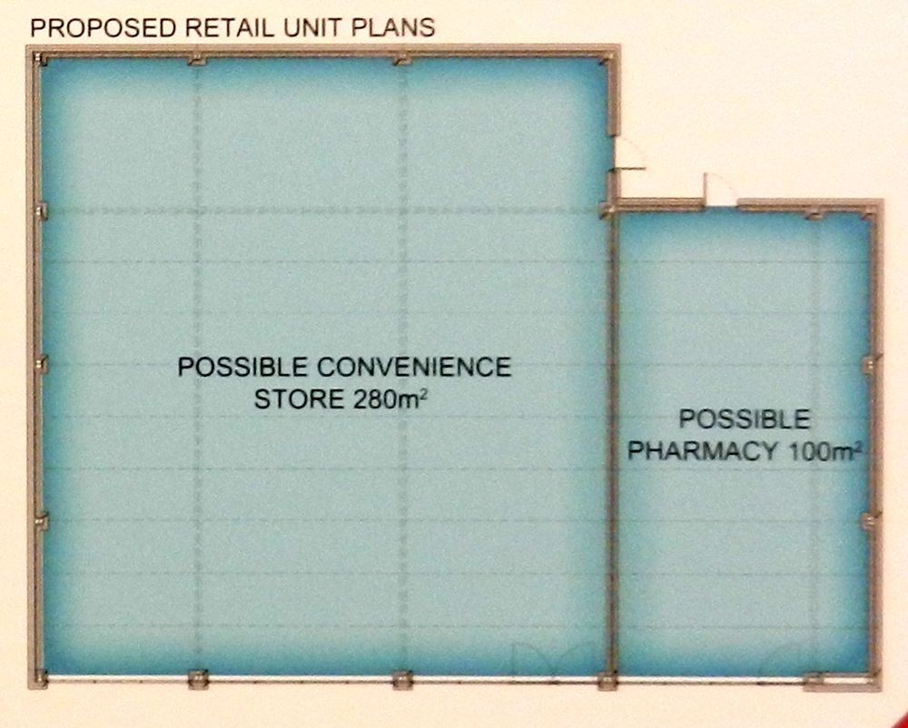
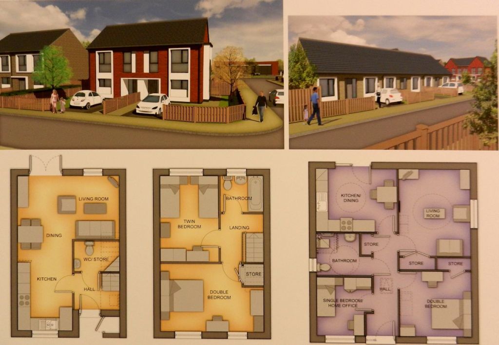
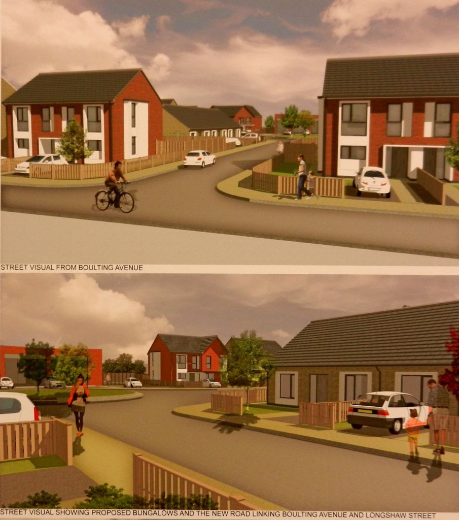
On the whole, the plans were welcomed by the community. In the meantime, Community House, once managed by the late Ian Telfer on behalf of the borough council, was converted into Dallam Pharmacy, a much needed facility for the community. Until then, our nearest chemist was on Folly Lane in Bewsey. The photos here show the Dallam facility in use on 22 May 2015 and the Harrison Centre on Boulting Avenue on 23 June 2012.


Demolition Part 2
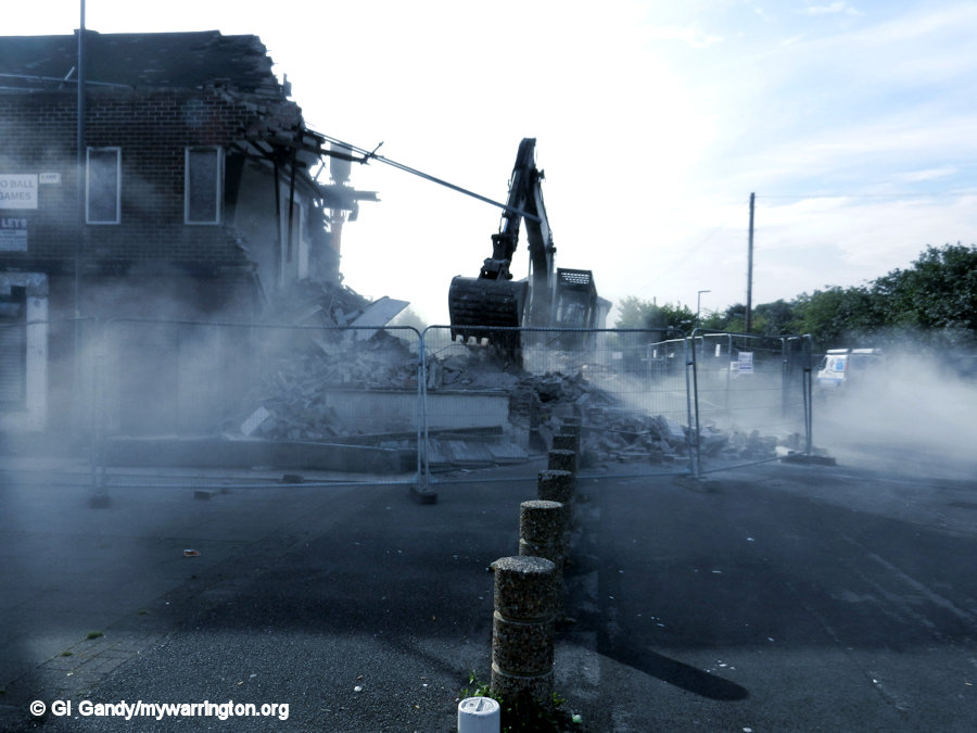
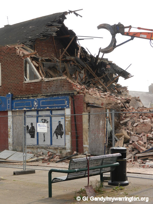
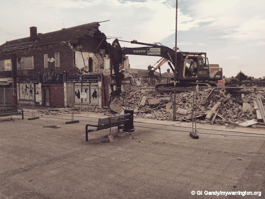
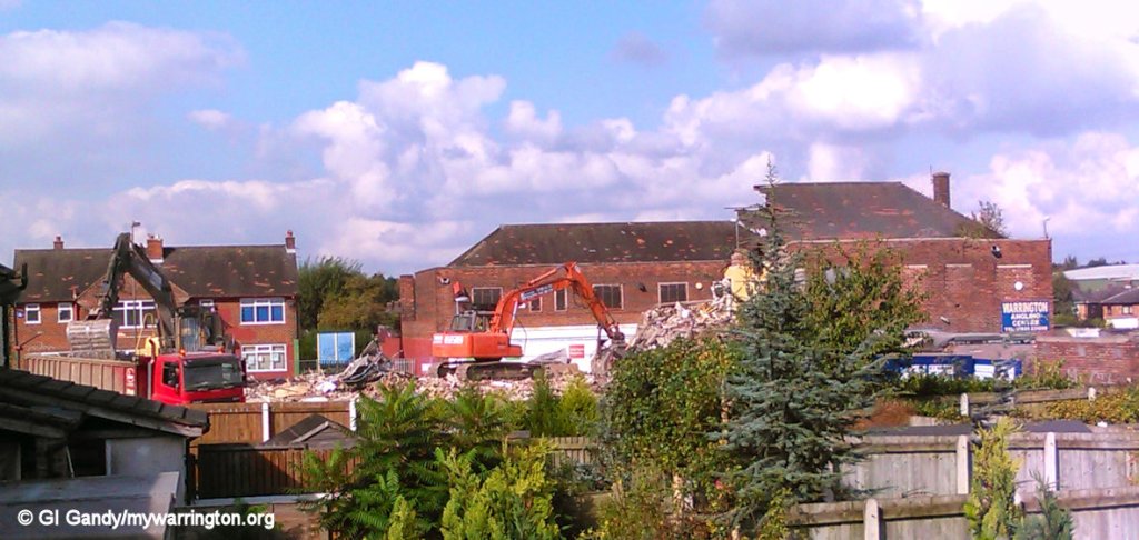
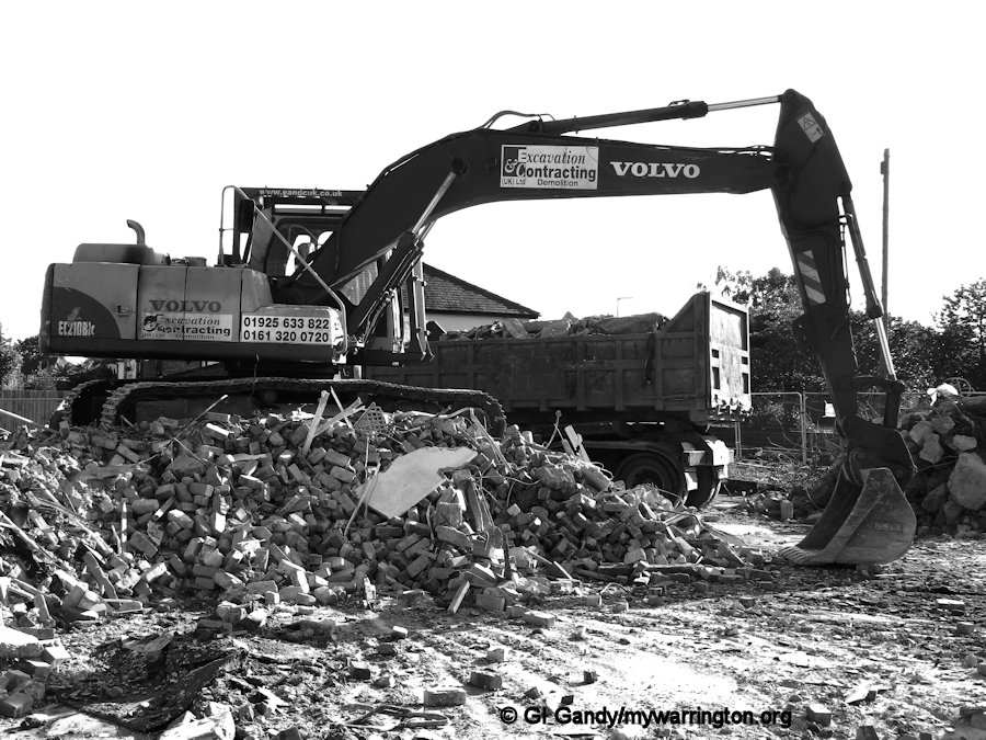
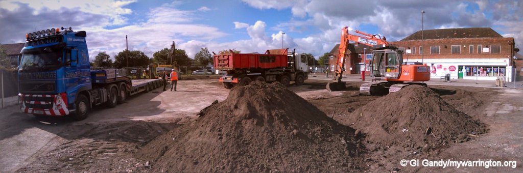
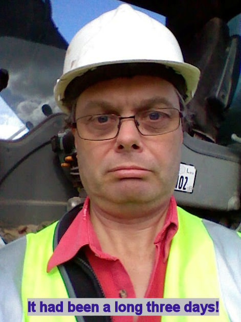
The demolition of the southern side of Harrison took three days to complete between 22 and 24 September 2014. The Caster Oil Kid (as I was once described by one of the neighbours because I get everywhere) was loaned a hard hat and free range in a safe place away from the demolition vehicles of Excavation and Contracting UK Ltd to photograph the event. The images here run as a manual show (click the first one and scroll on).
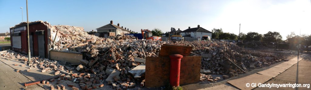
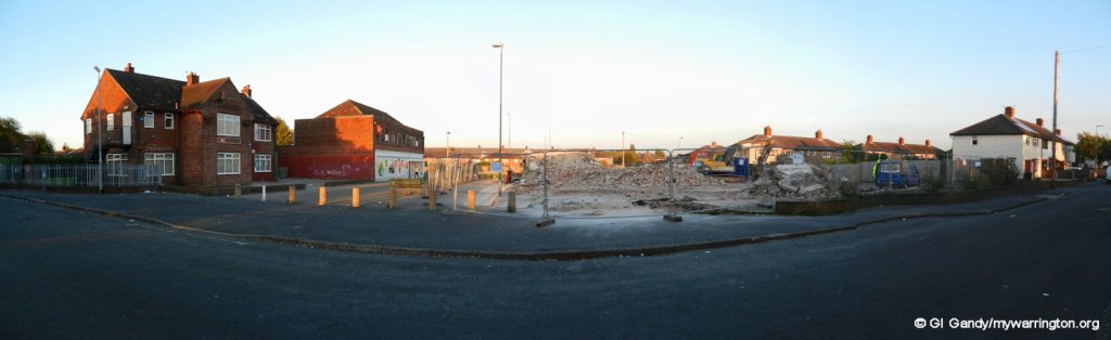
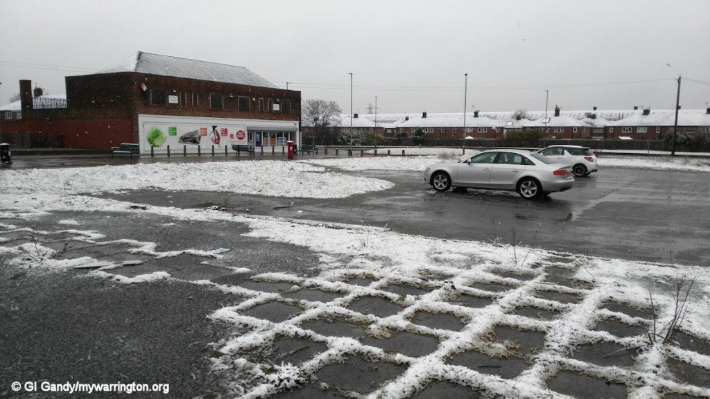
And how the space looked a couple of years later on 4 March 2016. Yes, it snowed in March – that pesky global warming again…
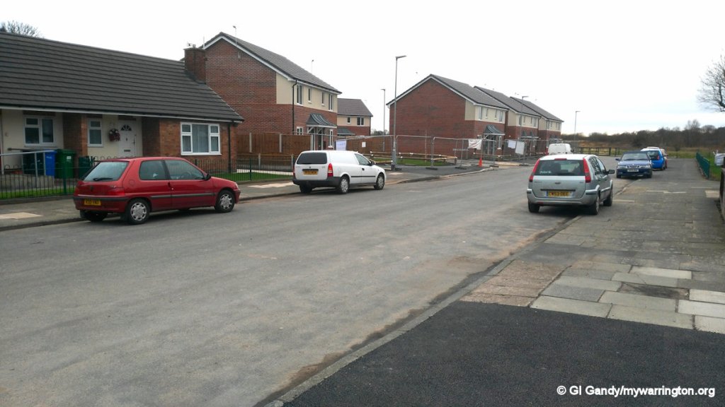
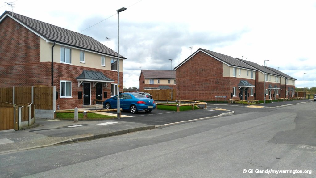
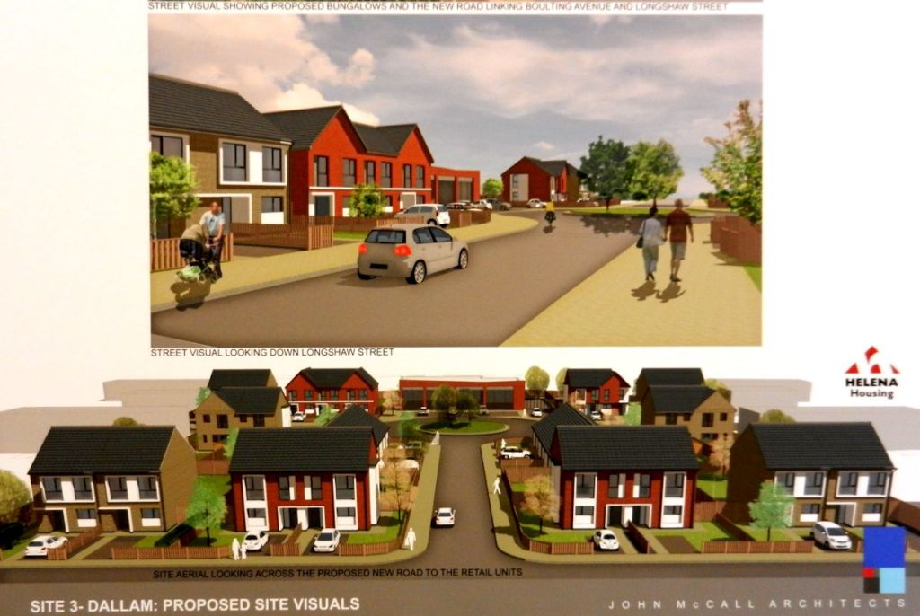
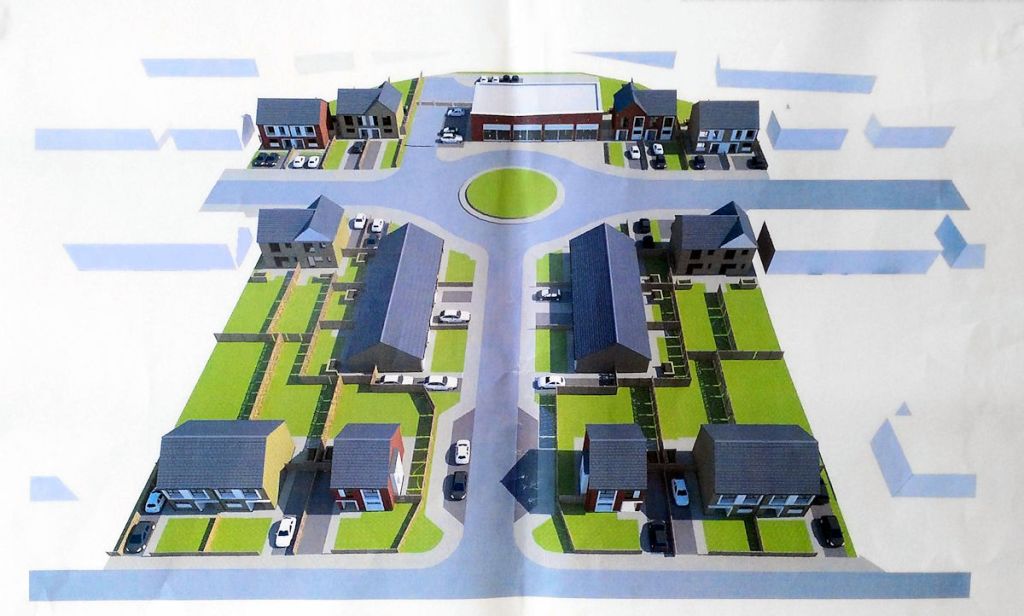
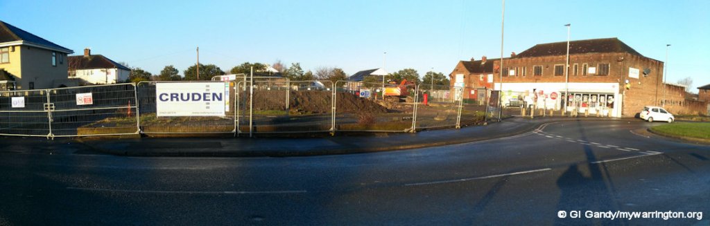
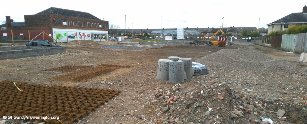
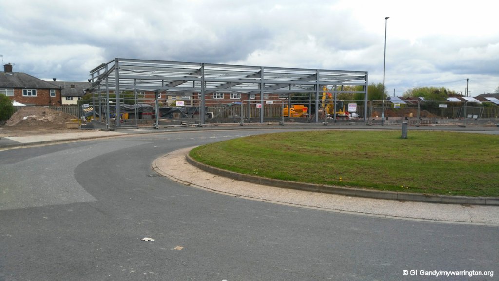
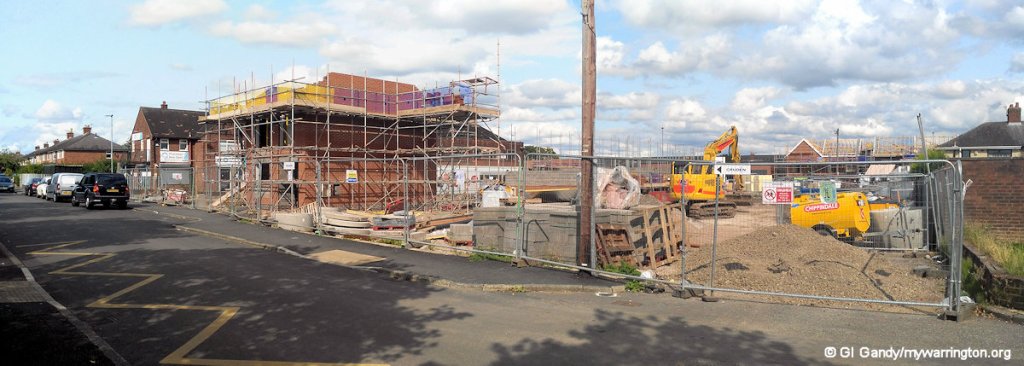
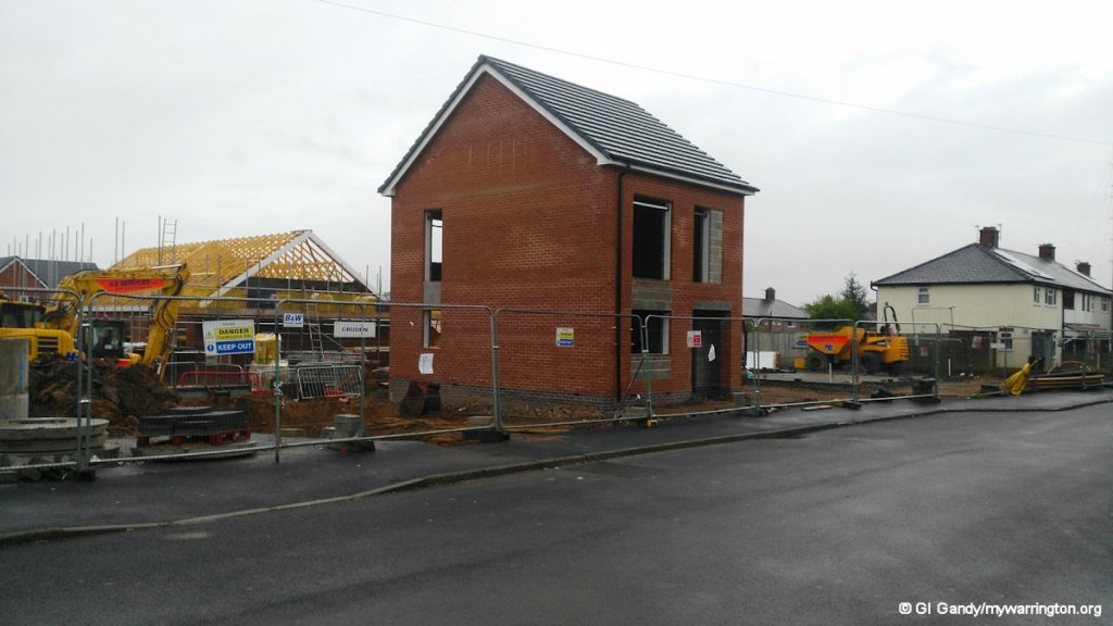
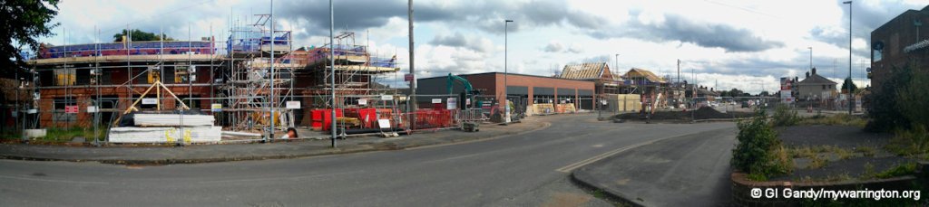
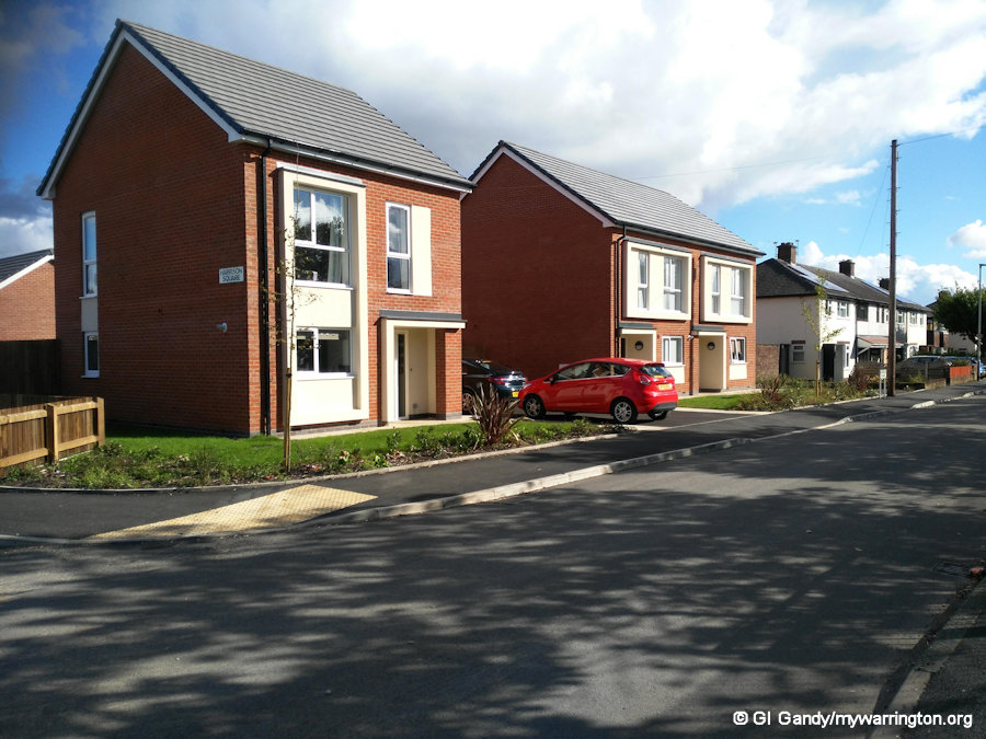
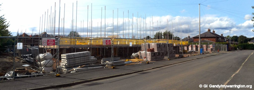
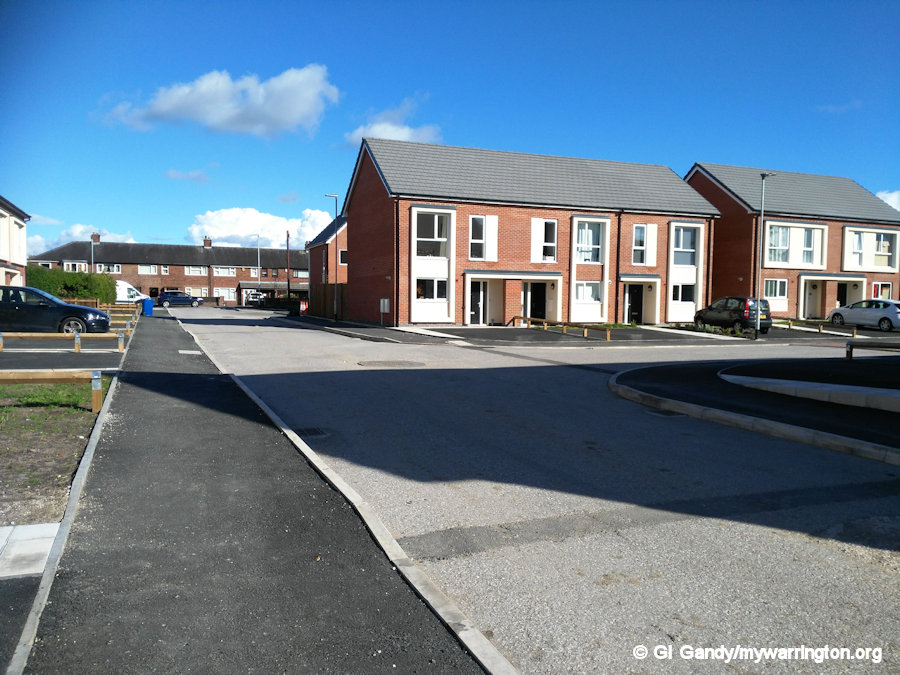
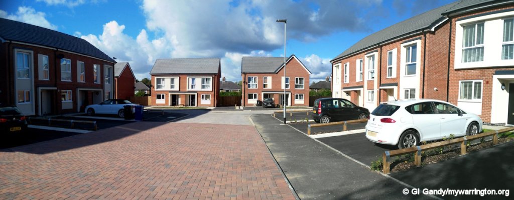
The Regeneration of Harrison Square
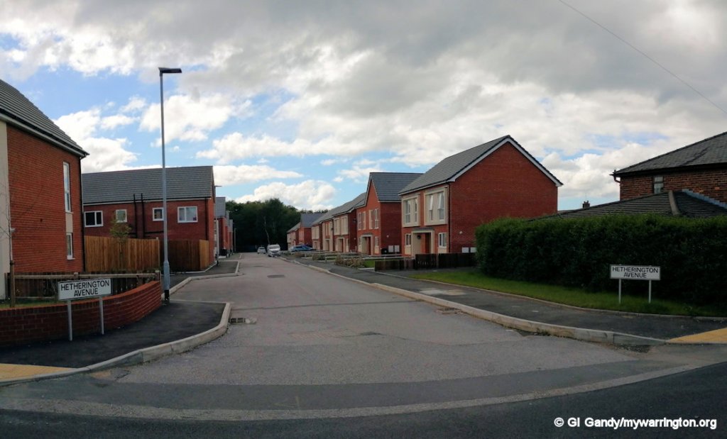
Two years after the public exhibition, work starts on the regeneration of Harrison Square, Boulting Avenue and Longshaw Street. Let’s look at the highlights of the build and the completed project in a series of photographs taken between February 2017 and June 2019. Again, view them as a slideshow.
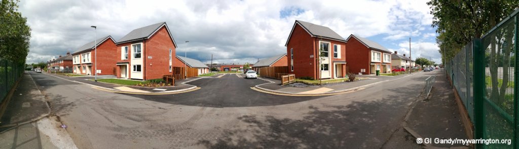
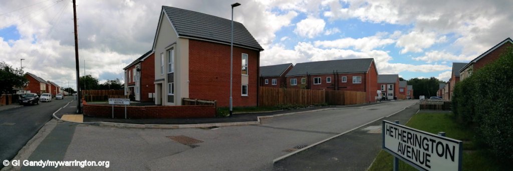
Harrison Centre to Hetherington Avenue


Grey to Green
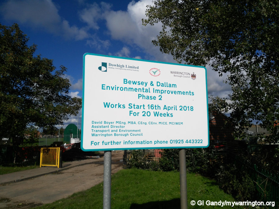
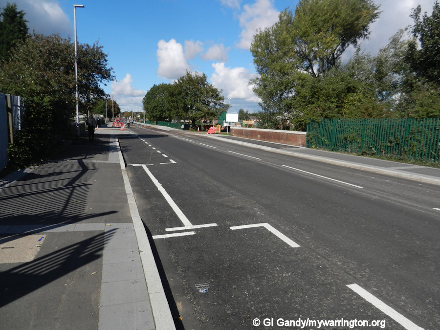
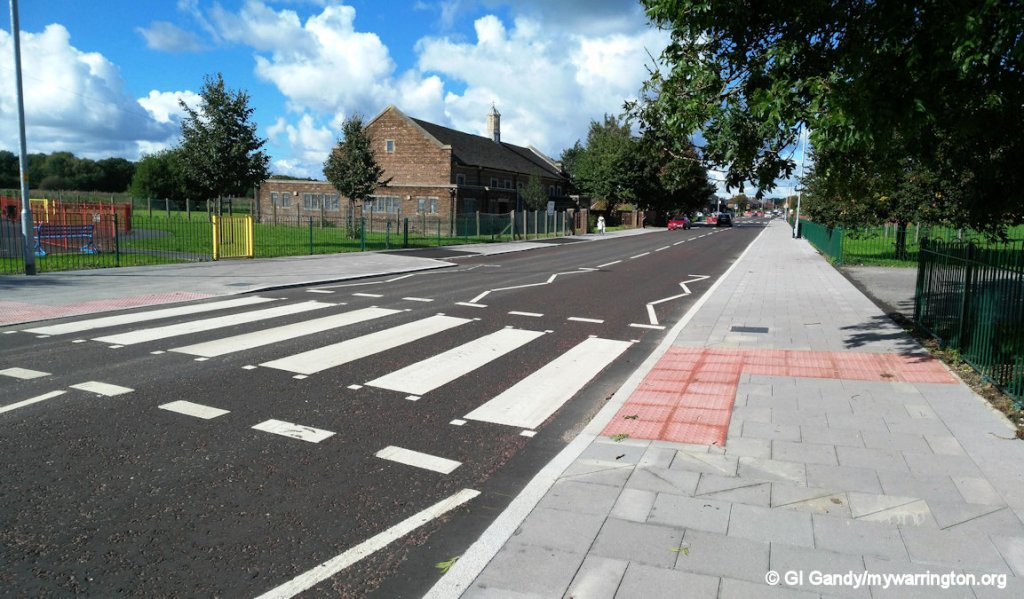
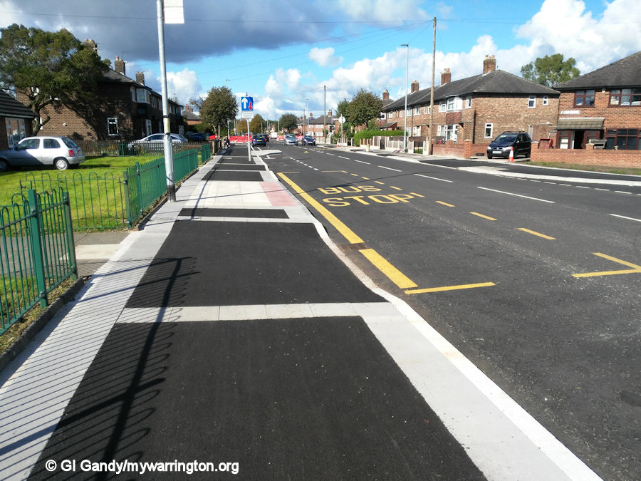
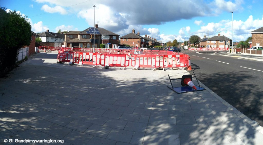
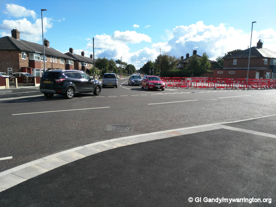
Grey to Green was a road and pavement improvement scheme for Bewsey and Dallam. The Bewsey section was completed in 2016 and the Dallam section in 2018. The work involved new pedestrian crossings, road markings, new pavements and parking spaces. The project also including a change of priority at the junction of Longshaw Street and Hawleys Lane. In times past, residents had complained about vehicles leaving Hawleys Lane at speed to travel down to Bewsey, thus putting pedestrians at risk from irresponsible and selfish drivers and motorcyclists. So the improvement meant that Longshaw Street was no longer the priority, instead Hawleys Lane would be. Pavements were widening at the junction and Longshaw Street traffic now has to give way. If any rider or driver now turned onto Longshaw Street at speed they are likely to crash their own vehicle due to the sharp angle they now must observe.
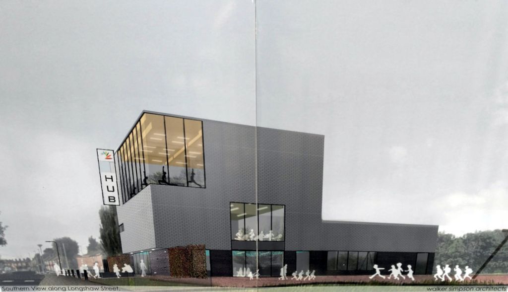
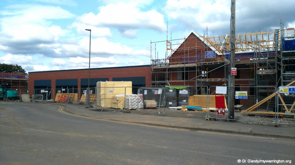
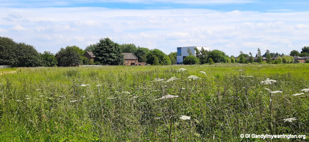
Bewsey and Dallam Community Hub
There is no pub in the Dallam area nowadays; the only one it had was Warrington Transport Club, which closed in the early 21st century before burning down. The building was demolished in May 2005. My mum worked at the Transport Club for 26 years before retiring. I still have a stool in my home which was given to mum when the club was renovated. The Warrington transport in question is the local council-owned bus company which has existed since 1902.
The large empty space next to the Dallam Brook vacated by the club now made the perfect space to build the promised Bewsey and Dallam Community Hub.
The £4.3 million hub on Longshaw Street was completed in June 2021 and officially opened on 15 November 2021. My photos here are from 20 Jun 2024 when the building in use.
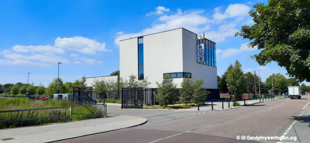
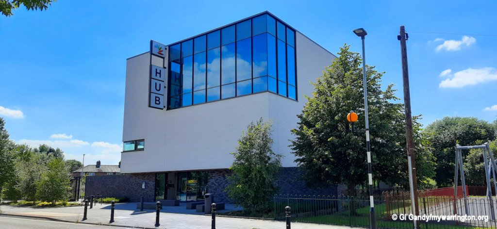
The facility provides residents with a range of community and wellbeing services, including community spaces, a state-of-the-art gym, multi-use studio, pool, and library provision.
The community hub project originally developed through the Delivering Wellbeing in Bewsey and Dallam programme, before being adopted as a priority project in the Central 6 Masterplan. The council and other partners, including Torus, provided the necessary capital investment along with a grant awarded by Sport England.
I was invited to take a look round on 20 June 2024, but didn’t take photos inside due to the building being in use. But I must say I was impressed. A member of the team said the site is well used by locals and it has generated a feel good factor in the area. Read more here.
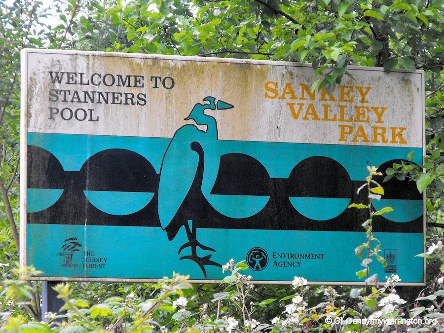
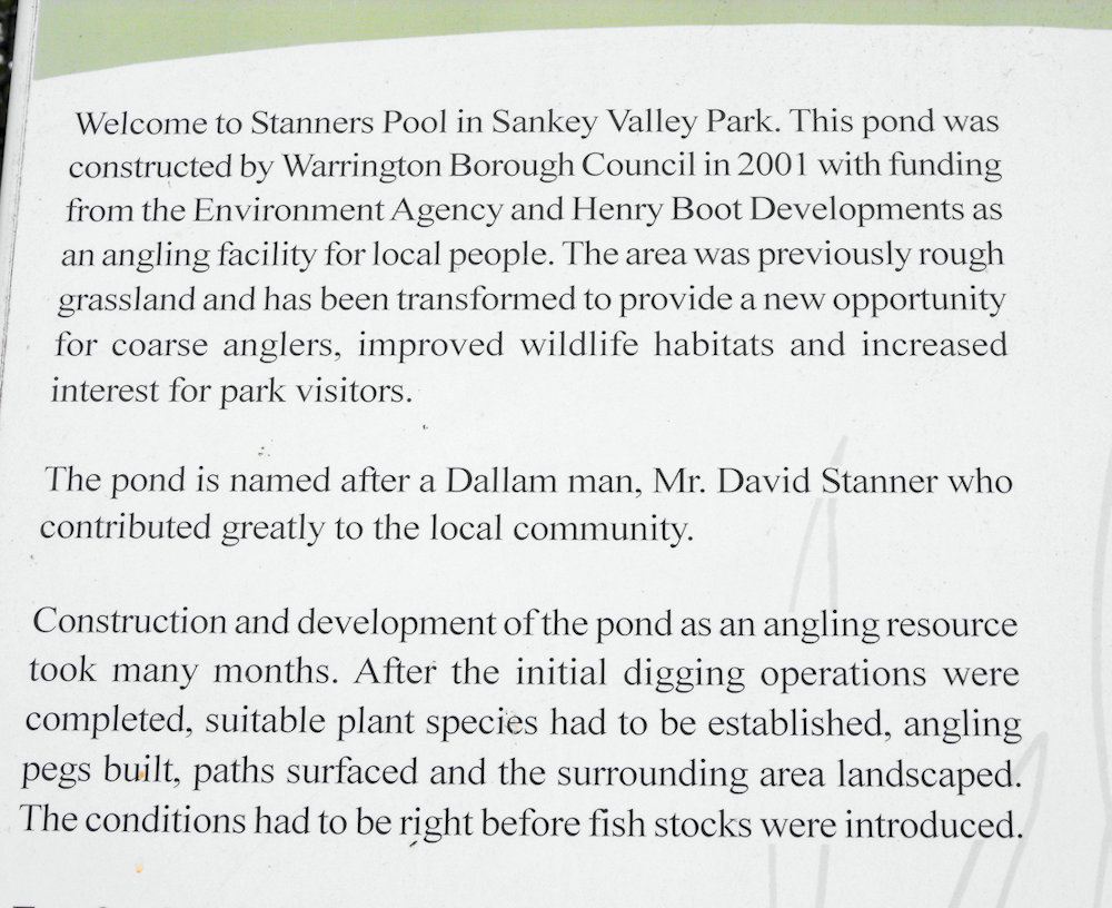
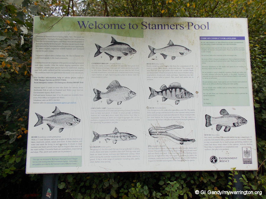
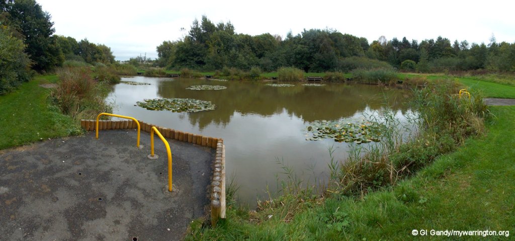
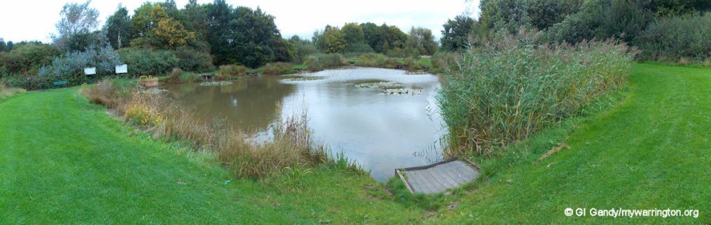
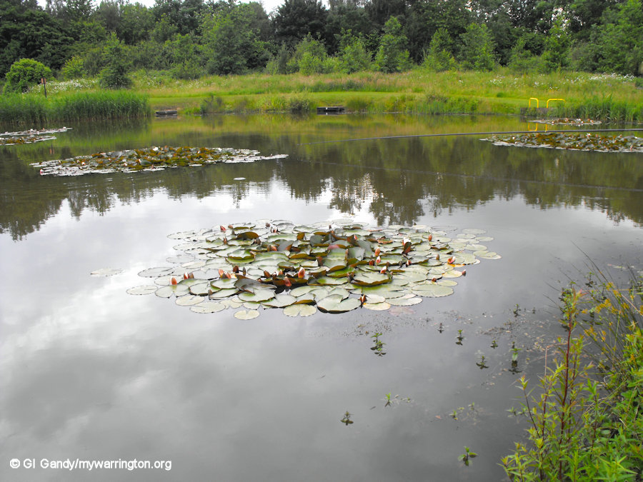
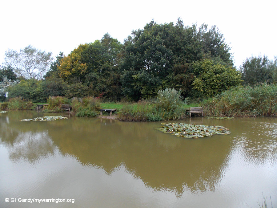
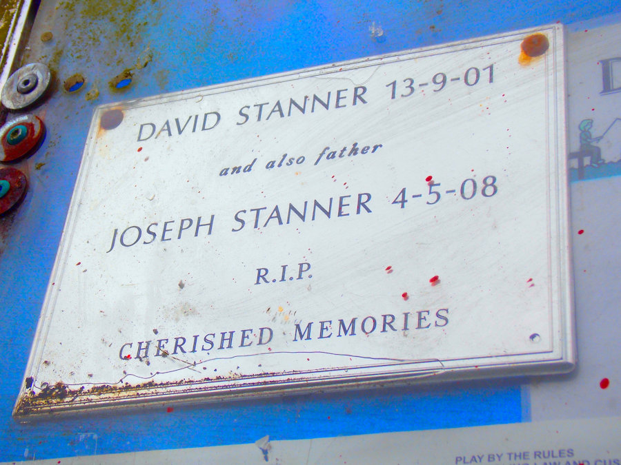
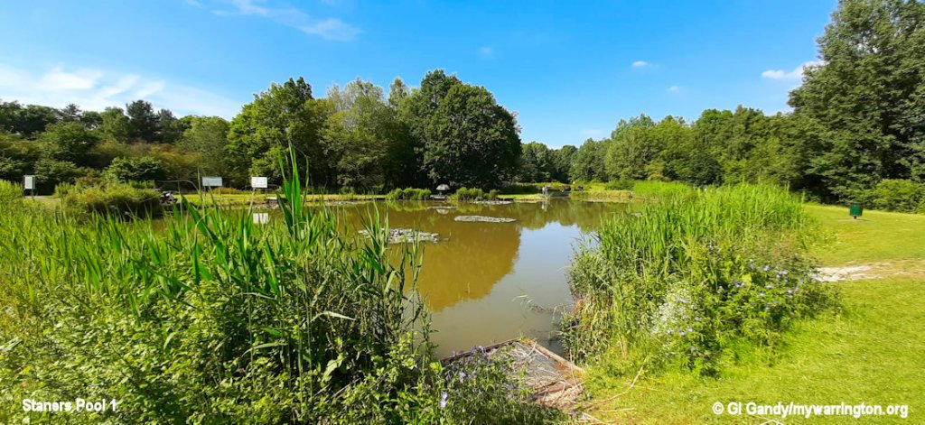
Stanners Pool
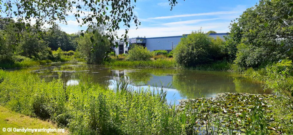
Dave Stanner was a much loved member of the community in Dallam and his early death in 2001 prompted residents to find a way to remember him. He loved fishing and so the idea for a fishing pool was suggested. Before then the only fishing pond in the area was Shaky’s Pit which had long seen better days. Parts of it still exist on the edge of Callands close to the Sankey Canal. You can read more about Stanners Pool in the photos below.
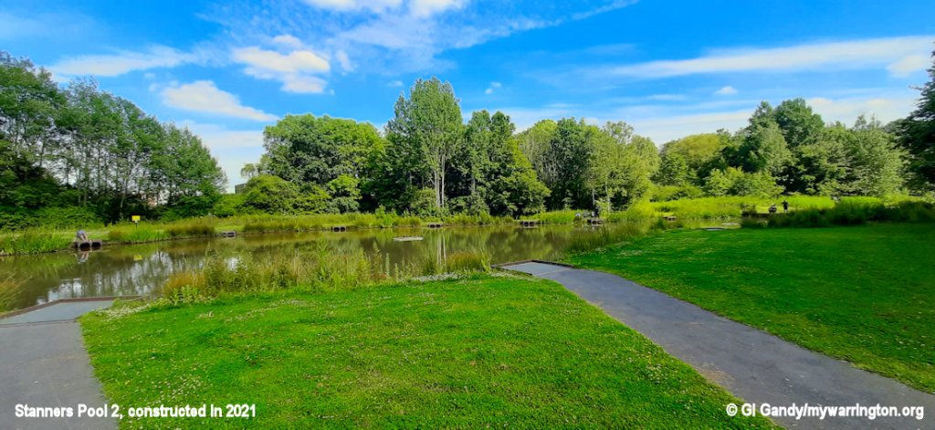
On my revisit to Dallam on 20 June 2024, I learned there was a second Stanners Pool. The original pool was so popular that a second pool was requested and work began on its construction in 2021. The second pool is approximately 14 feet (4.3 metres) deep. There is a tunnel that links both pools so the fish can move between the two.
A second pool was added in 2021.
Shaky’s Pit on the opposite of the Sankey Canal in Callands received a makeover when the Callands and Gemini areas were created. Here it is on 20 Jun 2024. Does anybody who know Shaky was?
Ordinary Lies
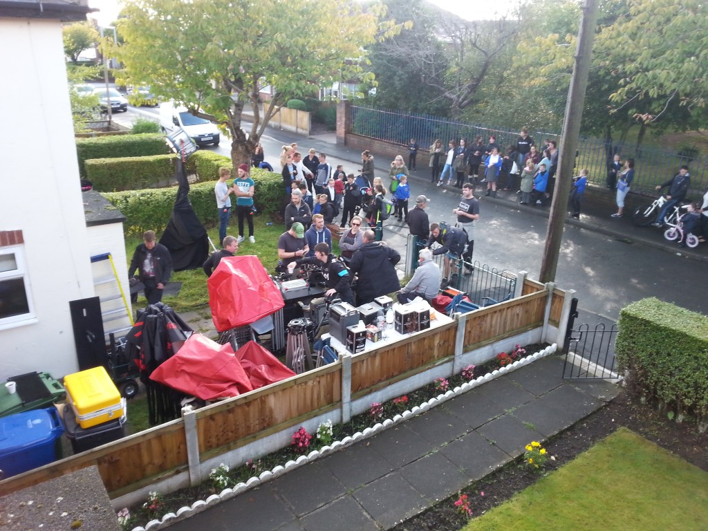
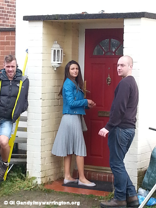
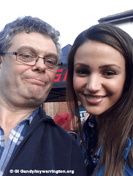
Ordinary Lies is a BBC TV drama series that was first broadcast on 17 March 2015. The six-part first series, written by Danny Brocklehurst, is set in a car showroom in Warrington employing a number of ‘ordinary’ people, each with dark secrets. As each episode unravels, it becomes clear how quickly lies can escalate with shocking consequences. The series starred Jason Manford, Sally Lindsay and Michelle Keegan, among others. Some of Michelle’s scenes were filmed in Dallam and I was lucky enough to have my photo taken with her during a break in filming. For the second series the cast and crew relocated to Wales.

Conclusions
I lived in Dallam for 45 years and only moved away after my parents passed away and I needed to downsize my living accommodation. I have visited the area on many occasions since and its always nice when people remember you. It has been a long journey for some to finally get some decent community facilities after many false starts and my hope is that the community hub, the play areas and open green spaces will serve the people of Dallam for many years to come.
And here’s a fact I didn’t know until I was researching some map data for a different section of the Downtown series: Dallam, at one time, had a police station at the junction of Hawleys Lane and Bardsley Avenue. Click here to see it on the map. I have been able to conclude that the section of the map in question was originally published before 1956. How do I know? Because if you scroll across to Longford roundabout the second college building (with access from Winwick Road) where I studied between 1998 and 2001 is not on the map – and that building was opened in 1956. On the map it only shows the Long Lane building.
