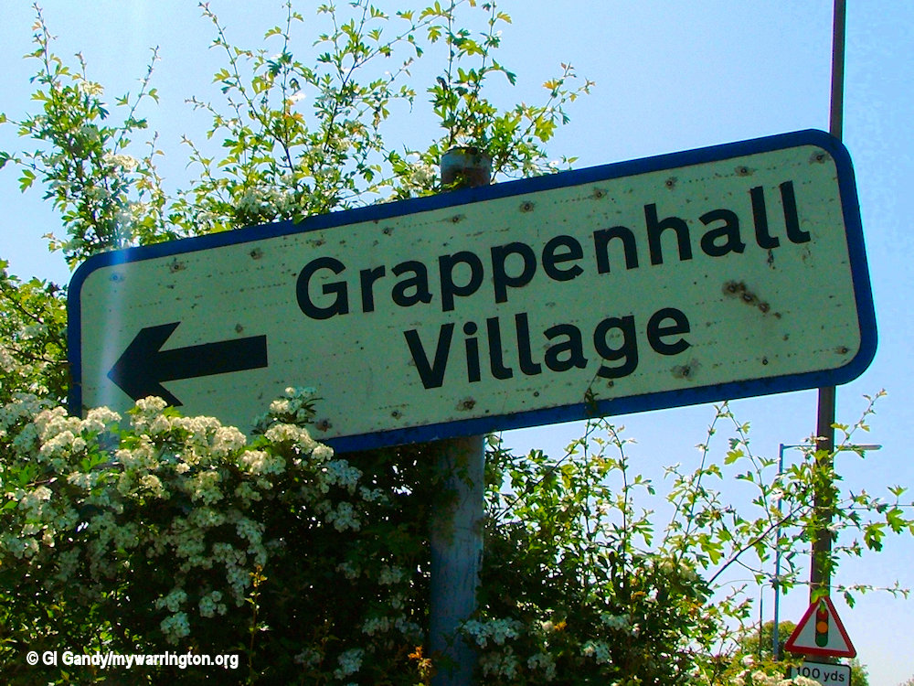
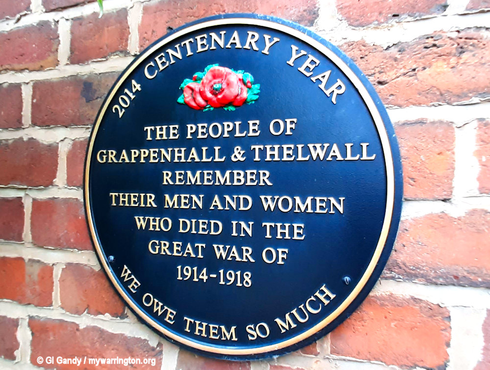
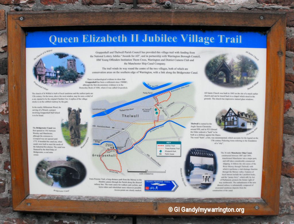
Introduction
In 1870-72, John Marius Wilson’s Imperial Gazetteer of England and Wales described Grappenhall like this:
GRAPPENHALL, a township and a parish in the district of Warrington and county of Chester. The township lies on the Bridgewater canal, near the North-western railway and the river Mersey, 2¾ miles SE by S of Warrington; and has a post office under Warrington. Acres, 1, 540. Real property, £5, 566. …
Pop., 701. Houses, 139. The parish includes also the township of Latchford, and contains 2, 550 acres. Real property, £14, 438. Pop., 3, 586. Houses, 712. The property is subdivided. G. Hall and the Heys are chief residences. The living is a rectory in the diocese of Chester. Value, £542.* Patron, the Rev. T. Greenall. The church was built in 1539. The two vicarages of Latchford are separate benefices. There two dissenting chapels, a national school, and charities £18.
GB Historical GIS / University of Portsmouth, History of Grappenhall, in Warrington and Cheshire | Map and description, A Vision of Britain through Time.
URL: https://www.visionofbritain.org.uk/place/1435
Date accessed: 22nd July 2024
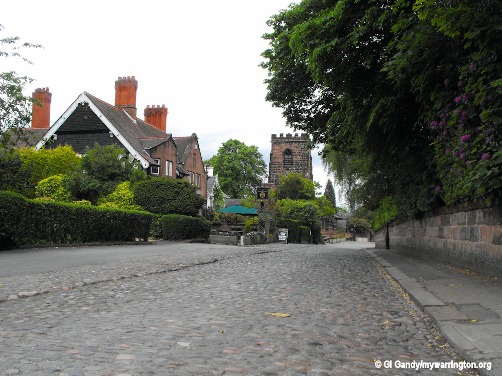
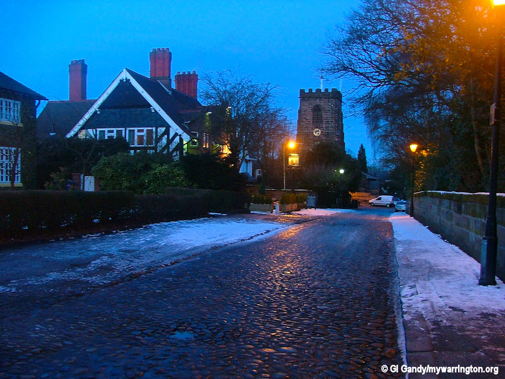
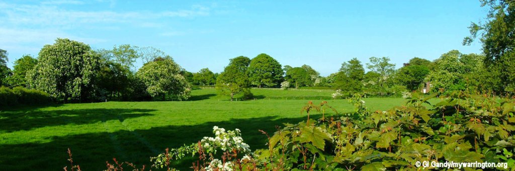
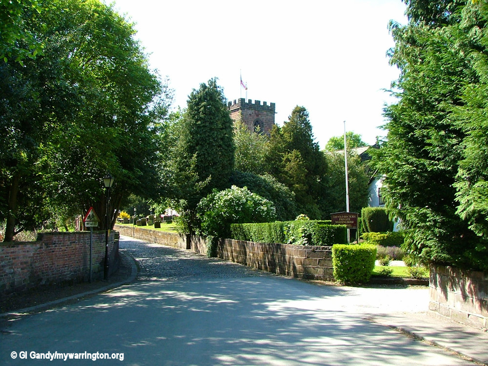
The classic postcard view of the village
There is archaeological evidence that the area around Grappenhall has been settled since 1900 BC.
See photos at the Cheshire Now website. See also Culture Warrington’s website for the story of Grappenhall burial urn.
Grappenhall is first mentioned in the Domesday Book (under the name Gropenhale), which states it to be worth five shillings.
Gropenhale comes from “grop” ‘grep’, or ‘grepe’ (meaning ditch/drain), and ‘halh’ (meaning flat land by a river).
Lumb Brook and Morris Brook both flow through Grappenhall, so the name could refer to those two waterways. The original boundary of Grappenhall stretched down to the River Mersey, so that seems to fit the meaning of the original village name.
Grappenhall has been included in the following Poor Law Unions from 1834:
- Runcorn (1837–45)
- Warrington Poor Law Union, Lancashire (1845–96)
- Runcorn (1896–1930).
information from Grappenhall, Cheshire Genealogy.
The parish had a population of 9,377 at the 2001 census, 9,687 at the 2011 Census and 9,651 in the most recent survey for 2021.
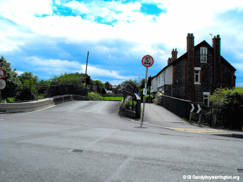
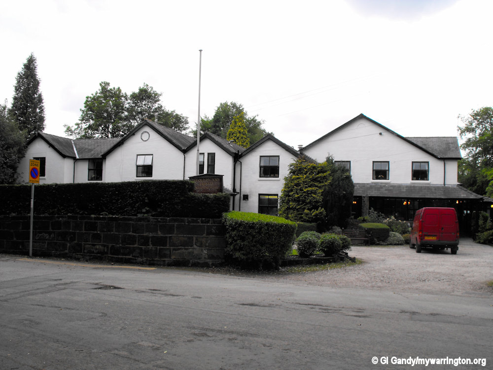
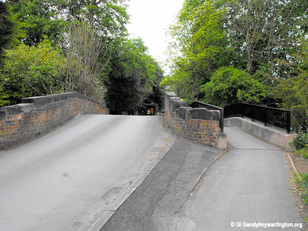
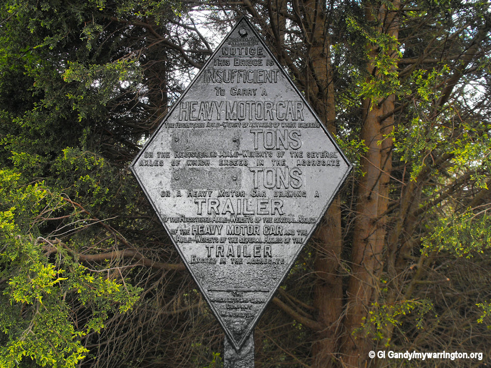
The entrance to Church Lane via Stanney Lunt Bridge over the Bridgewater Canal from the A56 Chester Road.
The two houses over Stanney Lunt Bridge on Church Lane were built in 1906 (white building closest to camera) and 1905
The Grappenhall and Thelwall Parish Council website tells us that separate administrative parishes of Grappenhall and Thelwall were established in 1894, and although merged in 1936, the parish was only designated Grappenhall & Thelwall in 1974. This part of Cheshire flourished as an agricultural area with associated rural industries such as leather processing.
Before the construction of the Manchester Ship Canal, the River Mersey formed the natural boundary with Lancashire. Early maps of the parish reveal a scattered settlement pattern, which comprised a number of large country houses, as well as farms and cottages.
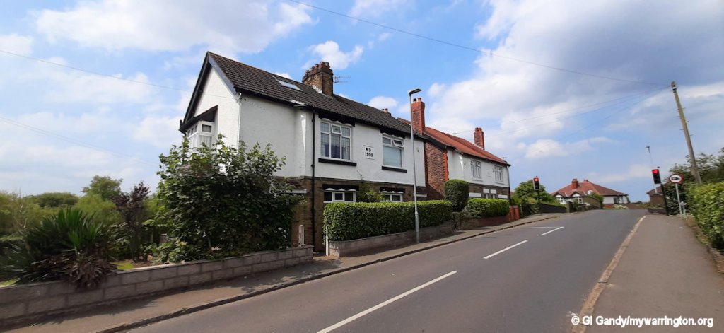
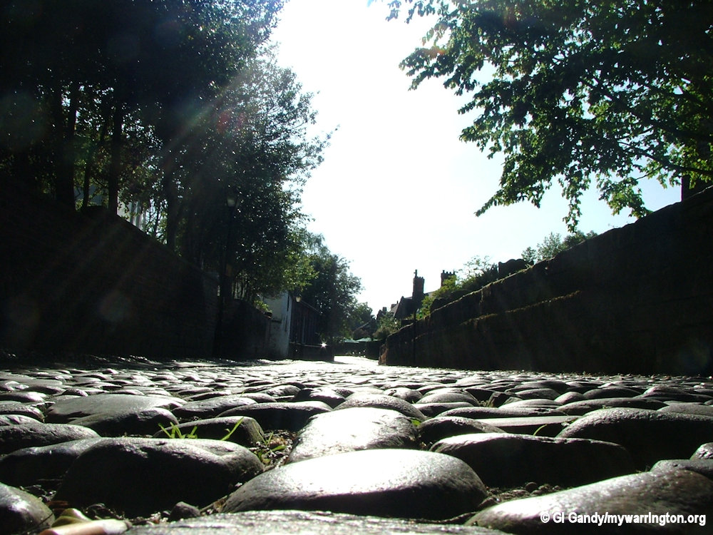
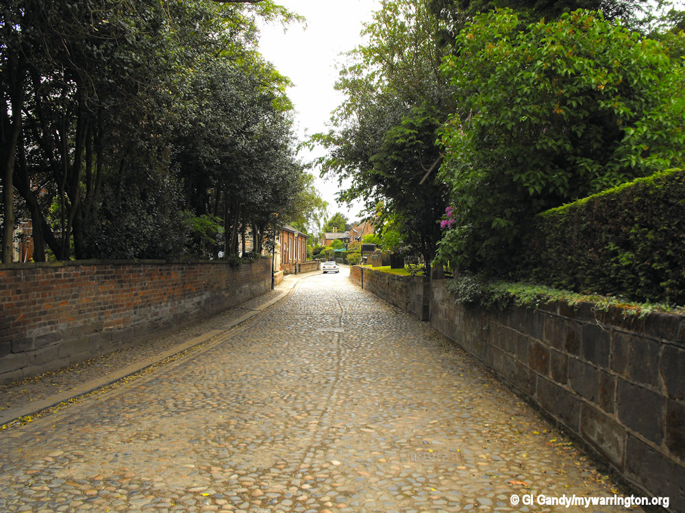
The oldest part of the village is on Church Lane which comprises mainly 17th and 19th century buildings.
See Genuki.org for more on Grappenhall.
You might also enjoy Cheshire’s Mix 56 radio station who have a feature about why they like Grappenhall.
The Boydell Family
Some of the notes are based on a lecture by Arthur Mounfield, F. R. Hist. S. From “The Warrington Examiner” of 2nd and 9th of June 1923 and reproduced with kind permission from the Boydell Family History website. Other notes come from Wikipedia and my own research.
After the Conquest, William of Normandy’s commissioners were instructed to put on record the names of those who held the land in the days of Edward the Confessor, the extent and nature of the aress, how many mills and fishponds, how much the land was worth in Edward’s time and how much after the upheaval of the Conquest. This became known as the Domesday Survey.
Grappenhall’s Domesday entry in full:
Osbern (Fitz Tezzon) holds Gropenhale and Edward of him, he and Dot, both freemen, held it as two manors. There is one hide and half a virgat of Land ratable to the gelt. The land is two carucates, one and a half of which are demesne; and there are two serfs and one villein and three bordars. There is a wood one League long and forty perches broad. There are two hays. Its value in King Edward’s time was five shillings (a year); it is now worth six shillings. When it came to the Earl of Chester it was waste.
The information is slight, but it is interesting. It means that the areas we call Latchford, Latchford Without and Grappenhall were held in Saxon days by two men named Edward and Dot. The county of Cheshire was devastated by fire and sword, and when it came to Hugh Lupus, who received the county as his portion, it was next to worthless. “It was waste,” says the record; and under those pitiful words lie materials for one of the most tragic volumes that could be written, a story of brave and simple men destroyed, their houses and crops burned and plundered. England changed hands amid pillage and blood, and the smoke of ruin filled the landscape.
The change that took place at Grappenhall was typical. Edward and Dot, the two Saxons, were put in charge under the new order. To cultivate the 2,400 acres they had two serfs, one villein, and three bordars (a bordar is a feudal tenant holding a cottage and usually a few acres of land at the will of his lord and bound to menial service). Allowing that all may have had families, the population of Latchford and Grappenhall would scarcely reach fifty.
In the wood three miles long they would hunt the deer, the freemen taking the venison, the serfs and bordars eating the umbles or remnants in the form of “umble pie.” Beyond a guess that they lived the simple life, and a confident statement that Latchford Without was not famous for villa architecture, we cannot say much about the home life of Edward and Dot. It is possible to picture Grappenhall with the pigs that feed upon the acorns in its forest and the serfs and villein who tend them, but of Edward and Dot we hear no more. They come and go in that one sentence in the Domesday Book.
Church Lane, Grappenhall
We must take notice of the new owner to whom the Conqueror gave the land, because he was the ancestor of the Boydells and the Middlehursts, and his children’s names fill many a misty charter. It should be explained that Hugh Lupus, who became Earl of Chester, received the county of Chester from William the Conqueror, and he in turn divided it among his followers, of whom Osbern Fitz Tezzon was one.
Osbern Fitz Tezzon, the Norman, was a man of some note. Possibly he saw little of Grappenhall and Latchford, for he held also Lyme, Warburton, Appleton, Hanley, Gresford and some other places. What is more important, he held, under Hugh Lupus, the castle of Dodleston, a very exacting post on the Welsh border. Osbern left Grappenhall to his son Hugh Fitz Osbern, who in turn had a son named Osbern Fitz Hugh.

Bridgewater Canal at Grappenhall
This Osbern the third had a son named Helto, who called himself Helto de Boydell. Thus came in the name of Boydell, which was destined to be associated with the village for centuries. Helto’s son was named Hugh de Boydell, and it is important to bring him into the discussion because it is in line of his documents that the name Latchford first appears. Here are what the records show:
“Randle, Earl of Chester, sendeth greeting, etc. Be it known to you that I have granted to Hugh De Boydell, the way in Latchford, with the passage of the water of Mersey, between Runcorn and Thel Wall, and that no wain of the two horses shall pass the saidd way and passage except by the allowance of the said Hugh and his heirs.”
This probably means in plain terms Hugh de Boydell was given the right to levy a toll upon those using the fords of the river. The date of this falls in the early part of the reign of Richard I, possibly about A.D. 1190. So long has Latchford had its name.
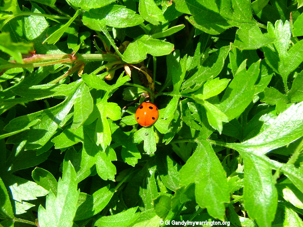
A ladybird photographed in the village
In l250, as an act of homage to the Church, William de Boydell by a charter gave “acquittance” to the Abbot and monks; be confirmed to God and the Blessed Mary that “the said Abbot and Monks for ever shall pass through my village Of Latchford with all things belonging to them without anything being required for the said passage. And for this grant and quit-claim neither I nor my heirs shall ask anything except their prayers and supplications.”
In a later charter, dated 1308, Sir John Boydell gave to the hermit friars of Warrington, the members of the religious house at Bridge Foot.
These charters give us the only glimpses we have of Grappenhall when it was a preserve of its feudal lord. The exchanging of privileges for prayers and masses by written agreement was quite characteristic of the period.
The Boydells were also active in church life as we shall now see.
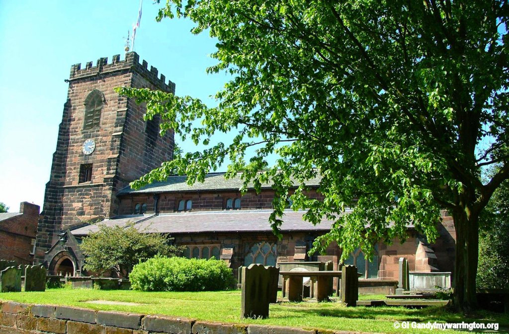
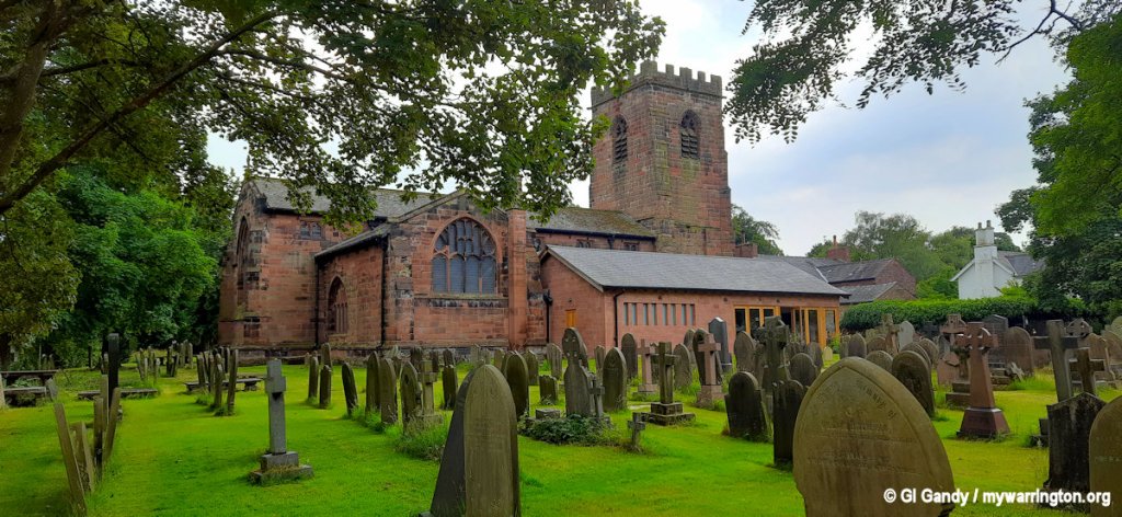
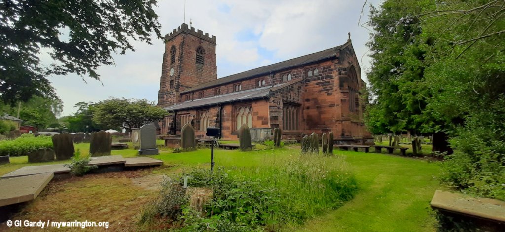
St Wilfrid’s Parish Church
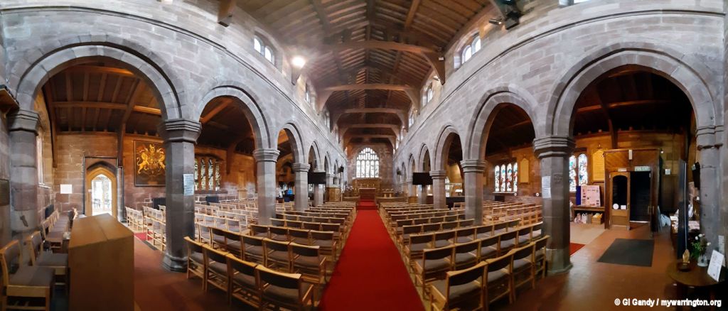
St Wilfrid’s Church is on Church Lane and has been designated by English Heritage as a Grade I listed building. It is an active Anglican parish church in the diocese of Chester, the archdeaconry of Chester and the deanery of Great Budworth.
The church is Norman in origin, built probably in the earlier part of the 12th century and completed about 1120. This was a small and simple church, consisting of a nave, chancel and, possibly, an apse. The foundations of this church were discovered during the 1873–74 restoration.
The foundations showed it to have been a small building. It would have had round-headed Norman windows and possibly a porch. Happily, for our interest, a scrap of the old building is left. When rebuilding took place in the 16th century, instead of demolishing the south wall, as they did the north, it was pierced and arches placed within it.
St Wilfrid’s, Grappenhall, on Church Lane
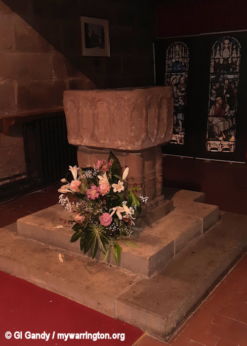
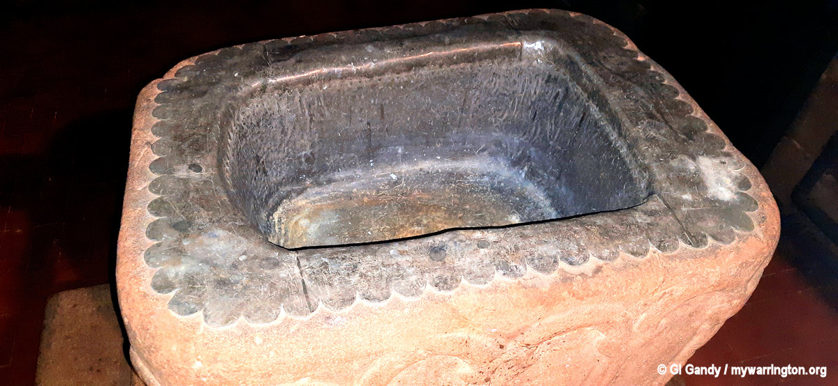
The upper portion was therefore left, and with it the corbel table and gargoyles of the Norman Church. These quaint faces carved by the early builders have looked down on the worshipper for about eight centuries. Formerly upon the outer wall of the church, they are now sheltered by the roof of the south aisle and are seen from within. Another relic of the first church is the Norman font.
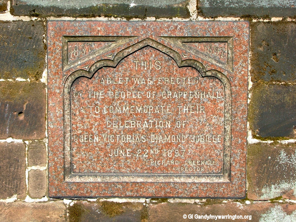
A chantry chapel was added by the Boydell family in 1334 in a position where the south aisle now stands. From 1529 the church was largely rebuilt in local sandstone. The old church was demolished and a new nave, chancel, north aisle and a west tower were built. In 1539 the south aisle was added, which incorporated the Boydell chapel.
The south porch was added in 1641 and at this time the west wall was strengthened. In 1833 the roof of the nave was raised to form a clerestory and in the 1850s the south aisle was further extended, and a vestry was built. There was a more substantial restoration in 1873–74 carried out by Paley and Austin.
The church is built in red sandstone with a slate roof. Its plan consists of a west tower, a continuous nave and chancel of seven bays with a clerestory, north and south aisles, a chapel at the east end of the south aisle, a vestry and a south porch.
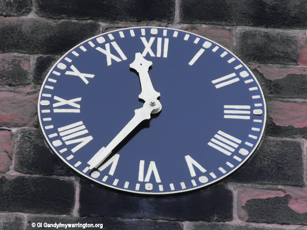
The tower is in three stages, with a Tudor west door, and a four-light west window. It has diagonal west buttresses and square east buttresses. In the middle stage are small windows, above which are clock faces and bell openings. On the summit is a crenellated parapet. The tower is about 76 feet (23 m) high.
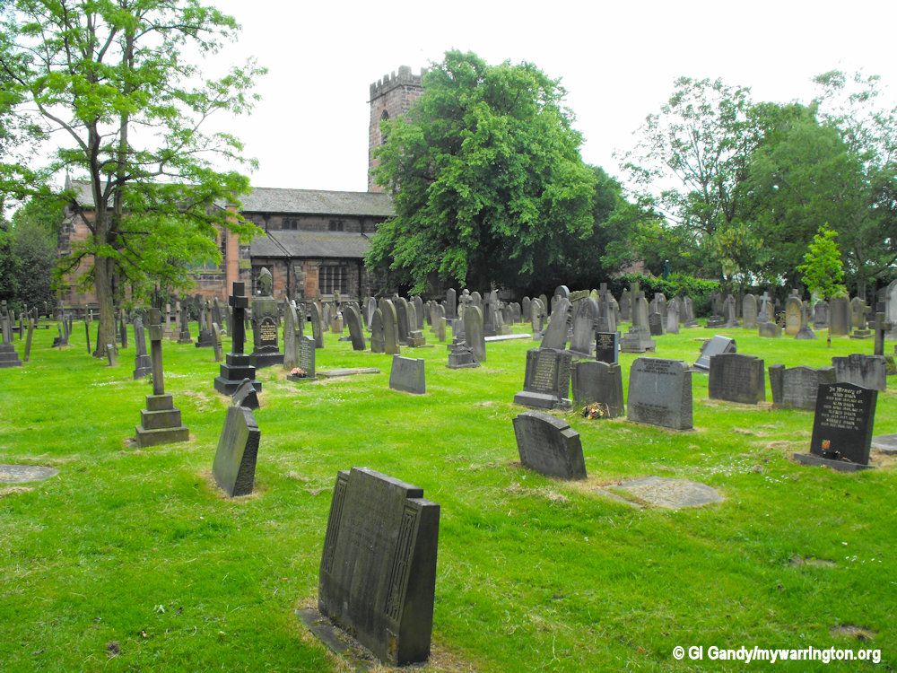
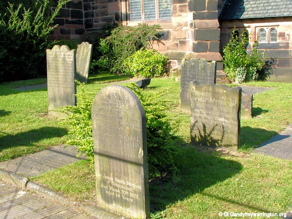
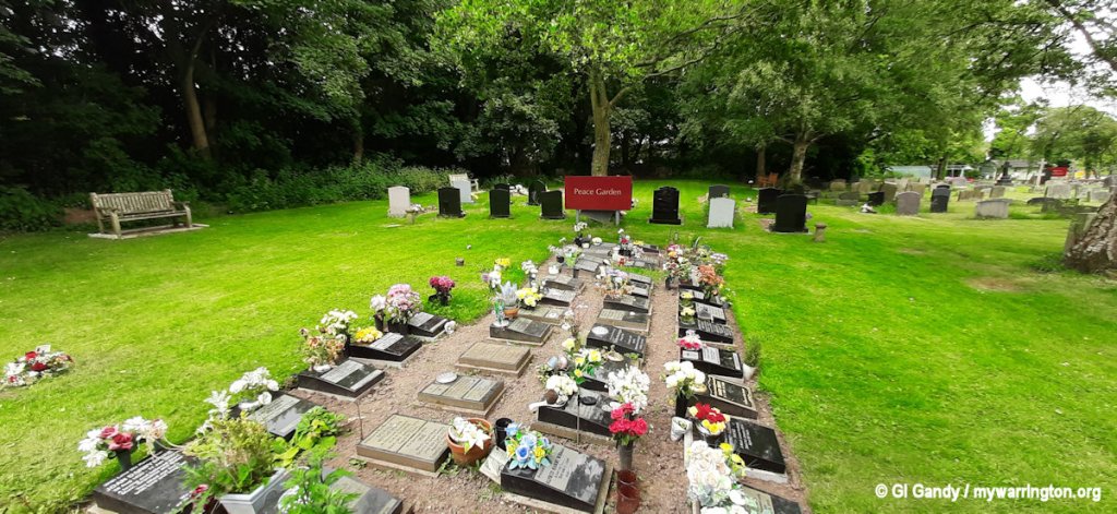
St Wilfrid’s church graveyard
The chancel east window is in Perpendicular style. The east window in the north aisle (formerly in the chancel) has five lights. The clerestory windows are paired and round-arched. Included in the internal fabric of the wall of the south aisle is a remnant of a Norman corbel table decorated with crudely carved human heads.
St Wilfrid’s Church has a carving of a cat on the west face of the tower. This is believed to be Lewis Carroll’s inspiration for the grinning Cheshire Cat in Alice’s Adventures in Wonderland.
There are other interesting features inside the church, including the altar dated 1641 and the royal coat of arms of Queen Anne (reigned 1702-1714).
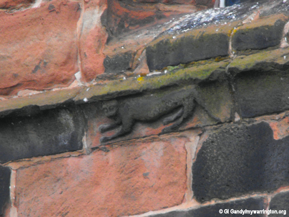
Said to be the influence for the Cheshire Cat in Alice’s adventures in Wonderland
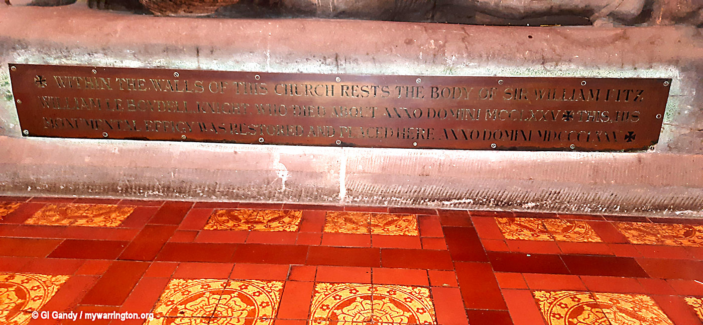
Built into the east wall of the north aisle are a piscina and a credence table. Inside the church are a holy table dated 1641, and the royal coat of arms of Queen Anne. In the chancel is an effigy of Sir William Boydell, who died in 1275. This was brought in from the churchyard in 1874 and restored.
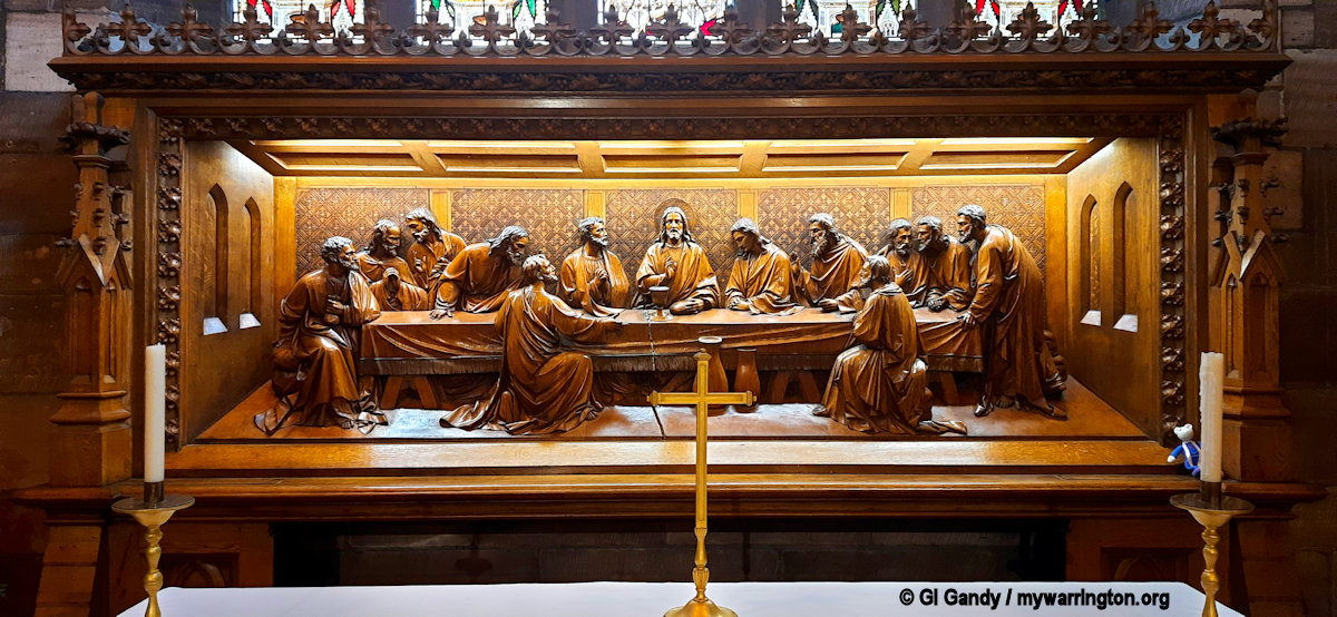
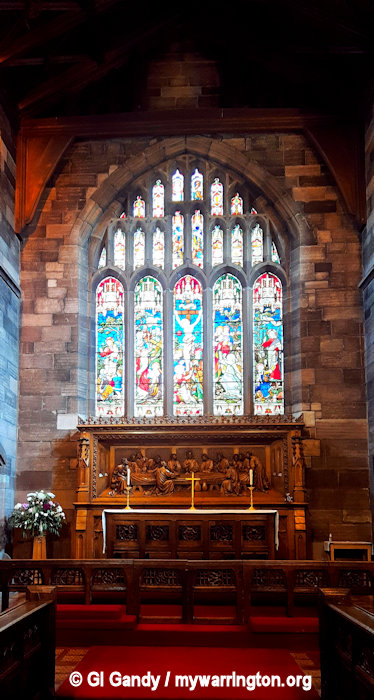
The reredos is carved in oak and is based on the painting of The Last Supper by Leonardo da Vinci. The font dates from the Norman era, or earlier, and was rediscovered in March 1873 during the restoration of the church.
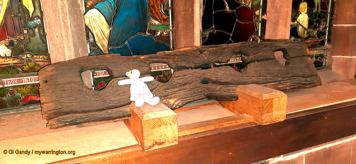
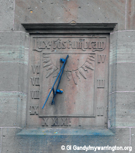
In the churchyard is a sundial dated 1714 which is Grade II listed. Its motto is “Pulvis et umbra sumus.” (we are dust and shadow). At the entrance to the churchyard, also Grade II listed, are stocks, the endstones probably dating from the 17th century. Read about the stocks on the Prison History website.
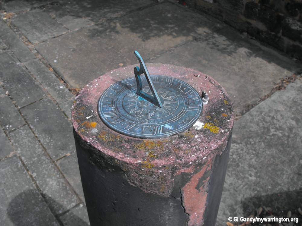
The sundial in the churchyard
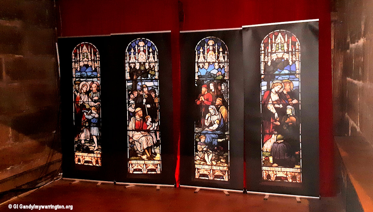
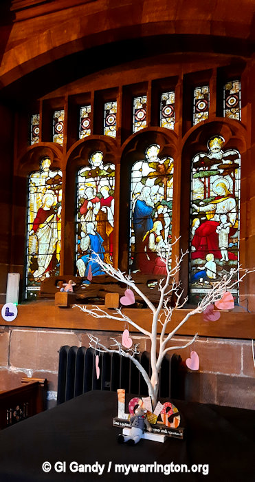
A window in the south aisle includes 14th-century glass which was rearranged in 1834 and depicts seven saints. Other windows in the aisle were made by Meyer of Munich. There are fragments of medieval glass elsewhere in the church.
St Wilfrid’s has a peal of eight bells. Four of these were cast by Henry Bagley II of Chacombe around 1700. A further bell dates from 1890 by John Taylor & Co, while the remaining three were cast in 1899 by Mears & Stainbank at the Whitechapel Bell Foundry. The parish registers date from 1573.
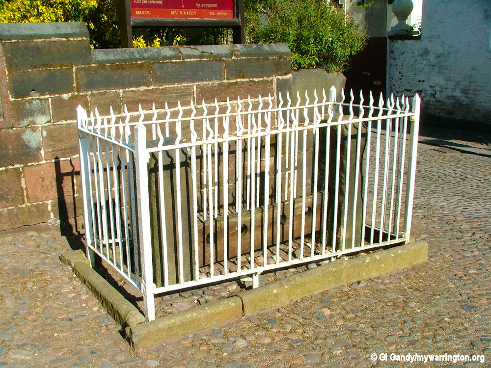
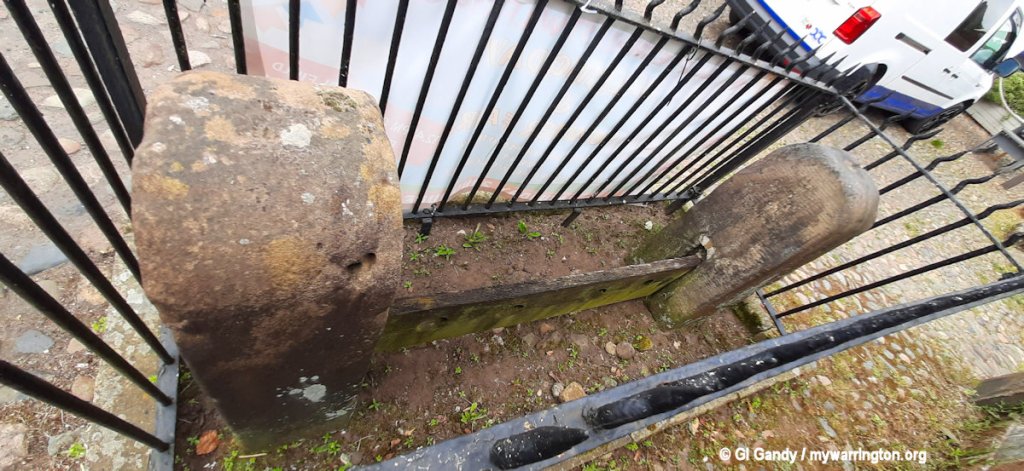
The village stocks
Live at St Wilfrid’s is a series of concerts of classical music hosted by the church. The concerts include performances by both young artists and by performers with international reputations.
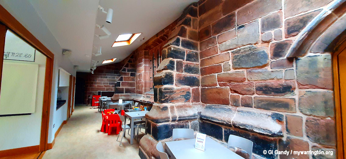
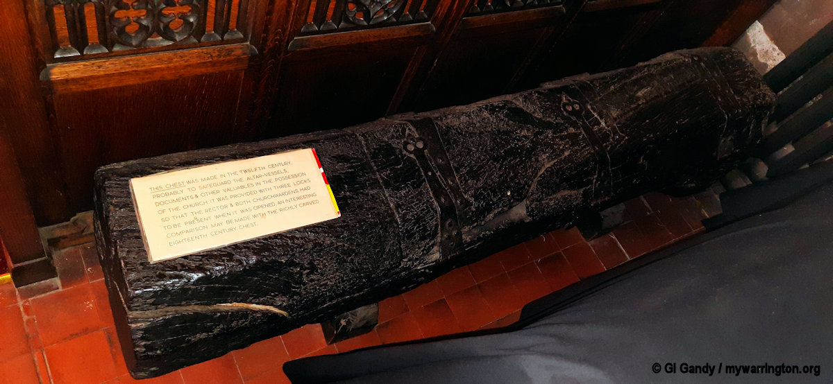
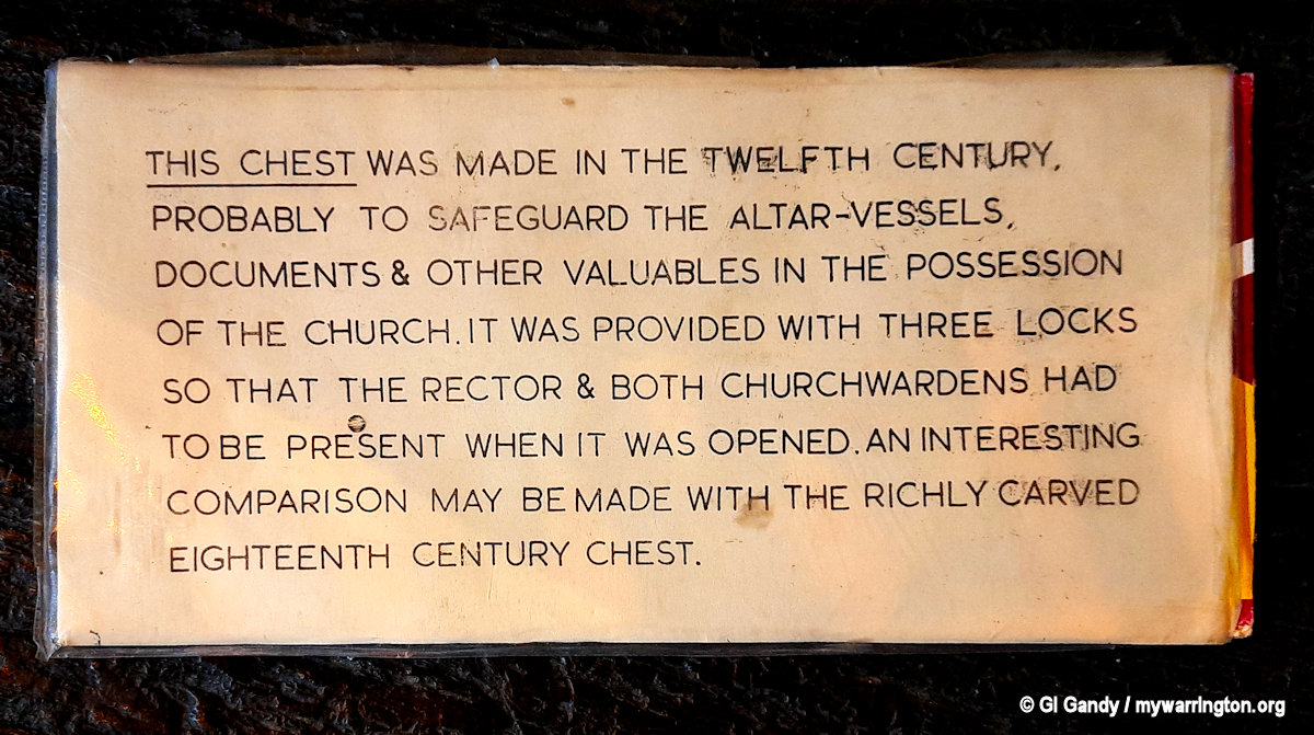
Let’s take a look inside St Wilfrid’s Church (photos taken 25 June 2024)
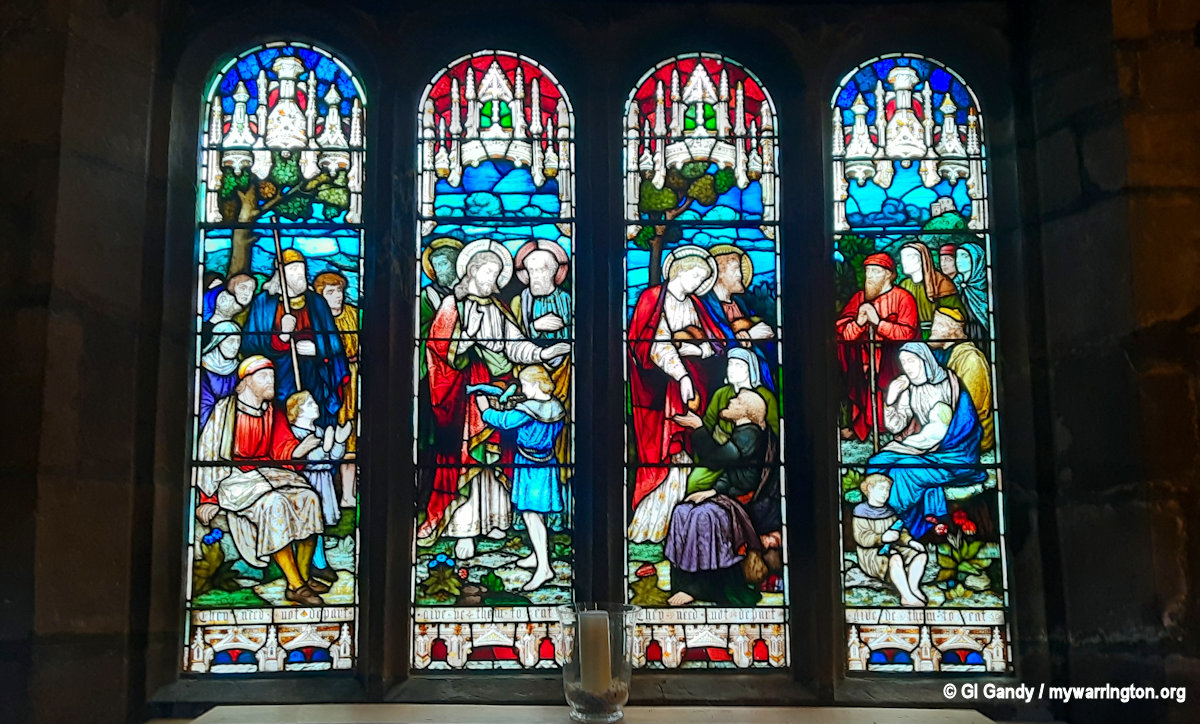
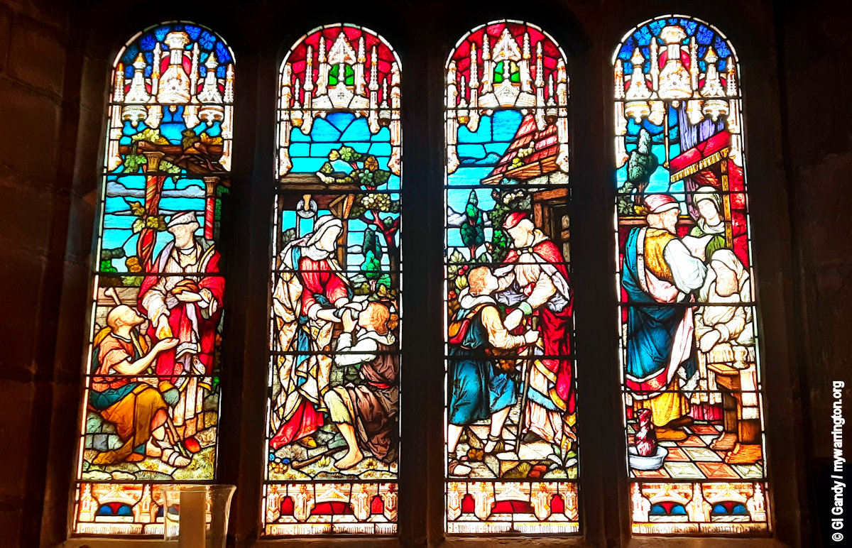
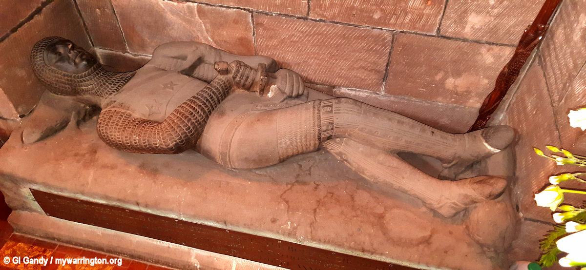
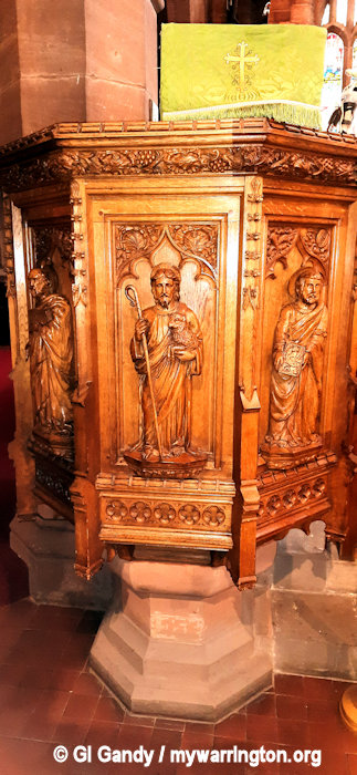
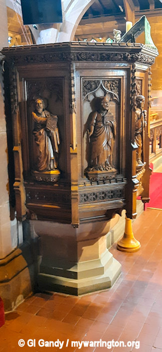
See the Boydell Family History website to read about the Boydell effigy and the Boydell window inside the church, which includes photographs, and where you can read the rest of the story not featured here in mywarrington.

A few last pictures of St Wilfrid’s Parish Church
The Old Rectory
The building dates to around 1830 and received Grade II listing status on 13 June 1984. The Old Rectory has now been converted into a retirement home. See the Historical England website for more details about the structure of the building.
The New Rectory
Across the road from the church is a large grey building. This was the New Rectory which was built in the early 1880s and is of Gothic design. It hosted many garden parties, fetes and social occasions in its time.

The former New Rectory as seen on 25 June 2024
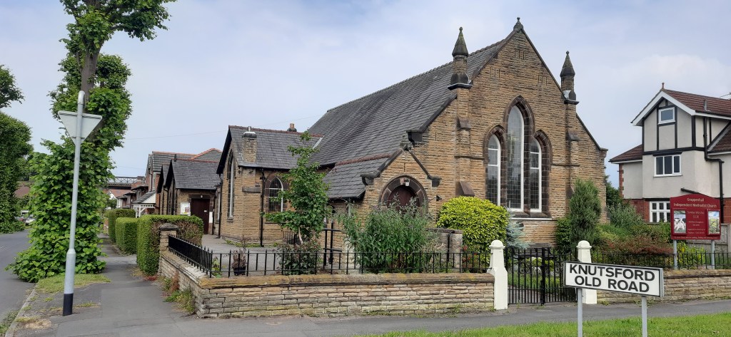
Grappenhall Independent Methodist Church
The origins of the church go back to 1855 when Thomas Leah, an Independent Methodist Lay Preacher moved into the area having found his faith in Lymm in 1828.
The Sunday School also started in 1855.
It started like many fellowships, in a room above a shop which soon became too small for the growing congregation.
This led to the purchase of some land on Chester Road and construction of a church building which opened in 1881.
Once again, the congregation grew and a larger building was required. This is the one we see today on Knutsford Road, which opened in 1913.
The building was enlarged in 1951.
Read more here.
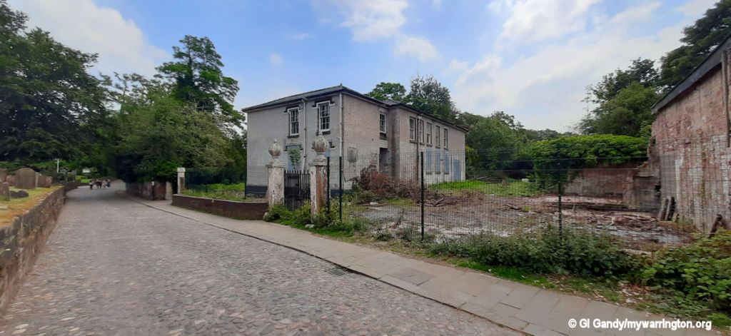
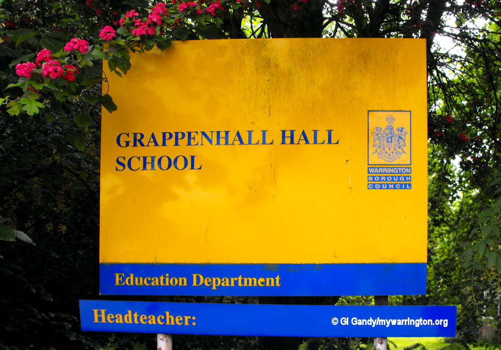
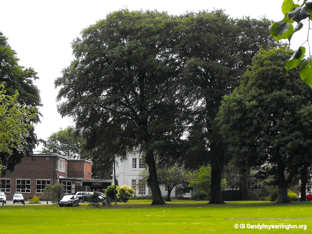
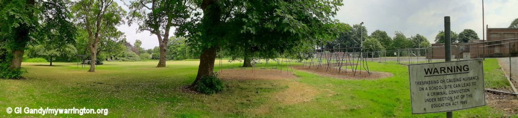
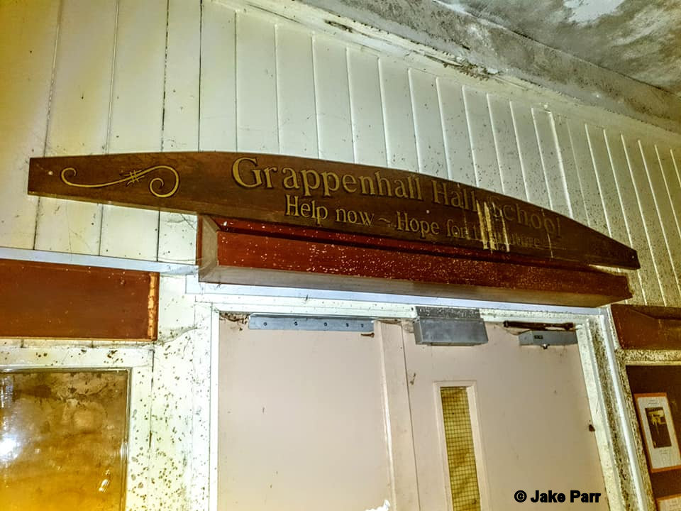
Grappenhall Hall School
Grappenhall Hall was built in 1914. The National Archives tell us Grappenhall Hall was built in 1914. The report gives the historian some fascinating information on the former Grappenhall Hall Residential Special School on Church Lane. For instance, it tells us the school was opened in 1957. In those times it came under No 3 Runcorn Divisional Executive, transferring to the Director of Education in April 1974 and to the District Education Officer in August 1987.
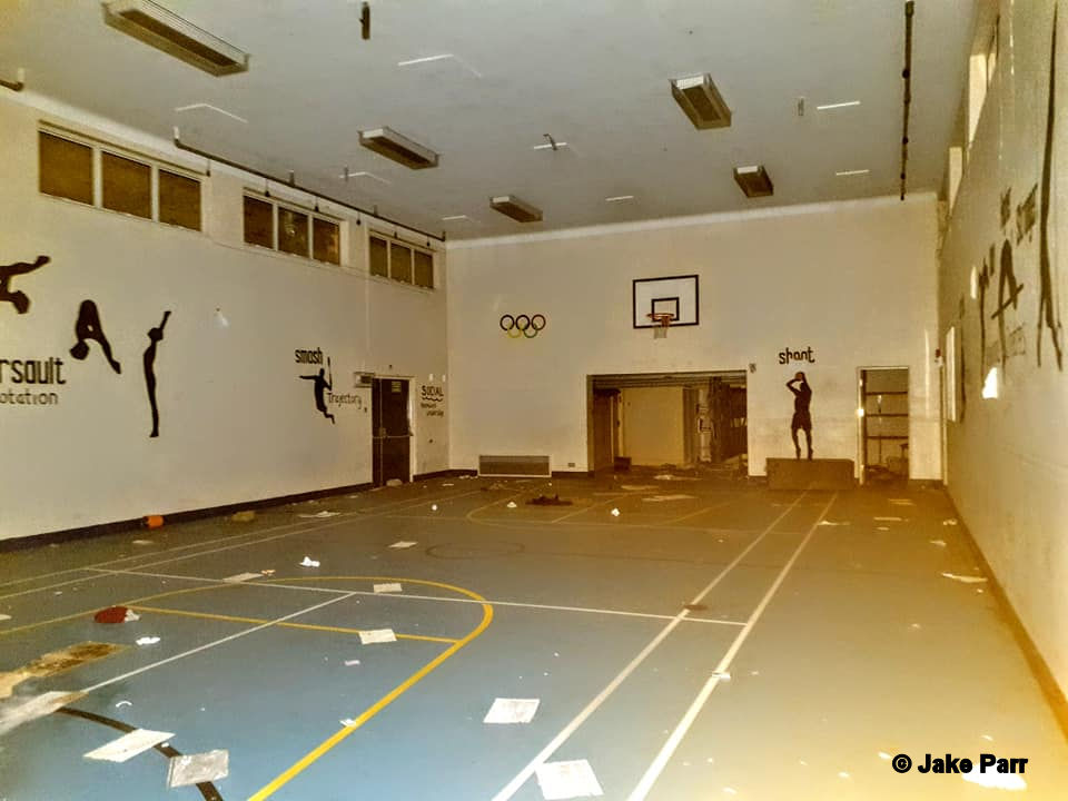
The sports hall was built in 1956 and refurbished in 2007. There were changing rooms attached to the facility and the hall measure 18 metres long by 10 metres wide. A tennis court was created in 1980 and used during daytime only as there was no floodlighting.
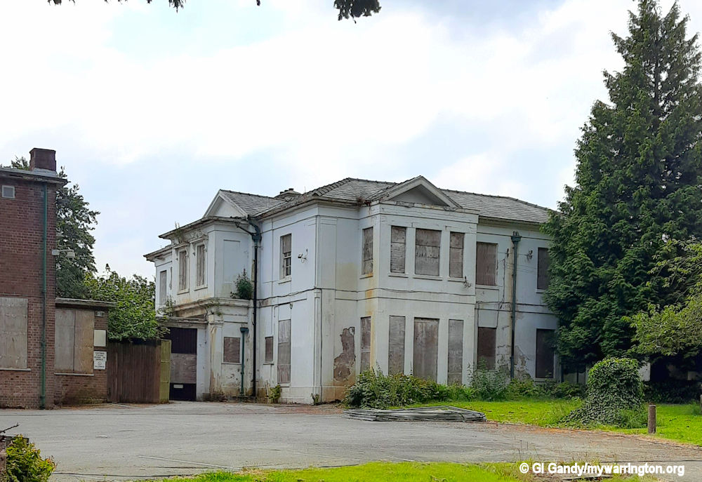
The special needs school closed on 1 September 2015 and all the pupils transferred to Green Lane in Padgate.
In 2019 the Warrington Guardian reported that after the school closed there was a debate in the area about how the site should be developed with talk in 2016 of it becoming new homes or even a boutique hotel.
Warrington Borough Council asked the Department of Education for permission to dispose of the land, either by selling it or developing it for another use.
But since then the derelict building has been largely forgotten.
In June 2017 the council told the Warrington Guardian it was ‘currently reviewing what can be done’ with the school grounds with ‘no definitive plans’ in place. A more recent suggestion for the transformation of the land has been new country park which fits in with the local plan.
In 2007 Geoff Settle posted some memories of the school in the Warrington-Worldwide forum.
I had the pleasure many years ago to visit the school and present 10 of the pupils with prizes and trophies. They had taken part in one of the four Chris Vose Running Races I organised for Warrington Athletic Club.
I received a call from a teacher at the school who asked if they could compete in the McDonalds 3km fun run. I said no problem and I didn’t give it a thought. We then had a chat about the fact that it would be their first run and that they had special needs.
I just told her that if she thought they’d be ok then I’d back her judgement. My only request to make sure that they did some training before hand and I gave her some advice. They had a wonderful day and won the team prize.
See a drone video of the site from Southern Urbex here.
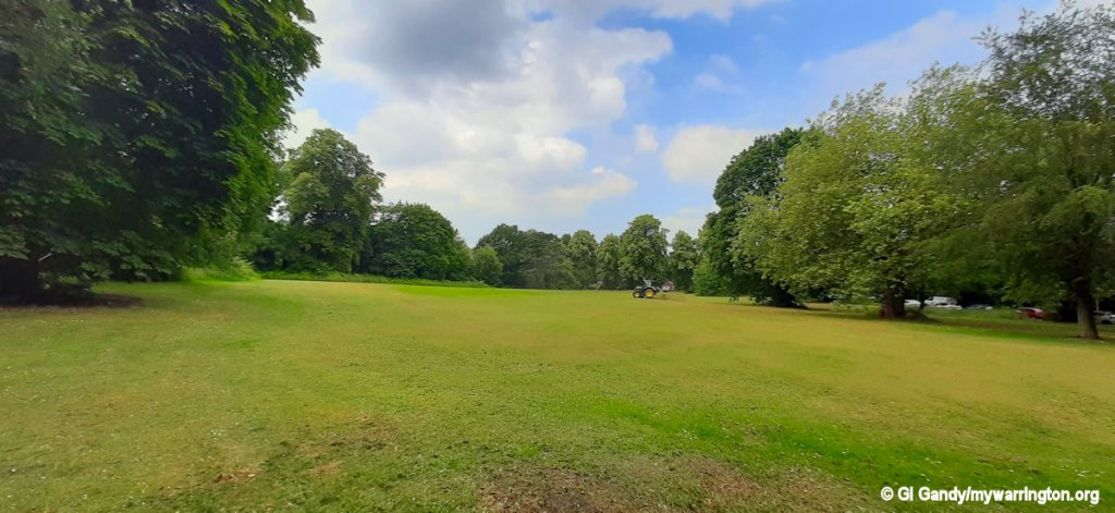
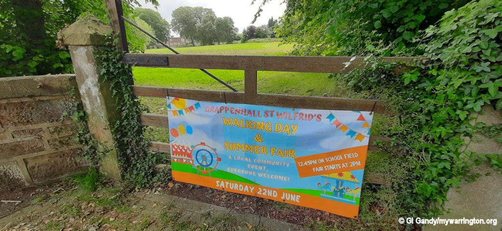
The former school must be costing the Council Tax payers a small fortune because when I visited the site on 25 June 2024 there was what looked like a security van and cabin stationed inside the security fence. Maybe it is time a formal decision was made on the future of the site. In the meantime, the school field is still being used for community events, such as the 2024 Walking Day and Summer Fair.
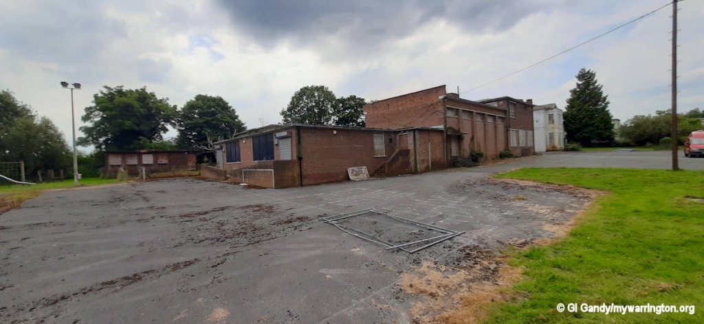
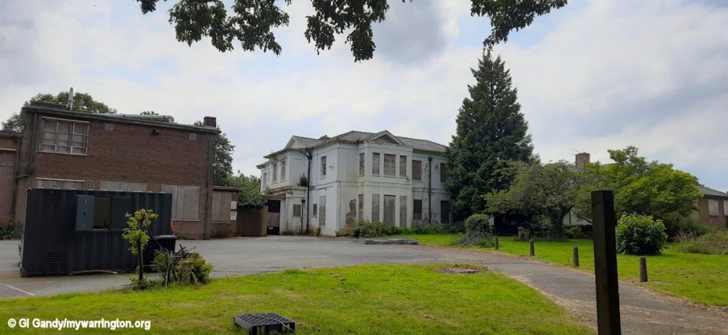
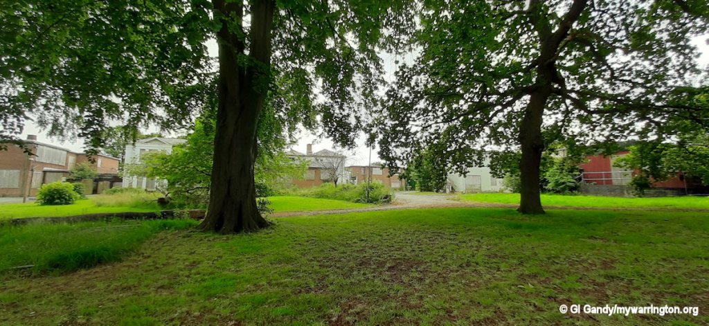
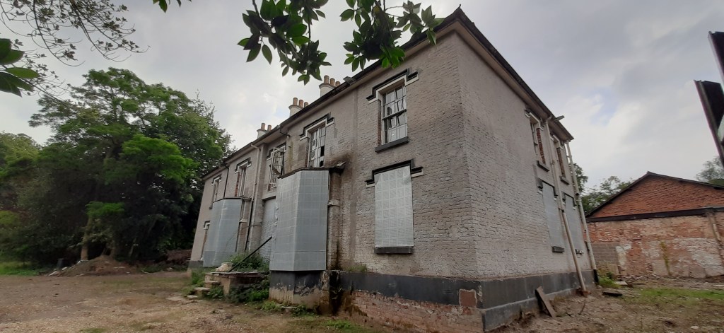
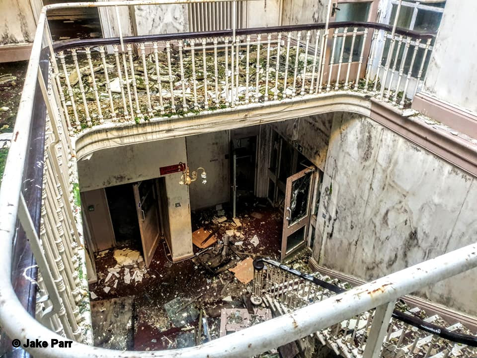
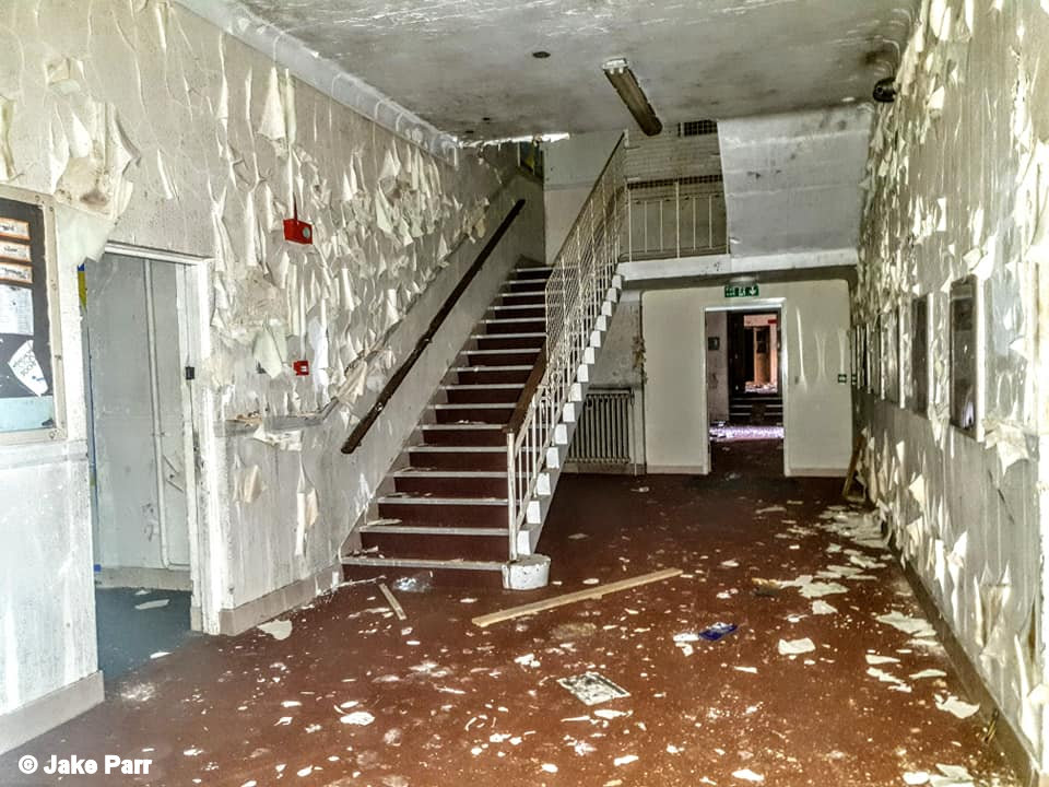
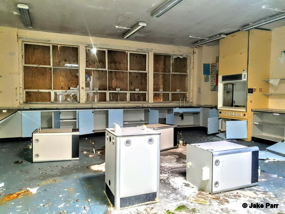
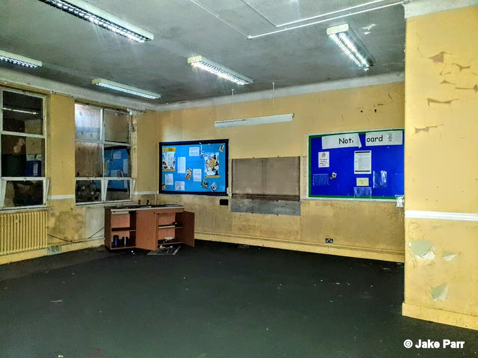
Whatever happens to the site it is going to take a lot of investment if the buildings are reused, as you can see from the following photos.
Take a look at some of Jake Parr’s photos of the derelict building. See the full set at Jake’s Facebook page, Exploring with Jake. Many thanks to Jake for permission to use these images here on mywarrington.
See also Warrington Guardian.
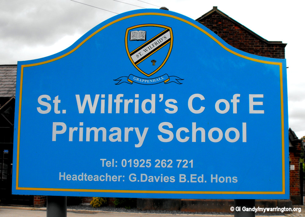
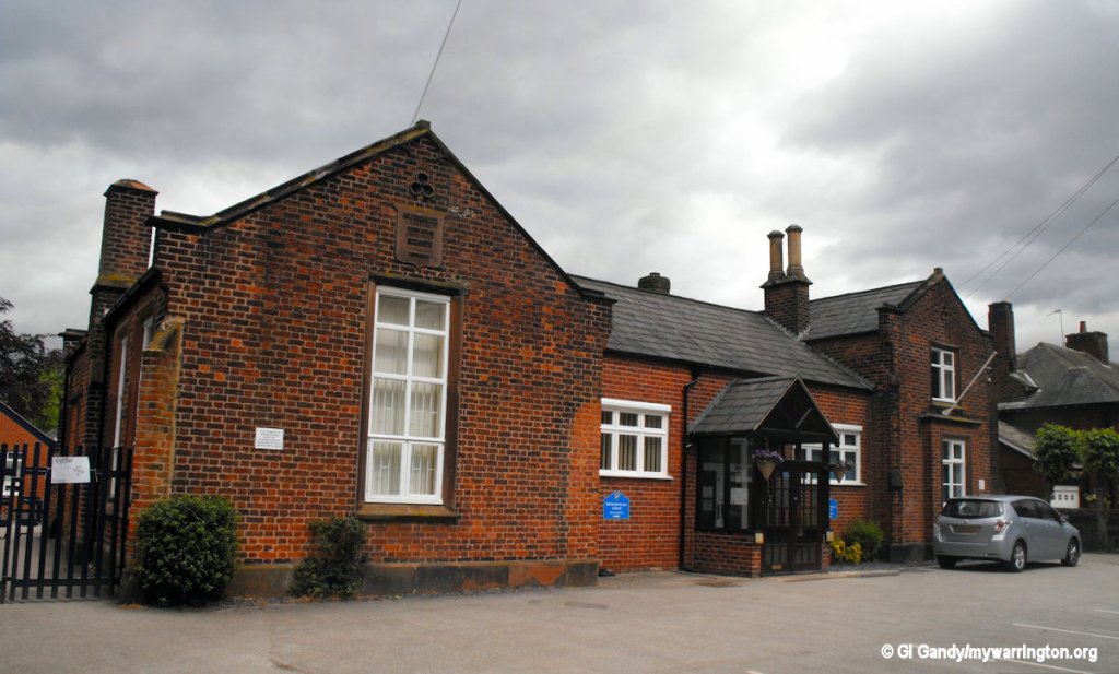
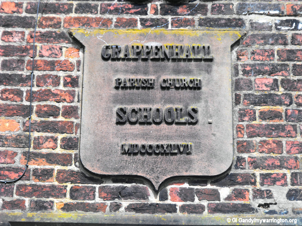
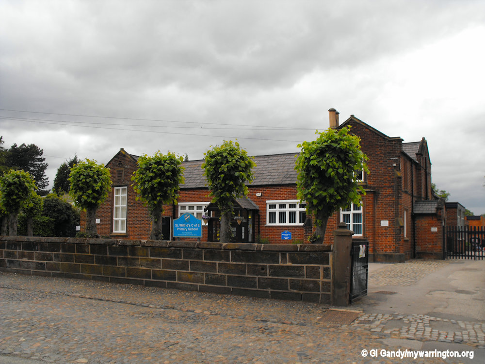
St Wilfrid’s C of E Primary School
The primary school on Church Lane was built in 1846. The school’s website says since then it has been extended many times and can now accommodate 420 pupils from the ages of 4-11. They have an annual admission limit of 60 children.
A third school in the district is Bradshaw Primary School, which opened in 1966 on Bradshaws Lane. Their school motto is ‘Proud of who we are and proud of what we achieve’.
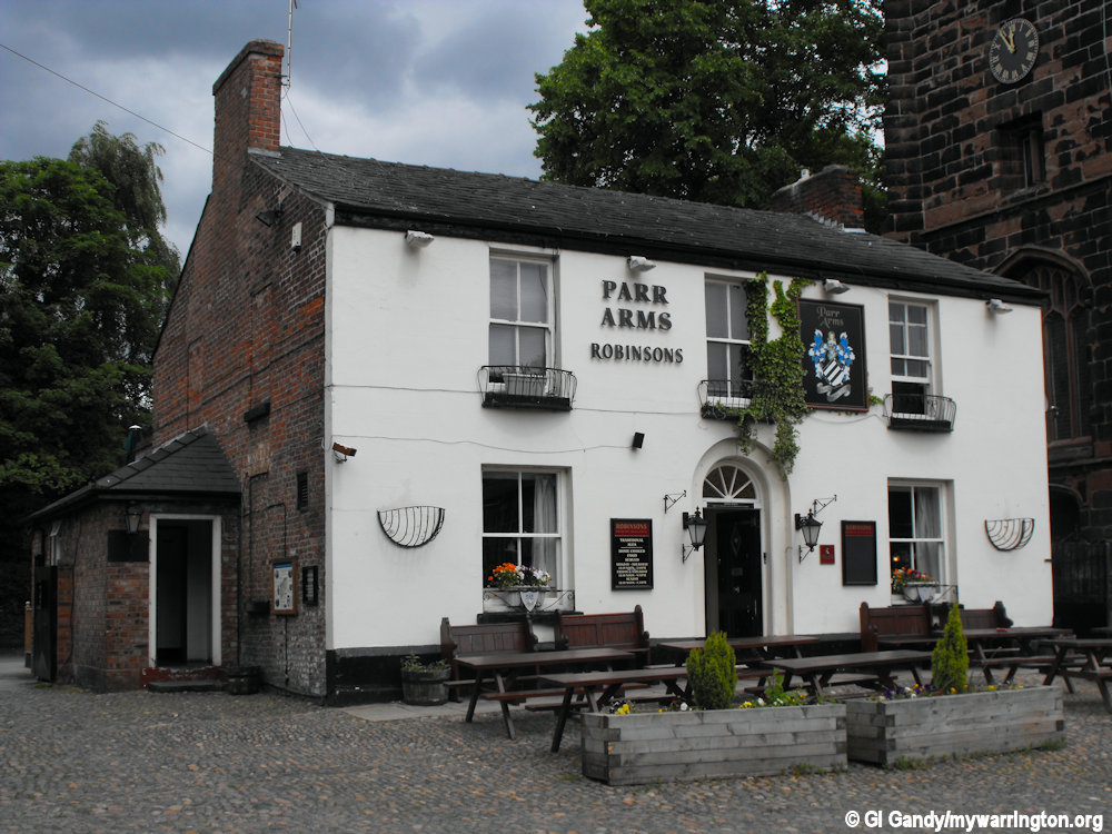
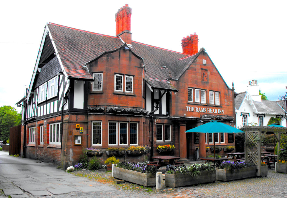
Pub Life
Two pubs stand next on Church Lane, the Rams Head Inn and the Parr Arms. The rams Head dates back to the 11th century according to their website. The Parr Arms has created a series of circular walks which can download here.
20 May 2011
20 May 2011
20 May 2011
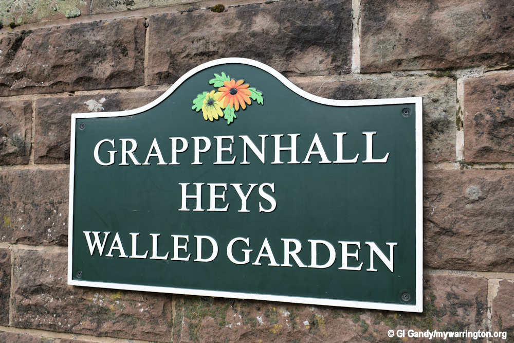
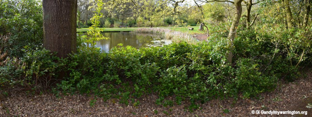
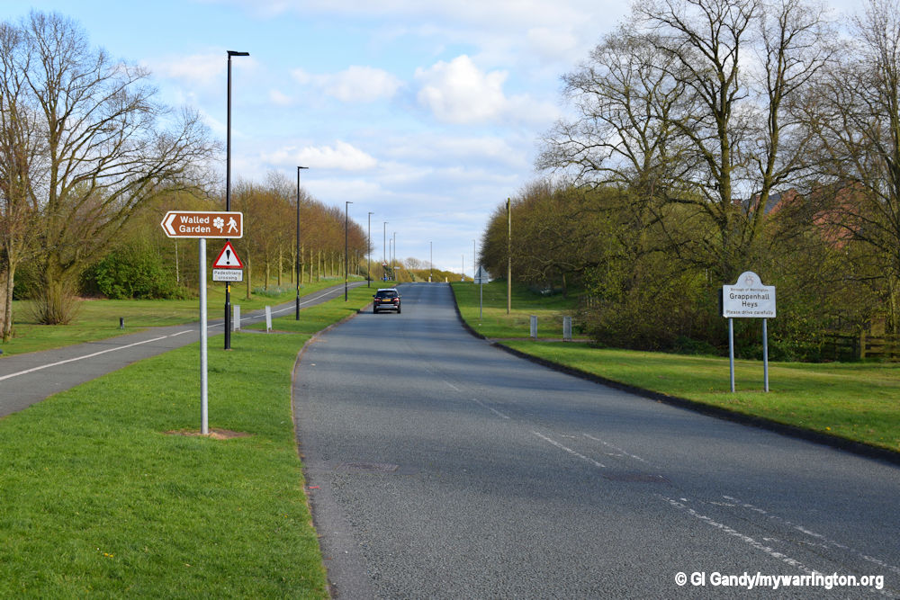
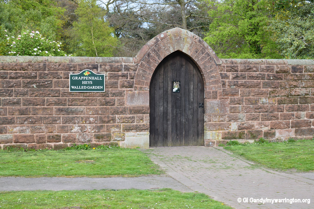
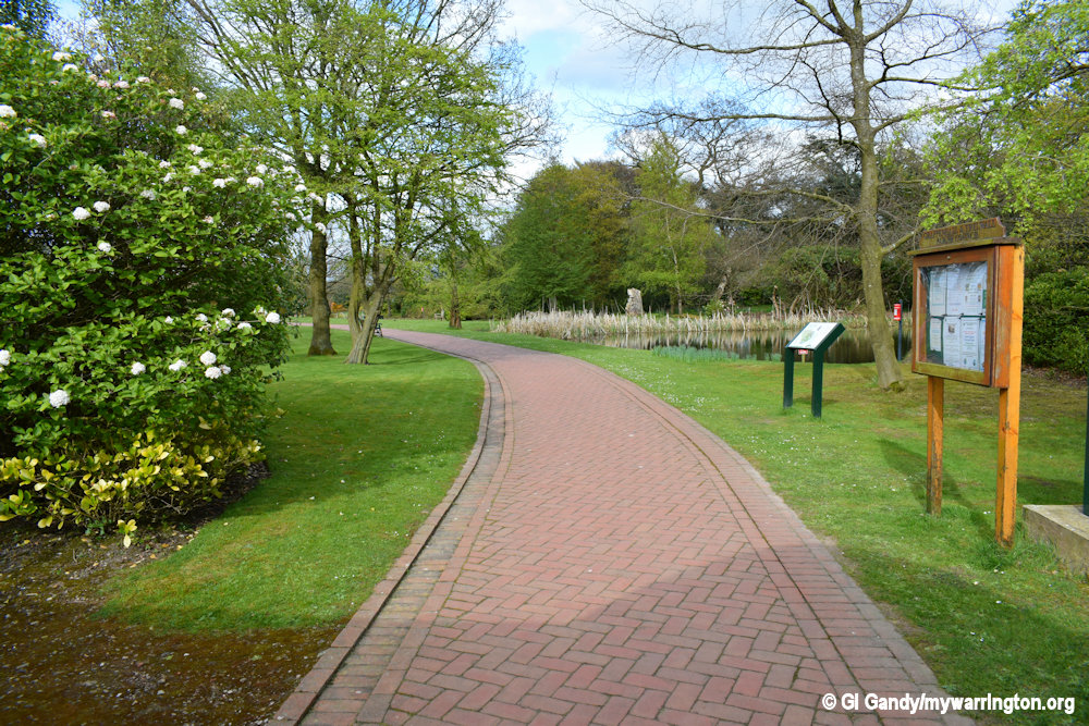
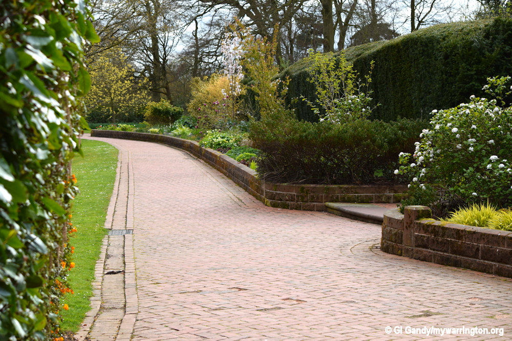
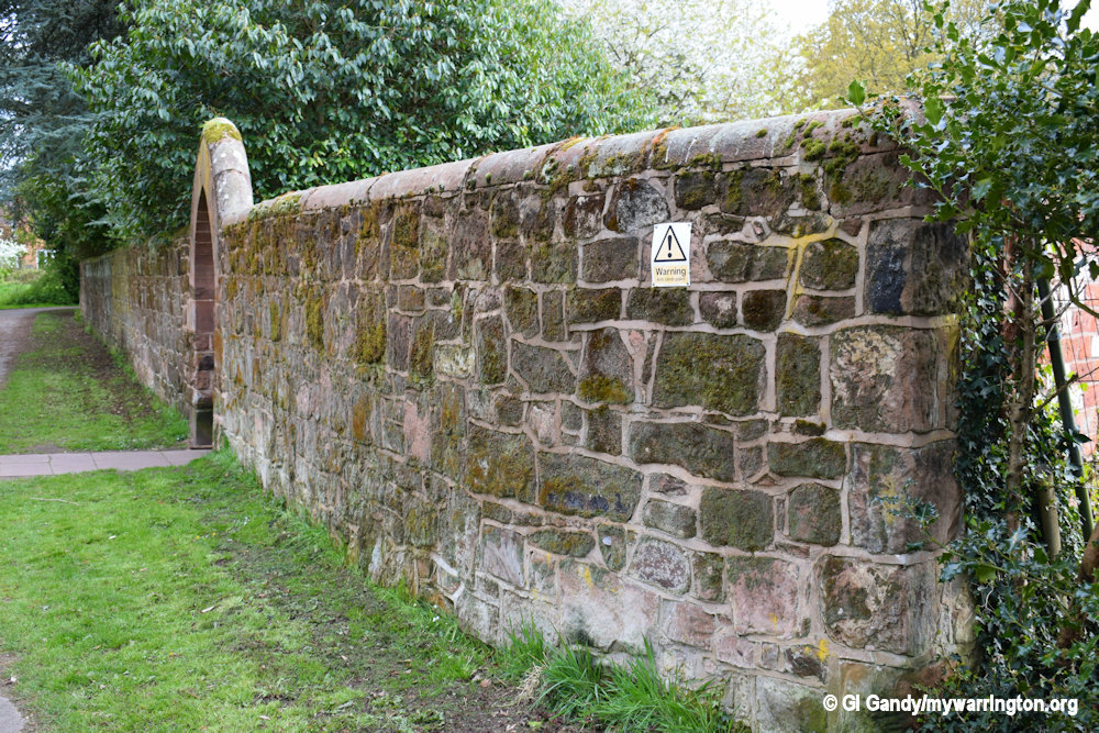
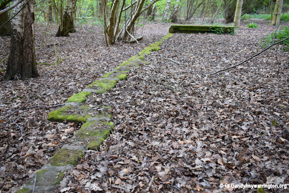
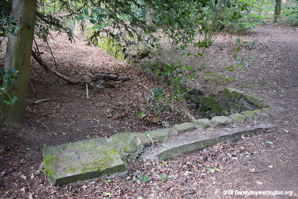
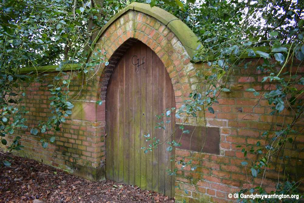
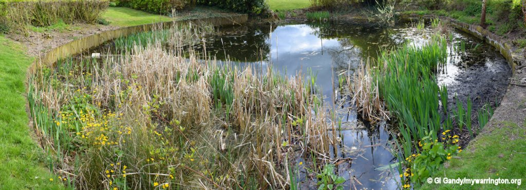
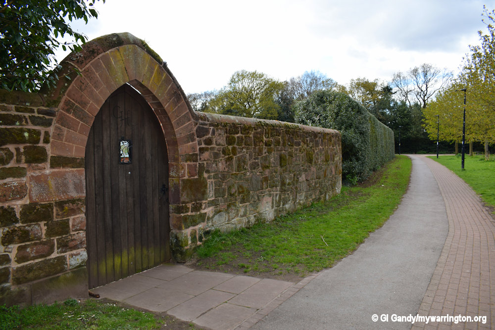
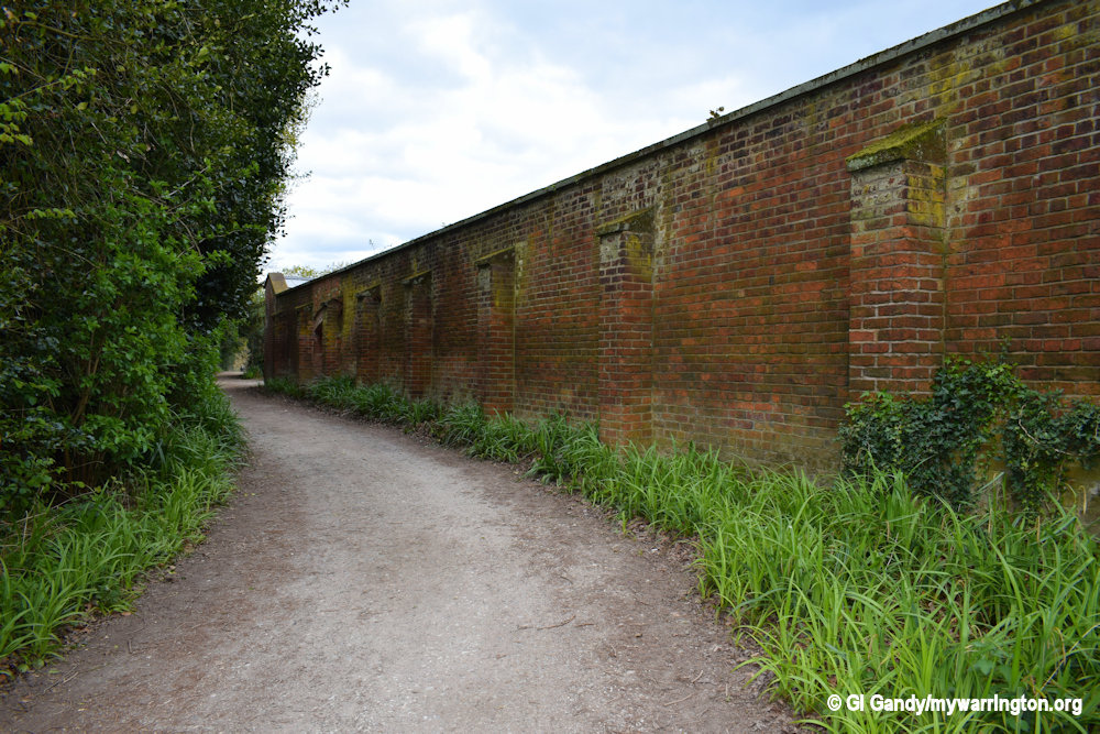
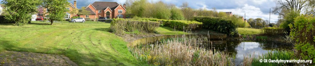
Grappenhall Heys Walled Garden
The walled garden was built around 1830 by Warrington banker Thomas Parr to accompany a mansion house. Thomas Parr’s father, Joseph Parr, founded Parr’s Bank and Thomas was appointed Chairman of the bank. Before opening the bank, Joseph Parr had made his wealth in the sugar refining industry that supported the slave trade in the British West Indies. Parr’s bank amalgamated through acquisitions into the NatWest of today.
Unusually, Parr included both a pleasure garden and a kitchen garden within the same boundary wall. In addition to enjoying their garden, the Parr family held frequent galas and special events for the community.
One annual event called “Beating the Bounds” involved a walk around the boundaries of the townships of Lymm, Appleton, and Grappenhall, which included the garden. Historical records suggest that the estate was at its height from 1875 to 1899.
By the 1950s, the estate had become derelict and parts of it were sold off. The house was demolished in the 1970s and the garden passed to English Partnerships for renovation. In 2005 control of the garden passed to Grappenhall and Thelwall Parish Council, which continued restoration in conjunction with a community group called “The Friends of Grappenhall Heys Walled Garden”. In 2012 the garden was given a Heritage Lottery Fund award towards repair of the Victorian glasshouses and completion of the restoration.
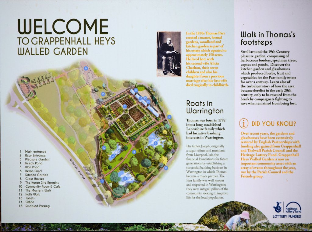
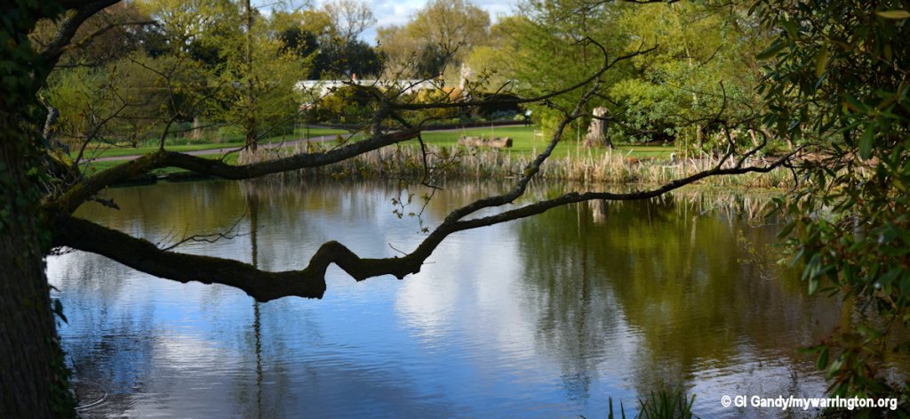
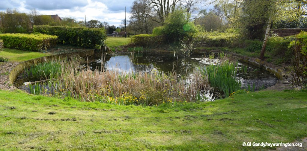
Pleasure Garden
There is a pleasure garden with herbaceous borders, specimen trees, wooded copses and three ponds. An 1829 tithe map shows the ponds were originally marl pits created by small-scale marl extraction. Over time the ponds became heavily silted up, but were sufficiently deep to obscure workers below ground level when they were eventually excavated during restoration. The footpath around the pleasure garden was named the “Master’s Walk”.
Kitchen Garden
There is a kitchen garden which produces fruits, vegetables and herbs, cultivated by the Warrington Organic Gardening Society. Varieties of pear and more than 20 varieties of apple are grown in a small orchard. Grapes and tomatoes are cultivated in fully restored glasshouses. Surplus fruits and vegetables are sold to the public.

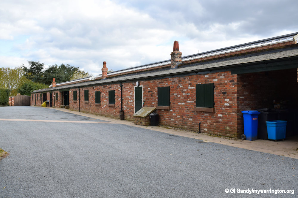
Facilities
The garden is a popular attraction in Warrington. Facilities include a cafe, toilets and free access. In recognition of its high standards, every year from 2017 the garden has been given a Green Flag Award, a benchmark national standard for publicly accessible parks and green spaces in the United Kingdom.
See the Grappenhall Heys Walled Garden website for details of opening times and other useful information, such as photographs of the former Grappenhall Heys house which was demolished in 1975.
The photos here date from 13 April 2017 when I visited with my late friend Sean Clemo
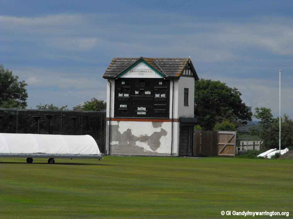
Grappenhall Cricket Club
Grappenhall Cricket Club played its first game in 1881 on a ground in Bellhouse Lane. The club moved to its current home of Broad Lane in 1892 with a new clubhouse. The club has improved immensely on their facilities with significant improvements to the facilities in 2011. They club are known as the Grappers.
In the early days the club played a number of friendly matches. Grappers then played regular fixtures up to the 2nd World War. In 1939, before war broke out, Grappers were founder members of the North Cheshire League but the league was stopped at the start of the war and was never resumed. From the 1960’s onwards GCC were members of the Manchester Association which was the prelude to the clubs most successful period.

In 1981, after a couple of good seasons following promotion to the top division in the late 70’s, the 1st XI won the top flight for the first time. One of Grappenhall’s best teams, it included some famous Grappers names such as Duncan Martindale, Rick Houghton, Chris Ashton, Neil Titchard, Jim Green, Nick Sharp and a young Neil Fairbrother, only a few years before he headed off for big things with Lancashire and England.
In 1992, the club were in their last season in Manchester Association before a move to the Cheshire County Cricket League. Grappenhall Cricket Club celebrated its 130th Anniversary in 2011 by holding the biggest and most prestigious event in the clubs 130 year history. On 30th August 2011 the club held a hugely successful Legends Day, with a T20 match between an England Legends XI and a Grappenhall XI including several megastars of world cricket.
Read more of the club’s history on the club website.
If football is your sport of choice then read about Grappenhall Sports FC here. As a taster, Grappenhall Athletic Club was formed in 1955 at Euclid Avenue Playing fields.
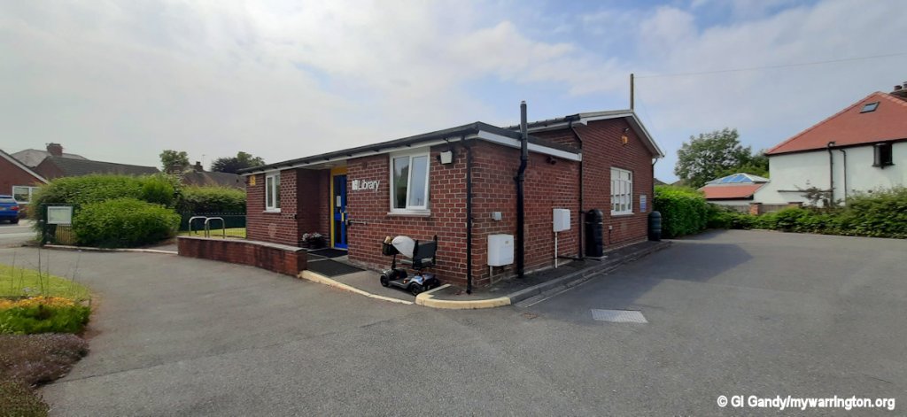
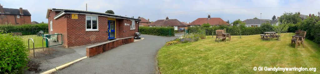
Grappenhall Library
The Grappenhall Community library is a community-run library in the village. It was opened by the local authority in 1959 before being handed over to the Friends of Grappenhall Library after closure on 2 April 2011 due to local authority cuts.
The library is run by the Friends of the Grappenhall Library Community Group , a charitable group that is open to members who pay an annual subscription. Lending of books is free and there is a charge for activities and events. The library is based at Victoria Avenue WA4 2PE. Link to their website.
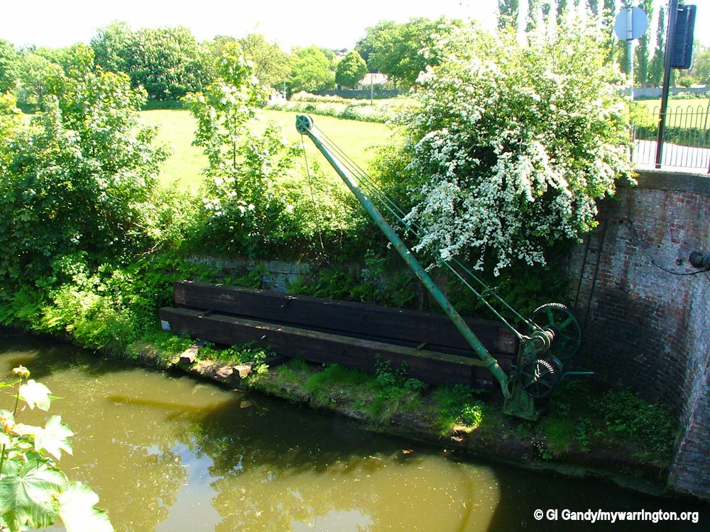
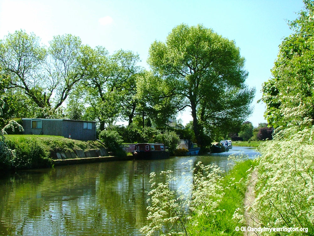
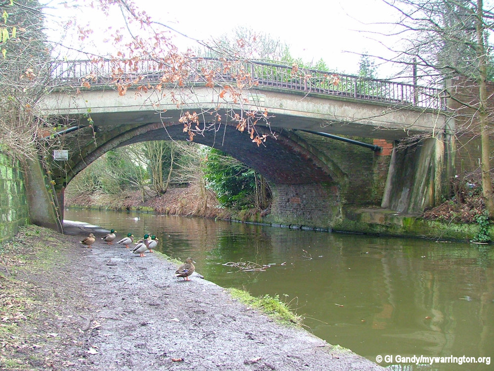
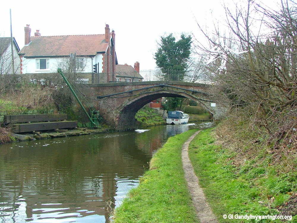
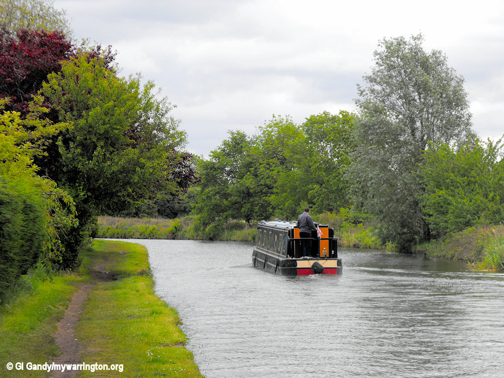
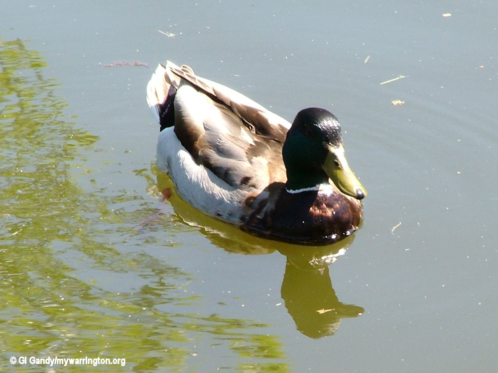
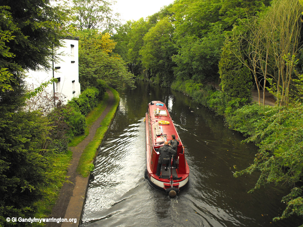
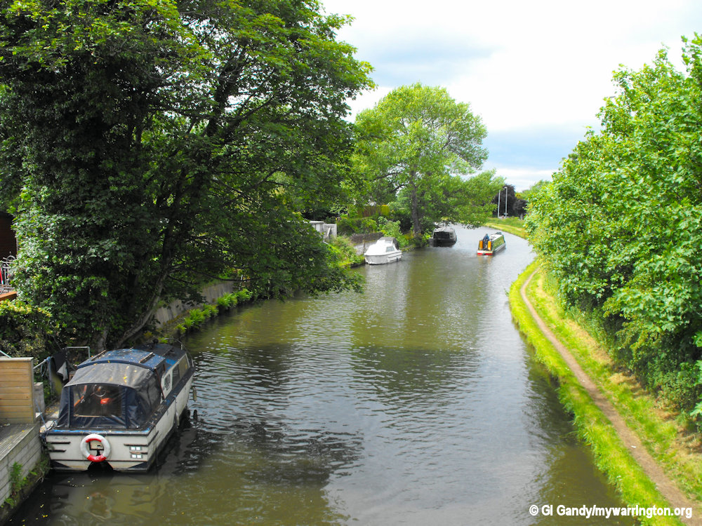
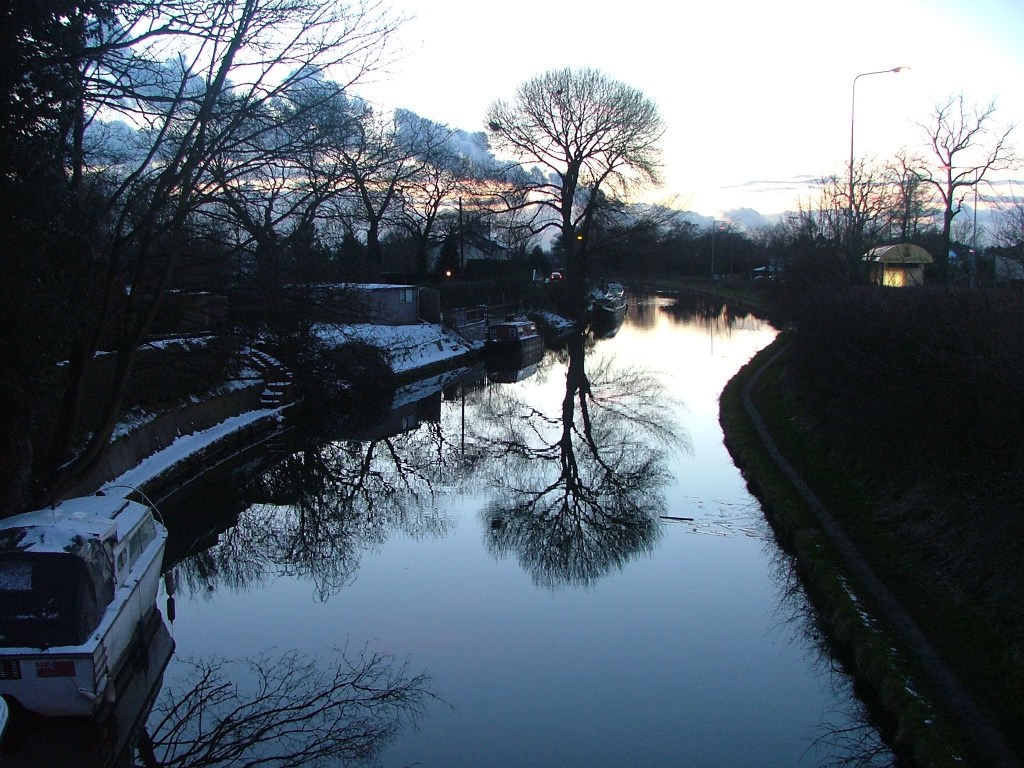
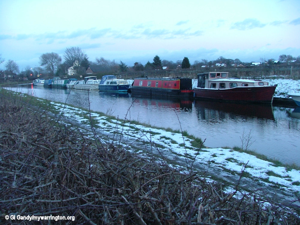
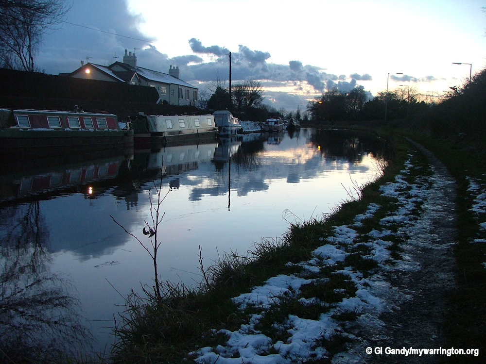
Bridgewater Canal
The history of the Bridgewater Canal, which opened in 1761, is covered in On the Waterfront. Here are some photos to whet your appetite.


Parts of the Case-Book of Sherlock Holmes were filmed in the centre of Grappenhall in 1984. The village name appears in the title of the song “Grappenhall Rag” by the Darwen singer-songwriter Bryn Haworth.
Further reading: Grappenhall and Thelwall Parish Council website
20 May 2011
20 May 2011

20 May 2011
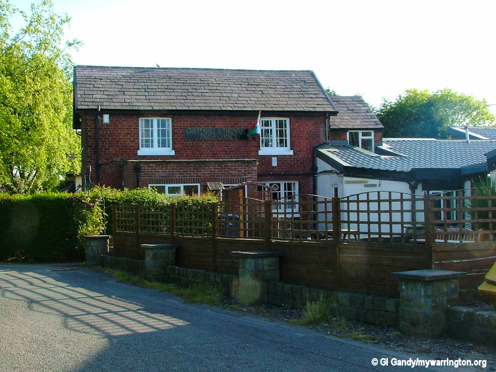
The Parish Council office next to the community centre with the Euclid Park draft plan
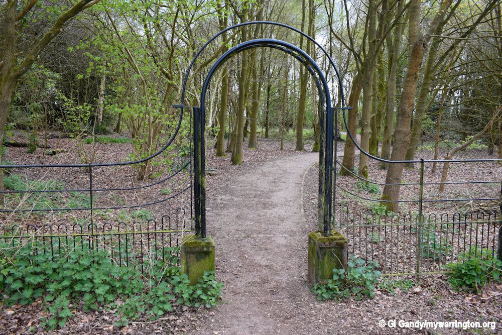
Don’t forget to visit Grappenhall Wood off Broad Lane or Australia Lane when you are next in the village. The site is a community woodland planted as part of the Woodland Trust millennium project ‘Woods on Your Doorstep’ See the Mersey Forest website for more information.
We started with a springtime photo of the village. Let’s finish with a wintertime one. Notice the date it was taken. That global warming again…