

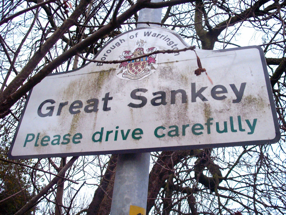
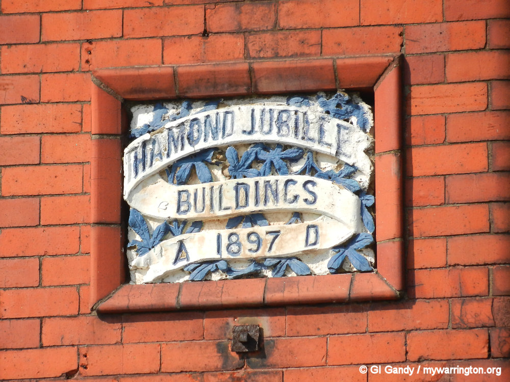
GREAT SANKEY Introduction
Sanki, 1202, 1212; Schonke, 1288; Sonky, 1242
In 1870-72, John Marius Wilson’s Imperial Gazetteer of England and Wales described Great Sankey like this:
SANKEY (Great), a township and a chapelry in Prescot parish, Lancashire. The township lies on the Sankey canal, the Grand Junction railway, and the Warrington and Liverpool railway, 2½ miles W of Warrington; and has a station on the latter railway, and a post-office under Warrington, both of the name of Sankey-Bridges. …
Acres, 1, 909. Real property, £3, 842. Pop., 563. Houses, 108. The manor belongs to the Hon. L. Powys. Barrow Hall is the residence of J. A. Wright, Esq. railway viaducts here cross the S. canal; and that of the Grand Junction railway has 9 arches. The chapelry was originally conterminate with the township, but was greatly extended in 1865. Pop., 1, 347. The living is a p. curacy in the diocese of Chester. Value, £120.* Patron, the Hon. L. Powys. The church is an old brick building. There is a national school.
GB Historical GIS / University of Portsmouth, History of Great Sankey, in Warrington and Lancashire | Map and description, A Vision of Britain through Time.
URL: https://www.visionofbritain.org.uk/place/10879
Date accessed: 22nd July 2024
It doesn’t matter what time it is – only four trains a day stop at Sankey for Penketh station from Warrington Central these days, two in the morning and two in the afternoon. And even then only two are direct – one in the morning and one at teatime. You have to change at Widnes for the other two! One in the morning, the other at teatime!
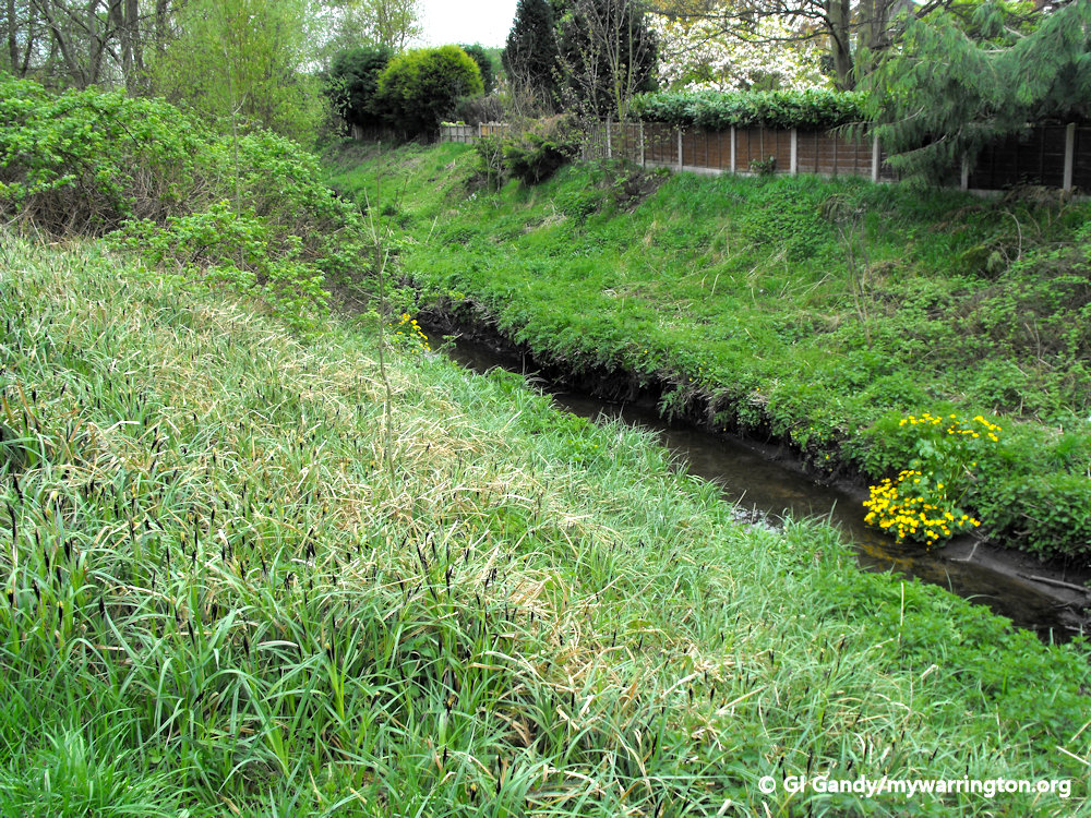
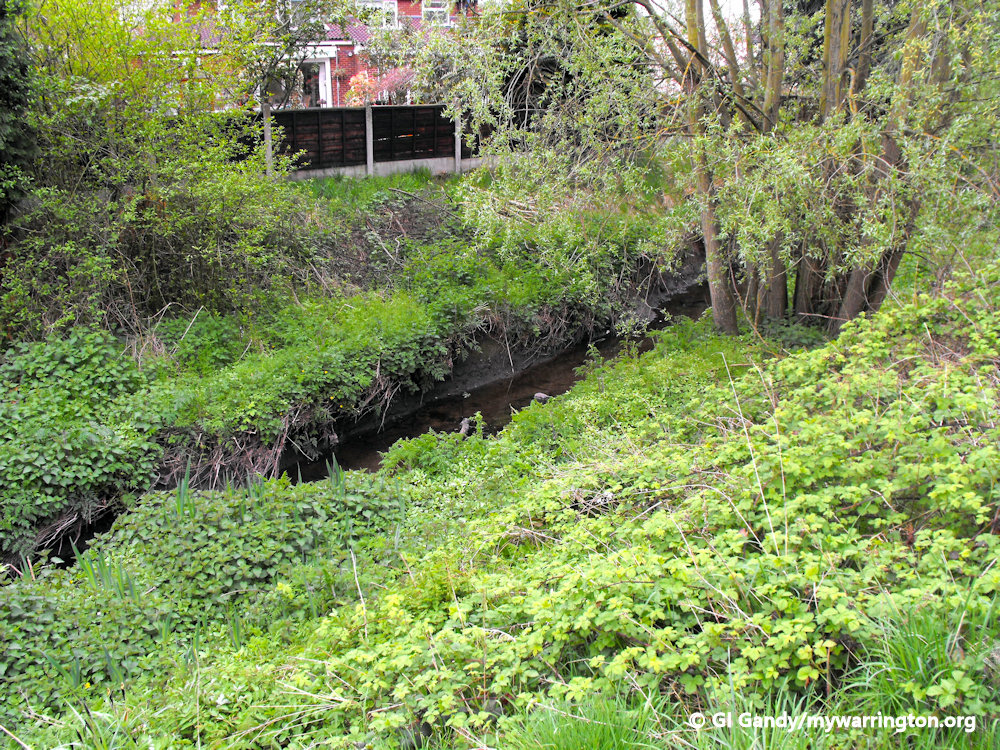
This township, with Penketh as a hamlet, was included in the lands of the lords of Warrington. Whittle Brook on the south serves for a partition from Penketh.
The manor of GREAT SANKEY is mentioned in several Boteler settlements and inquisitions, and on the sale of their estates about 1585 became the property of the Bolds of Bold.
Sir Thomas Bold in 1610 granted it to Thomas Tyldesley and Thomas Orme; the latter shortly afterwards resigned his interest, so that Thomas Tyldesley was solely seized in 1613.
Within fifteen years it had passed to Sir Thomas Ireland of Bewsey, and has since descended, with other estates of this family, to Atherton, Gwillym, and Powys, Lord Lilford being the present lord of the manor. Manor courts were held yearly until 1888.
A branch of the Rixton family settled here as did the family of Whethull or Whittle in the 14th century. The Leghs also held lands here, as may be seen by their inquisitions. The freeholders in 1600 were James Whittle, Randle Rixton, and Thomas Taylor. A chapel was built in 1650 and they recommended that it should have a separate parish.
With thanks to British-history.ac.uk
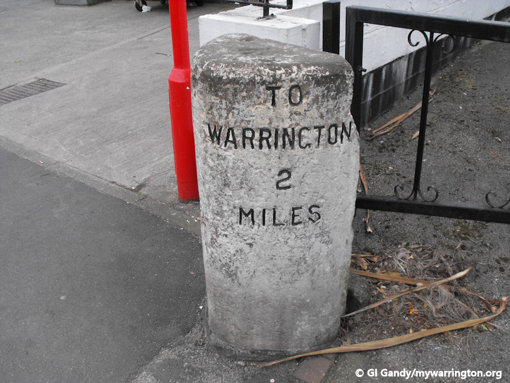
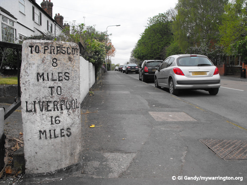
Milestone at Liverpool Road, Lane Ends on 13 April 2011. It is now a listed monument.
The Sankey Name
The first part of the name Sankey is possibly derived from a personal name and the second part means “water”, “stream”, or “river”. Most people agree that the village takes its name from the brook which flows through it, Sankey Brook. Sankey Brook formed the boundary between Great Sankey in the west and Little Sankey in the east. More on Little Sankey later.
The brook powered the lord of the manor’s water mill in the 14th century. Mill Lane once led to Sankey Green (the street sign is still visible on the wall of the convenience store on the corner of Lovely Lane by Sankey Green). Whittle Brook also runs through the village.
Sankey Street in Warrington town centre is recorded in a 14th century deed as “Sonky” Street and Sankey Street itself was also known as “Sonkygate Street” at one time. The history books tell of various people called Sankey have lived in the area.
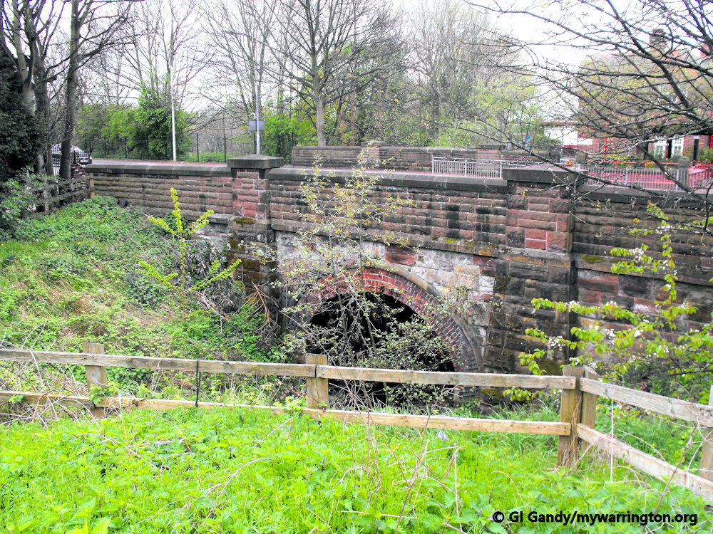
Whittle Brook flows under Barnes Bridge on Liverpool Road. 13 Apr 2013


More photos of Barnes Bridge on Liverpool Road.
Great Sankey forms part of the Warrington South constituency of the United Kingdom Parliament. It is also divided into three council wards for the election of councillors to Warrington Borough Council: Great Sankey North, Great Sankey South and Whittle Hall. The civil parish is governed by a parish council consisting of fifteen elected members.
Village Origins
Great Sankey is a civil parish and suburb of west Warrington. The village of Great Sankey was originally a chapelry in the parish of Prescot in Lancashire. It became a separate civil parish in 1866, and it was transferred to Cheshire’s administration in 1974. Don’t forget, just like the rest of old Warrington, the county boundary did not change in 1974, so we are still in Lancashire. And of course, we are not under Cheshire control either these days (apart from the police and fire service), since we became a unitary authority in 1998.
There was industrial growth along the banks of the Sankey Canal at Sankey Bridges during the 19th century, but otherwise the area was rural. Since then, the area has transformed into a residential suburb for Warrington New Town. Lane Ends is the name given for the area surrounding the junction of old Liverpool Road and Penketh Road (A562). This was where the old country lanes ended and fields began.
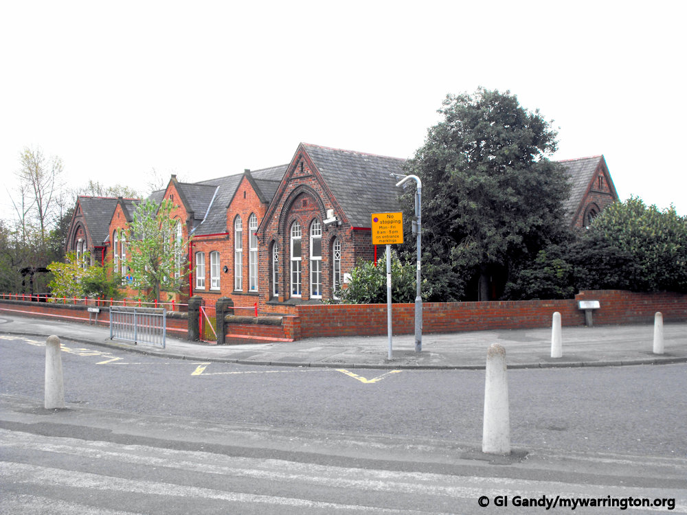
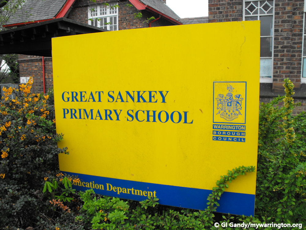
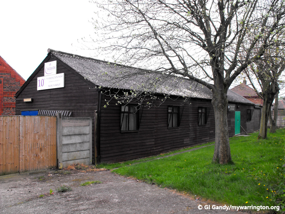
Great Sankey Primary School on 13 Apr 2011
The foundation stone for Great Sankey Primary School was laid in 1885.


Barrow Old Hall
The origins of Barrow Old Hall date back to 1313 when William le Boteler, the lord of the manor of Warrington granted four acres of land and buildings to Thomas de Barwe and his wife Selicia.
I am using extracts from the information board at the site of the hall, which is located next to Great Sankey Community Hub and Great Sankey High School on Barrow Hall Lane. I have also included additional information from Historic England.
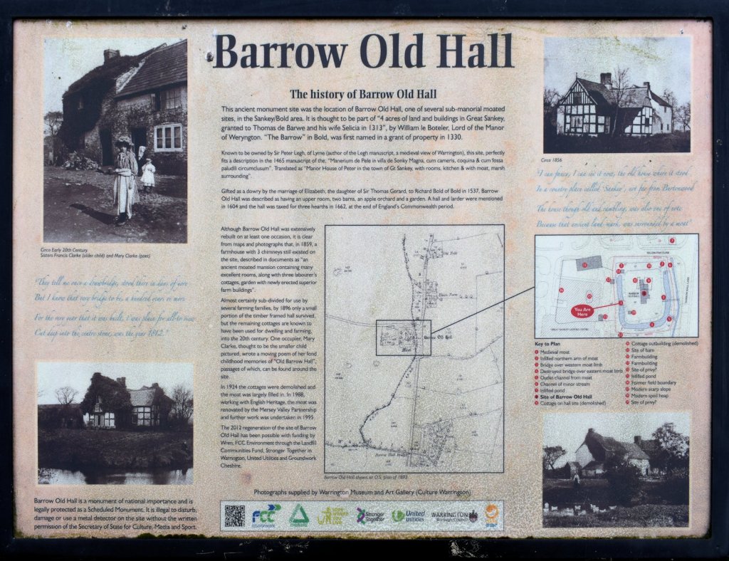
Barrow Old Hall was one of several sub-manorial moated sites in the Sankey/Bold area. It is thought to be part of four acres of land and buildings granted to Thomas de Barwein 1313 by William le Boteler, lord of the manor of Warrington. The “Barrow” in Bold was first named in a grant of property in 1330.
At one time it was owned by Sire Peter Legh of Lyme. He wrote the Legh manuscripts, a medieval view of Warrington in the 15th century. The English translation of the 1465 Latin document describes the area as “Manor House of Peter in the town of Gt Sankey, with rooms, kitchen & with moat, marsh surrounding”.
It was also described as having an upper room, two barns, an apple orchard and a garden. A hall and larder were mentioned in 1604 and the hall was taxed for three hearths in 1662, at the end of England’s Commonwealth period.
Over the years extensions were added to the building. Photographs from 1859 show a farmhouse with three chimneys and it was described as “an ancient moated mansion containing many excellent rooms, along with three labourer’s cottages, garden with newly erected superior farm buildings”. By 1896 only a small portion of the timber framed hall survived, but the remaining cottages continued on into the 20th century.
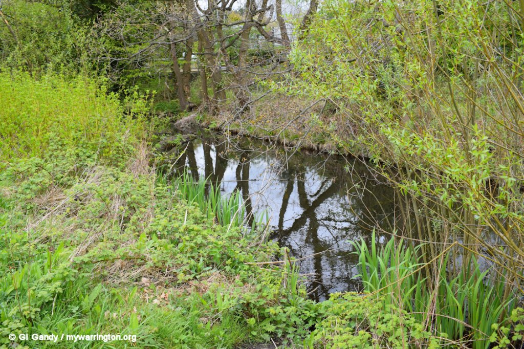
The cottages were demolished in 1924 and the moat was filled in. In 1988 the moat was renovated by Mersey valley Partnership in association with English Heritage, with more work done in 1995.
The 2012 renovation of the site was made possible with funding from Wren FCC Environment through the Landfill Communities Fund, Stronger Together in Warrington, United Utilities and Groundwork Cheshire.
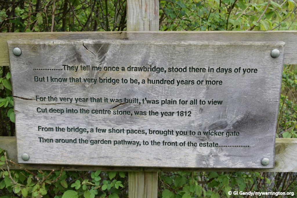
One occupier, Mary Clarke, wrote a poem about her childhood memories of life at the hall.
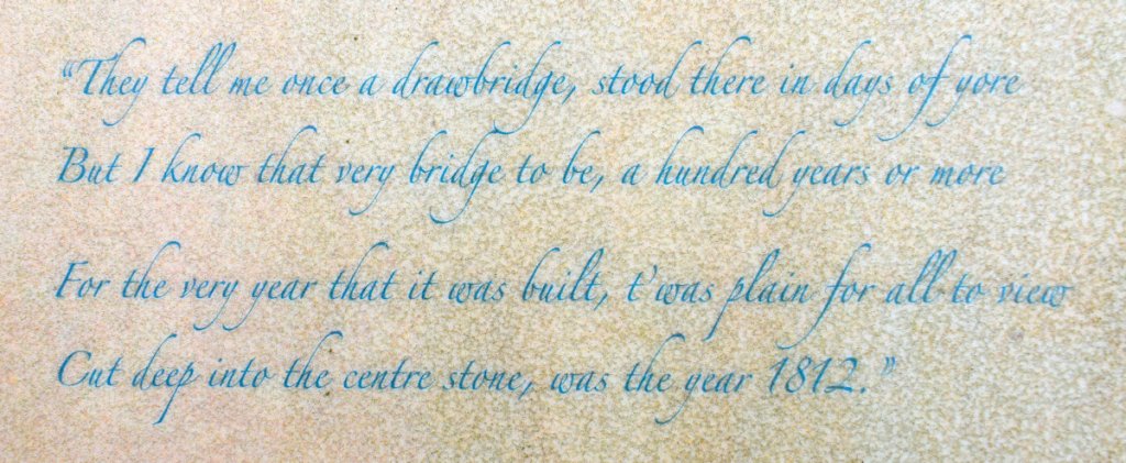
Mary Clarke’s poem.
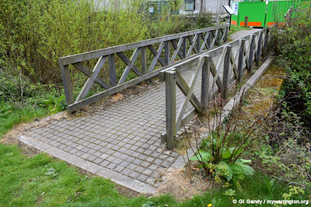
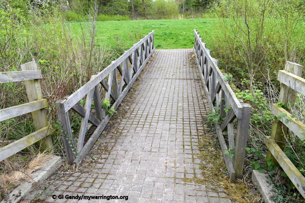
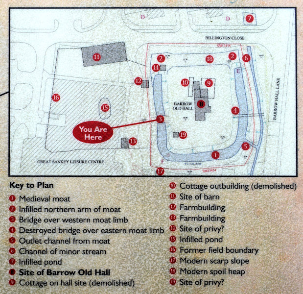
See a plan of the site in the image (right).

Historic England are the source for the following notes on Barrow Old Hall.
Official list entry
Heritage Category: Scheduled Monument
List Entry Number: 1013363
Date first listed: 22-Oct-1970
Date of most recent amendment: 13-Jun-1991
Location
The building or site itself may lie within the boundary of more than one authority.
District: Warrington (Unitary Authority)
Parish: Great Sankey
National Grid Reference: SJ 56177 89586
The photos show the site as it looked on 13 April 2017.
Reason for Designation
Around 6,000 moated sites are known in England. They consist of wide ditches, often or seasonally water-filled, partly or completely enclosing one or more islands of dry ground on which stood domestic or religious buildings. In some cases the islands were used for horticulture. The majority of moated sites served as prestigious aristocratic and seigneurial residences with the provision of a moat intended as a status symbol rather than a practical military defence. The peak period during which moated sites were built was between about 1250 and 1350 and by far the greatest concentration lies in central and eastern parts of England. However, moated sites were built throughout the medieval period, are widely scattered throughout England and exhibit a high level of diversity in their forms and sizes.
They form a significant class of medieval monument and are important for the understanding of the distribution of wealth and status in the countryside. Many examples provide conditions favourable to the survival of organic remains. The moated site at Barrow Old Hall was one of a group of six moated sites in the former township of Bold and is of importance because it represents a rare and unusual example in NW England of a large number of moated sites in one township. In addition the monument retains considerable archaeological potential for the recovery of evidence of building foundations within its interior and for the recovery of organic material from the waterlogged moat.
Details
The monument comprises a moated site the island of which was formerly occupied by Barrow Old Hall. The hall was completely rebuilt on at least one occasion and towards the end of the 19th century was converted into a country cottage, finally being demolished in the 1960’s. Limited excavation in 1986-7 found remains of a 17th century structure and evidence for earlier buildings. The moat is 12m max. width, waterlogged on three sides but has been infilled on the north side. A short length of inlet/outlet channel links the moat with a tributary of Whittle Brook. The island is grassed over and measures c.40m x 50m. It is approached on the west by a restored bridge originally of early 19th century date.
Most moats were constructed between 1250-1350 and are generally seen as the prestigious residences of the Lords of the manor. Barrow Old Hall is one of six moated sites in the medieval township of Bold. The earliest dated reference to an estate at Barrow is 1330. Its medieval associations with the principal manor of Bold Old Hall and its position on the edge of the township suggest that its development as a moated site may have occurred late in the medieval period. All fences and the concrete setting for the information board are excluded from the scheduling, however, the ground beneath these features is included.
My thanks to Historic England for permission to use their notes on the mywarrington website.
Sankey for Penketh Railway Station
Sankey for Penketh railway station is on the original Cheshire Lines Committee route between Liverpool and Manchester that passes through Warrington Central. It is now a Grade II listed building. The station is served by just four trains a day between Sankey and Warrington, and on two of them you need to travel to Widnes and change to get to Warrington Central. This is since Warrington West opened on 15 December 2019. The services are run by Northern Rail. Public transport buses link Sankey with Warrington bus station and the shopping/cinema complex at Westbrook and Gemini Retail Park. Read more about the station in the Cheshire Lines Committee section of Making Tracks.
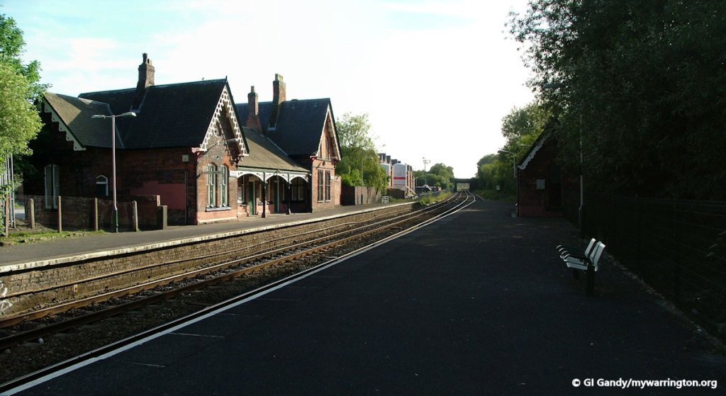
Sankey Railway Station on 6 June 2006.
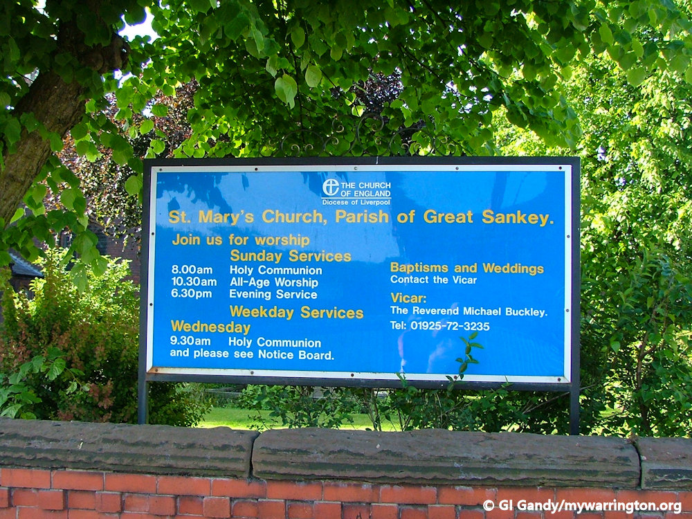
The Four P’s
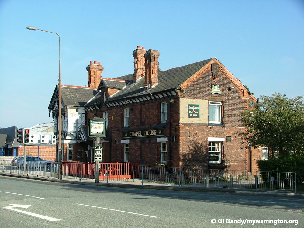
If you have ever played that popular trivia game, you might remember there was a question in the set asking where was the only place in England that had a crossroads junction featuring Four Ps, a police station, a parish church, a post office and a public house. The answer is Great Sankey in Warrington, namely Liverpool Road, Station Road and St Mary’s Road. However, the question is now irrelevant because two of the four buildings no longer operate in their original mode.
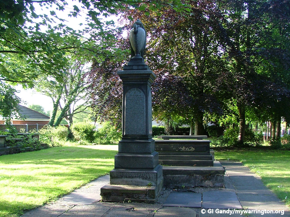
The police station moved into Penketh and the building has now become a private house. The post office is now an estate agents. The church is St Mary’s CofE which dates back to 1769, but isn’t the first on the site. The first was a chapel built in 1640 belonging to the parish of Prescot and was built on land donated by the Ireland family of Bewsey Hall. The second building dates to 1768 with connections to the Atherton family of Bewsey. The current building is Grade II listed. The fourth ‘P’ is the Chapel House pub.

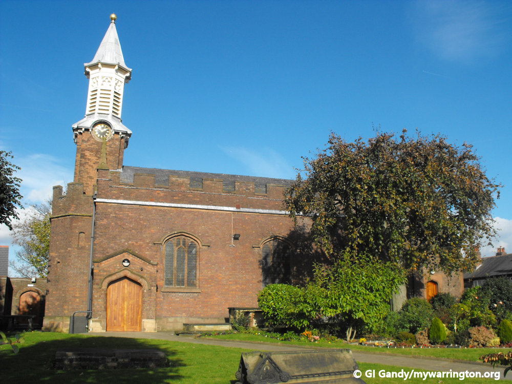
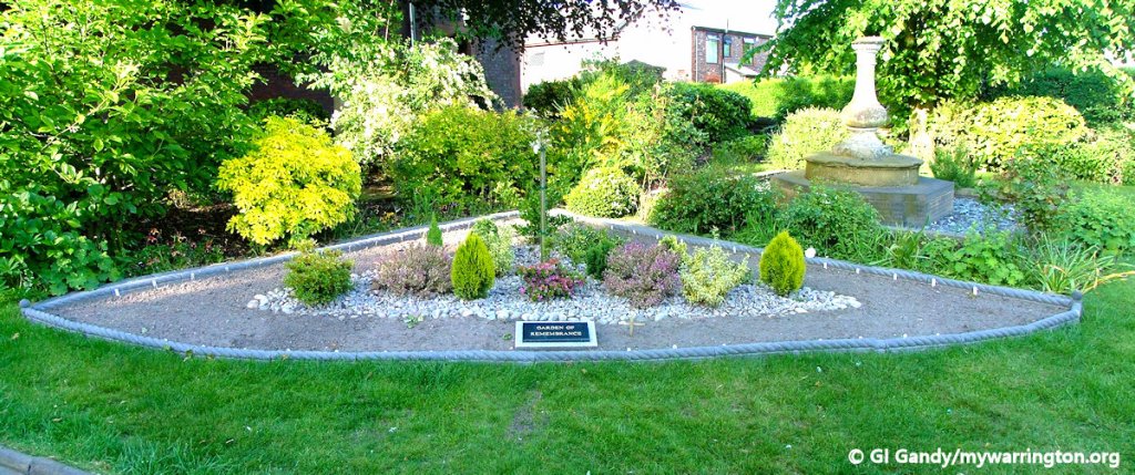
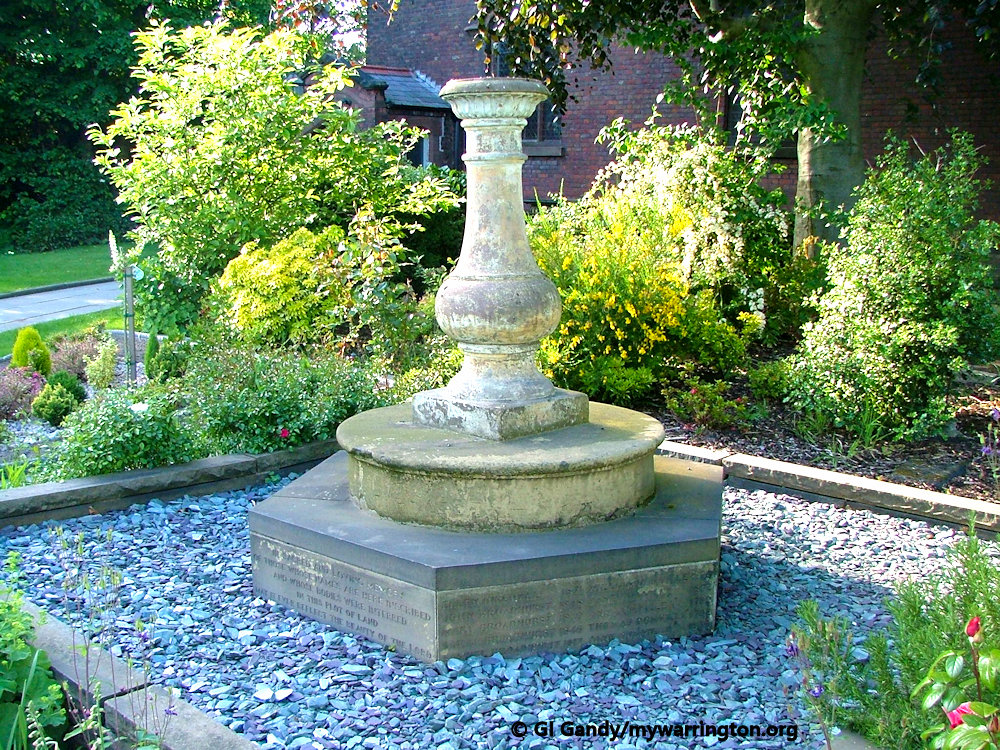
More on St Mary’s Church.
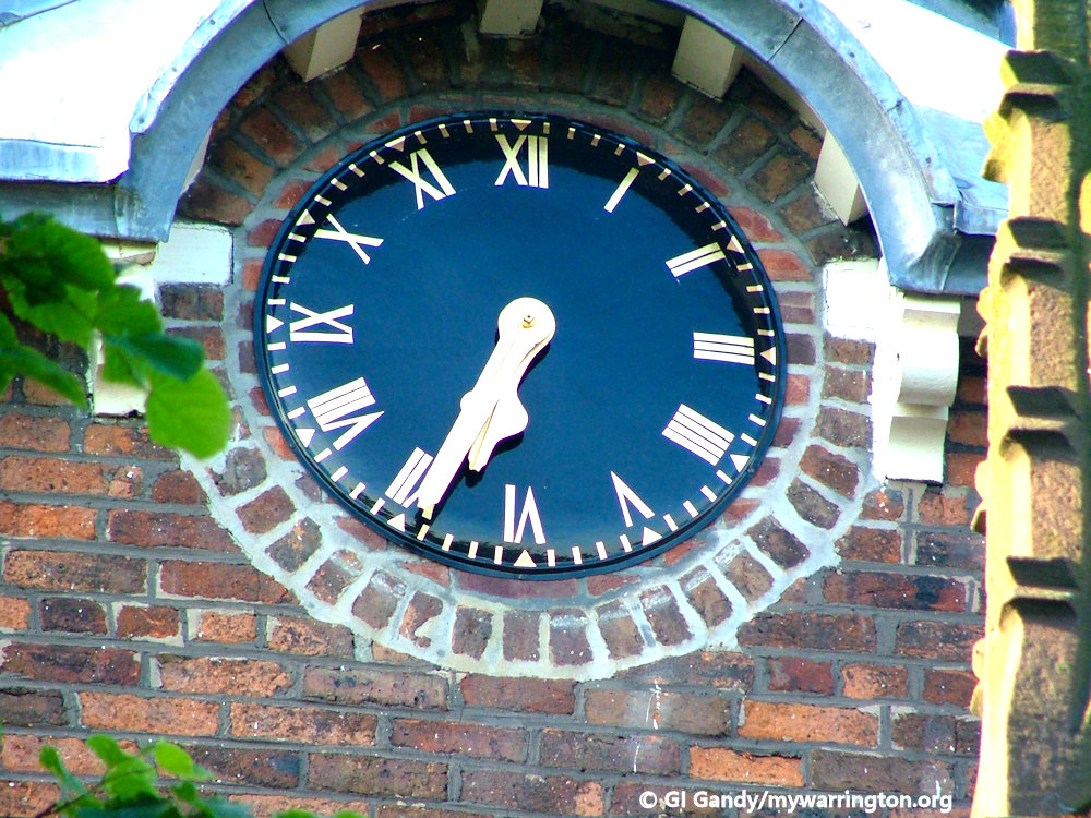
The original part of the church is the body with its polygonal west end. The west turret was added in 1868–69, and the chancel and porch, by William Owen, were built in 1883. The turret has a clock face on each side, an octagonal timber bell stage, and a lead-covered spire with a ball finial. The church is constructed in brick on a sandstone plinth, with stone dressings and a slate roof. The sides of the nave are battlemented. From Wikipedia.
See lan-opc.org.uk for more details on the church.
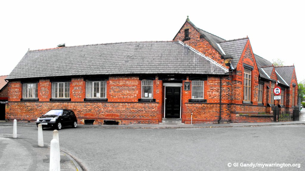
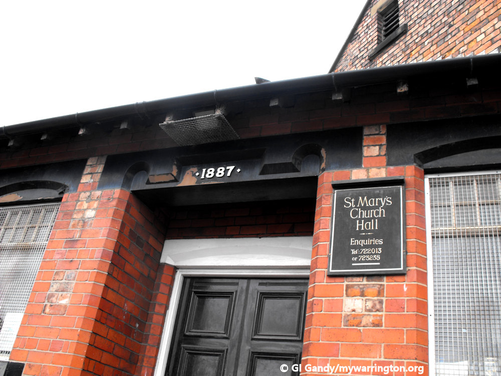
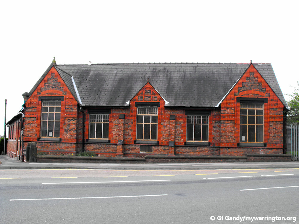
The church hall was built in 1887 and was changed to a Kids Planet nursery in 2018. The middle photo shows the date, but sadly the door has been bricked up now.
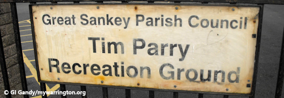
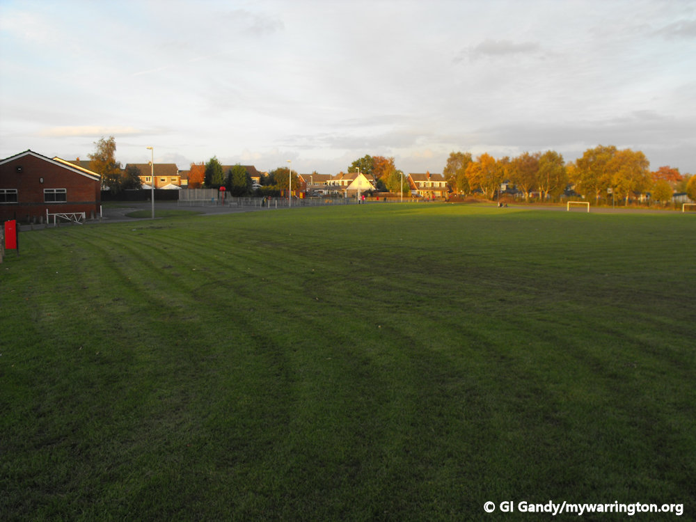
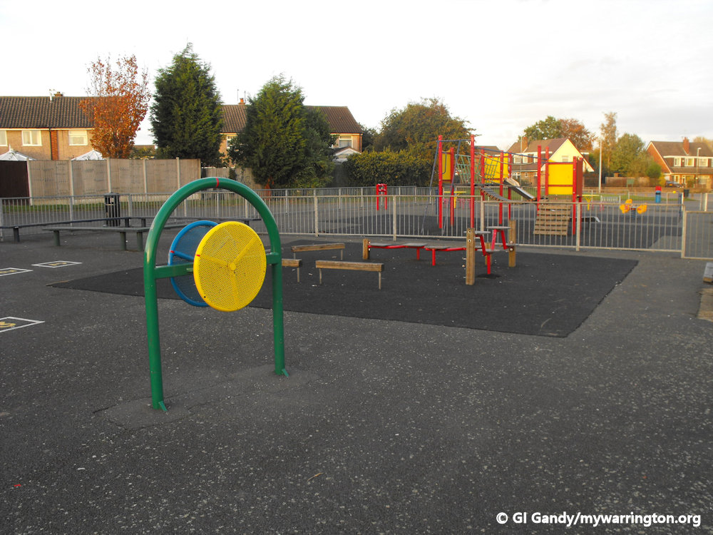
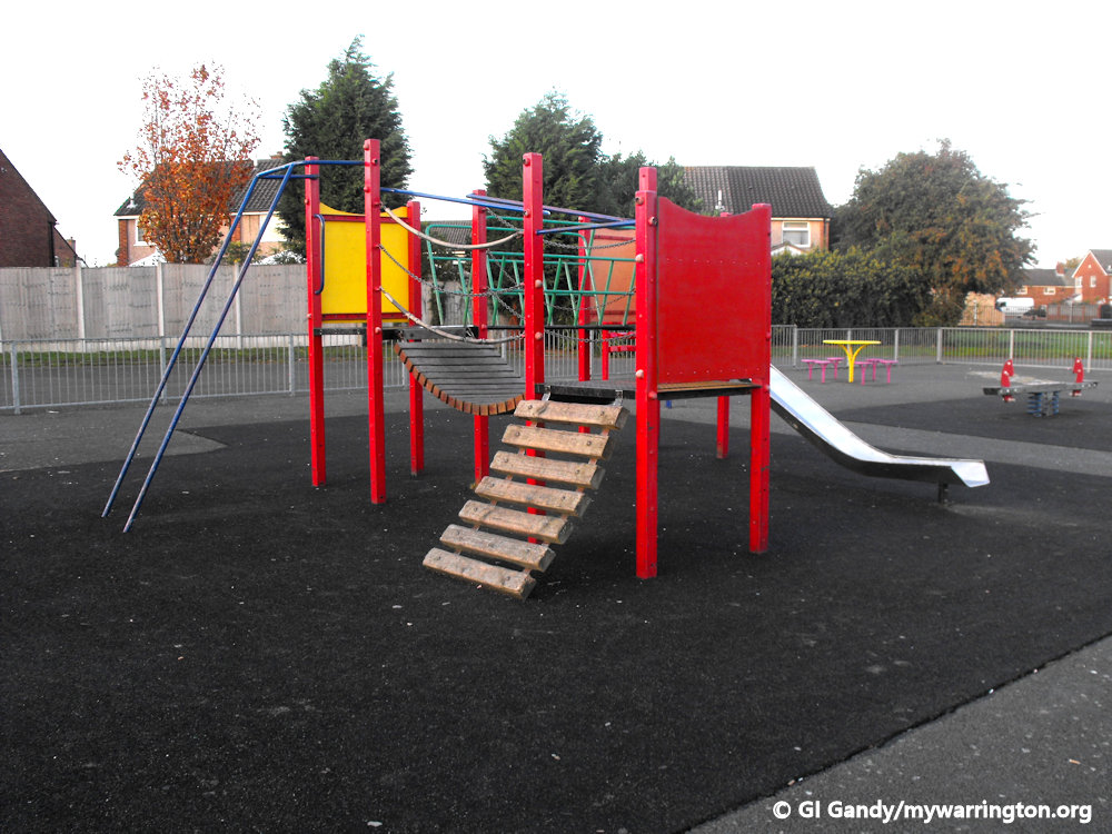
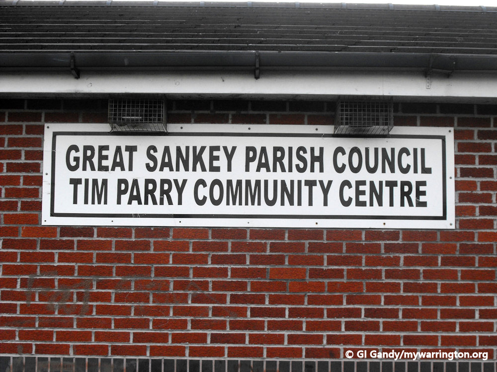
Tim Parry Recreation Ground
A large open green area off Wroxham Road is now named the Tim Parry Recreation Ground in memory of the 12-year-old boy who was killed in the IRA bombing of Bridge Street in the centre of Warrington on 20 March 2003. He lived in the area and the community centre on the ground is also named after him. Park Road Primary School is next to the recreation ground.
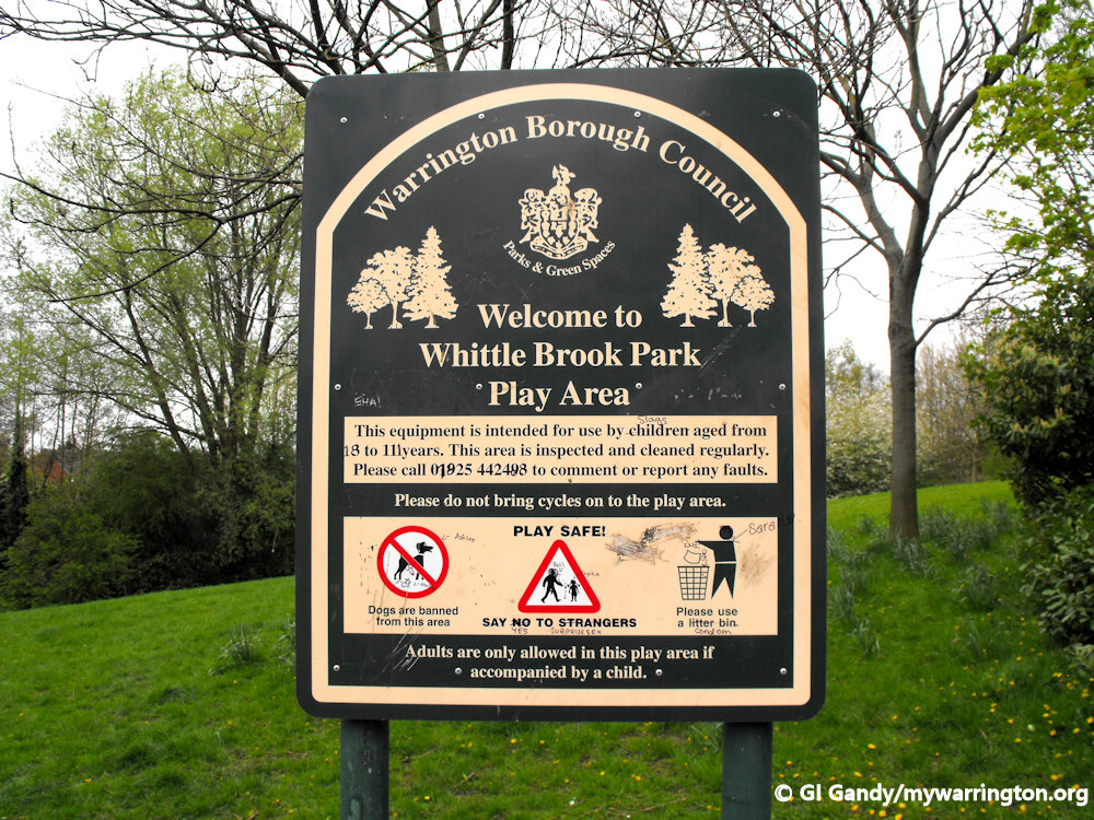
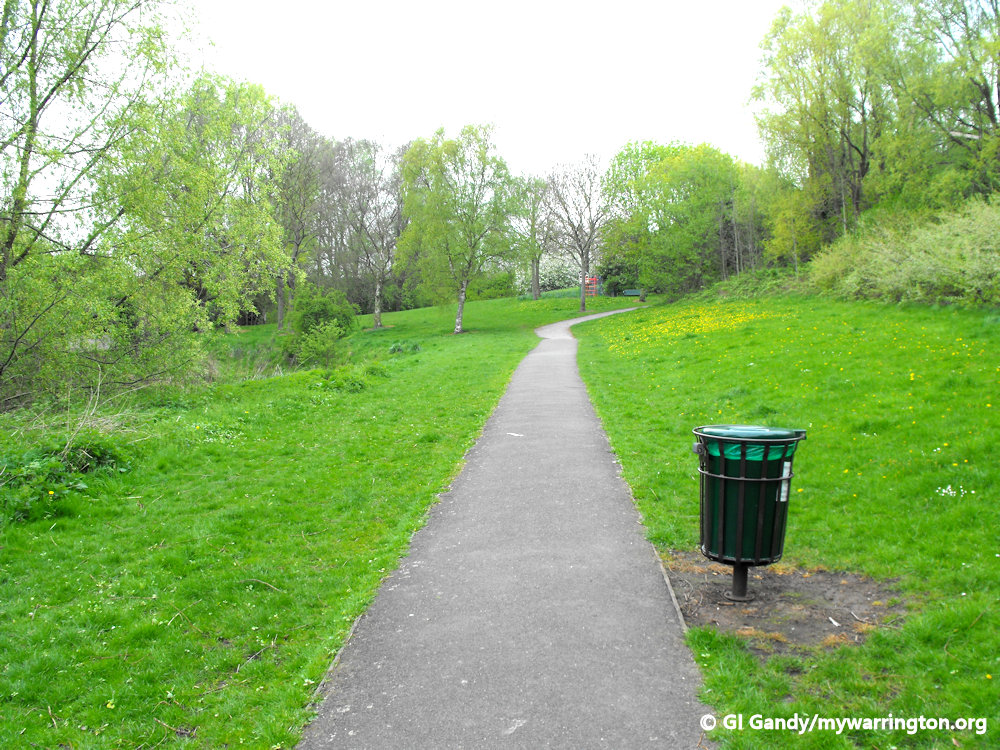
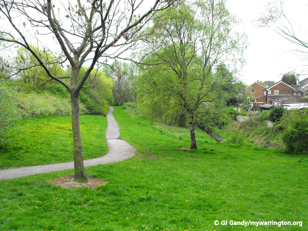
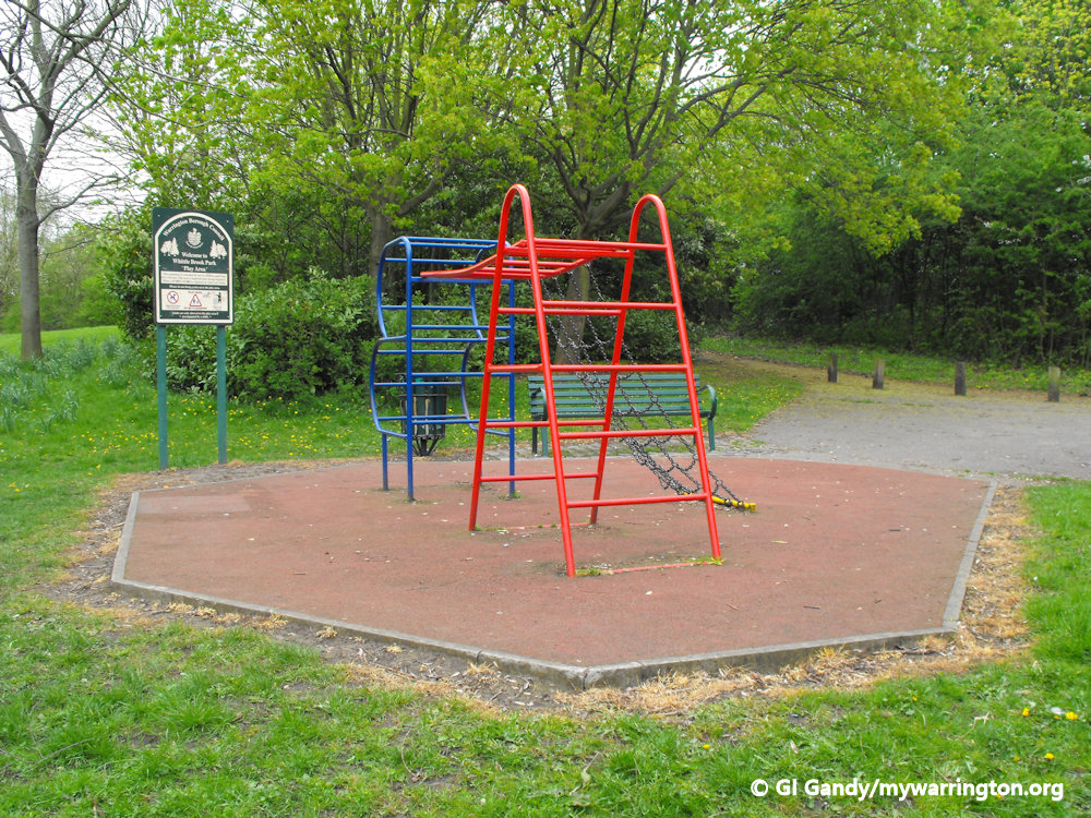
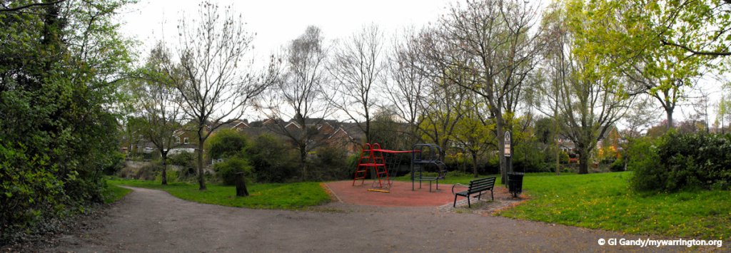
Whittle Brook Park
Another park in the district is Whittle Brook Park off Whittle Avenue.
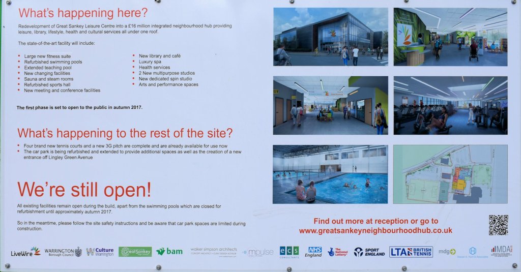
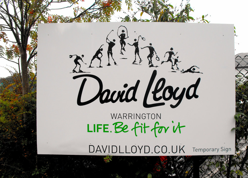
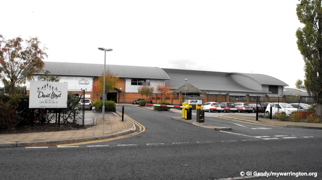
Great Sankey Community Hub
The Livewire website for the hub introduces itself in this way: Join LiveWire and access Great Sankey Neighbourhood Hub. If you’re searching for a gym with over 120 stations, 100 weekly fitness classes, swimming pools, and tennis courts and 3 group fitness studios including a dedicated group cycle studio then this is the place for you.
During my visit to Barrow Old Hall site I witnessed part of the redevelopment of Great Sankey Leisure Centre into the hub. The following photos were from the construction company message boards.
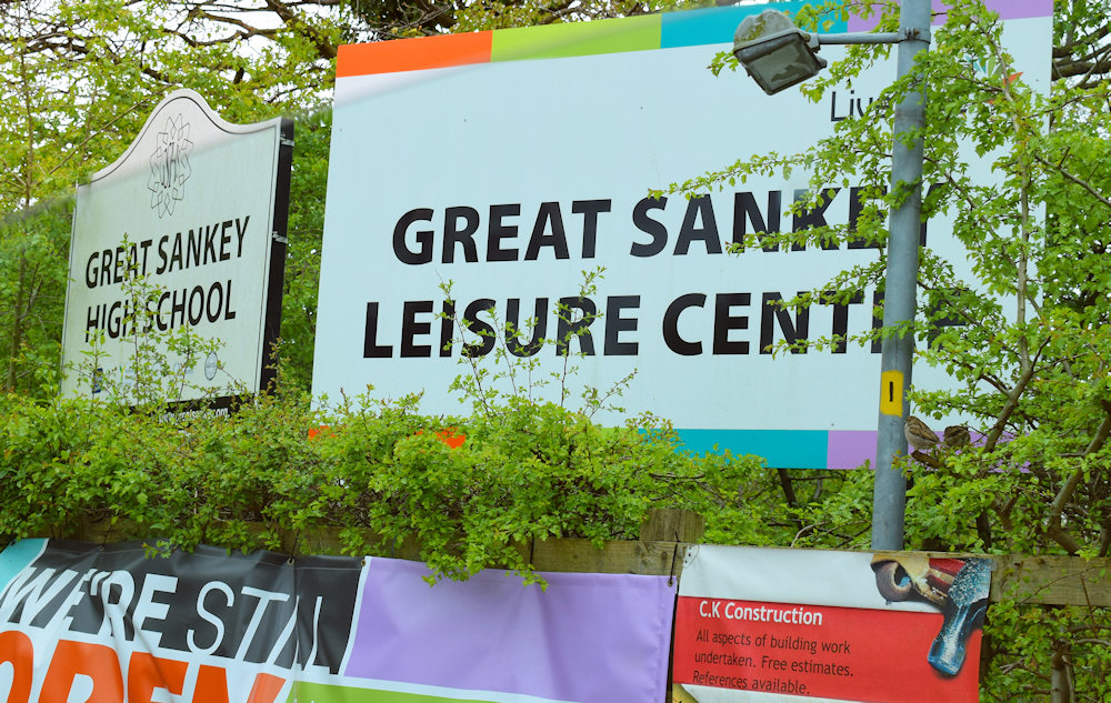
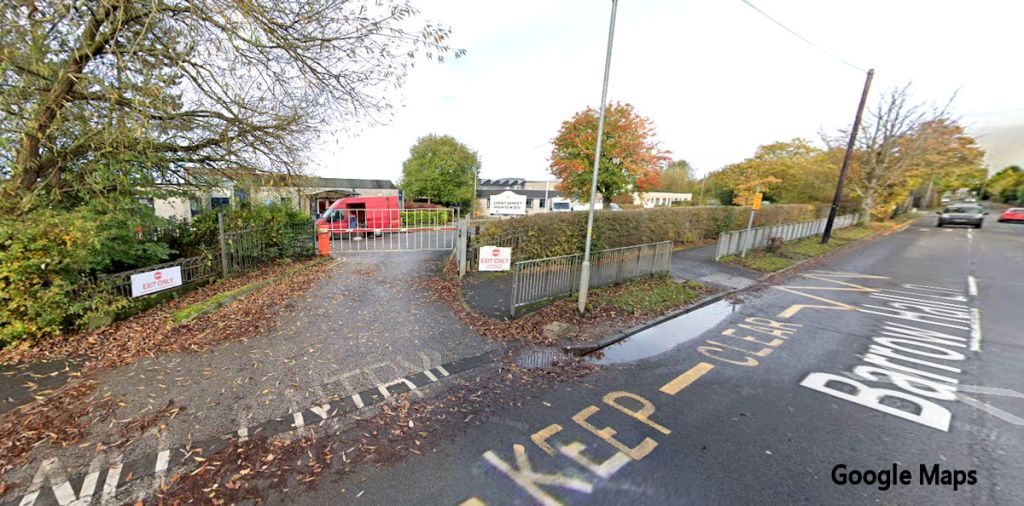
Great Sankey High School
Great Sankey High School (GSHS) is a coeducational secondary school and sixth form with academy status, located on Barrow Hall Lane.
It is a member of the Omega Multi-Academy Trust (OMAT). The school was first built in the 1970s and extensions have included a mathematics & humanities block and theatre. GSHS has been awarded, and retained, an Artsmark Gold award, the highest award for the Arts.
A new purpose-built sixth-form college was opened on the school site in September 2011 by Alan Yates (former Headteacher) and Simon Moran (Managing Director of SJM Concerts).
In December 2019, the new PE hall was opened by current headteacher John Shannon on the site of what used to be the neighbouring primary school, Barrow Hall Primary School, along with a diner in use for the Year 7s that was completed in January 2019. The new science block containing 11 laboratories was built on the same site and was opened in February 2020. The plans for taking the school’s grounds were confirmed by previous headteacher, Paula Crawley, when Barrow Hall Primary School relocated to a close area.
In 2004, the school was awarded specialist schools status in the field of Engineering and has since increased the provision of Engineering throughout the curriculum. The school also operates a Young Apprentice scheme, where Year 10 students have the opportunity to Start a two-year course and earn an NVQ level 2 with the school.
In a partnership with the RAC, the school has built an RAC automotive engineering skills centre. This allows students studying engineering and automotive engineering, access to facilities that few other engineering colleges possess, whilst also providing facilities for other schools and businesses in the local community.
The school has many teams participating in sports such as football, rugby league, hockey, netball, basketball, cricket, badminton, athletics and handball.
On 24 August 2019, Great Sankey High School’s Year 7 Rugby team won the Champion Schools Final against Standish High School at Wembley Stadium. On 8 July 2022, Great Sankey High School’s Year 10 Rugby team won the Champion Schools Final against Spen Valley High School at Kingston Park. In the same competition, in 2023, Great Sankey’s Year 11 team beat Spen Valley High School 38-8 at the Millennium Stadium to win a third Champions Schools in a row.
The school has two main bands that perform regularly in the local area and abroad, in locations such as Italy, France, Spain and Germany. They have also played in the UK in London (Covent Garden) and Warrington train station (where they played for the Duke of Edinburgh). In the past, the Concert Band has achieved a silver medal at international level competing against some of the best school and college bands from all around the world. The Swing Band (run by Mr Bryan) competed in Warwick at the national finals after gaining a gold medal at the regional series in 2007.
Both bands performed by formal invitation on the Fantasy Festival Stage at Disneyland Park, Paris, in summer 2008, 2012 and 2014.
Notable Former Pupils
- Shafilea Ahmed – murder victim
- Kathleen Dawson – backstroke swimmer and gold medal-winner at 2020 Tokyo Olympics
- Ben Evans – rugby league player for London Broncos, Warrington Wolves, Bradford Bulls, Toulouse Olympique and Wales
- Rhys Evans – rugby league player for Warrington Wolves and Leigh Centurions
- Andrew Gower – actor
- Gareth O’Brien – rugby league player for Warrington Wolves and Salford Red Devils
- Gemma Prescott – Paralympic athlete in F32 throwing events
I will profile these remarkable pupils in Warrington People at a later date.
Pub life
Omega Business Park
Omega is a property development site in west Warrington comprising 226 hectares straddling the M62 motorway. The site comes under the area of Great Sankey and comprises a large part of the former RAF/USAF Burtonwood airbase. A new junction on the M62 (junction 8) was built in anticipation of the development.
The whole site was to provide 650,000 sq m of offices, manufacturing and distribution space along with ancillary leisure/retail facilities, hotel and conference facilities. Around 24,000 jobs were hoped to be created over the lifetime of the scheme to make one of Europe’s largest business parks.
A large part of the southern part of the site was eventually allocated to new housing.
A Final Walkabout

SANKEY BRIDGES
Descriptive Gazetteer Entry for Sankey Bridges
Sankey Bridges, ry. sta., ½ mile E. of Sankey sta., SW. Lancashire; P.O.
(John Bartholomew, Gazetteer of the British Isles (1887))GB Historical GIS / University of Portsmouth, Lancashire (Ancient County) through time, A Vision of Britain through Time.
http://www.visionofbritain.org.uk/descriptions/2092290
Date accessed: 05th September 2025
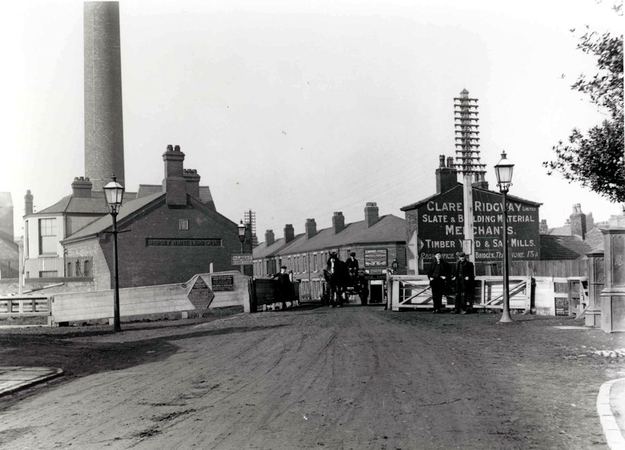
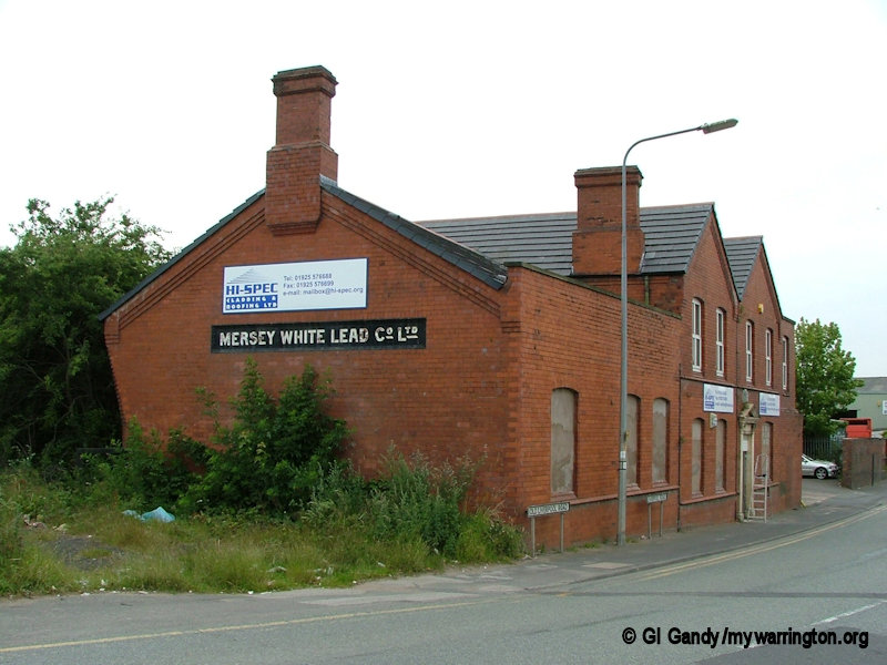
Sankey bridges and Clare & Ridgway slate and building Material merchants, with Mersey White Lead Co Ltd. Image courtesy of Warrington Museum.
Sankey Bridges is a district of west Warrington. Located around the crossing of the main turnpike road between Warrington, Prescot and Liverpool over the Sankey Brook, it became home to many industries after the opening of the Sankey (St Helens) Canal, the first wholly artificial canal built in England during the Industrial Revolution.
There is a record in the archive showing that an Edward II Charter was granted for repairing Warrington Bridge and Sankey Bridges in 1310.
The area was a hive of industry after the coming of the Industrial Revolution. Private wharves, a coal yard and a public house called the “Resolution Sloop” were in existence in 1756.
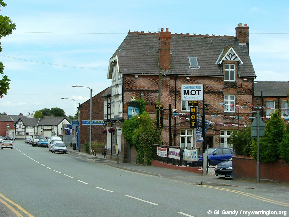
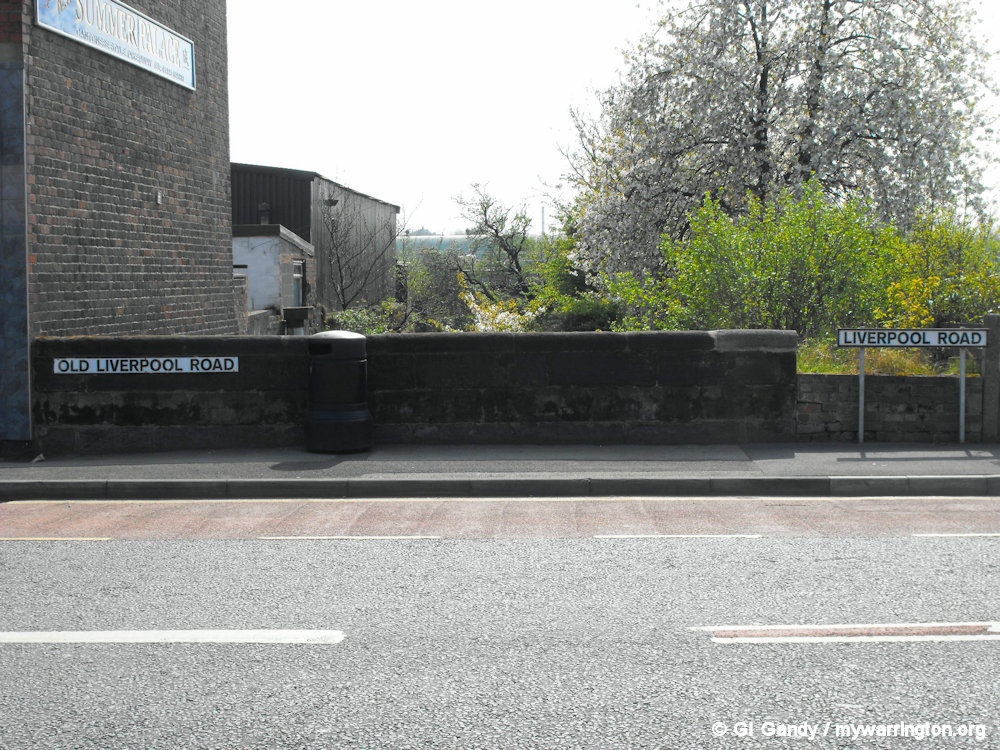
The original turnpike road is now Old Liverpool Road, showing here The Sloop pub and in the distance The Black Horse pub (painted white) (7 July 2004).
When opened in 1757, the Sankey Canal entered the river Mersey through a set of locks situated at Sankey Bridges, although the canal was subsequently extended to locks further downstream, at Fiddler’s Ferry and Runcorn Gap. Sankey Lock continued in use until at least 1830. No trace of the lock remains today.
Clare & Ridgway
The Clare family owned a boat yard and dry dock and they began building “Mersey flats” in 1807. A Mersey flat is a type of doubled-ended barge with rounded bilges, carvel-built fully decked. Traditionally, the hull was built of oak and the deck was pitch pine. Some had a single mast, with a fore and aft rig, while some had an additional mizzen mast. Despite having a flat bottom and curved sides, they were quite stable. They were common from the 1730s to the 1890s.
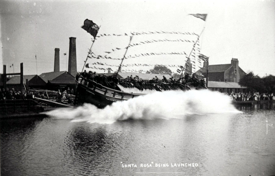
Santa Rosa launch at Sankey Bridges in 1906. The 200-ton ship was launched by Mrs Ridgway in front of an excited crowd. Image courtesy of Warrington Museum.
The business continued for most of the century but the boatyard had financial difficulties in about 1848. However, things turned around in 1855 and their order books were full until at least 1881. The last boat to be built in Sankey Bridges was launched in 1913 and the maintenance yard remained in use until after the First World War.
Their business empire didn’t just build boats. And they had more than one location. They also had works at Winwick Street in the town centre. According to an 1876 trade advertisement they were wholesale and retailer dealers in Velinheli, Bangor and other slates, cisterns, slabs, enamelled slate mantel pieces and toilet tables.
They also dealt in lime, coal, flags, fire bricks, sand, Roman and Portland cement and Plaster of Paris. In addition, the company had its own saw mill and dealt in other items such as pig and cattle troughs, roofing felt, air bricks and slopstones. See Grace’s Guide for the advertisement.
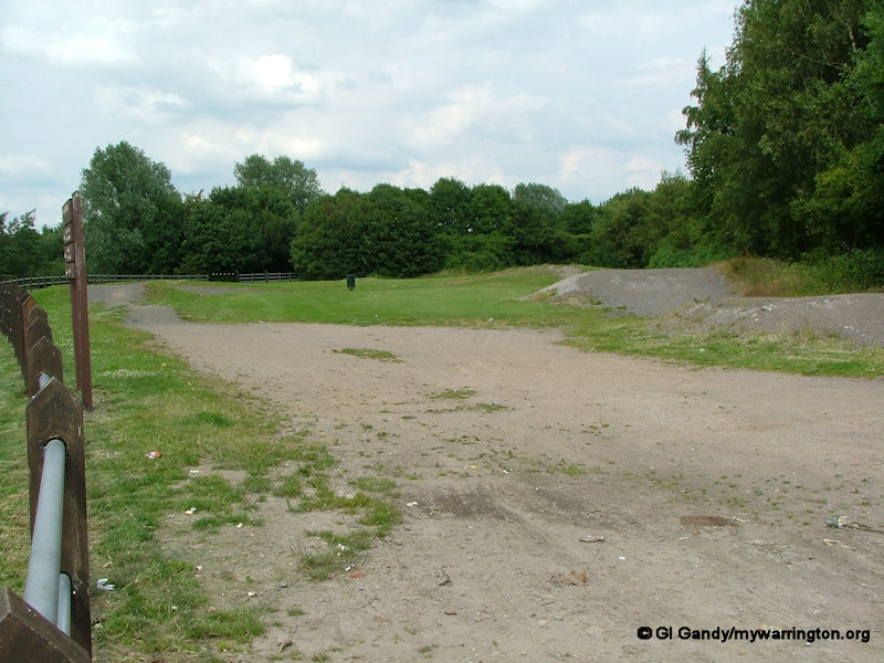
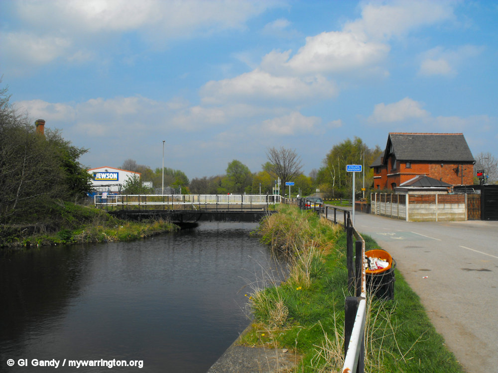
Today the boat yard land is occupied by Jewson builders’ merchants and a BMX track now occupies the site of the dry dock off Liverpool Road.
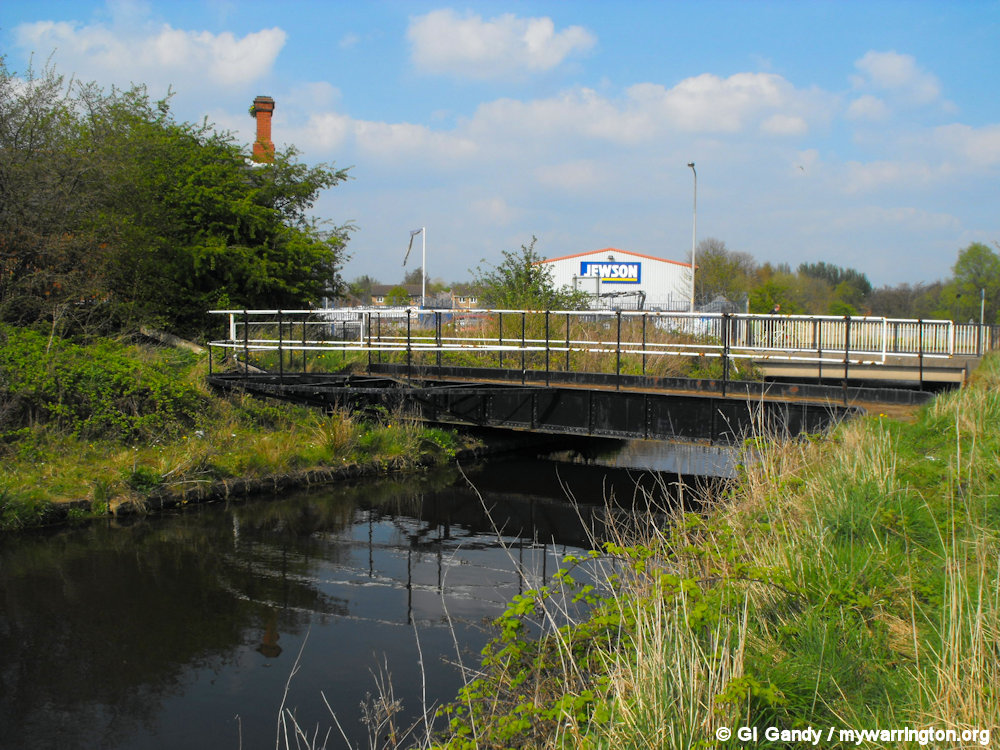
Sankey Canal with Jewson’s in the background on the site of the Clare’s boat yard (13 Apr 2009)
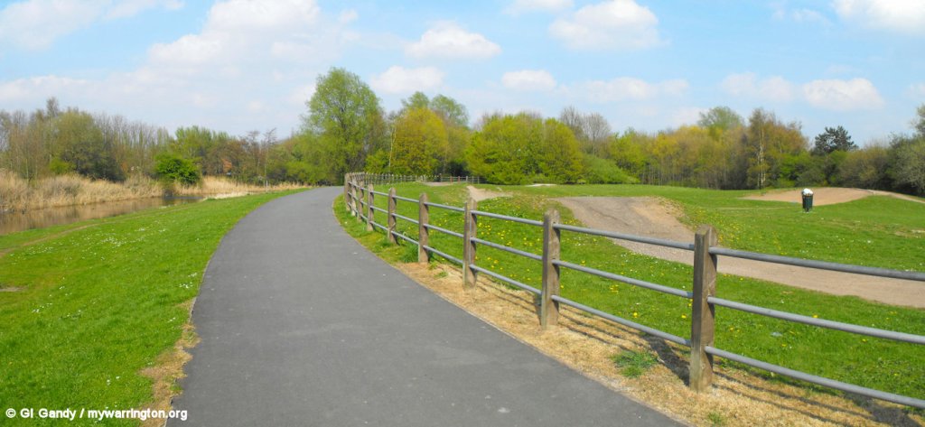
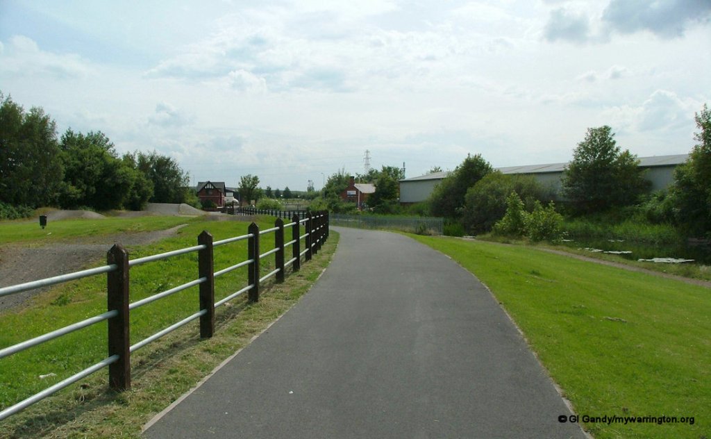
The BMX track and footpath in Sankey Valley Park (13 Apr 2009).
A Mersey flat is a type of doubled-ended barge with rounded bilges, carvel build and fully decked. Traditionally, the hull was built of oak and the deck was pitch pine.
Some had a single mast, with a fore-and-aft rig, while some had an additional mizzen mast.
Despite having a flat bottom and curved sides, they were quite stable. They were common from the 1730s to 1890s. Information: Wikipedia.
The Warrington Guardian tells us that Clare and Ridgway’s Eustace Carey jigger flat was still being used as a barge up until 1965 before beaching off Spike Island and that the company was in business for 120 years.
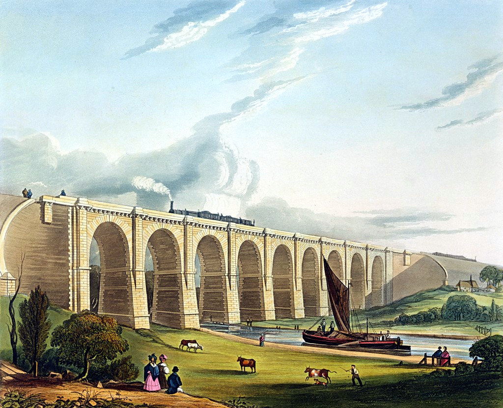
A Mersey flat on the Sankey Canal, approaching the Sankey Viaduct (1831). The image is in the public domain.
The Mersey White Lead Co Ltd started out on 21 February 1889.
Grace’s Guide has the following listing on their website:
Mersey White Lead Company limited. Leadworks, Sankey Bridges, Warrington, Lancashire. Telephone: Warrington 30258. Telegrams : Lead, Warrington. Passenger station: Warrington, 1 mile. Goods station: Private siding, Sankey Bridges. — White lead, dry and ground in oil, and ready mixed paints.
The white lead was added to paint to increase its weather protection, enhance colours and make it go further. Read more on Daresbury District Heritage Group Facebook page.
The building still stands on Liverpool Road close to where the original road bridge allowed for the passing of boats.
The advent of the railways marked significant change for the fortunes of the canal. By the 1830s canal dividends were falling. In 1845 the St Helens Canal and Railway Company was formed to amalgamate the commercial interests of both the canal and the railway.
The area became more complex with houses, factories, storage yards, watercourses, locks, bridges, road crossings, railway lines and the station all crammed in. Looking back at the wonder photos from the those days I imagine it being a great place to be with lots of activity to keep younger minds interested, especially seeing a boat being launched or a train blowing off steam as it passes through the area.
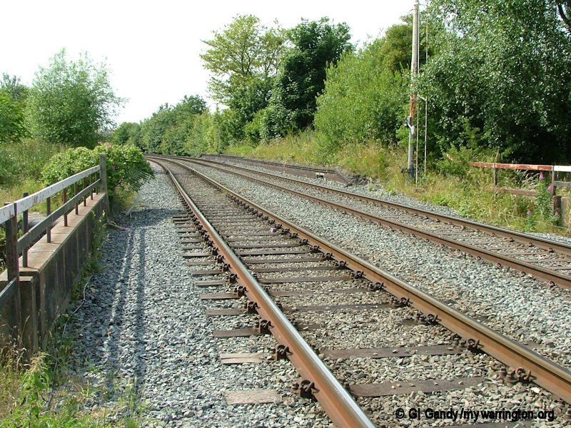
The remains of Sankey Bridges station platform west of the canal (6 July 2004)
In the early days canal traffic had priority over both road and rail traffic. It was custom to leave all the bridges open so boats could sail through uninterrupted. If a road crossing was required the bridge would be swung over. The railway bridge was controlled by a signal box on the bank at the end of the station platform and red warning lights shone to remind the train to stop.
On a foggy night in November 1858 the locomotive “Actaoen” ran into the canal at Sankey Bridges. The engine was required to return the same night but nobody remembered to tell the station master whom, after the passage of the train, swung the bridge to allow canal traffic to pass during the night, and retired to bed as usual. On returning the driver missed the danger signal in the fog and the engine plunged into the canal. It took several days to haul it out of the water.
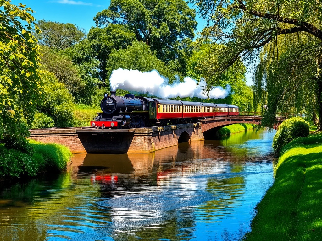
An AI image depicting a train approaching a canal.
Looking south (first image) with the dry dock on the left of the fence and across the canal the boatyard was where the builder’s merchants is today across the canal. A BMX track now occupies the site of the dry dock (second image). My photos were taken on 6 July 2004.
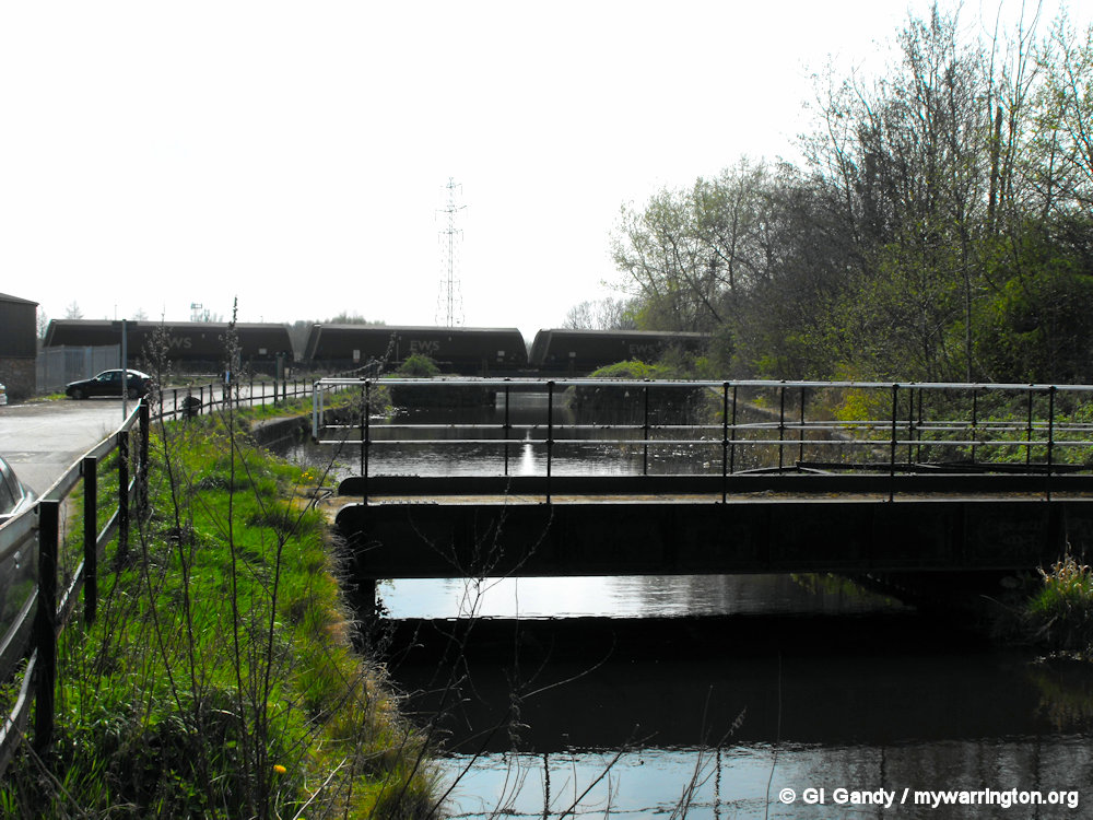
The nearer bridge was the relief swing bridge provided to allow passage along the main Liverpool-Warrington A57 when the main bridge over the canal was out of action.
The concrete plinth beyond it is the present bridge, superseding the bascule lifting bridge installed in 1915, which replaced the original wooden swing bridge as traffic weights increased. Information via David Long in Wikipedia.

A road bridge over the Sankey Brook is interesting. On the northern it is called “Sankey Mill Bridge”, whilst on the southern side it is described as “Mill Sankey Bridge”. According to the OS Map it is known as “Mill Bridge”.


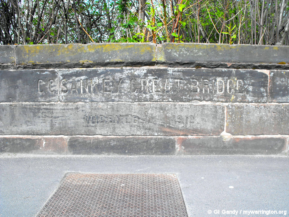
Another bridge, this time by the Sankey Canal, is called “Sankey Great Bridge” or “Great Bridge” on the same OS Map.
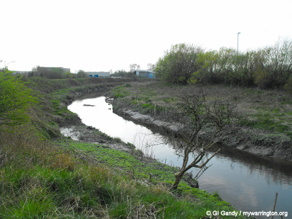
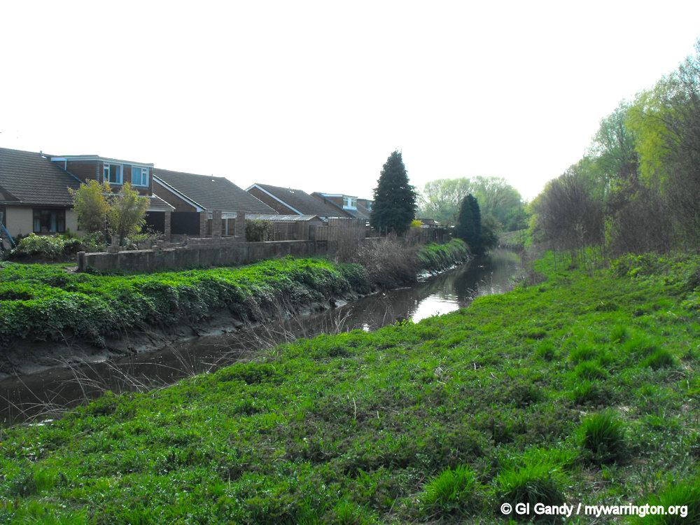
You may not realise why we have two separate waterways next to each other. The reason is that the Sankey Brook was there first and the Act of Parliament originally gave permission to make the brook wider and deeper for boats to travel on.
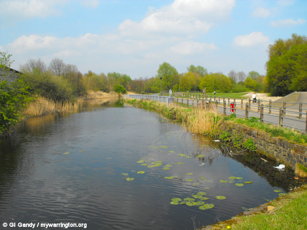
In the end a seperate channel was dug which became the Sankey or St Helens Canal and the first section opened in 1757, four years before the first part of the Bridgewater Canal, which opened in 1761. However, most of the Sankey Canal has now been filled in and turned into Sankey Valley Park for most of its 15-mile length.
Here are some more views of the Sankey Canal and Sankey Brook.

One other form of transport to enter the district was the corporation tram in 1902. The tram route started on 23 April 1902 and ran from town centre to Sankey Bridges, stopping just before the bridge across the Sankey Canal. The trams ended on 27 March 1935 when buses took over. See On the Buses for the full story.
Church Life
Bethany Pentecostal church now meets in Sankey Bridges Methodist Church building (they started in March 1978.
The Methodist Church was built in 1885 and was in use by them until 19 February 1978. The church opens a new vestry on 13 October 1906.
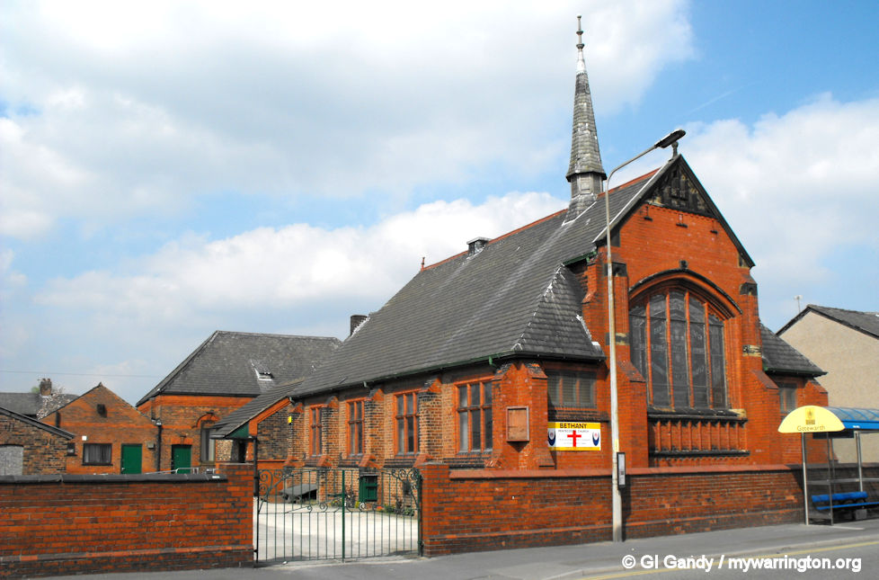
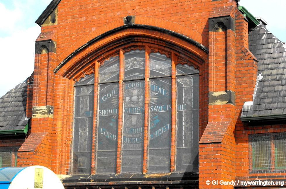
The former Methodist Church is now used by bethany Pentecostal church. Note my second image is in reverse so you can read the stained glass window which normally reads from the inside. Photos taken 13 April 2009.
St Luke’s Anglican Church on Liverpool Road is a Grade II Listed building. It was built in 1892 by Bodley & Garner and the foundation stone was laid 4 July 1892.
It was opened for use on 18 October 1893 and closed on 1 July 1986, having received listing status on 4 April 1975. It does not have a graveyard.
Now decommissioned as a place of worship, it was taken over for business use and used as a builder’s storage location, as can be seen here from the back by Samuel Street. Read more here.
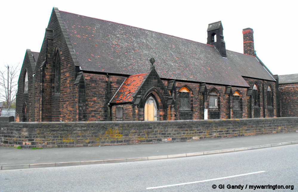
The former St Luke’s as seen on 13 April 2009.
School life
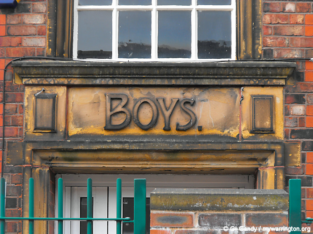
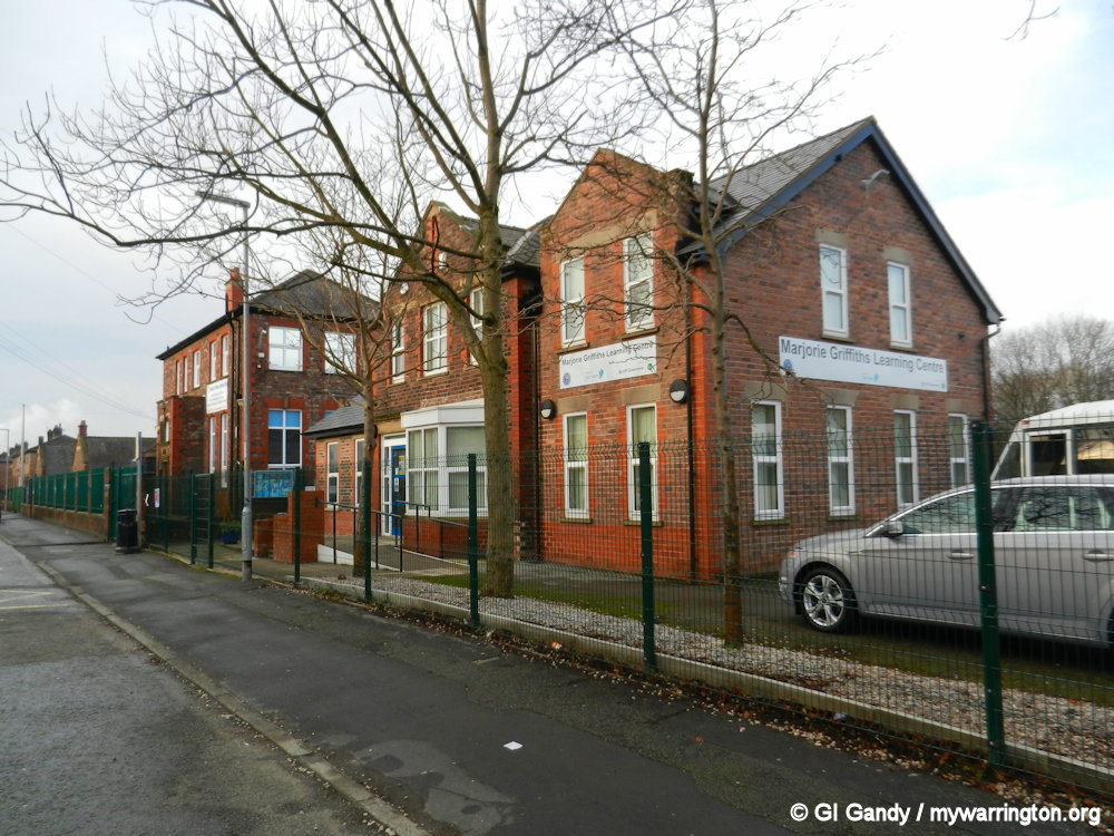
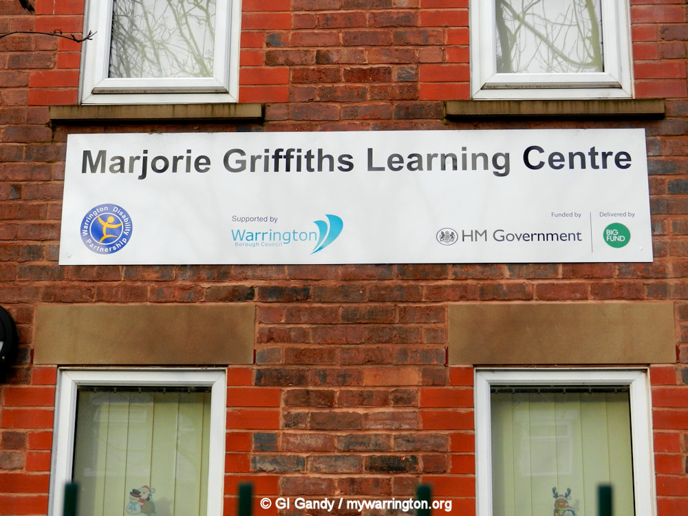
Evelyn Street School Sankey Bridges Infants School becomes Evelyn Street School on 21 June 1912 and opened for use on 15 August 1912. It also had a senior school section. Warrington Disability Partnership is based on Beaufort Street in buildings that were once part of the school. Also in the building is the Marjory Griffiths Learning centre. Marjory (still affectionately called Miss Griffiths by pupils taught by her) was a teacher at the original senior school before pupils moved to Bewsey Secondary Modern school in a 1972 merger.
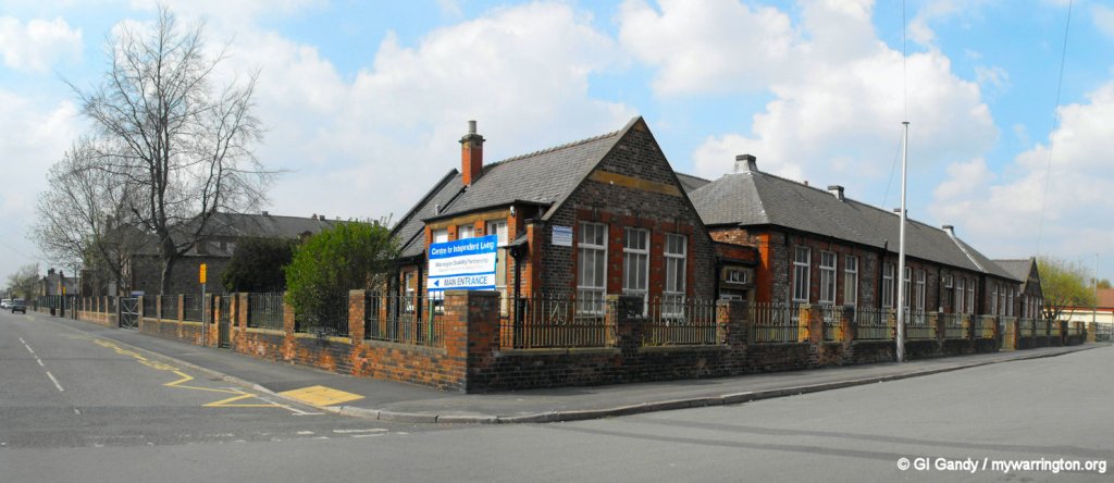
Evelyn Street school on 13 April 2009
Pub Life
There are two pubs in Sankey Bridges.
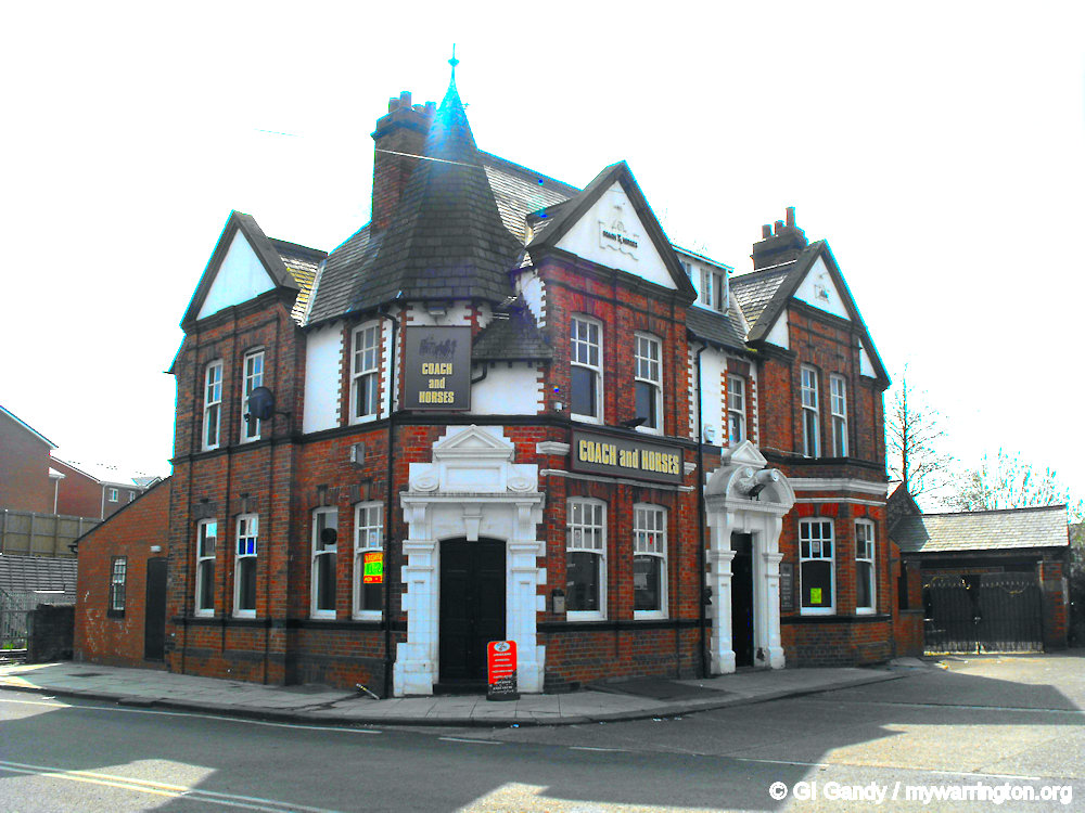
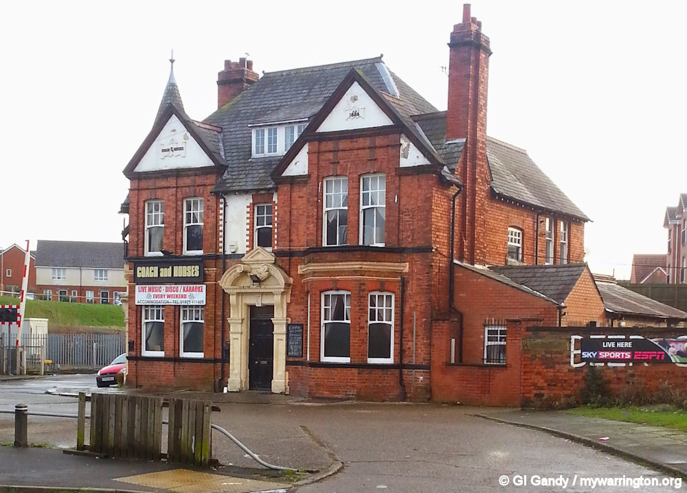
The Coach and Horses opened in 1884. In 2022 the building was converted into a restaurant called Deva Bistro and Meathouse. Since then the ground floor of the building is in use as San Marino Italian restaurant. An application to turn the upper floor into a 5-bed house of multiple occupancy (HMO) was turned down by the council in 2025.
The Black Horse opened in 1632 as a coaching inn. It is one of the oldest buildings in Warrington and is Grade II listed, receiving the listing on 4 April 1975.
It was the location of the very last skirmish in Warrington between the Royalists and the Ironsides (Cromwellians) when a group of Cavaliers (Royalists), on the run, entered the Black Horse and demanded all the horses in the stable.
The landlord refused and was killed by a sword. Read more about the pub in Haunted Histories, especially about the ghost (there’s always a ghost!)
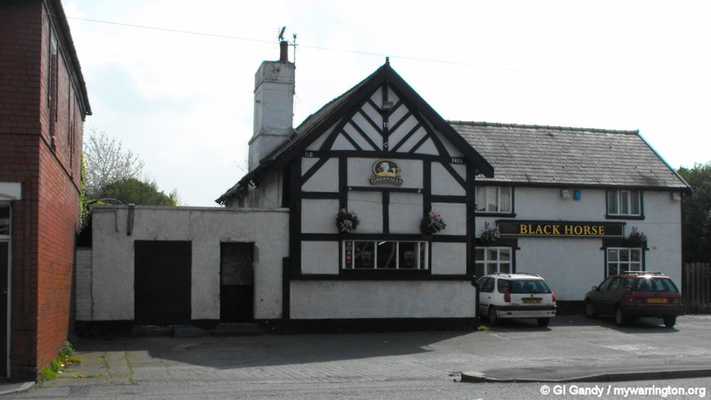
The Black Horse (13 April 2009)
The Sloop Inn opened in 1877.
As well as the inside bar and seating area, it also boasts a beer patio with a stage area. To the rear is a single-storey flat roof extension and it has a mock Tudor façade.
In 2017 a campaign was launched to save a pub which could be demolished to pave the way for the controversial £195 million Western Link scheme. The consultation on the ‘red’ route runs until Monday after transport chiefs recommended that it was the best option to tackle the town’s congestion misery.
The proposed bypass would link the A56 Chester Road with the A57 Sankey Way in Great Sankey. Eight properties – including four that are occupied – would be demolished if the project gets the green light from the Government, including the pub.
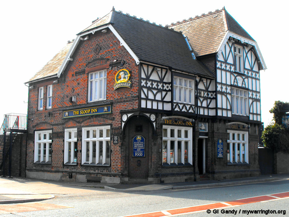
The Sloop Inn (13 April 2009)
Other buildings

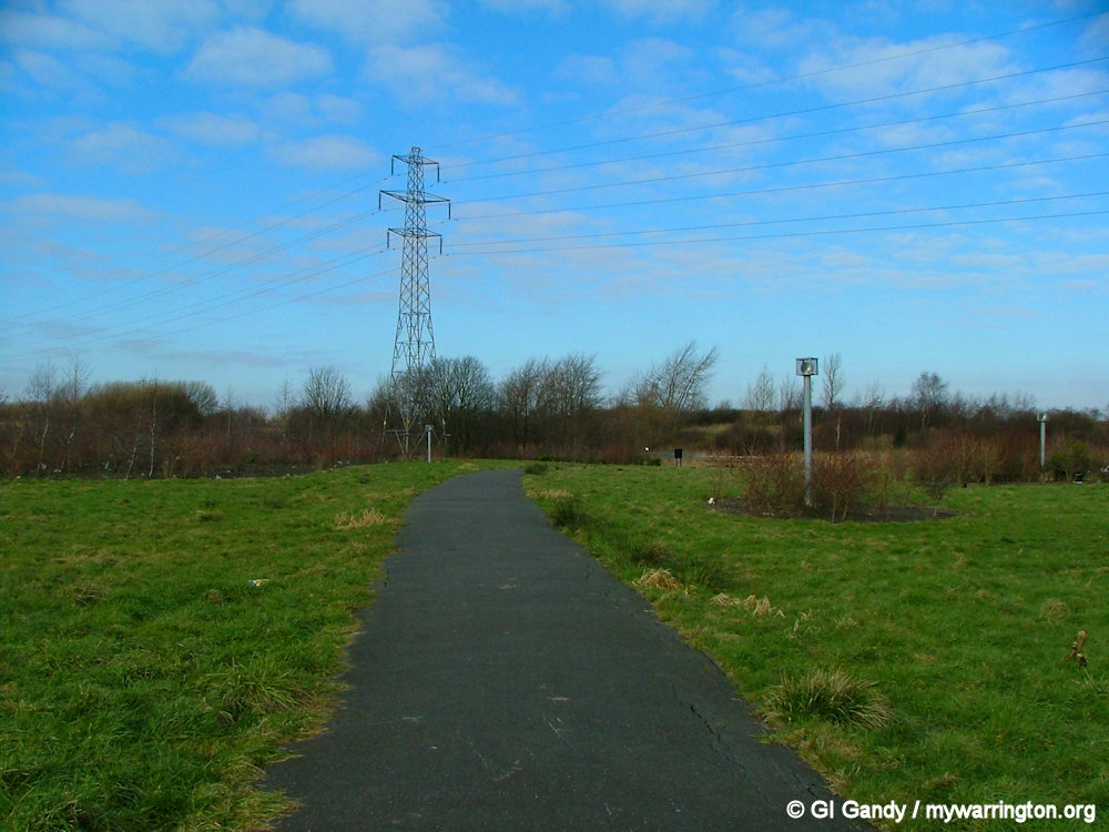
Back to Nature
Sankey Bridges hosts part of the Trans Pennine Trail and other wildlife and recreation areas. Here are some photos to finish off this section.
LITTLE SANKEY
In 1870-72, John Marius Wilson’s Imperial Gazetteer of England and Wales described Little Sankey like this:
SANKEY (Little), a parcel in Warrington township, Lancashire; near Great Sankey.
GB Historical GIS / University of Portsmouth, History of Little Sankey, in Warrington and Lancashire | Map and description, A Vision of Britain through Time.
URL: https://www.visionofbritain.org.uk/place/22747
Date accessed: 22nd July 2024
The location is where the name “Lt. Sankey Green” appears on the OS First Series one inch map. The name “Little Sankey” appears much more clearly at the same location on the original OS six inch (1:10,560) map.
Sankey Green, location of Little Sankey Hall, was created in 1971 when the Sankey Way dual carriageway was constructed. Photographed on 10 Sep 2006.
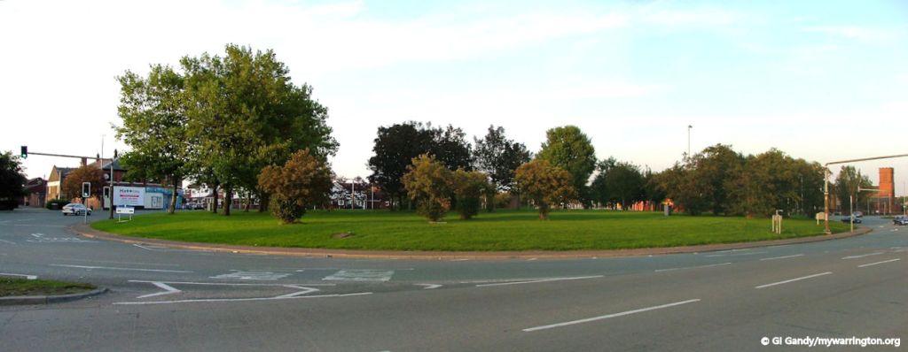
Little Sankey Hall
The home of the Sankey family until 1615, it was demolished in the 1890’s and the site now lies beneath the Sankey Way roundabout.
Sankey Brook powered the lord of the manor’s water mill in the 14th century.
Mill Lane once led to Sankey Green (the street sign is still visible on the wall of the convenience store on the corner of Lovely Lane by Sankey Green).
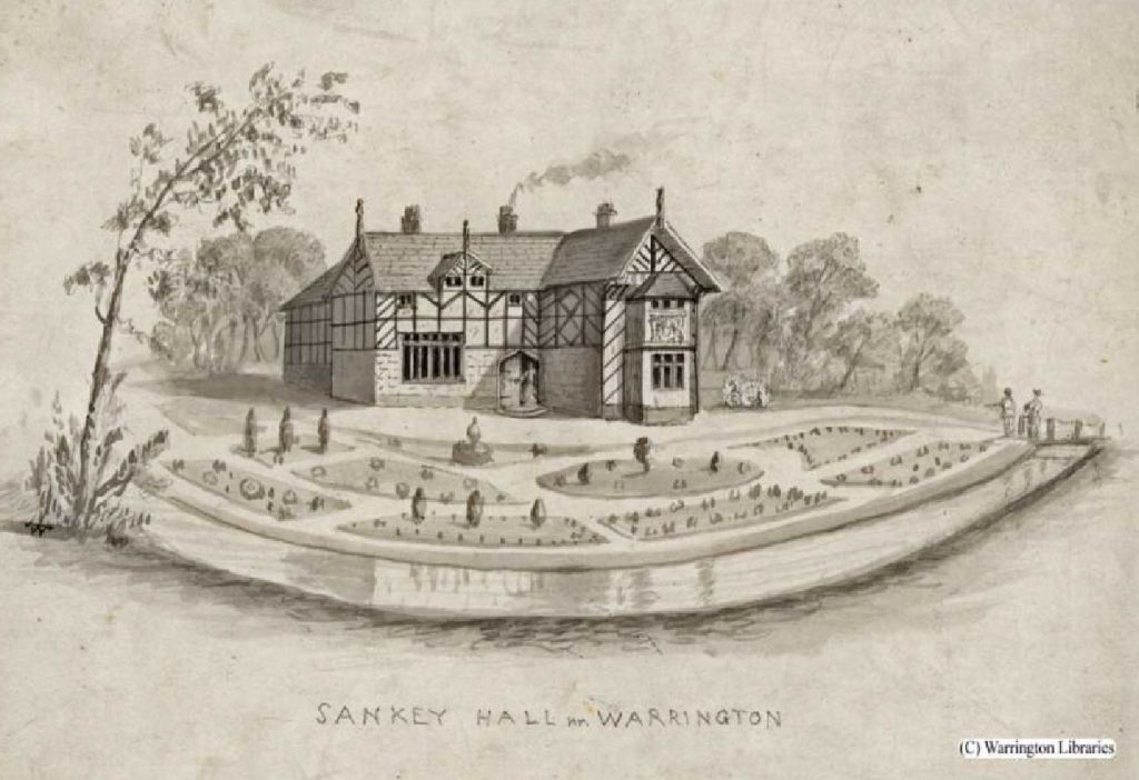
Image courtesy of Warrington Museum and Library
LINGLEY GREEN
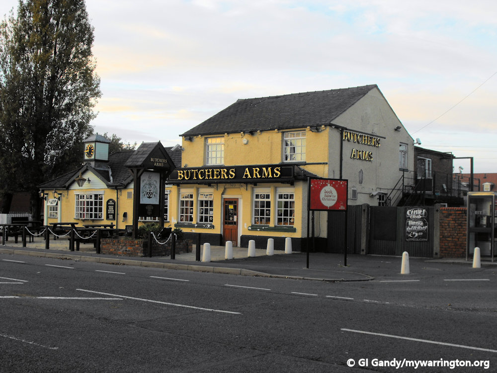
Lingley Green is located in west Warrington close to Liverpool Road. There is a triangular-shaped green at the junction of Park Road and Lingley Road. The Trigger Pond pub is on the corner of Liverpool Road and Lingley Green Avenue and the Butchers Arms pub is on the corner of Liverpool Road and Lingley Road.
Much of the housing in Lingley Green has been added since the mid-1990s. Previously there was a 12-bed smallpox hospital on Park Road, roughly where Whitwell Close is today. Park Road led to Park Farm, just outside the Warrington border. Lingley Green Farm was close by on Park Road.
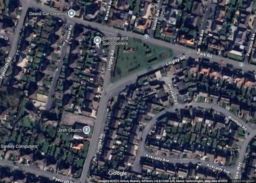
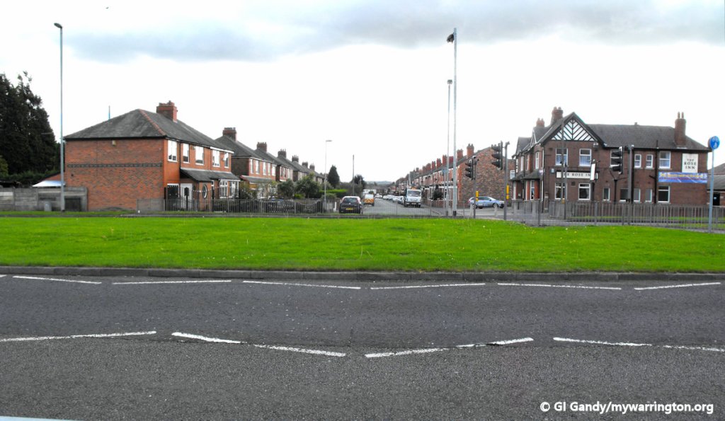
Lingley Road and Park Road from Google Maps
Lingley Mere Business Park to the north of Lingley Green is built on the site of the former RAF Burtonwood Air Base. It includes a large Royal Mail distribution centre with access from the M62 motorway at Junction 8 via Burtonwood Road and Lingley Green Avenue.


See also Sankey Bridges.
