

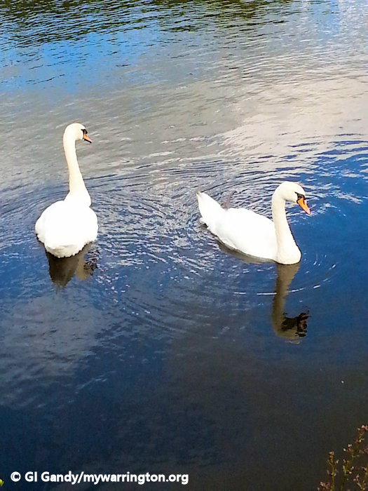
Swans on the Mersey at Howley 22 Jul 2015
Introduction
The National Gazetteer of Great Britain and Ireland of 1868 describes the district in this way:
“HOWLEY, a tything in the parish of Warrington, hundred of West Derby, county Lancaster, 2 miles from Warrington. It is situated near the river Mersey, and the Sankey and Bridgwater canals.”
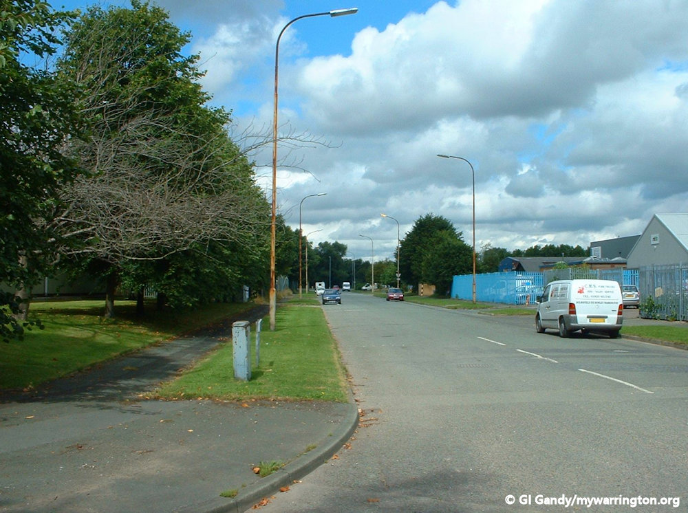
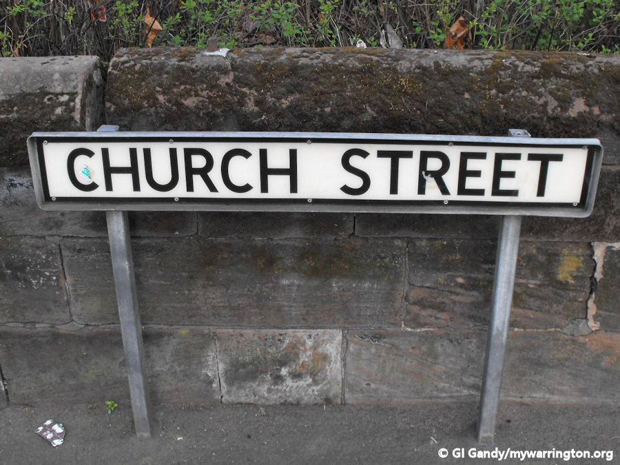
The name comes from two Old English words “holh” and “leah” and means “hollow meadow”. It was in fact the centre of the town in Anglo Saxon times. The main street is Church Street leading to Manchester Road, which separate the district from Fairfield.
The reason for Market Gate being the centre of town today is due to residents moving west during the Victorian industrial times for work. It also resulted in Holy Trinity church becoming a chapel of ease to the Parish Church of St Elphin as the population increased.
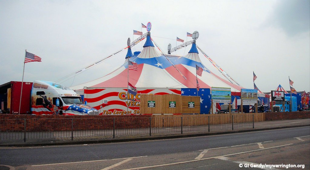
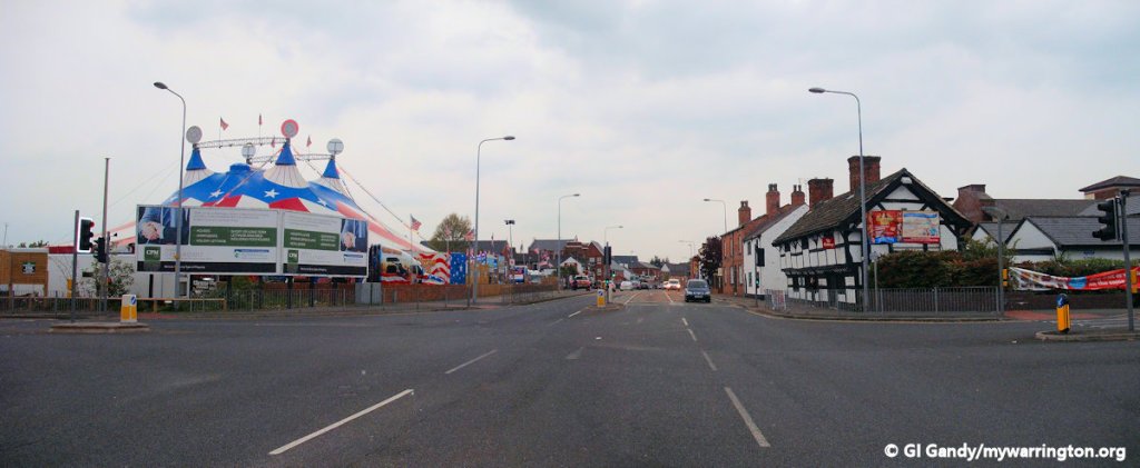
A fair had been held at Howley since medieval times. It included stalls, horse racing and greasy poles until 1859 when the fair was banned.
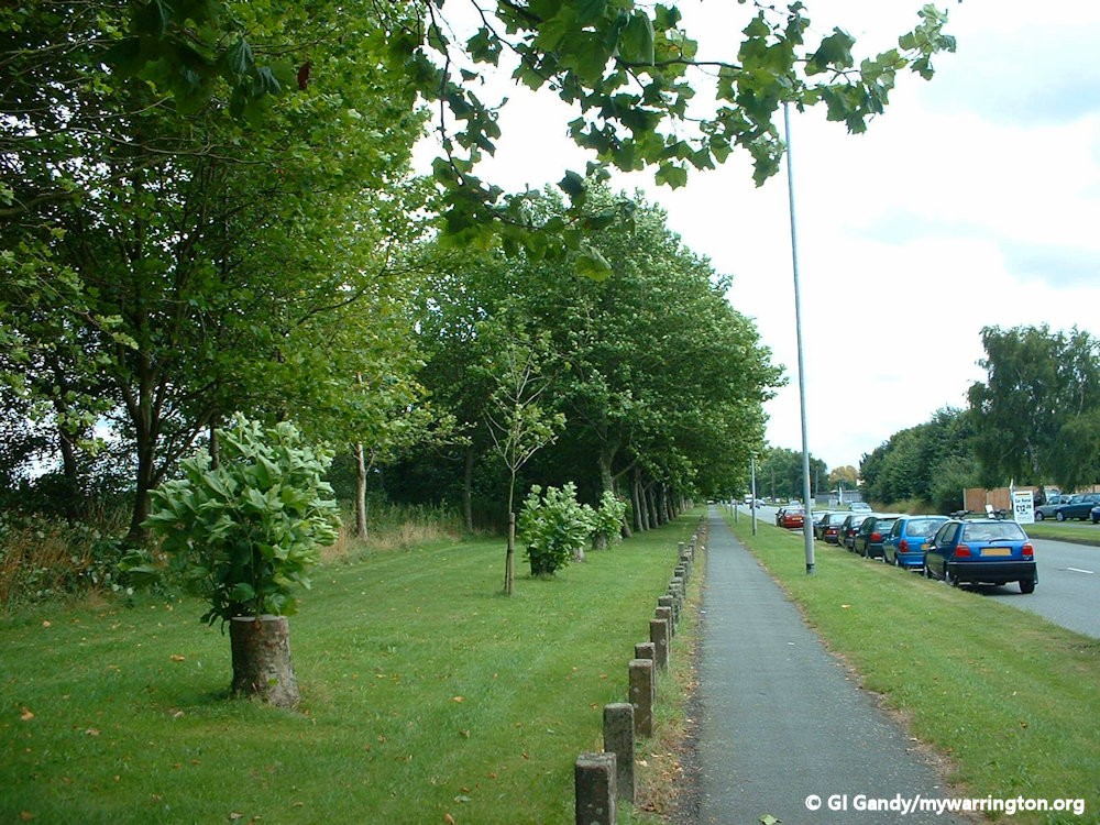
Fairfield and Howley are linked together for local authority purposes. See the area on the OS 1840s-1880s map.
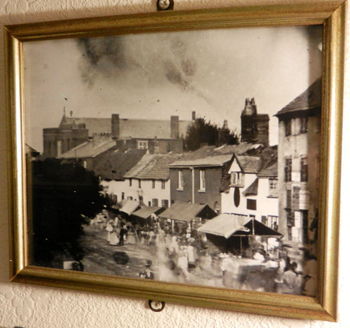
Church Street Fare 1855 from a photo in the Warrington Museum collection. We can see the National School on the far left and the Workhouse on the far right.
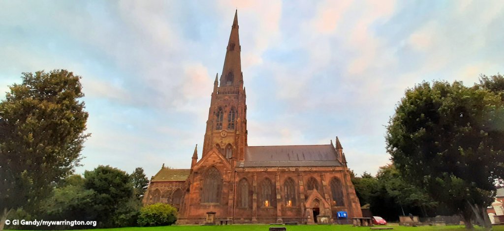
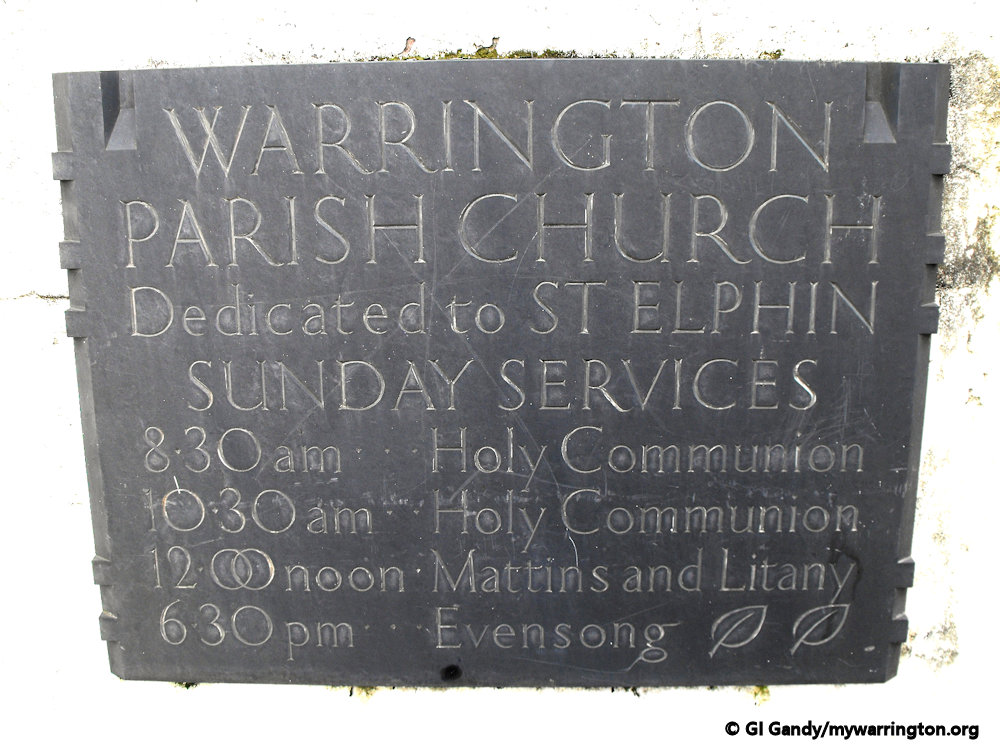
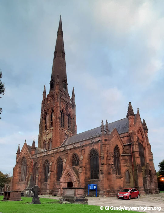
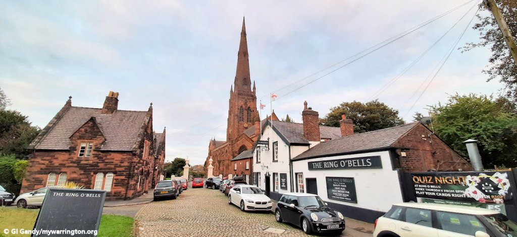
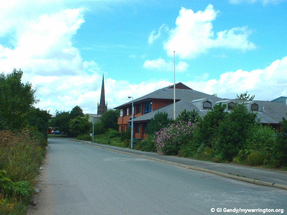
The Parish Church of St Elphin
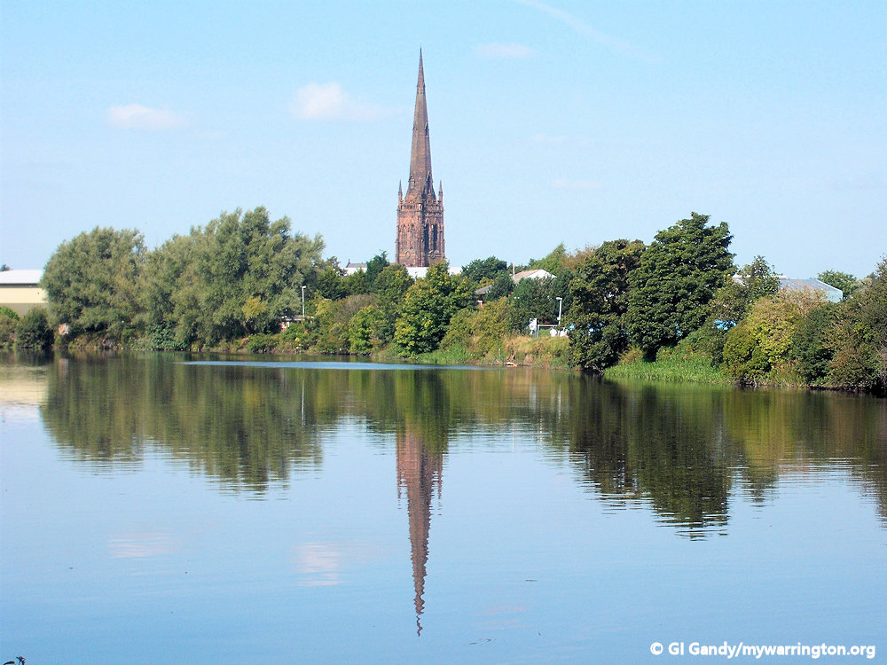
The Parish Church of St Elphin (or simply the Parish Church, as it is known locally) was founded in 642 AD and built out of wood alongside the north to south Roman road, which crossed the Mersey at this point. It was later rebuilt and enlarged in the 19th century. The church is dominated by its 281 feet (86 m) high spire.
St Elphin
Elphin of Warrington (died 679) was a Christian saint who lived in the North West of England in the 7th century, and is considered by some the patron saint of the town of Warrington.
Little is known about his life, but according to tradition he was a companion of Saint Oswald at Iona. When Oswald became king of Northumbria and moved his country residence to Makerfield, Elphin accompanied him and Oswald built a wooden church for him on the site of the present parish church in Warrington. The Domesday Book also describes two carucates of land in the hundred of Newton-in-Makerfield as belonging to St Elphin. He was martyred in 679 AD. From Wikipedia.
The Church (continued)
A place of worship has been present on the site since at least 642 AD, and the presence of a priest in Warrington was recorded in the Domesday Book. According to tradition the first church was built by Saint Oswald for his companion Elphin, who remained as the first priest there until his death in 679.
There is debate among historians as to whether the church was actually dedicated to Elphin or Helen. But without absolute proof from written records, we must continue to accept that the Elphin of Domesday is indeed the one dedicated to our Warrington church.
The earliest fabric in the present church is in the chancel and the crypt, which survive from the church built in 1354 by Sir William Boteler. The church was badly damaged by the Parliamentary forces in the Civil War.
Following this the tower was rebuilt in 1696 and the nave in 1770. The south aisle was added in the early 19th century. Most of the fabric of the present church is the result of an extensive restoration between 1859 and 1867 by Frederick and Horace Francis. It was during this restoration that the spire was added. The bells were recast in 1698 and again in 1884. In 1950 they were recast again and the clock was replaced.
Within the church, St Ann’s Chapel was founded by Thomas Massey, rector of Warrington from 1448 to 1464. It continued to belong to the Massey family until they died out in 1748.
The chapel was then acquired by the Patten family who built a vault to bury members of the family, the last being Lord Winmarleigh in 1892. The Lady Chapel was founded and endowed by Sir John Boteler in 1290. He and other family members were buried in the chapel. In 1943 it became the chapel of the South Lancashire Regiment and in 1976 the chapel of the Queen’s Lancashire Regiment.
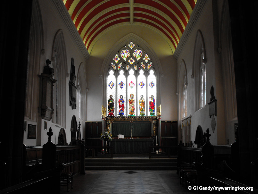
The plan of the church consists of a wide nave, wide north and south aisles with a chapel at the eastern end of each aisle, a central tower with a tall spire at the crossing, and a chancel. In the aisles are galleries containing pews with doors. The reredos dates from 1933 which was further decorated in 1999 by Ronald Sims.
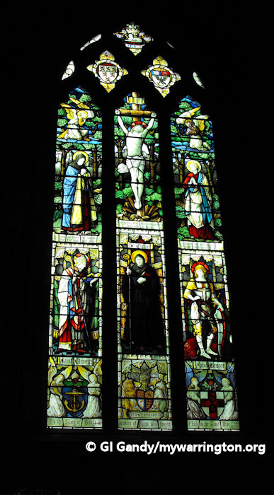
Some of the stained glass in the church is by Pugin. This was damaged in the second world war and has been re-set. Other glass is by A. Gibbs.
The monuments include tablets to Dr Thomas Percival, who died in 1804, by H. Rouw (brother of Peter Rouw), and to Thomas Lyon, who died in 1818, by Webster of Kendal.
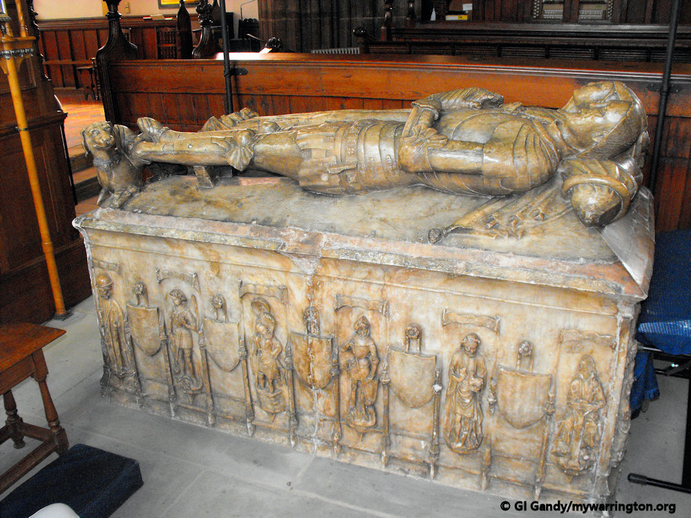
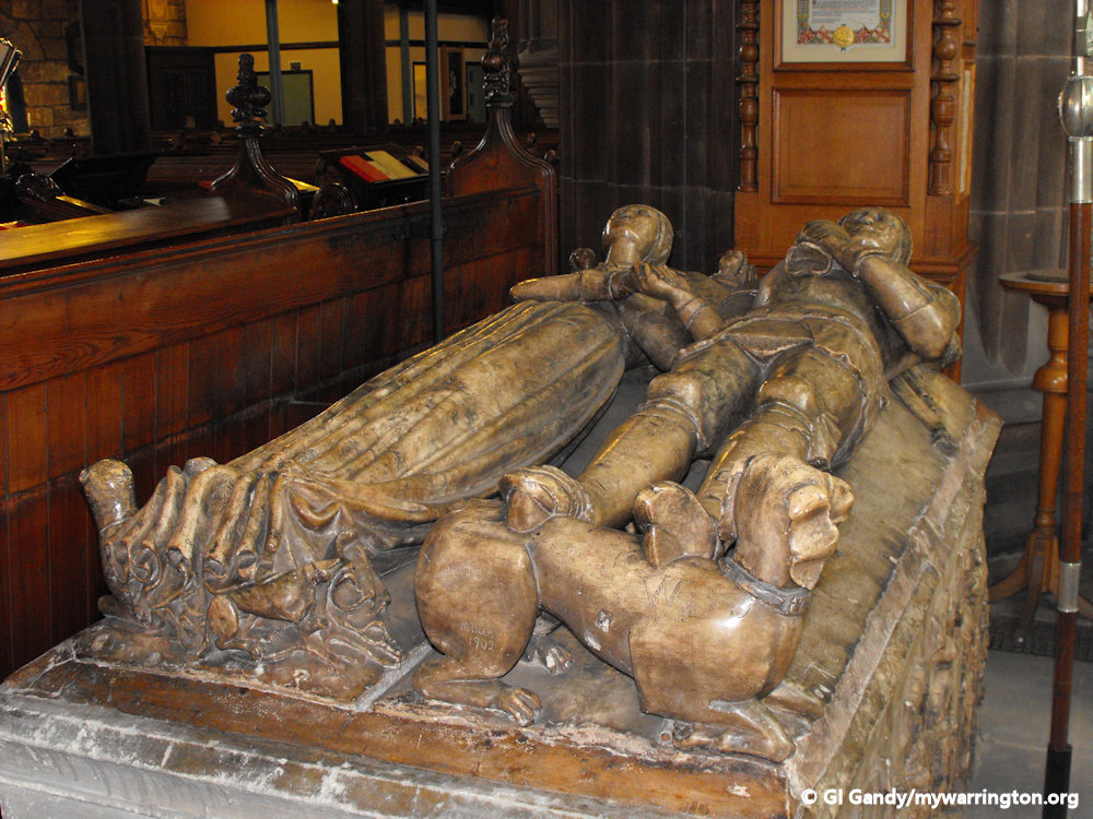
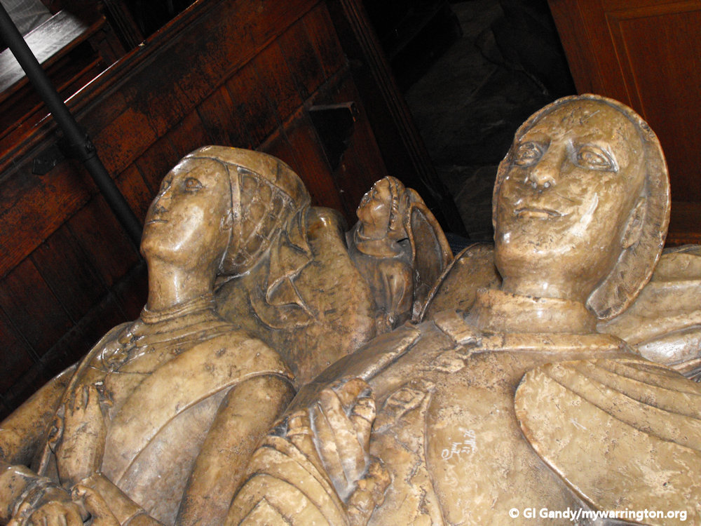
The regimental chapel in the south transept includes a number of ancient monuments. These include an effigy to Lady Alicia Boteler from the early 14th century and an alabaster monument to Sir John Boteler who died in 1463 and his wife.
The screen is a Boer War memorial dated 1903 by William and Segar Owen. The stained glass in the chapel is a Second World War memorial by Hugh Ray Easton dated 1947.
A pipe organ was installed in 1876 by the London firm of Gray & Davison at a cost of £1,296. Additions were made by the same firm in 1881. It was rebuilt in 1902 by the Manchester firm of Alexander Young and Sons. At this stage the organ was divided in two, placed on galleries over the north and south transepts.
It was rebuilt in 1946 – for about £6,000 – by the Liverpool firm of Rushworth & Draper Ltd. when the organ was re-arranged with part being placed on a gallery at the west end, while the rest remained only on the gallery in the south transept. This fine three manual and pedal instrument is no longer used. Instead, in November 2005 an electronic organ of twenty audio channels and 61 stops – also with three manuals and pedal – was provided by the Darwen (Lancashire) firm of Phoenix Organs.

Spire
The church is dominated by its spire, 281 feet (86 m) high. It is the fifth highest parish church in the UK, after the St. Walburge’s Church, Preston, St. James Church, Louth, St Mary Redcliffe, and St. Wulfram’s Church, Grantham.
the eighth highest spire in England, after the above four and Salisbury Cathedral, Norwich Cathedral, and Coventry Cathedral.
External features
The gateway to the church dates from the 18th century. It consists of two stone rusticated gate piers surmounted by a cornice and urns. Between these are two iron gates over which is a curved iron arch. To the sides are low stone side walls and small iron side gates for pedestrians.
The gateway is listed at Grade II. Also listed Grade II are the cobbles and the pavement leading to the gateway. The church and its grounds lie within the Church Street Conservation area.
Some details from Wikipedia.


Mote Hill – Warrington Castle
A friend of mine was totally shocked when I revealed to him that Warrington once had a castle. My research led me to the following report, which is published with “reasonable reuse for education purposes” from www.gatehouse-gazetteer.info
The Mount, also known as the Mote or Moat Hill, Warrington, was the largest motte and bailey castle in Lancashire. (VCH 1908). It was placed on a slight eminence, raised about thirty feet above sea-level and approx. 250 yards from the north bank of the Mersey. It commanded the ancient ford and routes to it There is little doubt that the castle was the residence of the manorial lords of Warrington until their removal to Bewsey Hall. The castle is mentioned as such in 1228, when William Pincerna was granted timber for its repair (VCH 1907) but by about 1587 it is referred to as the “.. scyte of the manor … decayed and no byldings thereupon…” (Beamont).
Thereafter, there are few literary references to the history of the site until the 18/19th c. when it is variously described as a ‘tumulus’ or ‘Roman botontinus’ (Watkin).
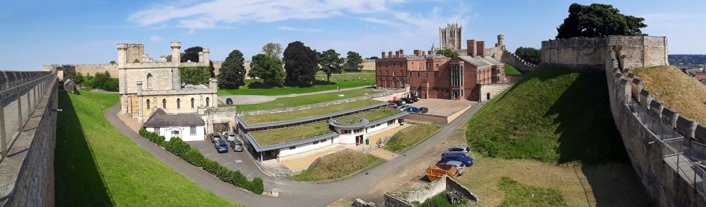
The image here shows Lincoln Castle from my visit on 31 July 2024. It is a motte and bailey type, the style that graced Mote Hill in Warrington in the 13th century. The motte (or mount) is on the right and the bailey enclosure is bound by the castle wall. The building in white and cream on the left is a working courthouse and therefore not open to the public as a visitor attraction. For more on Lincoln Castle, see their website.
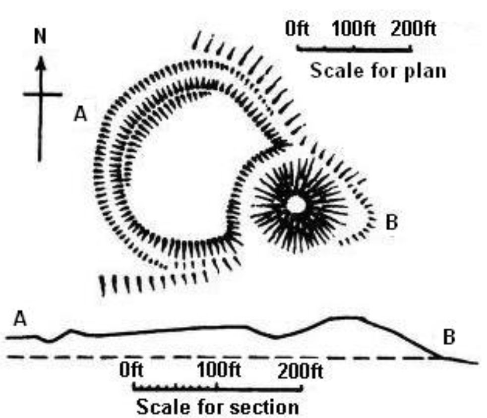
The only authoritative description of the site is that given in the VCH for 1908 when there were few remains of the earthworks – only the northern part of the motte mound and ditch and a vague outline of the ditch of the bailey on the northeast of the motte.
Earlier accounts indicate that the mound was oval, 162 feet NW-SE and 129 feet NE-SE, and 9 feet high, with a flat top, 90 feet in diameter. A ditch, partly water filled, once surrounded the motte. The bailey was formed by a ditch, averaging 6 feet deep in 1908, but as late as 1819 there had been traces of a substantial rampart-bank.
The mound was excavated in 1832. On its top was a circular depression, c.1. foot deep, filled with carbonized reeds, straw and brushwood mixed with bones and decayed animal refuse. A pit of concial form contained ashes and burnt bones.
Some distance from this fireplace, a well was found, lined with wood, and filled with earth. In the Stratum of animal and vegetable matter at the bottom, were found early Md. potsherds, part of a horse-shoe, a curved knife-blade said to be Saxon, a fragment of a quern, iron nails, a bronze fibula described as Saxon, Roman amphora sherds, an earthenware button, fused lead and two crude chess pieces of jet.
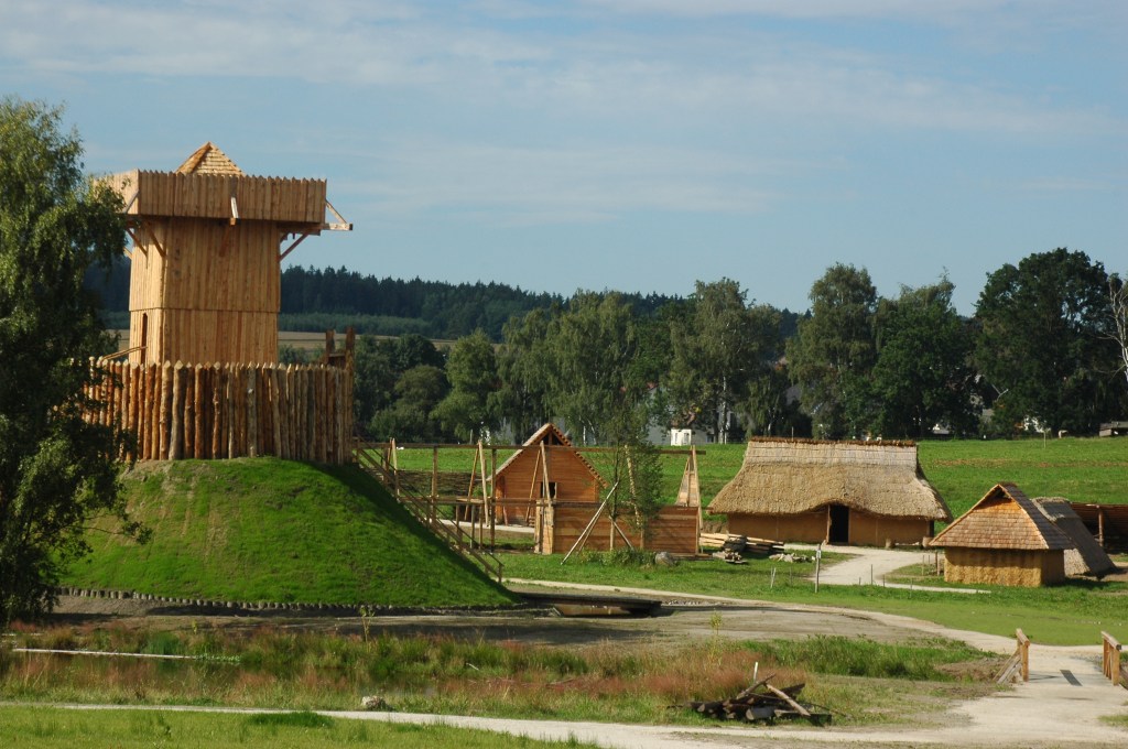
The Slavic early medieval settlement in the Bärnau-Tachov History Park with the motte in the foreground (translated from German). This file is licensed under the Creative Commons Attribution-Share Alike 3.0 Unported license by Barbara Brunner. See Wikimedia.org
These latter have attracted a great number of literary references and have been variously described to the 9th, 10th and 12th c., (Arch. Journal 1852, 1853, 1856) but there is not much evidence for a pre-Norman dating (VCH 1906).
Above the hollow was a layer of vegetable soil, with boulder-stones forming a rough pavement on it. A silver penny of Henry III was associated with this pavement. Above the stones was a layer of clay, earth and sand, three feet thick containing a number of 17th c. military and other relics. Tradition has always said that the mound was raised higher by the parliamentarians besieging the town in 1643 to place a cannon on it, and these finds confirm it. No evidence to suggest that stone walling replaced the original wooden palisading was found. Several massive timber beams and a few squared stones were found in the mound but their original position is not recorded. In 1841 the site was partly levelled in erecting school-buildings and was further mutilated in 1851 when the school was enlarged. The school was removed in 1905.
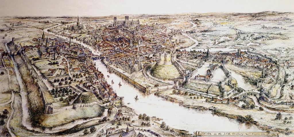
A panoramic view of York in the 15th century. A watercolour by E. Ridsdale Tate produced in 1914, the earliest publication I have found it in is Edwin Benson’s 1920 volume “Life in a Mediæval City”, published in London. A reconstruction of the English city of York in the 15th century, showing the motte-and-bailey fortifications of Old Baile (left foreground) and York Castle topped by Clifford’s Tower (centre right). The castle would have been in a similar style to ours at Warrington. This work is in the public domain in its country of origin and other countries and areas where the copyright term is the author’s life plus 70 years or fewer. See commons.wikimedia.org
There are no extant remains of the motte and bailey. The site is occupied by a public park and waste ground marking the area where the Clergy Orphan’s School formerly stood.
A small, modern mound, with stone walling around the base, was erected at SJ 6162 8851 to mark the site of the motte, by Warrington Corporation. The finds made in 1832 are stored in Warrington Museum with the exception of the ‘curved knife-blade’: Accn. Nos. 1559-85 and 832-3. A copper boss was found in 1929 in making tennis courts here (F1 RWE 21-OCT-60).
An exploratory excavation to the east of St. Elphin’s church, revealed that the motte, composed of sand within a retaining wall of turf backed with clay had been destroyed to within one foot of the original peat ground surface.
The ditches, 110ft. wide, had been retained by timber piling. The wet conditions, the 19th century destruction and the overlying build-up rendered the excavations unsatisfactory in terms of finds and structures (Hill 1972). (PastScape)
Plan of Topcliffe Castle, England. Author Ella Armitage (1841-1934). This work is in the public domain in its country of origin and other countries and areas where the copyright term is the author’s life plus 70 years or fewer. See commons.wikimedia.org
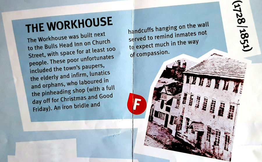
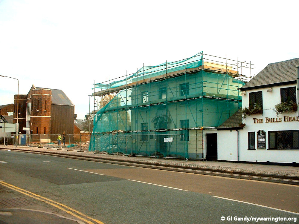
The Workhouse
A workhouse was institution to provide employment for paupers and sustenance for the infirm. They were founded in England from the 17th through the 19th century and also in such countries as the Netherlands and in colonial America. Warrington had two workhouses. The first was opened on Church Street next to the Bulls Head pub in 1728. It had space for 100 inmates and operated under strict rules which included no alcohol, spitting or filth or swearing. There was also a ban on books and other publications with an ‘immoral tendency’. The Church Street workhouse was closed in 1851. A second workhouse was located in what is now Warrington Hospital. This will be discussed in the Whitecross section of Downtown.
Industry
Thomas Locker and Co
Once the workhouse on Church Street was demolished, the site was occupied by Thomas Locker and Co. Thomas Locker was a wiredrawer who was born in 1867. The company was founded in 1879 One of their products was woven wire and perforated metal screens. In 1921 “An Order authorising the employment of women and young persons of 16 years of age and over in wire winding and weaving at the works of Messrs. Thomas Locker and C., Ltd., Church Street, Warrington, on two day-shifts” came into being. I assume this was due to a change in the law.
In the 1947 the company became a public company. By 1960 the company were manufacturing wire sieves for mining and in 1961 they were engaged in manufacture and sale of woven wire, perforated metals, wire work, screening and handling plant and air and liquid filtration equipment. In 1972 Locker’s acquired the wire weaving and wire working activities of Associated Perforators and Weavers, half owned with Butterfield-Harvey Group.
Text from Grace’s Guide. See also Warrington Museum website.
Leather and Tanning
Industry has played a large part in the district’s history. Leather tanning was first recorded in 1633 and became a major industry in the 19th century, especially around Bishop’s Wharf alongside the River Mersey where Riverside Retail Park stands today.
The word tanning comes from late Old English tannian ‘convert into leather’, probably from medieval Latin tannare, perhaps of Celtic origin; reinforced in Middle English by Old French tanner.
Mersey Street looked so different in those times, and not just as a narrow winding street rather than the dual carriageway of today. Horse and cart rather than motorised vehicles. The sites and in particular the smells of tanneries was something else. It was not the nicest place to work. My brother worked at Eagle Ottawa in Latchford in the 2oth century and he described the smell of the animal hides as ‘not for the faint-hearted’. He described the piles of animal skins still containing scraps of meat and layers of fat, all so we can have leather seats in our cars or handbags and jackets.
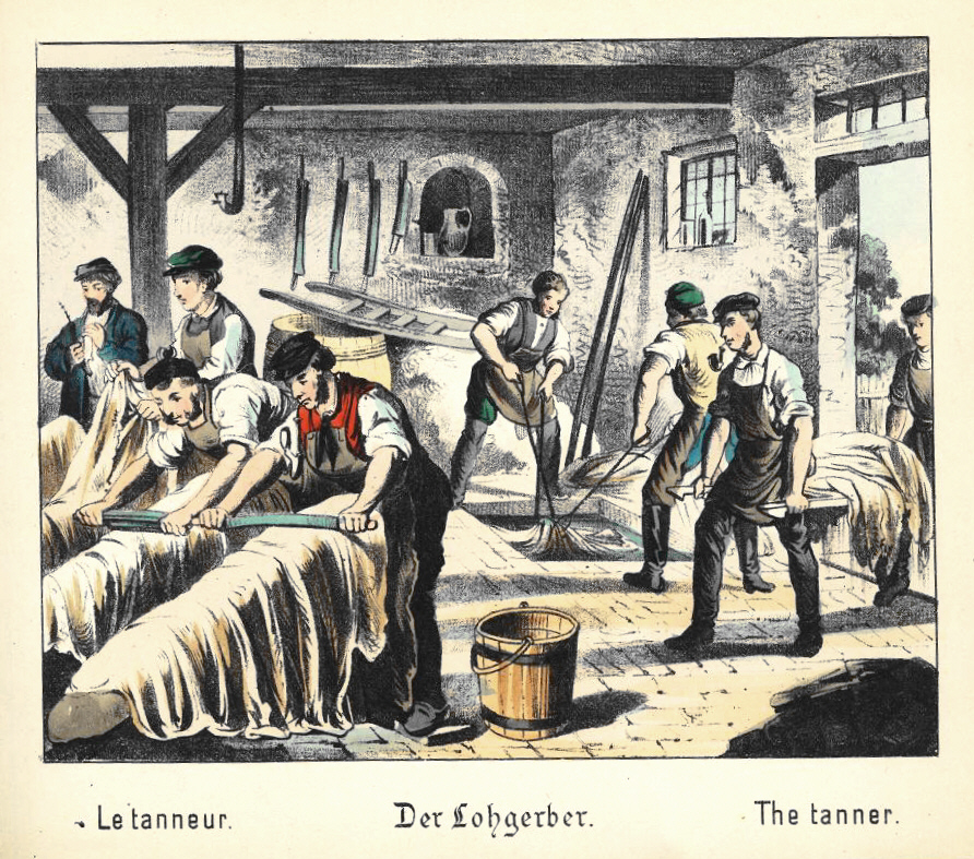
Image from What do you want to be? Pictures from the life of a craftsman. Berlin: Winckelmann [c. 1880]. Image is in the public domain. Wikipedia.
By the 19th century around 600 people were employed in the tanning industry. One company close to Howley was Waring’s on Fennel Street (Lidl is on the site today). Howley Tannery was alongside the river Mersey, next to Holmesfield Tannery. Vernon Street Tannery was behind Mersey Street, with Old Tannery and Mersey Tannery on Mersey Street itself.
The tanning process including soaking the animal hides in vats filled with a lime solution to remove the fat and bristles. The process was repeated with stronger chemicals and could take around 14 days to complete.
Curing the hides with salt is done to prevent putrefaction of the collagen from bacterial growth during the time lag from procuring the hide to when it is processed. Curing removes water from the hides and skins using a difference in osmotic pressure. The moisture content of hides and skins is greatly reduced, and osmotic pressure increased, to the point that bacteria are unable to grow. In wet-salting, the hides are heavily salted, then pressed into packs for about 30 days. In brine-curing, the hides are agitated in a saltwater bath for about 16 hours. Curing can also be accomplished by preserving the hides and skins at very low temperatures.
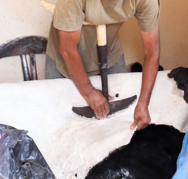
This man cleans the animal skin of all fat and impurities. Author: Santosjmr. This file is licensed under the Creative Commons Attribution-Share Alike 4.0 International license.
The steps in the production of leather between curing and tanning are collectively referred to as beamhouse operations. They include, in order, soaking, liming, removal of extraneous tissues (unhairing, scudding and fleshing), deliming, bating or puering, drenching, and pickling.
In soaking, the hides are soaked in clean water to remove the salt left over from curing and increase the moisture so that the hide or skin can be further treated.
To prevent damage of the skin by bacterial growth during the soaking period, biocides, typically dithiocarbamates, may be used. Fungicides such as TCMTB may also be added later in the process, to protect wet leathers from mold growth. After 1980, the use of pentachlorophenol and mercury-based biocides and their derivatives was forbidden.
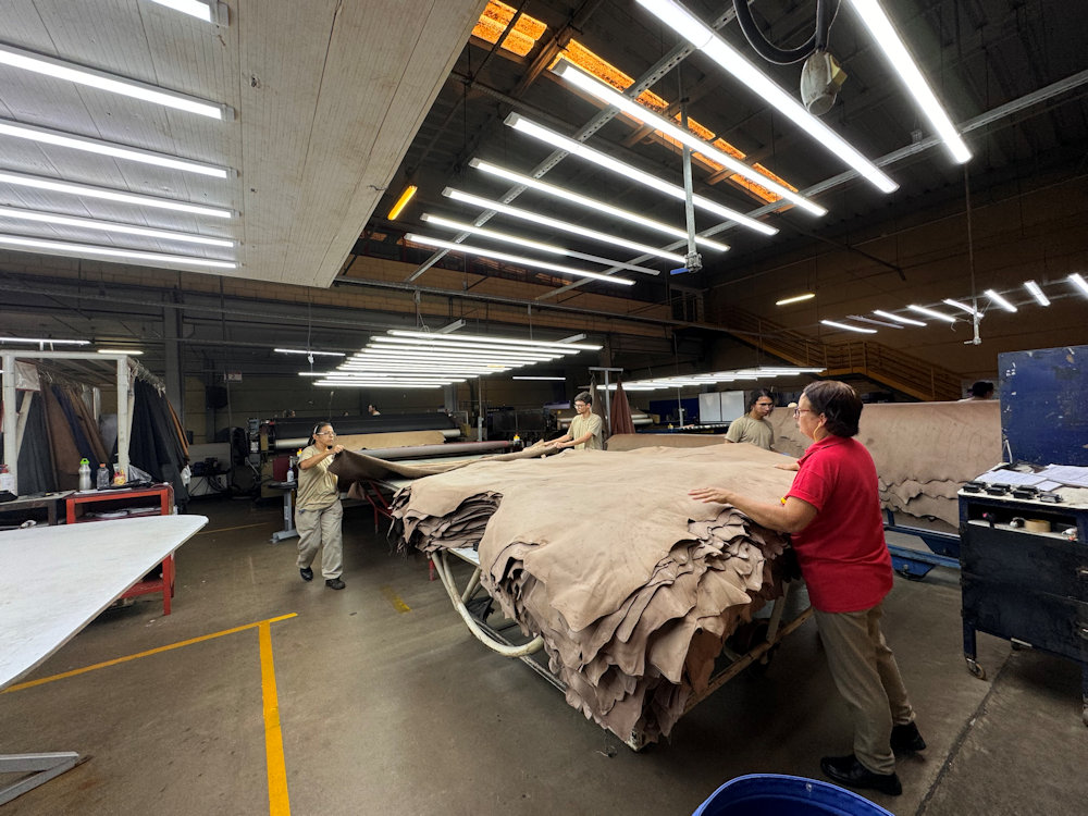
Modern leather making. Author: Alexarosatti. This file is licensed under the Creative Commons Attribution-Share Alike 4.0 International license.
Liming. After soaking, the hides are treated with milk of lime (a basic agent) typically supplemented by “sharpening agents” (disulfide reducing agents) such as sodium sulfide, cyanides, amines, etc.
Any hairs remaining after liming are removed mechanically by scraping the skin with a dull knife, a process known as scudding.
Deliming and bathing. The pH of the collagen is then reduced so the enzymes may act on it in a process known as deliming. Depending on the end use of the leather, hides may be treated with enzymes to soften them, a process called bating. In modern tanning, these enzymes are purified agents, and the process no longer requires bacterial fermentation (as from dung-water soaking) to produce them. Some information from Wikipedia.
Read about Orford Tannery in Working Life Memories and outside the mywarrington website you can read about Penketh Tannery at Penketh.com For a detailed read about Warrington’s industries, Warrington at Work by Janice Hayes and Alan Crosby (Breedon Books publishing) is still available.
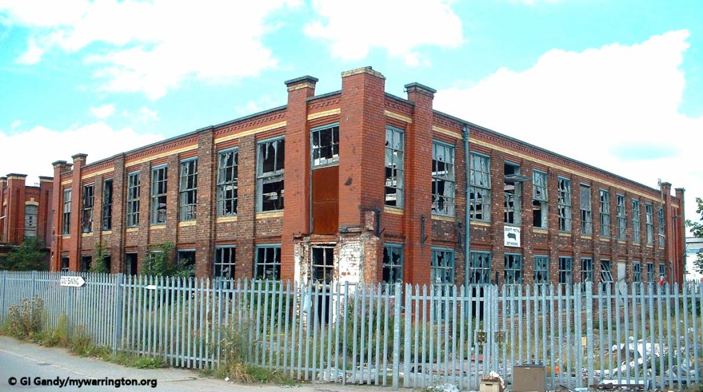
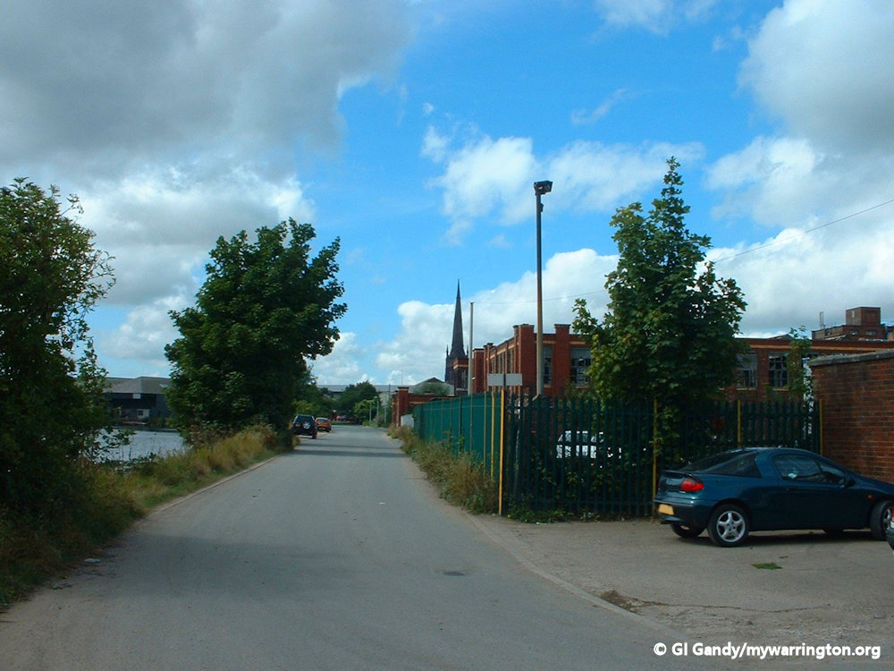
Other industries
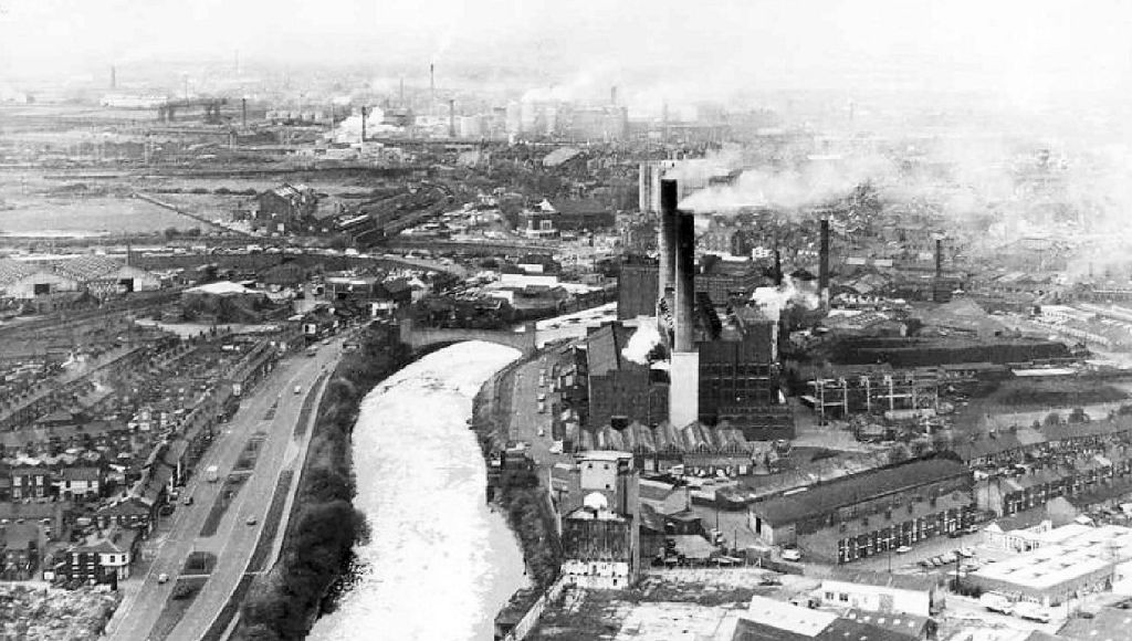
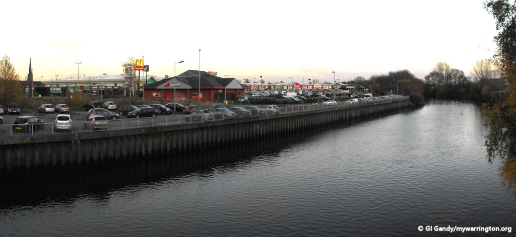
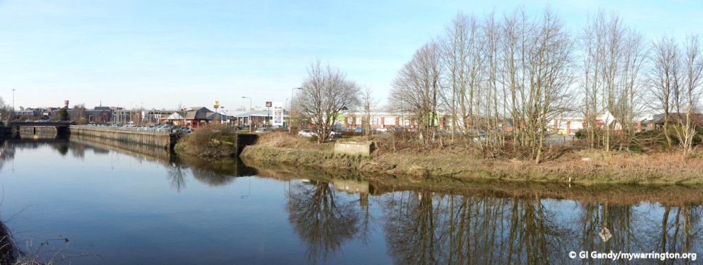
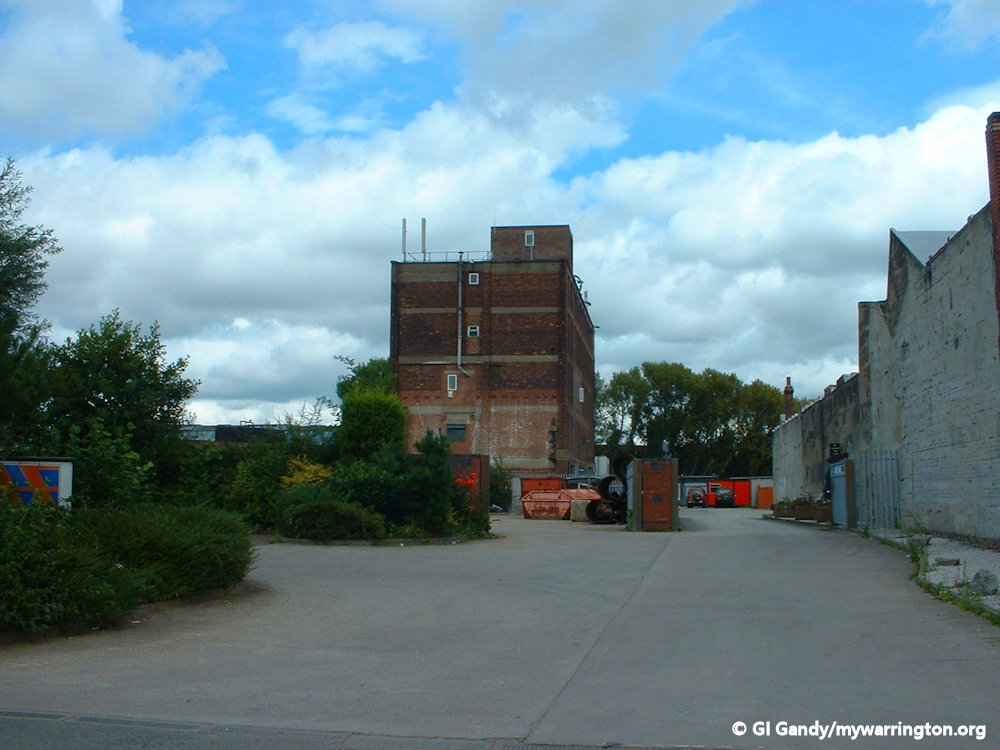
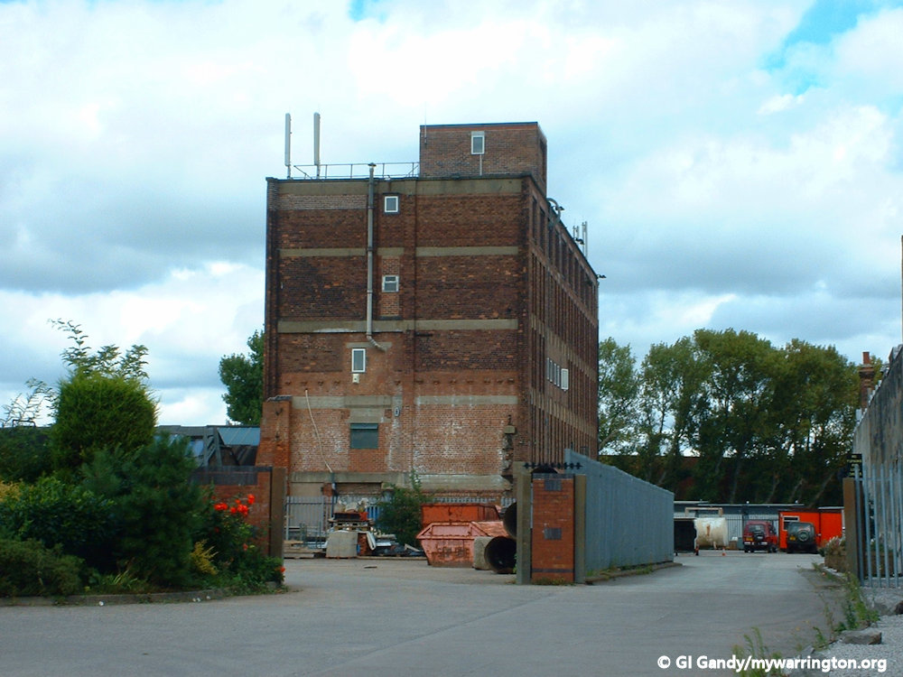
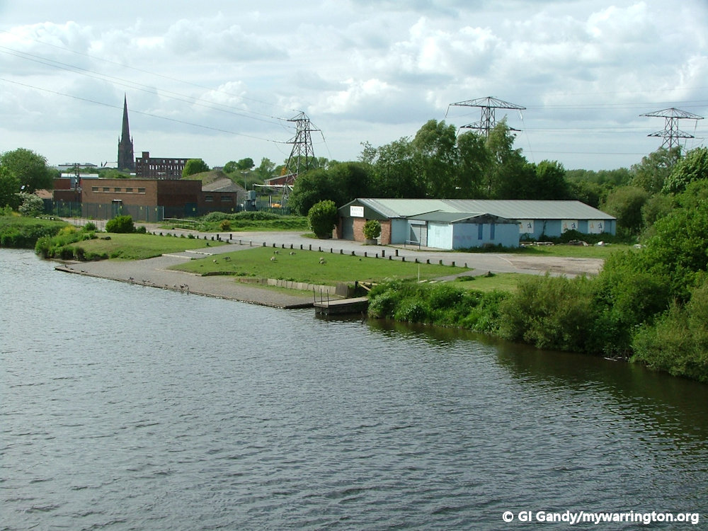
A view of the Howley industrial area showing the electricity generating station in the centre alongside the river Mersey.
Looking at the OS 25 inch map 1892-1914 we can see a variety of industries at Howley. These include Howley Saw Mills, Florence Wire Mill, Mersey Corn Mill, Ellesmere Wire Works, Castle Rubber Works, Mersey Boiler Works, Phoenix Works, a fustian cutting shop and some unnamed warehouses and buildings. The town’s electricity generation station was also based at Howley with Bishop’s Wharf the site where boats were loaded and unloaded. Further up the Mersey there was Howley Quay. Riverside Retail Park is here today.
On the north side of Mersey Street, and now part of the town centre area, the town’s tram shed was located, as well as the town’s gas works. Richmond’s Gas Stove and Meter Works on Academy Street and another tannery.
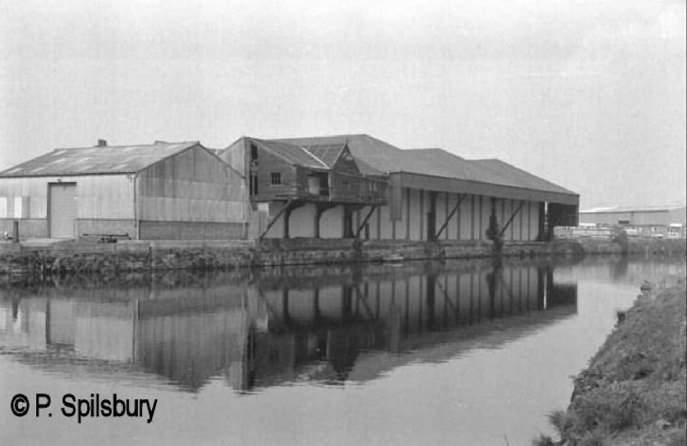
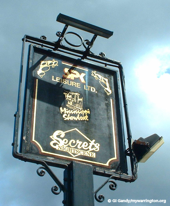
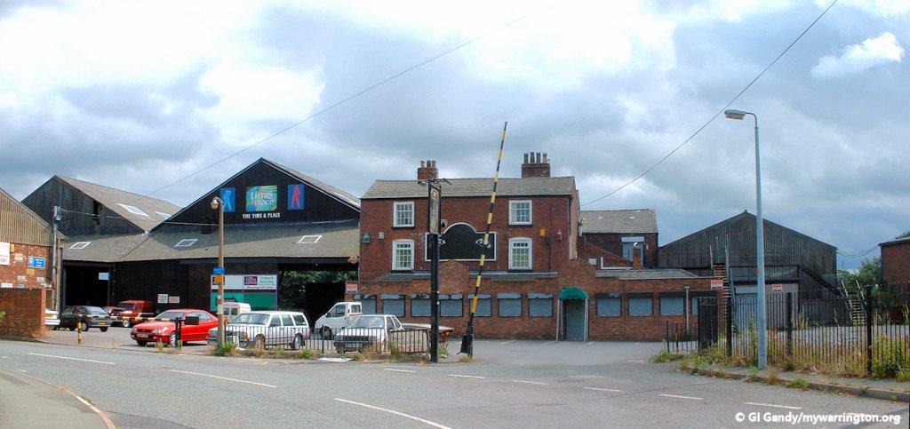
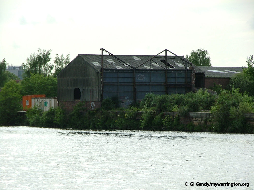
This is Howley wharf in the early 1970’s. Part of it became the Mississippi Showboat club, which was burnt down on 2 March 2004. Bishops Wharf and Isherwood had a road haulage yard to the left of the warehouse. It must have been an interesting sight years ago when barges regularly came up this part of the river.
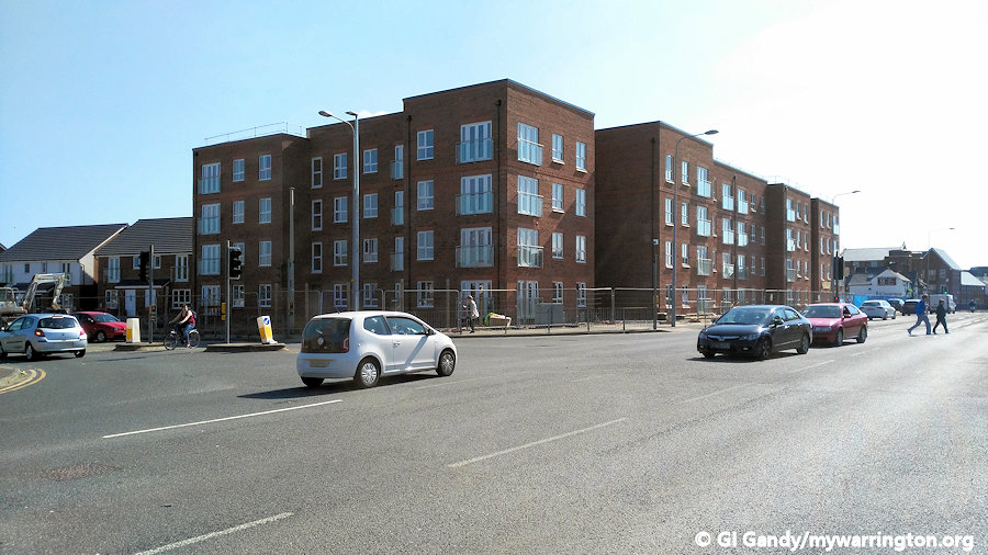
And to finish up on industry, here is a manual slide show of the area as it looked on 13 August 2003 before the eastern side of the site was redeveloped for housing.

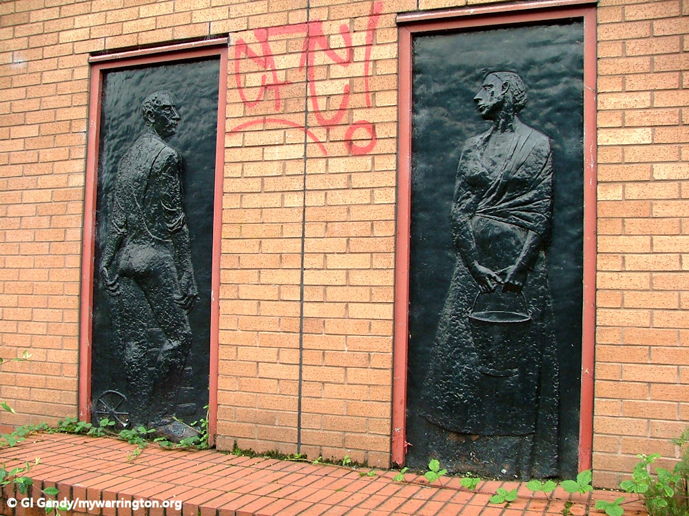
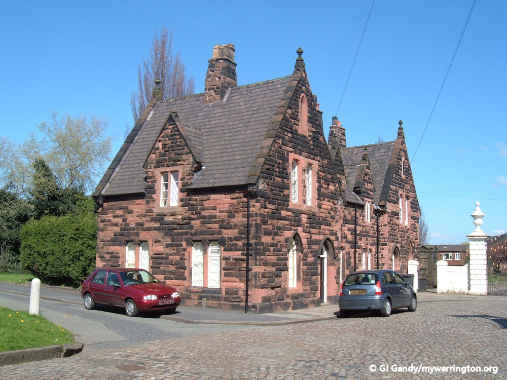
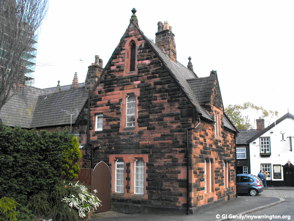
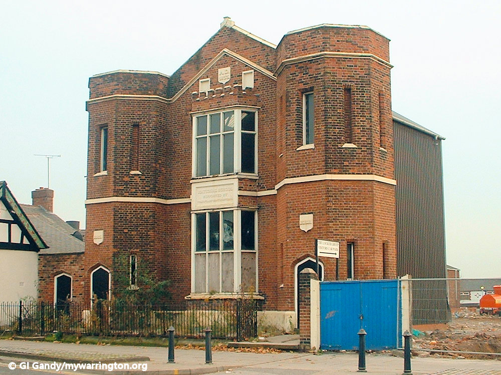
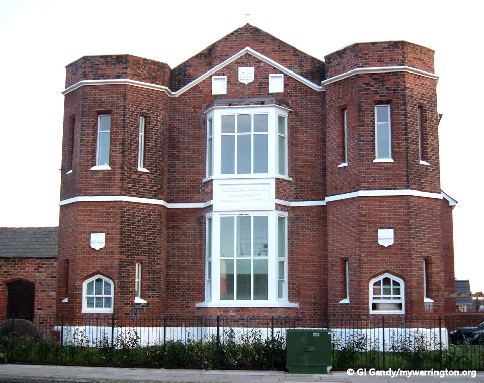
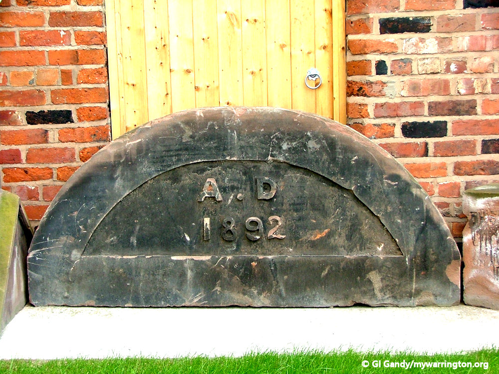
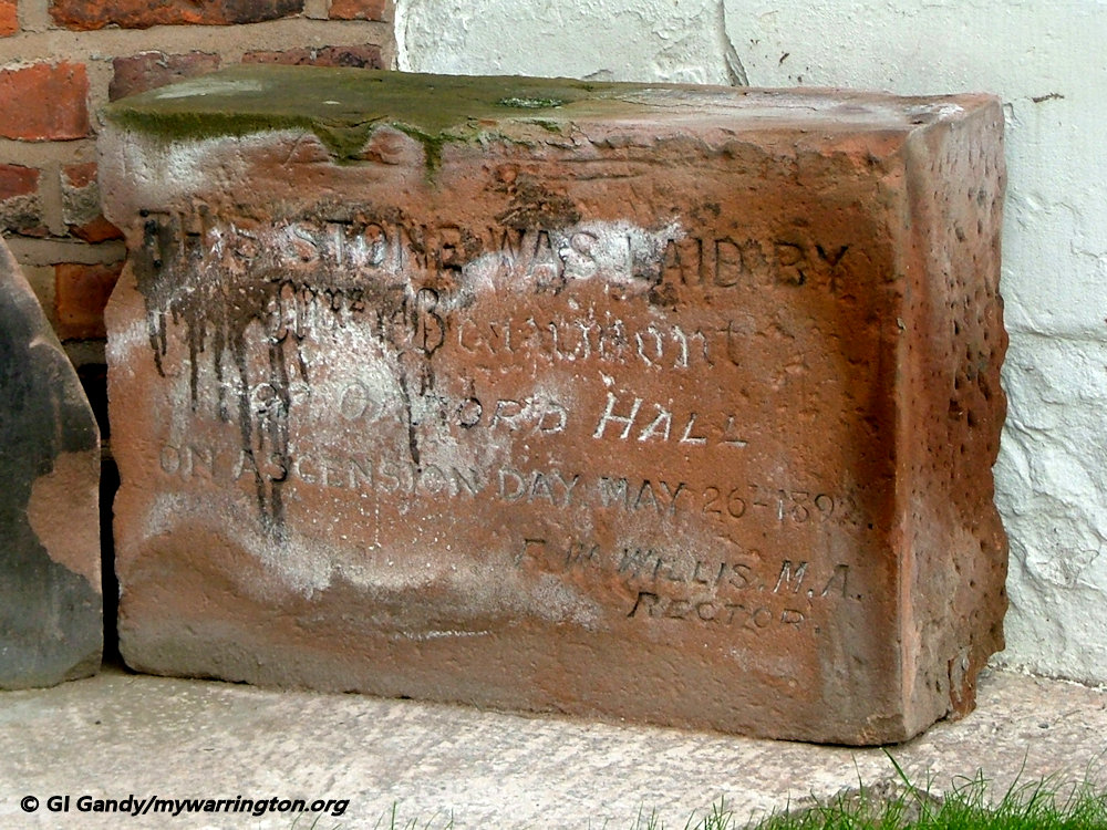
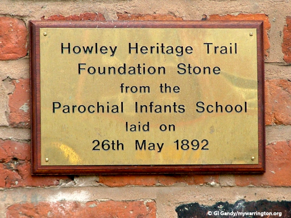
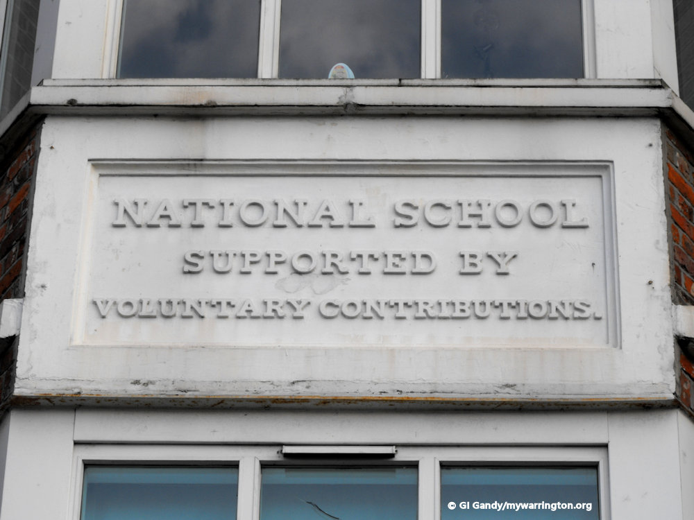
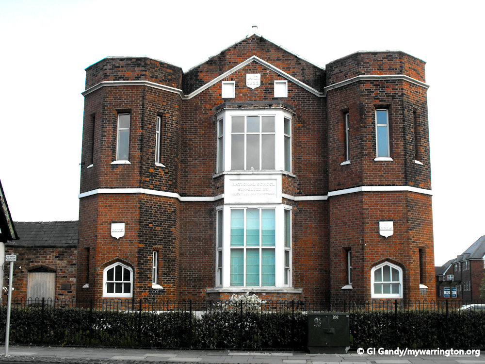
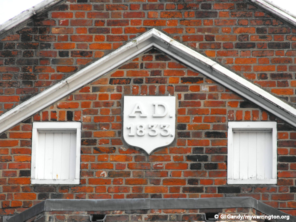
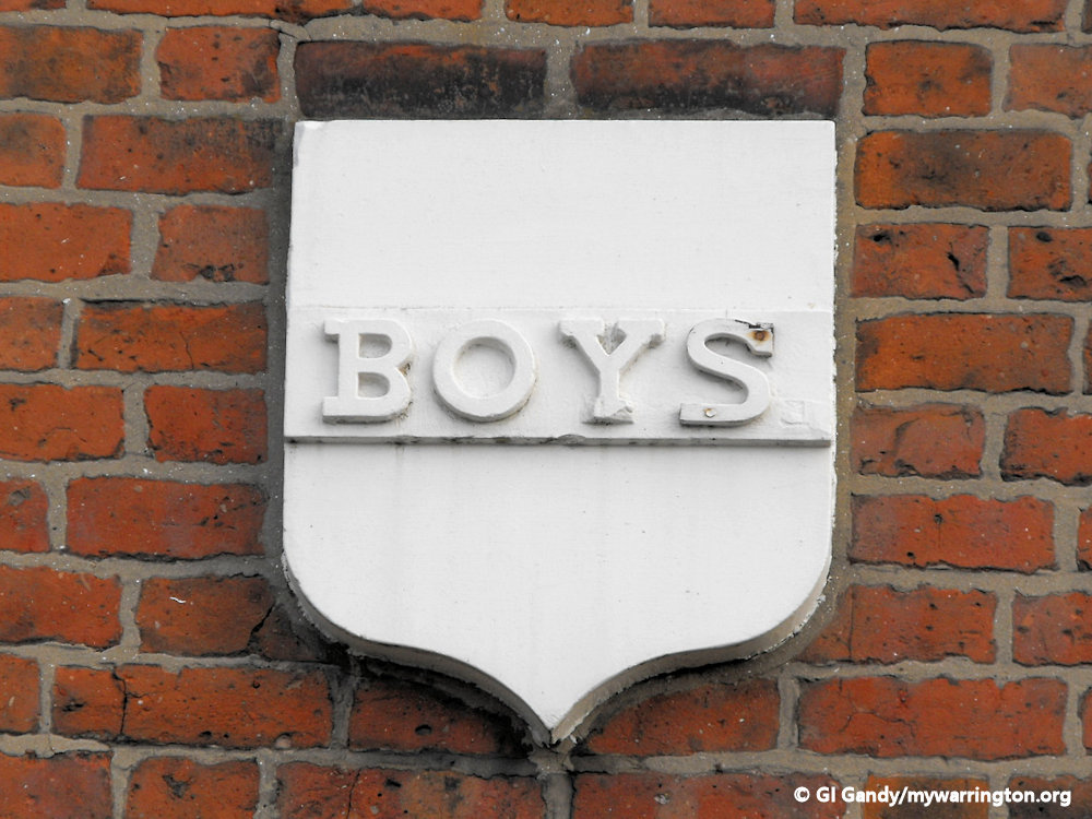
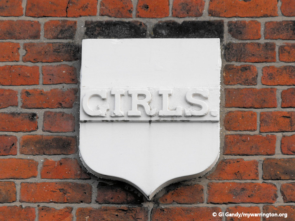
National School
Rector Horatio Powys founded the National School on Church Street in 1834 when 532 pupils paid one penny a day to be educated.
Powys was born on 20 November 1805. In 1831 he became the rector of the parish of Warrington, Lancashire and he was for some time rural dean of Cheshire.
He married, on 21 February 1833, Percy Gore, eldest daughter of William Currie of East Horsley Park, Surrey.
He died of cancer at Bewsey House, Bournemouth, on 31 May 1877, and was buried at Warrington on 5 June 1877.
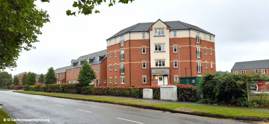
In total, 532 pupils were education the until the building closed 1960. The front of the building has been retained in the new housing development on the site.
The front of the school building during conversion into apartments on 10 Nov 2003
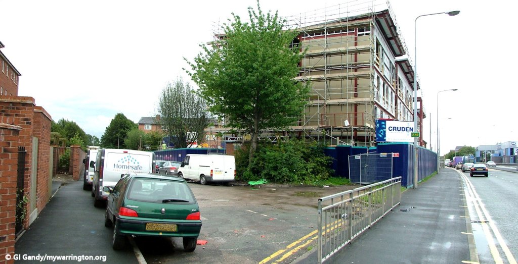
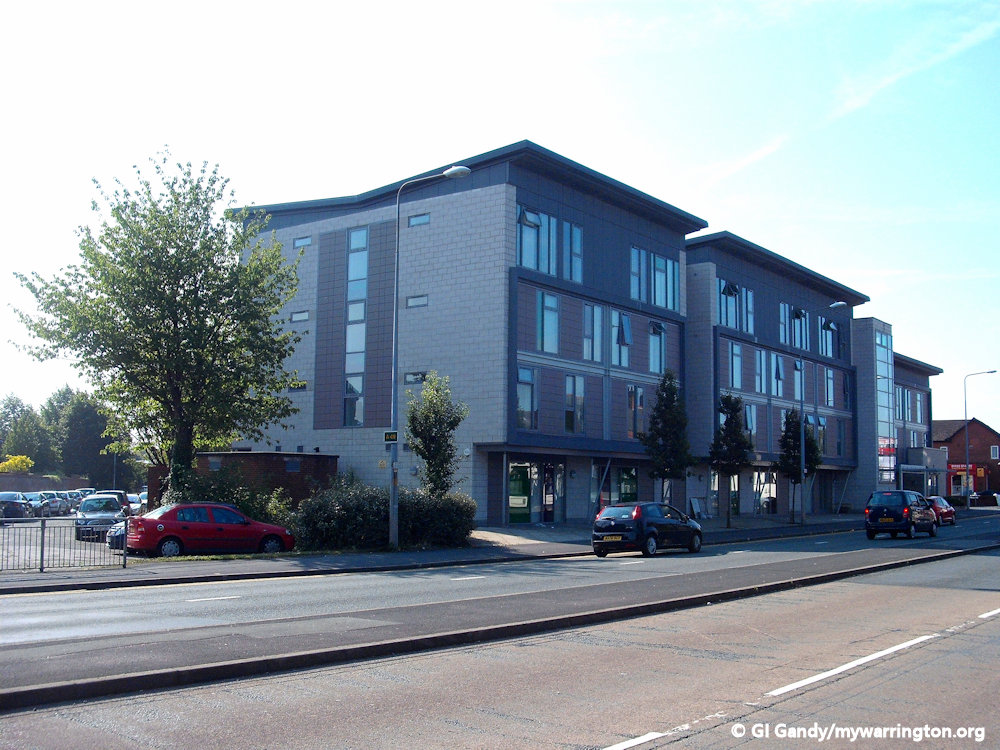
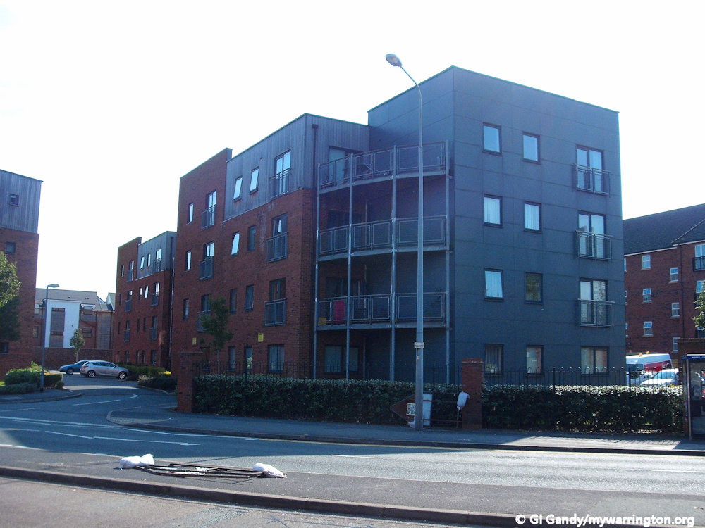
Clergy Daughters School and Warrington Training College
Clergy Daughters School
St Elphin’s School was a boarding school for the daughters of the clergy of the Church of England. It was originally Based in Warrington. It moved to Darley Dale, a rural area near matlock in Derbyshire, in 1905, as the Warrington area had changed from open countryside and become highly industrialised. The image comes from a Howley Heritage Trail leaflet.
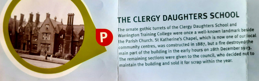
The Warrington Clergy Institution for the relief of widows and orphans of clergymen in the old archdeaconry of Chester, which included Cheshire and South Lancashire, was founded in 1697. The buildings were erected on the site of the old mote hill. The Warrington school was opened on 15 March 1844 and was dedicated to Saint Elphin who according to tradition founded Warrington’s parish church.
In 1857 the objectives of the school were: to provide a good education on advantageous terms: (i) to orphan daughters of clergy from the Archdeaconries of Manchester, Liverpool and Chester; to the daughters of clergy still working in these Archdeaconries; to the daughters of clergy from any diocese.
The school in Darley Dale abruptly closed in March 2005 following financial problems.
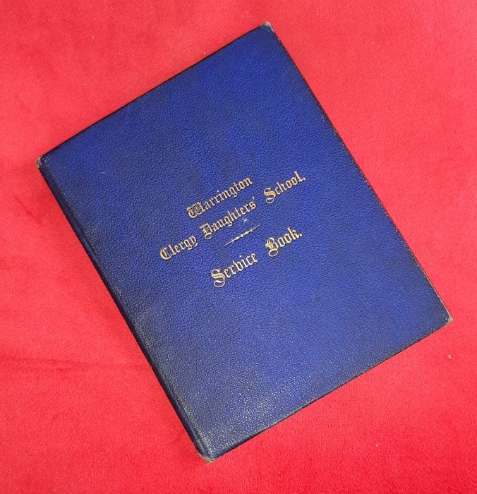
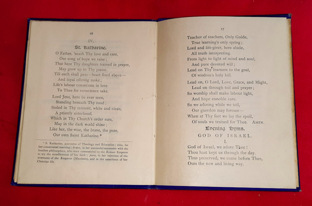
Warrington Clergy Daughters School Service Book 1882
Warrington Training College
What is the connection between Warrington Training College and Liverpool Hope University? Well, the origins of the university go back to three individual establishments – Warrington Training College, Notre Dame College and Christ’s College. We will concentrate on the Warrington connection.
The university’s earliest origins lie in the “Warrington Training College” set up in 1844 under the auspices of the Rector of Warrington Horatio Powys. Powys, who has a lecture theatre named in his honour in the EDEN Building, was the first Secretary of the Board of Education set up by the Diocese of Chester in 1839.
The Warrington Training College was the second college set up by the Chester Diocesan Board within the current boundaries of Cheshire; the first having been established in Chester itself in 1839 (similarly the point of origin of the University of Chester). With the Chester college having been designed to train its (male) schoolmasters, the Warrington college was set up as a counterpart to train female teachers for the diocesan elementary schools.
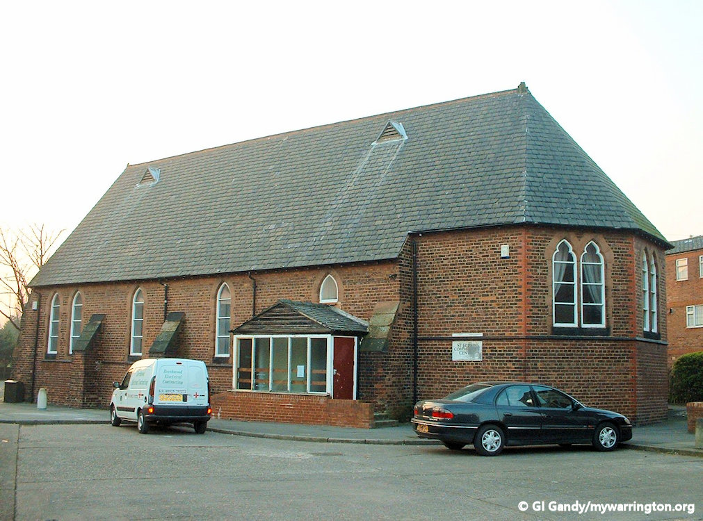
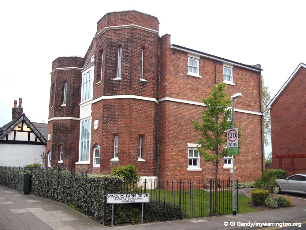
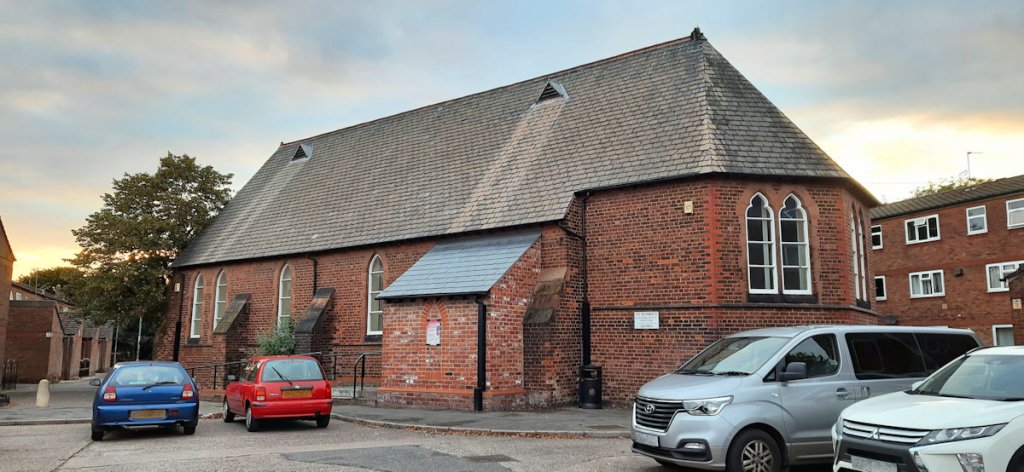
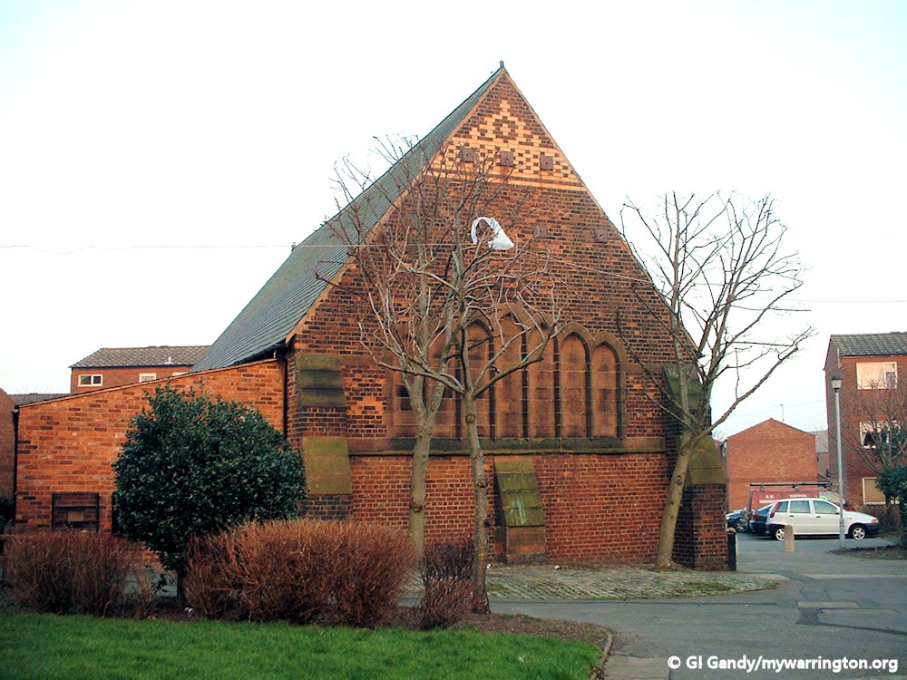
St Katharine’s Chapel, now St Elphin’s Community Centre, on 22 Feb 2003
During its life a chapel was added to the site at Warrington, called St Katharine’s Chapel, with its foundation stone showing the date of 1 July 1887. This is still in use today as St Elphin’s Community centre.
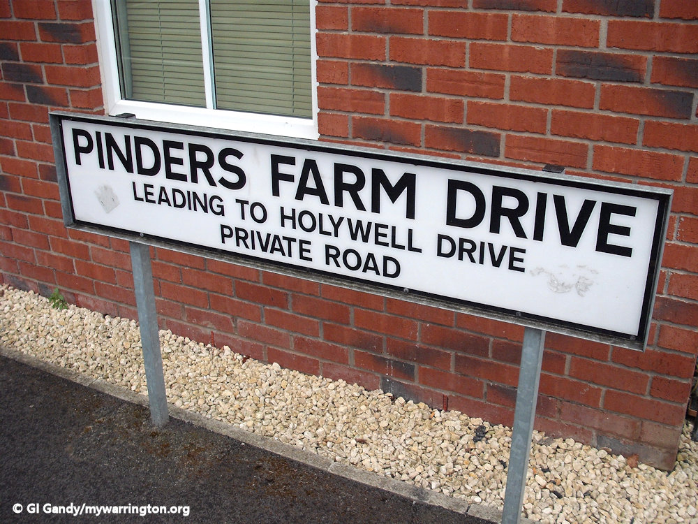
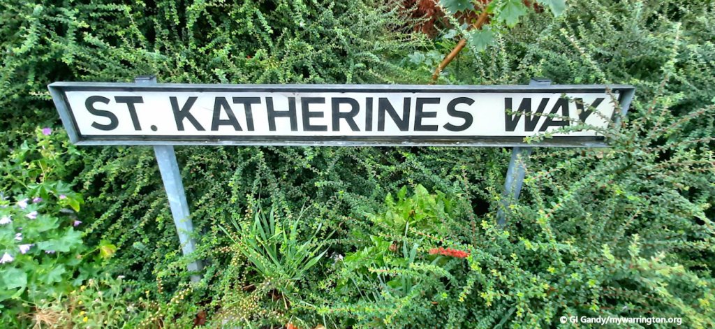
The main building, however, was not as successful. It burned down in a fire in 1923 and the college moved to Liverpool in 1930. The street names for the modern social housing estate remember the college. We have St Katherine’s Way (spelled differently for some reason), St Elphin’s Close and College Close.
The community centre on 14 Sep 2021
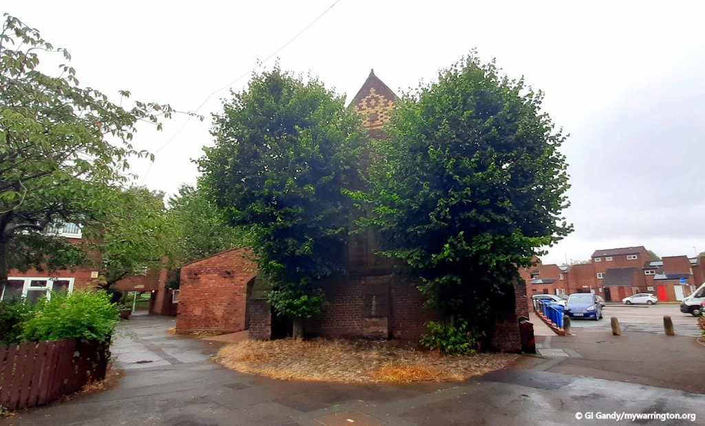
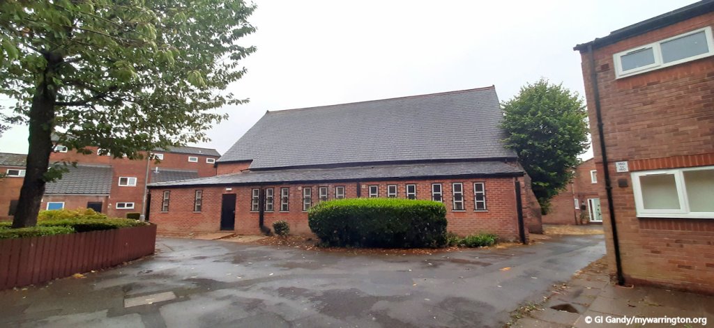
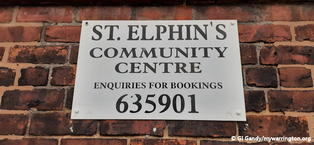
St Elphin’s Community Centre
Pub Life
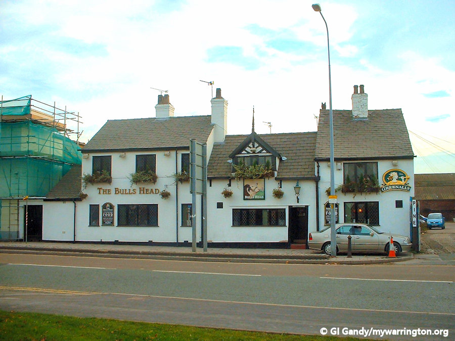
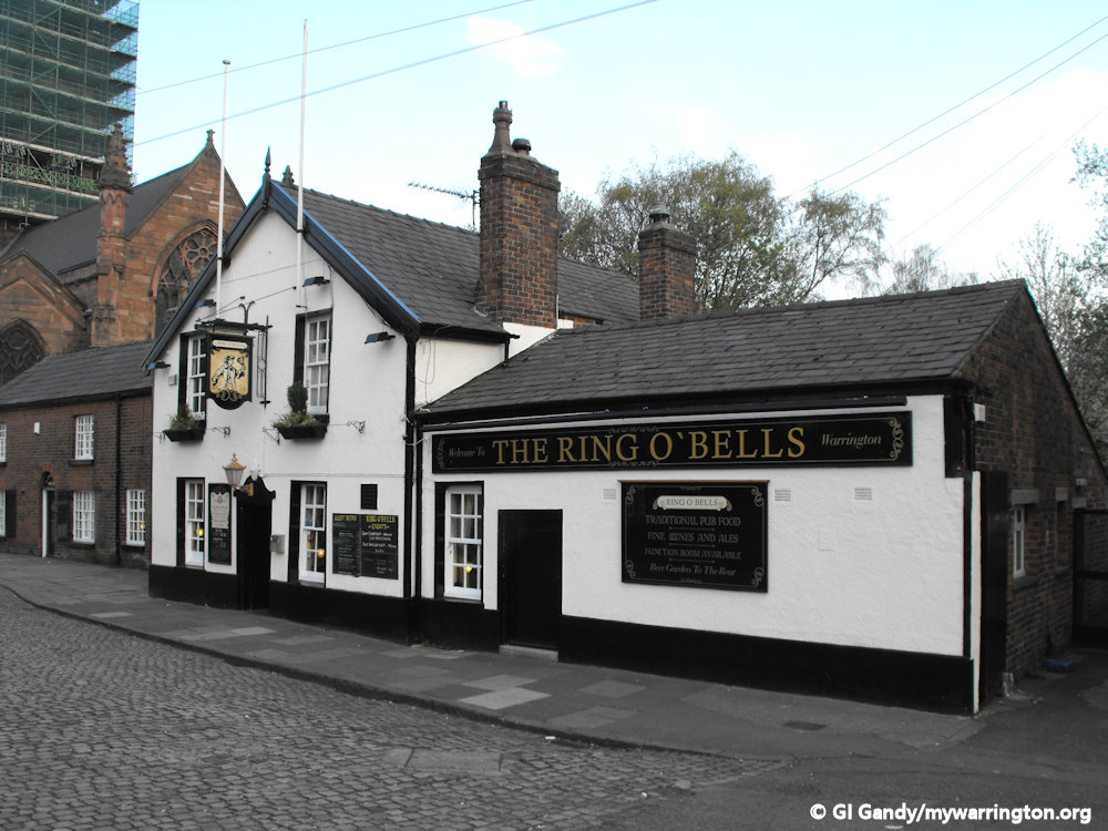
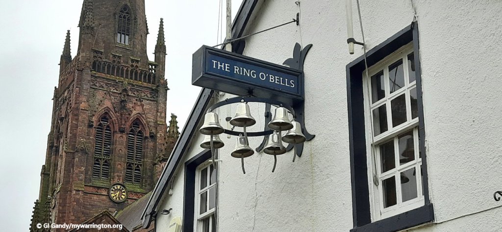
Three longstanding pubs occupied the Howley side of Church Street until 2019. Two that still exist as pubs are the Grade II listed Ring O’ Bells (built before 1832) and the Grade II listed Bulls Head (1600s). The Bulls Head has the oldest crown green bowling green in the town.
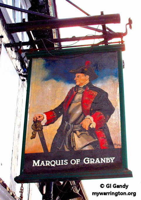
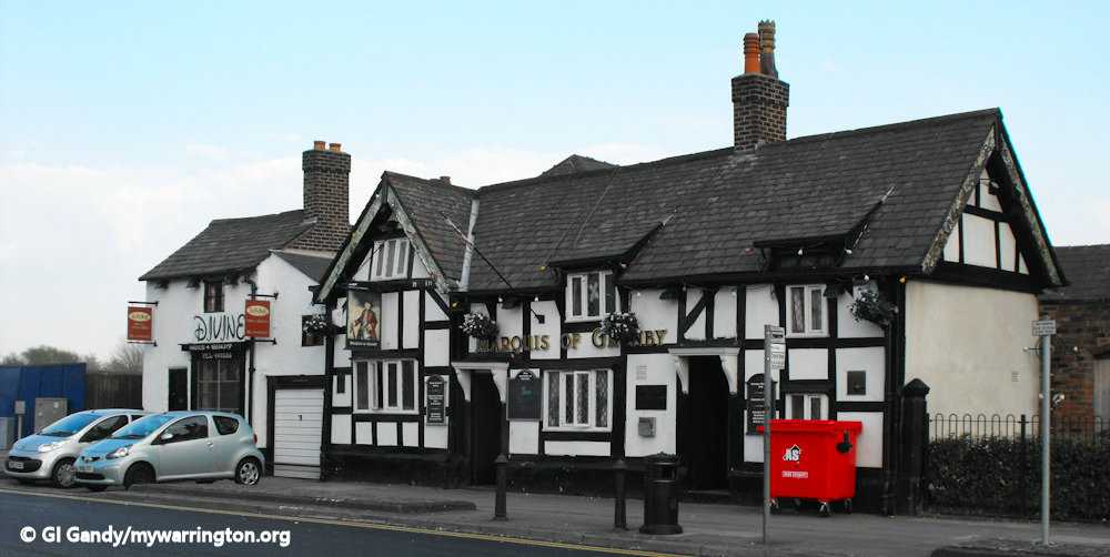
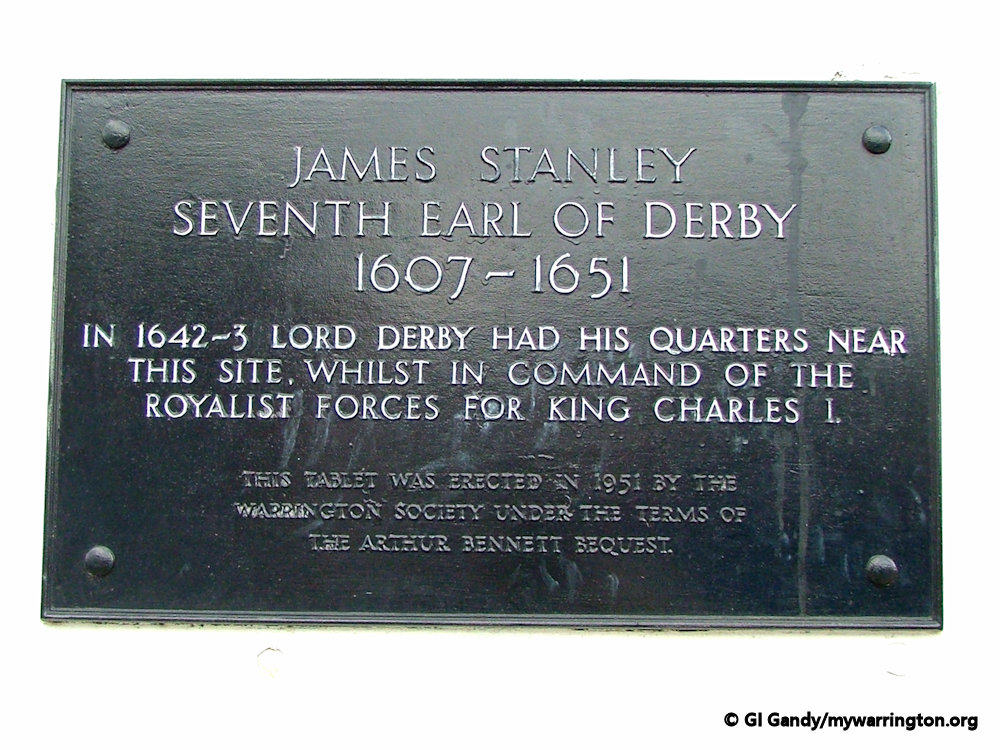
The third pub, the Marquis of Granby dates back to at least 1660. However, it is no longer a pub and was converted into a mixed-use health and wellbeing centre (Class E) in 2021, offering complimentary therapies and advice. It is also Grade II listed. But it does have a history to it. It was the place where James Stanley, the 7th Earl of Granby held his headquarters during the Civil War of 1642-3.
Stanley took no part in the political disputes between King and Parliament and preferred country pursuits and the care of his estates to the royal court or public life. Nevertheless, when the Civil War broke out in 1642, Lord Strange devoted himself to the king’s cause. With the death of his father on 29 September 1642 he succeeded as 7th Earl of Derby.
His plan of securing Lancashire at the beginning and raising troops there, which promised success, was however discouraged by Charles, said to be jealous of his power and royal lineage, who commanded his presence at Nottingham.
His subsequent attempts to recover the county were unsuccessful. He was unable to get possession of Manchester, was defeated at the battles of Chowbent and at Lowton Moor, and, in 1643, after gaining Preston he failed to take Bolton and Lancaster Castle.
Finally, after successfully beating off the attack by Sir William Brereton on Warrington, he was defeated at the Battle of Whalley and withdrew to York, whereupon Warrington surrendered to the Parliamentarian forces.
His life ended on 15 October 1651 when he was beheaded at Bolton for treason.
Read more about Stanley in Warrington People. This report from Wikipedia.
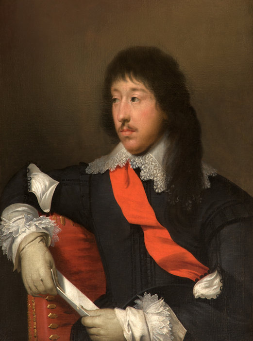
The pub sign in Warrington (left) with an oil-on-canvas portrait painting of James Stanley, 7th Earl of Derby by Cornelis Janssens van Ceulen held at Tabley House. The image on the right is in the public domain. See Wikipedia.
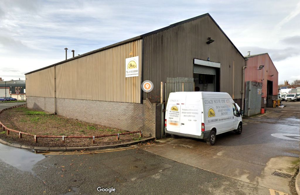
Coach House Brewing Company
Coach House was established in 1991 following the closure of Greenalls Brewery earlier that year. Greenalls started out in the town in 1762. Coach House are the oldest cask ale producer in Cheshire who celebrated their Silver anniversary in 2016. The town’s brewing heritage has been continued by ex-employees committed to the brewing and supply of hand-crafted cask conditioned fine ales. Coach House beers have enjoyed considerable success at the Great British Beer Festival and competitions throughout the country which bears testimony to the quality and popularity of their products. The original line up of their bottled beers has been added to with the introduction of Postlethwaite’s, Blueberry Bitter, Post Horn and Dick Turpin bitter. Link to their website.
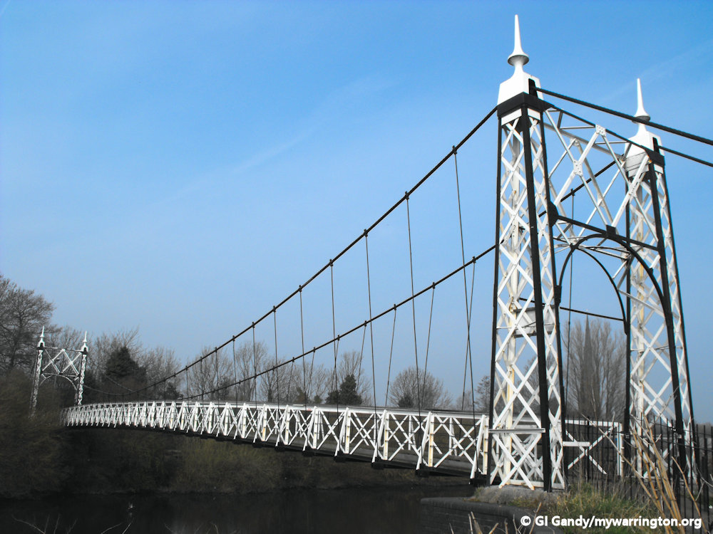
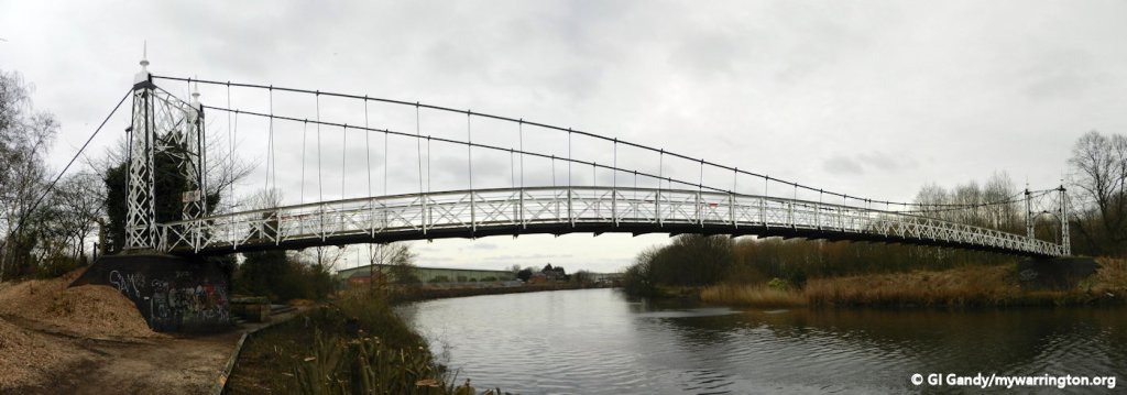
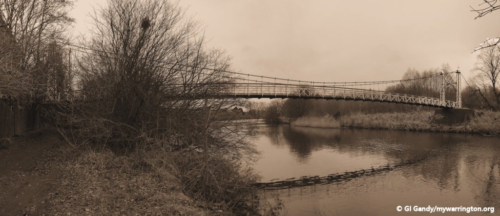
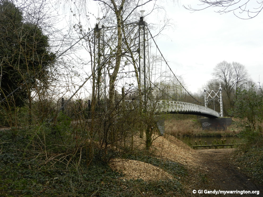
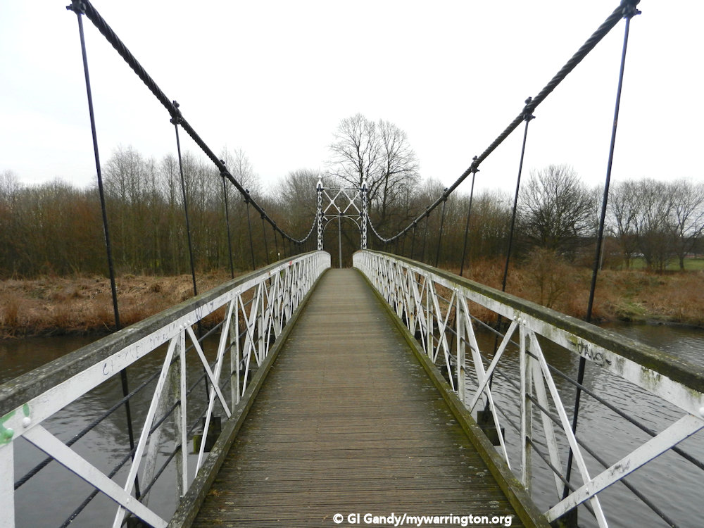
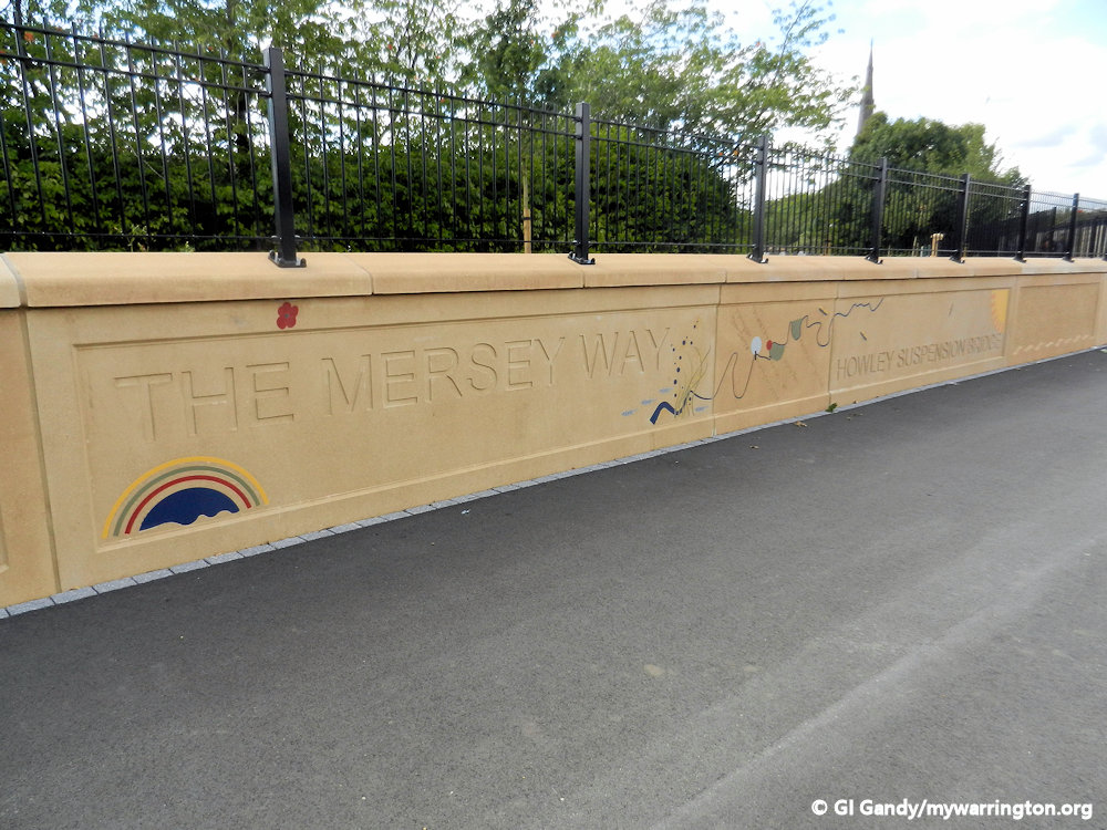
Howley Suspension Bridge
Howley Suspension Bridge links the district with Victoria Park. It was begun in February 1912 by David Rowell & Co., who were prolific builders of many similar steel suspension footbridges
The Company was formed by David Rowell in London in 1855 initially trading as a fencing business but diversifying into structural steel frame buildings. It built various bridges between 1903 and 1951. The Company was liquidated in 1970.
Howley Suspension Bridge was officially opened on 2 August 1912. It is a grade II listed monument (listed on 4 April 1975). Each end has two tapering square piers of open ironwork, with round arches across the pathway. It was originally meant to be 60 feet wide and 150 feet long to help with traffic congestion at Bridge Foot.
The original proposed bridge was to be made out of cast iron and designed by Thomas Telford (who built the Menai Suspension Bridge that connects Anglesey to mainland Wales).
Telford’s bridge at Warrington would have cost £12,000, but due to lack of funds, only a footbridge was built, costing just £600.


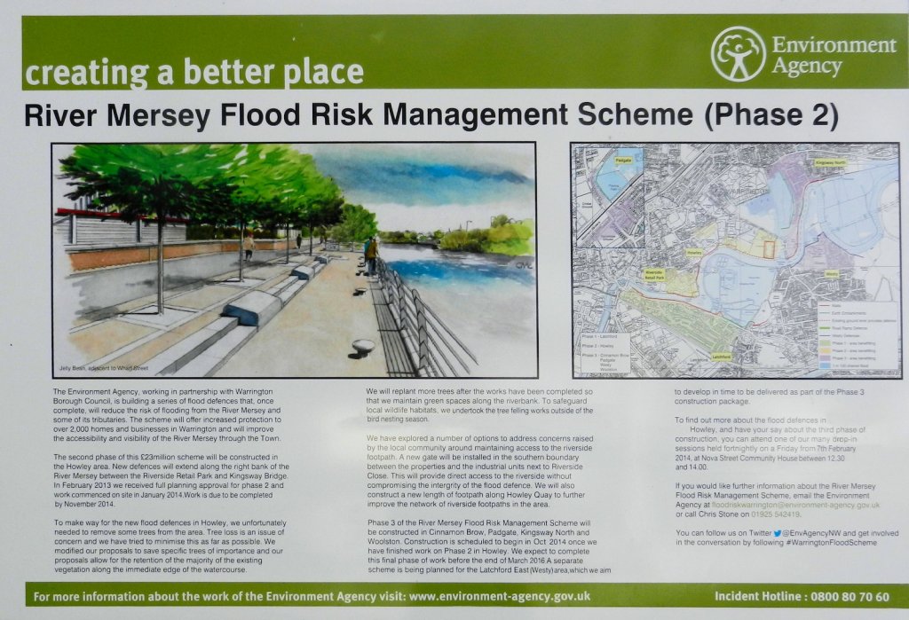
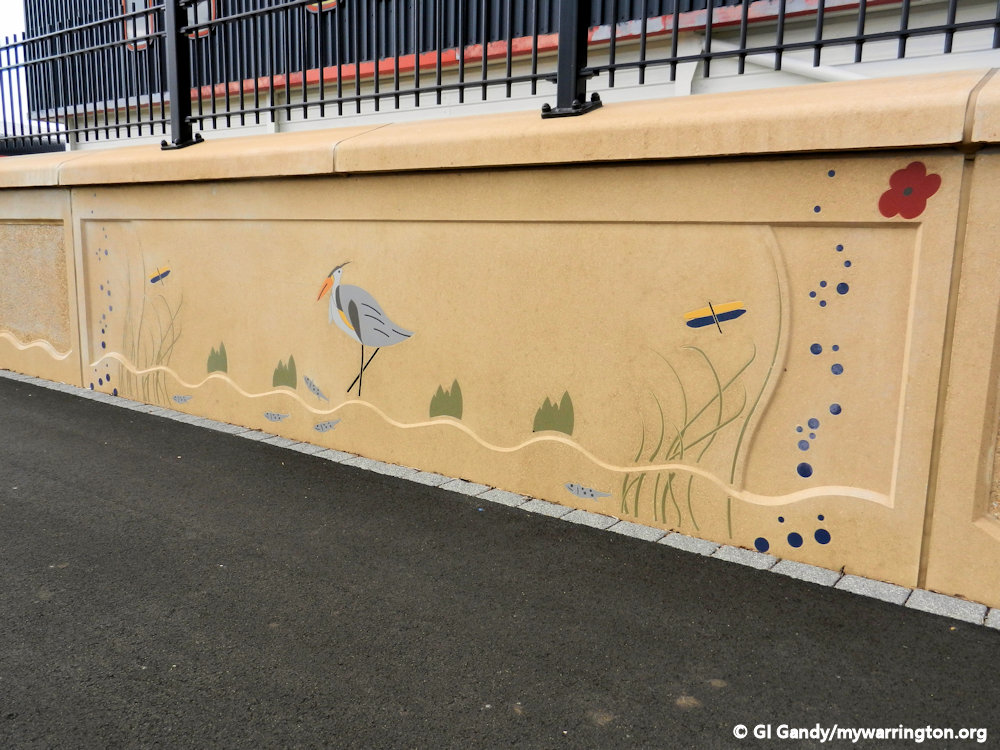
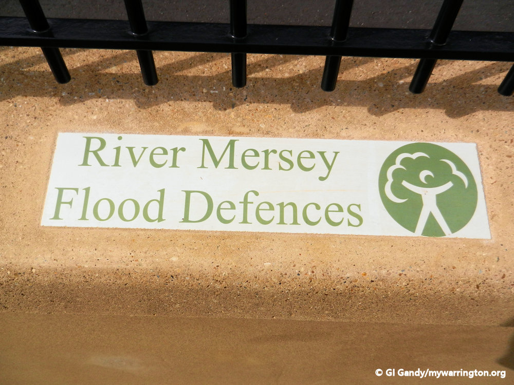
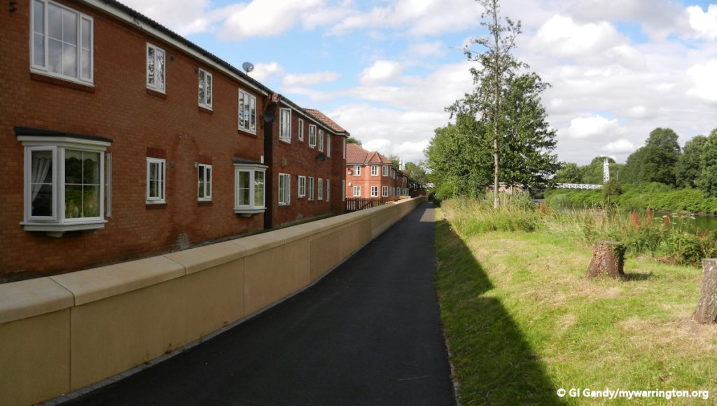
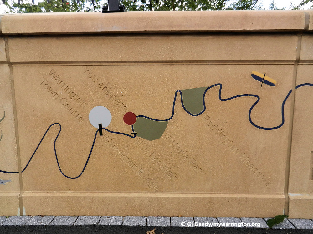
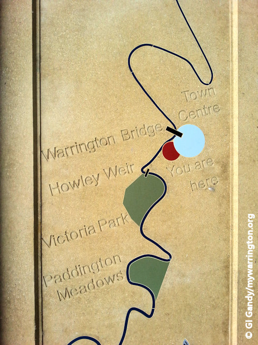
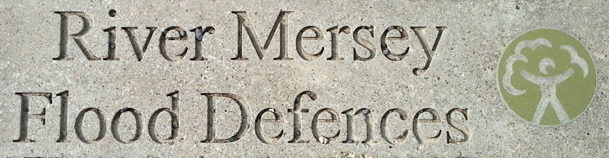
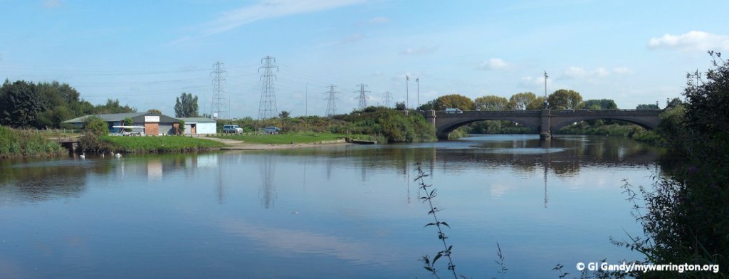
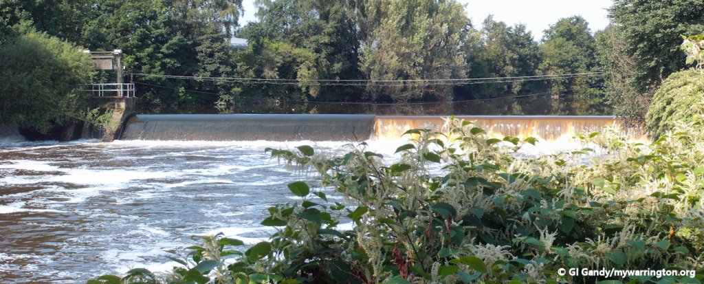
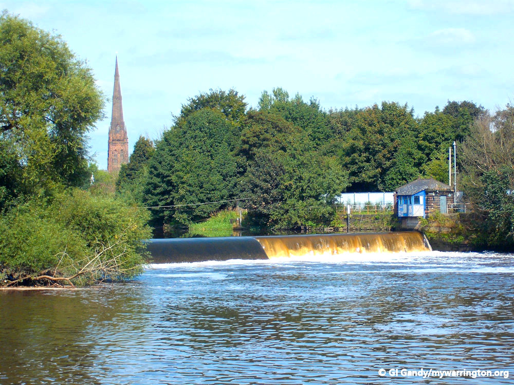
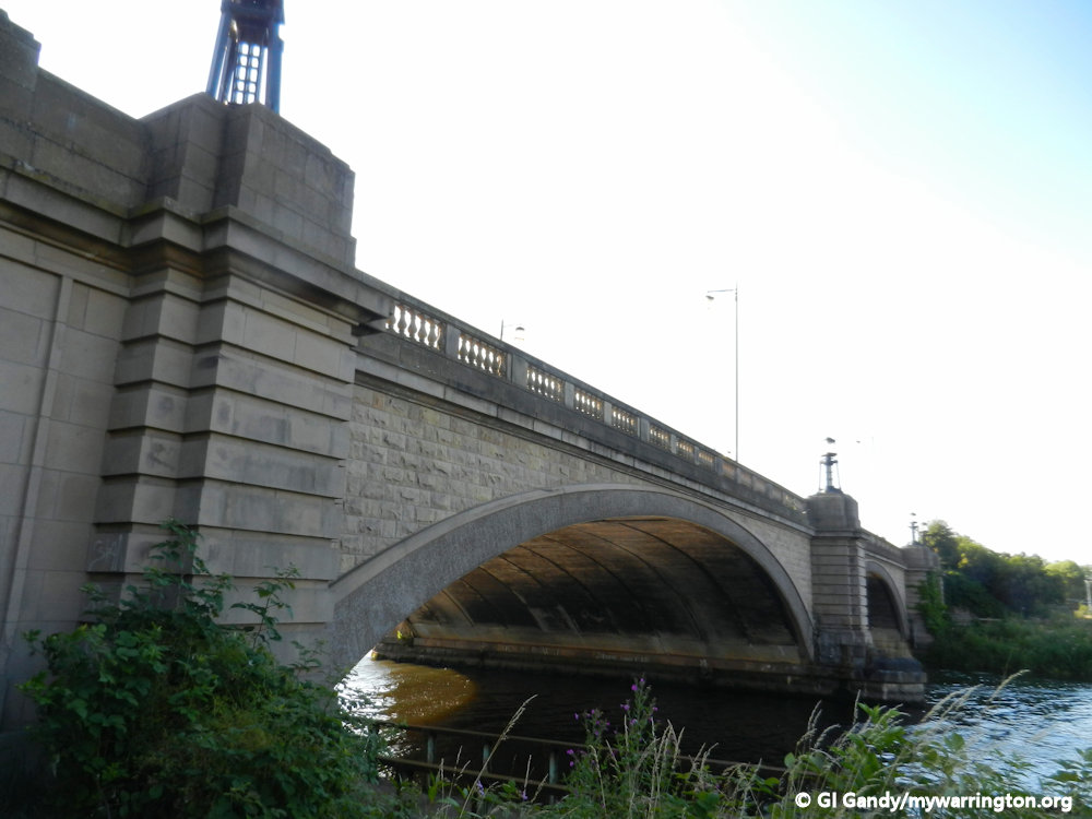
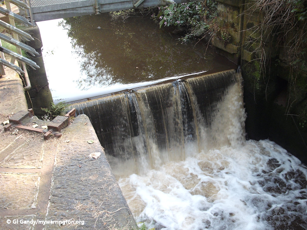
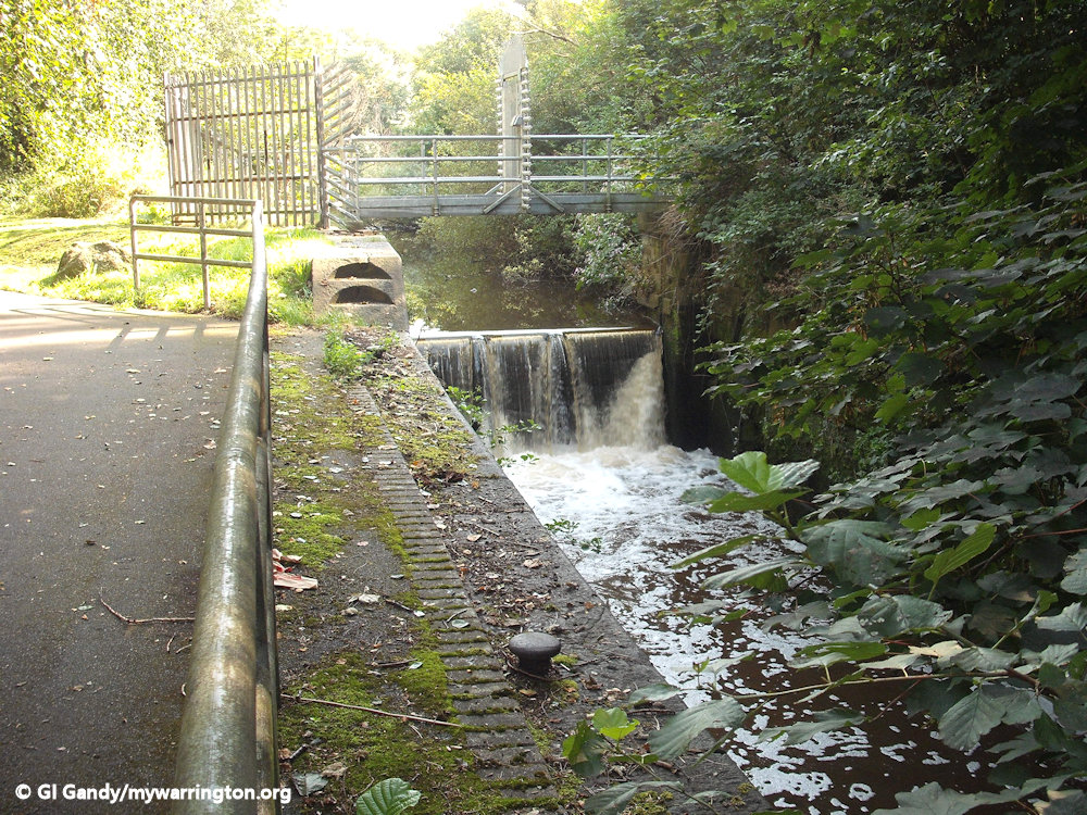
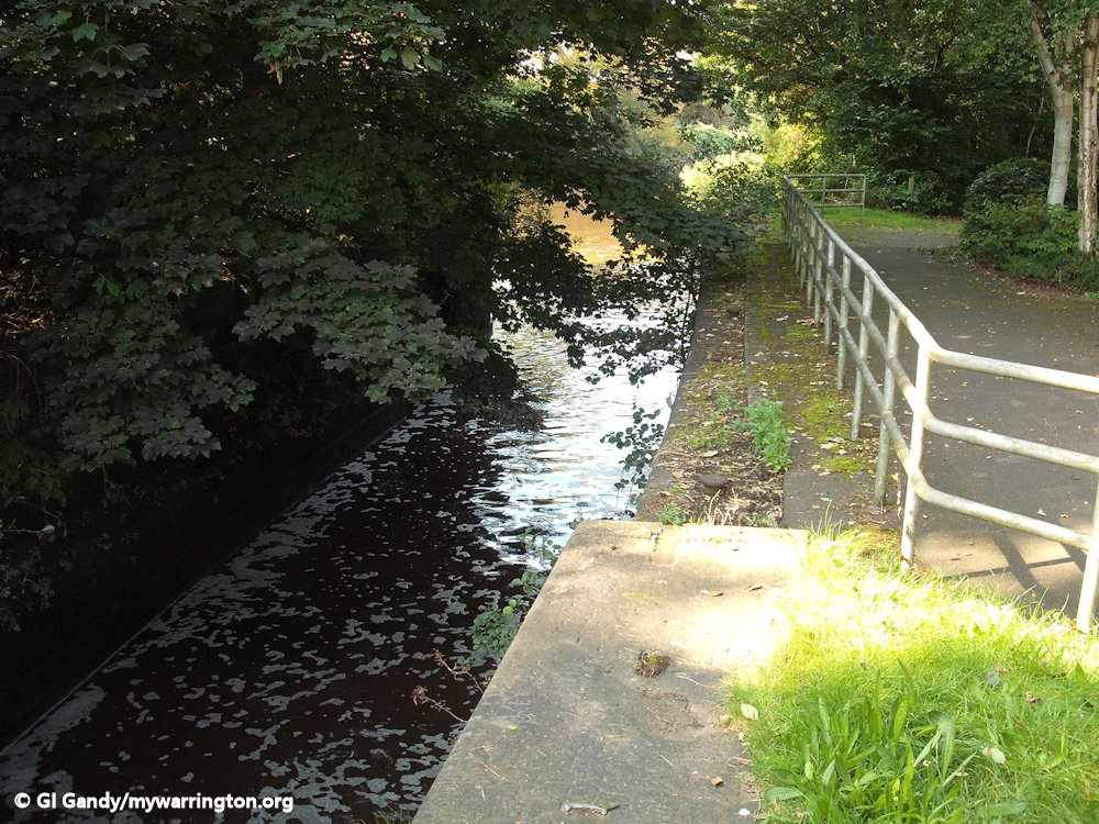
River Mersey Flood Defence

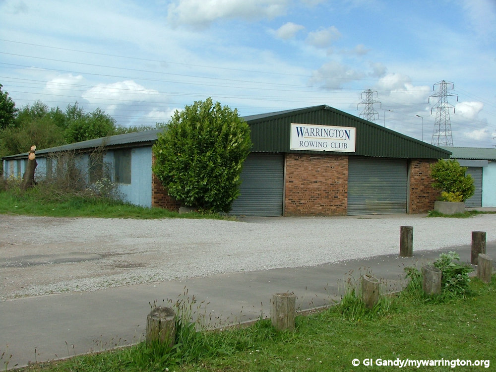
Warrington Rowing Club
The club formed its first boathouse in 1985 at Old Quay in Howley. Later that decade the club bought three pre-fabricated cottages in Hull and rebuilt them at the present site to form its second boathouse in 1989. The club created a Head of The Mersey race before its landmark Lottery Grant. Training time and facilities were given to Bridgewater High School and then Lymm High School.
The third, current boathouse and clubhouse was commissioned in 2012.
The club colours are primrose yellow, white and royal blue.
The club has produced multiple national champions.
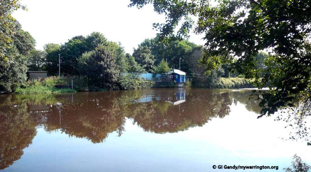
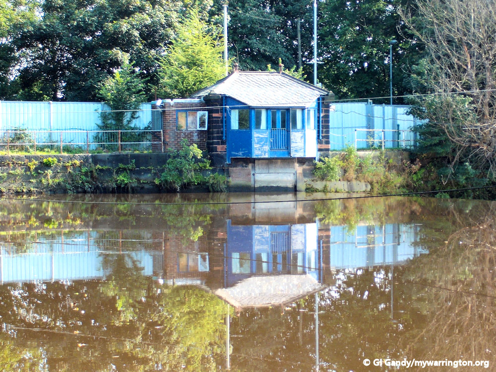
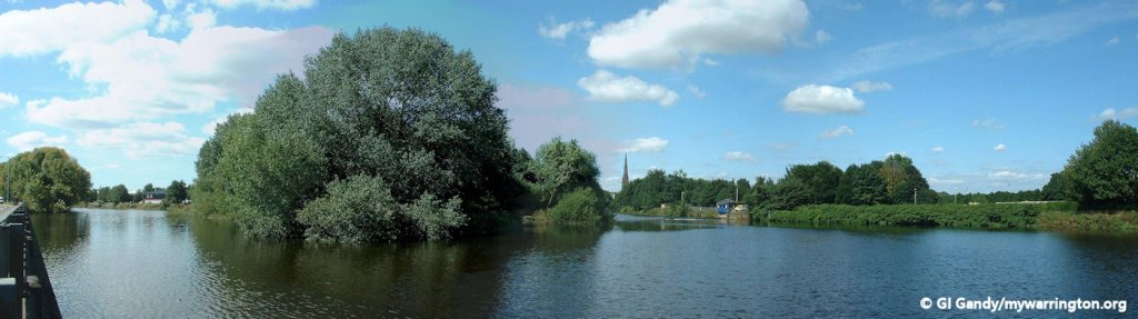
Some final photos from the River Mersey.
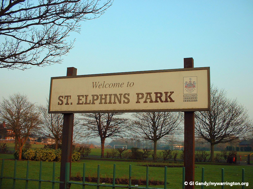
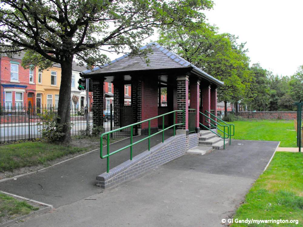
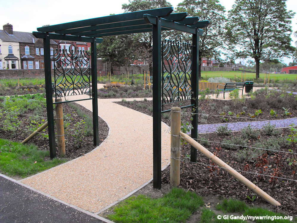
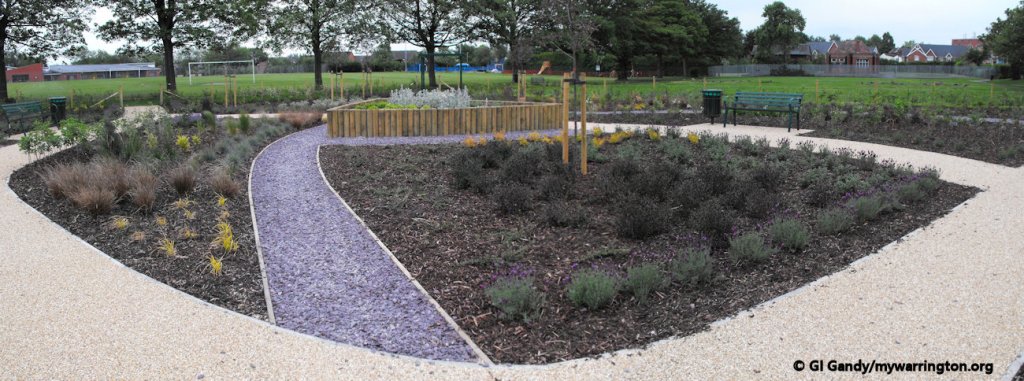
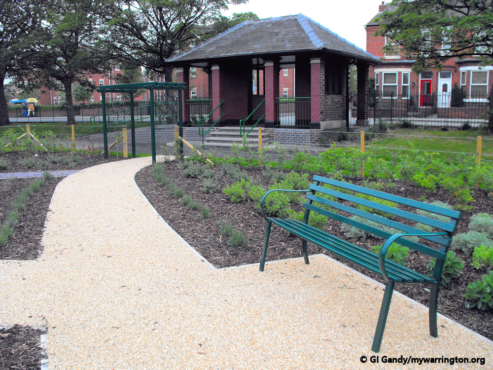
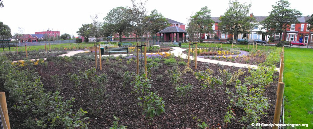
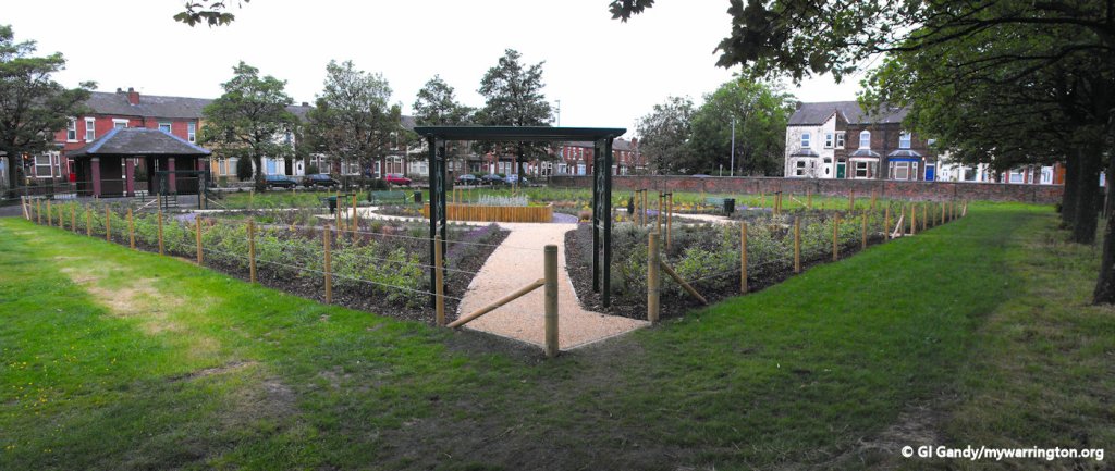
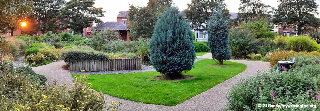
St Elphin’s Park
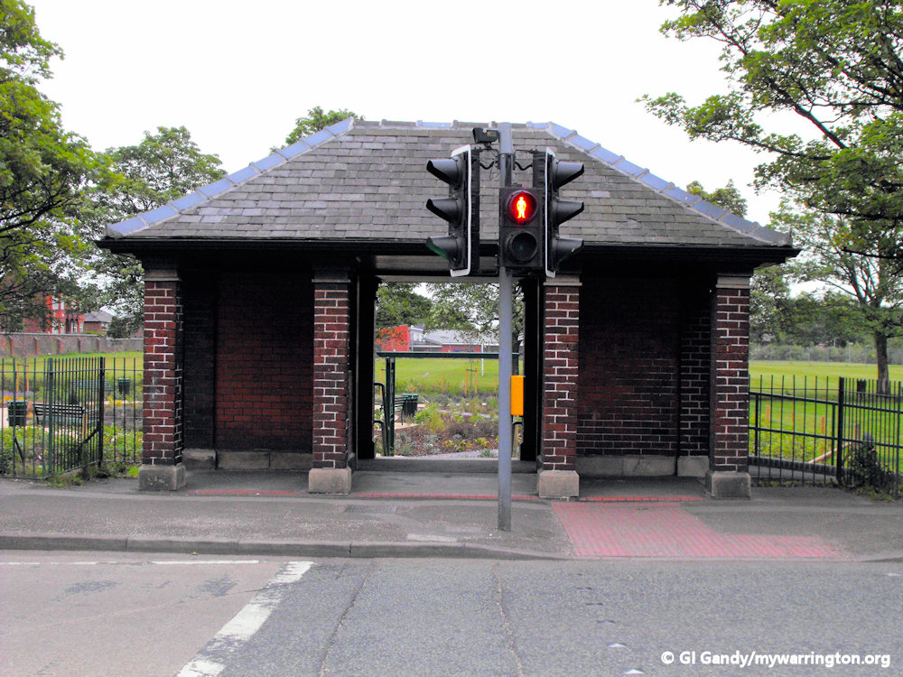
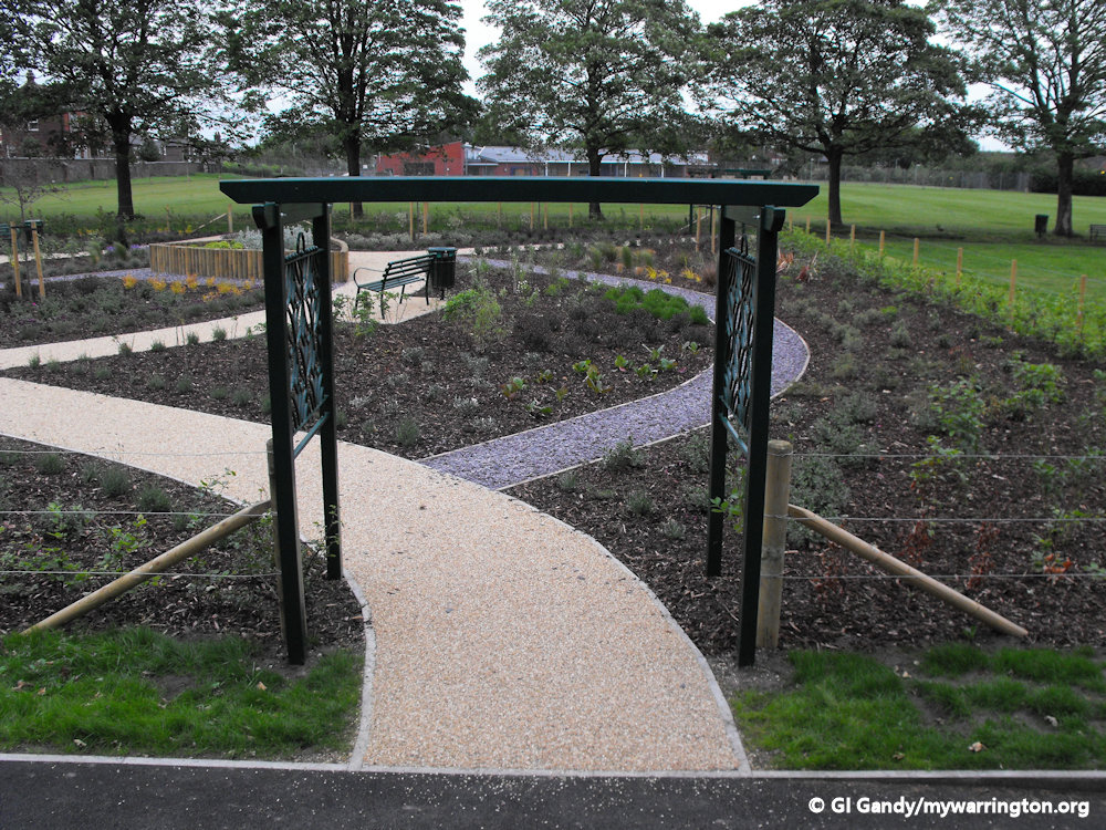
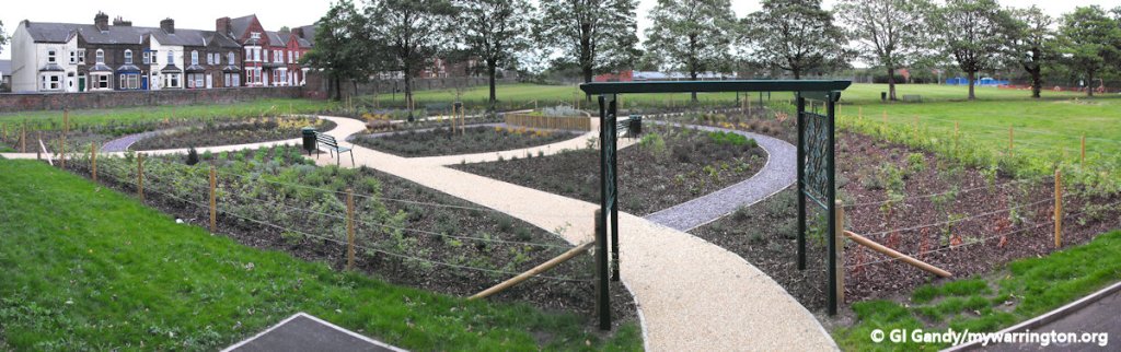
The land that became St Elphin’s Park was purchased by the council in 1907. Part of the park occupies the site of the former Clergy Daughters School. In 2011 a new community garden was created in one section of the park. An old tram stop was converted into the entrance to the garden from Manchester Road.
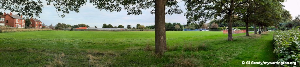
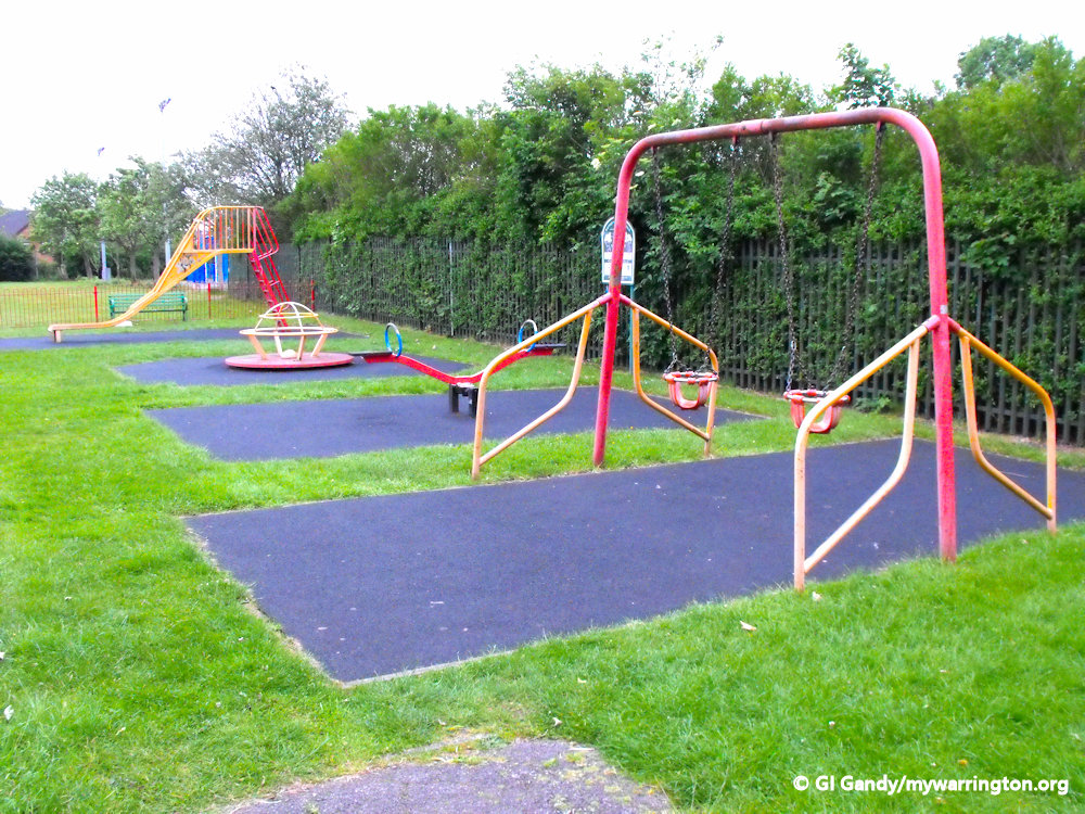
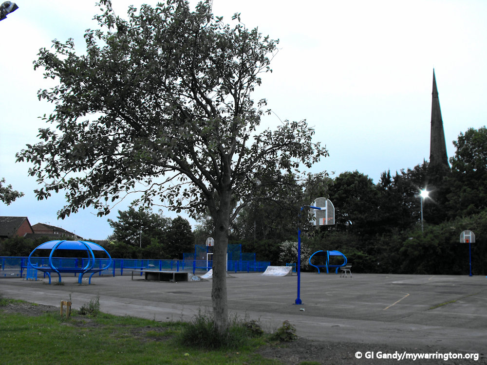
The park has a children’s play area, bowling greens, a large open space for sports, a skateboard park and a pavillion from where community fun days and other events are organised.
Some of my reports come from Wikipedia (Liverpool_Hope_University), British History Online and Wikipedia (St_Elphin’s_School).
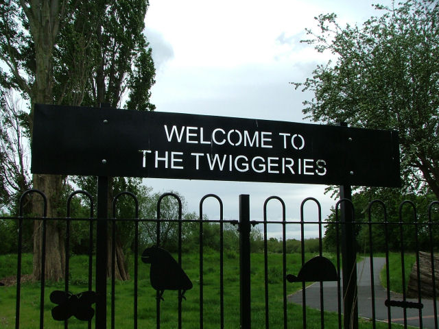
The Twiggeries
The Twiggeries was once a willow coppice for a thriving basket making industry in the 19th century.
Willow baskets were supplied to the tannery industry at Howley for the transportation of hides. As hide demand lessened so the site became derelict.
It now houses a unique wildlife community within the centre of the town, and is a good site to see warblers from Africa singing in spring, as well as other birds which can be seen and heard.
Read more in Warrington Green.
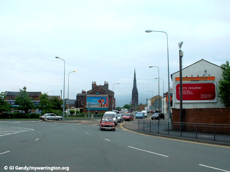
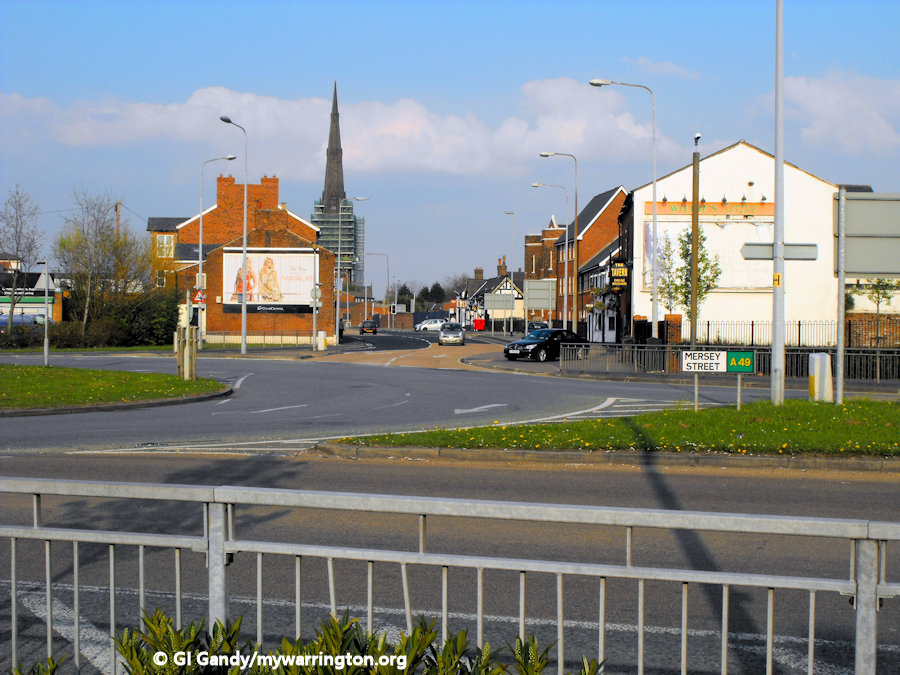
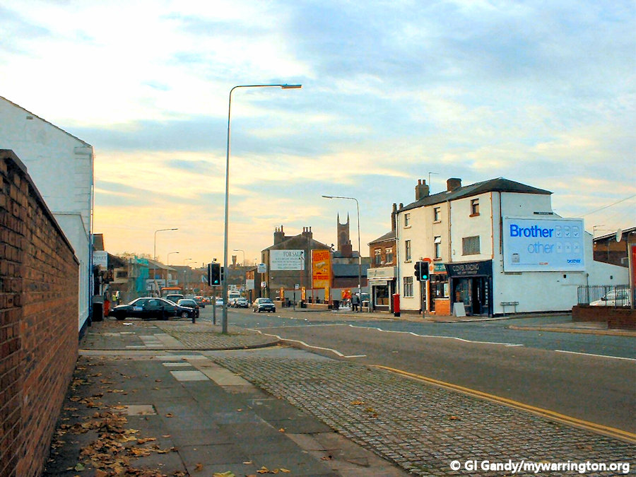
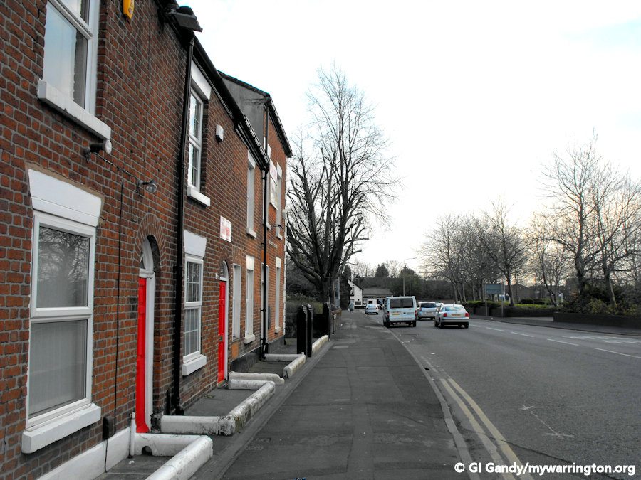
Here are some scenes around modern-day Mersey Street.

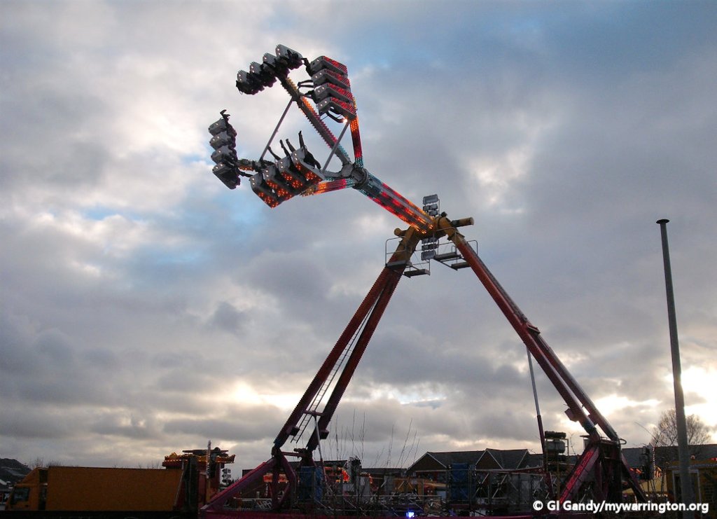
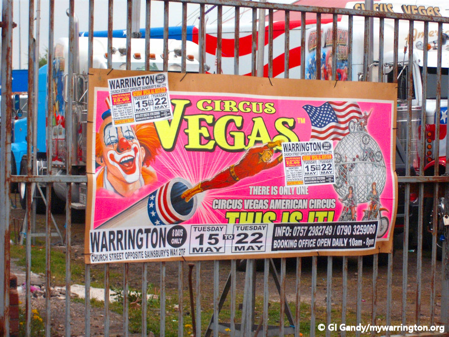
To finish off, view this manual slideshow showing scenes of Church Street, including a visiting fair.


