J. M. Wilson’s Description of Lymm
In 1870-72, John Marius Wilson’s Imperial Gazetteer of England and Wales described Lymm like this:
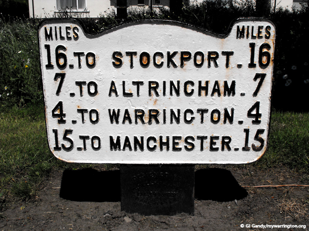
LYMM, a village, a parish, and a sub-district in Altrincham district, Cheshire. The village stands on the Bridgewater canal, near the Manchester, Warrington, and Garston railway, 1¼ mile SSE of the river Mersey, 1¼ SW of the river Bollin, and 4½ ESE of Warrington; and has a station on the railway, a post office under Warrington, a police station, an old cross, gas-works, and fairs on 5 May and 5 Nov.
The police station is a neat small building, containing four cells. The cross is partly cut out of solid rock, and is in fine preservation. The gas-works were erected in 1862. The parish contains also the hamlets of Heatley-Heath and Cliffe-Lane, and the places called Crouchley-Lane, Burford-Lane, Lymm, Booths, Oughtrington, Broom Edge, Reddish, and Statham; and it extends to the Mersey and the Bollin, Acres, 4,284. Real property, £18,377; of which £200 are in quarries. Pop. in 1851, 3,156; in 1861, 3,769. Houses, 735. The manor is divided. Lymm Hall, an ancient edifice, formerly moated, is the seat of J. Barratt, Esq. Oughtrington Hall is the seat of A. F. Payne, Esq.; Statham Lodge, of P. Stubs, Esq.; Beechwood, of G.Dewhurst, Esq. There are many recent Villas and well built houses. Tanning and fustian-cutting are carried on. The living is a rectory of two medieties in the diocese of Chester. Value of the first med., £349;* of the second med., £249.
* Patron of the first, E. Leigh, Esq.; of the second, R. E. E. Warburton, Esq. The old church dated from about 1322; and, except the W[est] window and the lower part of the tower, was taken down in 1850. The new church was built in 1851; is in the early decorated style; comprises nave, aisles, transepts, and chancel, with a tower; has a fine E[ast] window, put up in 1865 in memory of the late rector, the Rev. W. M’Iver; and includes, in the N[orth] aisle, a private chapel in lieu of one in the old church. Two chapels of ease are in Oughtrington and Broomedge. An Independent chapel was built, in 1863, at a cost of about £3,200. There are also chapels for Baptists, Wesleyans, and Primitive Methodists, an endowed grammar school, parochial schools, a mixed school, an infant school, and charities £95.—The sub-district contains also Warburton parish, and parts of three other parishes. Acres, 18,170. Pop., 7,395. Houses, 1,398.
GB Historical GIS / University of Portsmouth, History of Lymm, in Warrington and Cheshire | Map and description, A Vision of Britain through Time.
URL: https://www.visionofbritain.org.uk/place/950 Date accessed: 01st September 2024
Introduction
My thanks go to Joe Griffiths at Lymm Parish Council for permission to use information from the council’s website for part of my reporting on this page. I have also accessed the Wikipedia files for other research. Some of the notes in this introduction will be expanded throughout the page with links to further information where available.
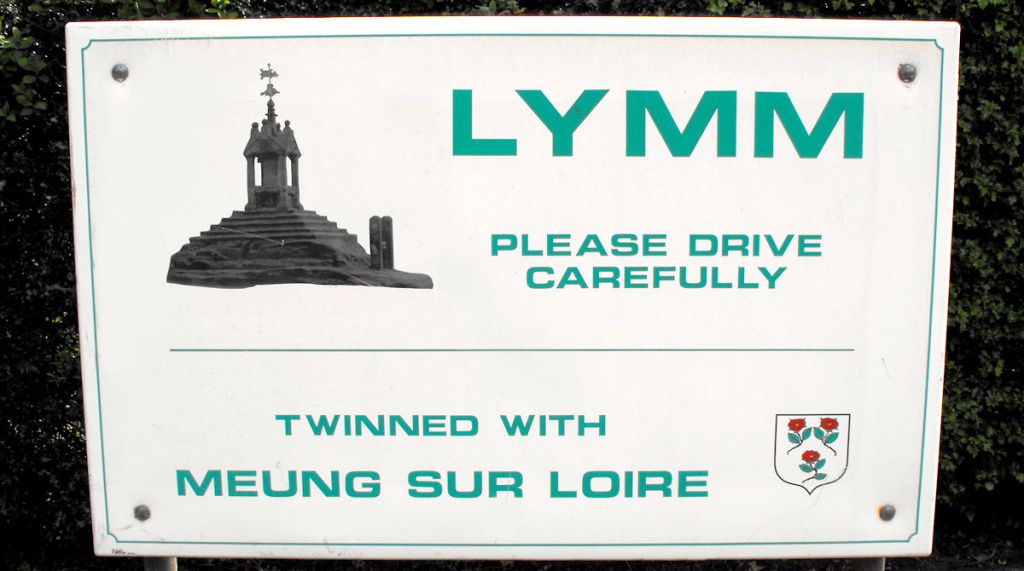
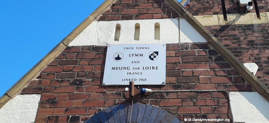
Lymm (pronounced “Lim”) is a large village and civil parish in south-east Warrington. Lymm was an urban district of Cheshire from 1894 to 1974. Its twin town is Meung-sur-Loire, in central France.
The name Lymm comes from the Old English Hlimme “roaring brook”, formed from hlimme to “resound, roar” or “place of running water” and is possibly derived from an ancient stream that ran through the village centre. The Anglo-Saxons arrived in the 7th century AD. Lymm Church is recorded in the Domesday Book when the name of the village was spelt Lime.
Pre-History
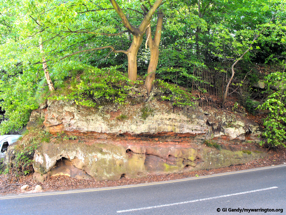
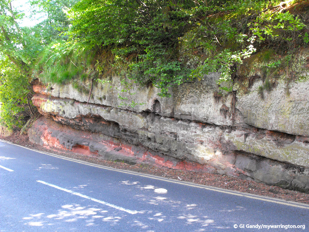
The sandstone rock on which Lymm now stands was formed in the late Triassic period about 220 million years ago. At this time Britain had a much hotter climate than it does today and was largely a desert.
The area which is now Cheshire was a basin carrying an extensive north flowing river system. Particles deposited and compacted by the river system formed the rocks which exist today. The valley running through Lymm features three different types of rock, reflecting changes in environmental conditions over time.
The rock in Slitten Gorge is known as Wilmslow Sandstone. As you climb the steps to Whitbarrow Road at the southern end of Slitten Gorge you pass into Helsby sandstone, which overlies the Wilmslow sandstone.
The Helsby sandstone, which has more of a red tone than the underlying Wilmslow formation, continues southward through the village centre, the Dingle and roughly halfway along Lymm Dam.
The southern half of Lymm lies on Tarporley siltstone. The names given to the sandstone indicate where they were first discovered.
12th-15th Century
At the beginning of the 12th century, the forest was gradually cleared and fields made. There was a corn mill and a fish weir. The parish church was rebuilt in the fourteenth century at a time when Adam or his son Gilbert was Lord of Lymm. The feudal system was decaying and was being replaced by tenant farming.
The de Limm family owned much of the village and lived in Lymm Hall up to 1342 when the property passed to the Domvilles by marriage.
16th-17th Century
St Mary’s Church acquired a tower in 1521 and the Grammar School was founded in 1597 by Sir George Warburton and W Domville. It was located next to the Church.
18th Century
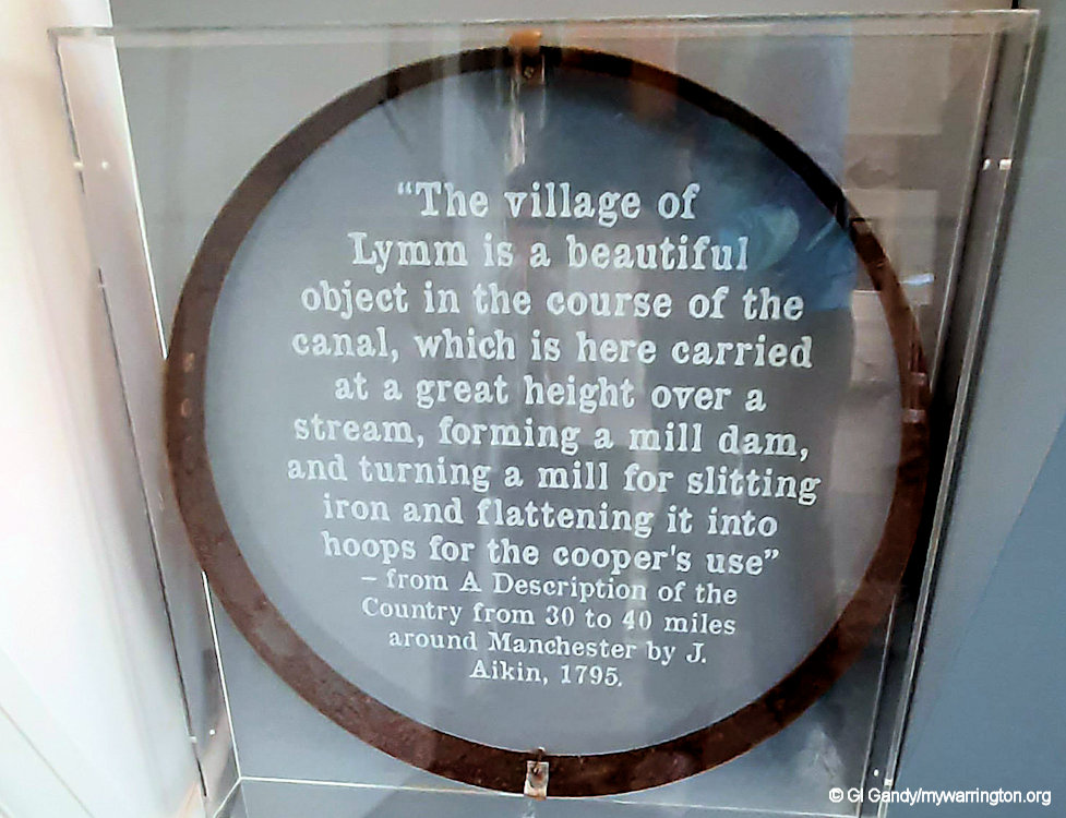
The Industrial Revolution didn’t leave Lymm behind. In fact, the Lymm section of the Bridgewater Canal was opened in 1777. New sandstone quarries were opened up and there were tanneries. Bricks and tiles were made of local clay. A slitting mill was an important feature of the economy for most of the 18th century.
19th Century
In 1824 a turnpike was built to by-pass the difficult route through the village centre so helping the mills.
Today this is part of the A56. The opportunity was taken to build a dam. This was created by flooding the marsh near the Church to create a natural looking lake.
The railway came to the village in 1853 when the Warrington and Altrincham Junction Railway opened. This made Lymm more prosperous because people could look for employment in Warrington and Manchester and it enabled local businessmen from the towns to have homes in Lymm.
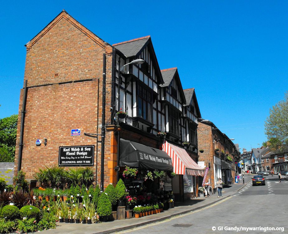
A former fustian cutting factory occupied the top floor of this building on Church Road in the village. Another surviving building for the industry is on Woodland Avenue. Both buildings consisted of one long table filling the whole length of the upper floor of the building.
Fustian Cutting
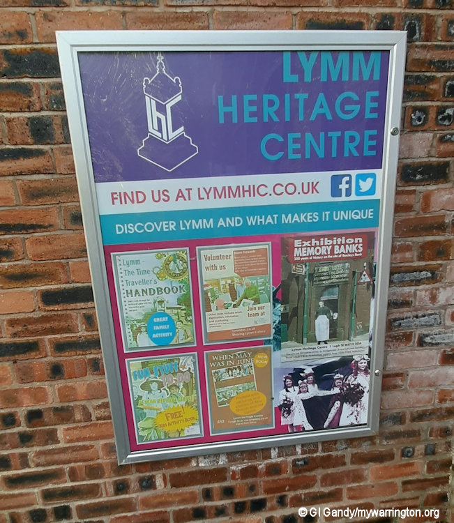
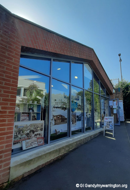
Fustian has often been described as the poor man’s velvet and is a type of cloth believed to have originated in 2nd Century Egypt, at a place called Fustat. Fustian had a strong linen warp, and a cotton weft, a long lasting, hard wearing coarse twilled fabric with a slight nap. See Lymm Heritage Centre for images and a timeline of the industry in the village.
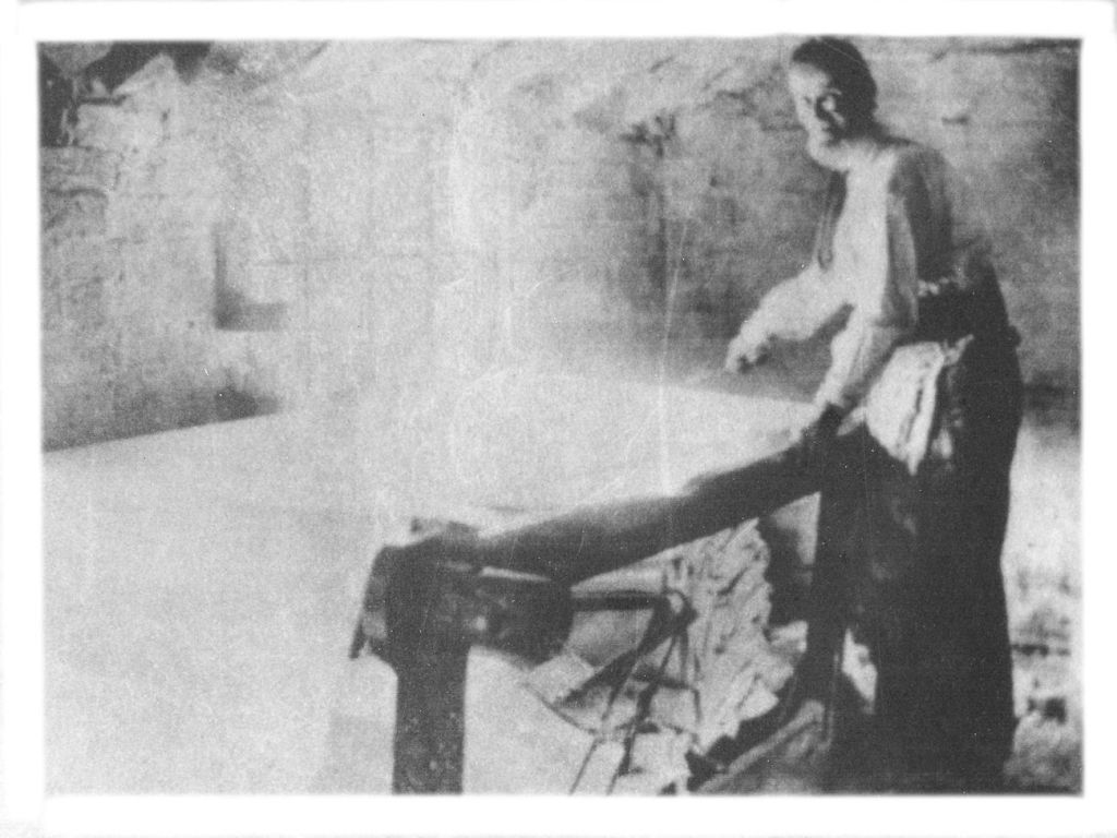
The photo, left, is the workshop on the top floor of the Church Road building above. This is the road which runs across the front of Lymm Dam and the cottages still stand about 1/4 of a mile to the west of the dam. The photo is taken taken from the information board at the Lower Dam by The Cross.
20th-21st Century
In the early part of the twentieth century, there was a salt-working industry in Heatley. ‘Lymm Pure Salt’ on red and white railway carriages became known nationally. Gold leaf from Lymm is present on the high altar at St Paul’s Cathedral. The first car drove into the village in 1902. However building was kept in check by planning restrictions and the Green Belt – that is not always the situation today.
The parish of Lymm today incorporates the hamlets of Booths Hill, Broomedge, Church Green, Deansgreen, Heatley, Heatley Heath, Little Heatley, Oughtrington, Reddish, Rushgreen and Statham. According to the 2021 Census it has a population of 12,700, compared to 10,552 in 2001.
The Manchester Ship Canal and river Mersey pass to the north. To the east of Lymm the River Bollin flows along the village’s border with Warburton and the borough of Trafford.
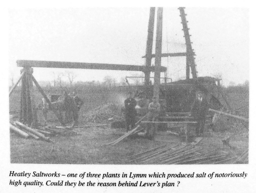
Heatley Saltworks – one of three plants in Lymm which produced salt of notoriously high quality. Could they be the reason behind Lever’s plan? Photo is taken from the Crosfield Bridge information panel at Lymm Dam.
The M56 (junctions 7 & 9) and M6 (Junction 20) motorways are both within 3 miles of Lymm. The conjunction of these motorways is known as the Lymm Interchange and hosts a service station known as the Poplar 2000 services, an important truck stop.
The A56 also passes through the village, connecting the nearby town centres of Warrington and Altrincham with a regular bus service which now links to Manchester Airport in a journey operated by Warrington’s Own Buses.
So that’s the introduction over. Let’s go into a bit more detail on some of the stories.
Lymm Hall
Lymm Hall is a moated country house on Rectory Lane. It is recorded in the National Heritage List for England as a designated Grade II* listed building.
A manor house and estate at Lymm once owned by the de Limme family came into the possession of the Domville family by marriage. In 1316 the estate passed from Gilbert de Limme to Thomas Legh de West Hall, in High Legh, whose daughter Agnes married John Dumbill.
The Dumbill (Domville) family originated in northern France and settled at Brimstage on the Wirral after the Norman Conquest. The Estate eventually passed to the Reverend Mascie Domville Taylor and on his death, it was broken up and sold in 1846.
The Hall has had several owners since the 1840’s, James Barratt and William Battersby being two who are remembered for their generosity to the Parish Church of St Mary.
In about 1840, stepped gables and mullioned windows were installed, resulting in a symmetrical front in neo-Jacobean style. The rose garden was designed by Edward Kemp in 1849; it was his first recorded commission.
The Hall and Moat House has been in the ownership of the Cotterill family since the early 1900’s and the Hall and stables have now been divided into several flats.
See the drone footage on YouTube.
George Ormerod in his History of the County Palatine and City of Chester published in 1832 says of Lymm Hall:
It is an ancient low building of stone, venerably grey with lichens, seated within the remains of a moat, on an eminence above the village, commanding an extensive view into Lancashire. The old bay windows, enriched by the late proprietor with ancient stained glass, are preserved in the entrance-hall, which is an interesting apartment, surrounded with family pictures. Soon afterwards many modern improvements were made in the building and it was enlarged and its ancient moat was entirely filled up.
The Structure of the building
The main (north) front and the west front are constructed in coursed buff sandstone; the south front is in brick with stone dressings on a stone plinth. The roofs are slated and the chimneys constructed of stone. The house has two storeys and attics.
The north front is E-shaped. It has a central porch with a balustrade, and three-light mullioned and transomed windows on each side. Above the porch is a two-light sash window. The parapet is plain, rising in two steps to the projecting wings. These have three-light mullioned windows in the lower level, three-light mullioned and transomed windows in the upper level, and a single-light window in the gable.
The west front has sash windows, a projecting chimney, and a canted four-light oriel window. The south front is irregular in plan, with a recessed gabled portion to the left containing one window, a central portion with three windows, and a right gabled portion containing a canted two-storey bay window.
To the right of the south front is a wing with a bow window containing a French window. Above this is a Doric cornice. The east front is obscured behind a 19th-century service wing.
Associated Structures
The hall is approached by a bridge over a moat (now dry) that dates probably from the middle of the 17th century.
The moated site on which the hall stands, together with an ice house, are a Scheduled Monument. To the west are two cockpits also recognised as a scheduled monument.
A temporary structure sited to the west of the main hall, colloquially referred to as ‘The Den’ existed in the late 20th century before being damaged beyond repair by weather activity.
Information about the hall compiled from notes on Lymm Parish Council and Wikipedia.
Lymm Grammar School (Oughtrington Hall)
Lymm Grammar School was founded c1597 by Sir George Warburton and W. Domville; the original building was situated adjacent to the Parish Church. A new school was built in 1885 on land donated by G. C. Dewhurst in Grammar School Road and in the 1940’s the governors authorised the purchase of Oughtrington Hall as an annexe to the Grammar School road site.
The school moved completely to the Oughtrington Hall site in 1955 and the Grammar School Road site became the Lymm County Secondary Modern School. With the advent of Comprehensive Education, the two schools amalgamated on the Oughtrington site, becoming Lymm High School and the old Grammar School was demolished to make way for modern housing.
Information from Joe Griffiths at Lymm Parish Council website.
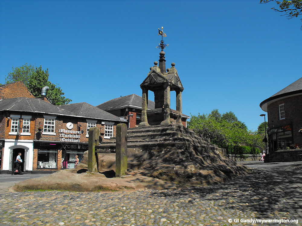
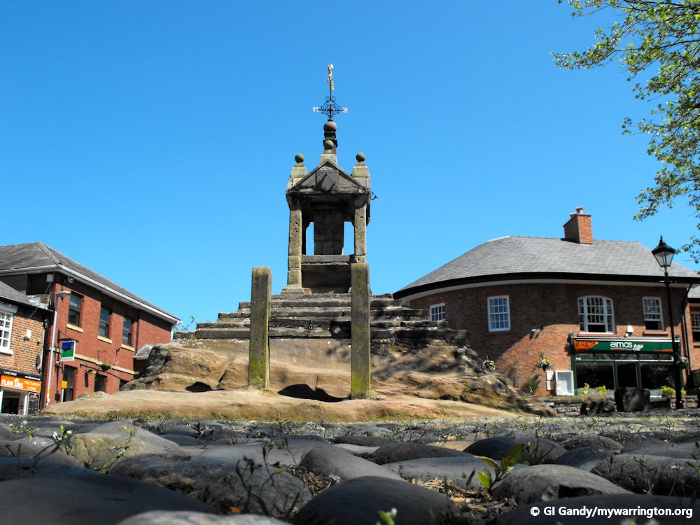
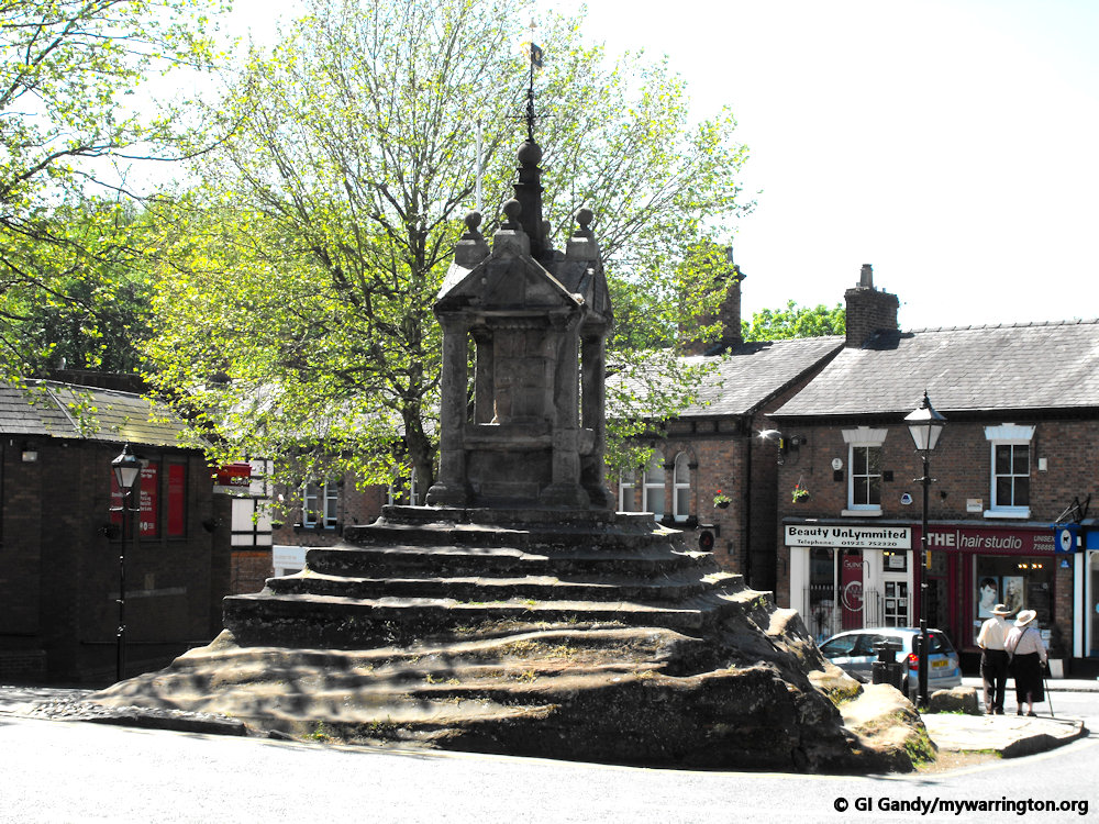
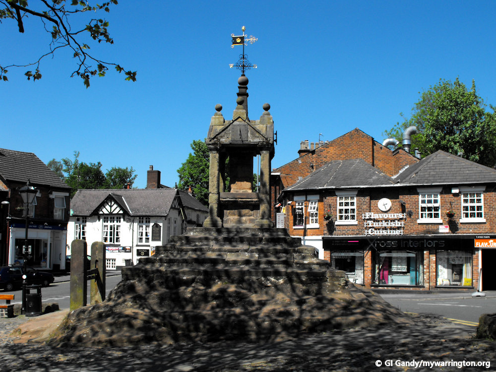
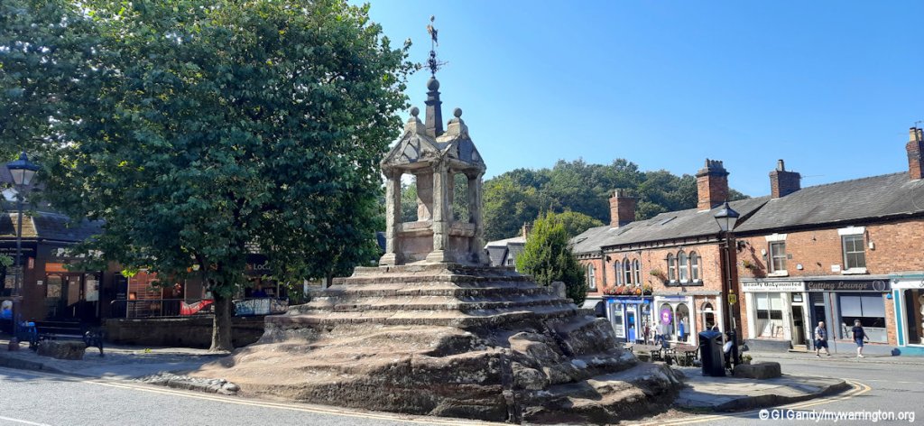
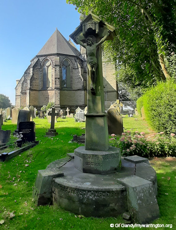
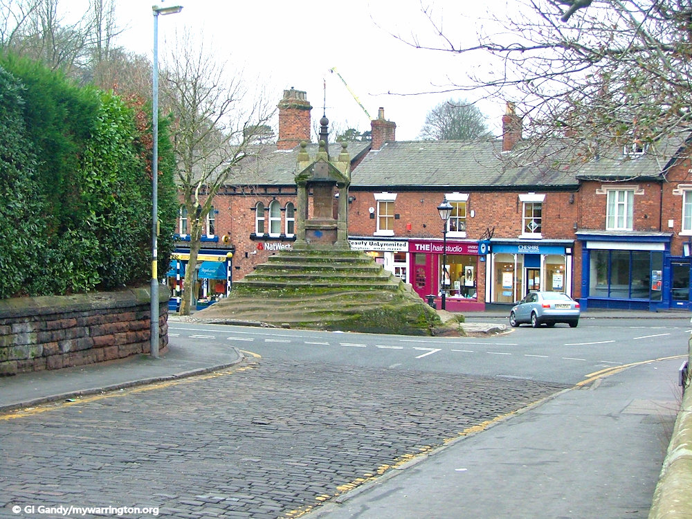
Lymm Cross
Crosses were once one of the commonest features of the English scene. Thousands were put up from the advent of Christianity until the Reformation in the 16th Century, and they make a fascinating study.
Roughly speaking, those erected before the 13th Century were tall shafts set in sockets, with an actual cross at the top, whereas in late medieval times they tended increasingly to be plain shafts, sometimes with masonry canopies, set at the top of steps. Clearly, that at Lymm belongs to the latter group, although it might possibly have replaced an older one.
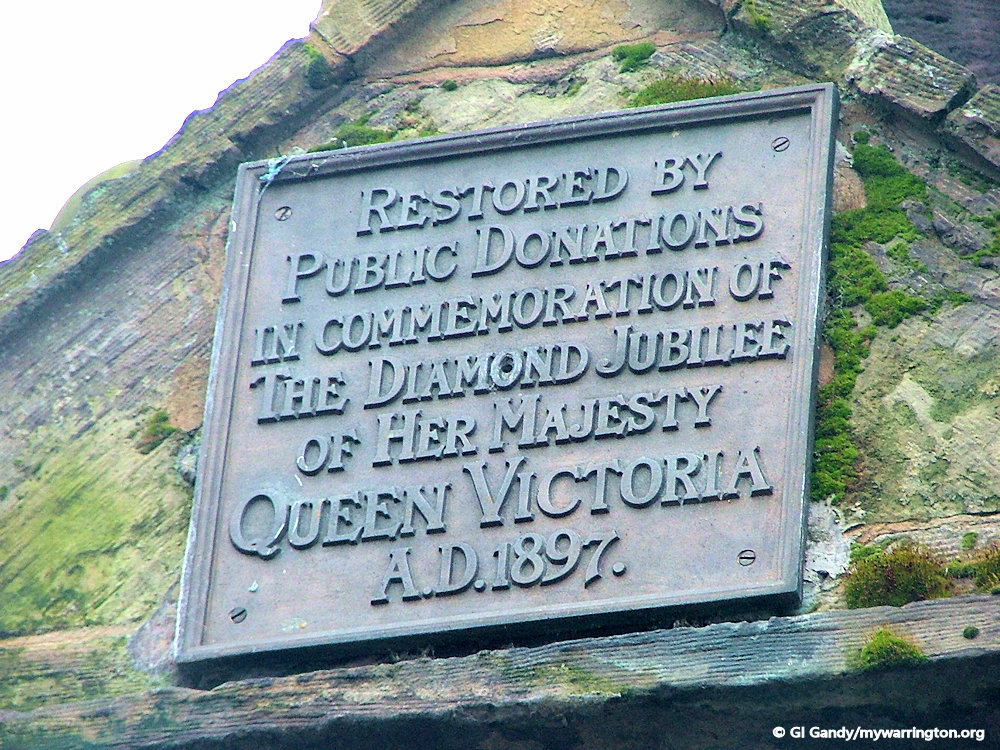
But of course, it was a work of man, and, as such, has needed a little attention from time to time. The last substantial face lift was in 1897, when the top was slightly modified.
C.E. Ardern, a historian from the late 19th Century, described the work as follows:-
The steps of the Cross, which have been greatly worn away by successive generations of schoolchildren, were partly refaced and the worn steps cut out and replaced. The defective stones in the masonry of the cross, especially the base shafts and the lower base of the central portion, were replaced by new stone to match the old.
Ardern goes on to say that the finials and gables were replaced by ones of “more appropriate design”, and that a new and much higher central finial and weathervane were added, together with the bronze sundials and commemorative panels which one now sees.
Ardern also remarked that the Cross had been “tinkered with several times during the last fifty years” (i.e. prior to 1897), and it was perhaps this “tinkering” which led a Mr. Bayley to write to the Manchester City News in the 1890’s:-
The Cross remains practically as it was fifty years ago, with the exception of the two dials which used to be upon it, but are there no longer. Judging however, from the nondescript style of the present erection, it can hardly one would think, be older than Seventeenth Century work.
He ended with a remarkably modern thought:-
As the present structure is in need of repair, it is desirable the Urban District Council should see to it without delay; and as such an old-time relic ought by all means to be preserved. I would like to suggest that it should be suitably railed in.
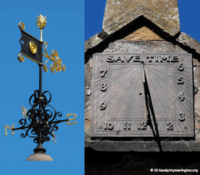
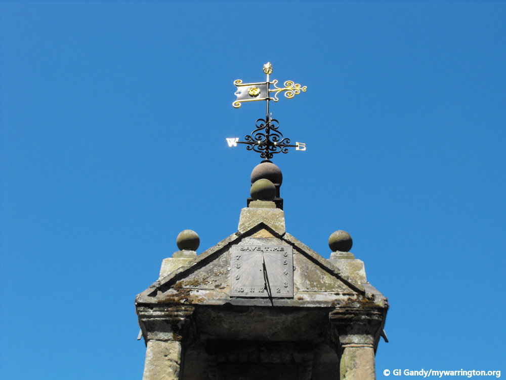
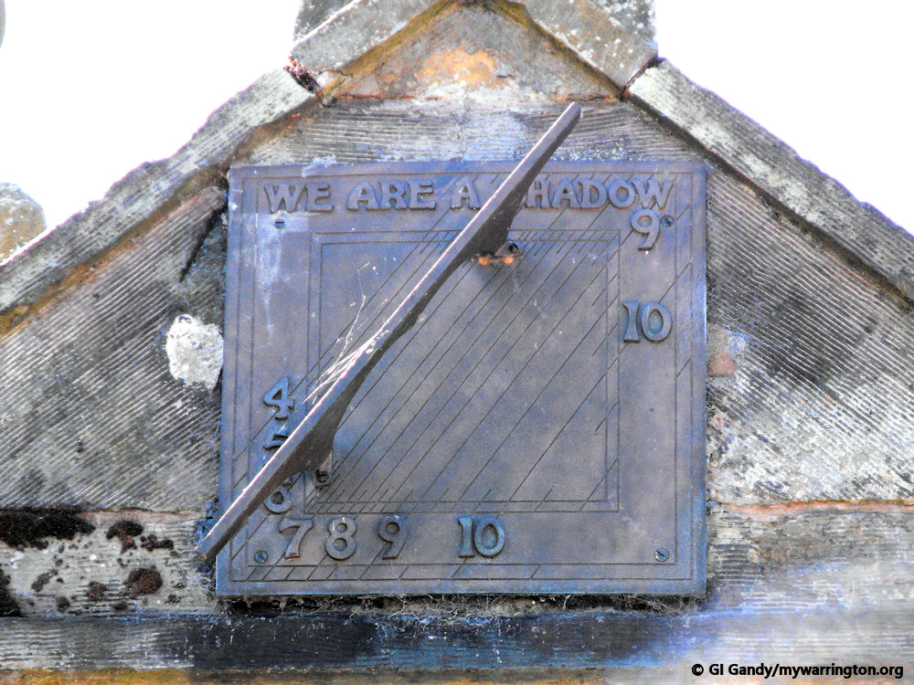
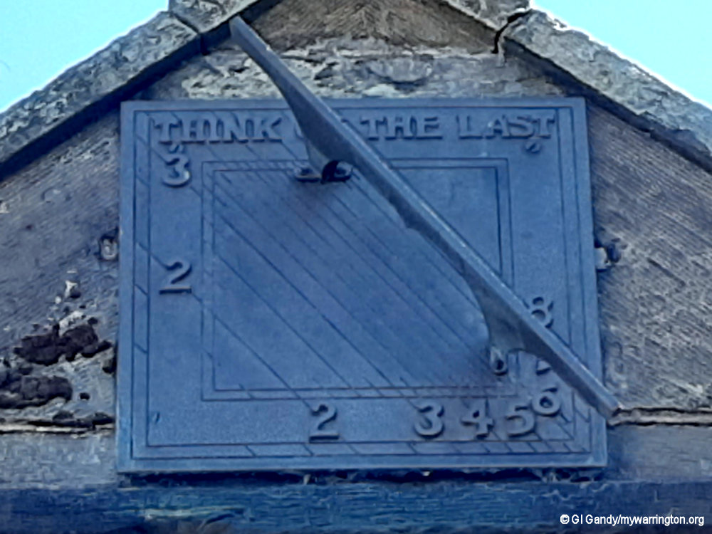
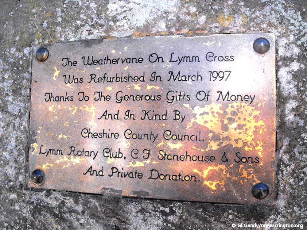
Close-ups of the weathervane and sundial on 25 May 2012
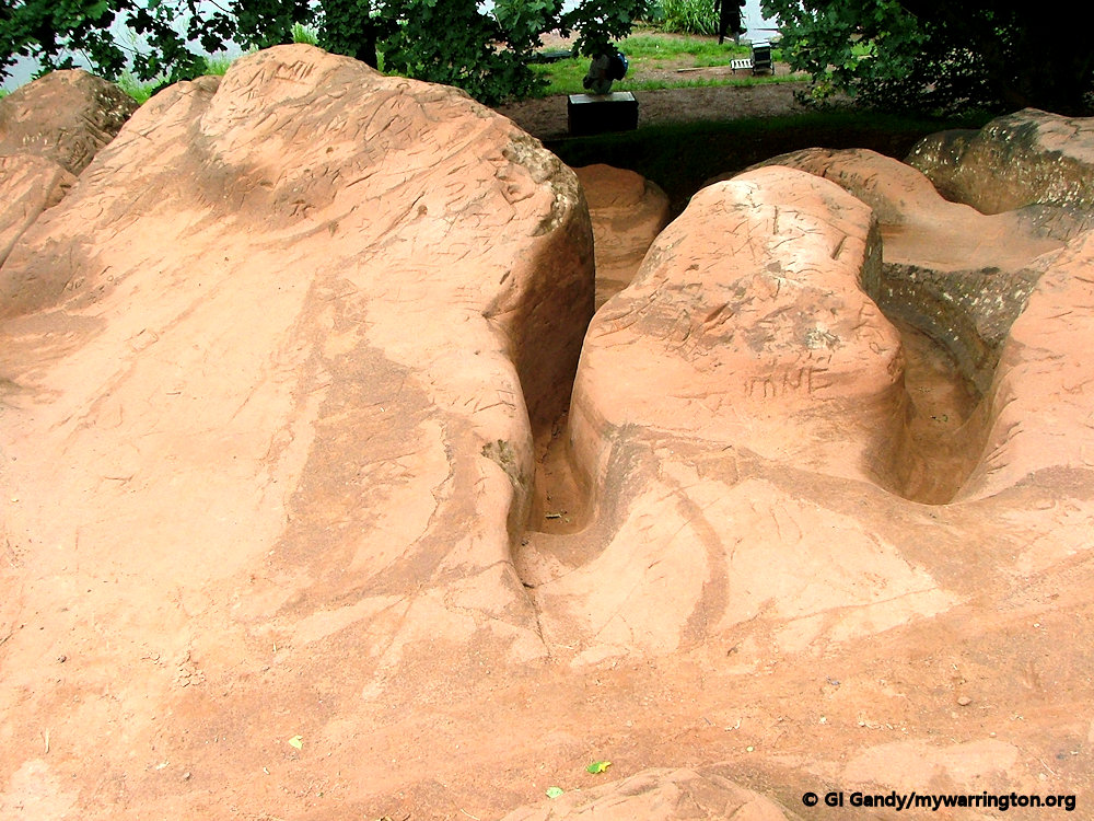
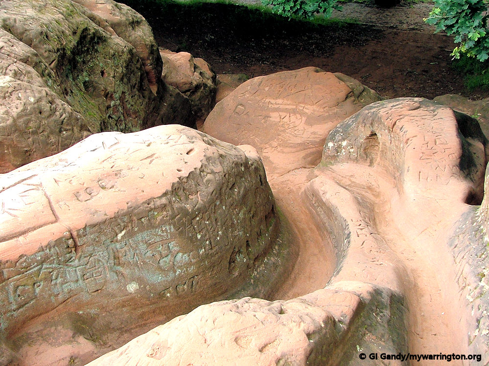
Description of the Cross
The cross dates from the early to middle 17th century. It is constructed of sandstone and stands on an artificially stepped natural outcrop of red sandstone.
Its shaft stands in a square pavilion of red sandstone with square corner pillars. It has a stone roof with a pedimented gable to each face and ball finials. Above the cross is an extension which carries a stone ball and an ornate weathervane.
On the east, south and west gables are bronze sundials of 1897 carrying the inscriptions “We are a Shadow”, “Save Time” and “Think of the Last”.
It is not known, however, why it was built. Some have suggested it resembles a market cross in a market square but there is no evidence a market existed at that location – the village does have a market, on a Thursday, but on Henry Street car park 180 metres to the west.
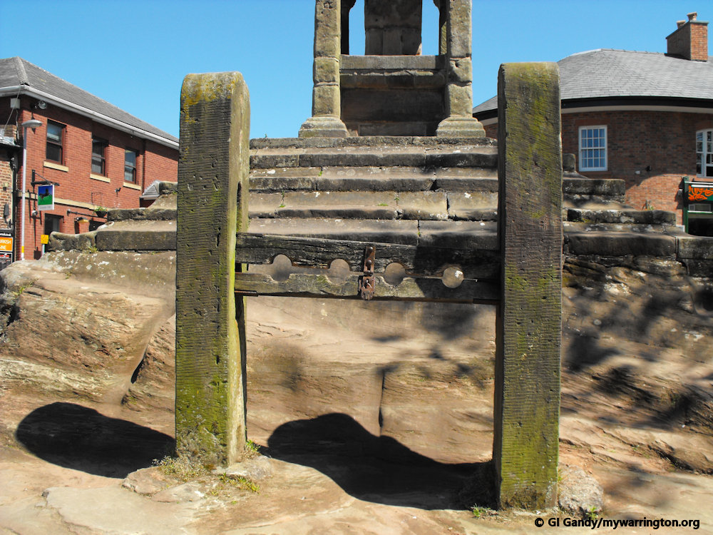
Others say it was a place of worship before the village had a church. The village stocks are next to the cross.
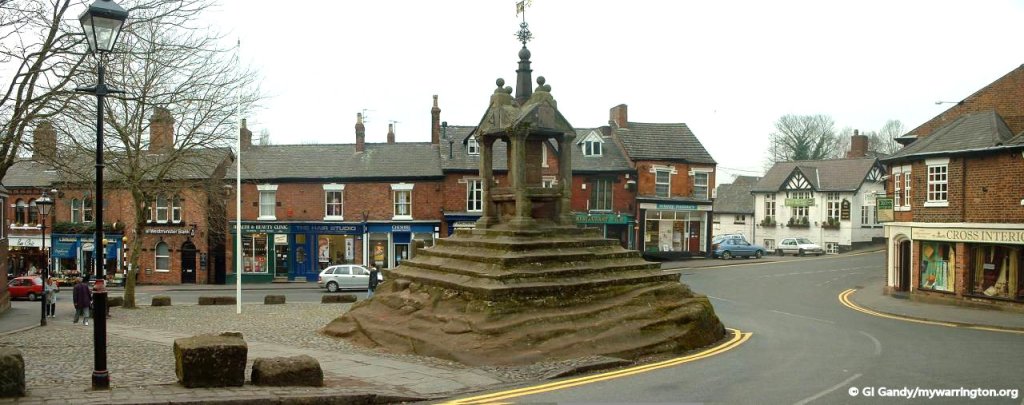
Lymm Cross as photographed from the south on 27 Feb 2003
The next images show the four sides of the cross from the north, south, east and west respectively.
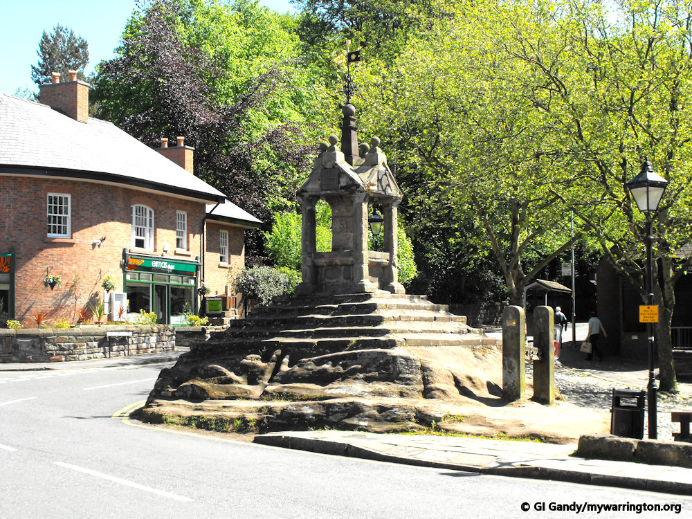
I revisited the village in September 2024 and took the following photos around Lymm Cross
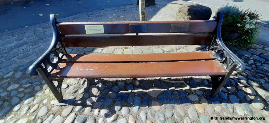
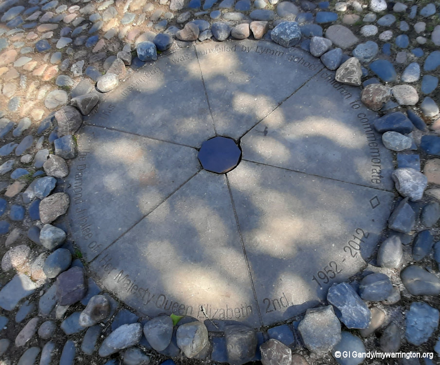
The wording on the memorial above reads: This inscription was unveiled by Lymm School Children to Commemorate the Diamond Jubilee of her Majesty Queen Elizabeth 2nd, 1952 – 2012.
Some of the information about Lymm Cross from Joe Griffiths at Lymm Parish Council website and Wikipedia.
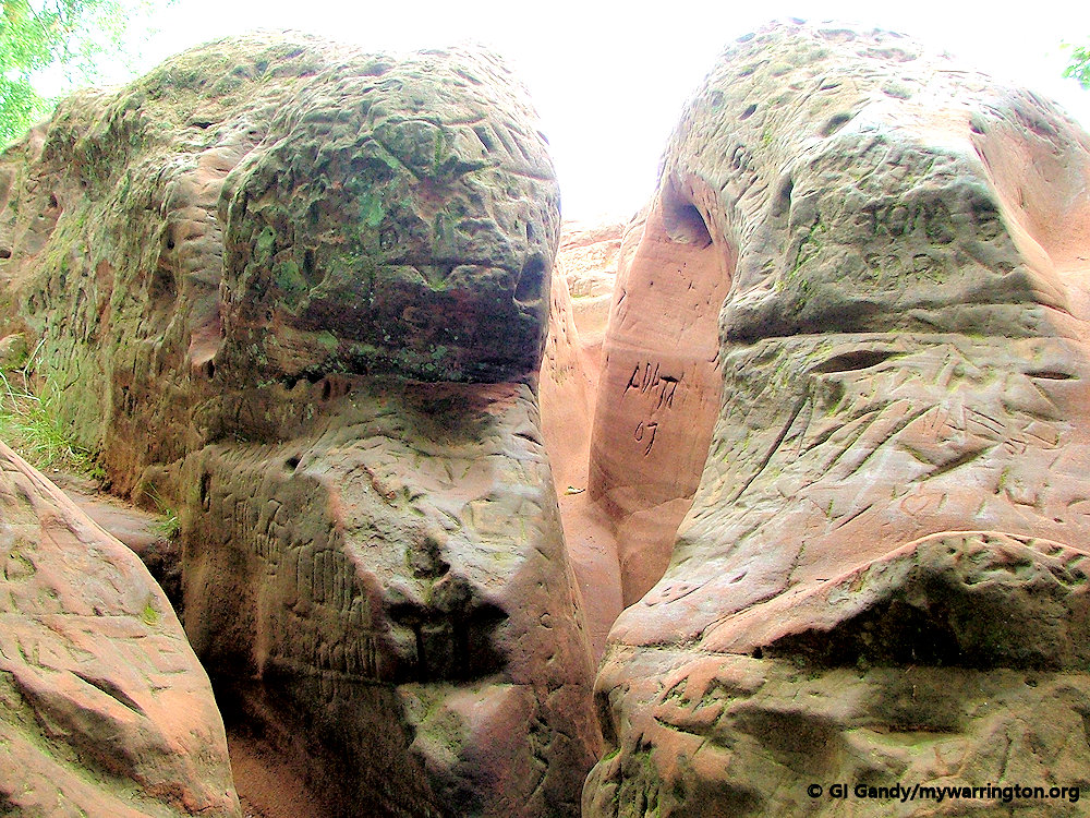
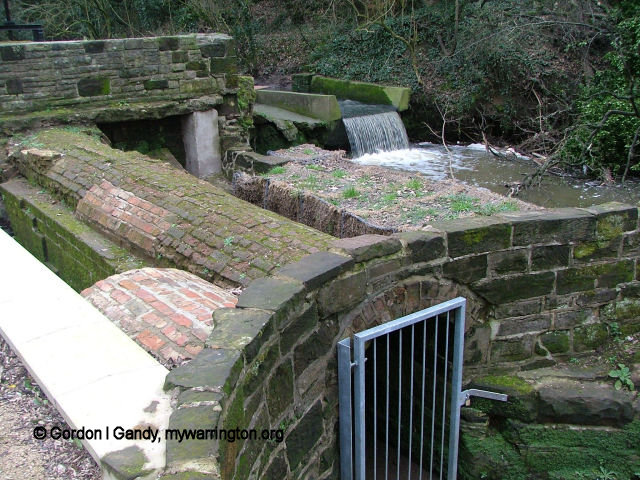
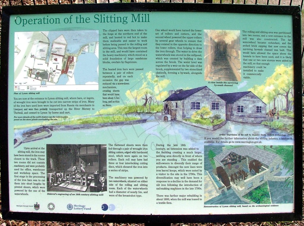
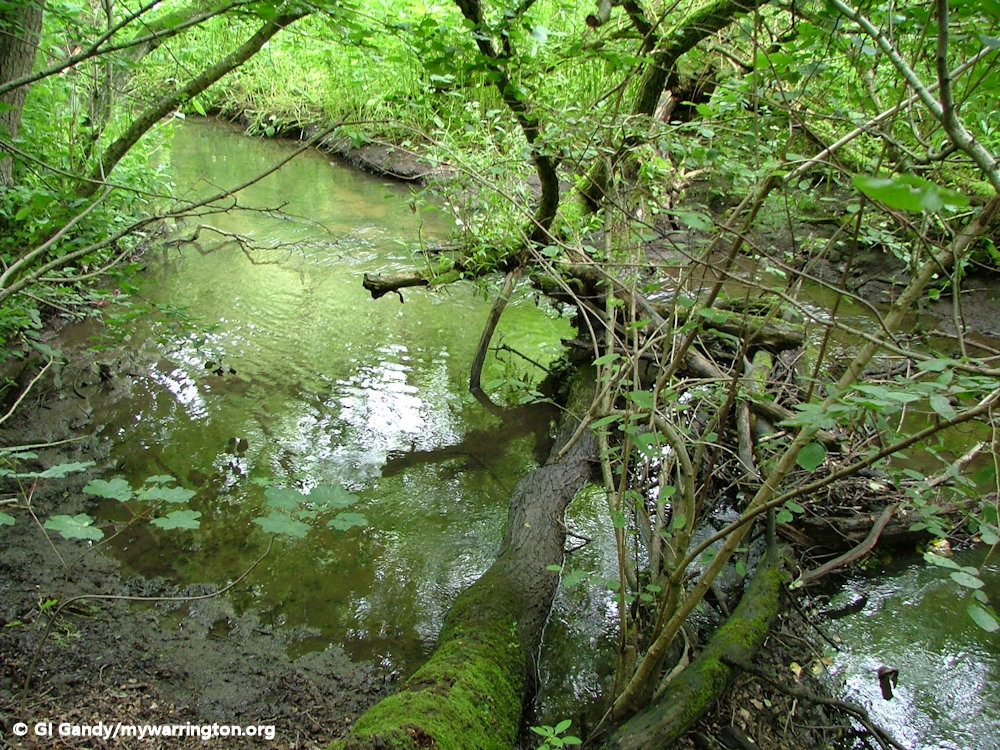
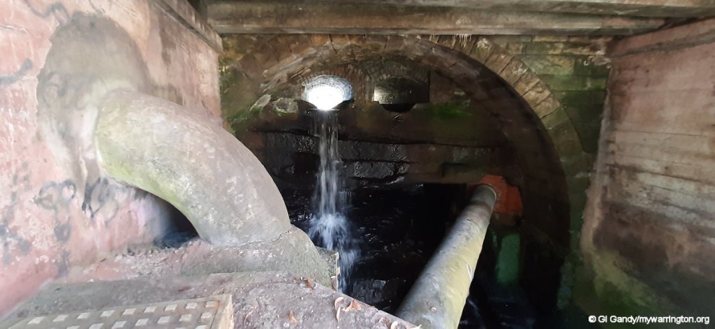
Lymm Slitting Mill
The structure you can see spanning the stream in Slitten Gorge is the remains of a slitting mill which operated between the early 18th and early 19th centuries.
Slitting Mills were introduced into Britain from the Low Countries at the end of the 16th Century when one was reputed to have been built in Dartford (Kent) in 1590. The mill’s original purpose was nail production, later giving way to the cutting of steel bands for the cooperage at Thelwall.
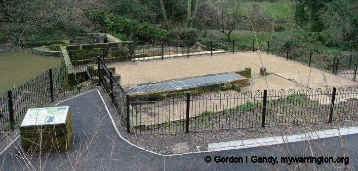
Lymm Slitting Mill
During this phase of the mill’s life the metal was taken by boat to Thelwall along the river Mersey (this was prior to the opening of the Manchester Ship Canal in 1894). In 1800 it was converted to a textile mill.
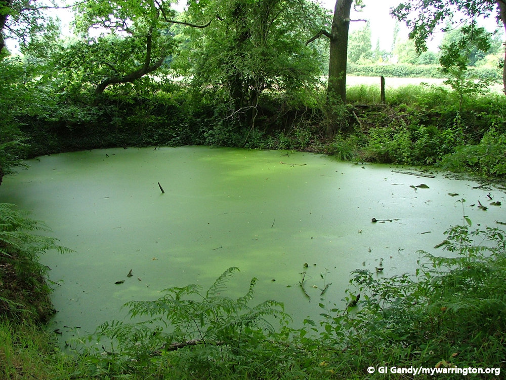
After its closure, the mill was pulled down to its current height and the Gorge was made into a Victorian beauty spot. At this stage most of the area was still a millpond but in 1905 the dam wall was breached and the pond drained away leaving the stream as it is today.
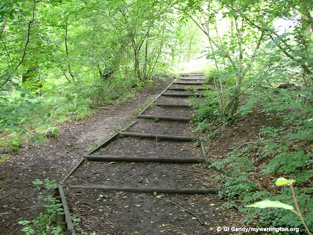
The area then became overgrown and remained so until it was cleared and landscaped by Warrington Borough Council in the mid 1970’s.
An information board describes the workings of the mill (see below).
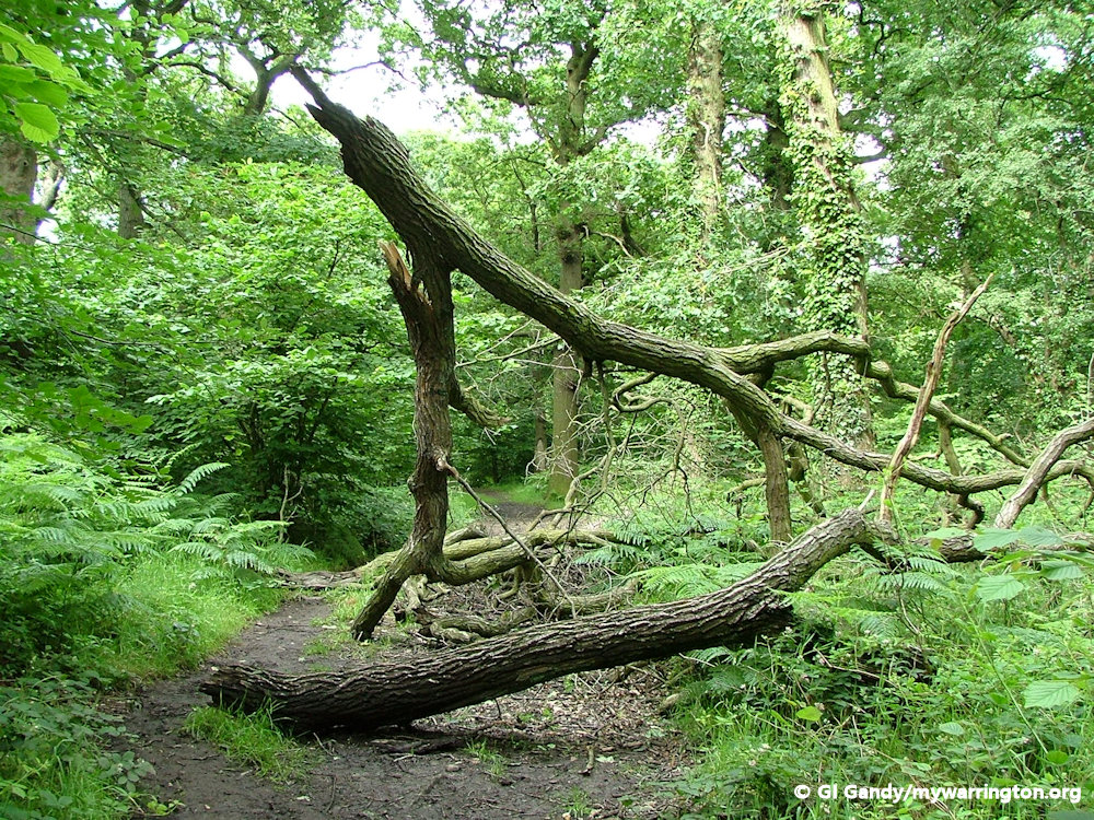
Here are two views of Slitten Gorge.
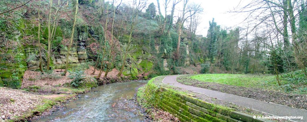
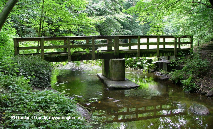
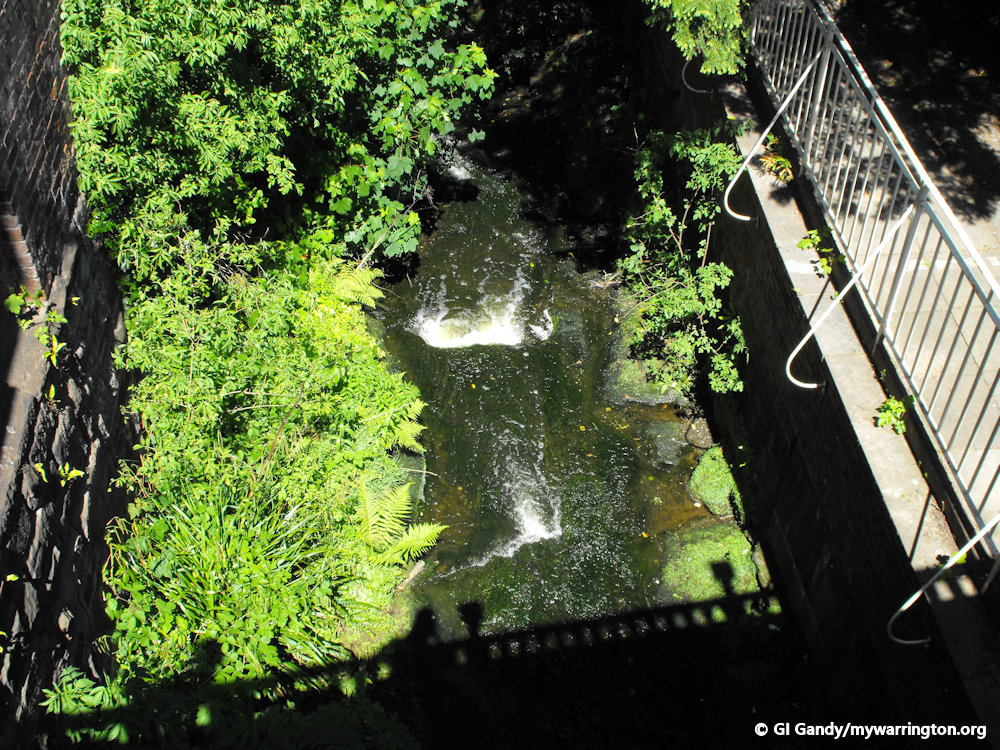
So what actually is Slitten Gorge?
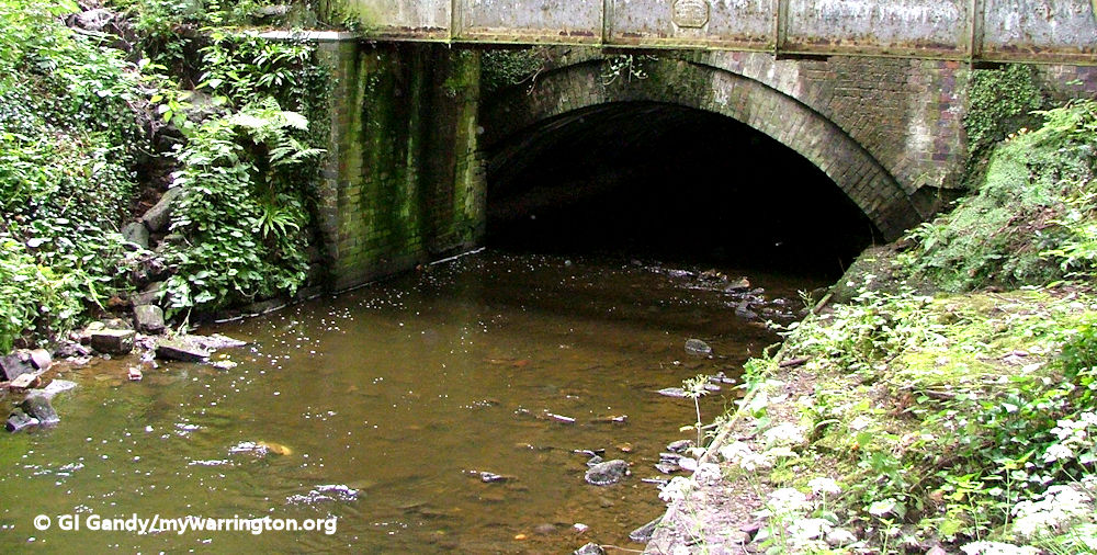
Slitten Gorge is a small area of parkland with a stream, known locally as Slitten Brook, running through it. The stream runs down from Lymm Dam and through the village centre before flowing through Slitten Gorge.
Downstream the water flows under Dane Bank Road and the Trans Pennine Trail. Eventually the stream flows into to the Manchester Ship Canal three-quarters of a mile to the north. From Slitten Gorge to the Ship Canal it is known as Sow Brook.
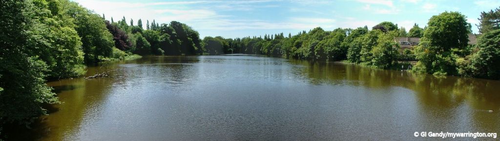
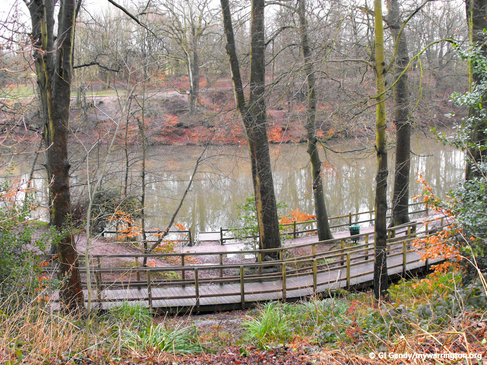
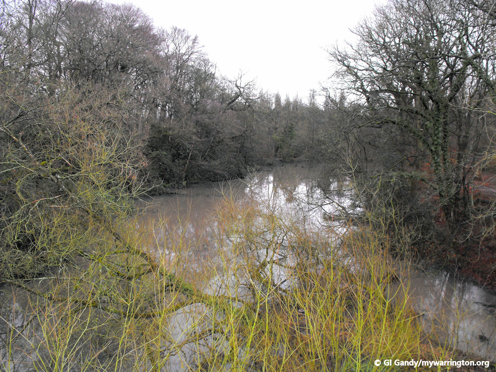
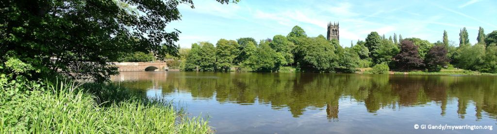
Lymm Dam
Lymm Dam was created in 1824 during the construction of what is now the A56 road, when local inhabitants objected to initial plans for a route through the village centre. Lymm Dam is about 20 feet (6 metres) deep near the wall by the A56, and then the depth fluctuates across the rest of it, with some parts being quite shallow.
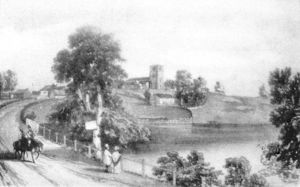
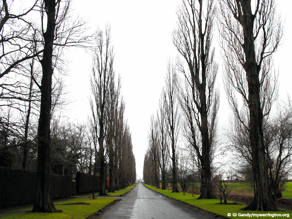
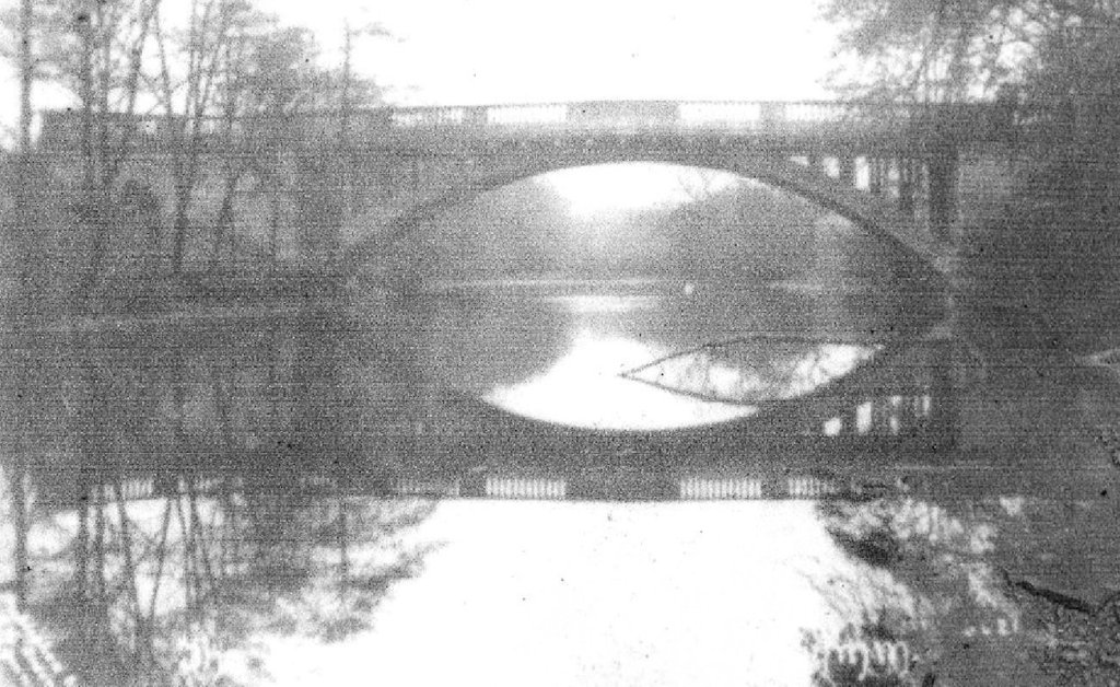
A view of Lymm Dam in the 1850s. At this time Lymm Grammar School stood below the church. Virtually no visible sign of the school remains, though you may just be able to make out the base of the wall which curves towards the water’s edge. The church itself has a different appearance to the present day, the current tower was built in 1890. Notice also the absence of the tall poplars on the horizon which form a conspicuous part of this view today. Photo is taken from the noticeboard at Lymm Dam.
For more detail on Lymm Dam, see the Warrington Green section of this website.
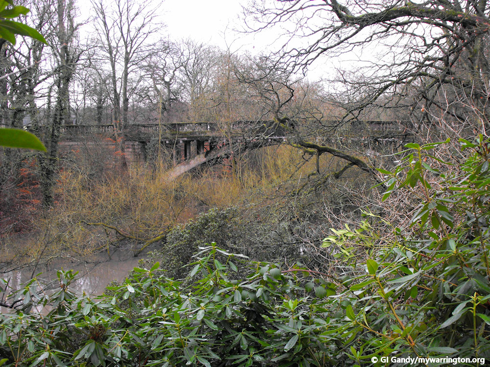
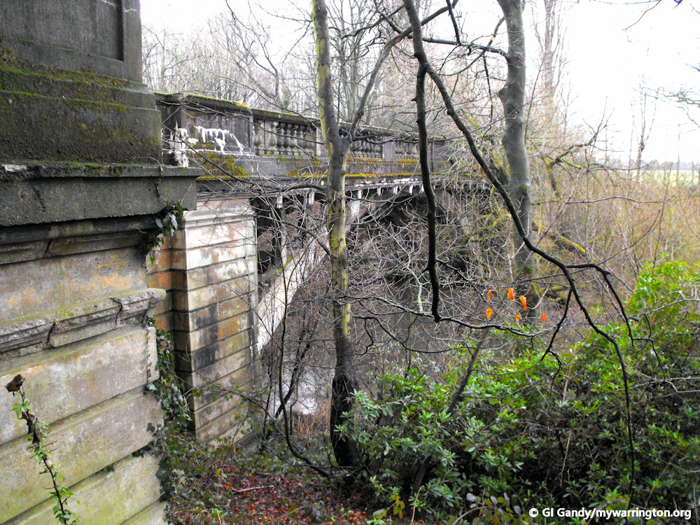
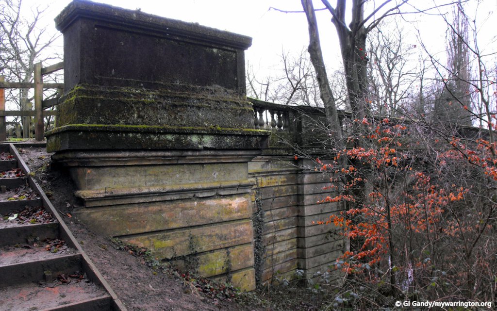
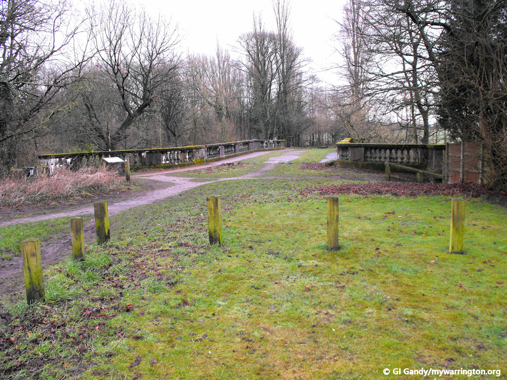
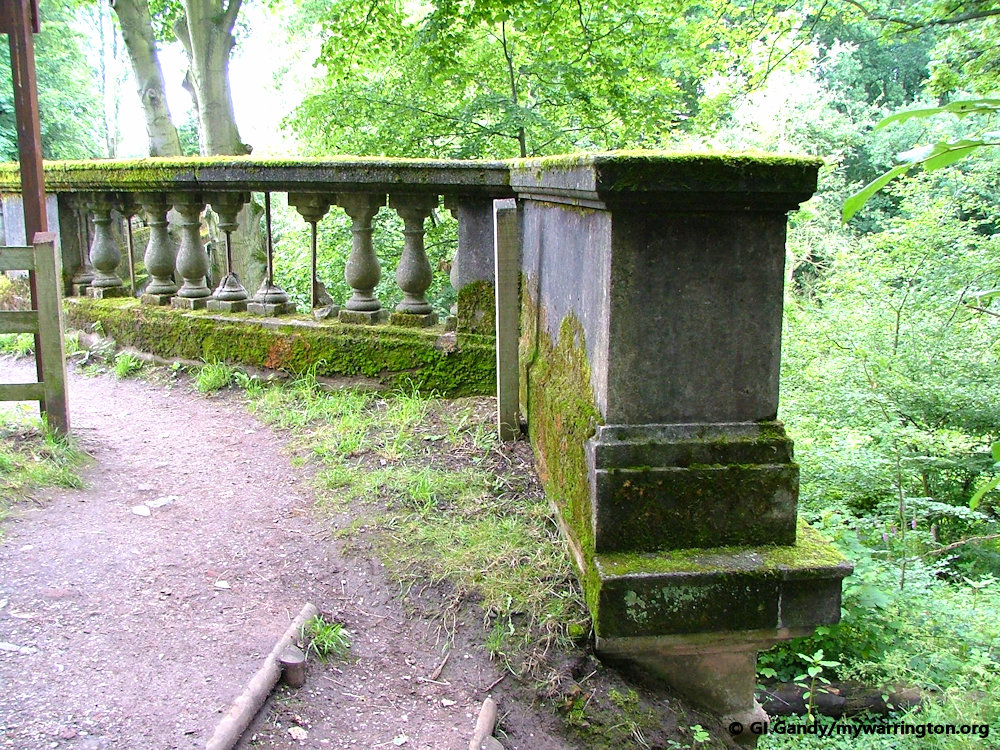
Crosfield Bridge
What I wish to concentrate on here is Crosfield Bridge to the south of the dam. This is in the form of photographs of the information board at that location with additional images from my collection.
Lever’s Plan
At the beginning of the 20th century, George Dewhurst sold the Beechwood Estate (of which Lymm Dam was a part) to William Lever. William Lever intended to make considerable changes to the area and develop the site into housing for his workers.
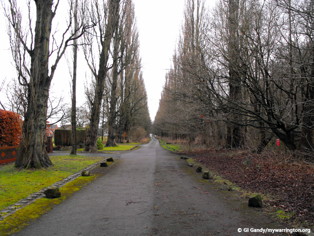
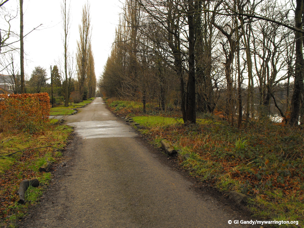
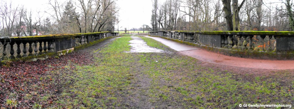
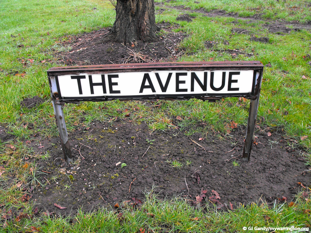
Lever’s proposed development was to be based around three roads (currently Lakeside Road, The Avenue and the bridleway running along the eastern boundary of Lymm Dam). The roads were to meet at the bridge and were planted with alternating Lombardy poplar and English elm trees. The elms unfortunately succumbed to Dutch elm disease in the 1980s but the poplars remain.
The bridge itself was constructed between 1918 and 1919; the work being carried out by local contractors Harry Fairclough.
This however was as far as Lever got with his development plans; the houses were never actually built. The reason for this is not entirely clear, though one possible suggestion is discussed below.
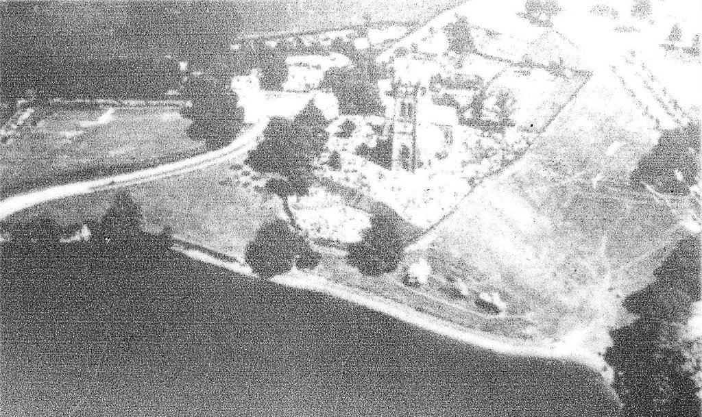
An aerial photograph of the area around the church in the 1920s. One of the newly constructed roads of Leverhulme’s proposed model village can be seen on the top right of the photograph. The photo is taken from the Crosfield Bridge information board.
William Lever had developed a commercial interest in the product of salt, which was prominent industry in early 20th century Lymm. It has been suggested that Lever’s proposed development at Lymm Dam was to house his workers. Lever’s advance into the salt industry aroused the interest of ICI who were a major force in salt production. Lever’s main business interest was soap and it is thought that ICI and Lever may have struck a deal whereby ICI would stay out of the soap business if Lever stayed clear of salt. This being the case, the development at Lymm Dam never materialised.
Whatever the reason, Lever left Beechwood and the house was demolished in the 1930s. The estate was divided and the section which is now Lymm Dam eventually passed into local authority ownership, remaining so to this day. Crosfield bridge and the tree-lined avenues which lead to it, are a legacy of a period of Lymm Dam’s history and a reminder that the area could have looked very much different today.
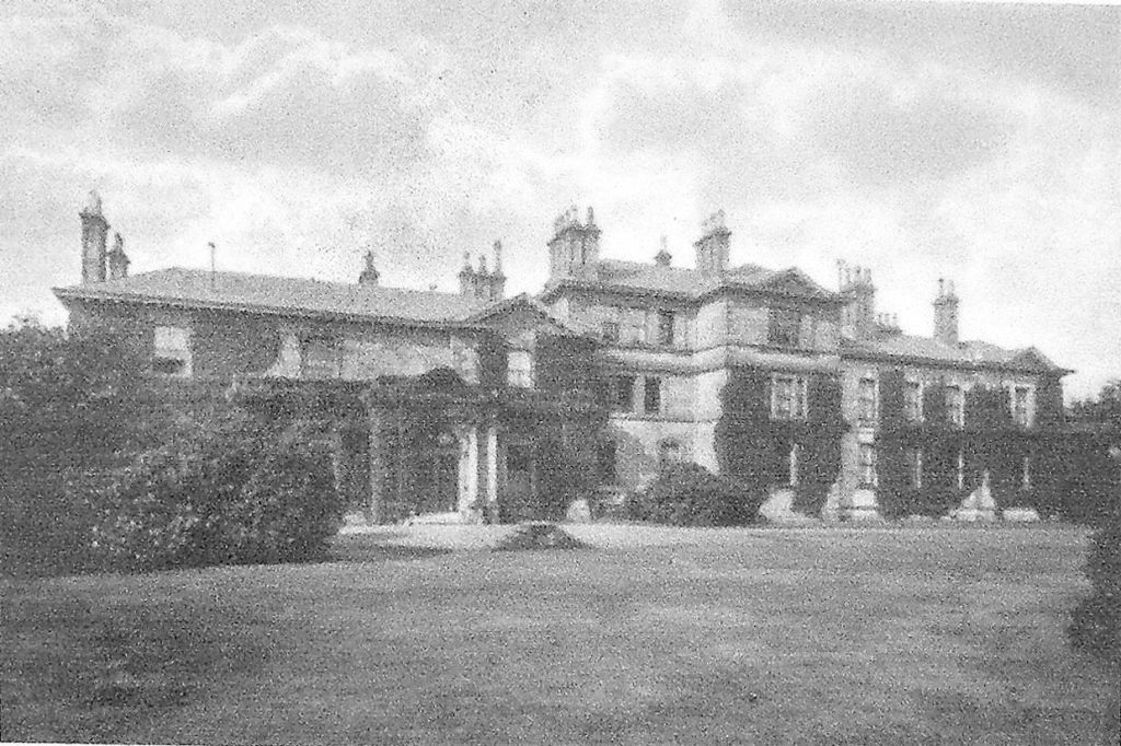
Beechwood, built by Thomas Ridgway and home of the Dewhurst family for many years. The former entrance to the estate is marked by the archway which still stands on Crouchley Lane. The photo is taken from the information board at the Lower Dam by The Cross.
The photo is taken from the Crosfield Bridge information board.
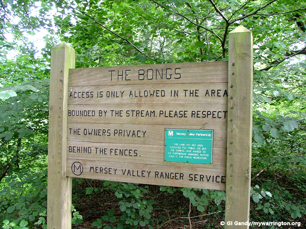
What is or are “The Bongs?”
This is a commonly asked question by first time visitors to Lymm Dam. The Bongs is the area of woodland south of the bridge (behind you as you read the information board) for half a mile. ‘Bongs’ is a mediaeval Cheshire dialect word (corrupted from ‘le bancs’) which means ‘wooded banks’.
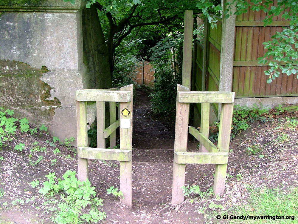
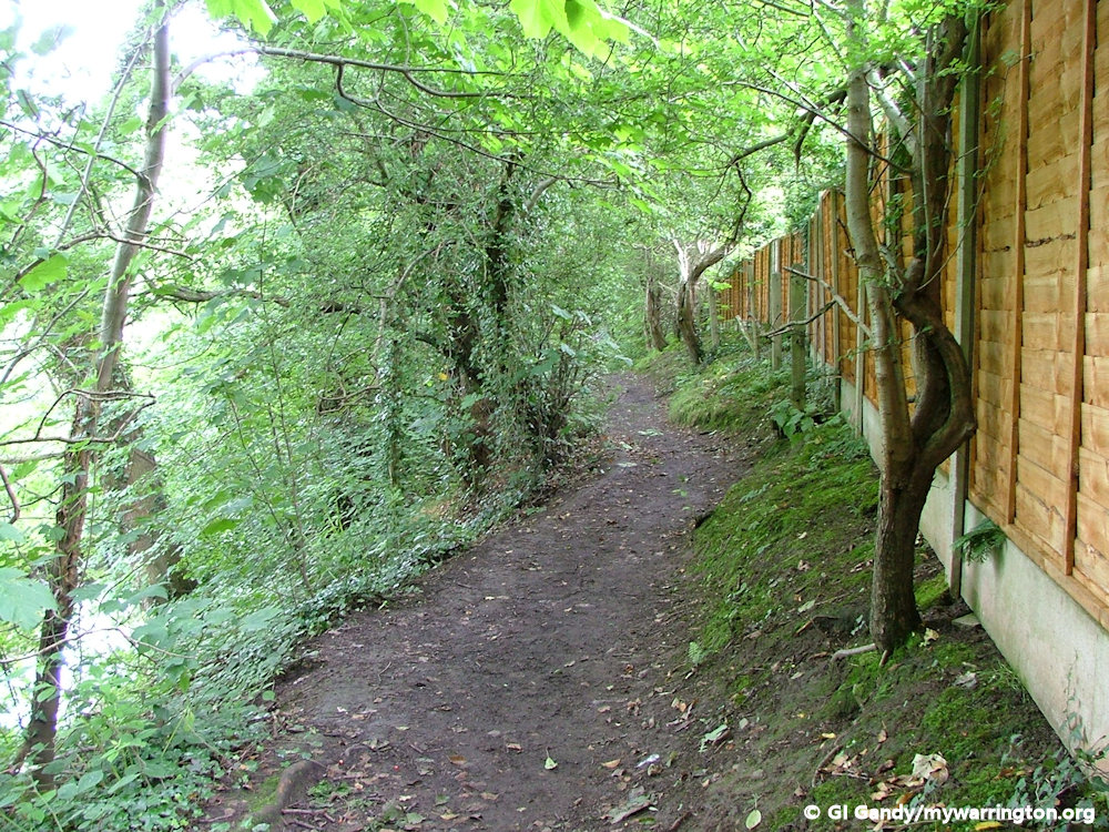
The Bongs is one of only a handful of areas of semi-ancient woodland in the Borough of Warrington (the phrase ‘semi-ancient’ means the woodland itself is older than the oldest trees in it). The wood is privately owned but a public footpath runs through it leading eventually to the A50 Warrington to Knutsford Road a mile south of here.
Bridge Repairs
Because Lever’s vision was unrealized, Crosfield Bridge has never been required to carry frequent regular traffic and as a result has not had any maintenance work carried out on to the structure. The bridge has now stood for over 100 years and has fallen into a state of considerable disrepair. The obvious deterioration which can be seen from the bridge deck runs throughout the structure. In 2001, Warrington Borough Council commissioned an engineer’s report into the full extent of the structural defects, together with recommendations for reinstatement work. Funding is currently being sought to carry out this work.
Crosfield Bridge in the early days
Church Life
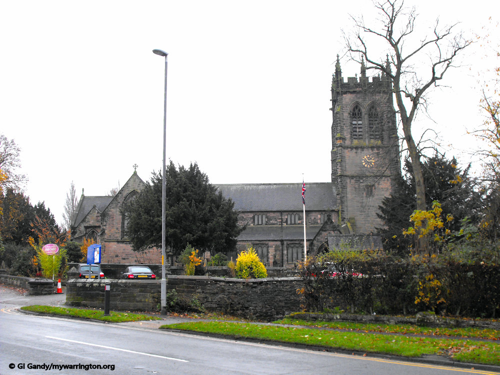
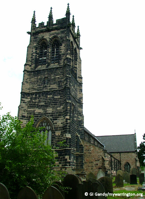
St Mary’s Church, Lymm
St Mary’s Church stands on a bank overlooking Lymm Dam. It is an Anglican parish church in the diocese of Chester, the archdeaconry of Chester and the deanery of Great Budworth. The church has been designated by English Heritage as a Grade II listed building.
The Domesday Book shows that a church was on the site in the 11th century. Since then it has been rebuilt a number of times. The present church was built in 1850–52 to a design by John Dobson of Newcastle. The nave and aisles from an older church dating from the 15th century were blown up with gunpowder prior to the rebuilding. Alterations and additions were made to the church between 1870 and 1872 by the Chester architect John Douglas, including an organ chamber and the reredos. The tower was replaced in 1887 by J. S. Crowther.
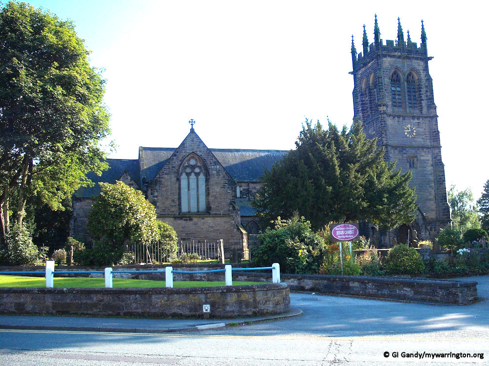
The church is built in buff sandstone. Its plan consists of a west tower, a five-bay nave with a clerestory, north and south aisles, a north porch, transepts, a chancel, and a vestry. The tower is in three stages with diagonal buttresses and an embattled top. Its west window is in Perpendicular style, and the bell-openings are paired with panel tracery.
The chancel has a panelled ceiling, and the transepts contain galleries. The plain pulpit is dated 1623. The stone sedilia and piscina are in Decorated style, dating from 1871–72, and were designed by John Douglas. The font is octagonal and dates probably from the 1660s. The church contains an ogee-headed tomb recess dating from about 1322 that has been moved from the older church. It contains a “supposed” Roman altar.
On the walls are two sgraffiti (singular sgraffito, sometimes spelt graffiti/graffito) one in the south aisle dated 1883, and the other in the north aisle, dated 1906. Sgraffito is a form of decoration made by scratching through a surface to reveal a lower layer of a contrasting colour, typically done in plaster or stucco on walls, or in slip on ceramics before firing (Oxford English Dictionary, from mid-18th century Italian, literally ‘scratched away’).
The stained glass in the west window is dated 1853 and is possibly by David Evans; the glass in the east window is from 1865. Three windows in the south aisle, dated 1851, are by William Wailes. One window in the north aisle, dating from 1897 is by Charles Eamer Kempe, and another, dating from about 1899, is probably by Shrigley and Hunt (Ltd).
Memorials in the church include one to John Leigh of Oughtrington Hall, who died in 1806, and his wife, who died in 1819. There are also two tablets by E. H. Baily in the south transept dedicated to members of the Fox family who died between 1830 and 1845 and a wooden memorial to William Domville of Lymm Hall, who died in 1686. Lymm’s parish registers, now housed at Cheshire Record Office, provide records of the inhabitants of Lymm since the Reformation, including notable local families such as the Booths.
Also in the church are 18th-century hatchments, and two churchwardens’ staves dating from the early 19th century. The pipe organ was built in 1858 by Forster and Andrews and rebuilt in 1944 by Jardine. The present electronic organ, built by the local organ-builder Hugh Banton, was installed in 2005. The ring consists of eight bells which were cast in 1891 by John Taylor and Company.
The churchyard contains the war graves of twelve service personnel, nine of World War I and three of World War II. A new £30,000 organ was unveiled at the church on 8 June 2005. Some information from Wikipedia.
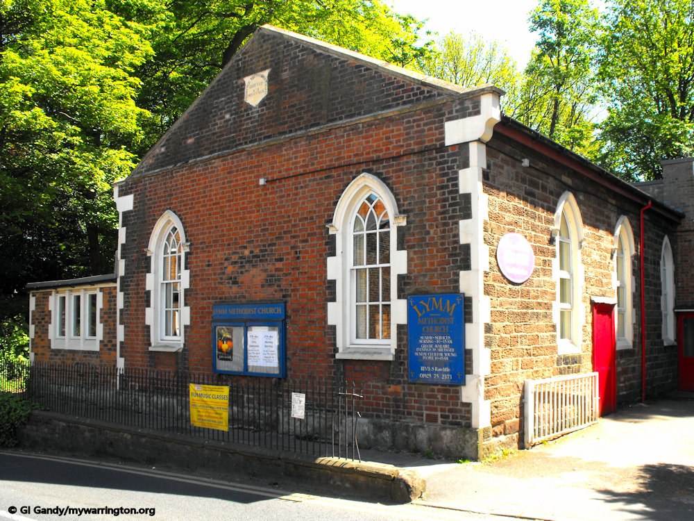
Lymm Baptist Church
According to the Baptist Handbook Lymm Baptist Church was founded in 1850, but its roots are to be found 100 years earlier at Millington, some four miles from Lymm. The land for the Millington Chapel was purchased in 1756 and the chapel was built in 1759. However, it is believed that a group of Baptists had been worshipping together at least 12 years earlier, perhaps in a farmhouse nearby.
The land on which the church was built was paid for by Thomas Ridgway, a tea merchant who was born in the village in 1802. You can still buy Ridgway tea today though it is now part of the Typhoo group. Read more at The Lymm Archive.

The church on Higher Lane 6 September 2024.
Lymm Independent Methodist Church
The Cherry Lane church started out as Sion Independent Methodist Chapel in 1801.
The current building dates back to 1849.
Lymm Wesleyan Methodist Chapel
The church was founded in 1809 on New Road, Lymm. It was rebuilt in 1879, closed in 1968 and demolished some time after. There is a photo of the now-demolished building on the Lymm Digital Archive (Lydia) website.
Lymm Strict Baptist Church
The Strict Baptist Chapel opened on Cherry Lane on 14 September 1819. The building is now used for a commercial business. There is a photo of the building on the Lydia website.
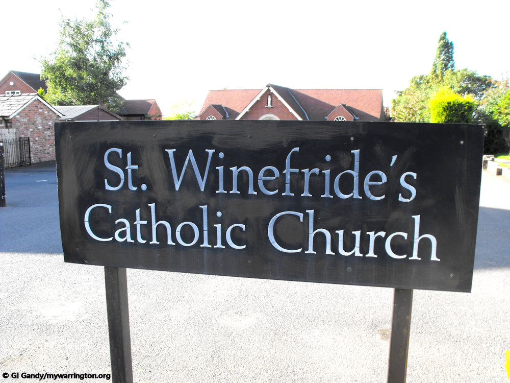
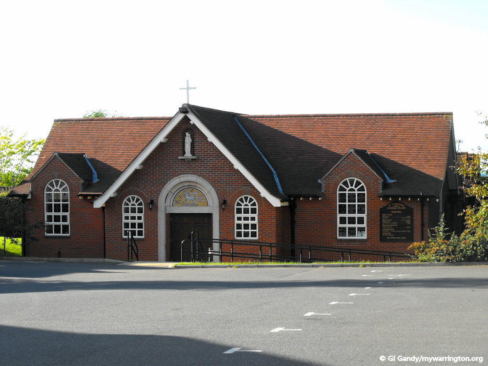
St Winefride’s RC Church
Mass has been said in the Lymm area since 10 February 1856.
Land was purchased in 1905 for the construction of the current church on Booths Hill Road, which opened on 19 November 1933. Since then it has been extended twice and now seats 200 people.
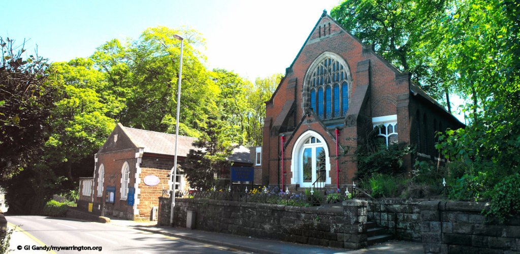
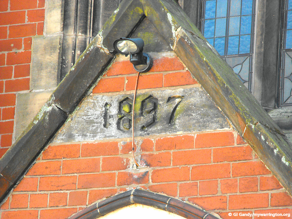
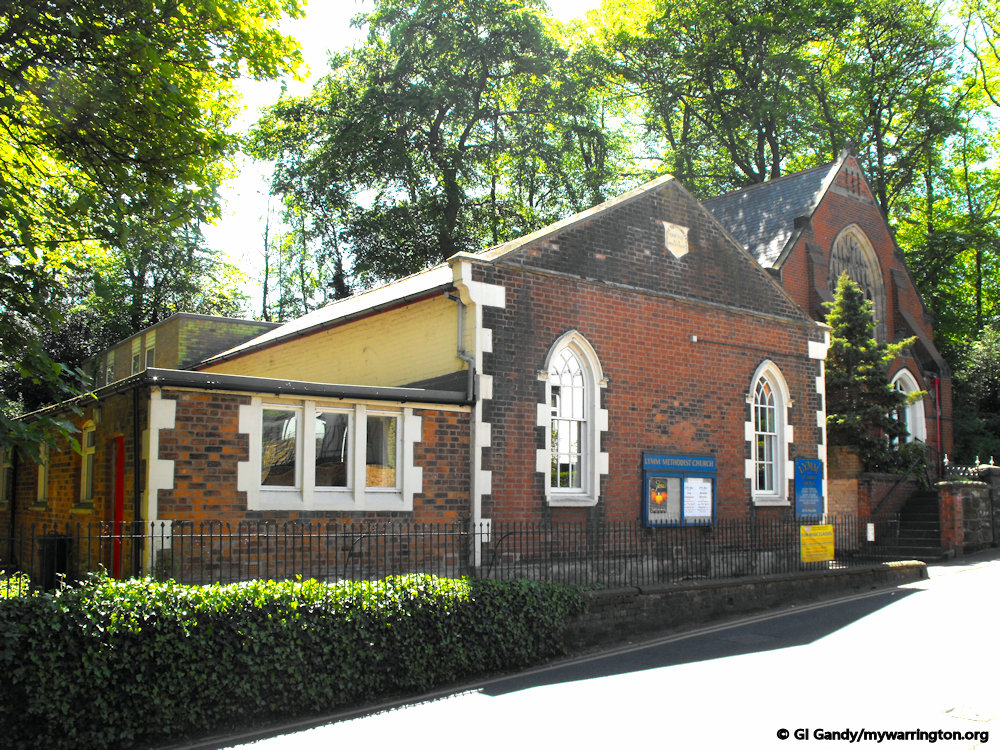
Lymm Methodist Church
Lymm Methodist Church is on Eagle Brow and is part of the Sankey Valley Methodist Circuit, in the Liverpool Methodist District. The former Primitive Methodist Chapel opened in 1849 and now serves as the church hall for the Methodist Church. The current main church building dates to 1897.
Life Church, Lymm
Life Church Warrington is a network of 5 churches that meet across the town of Warrington. Week to week they meet and serve in their various locations, but also enjoy the benefit of being connected to the wider church across the town. It meets in Lymm Methodist Church every Sunday at 5pm.
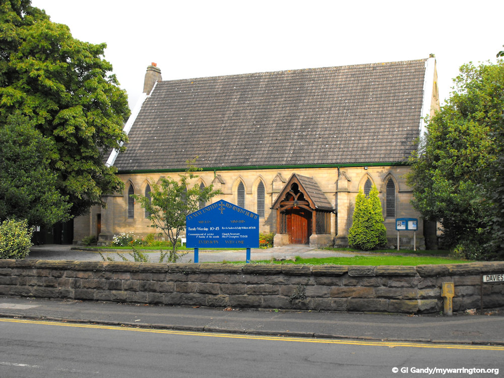
Lymm United Reformed Church
Lymm United Reformed Church was built in 1863 on the banks of the Bridgewater Canal at the heart of the village. Their website tells us some history of the United reformed Church.
In 1517 Martin Luther launched a movement of challenge in the Church that is called the Protestant Reformation. Changes came quickly. Bibles were translated and printed in languages everybody used (not just in Latin).
The creation of the United Reformed Church in 1972 formally merged the Presbyterian Church of England and the Congregational Church in England and Wales.
The denomination expanded when Churches of Christ joined it in 1981, followed by Scottish Congregationalists in 2000.
Link to the Lymm fellowship’s website.
St Peter’s Church, Oughtrington
The parish church of St Peter’s Church on Oughtrington Lane is an example of Gothic Revival architecture. It was built between 1871 and 1872 at the expense of C. G. Dewhurst, the architects being Slater and Carpenter, and opened on 29 June 1872, St Peter’s Day.
The church is recorded in the National Heritage List for England as a designated Grade II listed building. It is an active Anglican parish church in the diocese of Chester, the archdeaconry of Macclesfield and the deanery of Bowdon. Its benefice is combined with that of St Werburgh, Warburton.
The church was built in 1871–72 Initially a chapel of ease in the parish of St Mary’s Church, Lymm; it became a separate parish in 1881. In 1932 a Lady Chapel was created in the north aisle.
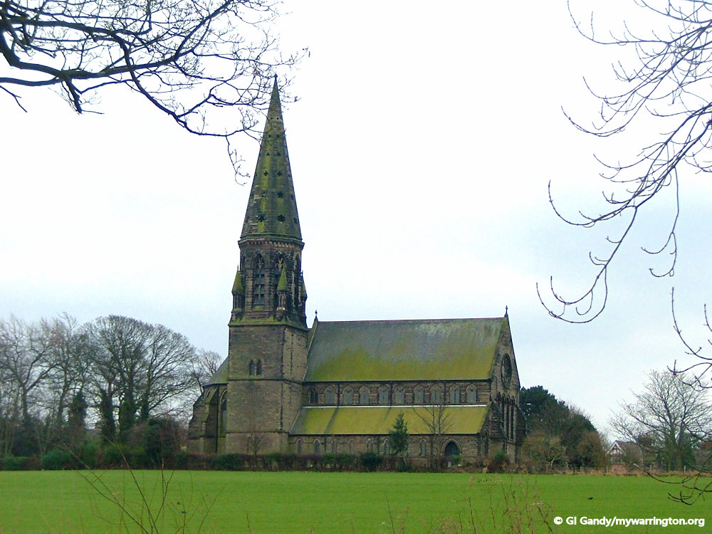
The church is built in grey sandstone with a grey slate roof. Its plan consists of a five-bay nave with a clerestory, north and south aisles, an apsidal chancel, a south vestry, a south porch and a northeast tower with a spire. At the west end is a rose window above four lancet windows. The tower has a square base over which is an octagonal belfry surrounded by pinnacles, and a stone spire.
The stained glass in the apse, dated 1894, and in one of the windows in the south aisle is by Kempe, and the stained glass in the windows at the west end, dated 1907, is by A. K. Nicholson.
The churchyard contains the war grave of a soldier of World War I. From Wikipedia.org
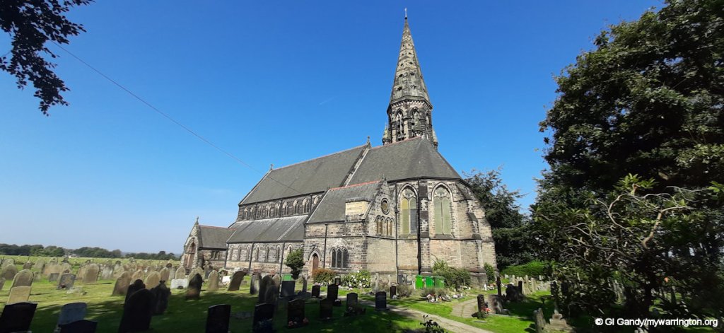
St Peter’s Church on 6 September 2024
Lymm Rushbearing Festival
Rushbearing is an old English ecclesiastical festival in which rushes are collected and carried to be strewn on the floor of the parish church. In the days when churches had cold earth floors, the annual renewal of rushes on the floor for cleanliness and warmth became an occasion for celebration.
The festival was widespread in Britain from the Middle Ages but had fallen into decline by the beginning of the 19th century, as church floors were flagged with stone. The parish church is dedicated to St Mary, so the festival is held near her feast-day of 15 August each year. George Ormerod, in the 1882 edition of his “History of the County Palatine and City of Chester”, writes the following:
The festival of Lymm Wakes featuring the Rushbearing ceremony was at use in the village in 1817, and that the cart of rushes was preceded by male and female Morris Dancers, who performed at each house and were attended by a man in female attire who rang a bell and held out a large wooden ladle to collect donations of money. The dancer in “female attire”, known as “Maid Marian” or the “Old Fool” was the leader of the troupe and in charge of the dancers.
Read more at the following websites: thelwallmorris.org.uk, ctld-lymm.uk and calendarcustoms.com.
Lymm May Queen Festival
Lymm May Queen is a traditional family highlight in the village calendar. Originally known as Lymm & Oughtrington Bank of Hope Festival, the first ever crowning was held in 1889. At that time the Queen was chosen from various chapels in turn. The very first Queen was Miss Amy Astley from the Congregational Church.
The 2024 event took place on 18th May with the procession starting at 12 noon leading up to the festival on the Henry Street and Davies Way car parks.
The procession consisted of floats, bands, drummers, dancing, vintage vehicles and many local schools and organisations taking part. With children’s rides, a variety of live acts in the May Queen arena, stalls and food & drink it was another successful day for everyone to enjoy.
To read more about the history event, see the Lymm May Queen website. You can also download the 2024 programme which includes a list of all the May Queens and Rose Queens from the event’s history.
Lymm Dickensian Festival
Lymm Dickensian Festival was started in 1985 by the late Monica Spence. Lymm Dickensian, as it is sometimes shortened to, is organised and run by a small group of dedicated and hard-working volunteers, with support from the local council and traders.
The Victorian festival attracts thousands of visitors to the village, who come for the warm and friendly atmosphere.
Each year there are a great variety of stalls and displays and the event continues to attract new stalls and entertainment.
The 2024 event will take place on Saturday, 14th December 2024 from 11.00 am – 5.00 pm.
The event is supported financially by Lymm Parish Council, Warrington Borough Council, local traders, schools, societies and volunteers from the local community on the day.
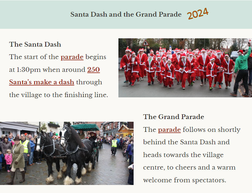
Image from lymmdickensian.org
Lymm Festival
The first Lymm Festival took place in 1999. It has grown over the years and now spans eleven days each June and can involve 50 or more events, and it is as true to its original aims as it was when it started.
Highlights for 2024 included an evening focused on “The Music The Beatles Gave Away”, with veteran BBC rock music presenter “Whispering” Bob Harris, ably assisted by music journalist Colin Hall.
As usual, the first event of the festival was the Foodfest. The village came alive with stalls from local restaurants and street traders, together with street entertainment, and got everyone in the mood for what was to come.
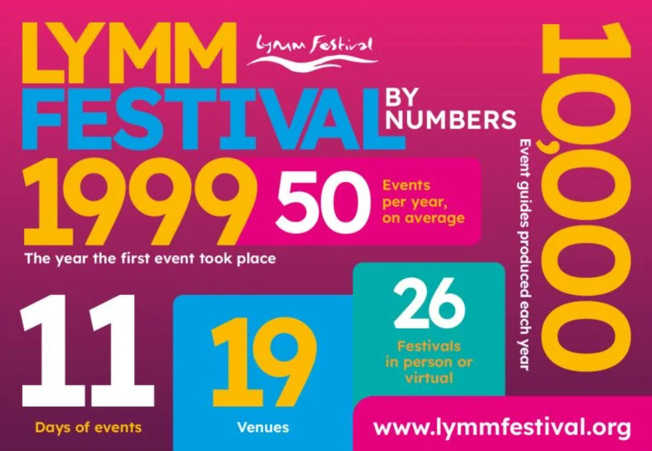
Another favourite event is Lymm Historic Transport Day which in 2024 opened with an eclectic vehicle parade (cars, vans, motorbikes, steam engines and more) through the village, followed by a full day of exhibits and activities on the May Queen Field.
By the Canalside you could see old working canal boats and a sail past , while on Henry Street Car Park there was a fantastic array of steam traction engines.
Music lovers enjoyed Festival Folk, Blues and Jazz nights including the Festival Music Night featuring, in 2024, long-established covers band Touch the Pearl.
Sports lovers could enjoy open days for bowls and tennis – plus the newly-formed Lymm Chess Club. And there were art and photographic exhibitions to enjoy as well!
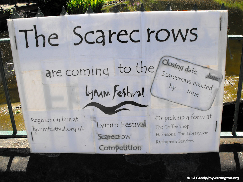
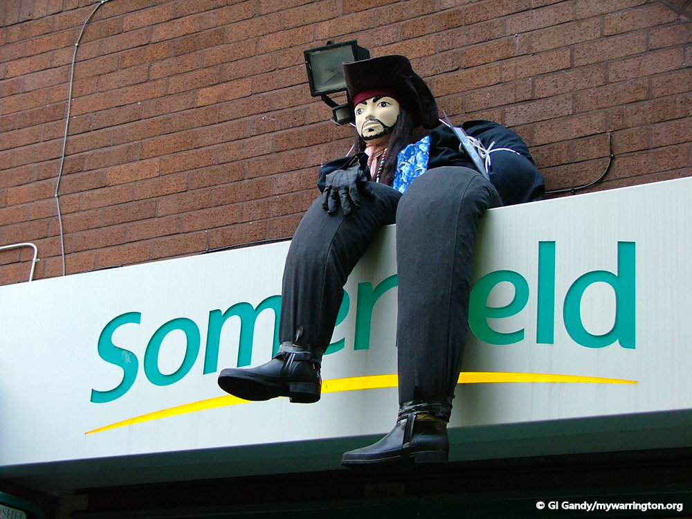
And no Lymm Festival would be complete without the famous Scarecrow Trail – themed this year on Transport and Travellers!
Report from Warrington Worldwide.
See also Lymm Festival website.
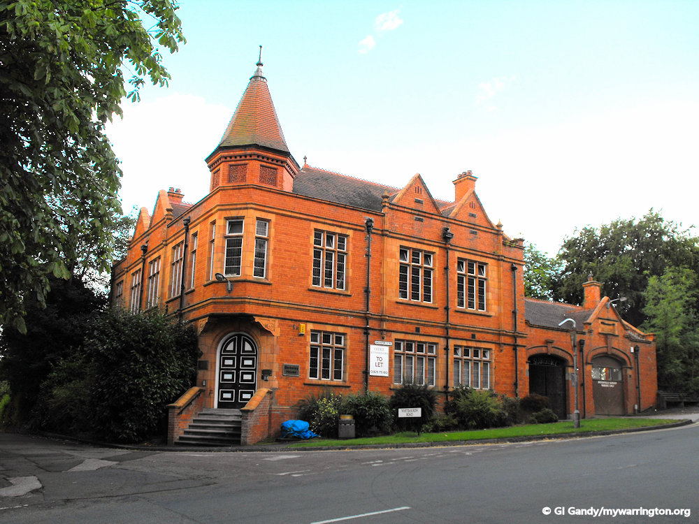
Lymm Hotel
THE Lymm Hotel on Whitbarrow Road served its last customers on 30 June 2019.
A statement on its website, which has now been taken down, said: “We would like to thank all our valued guests for their continued support.”
It became famous during the 1966 Football World Cup when it was the base for the Brazilian national team, featuring the late star player Pele. Read more about when Pele stayed in Lymm at the Warrington Guardian.
Locally the hotel acted as the starting point for village celebrations such as Lymm Dickensian Day.

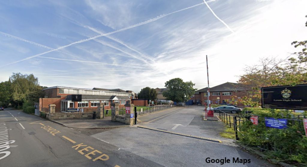
Lymm High School (Oughtrington Hall)
Lymm Grammar School was founded c. 1597 by Sir George Warburton and W. Domville; the original building was situated next to the Parish Church.
A new school was built in 1885 on land donated by G. C. Dewhurst in Grammar School Road and in the1940’s the governors authorised the purchase of Oughtrington Hall as an annexe to the Grammar School road site.
The school moved completely to the Oughtrington Hall site in 1955 and the Grammar School Road site became the Lymm County Secondary Modern School.
With the advent of Comprehensive Education, the two schools amalgamated on the Oughtrington site, becoming Lymm High School and the old Grammar School was demolished to make way for modern housing.
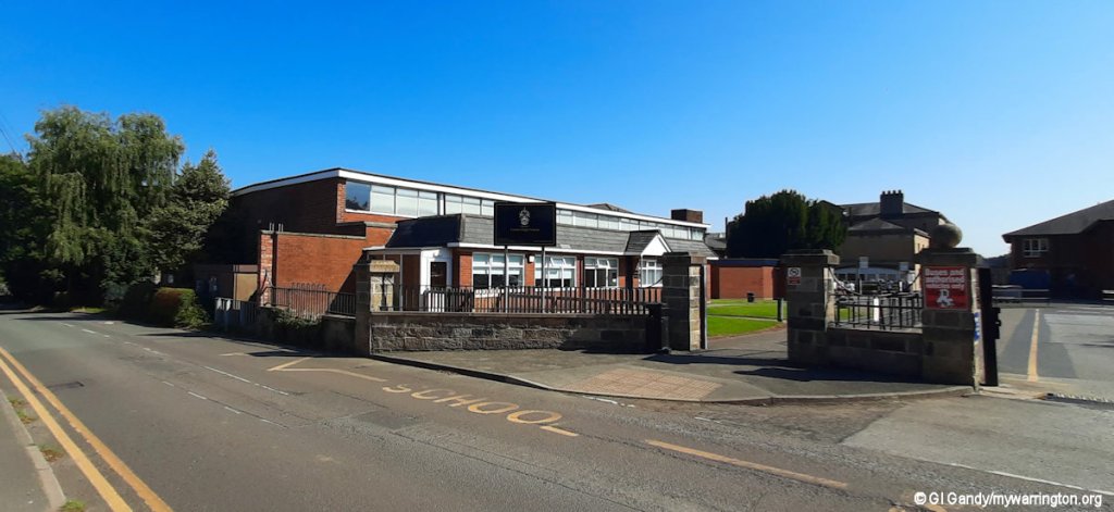
Information from Lymm Parish Council website, thanks to Joe Griffiths.
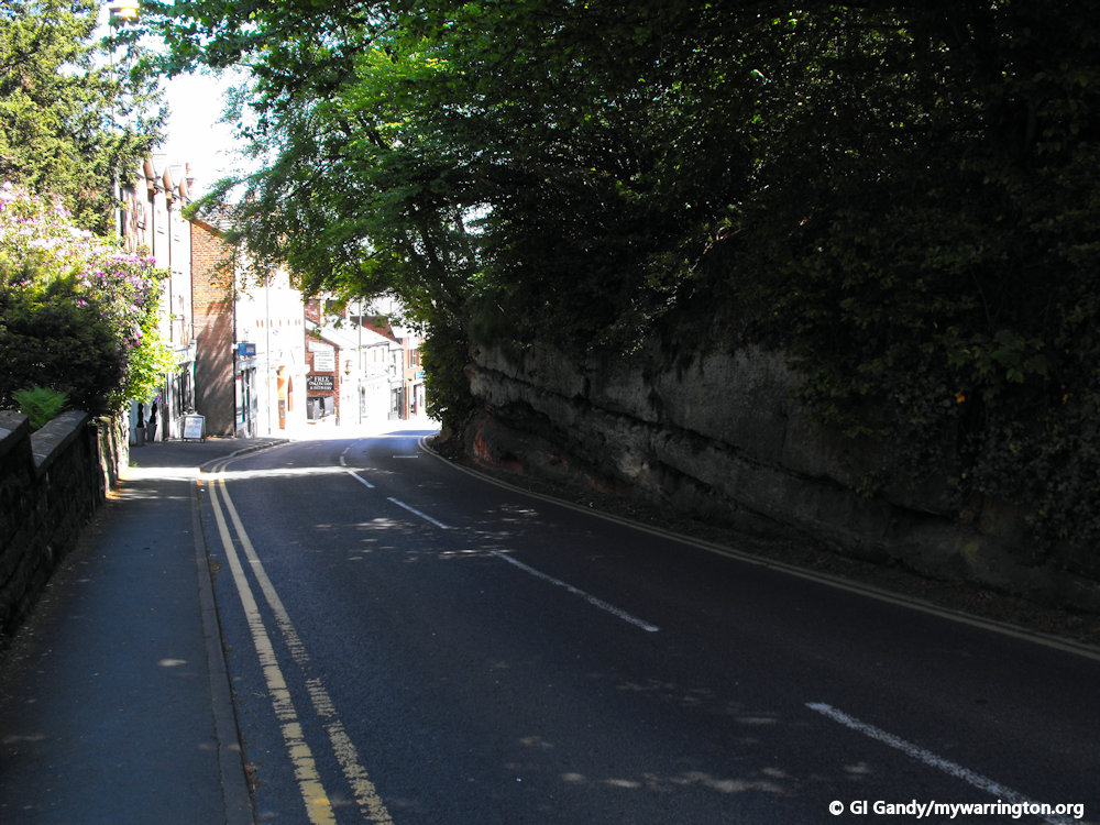
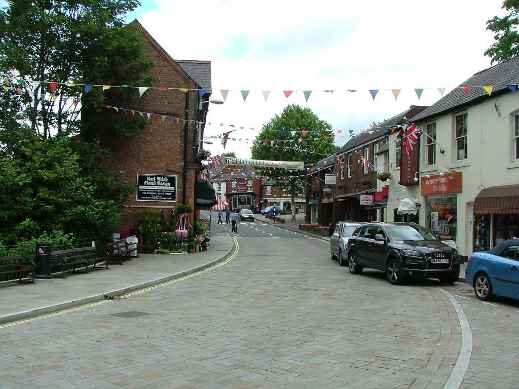
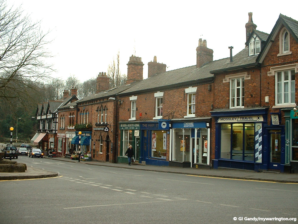
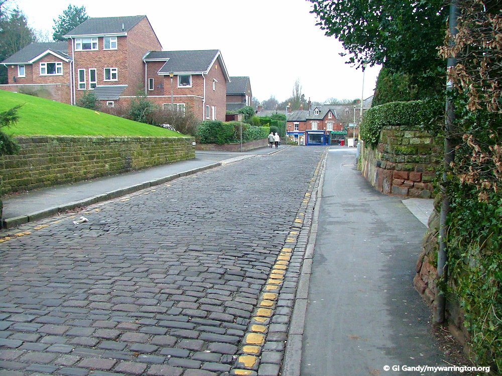
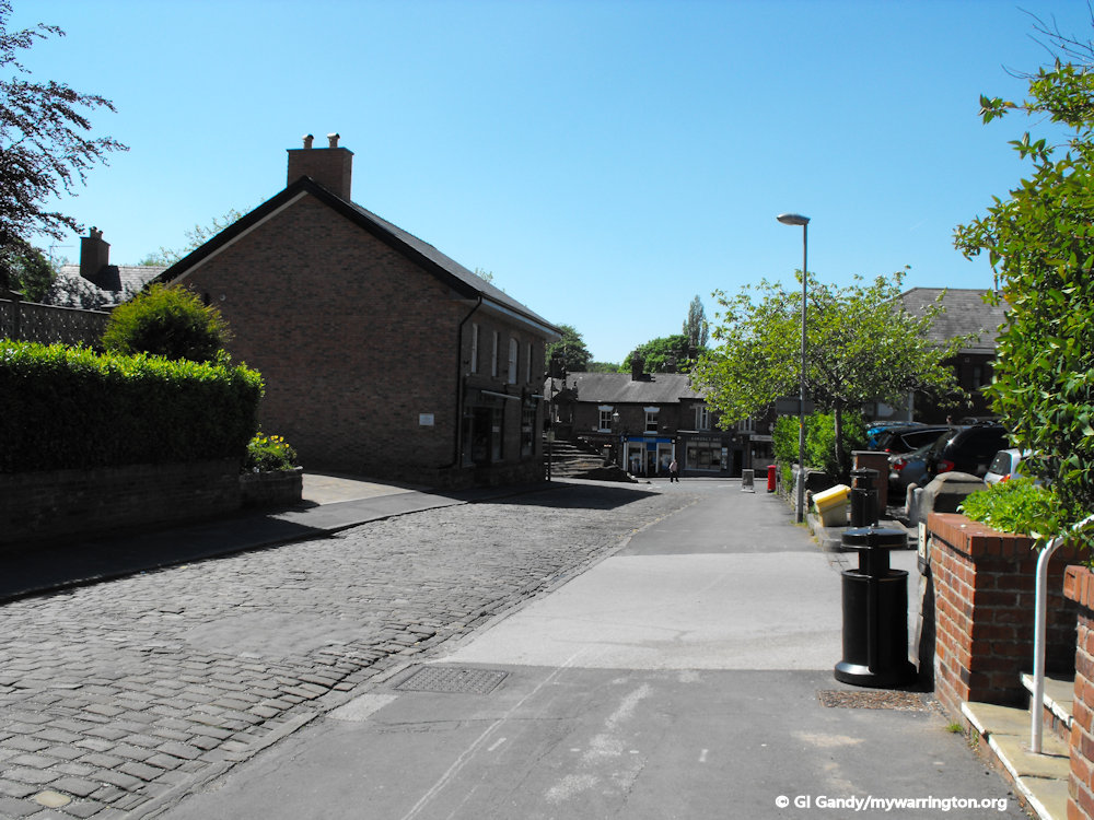
Around the Village
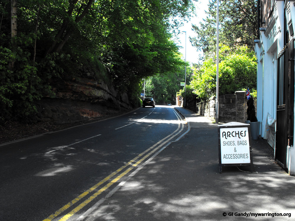
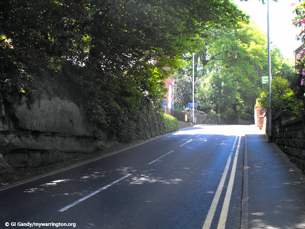
Let’s approach the village centre via Eagle Brow. Click the first image for a manual slideshow.

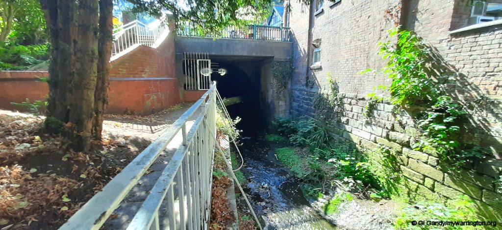
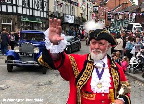
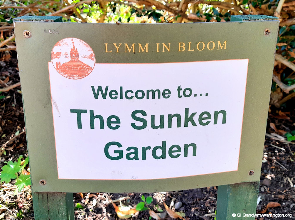
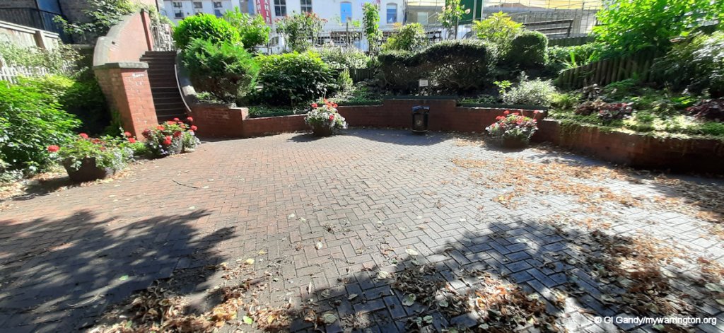
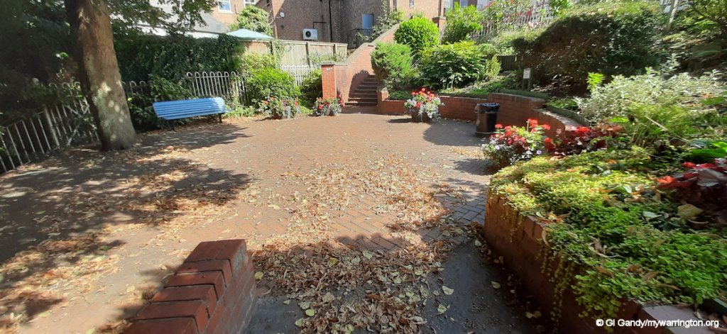
Peter Powell Memorial Garden
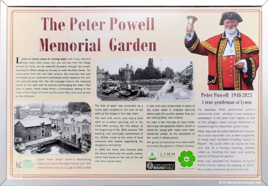
To the right of the Slitten Brook in the photo above is a new memorial garden dedicated to the memory of Lymm town crier Peter Powell, who passed away on 12 January 2023.
During his career, Peter, aged 74, travelled the world working for Japanese Tractor manufacturers Iseki, but always found time to return to Lymm to help lead events like Lymm Dickensian, Lymm May Queen, Lymm Transport Day, Lymm Duck Race and many more. He also travelled the world representing the village at Town Crier championships.
He was also Chair of the Lymm Clothing Charity for many years and worked behind the scenes on many community projects.
Read tributes at Warrington-Worldwide.
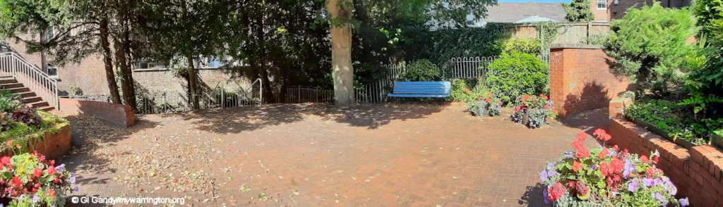
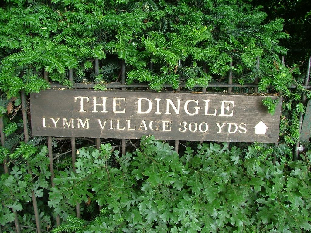
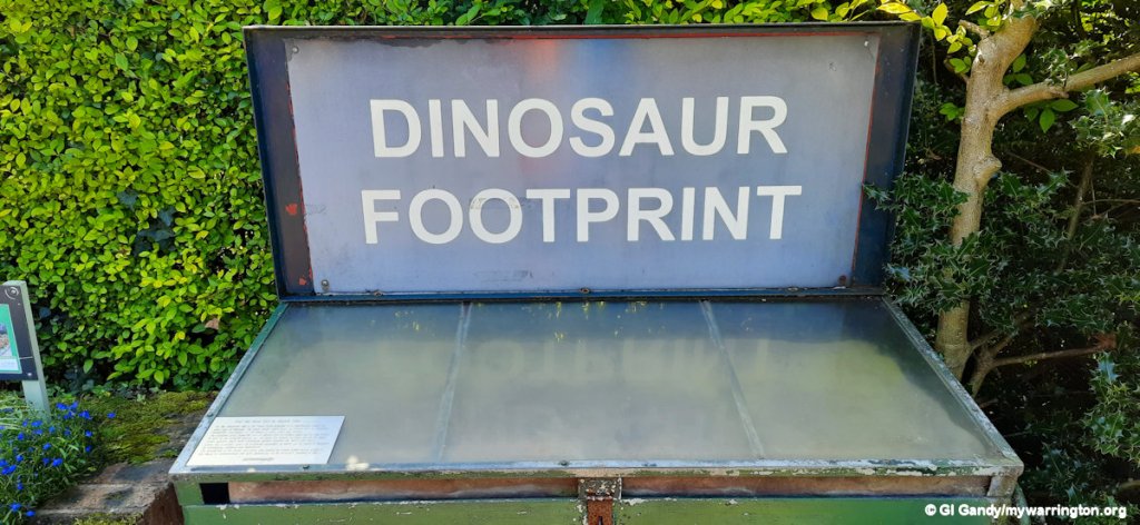
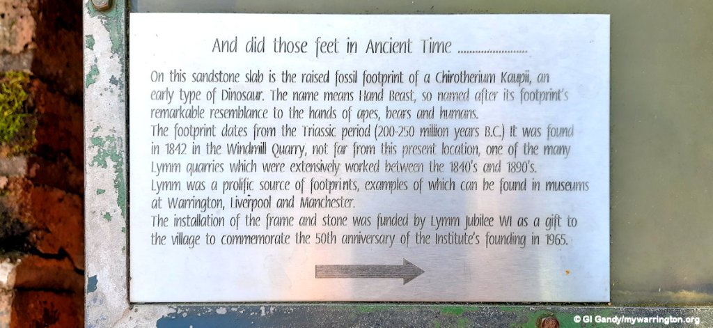
Further along we have The Grove, a short street alongside The Dingle pond. Here you can view the dinosaur footprint.
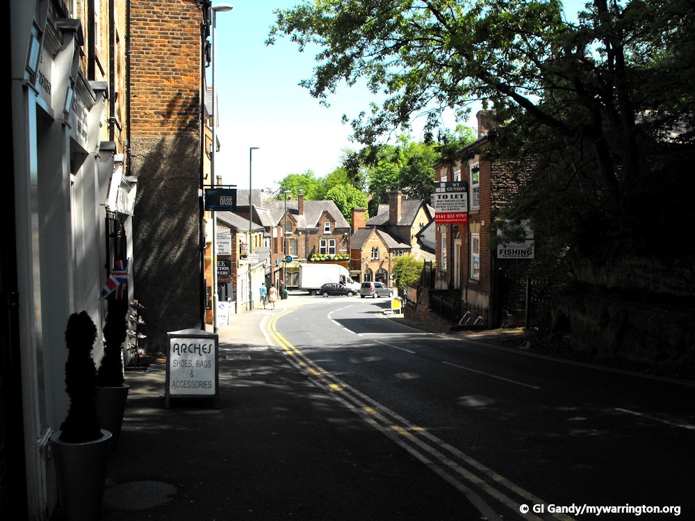
Moving round the corner we enter The Cross where more shops and services are available.
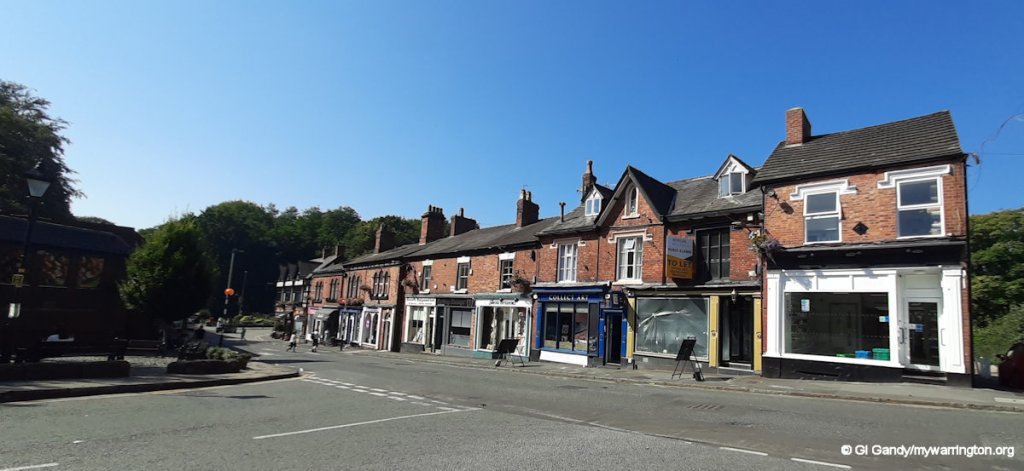
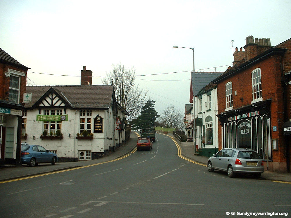
Onto Pepper Street now, passing Lymm Cross on the way.
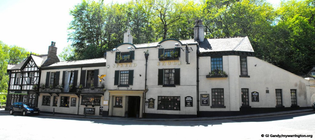
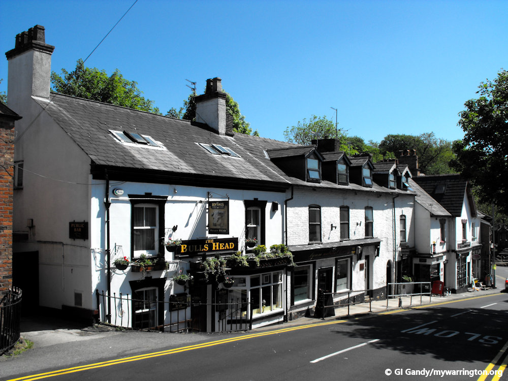
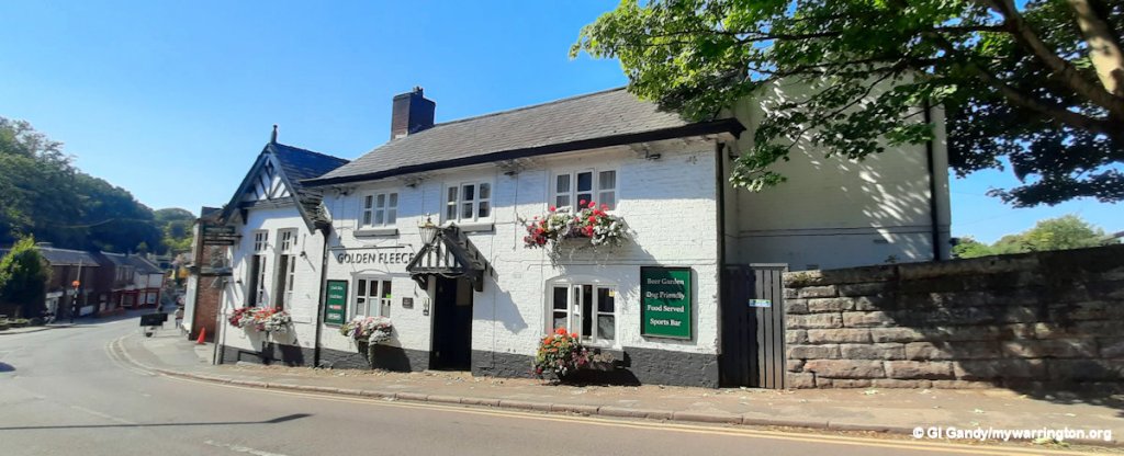
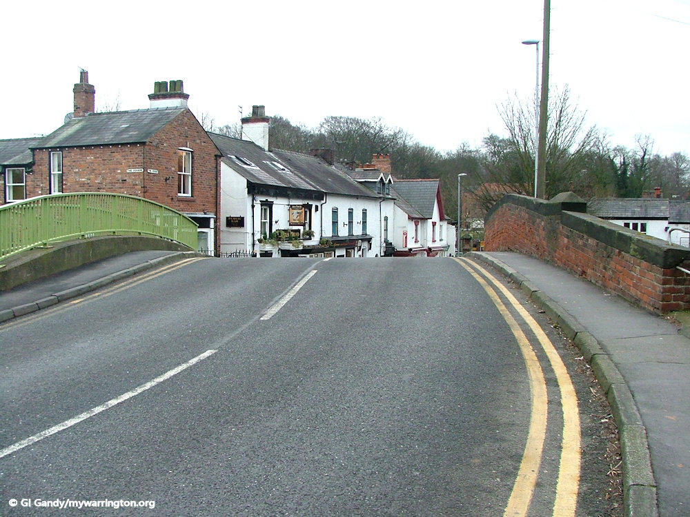
We continue now to the eastern end of the Cross and Lymm Bridge. The Bulls Head, Golden Fleece and the Spread Eagle Inn were all named on documents dated 1770, which means they have been part of the village for at least 250 years.
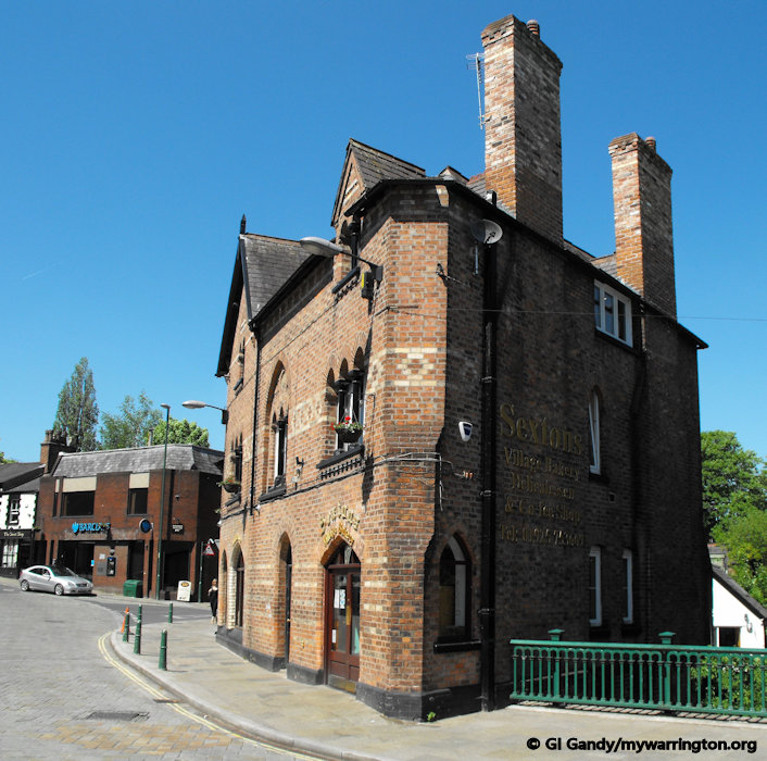
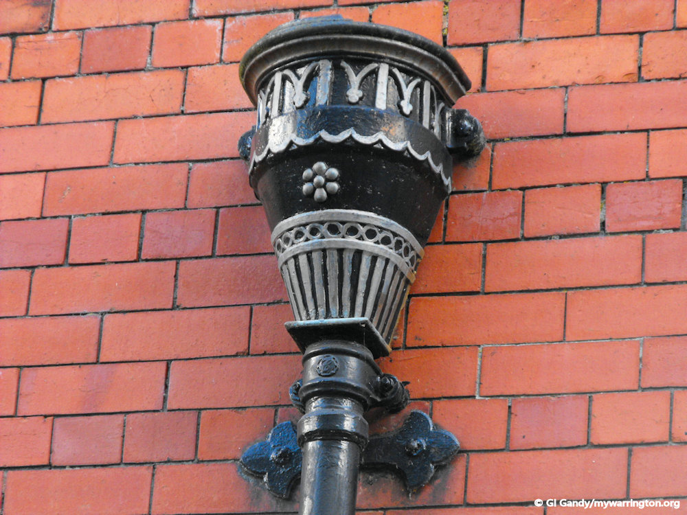
The police station is shown on the late-19th century map. It is still in the same location on Dane Bank Road, but now administered by Cheshire Constabulary.
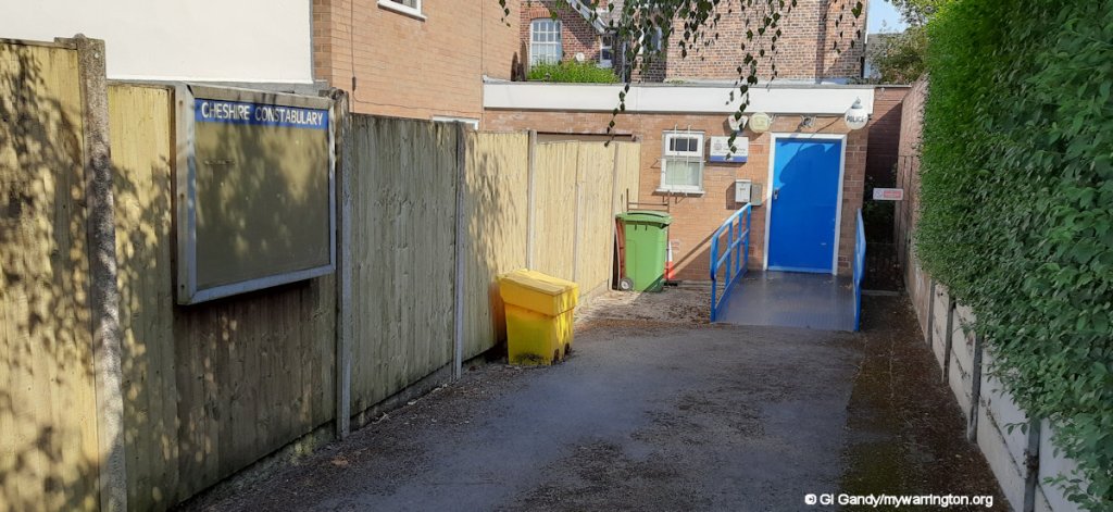
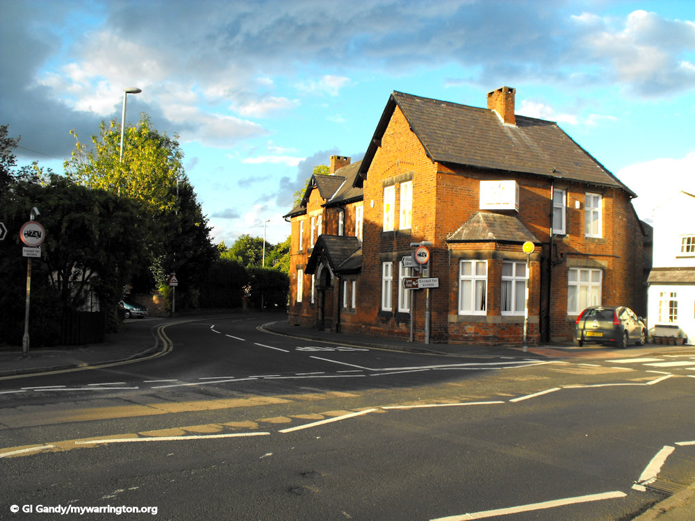
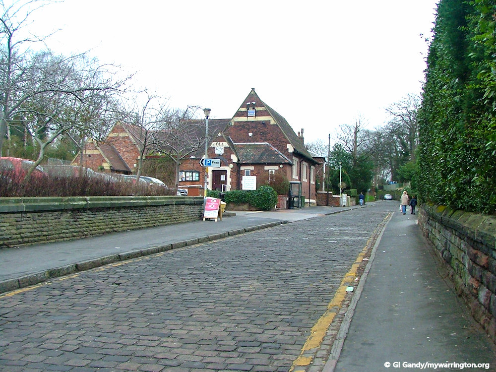
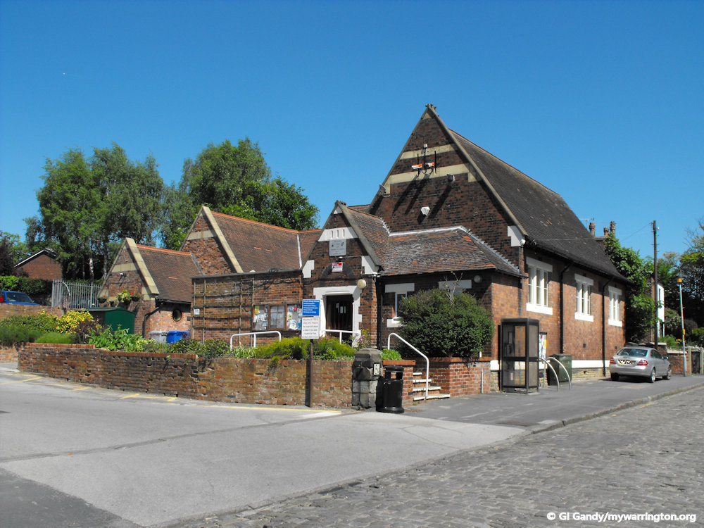
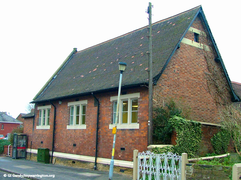
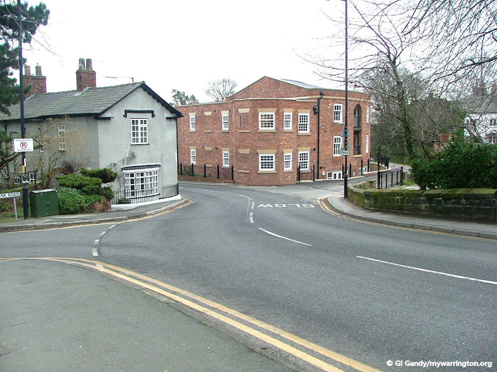
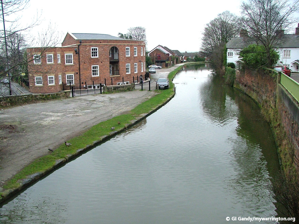
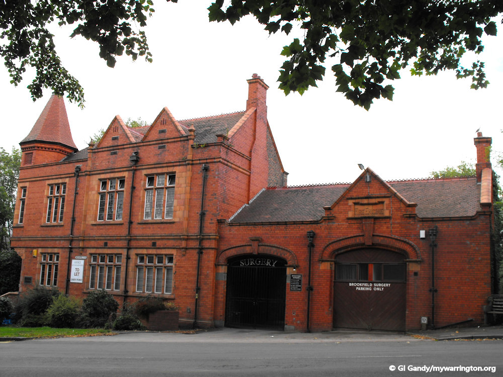
Back in time for our next walk along the Bridgewater Canal to the old fire station. Lymm Urban District Council occupied the main part of the building on the left as we look, with the fire station being on the right. The council was created in 1894 and ran until the boundary changes in 1974 when the Parish Council took over. There is a story in the archives saying that in the days of horse-drawn fire engines there was a reward to the first horse driver who got to the fire first. The building is now used as Brookfield Surgery.

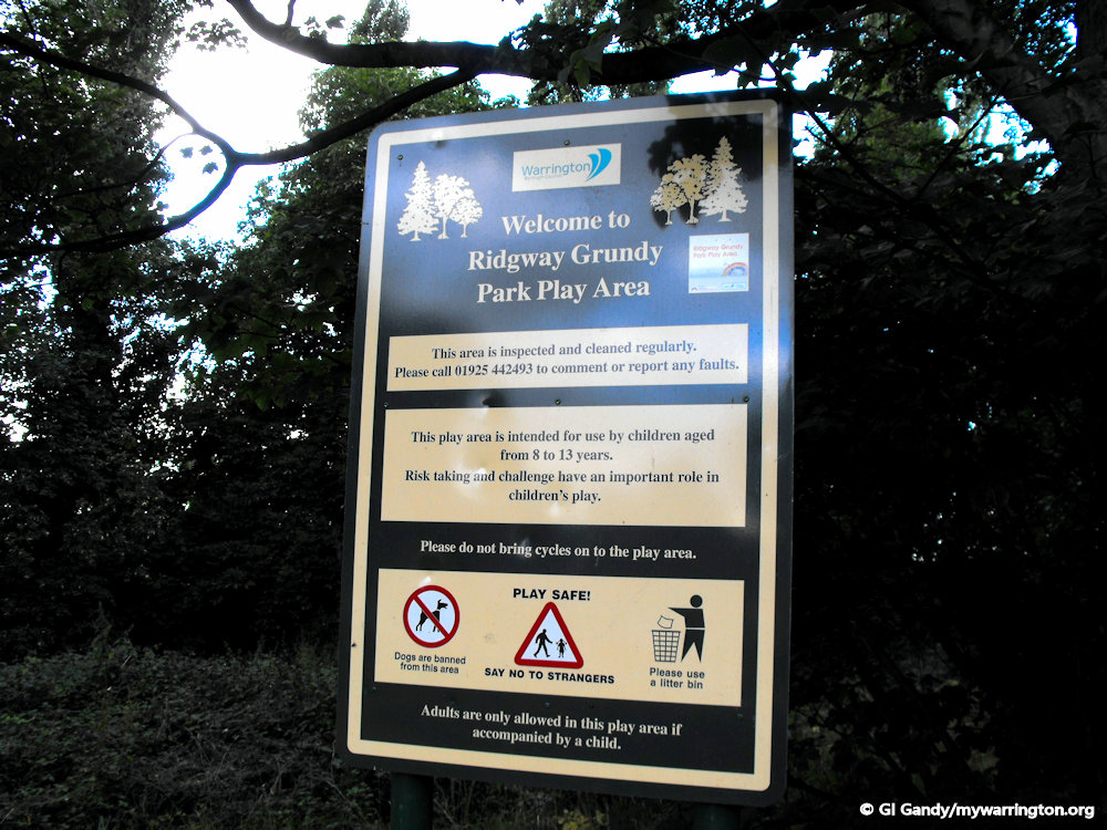
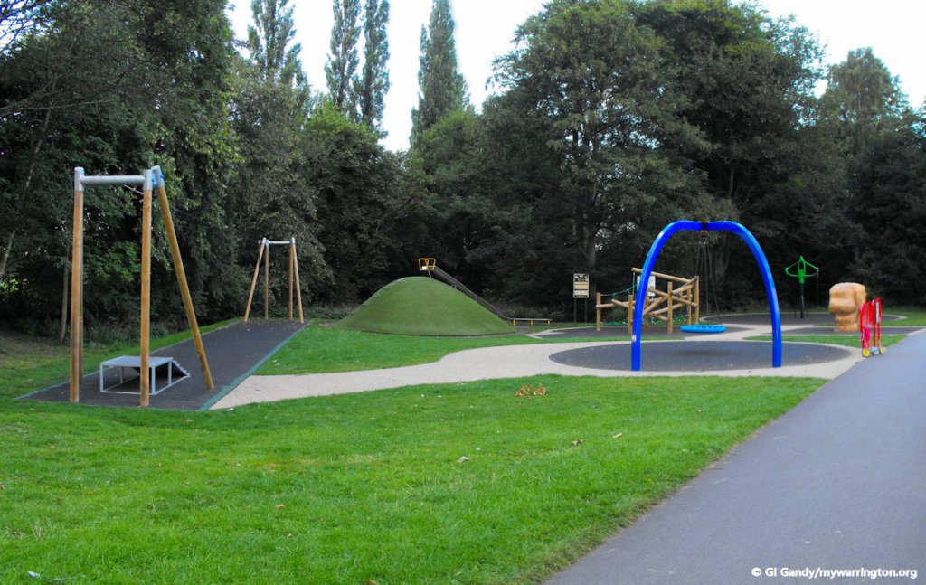
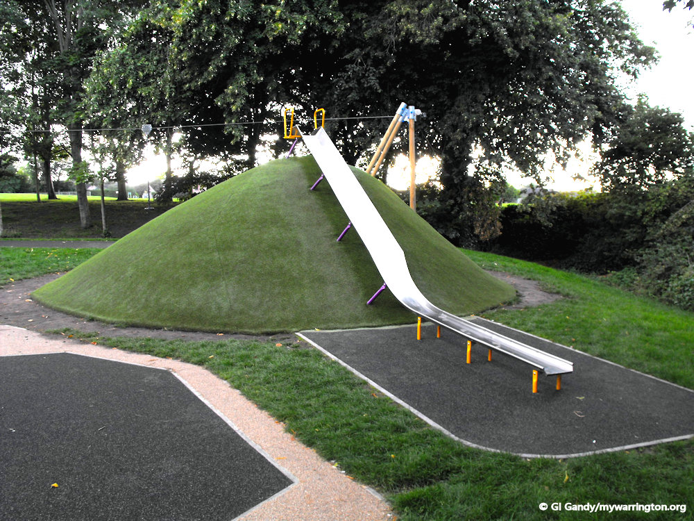
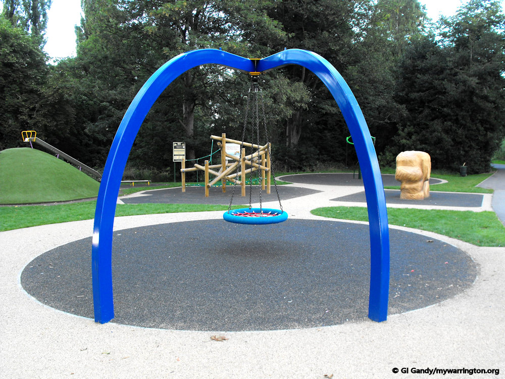
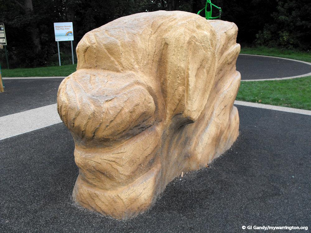
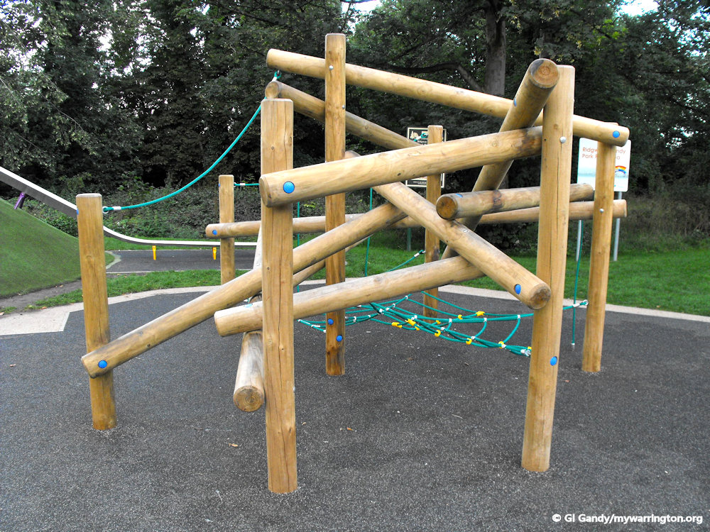
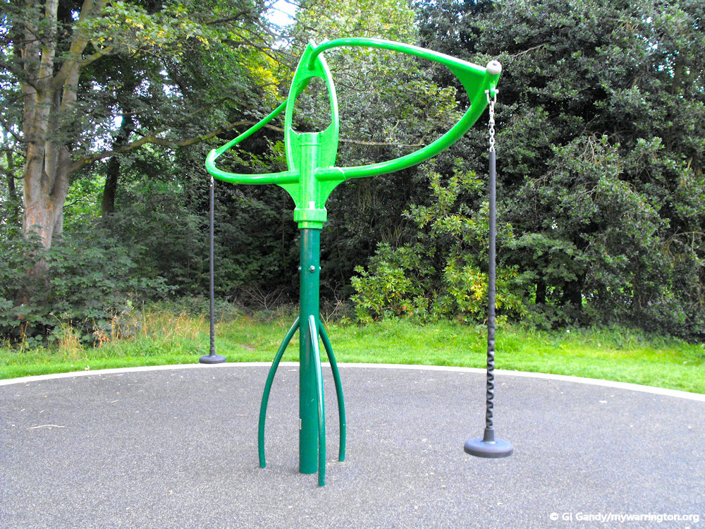
Ridgway Grundy Memorial Park is located between the A56 and the Bridgewater Canal.
If you watched the Paris 24 Olympics and Paralympics, you might be inspired to practice your skills on a skatepark. Well, at Ridgway Grundy you can do just that. You never know, we might be seeing you at Los Angeles in 2028.
So who are the Ridgways and the Grundys? We learned earlier that Thomas Ridgway was a tea merchant. He opened branches in Birmingham and London. Thomas Grundy was the owner of Brookfield House on Church Road. He donated the building for use as a hospital for the duration of the First World War.
The park was used for the Lymm May Queen festival after the end of the First World War. The Ridgway and Grundy families were linked together for generations – they were both in the legal profession.
My thanks to Alan Williams at Lymm Heritage Centre for helping to locate information on the two families. Read a report of inter-marriage between the families in the photo, right.
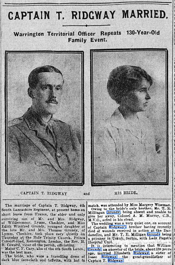
Thanks again to Alan for the newspaper article.

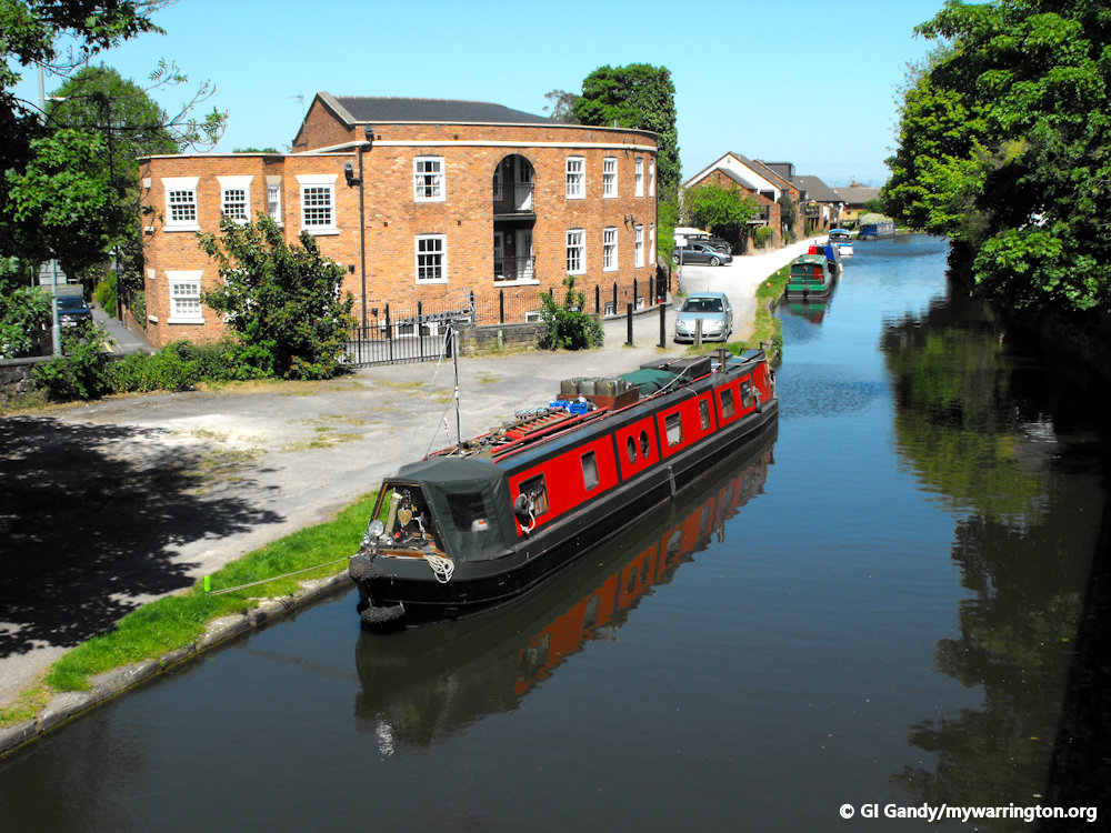
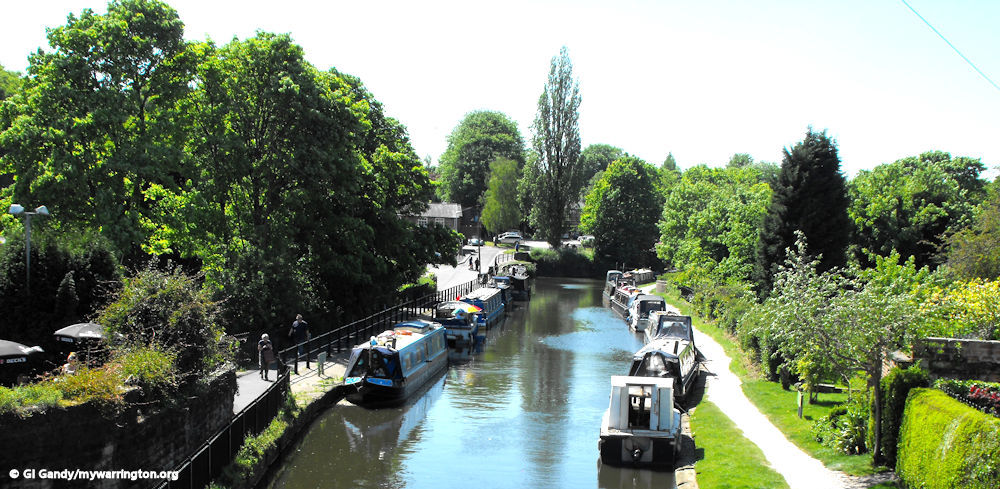
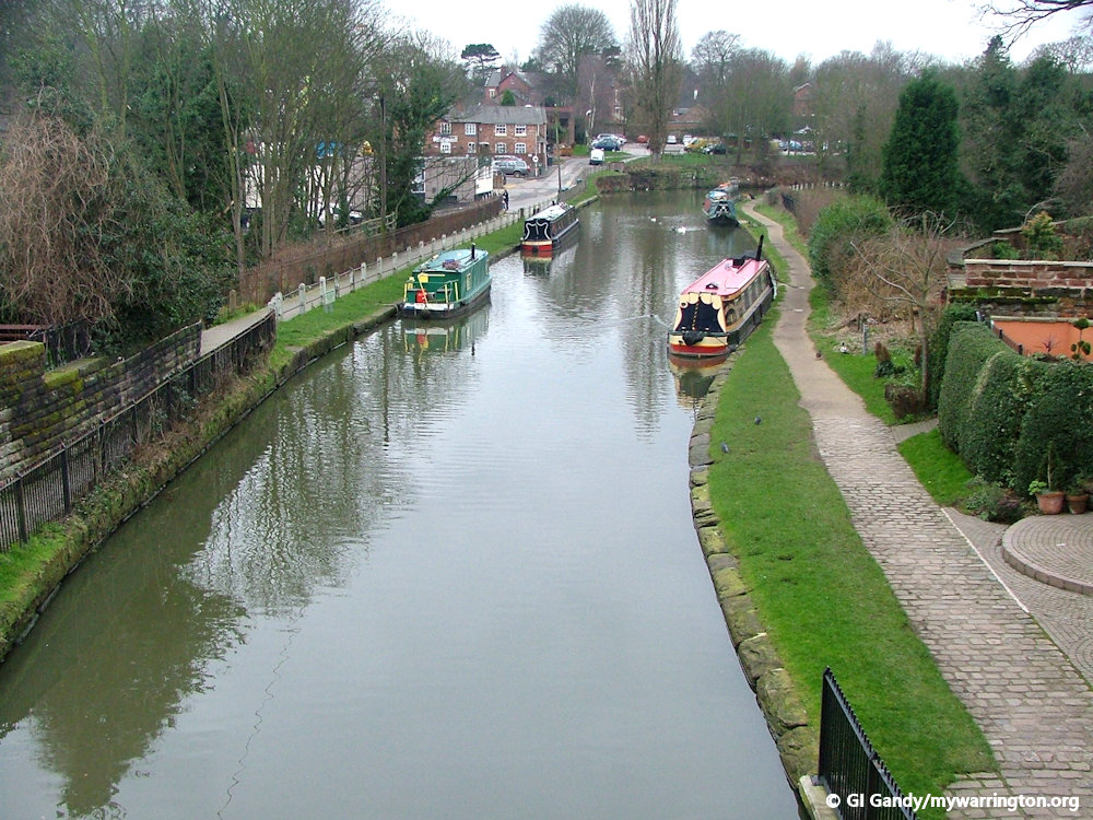
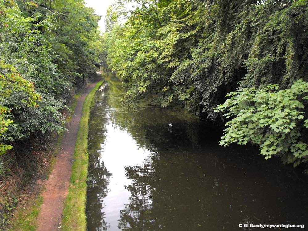
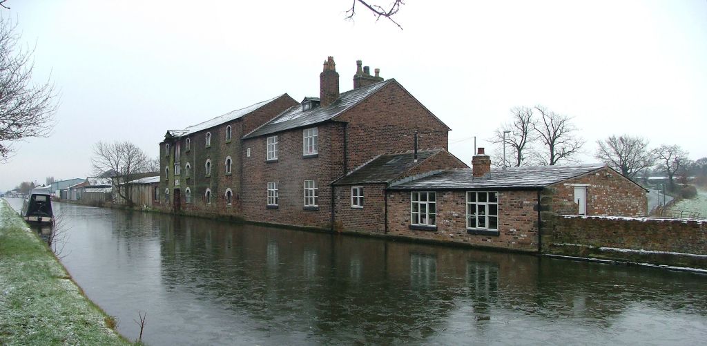
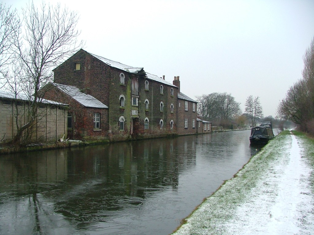
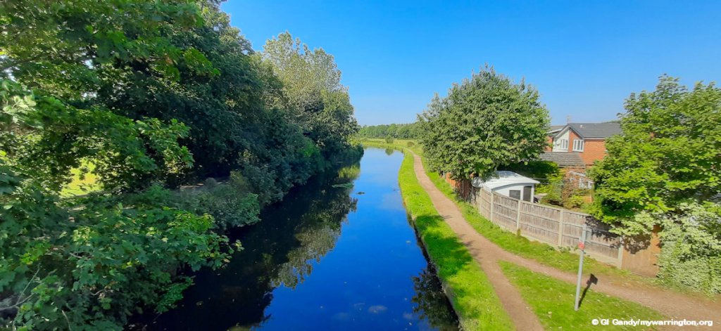
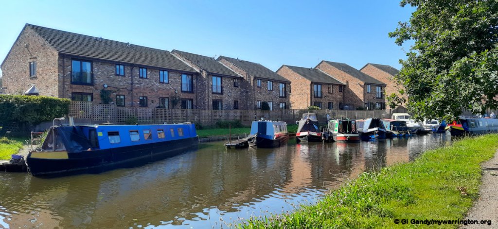
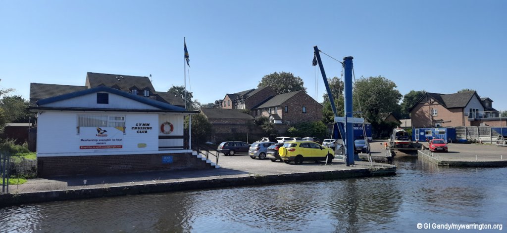
As we are near the Bridgewater Canal, let’s take a walk along it.
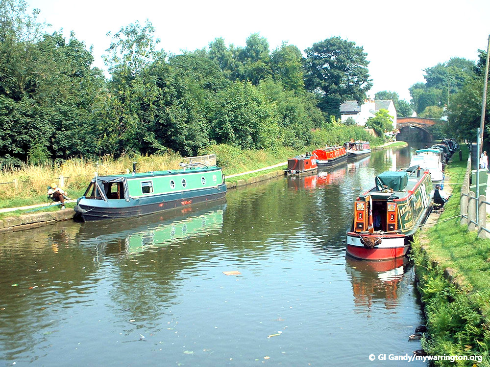
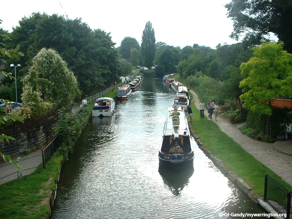
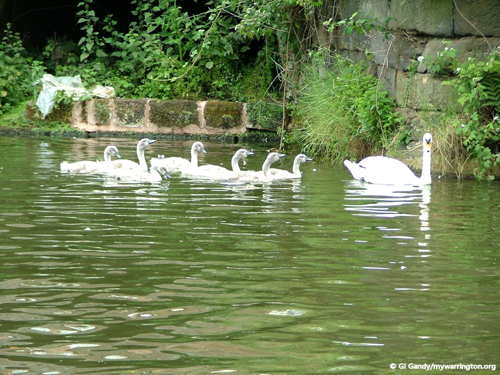
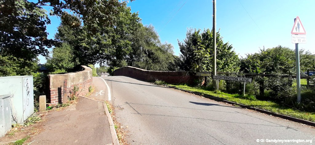
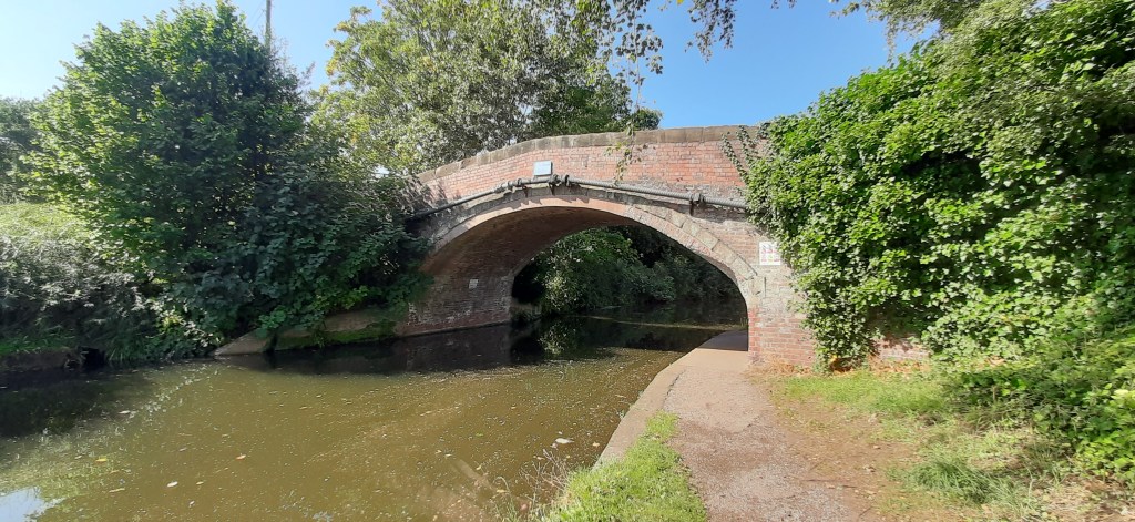
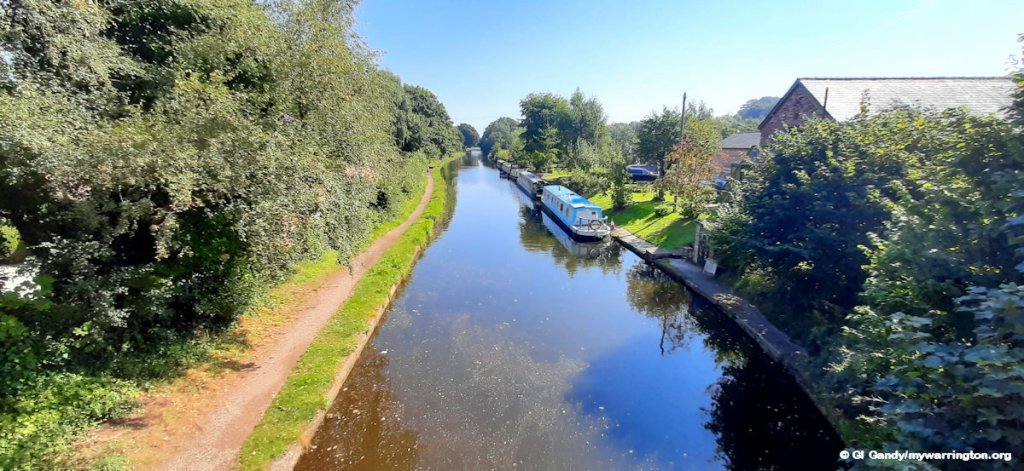
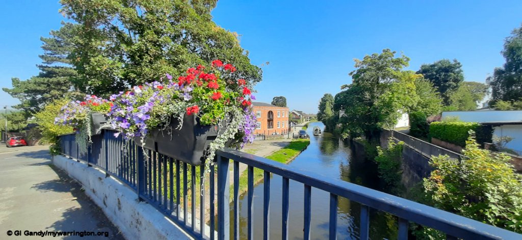
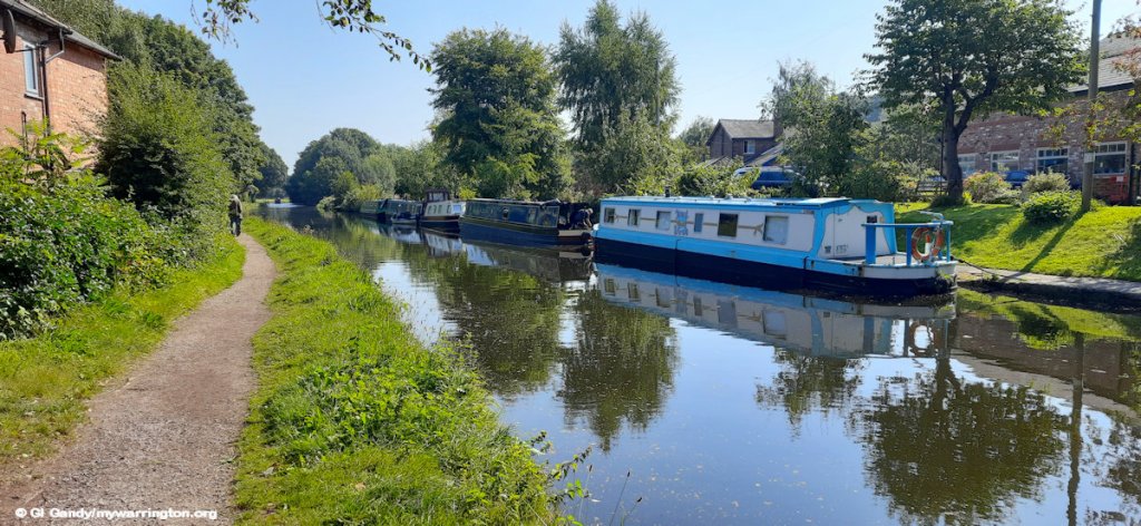
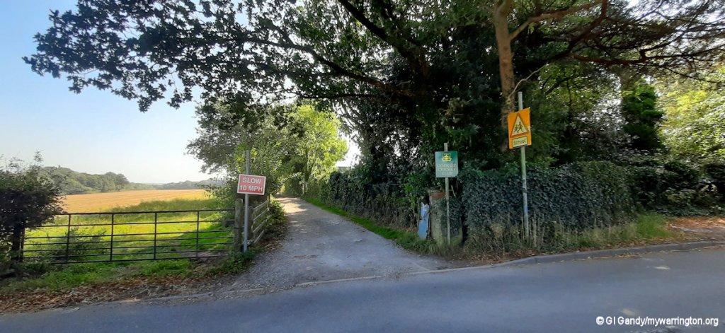
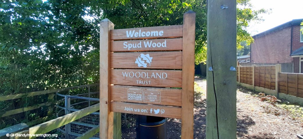
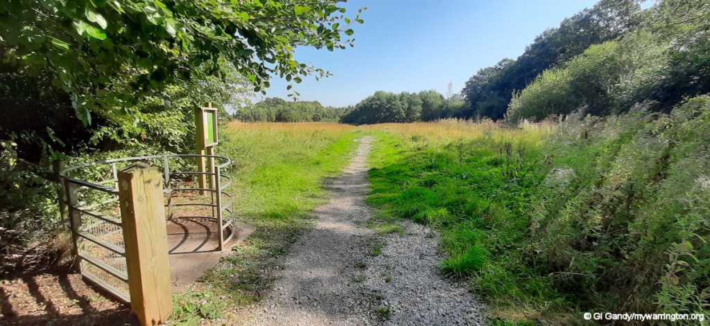
Back out to Oughtrington Lane for the next photos. Lymm Cricket Club and one of the entrances to Spud Wood are between St Peter’s Church and Lloyd Bridge over the Bridgewater Canal. Spud Wood is my favourite place name in the town and got its name because the plantation was originally a potato field. you can read more about the wood in Warrington Green.
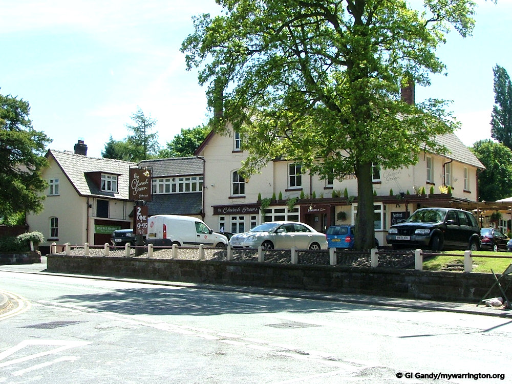
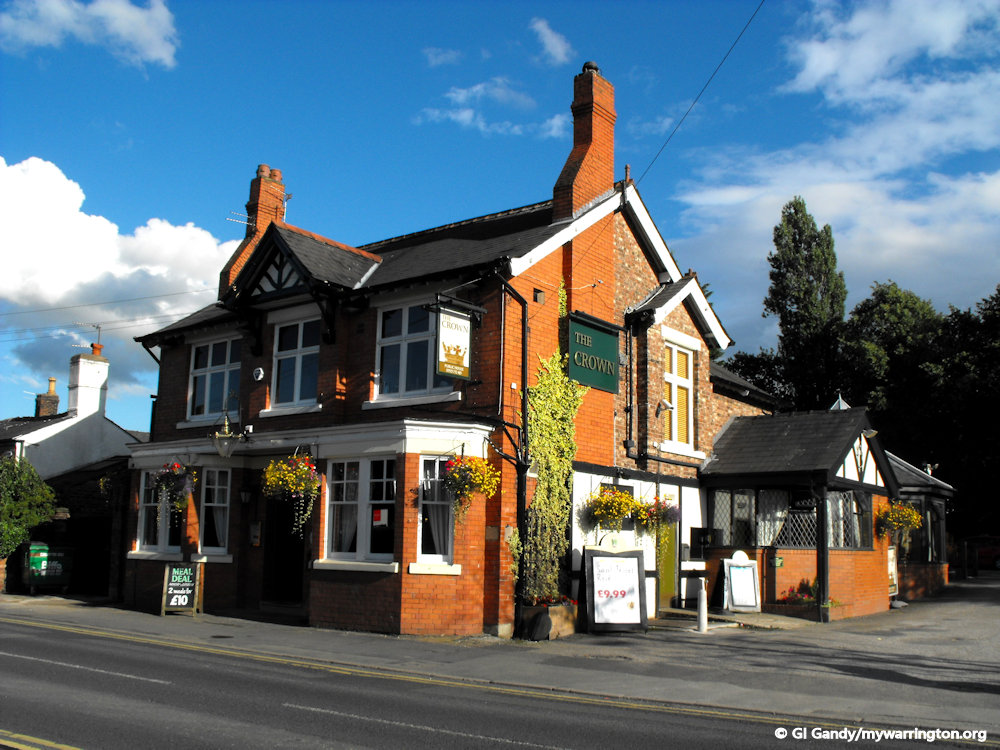
And if you need some refreshment after that virtual tour, you could visit the village and visit one of the many establishments, including the two seen below.