
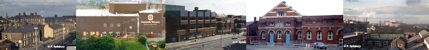
Peter Spilsbury has taken countless numbers of photographs in and around Warrington over his lifetime. I first met Peter in mid-2006 at Risley Moss Local Nature Reserve whilst conducting research for Warrington Green. During that chance meeting Peter said he would select some of his photographs for me to show on the website. Peter passed away on 21 January 2025 at the age of 85. He was a member of Latchford History Group and lived in the district for many years before retiring to Birchwood. He was also a member of Warrington Amateur Photographic Society. In his working life he was employed by British Aluminium at Bank Quay and also worked for the Post Office. mywarrington is proud to present Peter’s Gallery.
All photos on this page Copyright © Peter Spilsbury
In this section we look at buildings. The descriptions are from Peter’s own notes, with additional notes from me where indicated. See more of Peter’s photographs throughout the Making Tracks sections.
WALKING THROUGH TIME
Golden Square shopping centre’s extension was completed in 2007, giving a new look to the town centre. But how much of the old town centre do you remember? Take a stroll with Peter Spilsbury as he shows you some of the glory days! The text is based on Peter’s notes. We’ll start with three photos from the fifties and sixties.
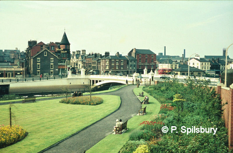
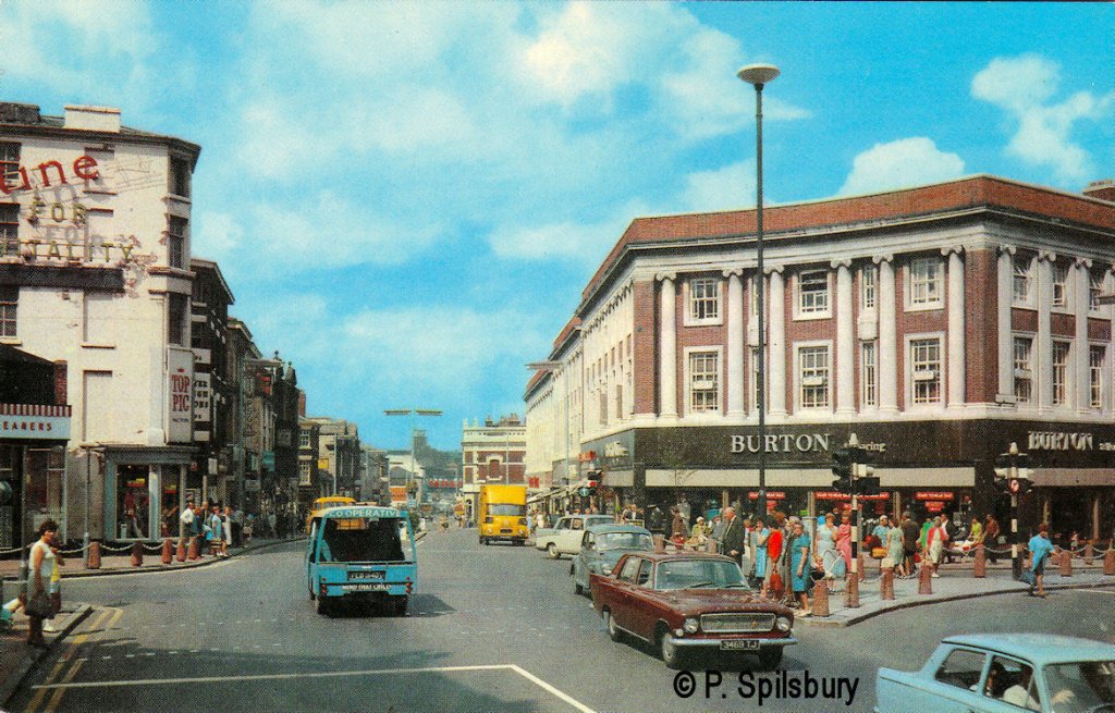
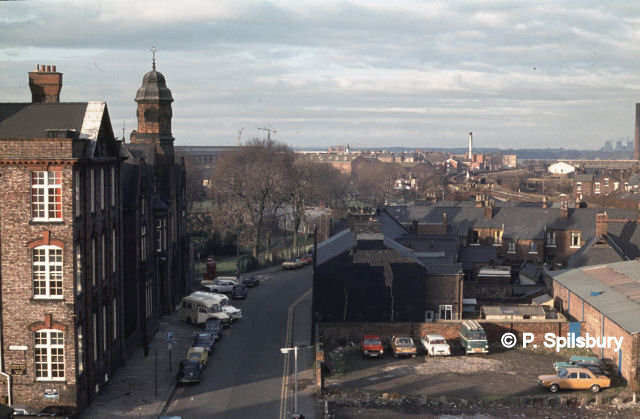
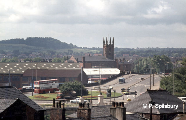
The photo above, taken in 1959, overlooks Marshall Gardens at Bridge Foot. In this scene we have Gartlands Garage, and the Wimpy, along with a Lancashire United bus, a Leigh bus and Johnny Lee’s pawn shop. You may also notice the Crosville Bus Stand opposite Gartlands. The Academy building on the left was literally moved north a few metres on rollers in the 1980s to make way for a new road scheme alongside. The building was eventually demolished and rebuilt in the style of today. Nowadays the Warrington Guardian newspaper offices are based there. Read more about the Academy in Tour 2. The chimney in the background belongs to Cockhedge Mill, now the site of Cockhedge Shopping Park.
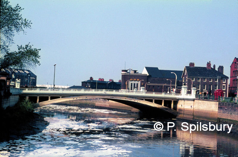
A view of Warrington Bridge at Bridge Foot in the late 1960s. The suds on the water were often blamed on Crosfields chemical works but are in fact caused by the weir half a mile away. The water flows towards Crosfields further up the river. The bridge was opened in 1915. Behind it is the Ritz (ABC) cinema which nowadays is hanging on in there as Mr Smith’s nightclub, but for how much longer? A pressure group is trying to save it. On the left is Gartons works. The joke going round in my schooldays was that GARTONS spelt backwards is SNOTRAG!
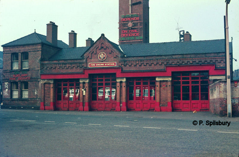
This photo was taken in the early 1960s. It’s the old fire station on Queen Street, now the location of Golden Square shopping centre. The Cheshire Fire Brigade are now based at Winwick Road, with four more stations in Birchwood, Lymm, Stockton Heath and Penketh.
Addition from Gordon: According to Cheshire Fire Service website, 1791 was this year was Warrington Fire Brigade formed and, like many others, made a charge for attending fires outside their area. Appliances were based around the town at this time, at the market and at the old bridewell (the old police station).
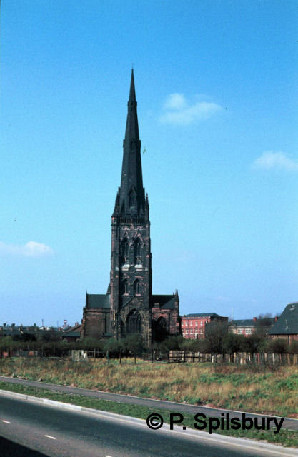
< The Parish Church of St Elphin in the early 1970s. This view is seen from Fennel Street before College Close was built. In the distance is Rylands Wire factory on Church Street, now long gone.
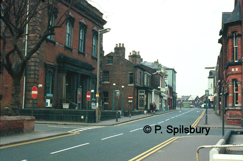
A view of Bold Street taken on 18 March 1973, looking towards Golborne Street. On the left is the Methodist Church, built in 1850, replacing the previous building on Bank Street which stood until 1848. A new church building now stands on the spot, opened in 1975. In the distance you can see a green hut. In those days you could park in Golborne Street and that was the attendant’s hut.
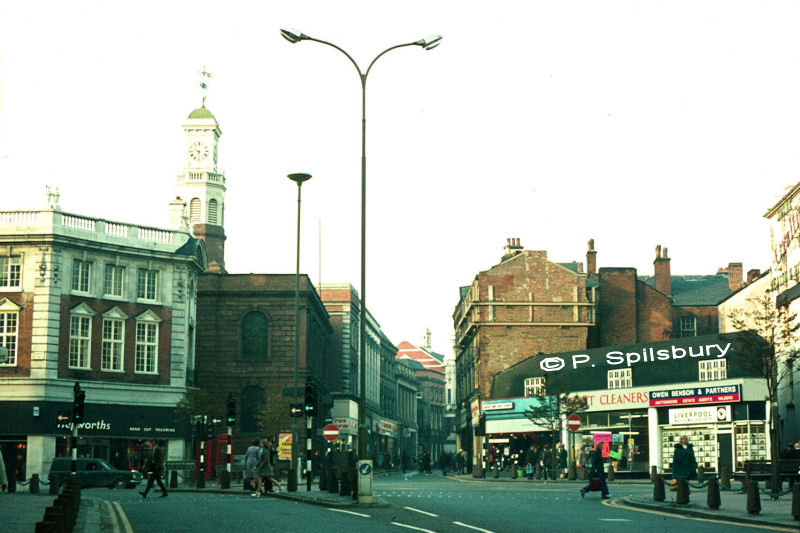
Market Gate viewed from Buttermarket Street on 4 November 1973. The town clock dominates the sky on top of Holy Trinity Church. Hepworths on the left is no longer here. Their subtitle, just visible, reads “hand cut tailoring”. It occupied the spot of the famous Boots Corner. Sankey Street in the centre was made into a one way street, so my bus to Dallam was diverted left at the lights, right into Rylands Street and Palmyra Square South, right again into Winmarleigh Street and then left onto Sankey Street to continue its journey. The traffic lights replaced the original roundabout.
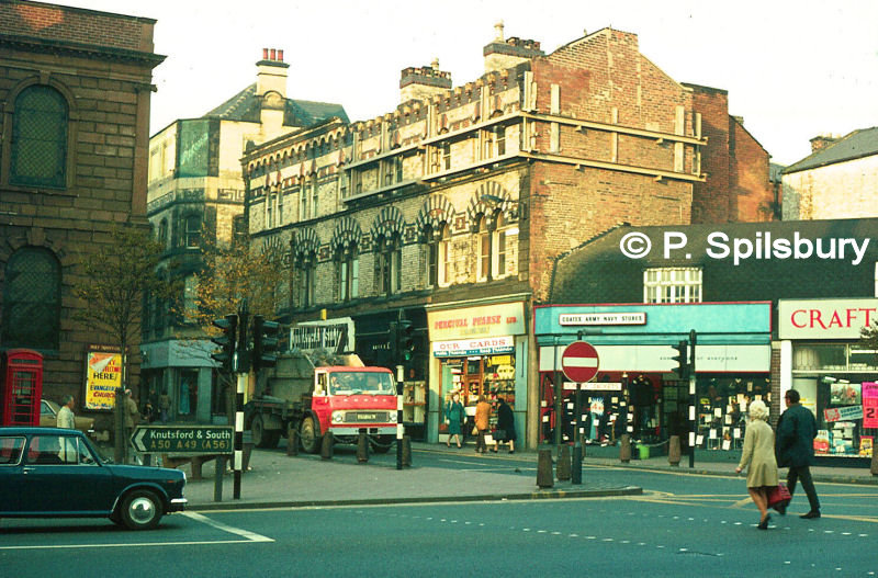
A close-up view of Sankey Street by Market Gate, also taken on 4 November 1973. Shops featured here include Jonathan Silver’s (behind the truck), Percival Pearse Ltd and Coates Army & Navy Stores. I was always amused by that as a youngster – a clothing shop run by a firm called Coates, but of course it was spelt different.
Addition from Gordon: Holy Trinity Church started out as Trinity Chapel in 1708 and was a chapel of ease to the Parish Church of St Elphin on Church Street.

The Russians are coming! Well, maybe not, but this striking image from 23 April 1978 shows the promotional artistry of Greenall’s Vladivar Vodka at Market Gate. And as Peter says, they wouldn’t let them decorate Fairclough’s Mill (The Big Pink Eye on the My Warrington page), but Greenall’s managed it here!
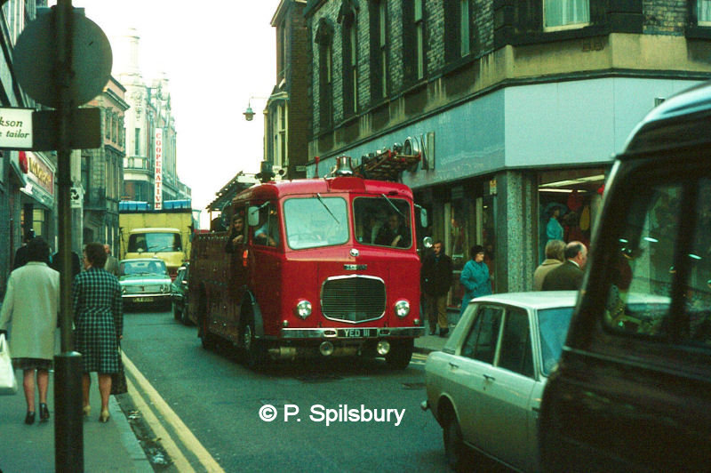
A fire engine joins the queue of traffic along the narrow street on 4 November 1973. It is difficult to imagine this being a two-way street but that’s what drivers had to negotiate in the early days. The bus company even purchased special narrow buses in 1965 to cope with two-way traffic on the road. I like how the Cooperative shop sign is completely visible through the open section of the truck in the distance.
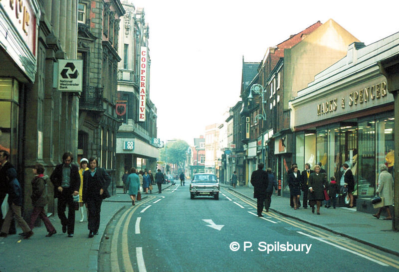
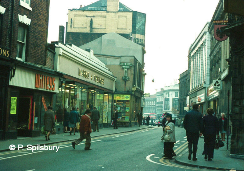
Two more views from 4 November 1973. Marks & Spencer’s store was built with a glass ‘false front’ with the main building behind. This was done to enable a quick conversion if the street was made wider, which never happened. NatWest and Barclays are still going strong, but Woolworth’s is no more. The company went into liquidation in January 2009. A new store, Asco, took the place of Woolworth’s later in 2009, but that has now gone, too. Another shop that is still with us: JE White Ltd sports shop, who now trade from the market on Bank Street. Can you recognise yourself in the shots? Maybe the fashions of the day will stop you admitting to it!
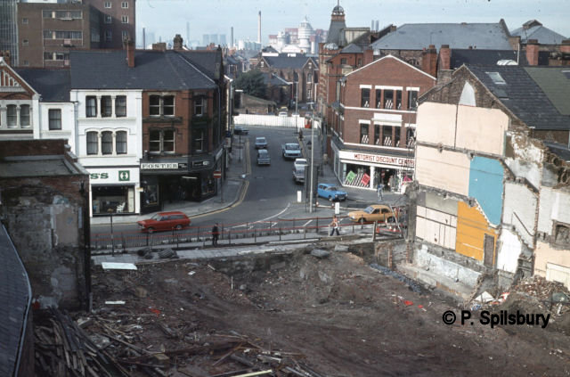
Here we see the start of the future – or at least the future as it was on 22 January 1978. It shows the shortest street in Warrington at the time – Castle Street. In the foreground Sankey Street is being demolished to make way for the new Golden Square shopping centre.
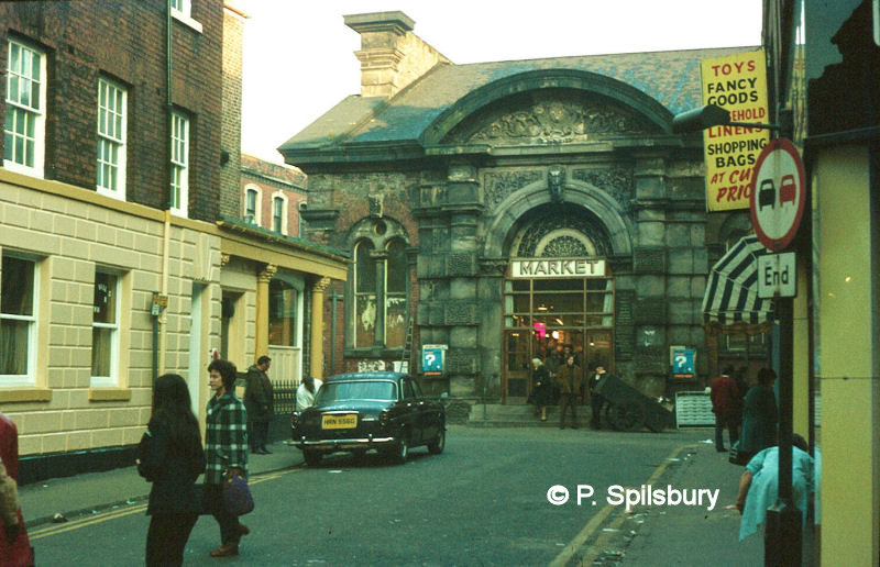
Here we see the entrance to the old meat market on 4 November 1973 at the top of Corporation Street. The building dates from 1856 but was demolished in the 1970s to make way for the new shopping centre. Today, the narrow passageway opposite Topshop/Topman is roughly on the site of Corporation Street. The Rover car parked outside the Blackburne Arms Inn was made in 1969. And is that the market cart I see from Warrington Market.
Following on from this, Anne Myles writes: I wonder if anyone remembers my grandfather’s, later my father’s, butchers shop in Corporation St [green and white striped canopy in photo above], demolished in the Sankey St widening? The street ran from opposite Holy Trinity Church to the steps of the old meat market. The shop was well known for it’s sausages.
My father had a large plaster pig, which stood on it’s hind legs, holding a tray of sausages. Around the edge of it’s hat ran the words “Tunstall’s sausages are delicious”. My father sold the business in 1962, to move to the new shops on Bruch Heath Gardens. It became Yates Greer’s, famous for its delicatessen.
During the war years, the American Red Cross was across the road, and one day they came into the shop and asked my father for a piece of steak, needed urgently. Against the rationing laws, my father found them a piece. He was not at all pleased when he learned they needed it to put on a visiting American boxer’s eye, when he was giving the American troops a boxing exhibition!
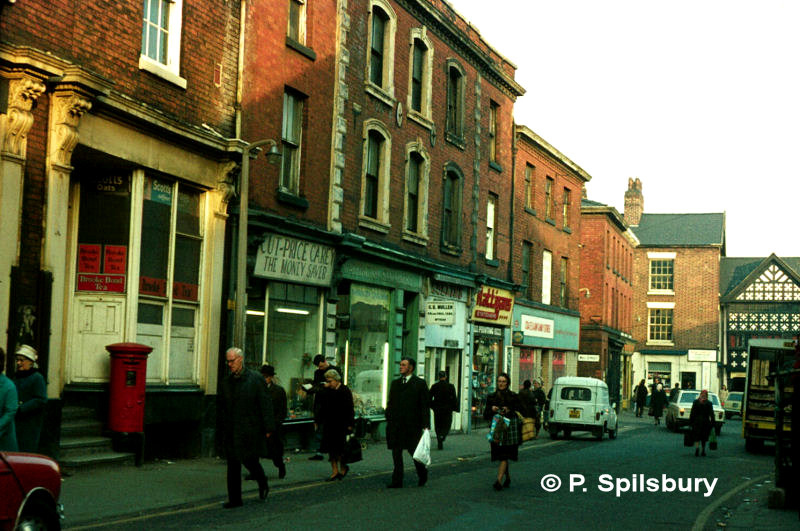
Round the corner we walk onto Market Place, also on 4 November 1973. The post box on the left stands outside the old Town Hall building, which served as the library reading rooms for a period. Next along there is Cut Price Carey’s (The Money Saver). Warrington Stationers and Rattigan’s stationers are two more of the shops in this scene. At the far end beyond Mill Street is the Barley Mow.
Horsemarket Street, viewed from Market Gate (above, left) on 23 August 1978 and from Town Hill on 22 October 1978 (above, right). Like the rest of town centre in those days there was no pedestrianization of the streets, so shoppers had to look out for passing traffic. Not much traffic here though. Mind you, in those days we had half-day closing (23 August was a Wednesday and 22 October was a Sunday when the world shut down for the Sabbath).
Addition from Gordon: Forget your 6 hours opening on a Sunday for shops above a certain size and all day opening for the rest!
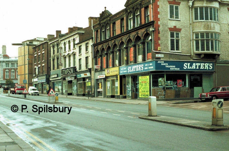
In the picture, above left, is Williams & Glyn’s Bank on the corner of Town Hill which used to be The Griffin Hotel.
Familiar names like Burtons and H. Samuel are on the right side. On the opposite side of the street (above, right) we see Slater’s clothing shop on the corner of Lyme Street, who are closing down to move to St Helens. Johnsons the Cleaners, Greggs bakery, Timpson’s shoes shop and another branch of Rattigans stationers reside along the rest of the row, but not for much longer, as this section was to be demolished to make way for Golden Square.
Horsemarket Street in an official postcard scene by Peter Spilsbury
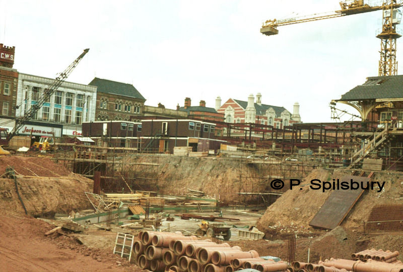
For those of you following my images of Golden Square redevelopment, you might think I have forgotten to include this image from a year ago. But in fact, this is the building of the ORIGINAL Golden Square shopping centre, taken on 27 July 1979! This is the big pit. Not many know of the huge cavern beneath the Mall and Square. In the background can be seen Jackson the Tailor, Etam fashion store, Woolworth’s, NatWest, Barclays and the Co-op on Sankey Street.
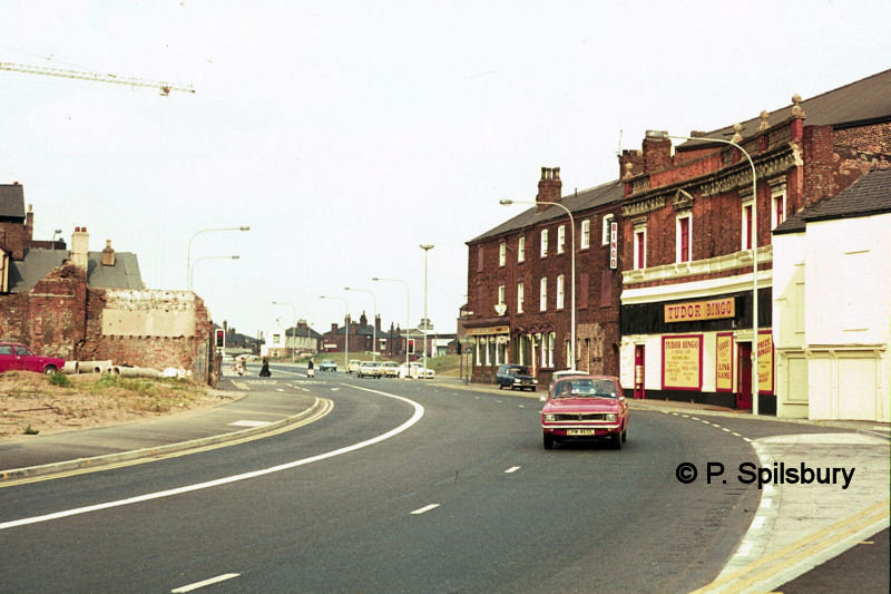
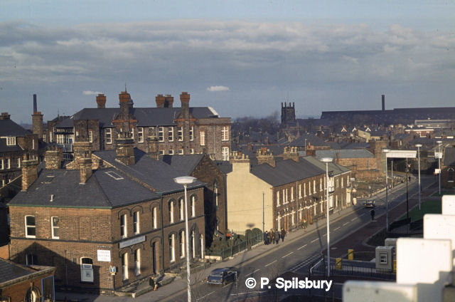
This is Scotland Road photographed on 13 August 1976. On the right of the scene we can see the Tudor bingo club. This used to be the Regent cinema, known locally as the Blood Tub because of the macabre plays that were put on there when it was a theatre. The Theatre Tavern is the pub on the corner (now the Prince of Wales). A crane on the Golden Square building site can be seen on the left.
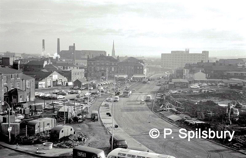
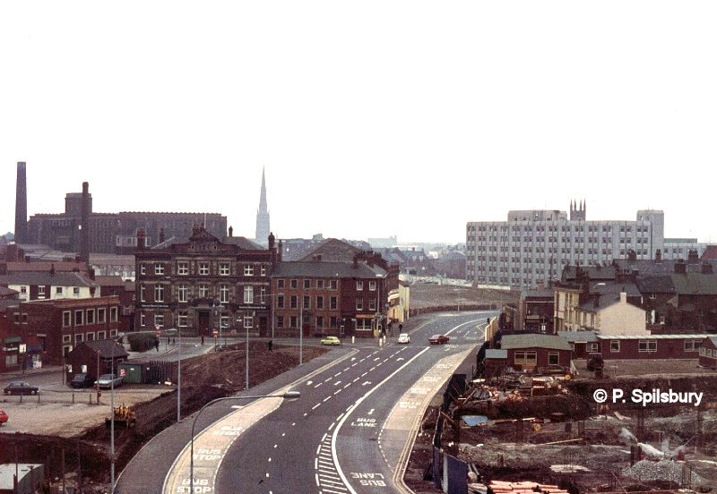
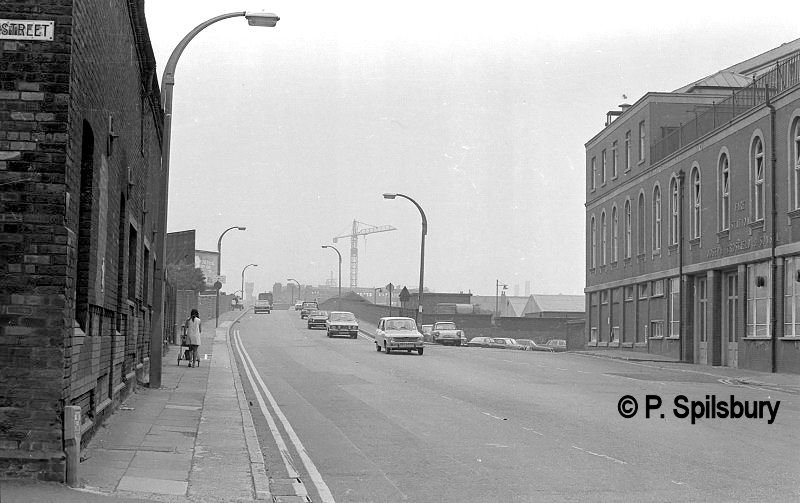
This view shows how Golborne Street and Queen Street changed forever during the 1970s. The roads were combined into what was then called the Inner Circulatory Ring Road, renamed as Golborne Street. In the distance you can see Cockhedge Mill, where Cockhedge Shopping Park is nowadays, whilst the building of Golden Square shopping centre develops on the right. This section will include British Home Stores. The photograph was taken on 8 January 1976.
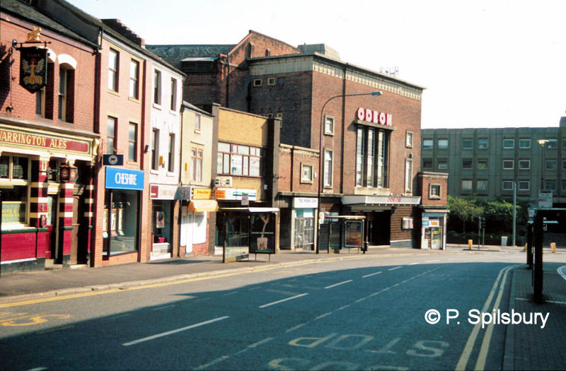
A familiar scene to cinema goers – The Odeon on Buttermarket Street, taken on 25 September 1994. Next to it is a small branch of Greggs bakery on the corner of Scotland Road, with the monstrosity called New Town House in the distance where the Britannia Hotel once stood. The Odeon was demolished to be replaced by Yates Wine Lodge (now The Looking Glass owned by J D Wetherspoon) and Norton Barrie clothing shop. All the other buildings along the row were left intact; just the businesses changed.
TOWN CENTRE – FROM THE TOP
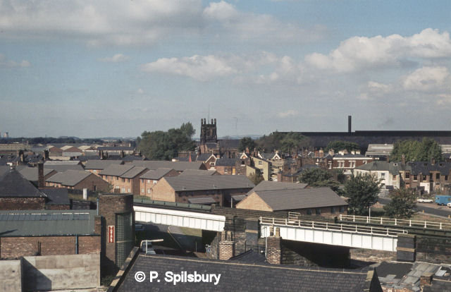
A series of images taken from the top of the town centre car parks in the 1970s and 1980s.
Hilden House & Priestley House on the left. Garven Place in the foreground. Baths roof on the right. Centre back is Crosfields & Sacred Heart church. (8 Jan 1976). Priestley House was renamed Bank Quay House in 2008.
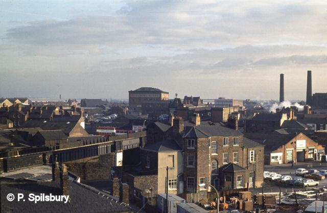
The rear of the Warrington Observer newspaper in the foreground. The little café is just to the right. The Cheshire Lines Committee warehouse stands out with Central Station just below it. Rylands offices above that. The chimneys of Cockhedge Mill to the right (8 Jan 1976).
Golborne Street. WHSmith’s on the left and Eustance’s jewellers in the centre at the corner of Bold Street and Sankey Street. The White Hart hotel just to the right and then the multi-storey car park. (8 Jan 1976).
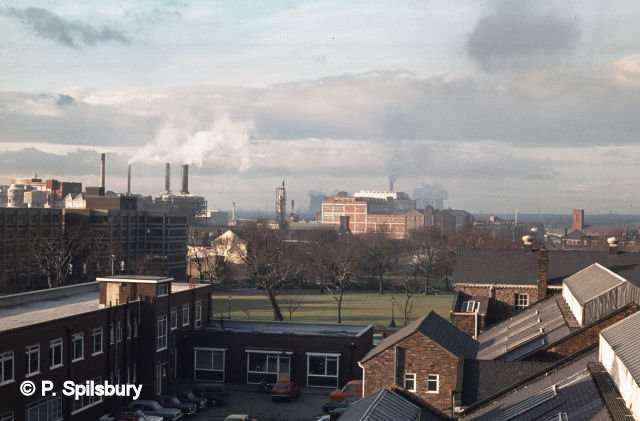
The Infirmary on the left (Kendrick Street). Cheshire Lines curve past the General Hospital. Bold Power Station in the right background (8 Jan 1976).
Legh Street. The pathology laboratory on the left. St Paul’s in the background with the roof of Lancashire Steel to the right. Rolleston Street under the bridge
(8 Jan 1976).
Golborne Street & Scotland Road. Behind the yellow car is the Theatre Tavern (now the Prince of Wales). To its left is Parr’s bank (now NatWest bank). On the sky-line from left to right is Cockhedge Mill, Parish church & New Town House. Below that is the Hop Pole pub. See a similar view from a year earlier on the Memory Lane page (15 Apr 1977).
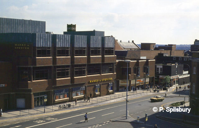
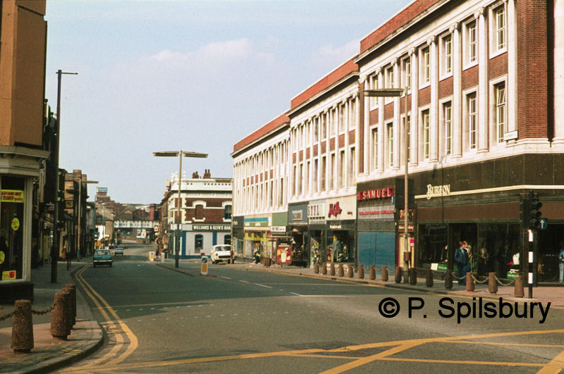
Golborne Street and Marks & Spencer (19 Sep 1980). This was the second Marks and Spencer store in this area. The original was on Sankey Street featuring the ‘false front’ glass entrance in readiness for the street widening scheme which never happened.
St Paul’s church with new housing in the Rolleston Street area. Bold Power Station is in the left background and Lancashire Steel on the right (19 Sep 1980).
The back of the shirt works on the left, then Wycliffe church & Bewsey Street. Tetley Walker’s brewery behind the church tower and further right is the Alliance Box works (8 Jan 1976).
Spot the difference. A similar view of Wycliffe church, but this time the buildings between the church and railway viaduct have gone. That area is now occupied by Making Space (19 Sep 1980).
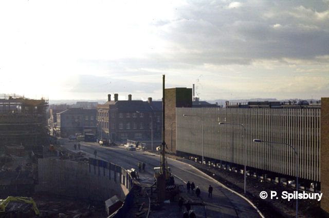
Friars Gate with Academy Way under construction. The road was originally called Rose & Crown Street and led to Mersey Street. Friars Green chapel is in the centre background with Crosfields behind. Even further behind is Fiddlers Ferry (3 Oct 1978).
Bridge Foot with the bus garage on the other side of the railway bridge. St James’ church and Hill Cliffe in the background (3 July 1978).
BANK QUAY 1971-1982
The photo, left, was taken from Parker Street, looking up Crosfield Street with Bank Park on the right.
On the left is a warehouse let for commercial use with the railway goods yard behind. At the far end of the street is a signal box on the Cheshire Lines. There was a little known branch line from there to the steel works in Dallam Lane.
Addition form Gordon: It was possible to transfer to and from the West Coast Main Line and the Cheshire Lines Committee line using gradients in the land close to the signal box area.
The entrance to National Carriers is in the background of the photo above left. They were the road services to B.R. They used 3 wheel Scammels, often referred to as mechanical horses, for delivering and collecting goods from the railway. Liverpool Road over the railway (photo, above, right) with the tower of Sacred Heart church in the background. Taken from the same area looking up the bridge.
Milner Street is on the left. Whitecross Wire Works occupied both sides of this street [Royal Mail sorting office and B&Q are here now]. It later became part of Rylands-Whitecross. How many can remember The Railway pub at the corner of Milner Street and Priestley Street or The Green Man on Sankey Green near the Bowling Green pub? On the other side of the road you can see where the pavement is interrupted. This is where Crosfields had their two fire engines and an ambulance. Two of the doorways can still be seen. One of the engines is now a heritage vehicle (see a photo of it in the Fire Station Open Day section on the Events page).

Crossing the road for this view, the road to the right was called Factory Lane and round the corner the road divides into two. The left hand fork going under Bank Quay Station coming out at the corner of Parker Street and Wilson Patten Street by the station entrance.
The right hand fork went over the low level railway and to another part of the factory and the river. There was a public footpath from Monks Hall sidings to the 12 Arches and Walton. Part of it can still be accessed.
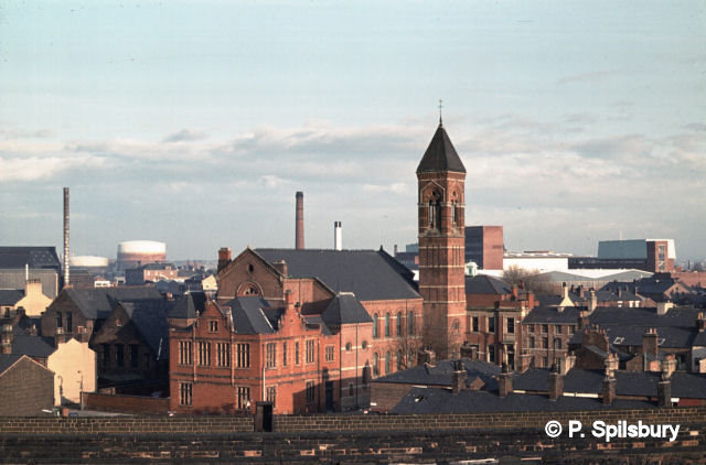
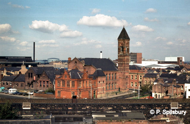
A view of Crosfield’s Memorial Theatre before it was demolished in 1991. The theatre was built to commemorate the 100th anniversary of the Crosfield Chemical Company. Construction was completed in 1925, with the first full-stage production, The Geisha Girl, staged the same year. The theatre was primarily used by the Crosfields Operatic and Dramatic Society, which was originally formed in 1901 and is still active today as the Centenary Theatre Company. The theatre was closed in 1991. The site was later redeveloped, and the building was demolished. The land is now the location of a Lidl and KFC. The last musical there was Cabaret and the last play was Hindle Wakes. The closure of the theatre in 1991 left a void in the local arts scene, and residents have expressed a desire for a new theatre to be built in Warrington. The original theatre company continues to put on performances at other venues, such as The Brindley in Runcorn.
Text for Crosfield’s Theatre is AI-generated.
Crosfield’s Centenary Theatre in Peter Spilsbury photo. I don’t have a date for when he took it, but it was before 1991.
STOCKTON HEATH VIEWS
All the photos here were taken from the top of St Thomas’ Church, Stockton Heath.
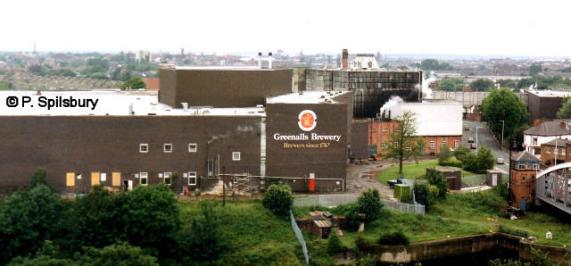
Greenall’s Brewery closed down in 1991 and Morrison’s supermarket took its place. Northwich Road swing bridge control box and the site of Twenty Steps Lock are in the bottom right hand corner.
Looking along Ellesmere Road towards Walton with Naylor’s timber yard and Walton Lock in view.
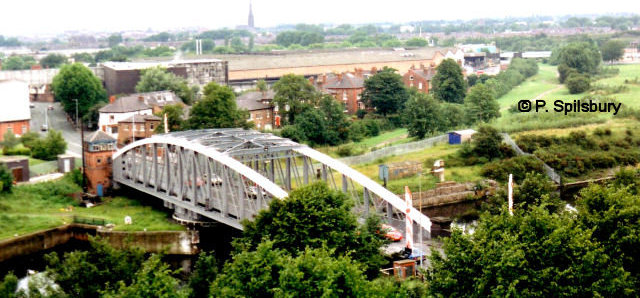
The bridge and control box on the left. G & J Greenall (burnt down in 2005) behind Stafford Road. The bed of the Black Bear Canal can be picked out.
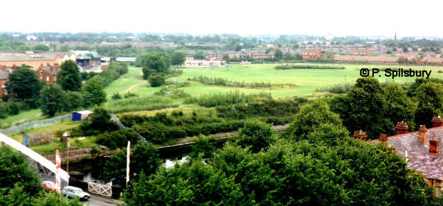
Black Bear country park and Loushers Lane fields.

The cantilever bridge stands out over Fairfield Road. Alexandra Park can be picked out among the houses.

London Road and the old Co-op, now with new tenants, and the east graveyard of the church stands out.
