

Introduction
In 1870-72, John Marius Wilson’s Imperial Gazetteer of England and Wales described Stretton like this:
STRETTON, a township and a chapelry in Great Budworth parish, Cheshire. The township lies 3½ miles S by E of Warrington r. station. Acres, 1,118. Real property, £3,420. Pop., 373. Houses, 70. The manor belongs to N. D. Milner, Esq.—The chapelry was constituted in 1833; and it has a post-office under Warrington. Pop., 833. Houses, 159. The living is a p. curacy in the diocese of Chester. Value, £180. Patron, T. H. Lyon, Esq. The church was built in 1827. There is a national school.
GB Historical GIS / University of Portsmouth, History of Stretton, in Warrington and Cheshire | Map and description, A Vision of Britain through Time.
URL: http://www.visionofbritain.org.uk/place/1516
Date accessed: 13th September 2025
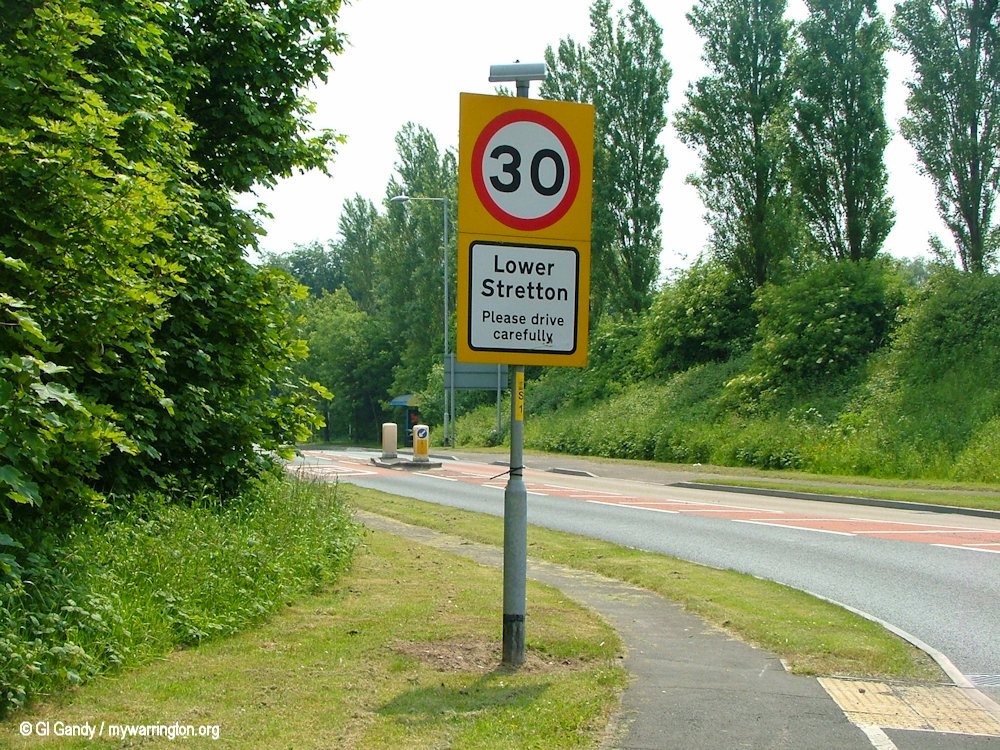
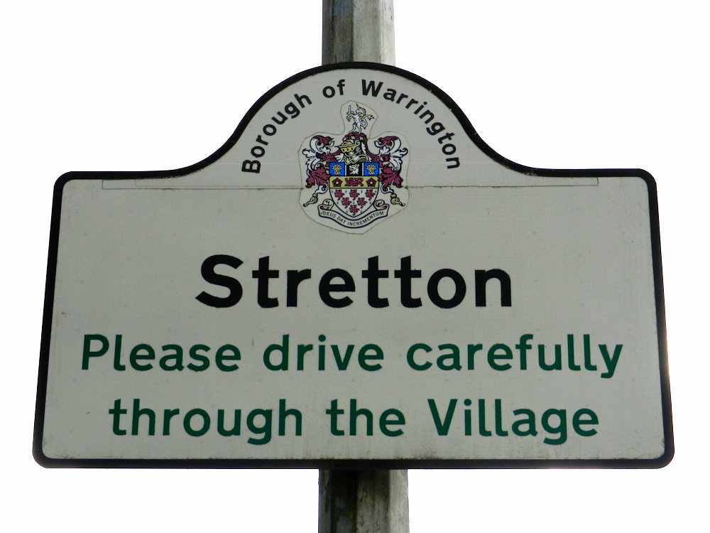
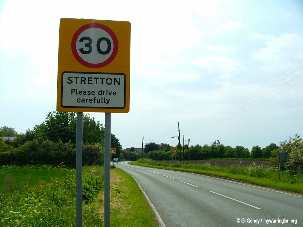
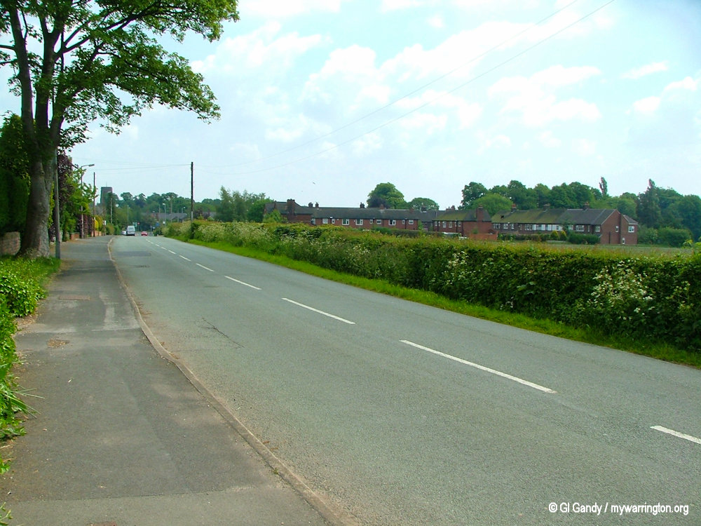
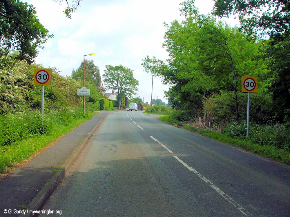
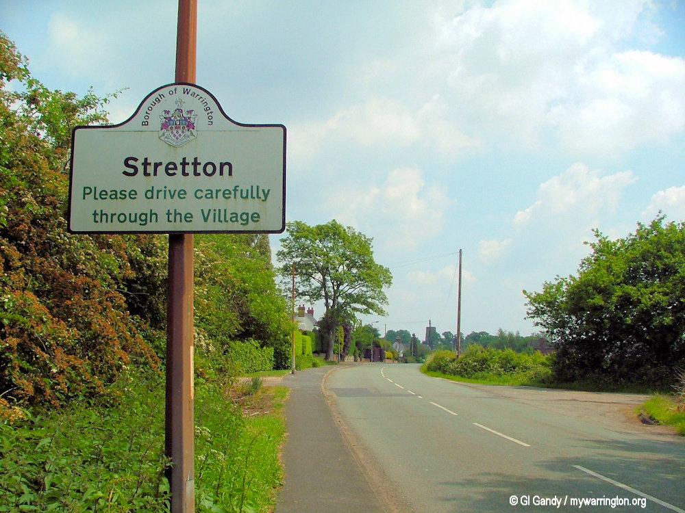
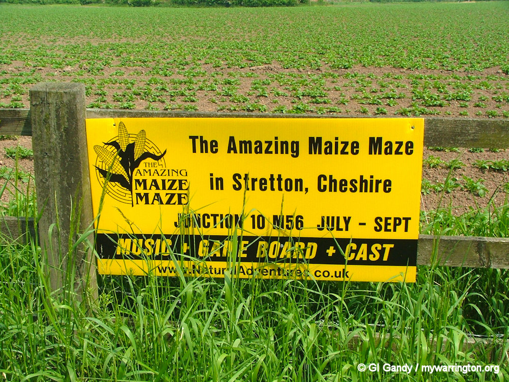
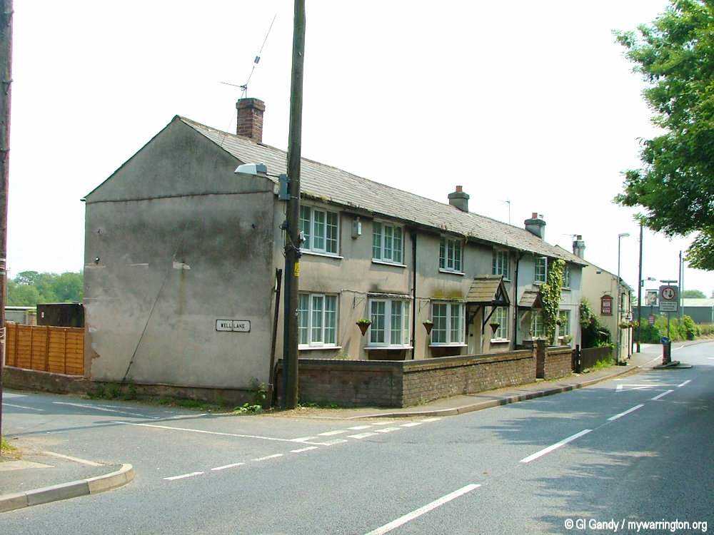
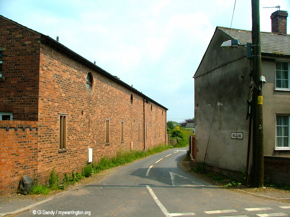
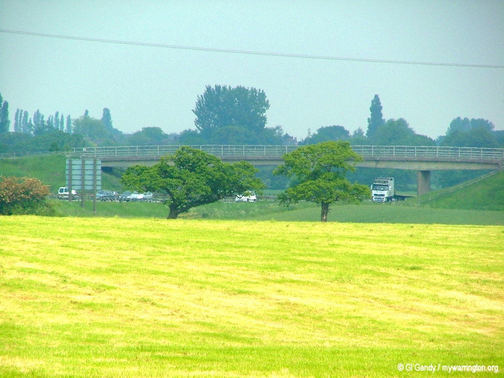
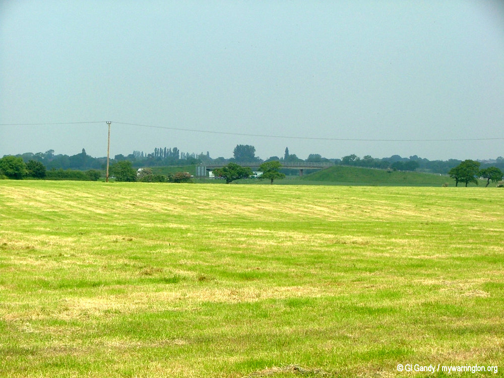
As you travel south along London Road and Tarporley Road on the A49 and cross the M56 motorway onto Northwich Road, you come into Lower Stretton. This is the furthest point south in Warrington district.
Roman Times
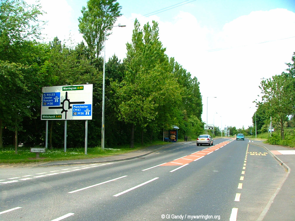
Stretton is a village and civil parish in south Warrington. The parish includes the village of Lower Stretton, separated by the M56 motorway at Junction 10. It is at the very southern tip of Warrington, about seven miles from the town centre.
It might seem strange that a motorway runs through your village, but that is the case here in Stretton. But in fact, it has always had two sections, Stretton and Lower Stretton in 1863, with Lower Stretton originally the centre of the village due to the manor of Stretton Hall being located here.
The name of the village means “the tun on the stret or road” – street town – Stretton.
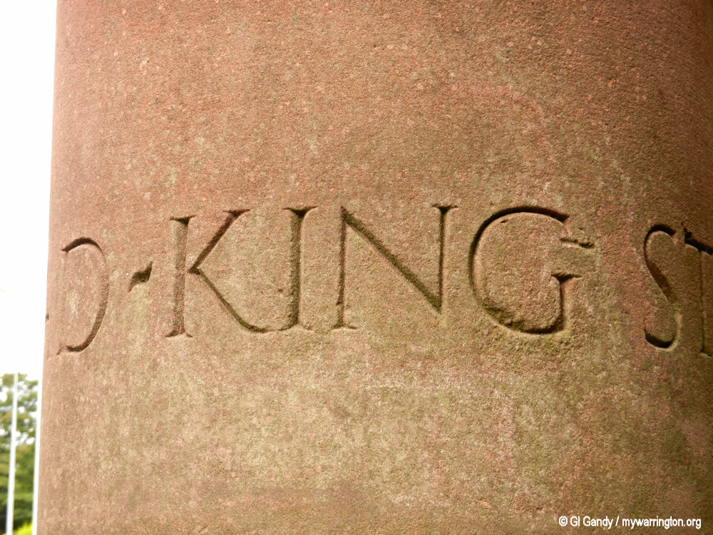
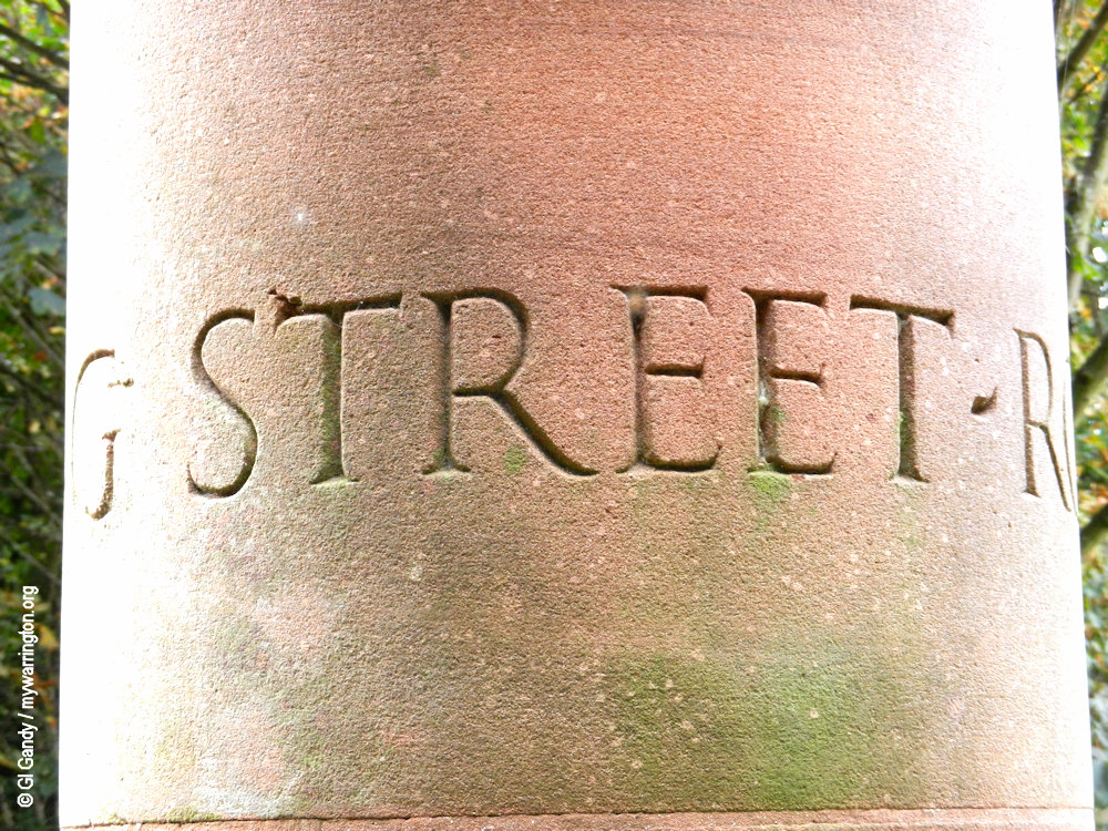
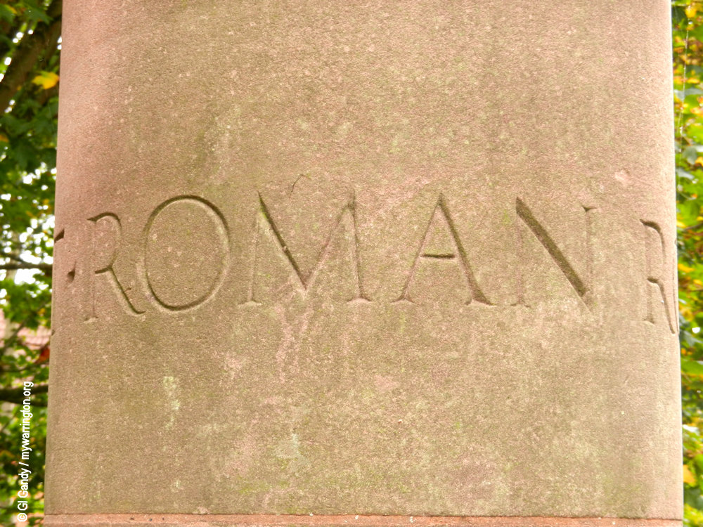
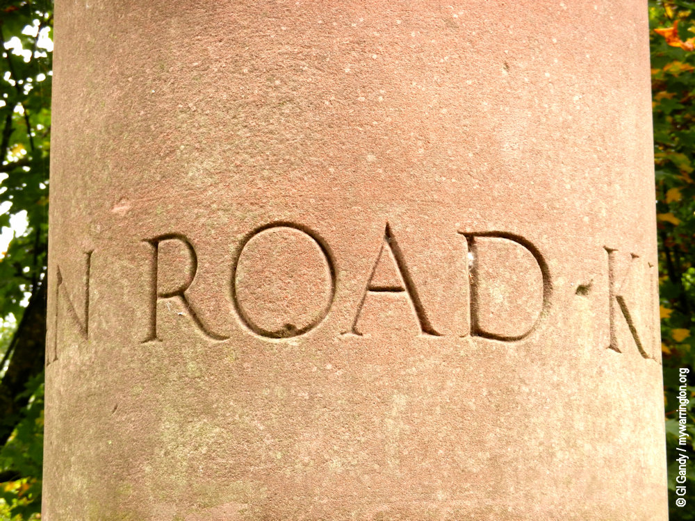
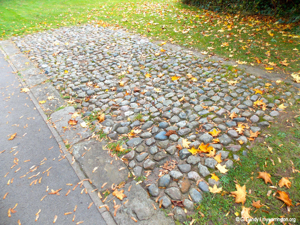
The district includes the main street and the roads accessed from it. The main street through the village goers back to Roman times when it was called King Street. King Street was a major military and trade route that connected the Roman settlement of Middlewich (Salinae) with Wilderspool, near Warrington.
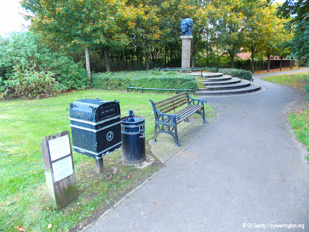
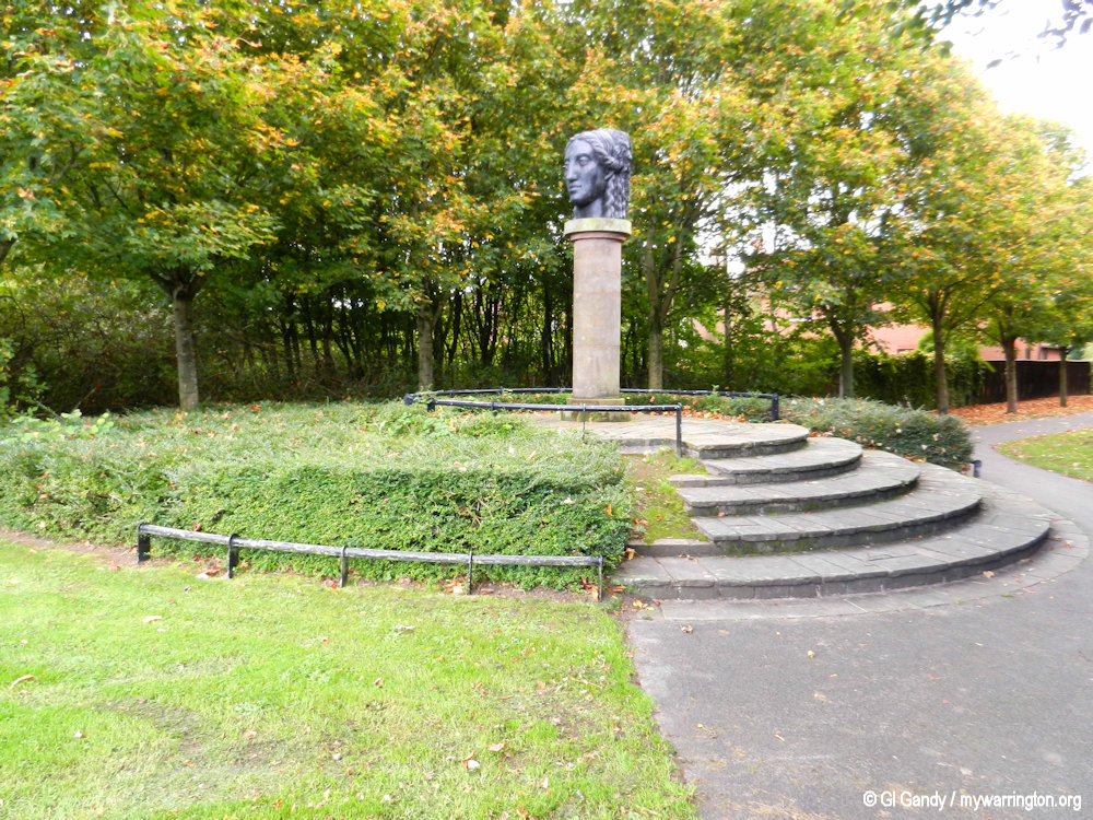
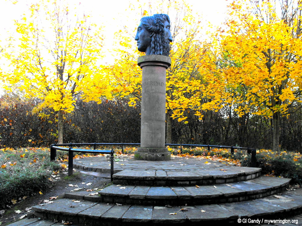
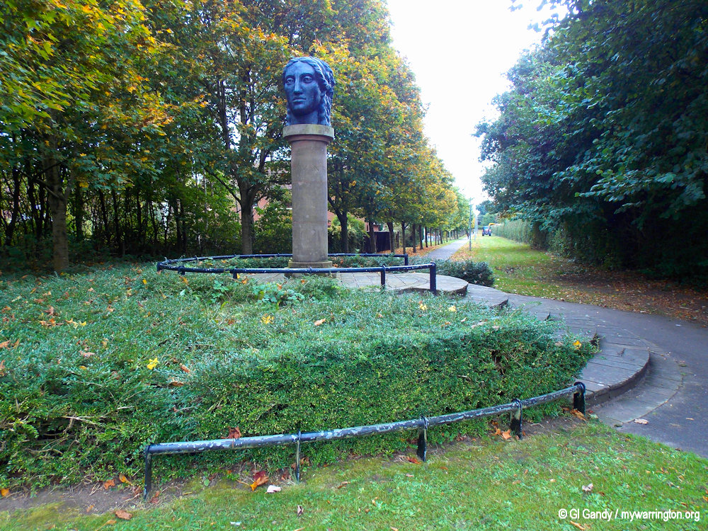
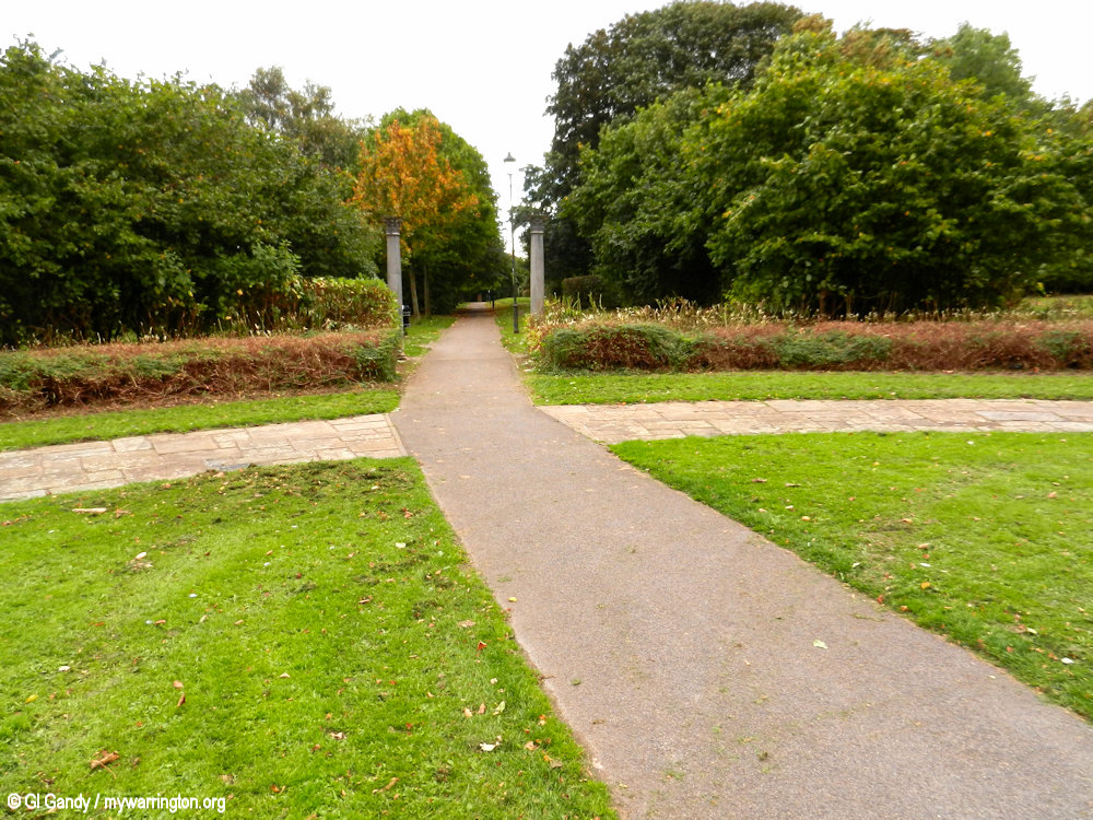
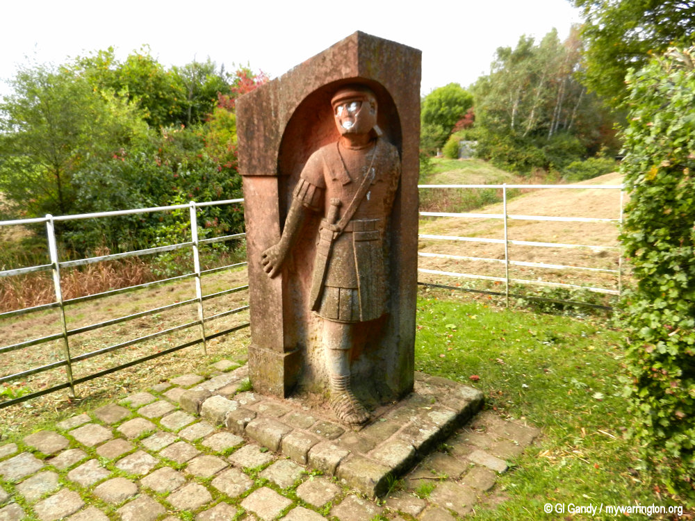
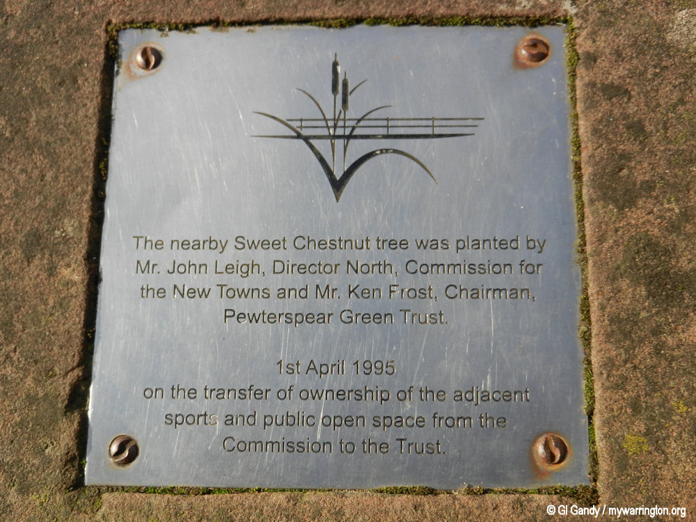
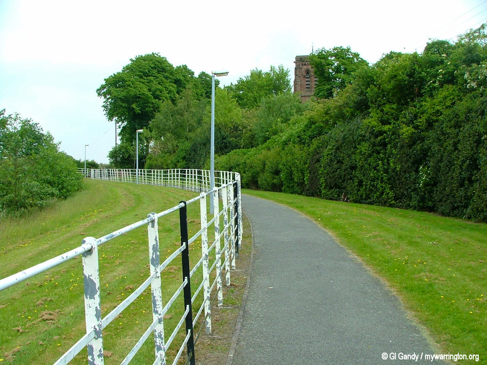
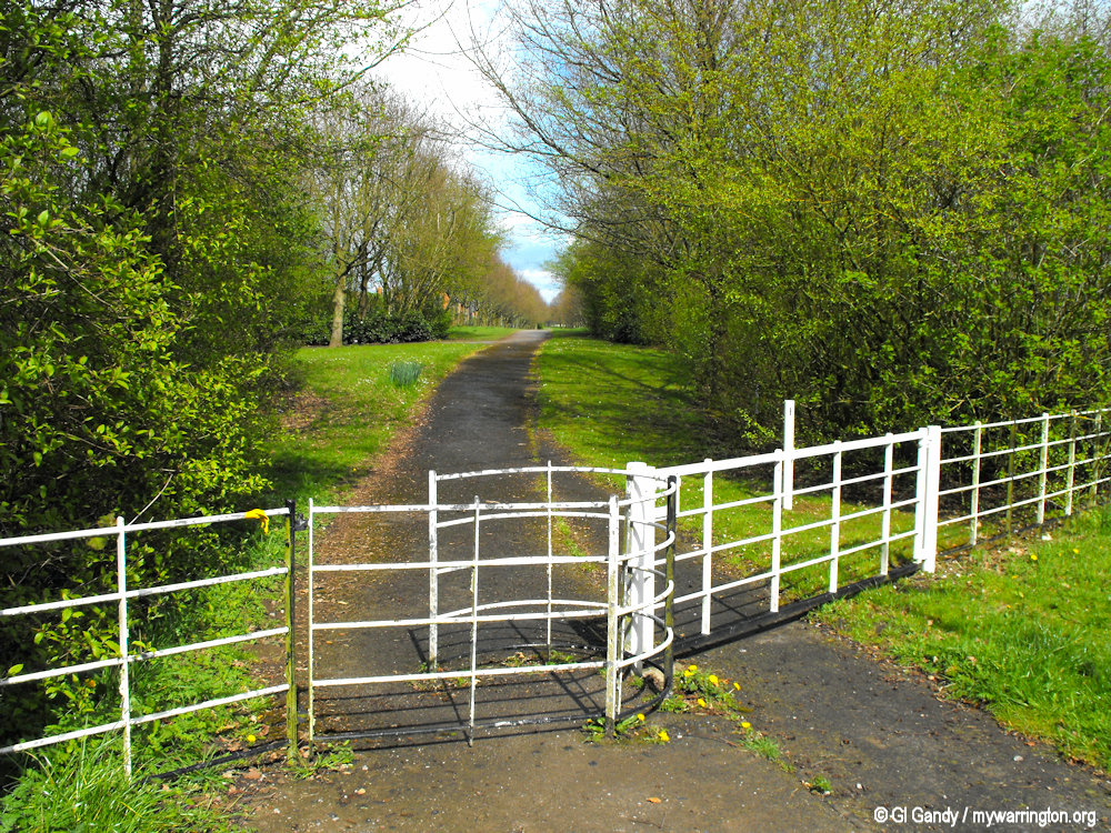
The public park at Pewterspear Green is laid along part of the route of King Street. It features a statue of Janus, the Roman god of beginnings, endings, gates and transitions.
It is still possible to walk along part of the route of King Street on Pewterspear Green (where you can see a statue of Janus) as well as drive on a section of it via the A49 London Road.
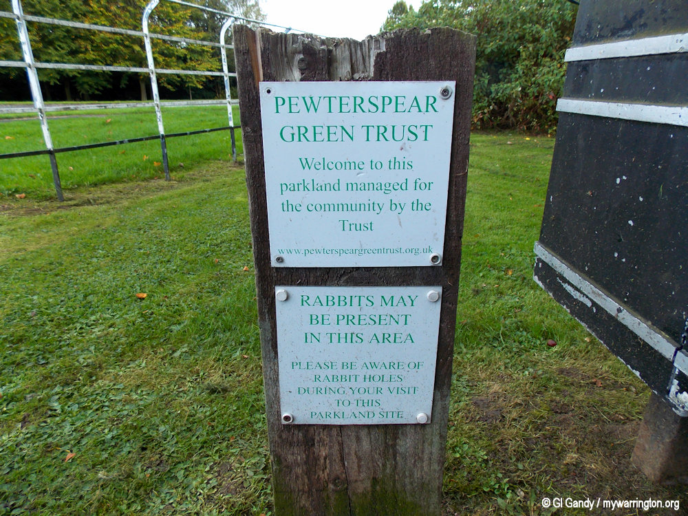
Stretton Road was constructed in 1830. Pewterspear was originally spelt with an ‘e’ on the end. Read about the Pewterspear Green Trust on their website.
But what are the origins of the name Pewterspeare / Pewterspear? Well according to Memories of Stretton by May Bower:
As one emerges into the Warrington Road, there is a private road up to Appleton Hall, commonly known as Pewter Spear. Now, we know that a spear of pewter would not be useful in any way. It would be too soft.
My own explanation of the name is this: several Cheshire squires fought in the Battle of Poitiers, and I believe that someone must have brought back a native from there, or a person named Pierre, and that the name has been corrupted from “Poitiers Pierre”. I am glad to see that the sign “Pewter Spear”, put up by the County Council, has been removed!
That solves a little conundrum I had because I was originally going down the spear made of pewter route and the various blacksmiths in the district…
I recommend you read May Bower’s memories. In it you can find out where the village stocks were, read the story of the gypsy going to ‘church’, discover what a peaceful Sunday in the village was like and also read a brief biography on Joseph Smith of Stretton Hall.
Let’s pick up where we left off with the Romans.
Janus
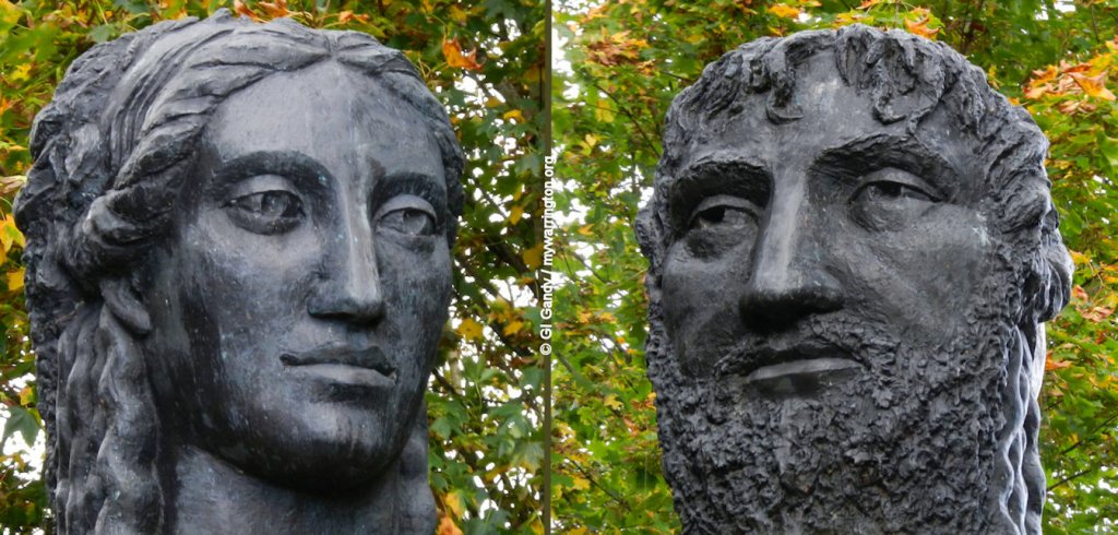
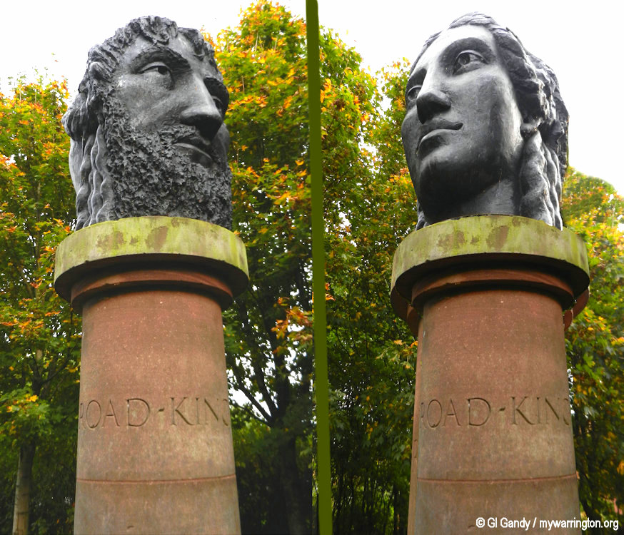
Janus is the ancient Roman god of beginnings, endings, gates, and transitions, famously depicted with two faces looking in opposite directions to symbolize his connection to the past and future. The month of January is named for him, and he presided over doorways, passages, and the start and end of conflicts. He was a primordial deity, considered a guardian of doorways and a patron of new beginnings.
His most prominent feature is his two faces, one gazing backward and the other forward, representing the simultaneous presence of past and future, beginnings and endings.
As the god of gates and doorways, he was seen as a guardian of entrances and exits, symbolizing the passage between different states.
He presided over the commencement and conclusion of conflict, with the Temple of Janus in Rome having its gates opened in times of war and closed during periods of peace.
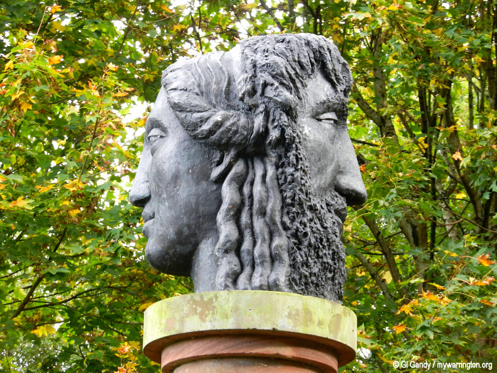
The two faces of Janus in a statue in Pewterspear Green park alongside London Road by Owen’s Corner roundabout. Photo taken 1 October 2013.
Take a look at the OS 25 inch map on the National Library of Scotland website for a comparison to the location of King Street to the modern A49 London Road.
If you look on that map and scroll up, you will notice a pub known as the Shovel and Broom at the location of Owen’s Corner, which to me is an unusual name for a pub. But there again, maybe not.
The ‘Owen’ in Owen’s Corner refers to Lawrence William Owen, a wheelwright born in the village in 1887.
Read lots more on the Stretton History website.
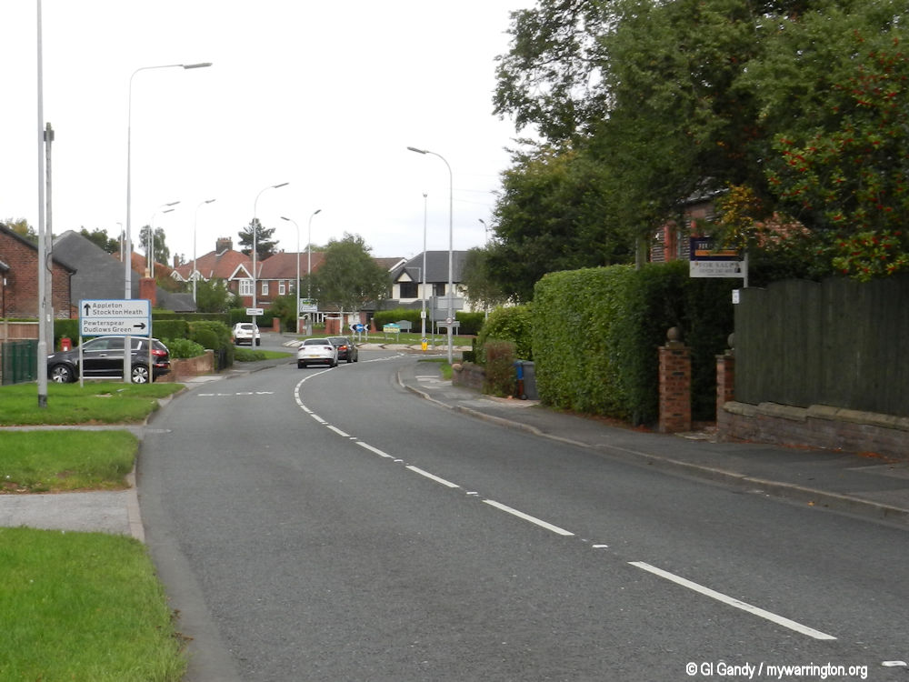
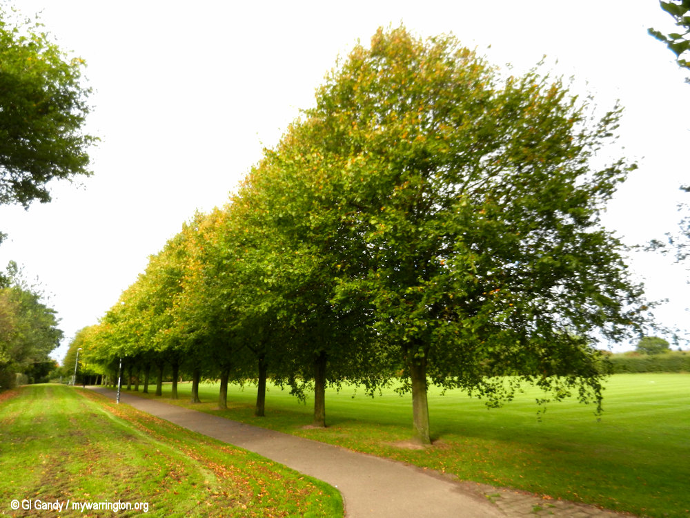
Looking north towards Owen’s Corner roundabout (11 Oct 2013)
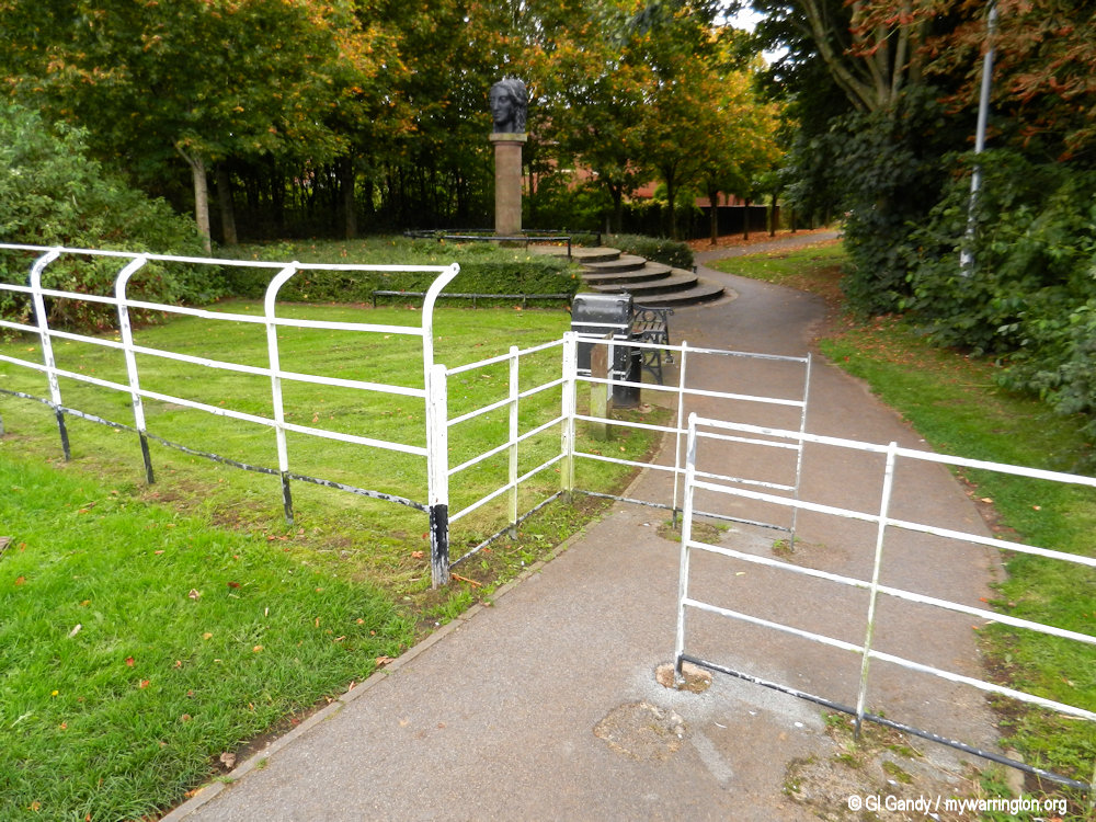
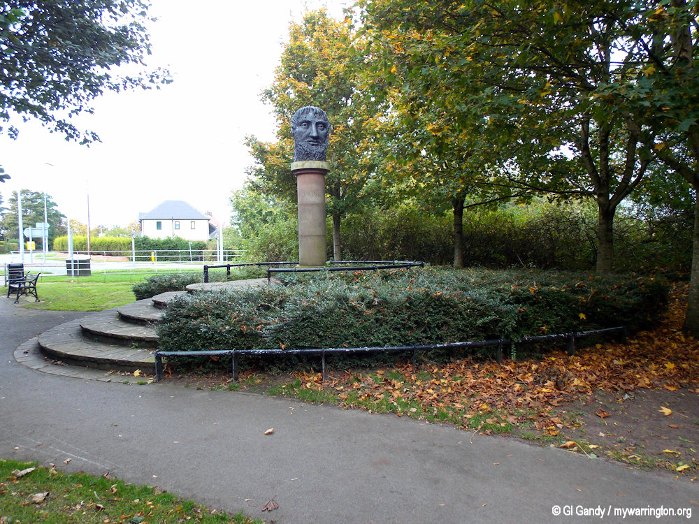
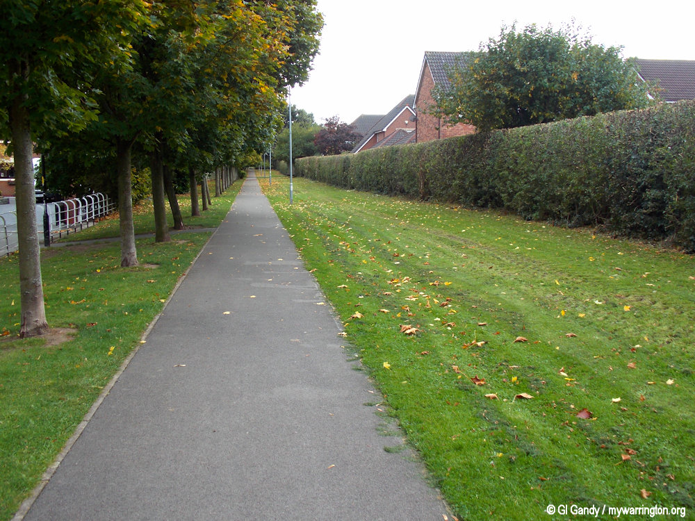
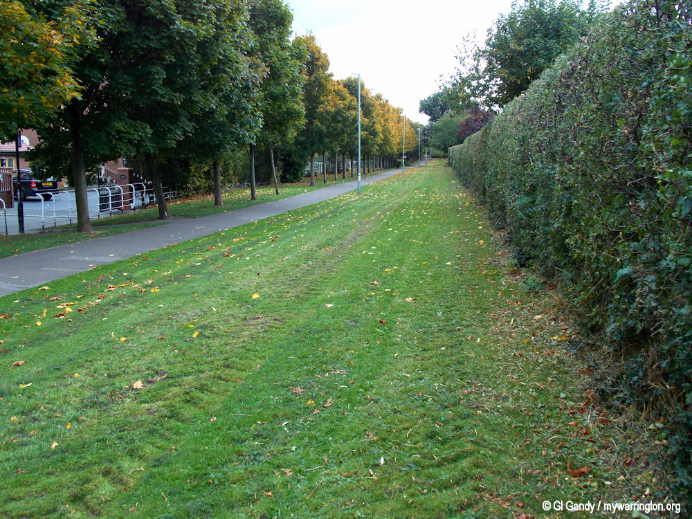
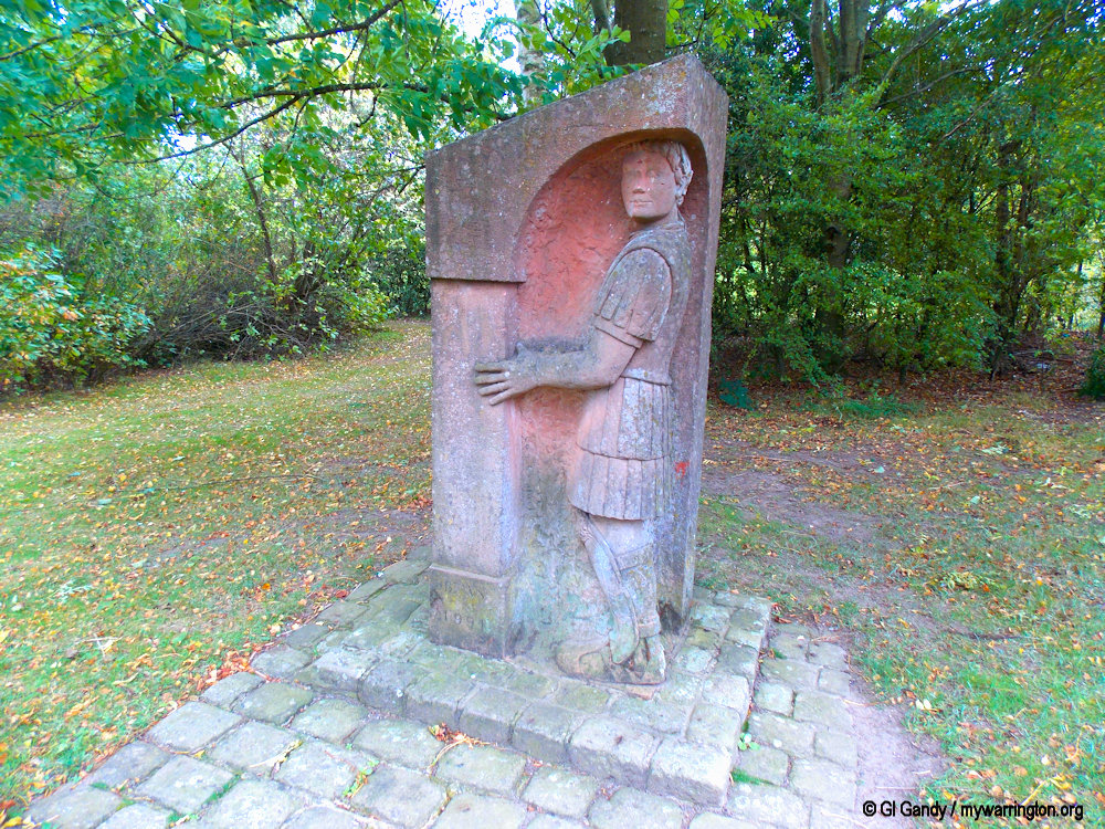
Photos of Pewterspear Green park showing a statue of the Roman god Janus on 11 October 2013.
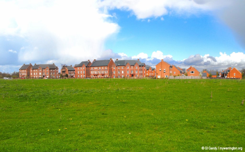
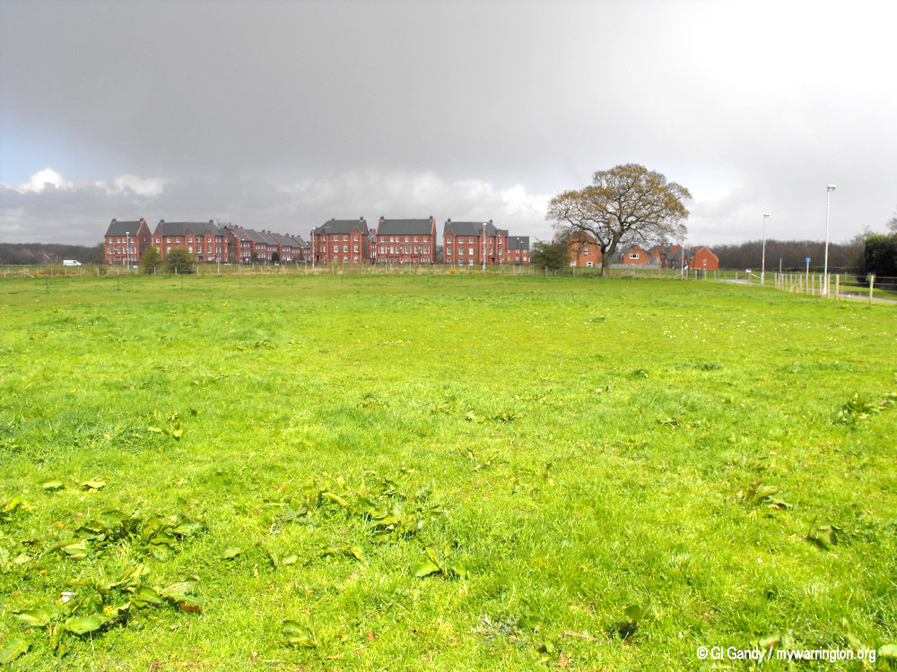
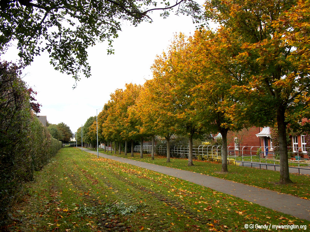
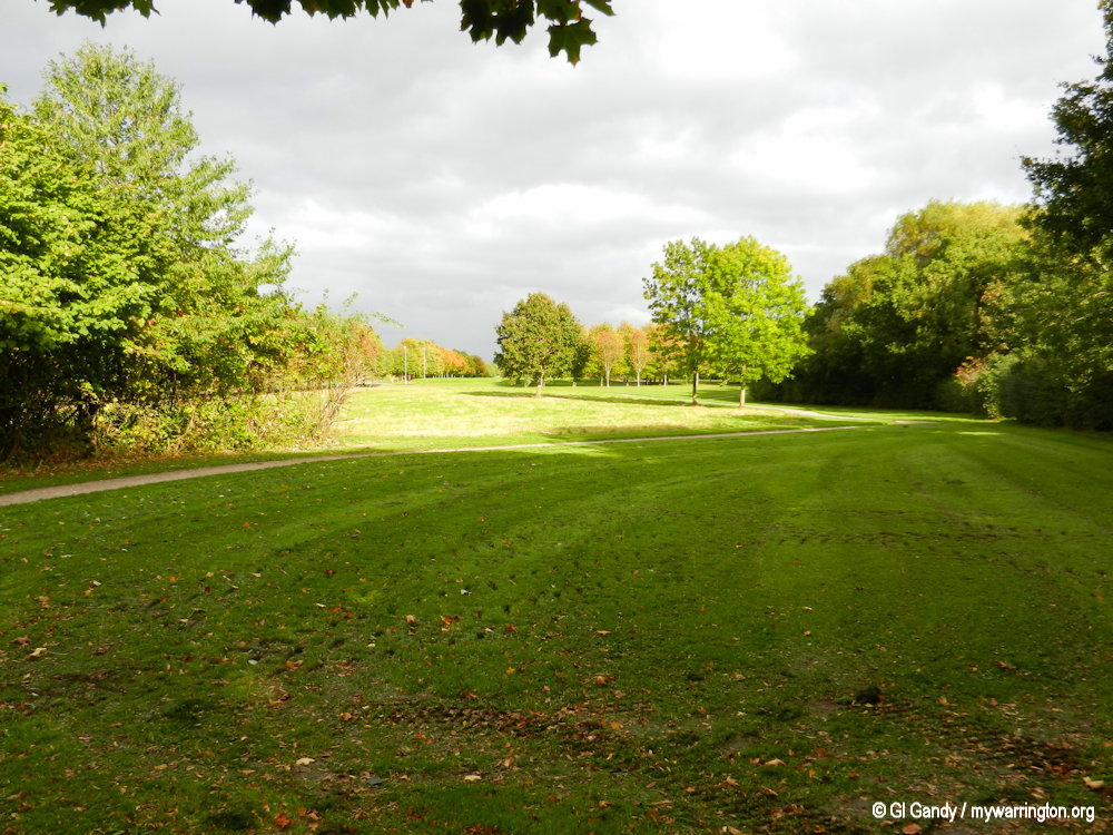
Views across Pewterspear Green with new housing in the district (10 April 2012).
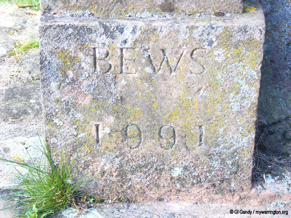
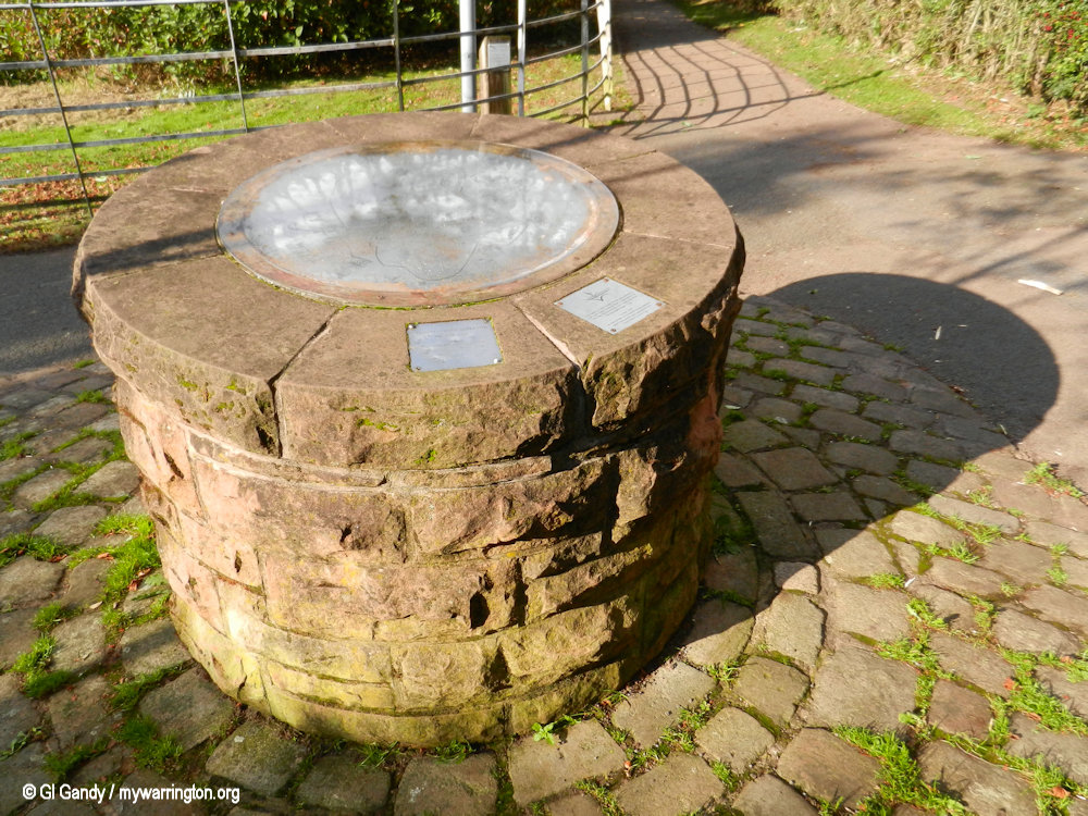
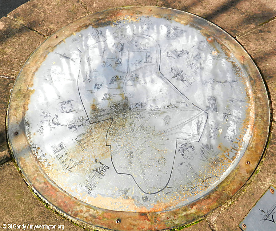
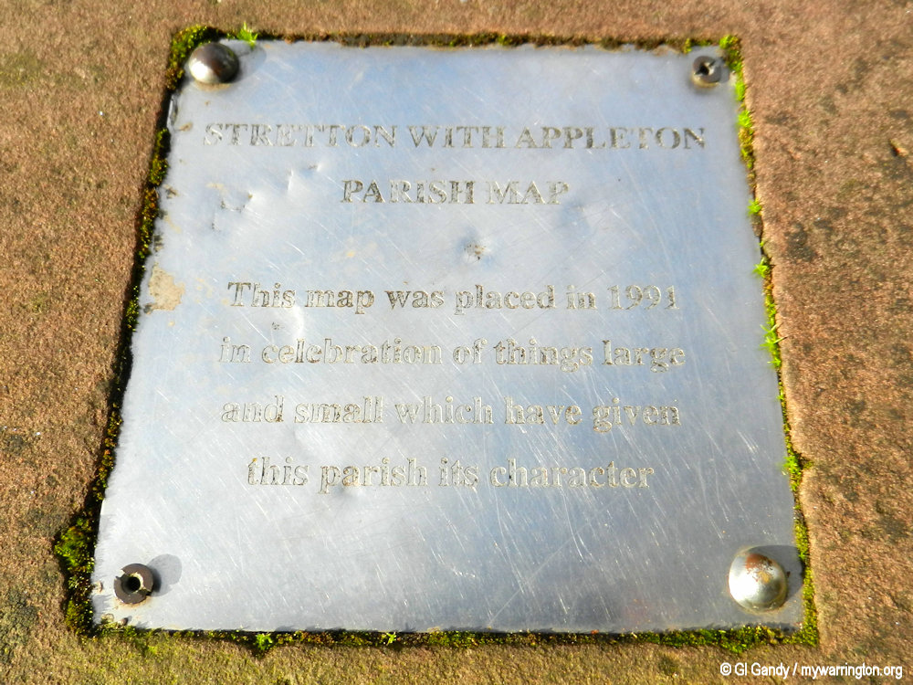
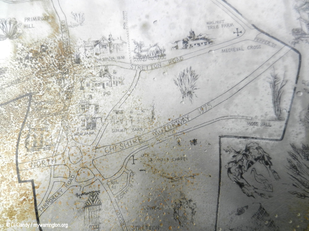
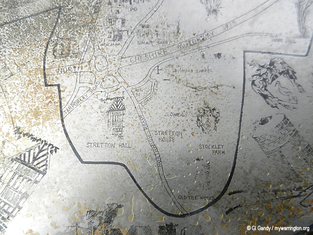
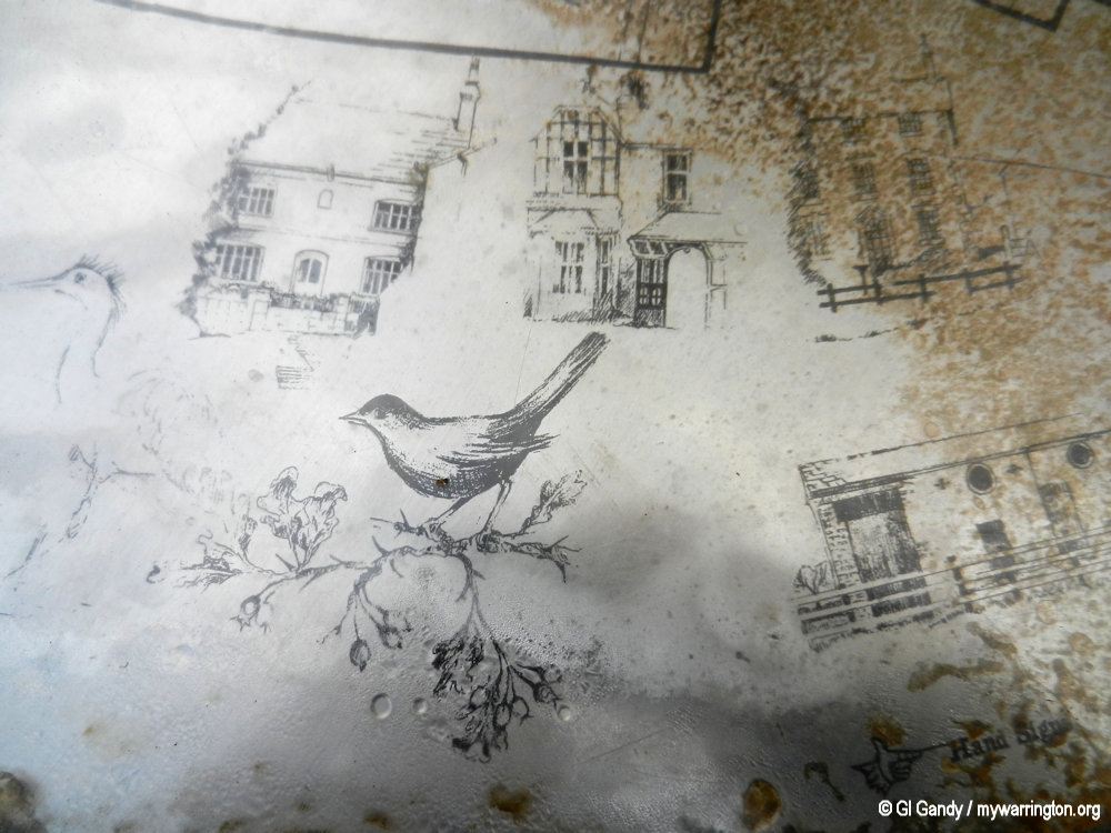
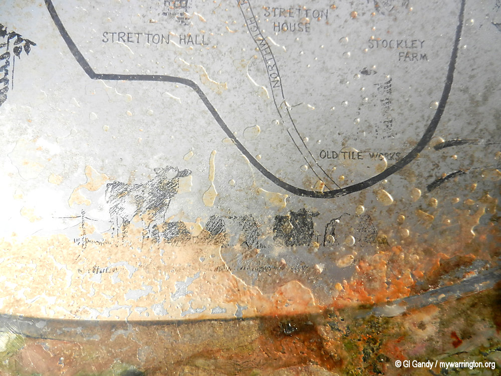
Heritage Map
In 1991 the Stretton with Appleton Parish Map was installed on a stone circle design along a pathway off Stretton Road. It has become affected by the weather over the years so the photos are the best that I can do.


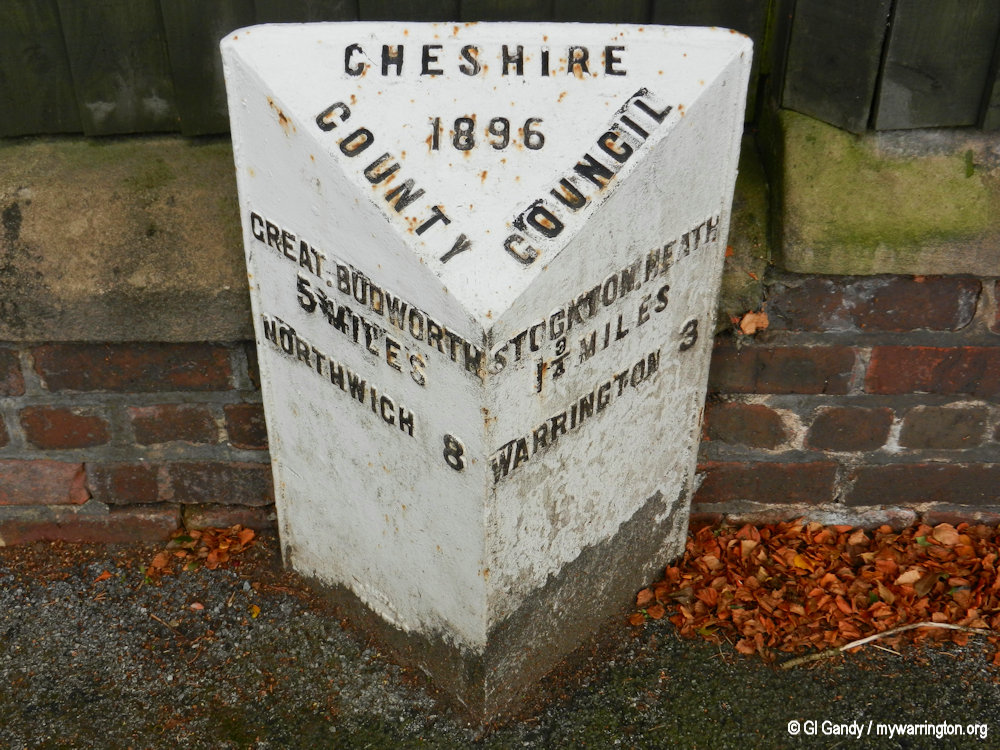
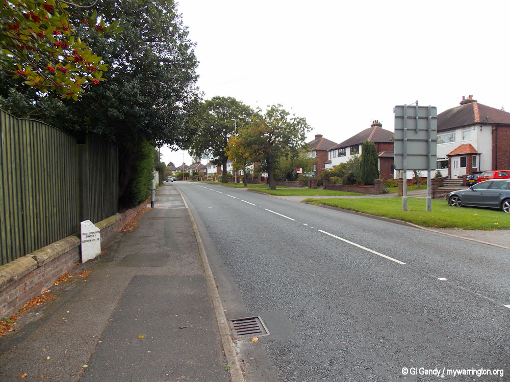
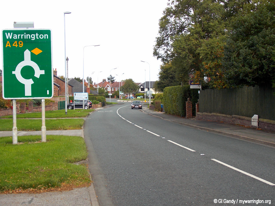
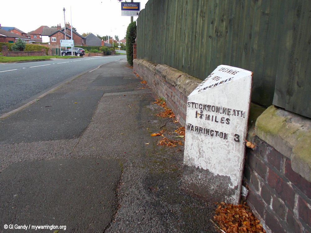
Milestone
There is one milestone in Stretton. It is located on London Road south of Owen’s Corner roundabout and opposite the A49 road sign. It was installed in 1896 and is now a Grade II listed building (List Entry Number: 1392450), having received that status on 6 March 2008. It was made by W. H. Smith of Whitchurch. Nothing to do with the bookseller and stationer.
I am not the only one to wonder how a metal or stone distance marker is classed as a building, but that is what it says on the Historic England website, so I will go with that.
Also, some are not made of stone either – I believe this one is cast iron, but on this website I will call them milestones for consistency.
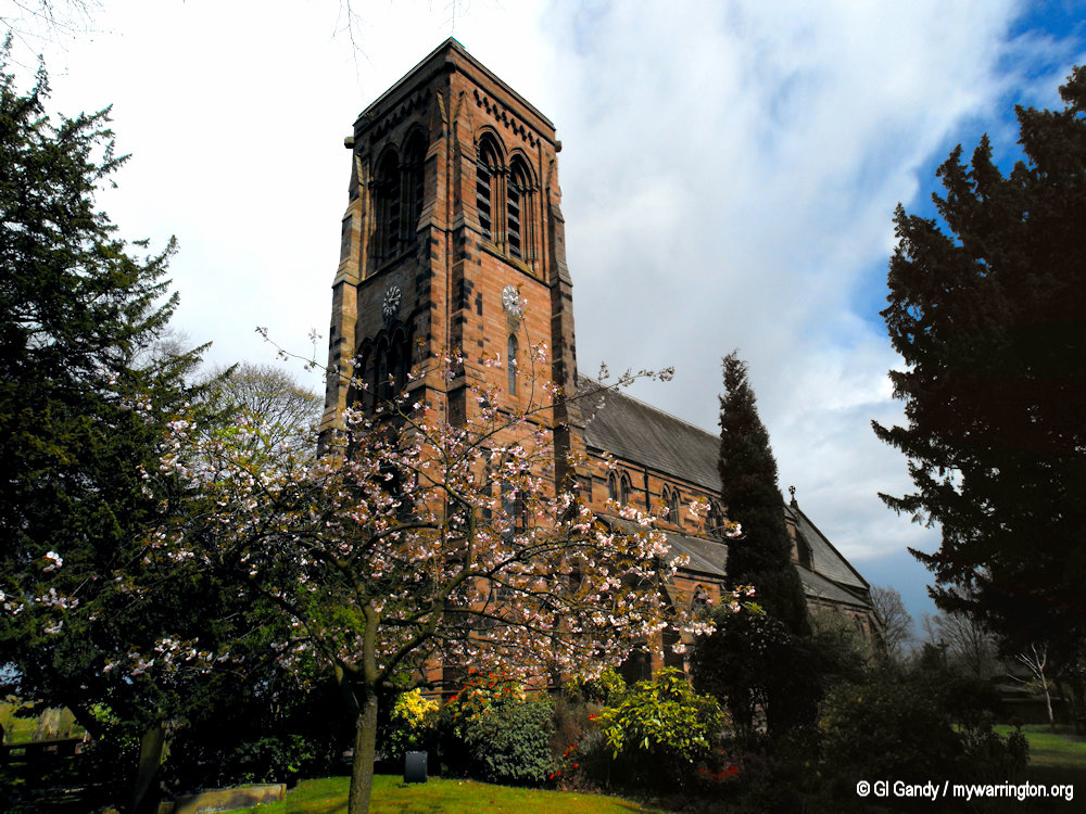
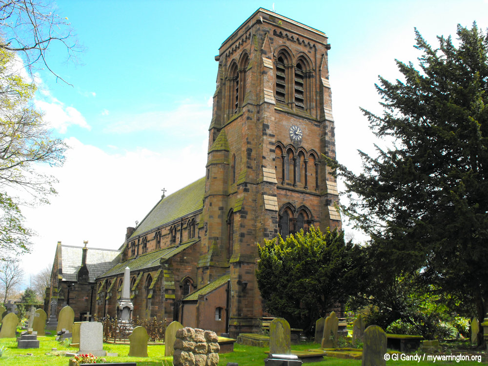
St Matthew’s C of E Church
St Matthew’s Church is recorded in the National Heritage List for England as a designated Grade II listed building. It is an active Anglican parish church in the diocese of Chester, the archdeaconry of Chester and the deanery of Great Budworth. Its benefice is combined with that of St Cross, Appleton Thorn.
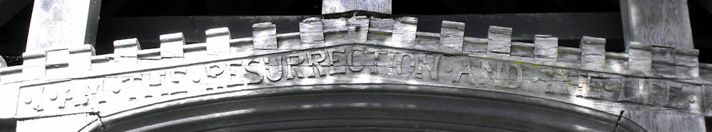
From the reign of Henry II, the village of Stretton was owned by the Starkey family and it is likely that a chapel was built for the family during the 13th or 14th century. In a will dated 1527 the chapel is referred to as the Oratory of St Saviour. In Leycester’s history of Cheshire it is stated that in 1666 the “ancient chapel of Stretton” was “ruinous and in decay”.
In 1826–27 a Commissioners’ Church was built as a chapel of ease to Great Budworth. It was designed by Philip Hardwick and accommodated 250 people. In 1859 Richard Greenall, vicar and archdeacon of Chester, commissioned George Gilbert Scott to build a chancel, which he did. Richard Greenall died suddenly in 1867, and following this the rest of the church was rebuilt as a memorial to him, Scott again being the architect.
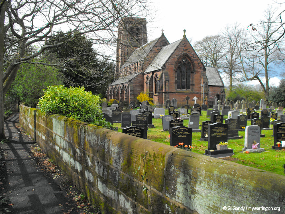
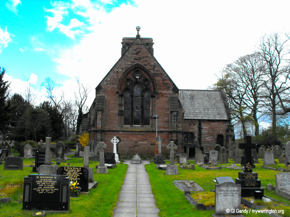
St Matthew’s church from Stretton Road on 10 April 2012.
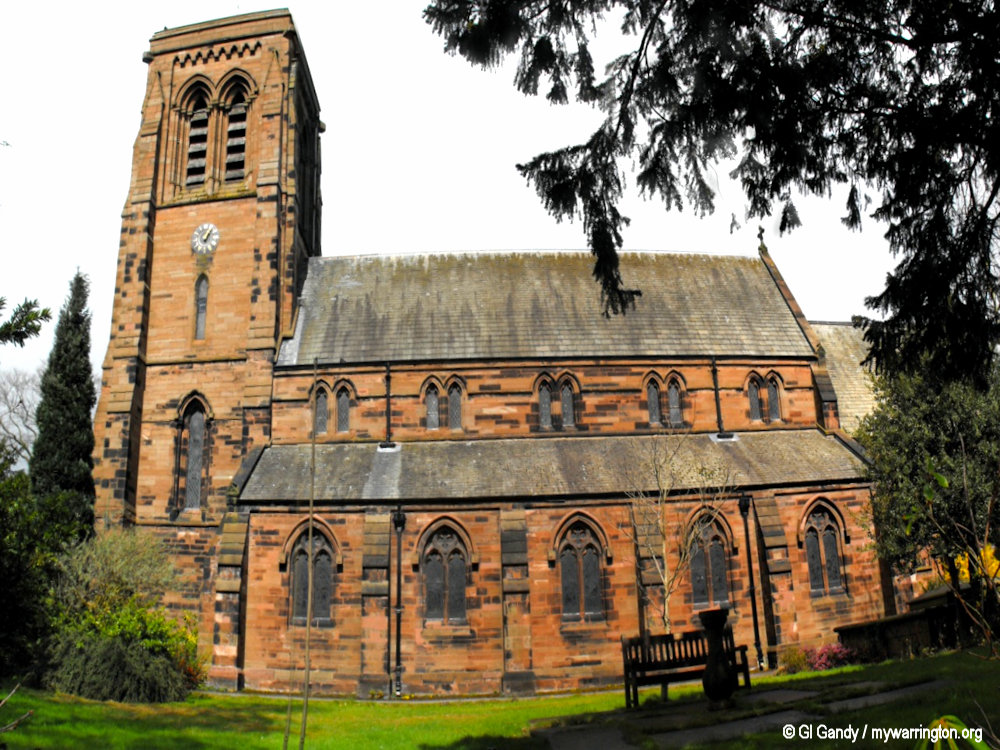
The church is built in red sandstone with Westmorland slate roofs. The plan consists of a five-bay nave with a clerestory, north and south aisles, a two-bay chancel, a north vestry and a west tower. The tower is in three stages with angle buttresses, an octagonal northeast turret, paired bell-openings and a corbelled plain parapet.
Exterior
On the west and south sides of the tower are clock faces which since 1963 have letter mottoes rather than numbers. The vicar, the Reverend Thomas E. N. Pennell, asked his Churchwarden, Mr Wallace Miln, to think up a few twelve letter mottos that might be suitable. Mr Miln produced over 80. They chose “Time is not all” and “Forget not God”.
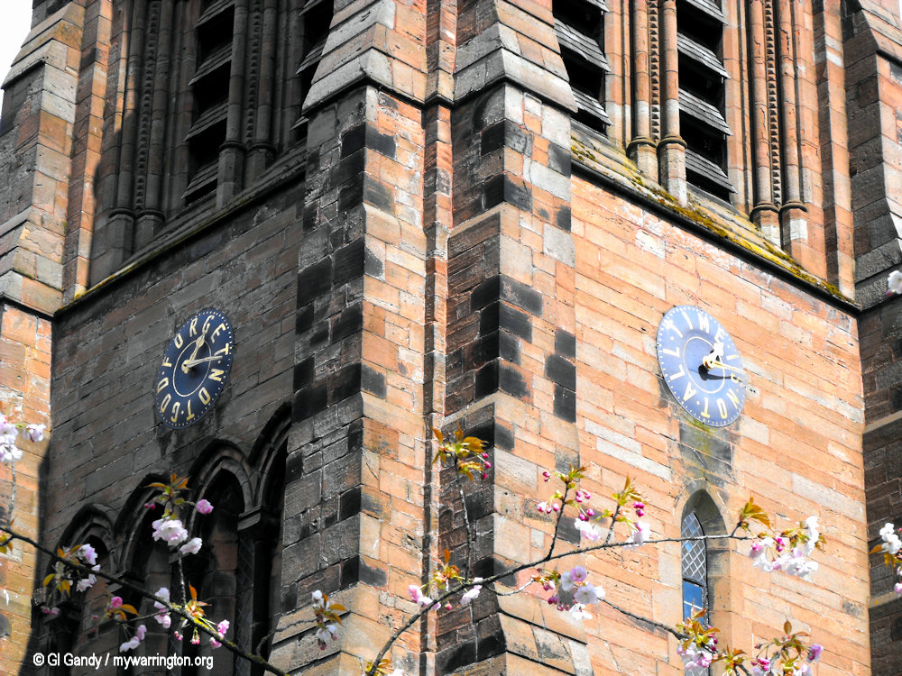
The sandstone building and the two clocks (10 April 2012)
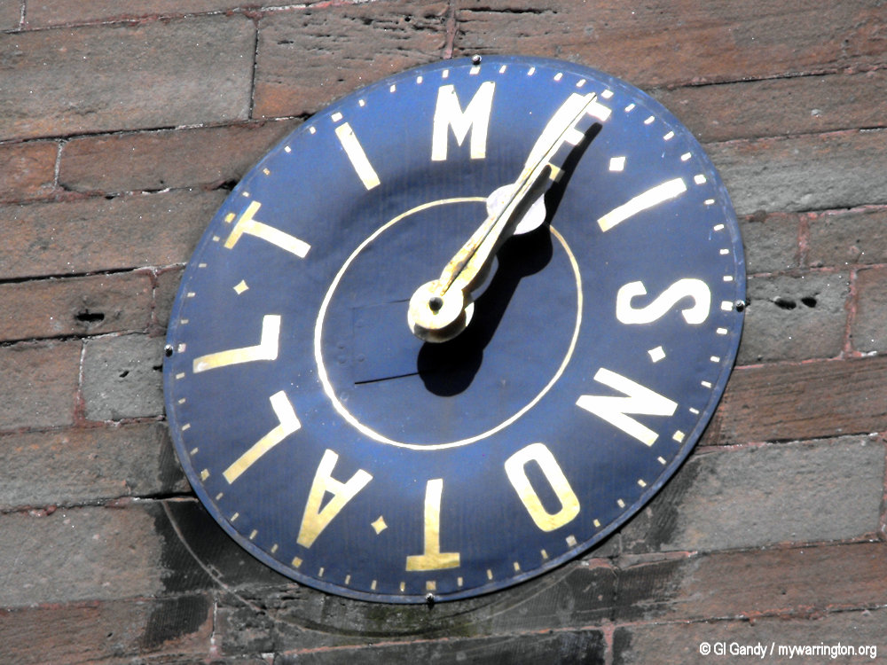
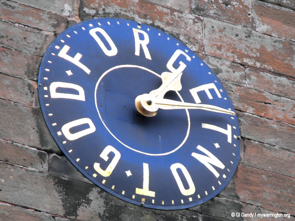
The Time is not all and Forget not God clock faces (10 April 2012).
There was originally a ring of six bells which were dated 1850. They were re-hung in 1920 and again in 1987. In 2003 two additional bells were cast, making a total ring of eight. The original bells were made by Charles and George Mears at the Whitechapel Bell Foundry, and the later bells were cast by John Taylor Bellfounders.
Interior
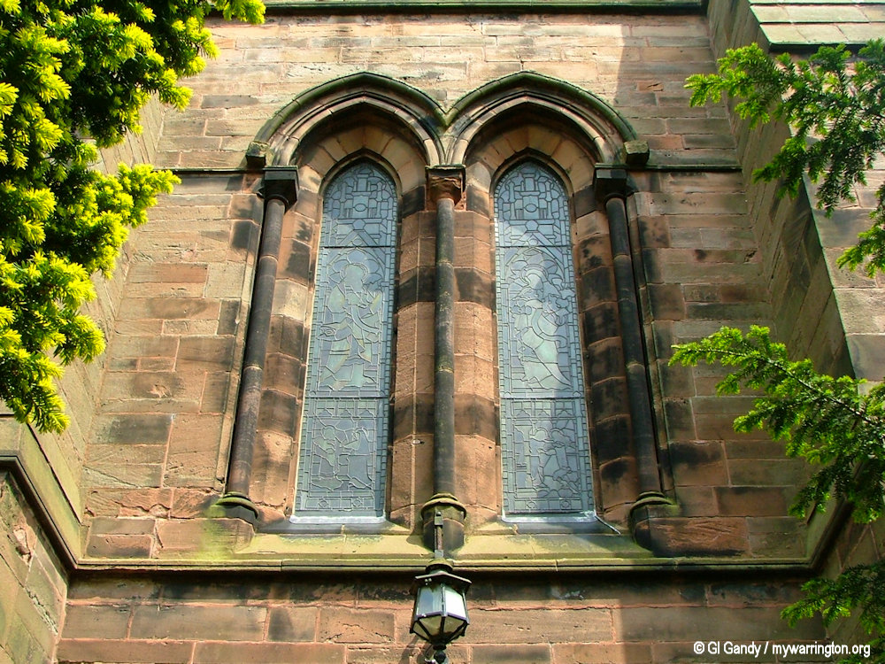
The west door screen, dated 1982, is made of oak and is by Hayes and Finch of Liverpool. The roof of the nave is of red deal and the pews are oak. The font, which dates from 1867, is in stone with a carved oak canopy. The pulpit was designed by Scott and installed in 1859. The tiles in the sanctuary are thought to be Minton encaustic tiles; the tiles elsewhere in the church are black and red.
St Matthew’s church (10 Apr 2012)
The organ was built by Henry Willis and installed in 1876. Additional stops were added to the organ in the early 1920s. The frontal section of the altar and the reredos were made of carved oak by E. H. Sankey in 1957. The east window was designed and made by Trena Cox and dedicated in 1939. Much of the rest of the stained glass in the church is by Clayton and Bell.
External features
In the churchyard is a war memorial which consists of a stone cross, approximately 15 feet (5 m) high, on an octagonal base which was consecrated on 1 November 1923. The churchyard also contains the war graves of three soldiers of World War I, and an airman of World War II. The lychgate dates from 1889. The cross on its roof was cut off in 1961 because of an infestation of death watch beetle.
Information: Wikipedia.
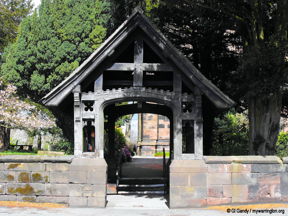
The lychgate on 10 April 2012.
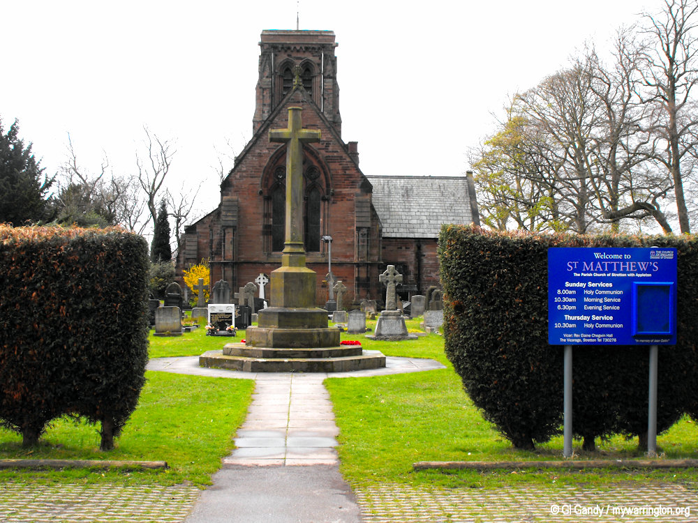
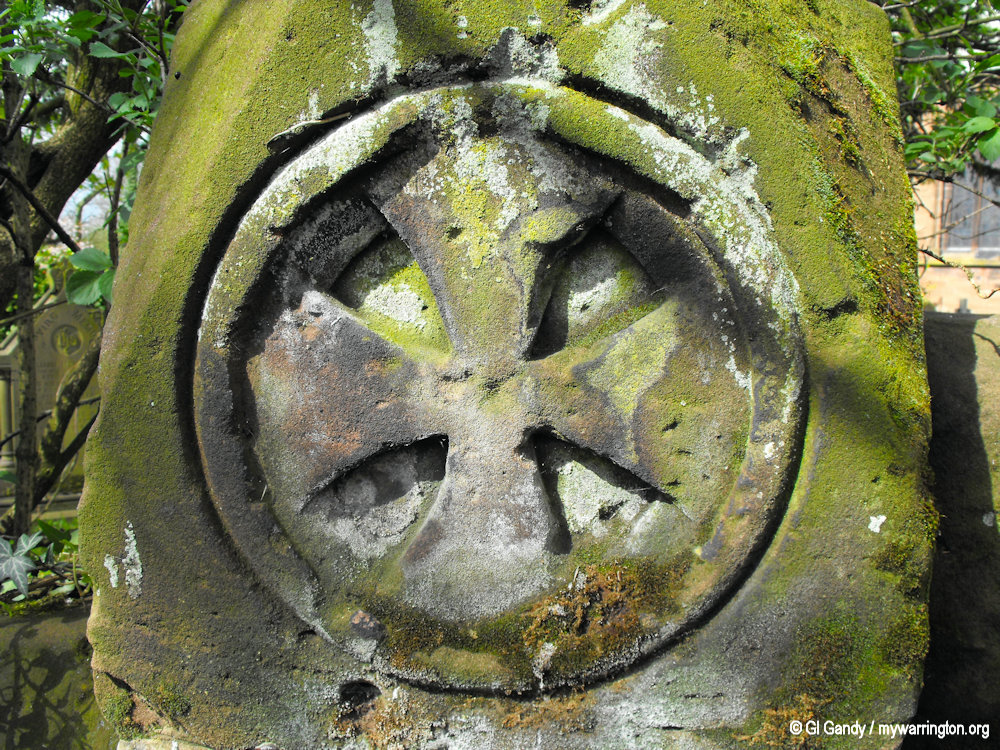

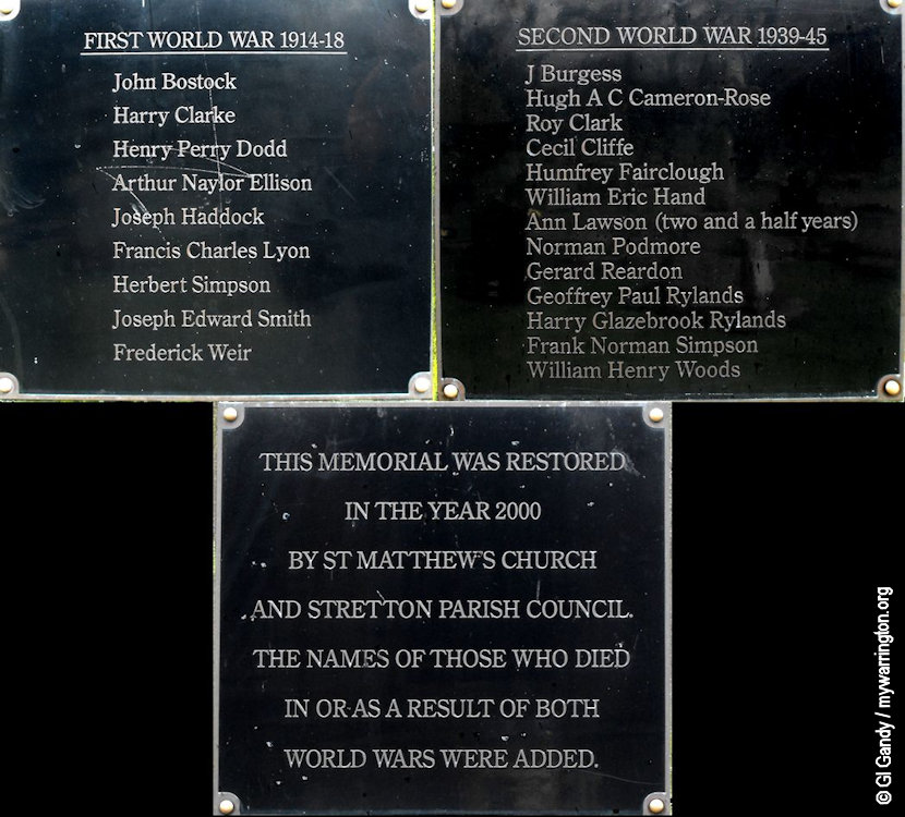
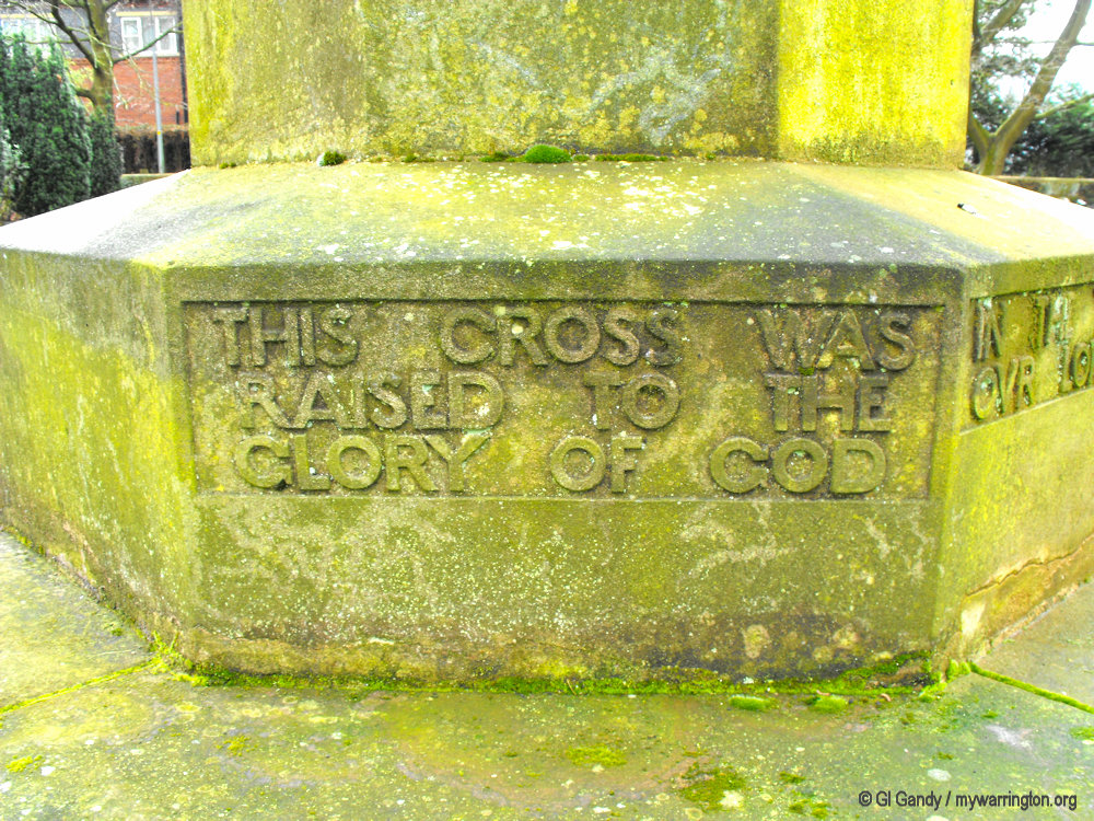
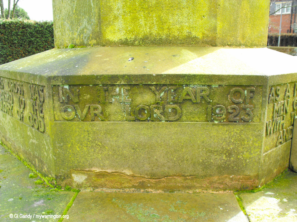
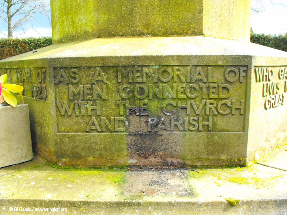
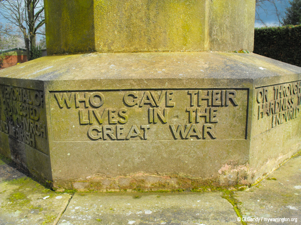
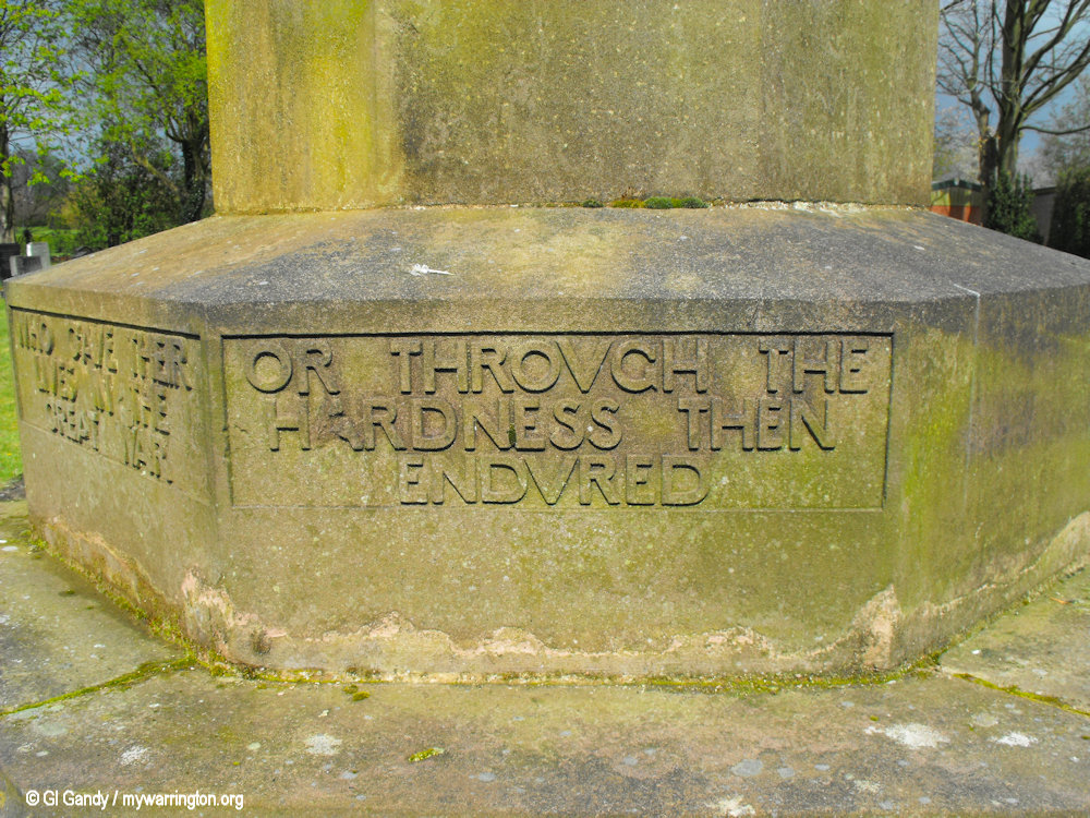
All photos of St Matthew’s Church and village war memorial were taken on 10 April 2012. The war memorial was unveiled on 1 November 1923.
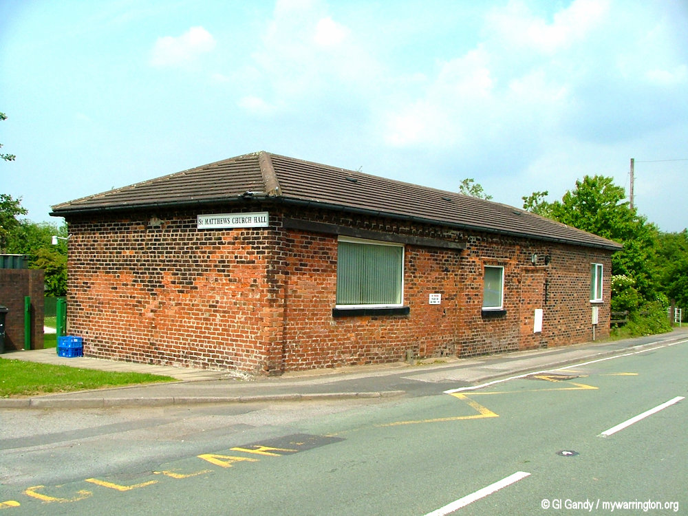
St Matthew’s Primary School
The first Stretton National School (St Matthew’s) opened in 1838 on Stretton Road. The second St Matthew’s C of E School, Stretton, opened on 10 October 1981 further east along Stretton Road. It is located between the church and the church hall.
In September 2023, Stretton St Matthew’s C.E. Primary School joined the Chester Diocesan Academies Trust (CDAT) family. CDAT is a Multi-Academy Trust (MAT) founded by the Diocese of Chester that operates church and community schools across Cheshire, Wirral, and parts of Greater Manchester.
St Matthew’s school and church hall on Stretton Road (10 Apr 2012)
RNAS Stretton
Royal Naval Air Station Stretton (HMS Blackcap), was an airfield in the village of Appleton Thorn, close to the village of Stretton in south Warrington. The airfield’s site was located to the south west of junction 9 of the later M56 motorway. All Naval Air Stations are named after birds.
RNAS Stretton was originally planned as a Royal Air Force night fighter station to protect Liverpool and Manchester from Luftwaffe air raids during World War II. However, changes in German tactics meant that the airfield was not required so it was transferred to the Admiralty on completion.
Read more in Military Service.
Remains of Royal Naval Air Station Stretton (HMS Blackcap) (1 Sep 2010)
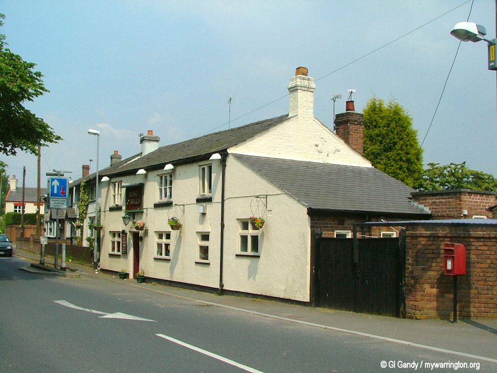
Pub Life
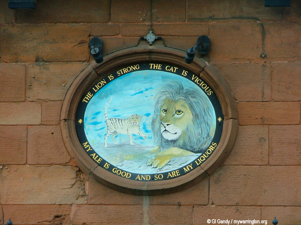
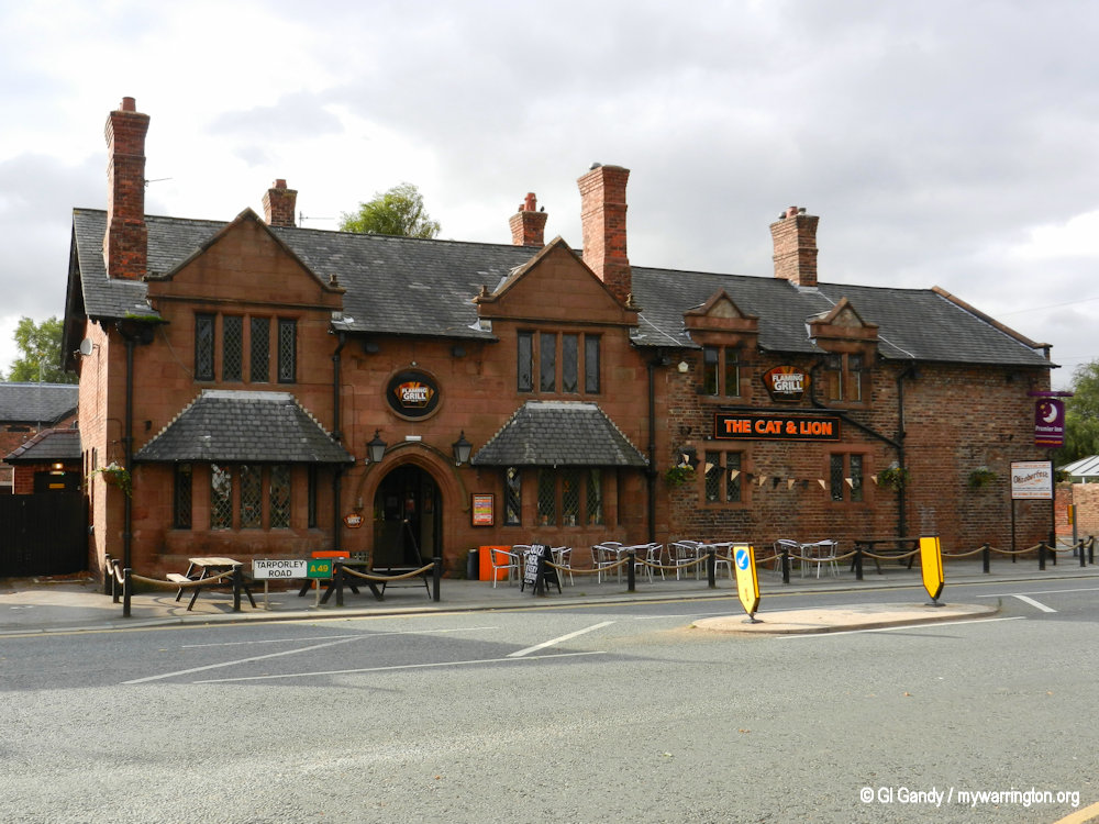
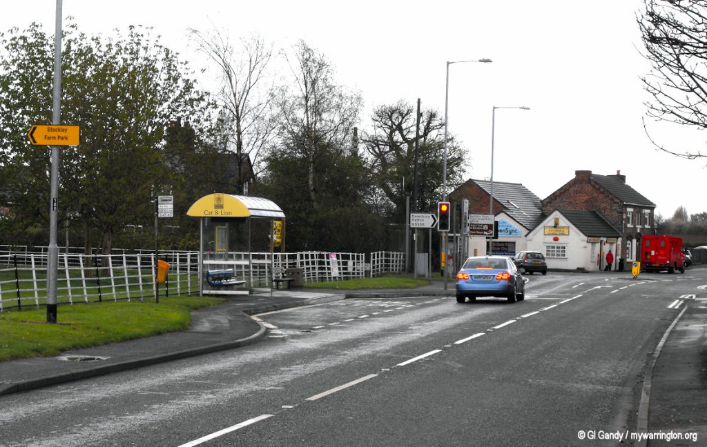
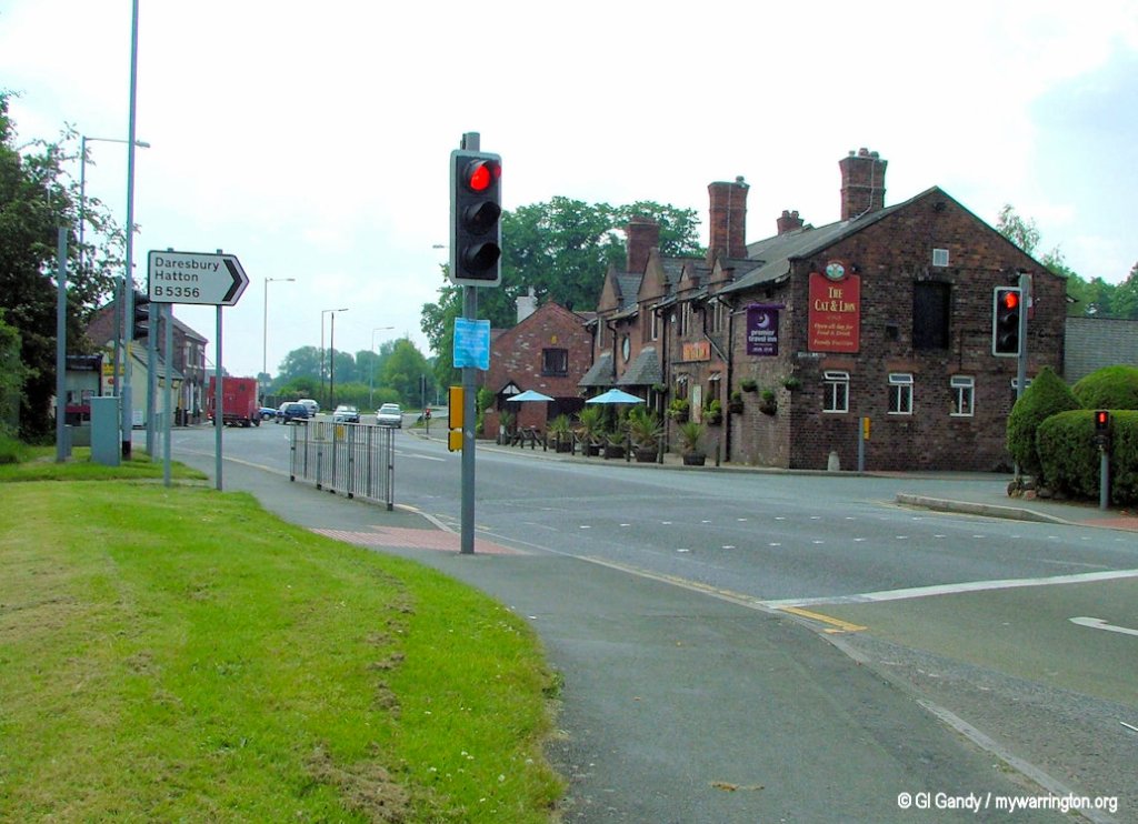
There are two public houses in the village today. The first in my list is the Cat and Lion on Tarporley Road.
The sandstone building, originally known as the White Lion, was first opened in at least 1636 as a coaching inn. This is the year when English poet Richard Braithwaite called here on his way to Lancashire.
Note the poem in the image here “The Lion is strong, the cat is vicious. My ale is good and so are my liquors”.
In 2013 the pub came under the Flaming Grill brand.
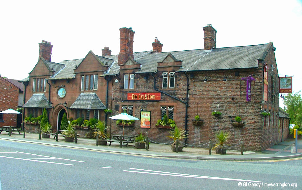
The Cat and Lion on Tarporley Road (6 Jun 2006)
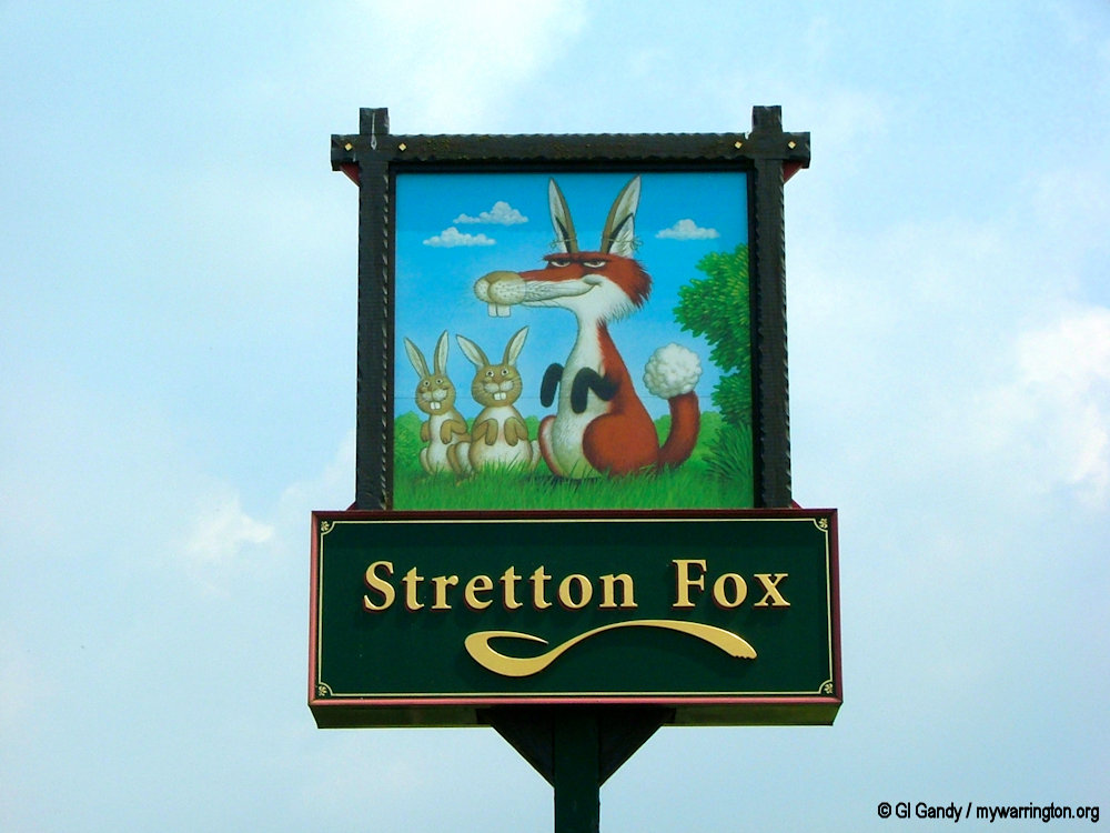
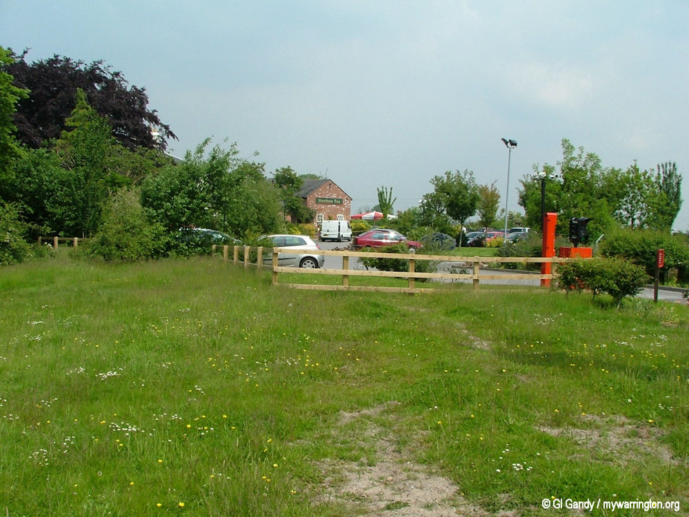
Another pub in the village is the Stretton Fox alongside the M56 motorway. The Stretton Fox is a converted farmhouse with seven separate dining areas.
A third pub is on Northwich Road in Lower Stretton. In 1851 it was known as Crown Inn when it stood on the opposite side of the road, having previously been called the Rose and Crown. In 2016, the pub was designated an asset of community value, but it was removed from the list in 2021. The pub was closed on 31 August 2023 and was given planning permission to change its usage in 2024. In November 2025 a plan to demolish the historic building and replace it with a new retail building, was rejected by borough planning chiefs. Planners were told the pub had struggled to remain viable in recent years. The highway authority objected to the new proposals because of inadequate parking provision and the likely impact on the local highway network and there were also objections from Stretton Parish Council and a number of local residents. Read more in Warrington-Worldwide.
Stretton Hall
Stretton Hall on Hall Lane (off Northwich Road) in Lower Stretton was built in 1664. It was the home of the Starkey family. The building was restored in the 19th century and is now Grade II listed. Further information can be found on Historic England and on the Stretton History Website.
See the Warrington Guardian for a story of further restoration work from 2023, including a photo of the hall.
Post Office
The post office was originally a greengrocers shop called The Beehive and still known as Beehive General Store and Post Office. According to the Stretton History Website there were houses on the site before 1846. The property next door was built in 1885. Notice the THL in the datestone. THL refers to Thomas Henry Lyon, the owner of Appleton Hall and lord of the manor.
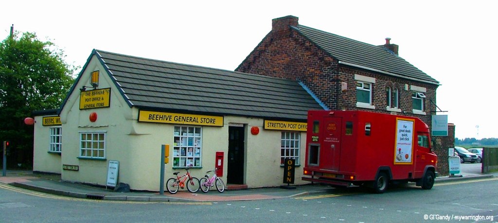
Stretton post office (6 Jun 2006)
Walkabout Stretton
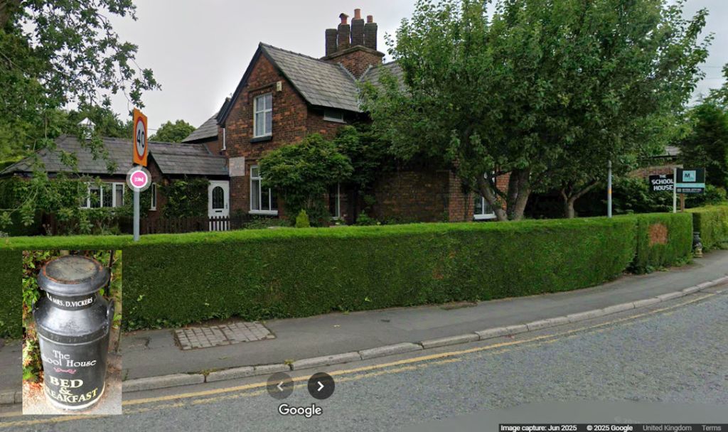
One photo to highlight here: The School House B&B occupies the Old School House built in 1838 next door to the first school in the village.
I like the decorative milk churn advertising the business, which I have inserted into the Google image.


Walkabout Lower Stretton
Don’t forget the Stretton History website for a more detailed history of the Stretton area, featuring stories, photographs and memories.
