

- Introduction
- History
- Milestone
- Travellers’ Rest Stone
- Walton Hall
- Greenall Family Grade II Listed Buildings
- St John’s the Evangelist Church
- Walton Lea Crematorium
- Walton War Memorial
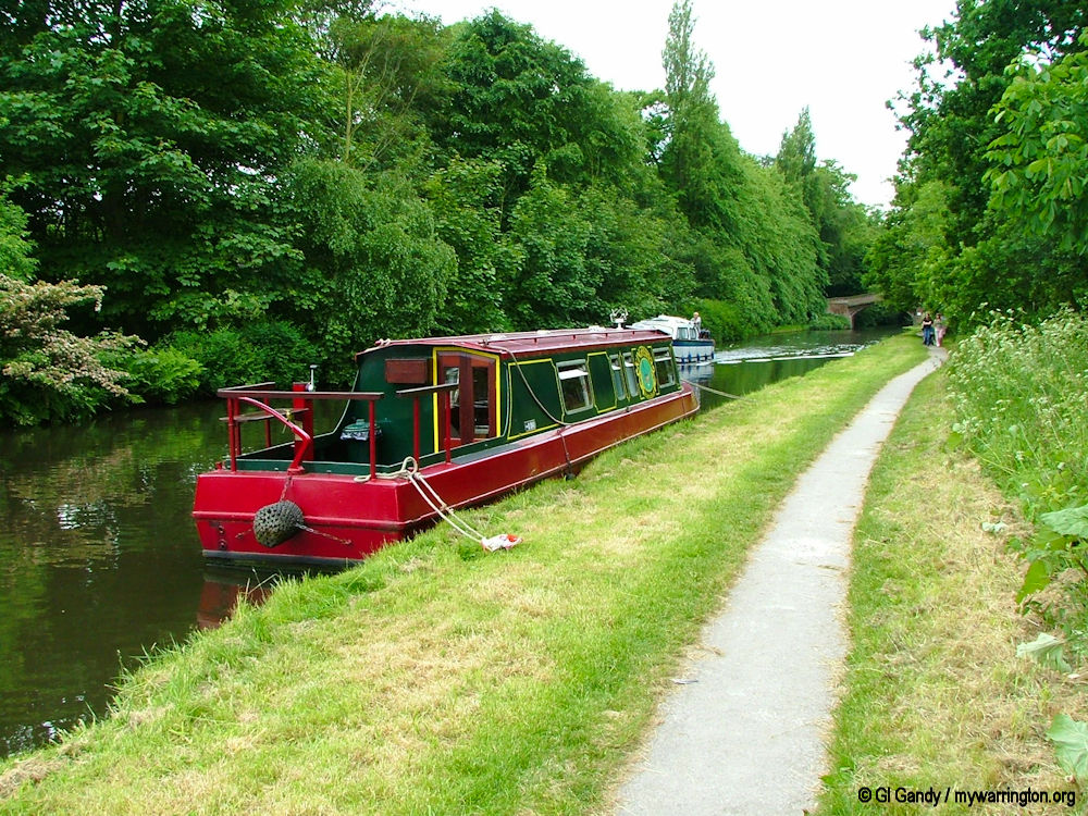
- Bridgewater Canal
- Pub Life
- Walton Lock
- Warrington Sports Club
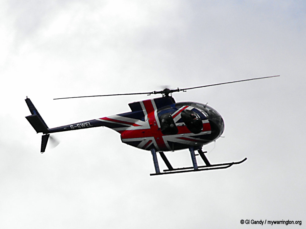
- Queen Elizabeth II Fields in Trust 2012
- King George V Post Box
- A Final Walkabout

Introduction
In 1870-72, John Marius Wilson’s Imperial Gazetteer of England and Wales Described Walton like this:
WALTON (Inferior and Superior), two townships in Runcorn parish, Cheshire; 2 miles S of Warrington. Acres, 537 and 424. Real property, £1,955 and £1,194. Pop., 395 and 160. W. Hall is the seat of G. Grunall, Esq.; and Mere Hall, of T. J. S. Brooke, Esq.
GB Historical GIS / University of Portsmouth, History of Walton, in Warrington and Cheshire | Map and description, A Vision of Britain through Time.
URL: http://www.visionofbritain.org.uk/place/3732
Date accessed: 18th September 2025
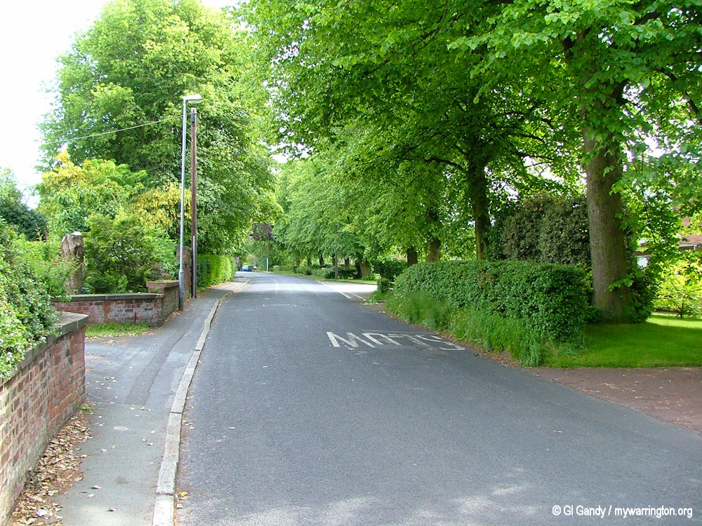
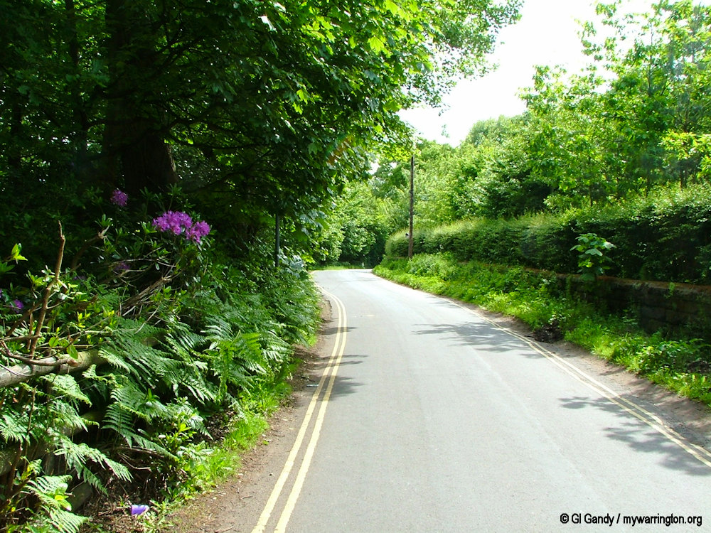
Bridgewater Canal by Walton Lea Road (31 May 2005)
History
Walton is a civil parish in south Warrington close to Stockton Heath and part of the council ward of Hatton, Stretton and Walton.
The name Walton comes from settlement/farmstead of Wealas – native Celts, which is what the new Anglo Saxon speaking peoples called the native inhabitants of England [not sure about this sentence].
Mark Olly in Celtic Warrington and Other Mysteries Book 3 (Churnet Valley Books, 2002) says Walton has seen many changes since the invading Saxons gave it the name ‘WAHL-TUN’ (the ‘town of the Britons, foreigners or Welsh’.
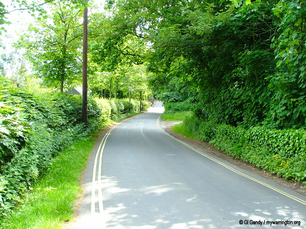
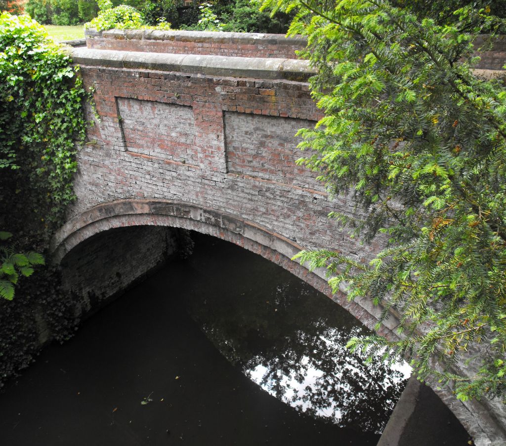
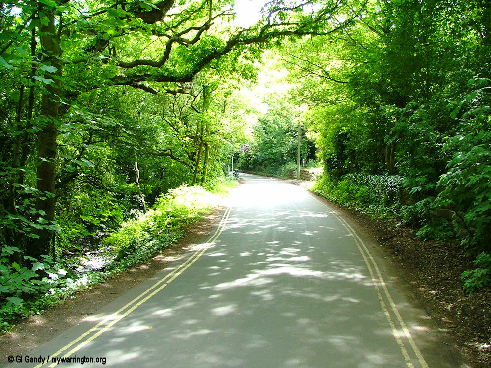
Hough’s Lane and Hough’s Bridge over the Bridgewater Canal at Walton (31 May 2004)
There is strong evidence that in many areas of England taken over by Germanic speaking settlers, the native British (Wealas) remained undisturbed, farming the same land they did when the Romans left.
Over time they forgot their Celtic tongue and adopted the language and culture of the newcomers in order to climb the social ladder or were coerced to do so. It was in the Anglo Saxon interest that the native British carry on as usual to ensure the economy produced food and goods for the new landowners.
Woodland alongside Hough’s Lane in Walton (31 May 2004)
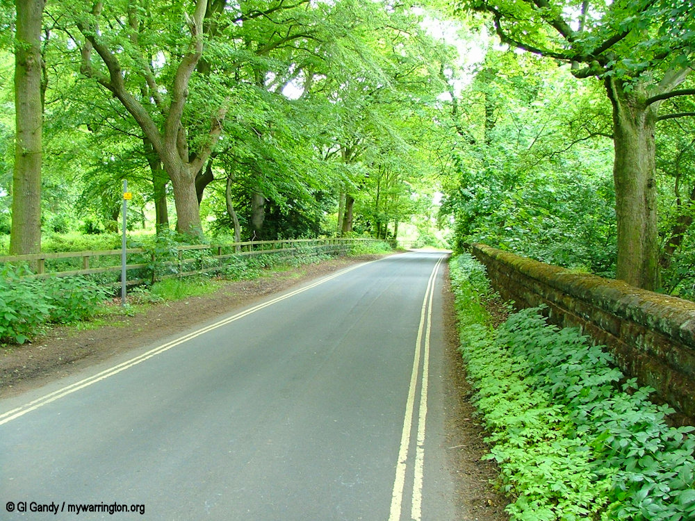
Walton Superior/Inferior
Walton is split into two area, Walton Superior and Walton Inferior (now known as Higher and Lower Walton respectively).
The parish was formed on 1 April 1936 from Acton Grange, Walton Superior and Walton Inferior. Walton Superior (or Higher Walton) was a township in Runcorn ancient parish, Bucklow hundred (SJ 5985), which became a civil parish in 1866.
In 1936 the civil parish was abolished to become part of Walton.
Higher Walton is the location of Walton Hal Gardens, while Lower Walton is the area around Ellesmere Road, the Manchester Ship Canal, The Stag Inn and the streets near by.
Some information: Genuki.org
The Stag Inn as it looked on 31 May 2004
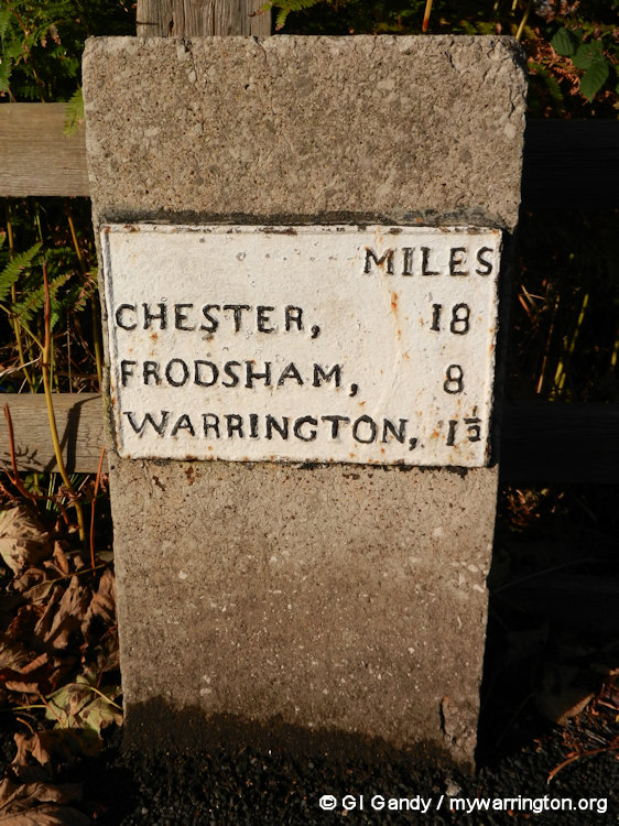
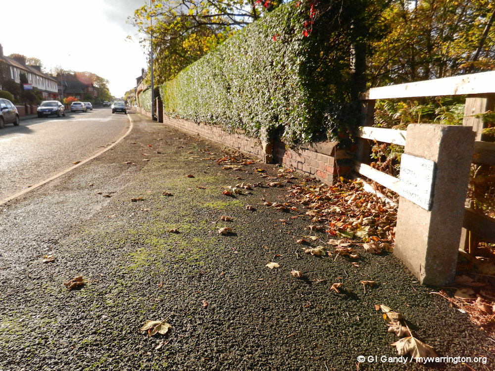
Milestone
The two images show the Walton milestone on Ellesmere Road, which gives distances in miles to Chester, Frodsham and Warrington. Remember, Walton wasn’t fully part of the Warrington district until 1933 when sections of the district were brought within the borough of Warrington along with parts of Winwick, Burtonwood and Great Sankey under the Warrington Extension Act. All other parts of the district came wholly within Warrington Borough in 1974 under a separate Act.
Travellers’ Rest Stone
Alongside Chester Road you can see “Travellers’ Rest stone at Stag Inn traffic island, Lower Walton”, to give its listing title. The Travellers’ Rest stone at the Stag Inn traffic island is a stone seat for travelling migrants, of around 1860 and designed by James Kendrick, is listed at Grade II This stone is one of several stones placed by Dr James Kendrick in the Warrington area around 1860. In September 1859, inspired by Charles Melly’s donation of drinking fountains in Liverpool, Kendrick proposed a series of stone seats for foot travellers through Warrington, in particular along the road from Liverpool to Manchester. This road was much travelled by itinerant labourers including many Irish harvest-time migrants. See Historic England for more.
The Traveller’s Rest in Walton.
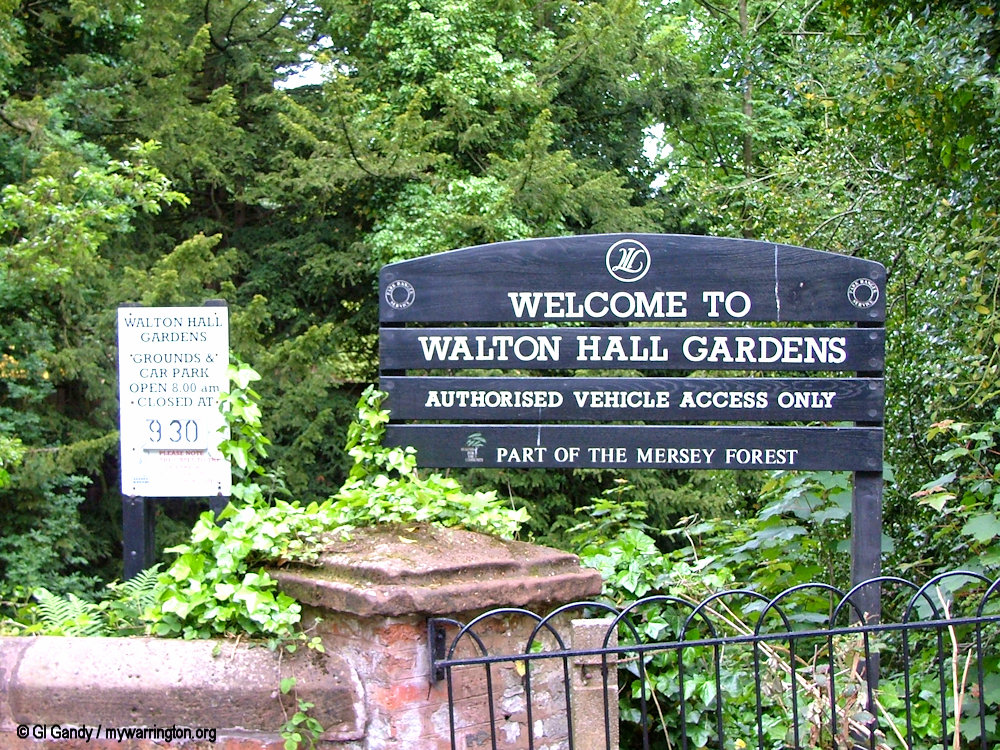
Walton Hall
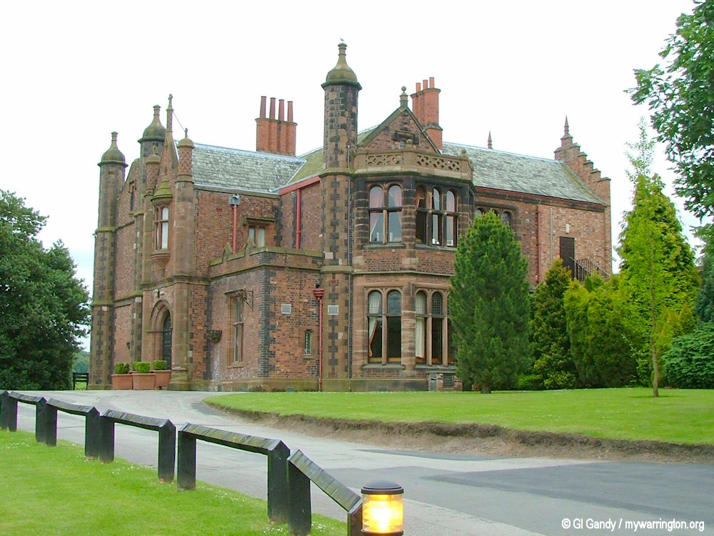
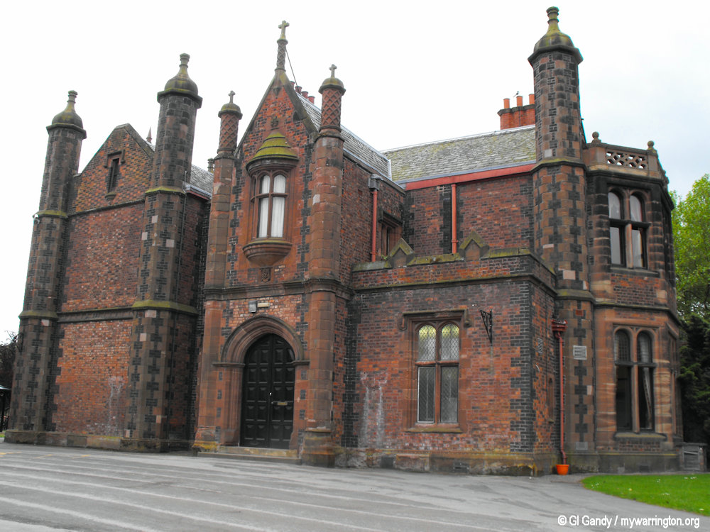
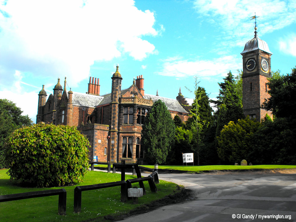
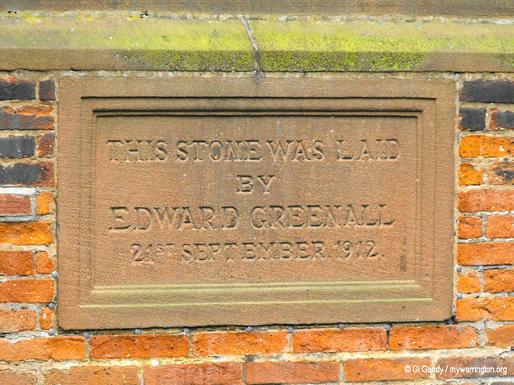
Walton Hall is a country house in Walton (grid reference SJ600849). It is a Grade II listed building. The hall and its surrounding garden and grounds are owned and administered by Warrington Borough Council.
The Greenall family purchased the Walton Hall Estate in 1812. The house was built in 1836–38 for Gilbert Greenall, brewer and Member of Parliament, to a design by Edmund Sharpe and is in mock Elizabethan style.
The Greenall Family
The Greenall family traces its descent from Thomas Greenhalgh who died in 1584. Their first brewery was built in St Helens in 1762 by Thomas Greenall (1733-1805).
Greenall went into business with William Orrett, the owner of a number of inns and Thomas Lyon, a landowner and business partner with Joseph Parr and Walter Kerfoot in a banking business.
Walton Hall on 31 May 2004
This partnership started brewing in Warrington and built a new brewery at Wilderspool in 1793. Gilbert’s sister, Isabella, married John Whitley and had five sons, some of whom became partners in the brewing business. In October 1880, the St. Helens and Warrington Brewery businesses became Greenall Whitley and Company Ltd, under the chairmanship of Sir Gilbert Greenall.
The partnership built a new brewery at Wilderspool near Warrington in 1793. Gilbert’s sister, Isabella, married a John Whitley and they had five sons together, some of whom became part of the business.
In October 1880 Whitley joined the Greenall company and it became Greenall Whitley Company Ltd with Sir Gilbert Greenall being the chairman.
Walton Hall on 31 May 2004
The Hall
In 1869–70 the hall was extended with a new wing being added for billiards and guests and a new entrance on the east front. A clock tower was also added around this time. The new wing has since been reduced, leaving the clock tower isolated.
The hall is built in brown brick with stone dressings and slate roofs. The east front has 2½ storeys and two wide bays with bay windows, two crow-stepped gables and three pinnacled octagonal buttresses. The entrance (north) front has a projecting porch.
The clock tower to the west has four stages, the top stage containing the clock, surmounted by a lead-roofed cupola and a large weather vane. The south face has a window with mullions and transoms and three crow-stepped gables.
Walton Hall and the clock tower on 15 July 2012.
The outbuildings include an iron-framed palm house. The retaining wall, balustrades and steps between the lawns east of the hall are Grade II listed. Also Grade II listed are the former lodge to the hall, and its associated gates, gate piers and screens.
The Greenall family sold the estate in 1941 and while tenants bought some of the farms, the hall and land for the present park and golf course was purchased by Warrington Council.
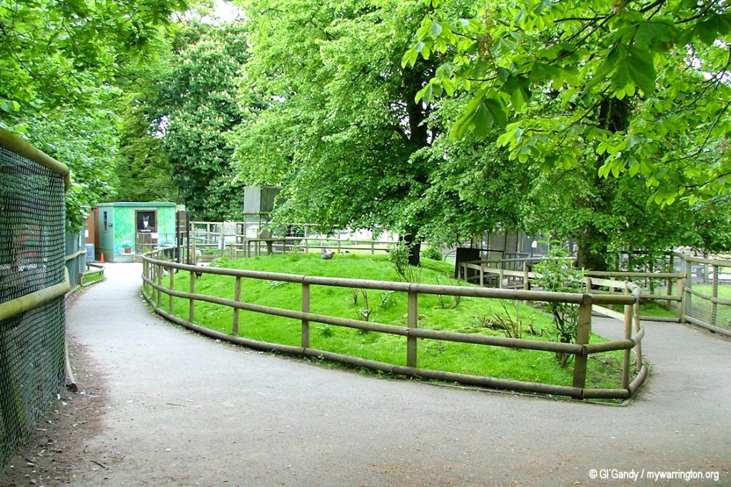
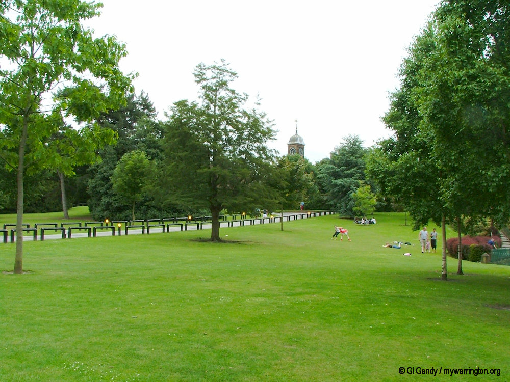
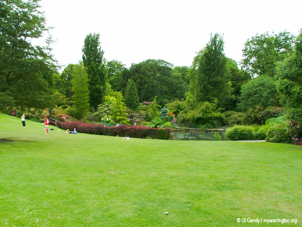
Since 1945 the grounds have been a public park, and now include lawns, picnic areas, a play area, a children’s zoo, cycle museum, a heritage centre and ornamental gardens. A programme of events in the grounds is organised.
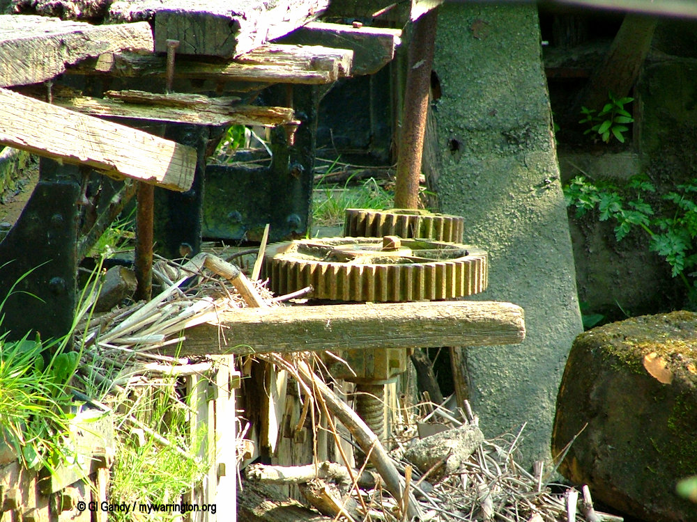
During the 1970s the hall was used for the storage of items by Warrington Museum. Items included Javan dugout canoe, specimen boxes of butterflies and moths, and stuffed rodents.
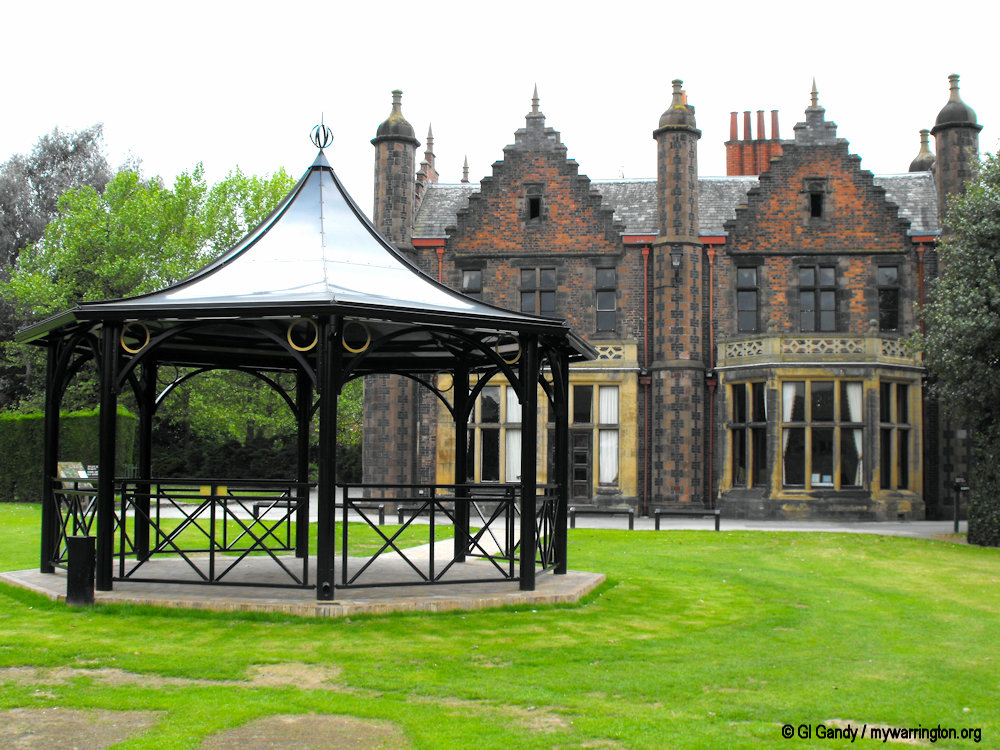
Walton Hall and the bandstand on 31 May 2004
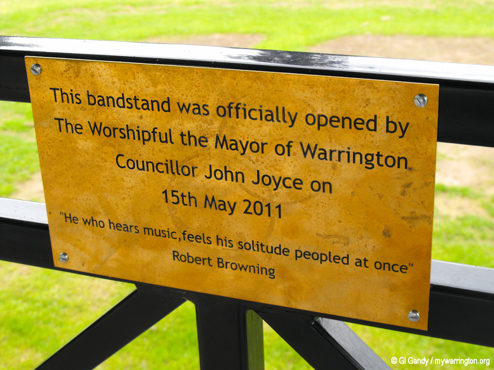
On 17 August 2010 arsonists burned down the bandstand, which was a popular attraction, especially in the summer when concerts were performed in the grounds of Walton Hall Gardens. The council commissioned a rebuild of the bandstand and a new version was officially opened on 15 May 2011.
The Friends of Walton Hall Music Society arrange a series of concerts in the hall given by young musicians. The hall is available for hire for weddings and other events.
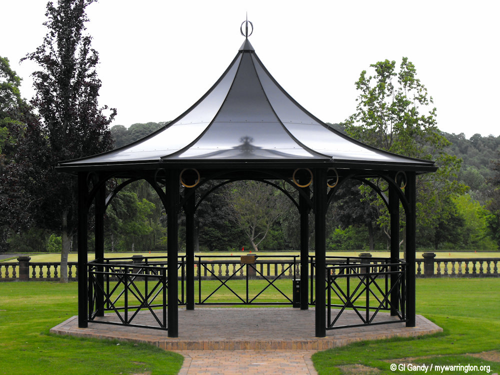
The Replacement bandstand was officially opened on 11 May 2011 (my photos 20 May 2011)
In 2010 archaeologists working on behalf of Warrington Borough Council unearthed an old water pump in the grounds. Link to the Warrington Guardian for a report.
Walton Hall and Gardens received significant funding from The National Lottery Heritage Fund (now The National Lottery Heritage Fund) for the restoration of its glasshouses, with funding secured as early as 2016 and work culminating in a reopening in 2019.
This grant supported extensive restoration of the Grade II listed conservatory range which now host students from Myerscough College and the Walton Lea Partnership, which provides life-skills training for adults with learning disabilities.
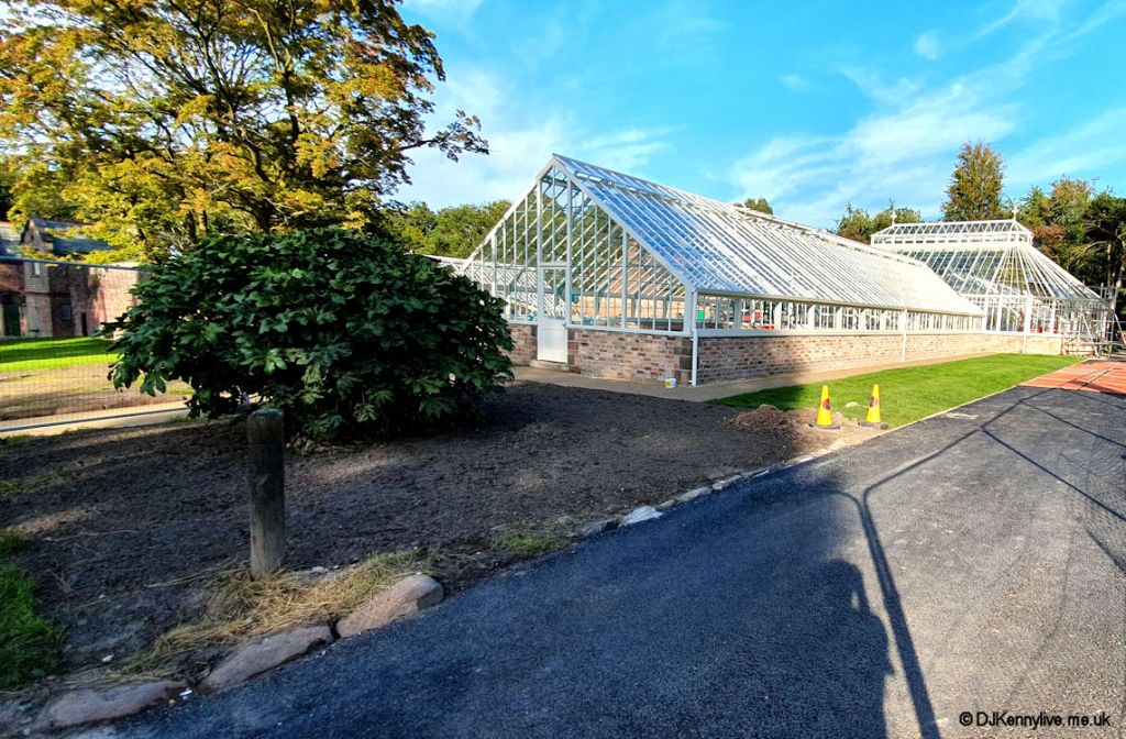
The restored glass house in a photo from 24 Sep 2019 (© DJKennylive.me.uk)
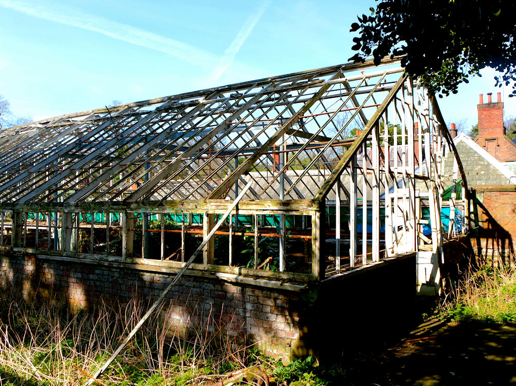
The second image shows the condition of the glasshouse before it was restored.
The copyright on this image is owned by Matt Harrop and is licensed for reuse under the Creative Commons Attribution-ShareAlike 2.0 license.
Image was adjusted for brightness, contrast and vibrancy by GI Gandy on 23 Sep 2025 for use on the mywarrington.org website. Link to the original here.
The adjusted image is also available under the same the Creative Commons Attribution-ShareAlike 2.0 license.
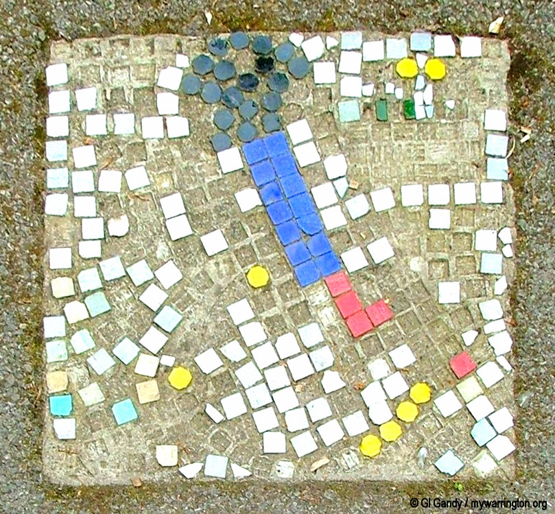
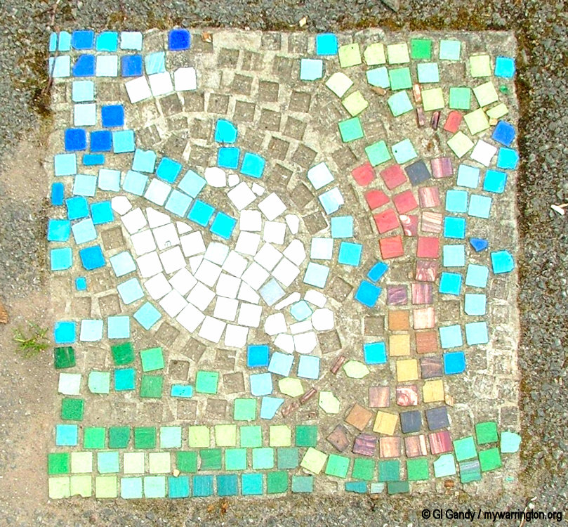
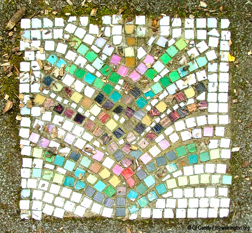
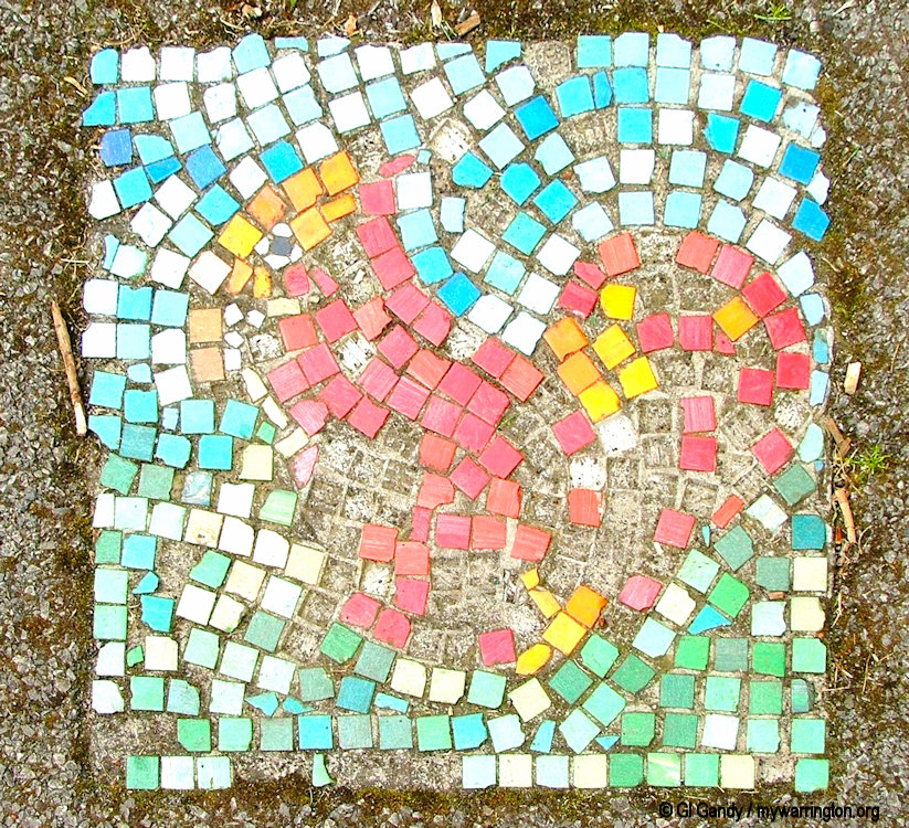
Mersey Forest Arts Project 93 – These mosaics were created by members of Dallam Centre for people with physical disabilities in conjunction with the Warrington Borough Council Ranger Services [on display in Walton Hall Gardens]. Photos © GI Gandy / mywarrington.org (31 May 204)

See more photos of the hall in the Walton Hall Gardens section of Warrington Green.
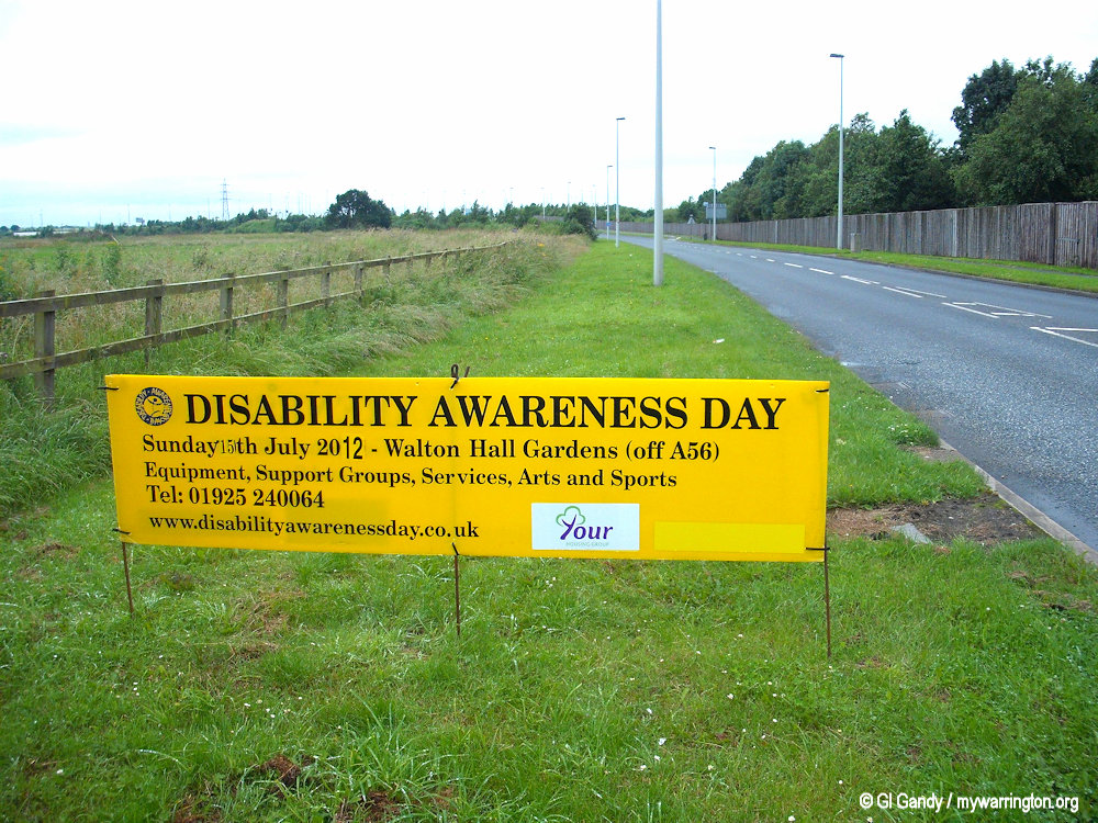
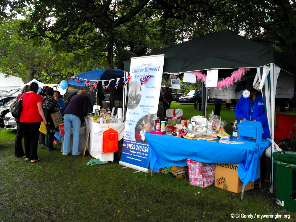
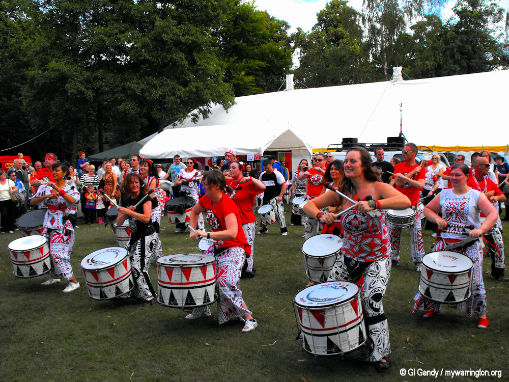
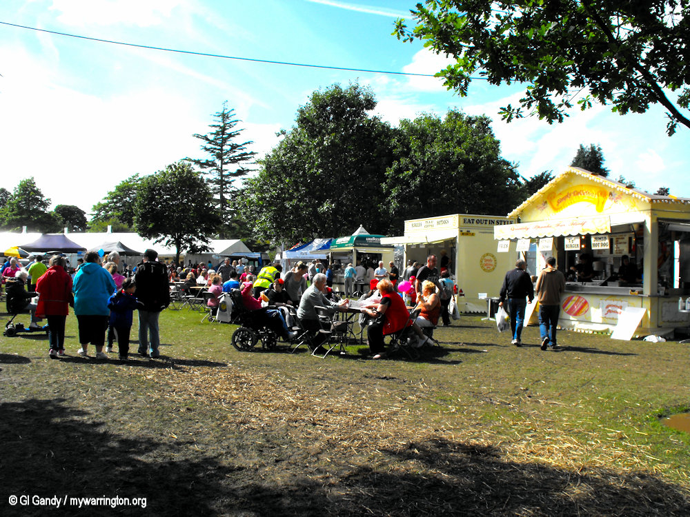
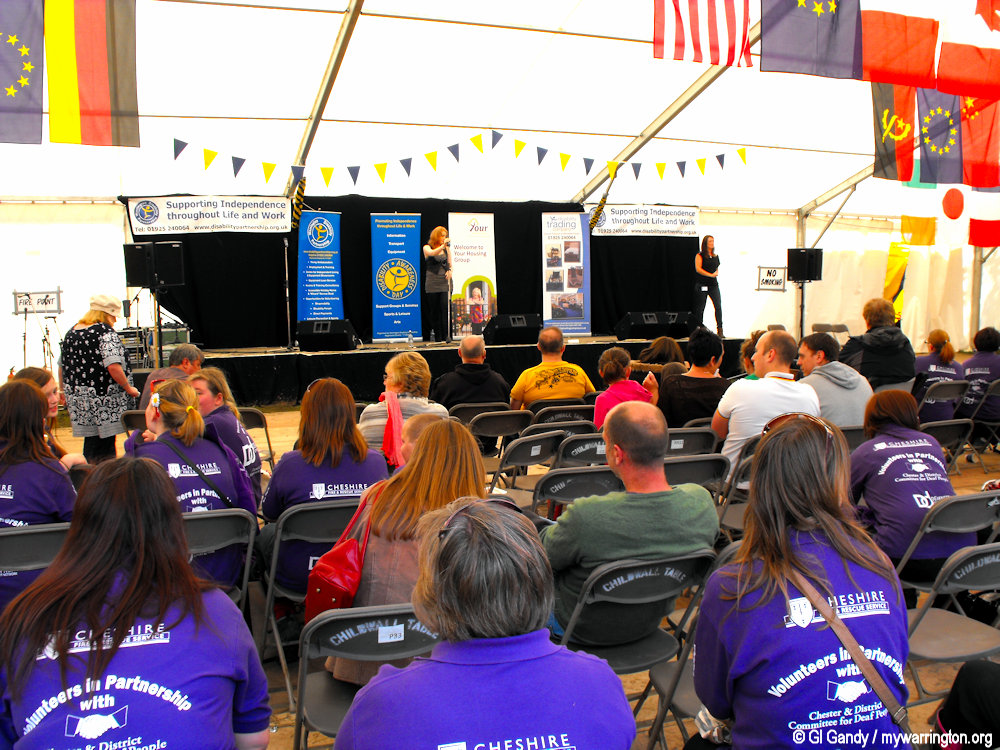
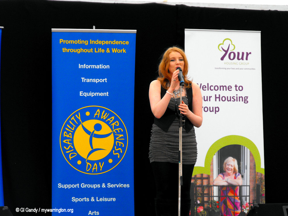
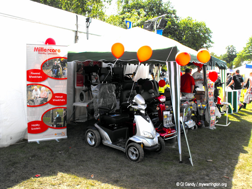
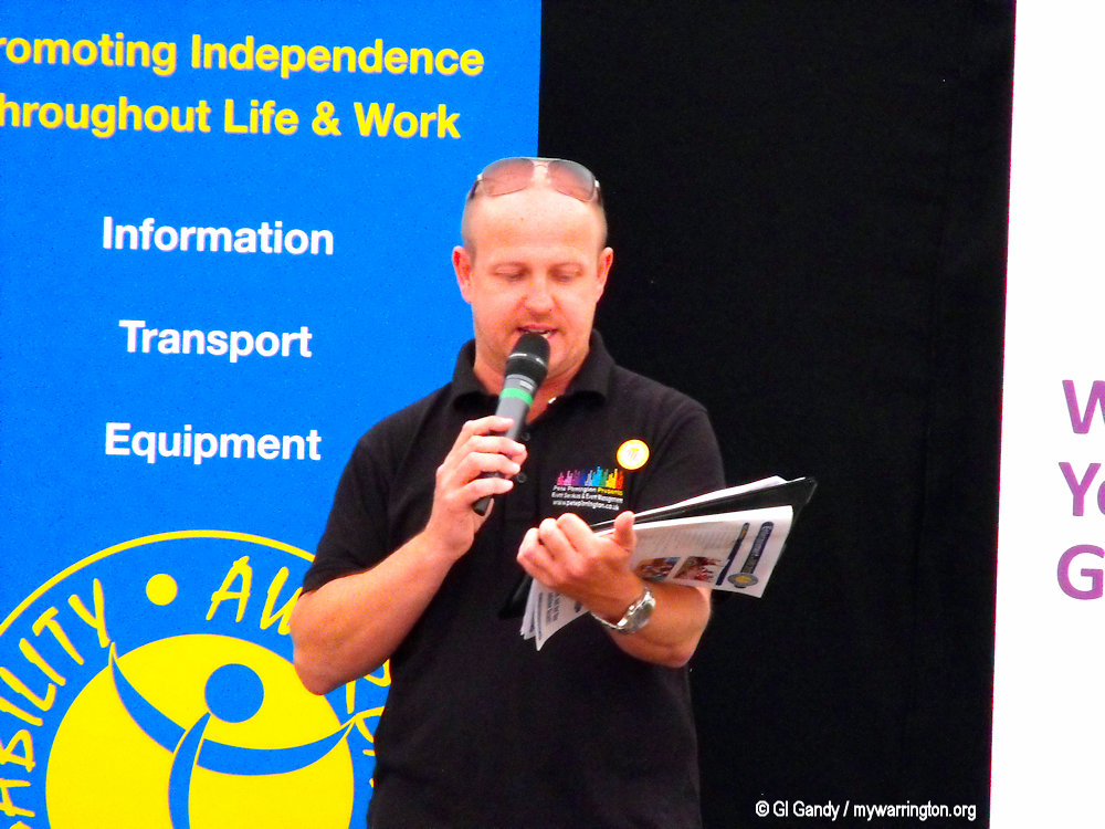
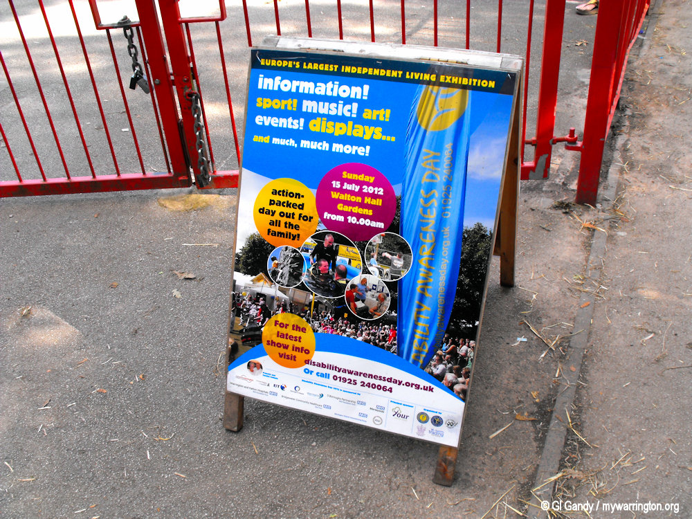
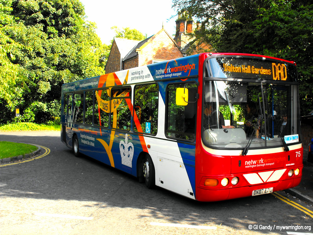
Disability Awareness Day
Walton Hall Gardens hosts Disability Awareness Day every year in conjunction with Warrington Disability Partnership.
Disability Awareness Day (DAD) is a large, volunteer-led Disability Awareness Day exhibition held annually in July. The event showcases a vast range of equipment, transport, leisure, and support services for disabled people, along with a Sports Zone, arts events, and family entertainment.
DAD aims to promote independence, highlight available resources, and showcase what disabled people can achieve in sports, arts, and other areas of life. See their website for more.
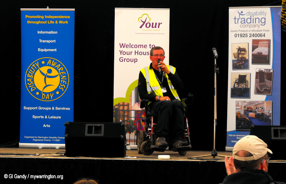
Photos from the the 15 July 2012 event, the year of Queen Elizabeth II Diamond Jubilee year.


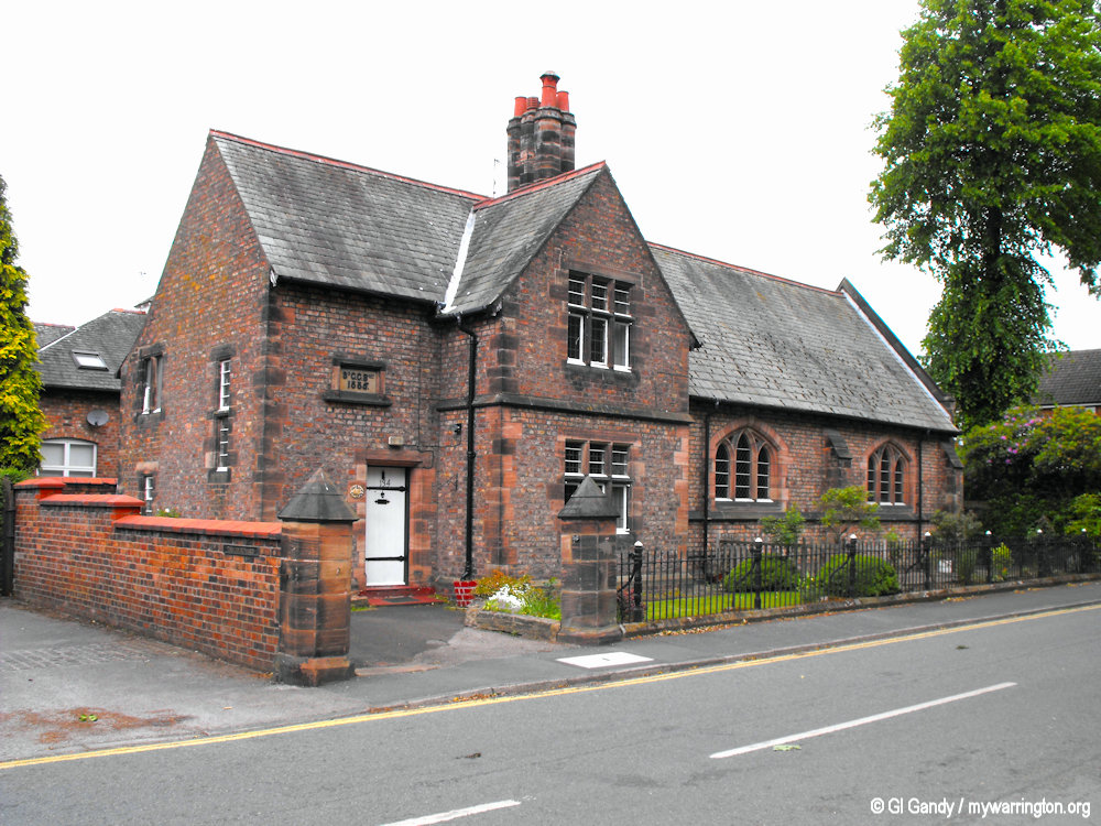
Greenall Family Grade II Listed Buildings
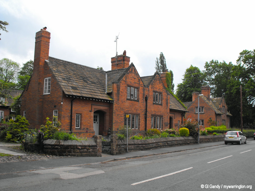
131-133 Old Chester Road, Walton (20 May 2011)
131-133 Old Chester Road. A pair of cottages forming part of the estate village built for Sir Gilbert Greenall, junior. They are in brick on a sandstone plinth with sandstone dressings, stone-slate roofs, and large brick chimneys. The cottages have two storeys, and each is in two bays. The windows are mullioned and have leaded glazing.
134 Old Chester Road. Built for Sir Gilbert Greenall as a school and attached schoolmaster’s house. The school has been converted into the village hall. The building is in brick with stone dressings and Westmorland green slate roofs. On the ridge is a brick and stone chimney with six attached octagonal flues. The hall has three-light windows with pointed heads, and at its end is a coped sandstone gable. The house is in two storeys and two bays, with gables on the front and ends. Its windows are mullioned.
134 Old Chester Road, Walton (20 May 2011)
135 Old Chester Road, Walton (20 May 2011)
135 Old Chester Road. A cottage forming part of the estate village built for Sir Gilbert Greenall, junior. They are in brick on a sandstone plinth with sandstone dressings, stone-slate roofs, and large brick chimneys. The cottages form a V-shaped block. Each cottage is in two bays, with shaped gables. The windows are leaded casements.
138-138A Old Chester Road, Walton (20 May 2011)
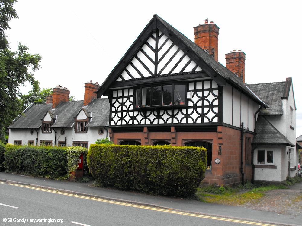
138-138A Old Chester Road. A pair of cottages forming part of the estate village built for Sir Gilbert Greenall, junior. They are in two storeys, the lower storey being in red sandstone on a projecting plinth, and the upper storey half-timbered and jettied. The roofs are in Westmorland slate. Both cottages have oriel windows, and no. 138A also has a canted mullioned bay window.
140-146 Old Chester Road. A terrace of four cottages forming part of the estate village built for Sir Gilbert Greenall, junior. They are constructed in sandstone and pebbledash and have Westmorland slate gabled roofs. The cottages are in 11⁄2 storeys. On the front are three gabled dormers and one canted bay window. Above the doors are small round windows. At the rear are casement windows.
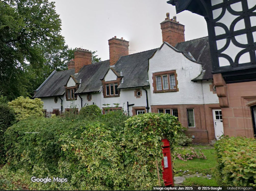
140-146 Old Chester Road – Image Google Maps
3 and 5 Walton Lea Road – Image Google Maps
3 and 5 Walton Lea Road. A pair of cottages forming part of the estate village built for Sir Gilbert Greenall, junior. They are in brick on a sandstone plinth with sandstone dressings, stone-slate roofs, and large brick chimneys. The cottages have two storeys, and each is in two bays. The windows are mullioned and have leaded glazing.
Information: Wikipedia. Photos © GI Gandy / mywarrington.org, except where stated.
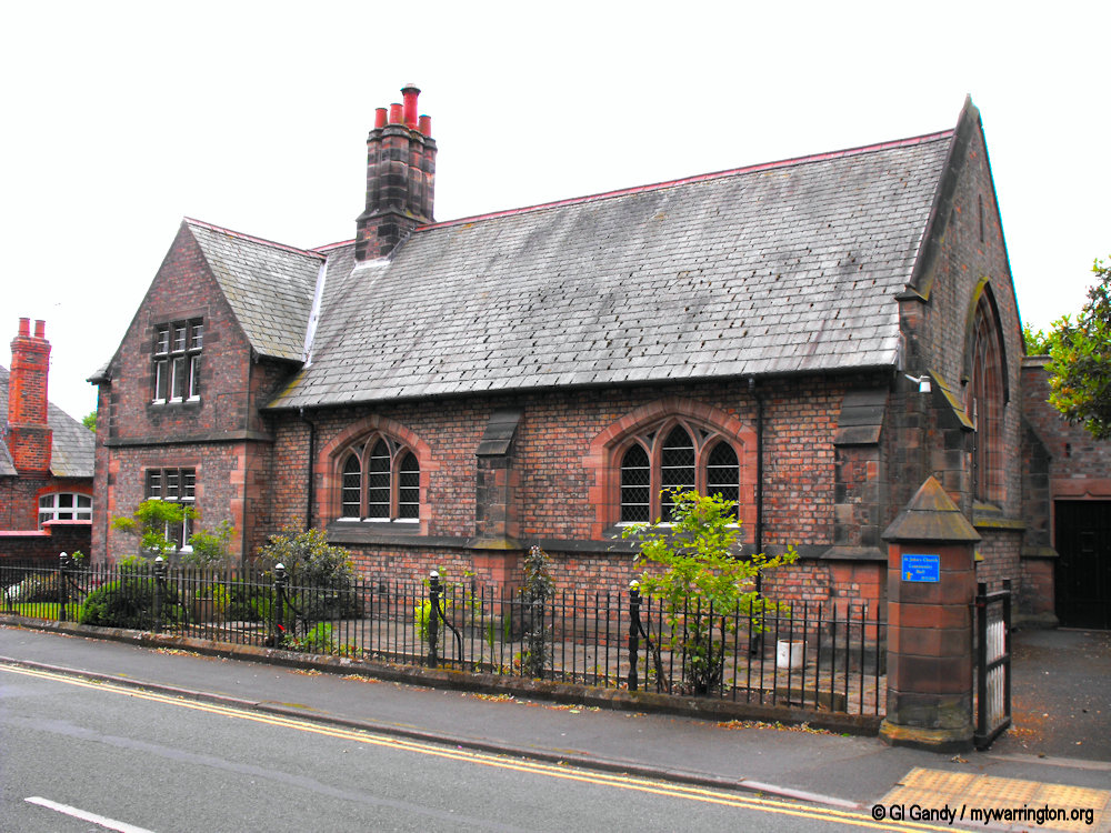
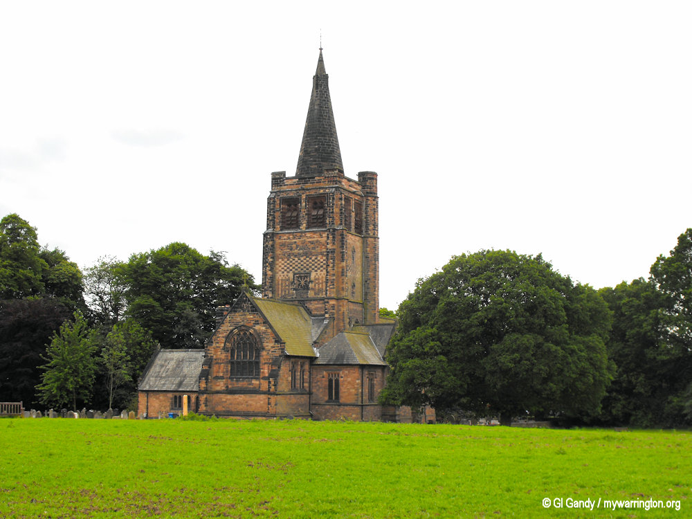
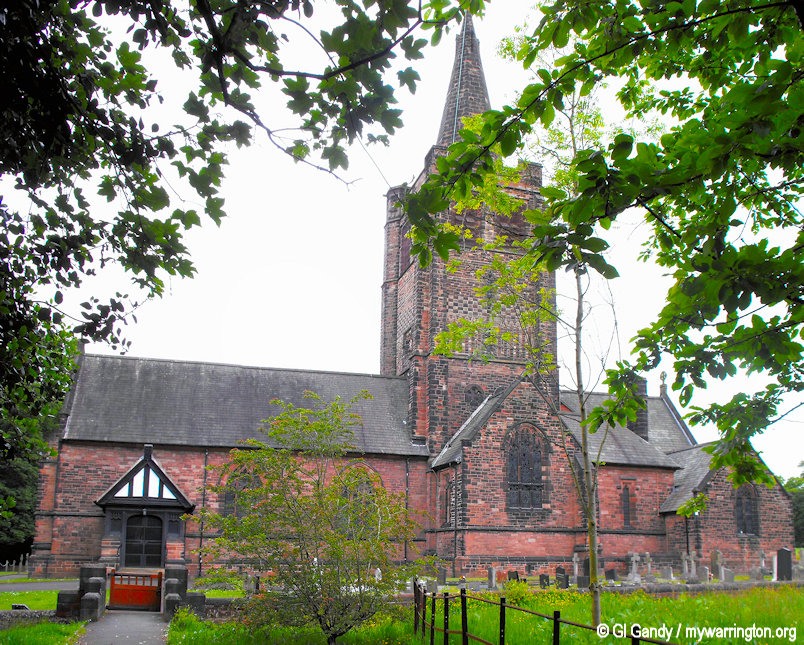
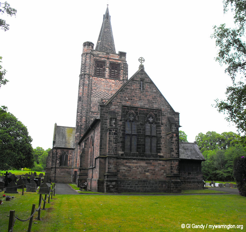
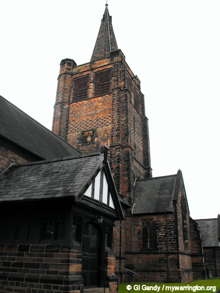
St John’s the Evangelist Church
St John the Evangelist’s Church is on Old Chester Road Walton. It was built as a private estate church towards the end of the 19th century but is now an active Anglican parish church in the diocese of Chester, the archdeaconry of Chester and the deanery of Great Budworth.
The church is recorded in the National Heritage List for England as a designated Grade II* listed building.
The church was built in 1882–83 for the brewer Sir Gilbert Greenall of Walton Hall. It was designed by the Lancaster architects Paley and Austin, the cost of its construction being £17,500 (equivalent to £2,719,230 in 2025).
Exterior
The church is built in red snecked sandstone with Westmorland Green slate roofs. Its plan is cruciform with a three-bay nave, north and south transepts, a two-bay chancel, a south vestry, and a south porch. The tower is in four stages with chequerwork in its third stage, a recessed octagonal spire and an octagonal north-west stair turret. The porch consists of an oak frame on a 6 feet (2 m) sandstone plinth. The church is in Decorated style.
Interior
The nave and chancels have barrel roofs. On the south side of the chancel is sedilia. The reredos contains a carving of the Crucifixion. The font is marble, and the pulpit is built of oak on a stone base. The floors are tiled. The stained glass includes a window in the south transept dated 1929 by Morris and Co. and elsewhere by E. H. Jewitt of Shrigley and Hunt.
Appraisal
The church was listed at Grade II* on 23 December 1983. Grade II* is the middle of the three gradings designated by English Heritage and is given to “particularly important buildings of more than special interest”.
The authors of the Buildings of England series describe it as a “glorious estate church, exquisitely detailed and composed”, and consider that the tower is one of Austin’s best.
External features
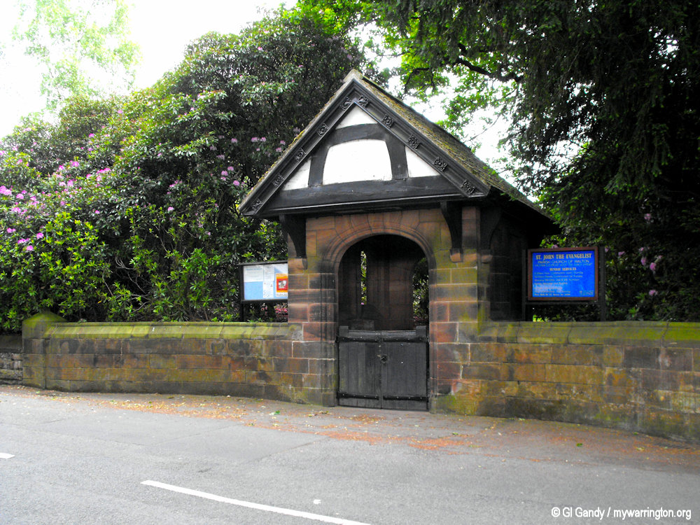
The lych gate dating from around 1885 is built in red sandstone with a Westmorland green slate roof and half-timbered gables on brackets. It was built at the expense of Sir Gilbert Greenall and was designed by Paley and Austin. It is listed at Grade II.
The lychgate at the entrance to the churchyard was designed by Paley and Austin for Sir Gilbert Greenall. It is constructed in red sandstone with a Westmorland green slate roof and half-timbered gables on brackets.
Some information: Wikipedia.
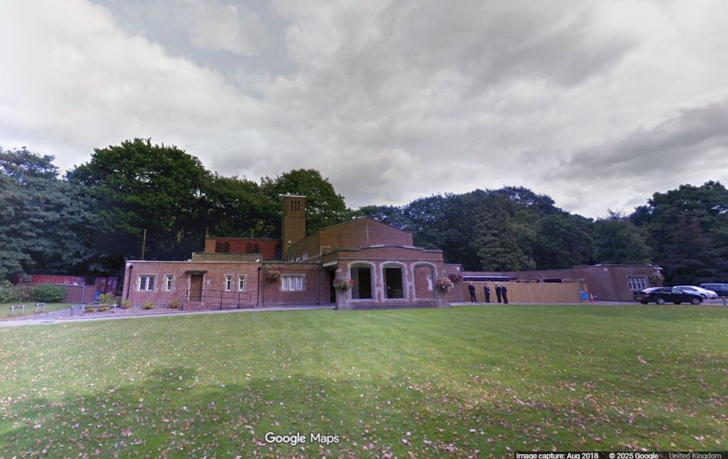
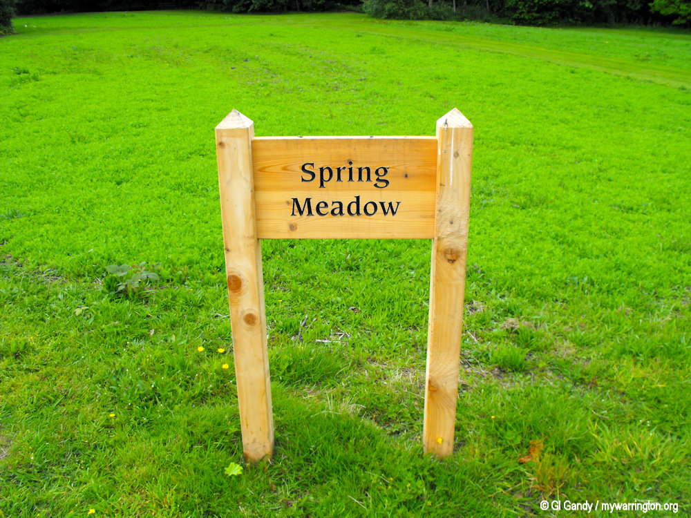
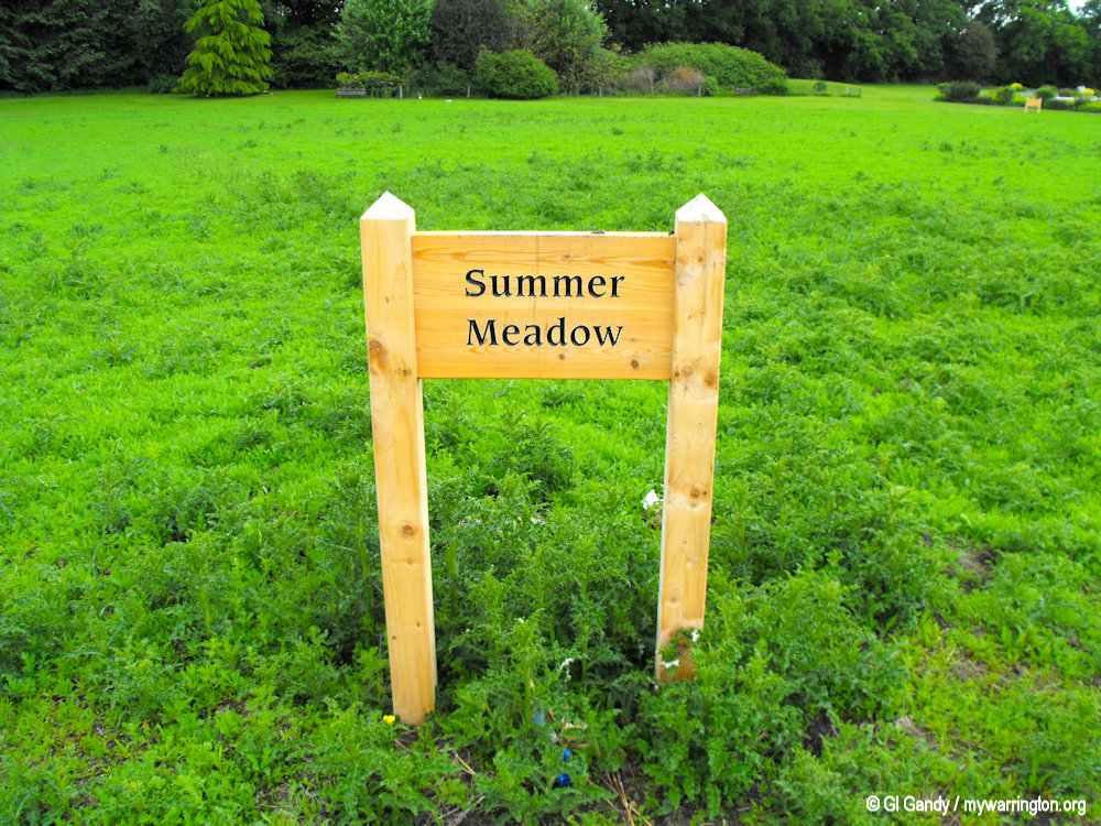
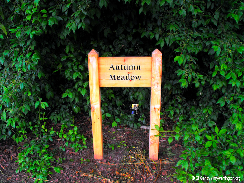
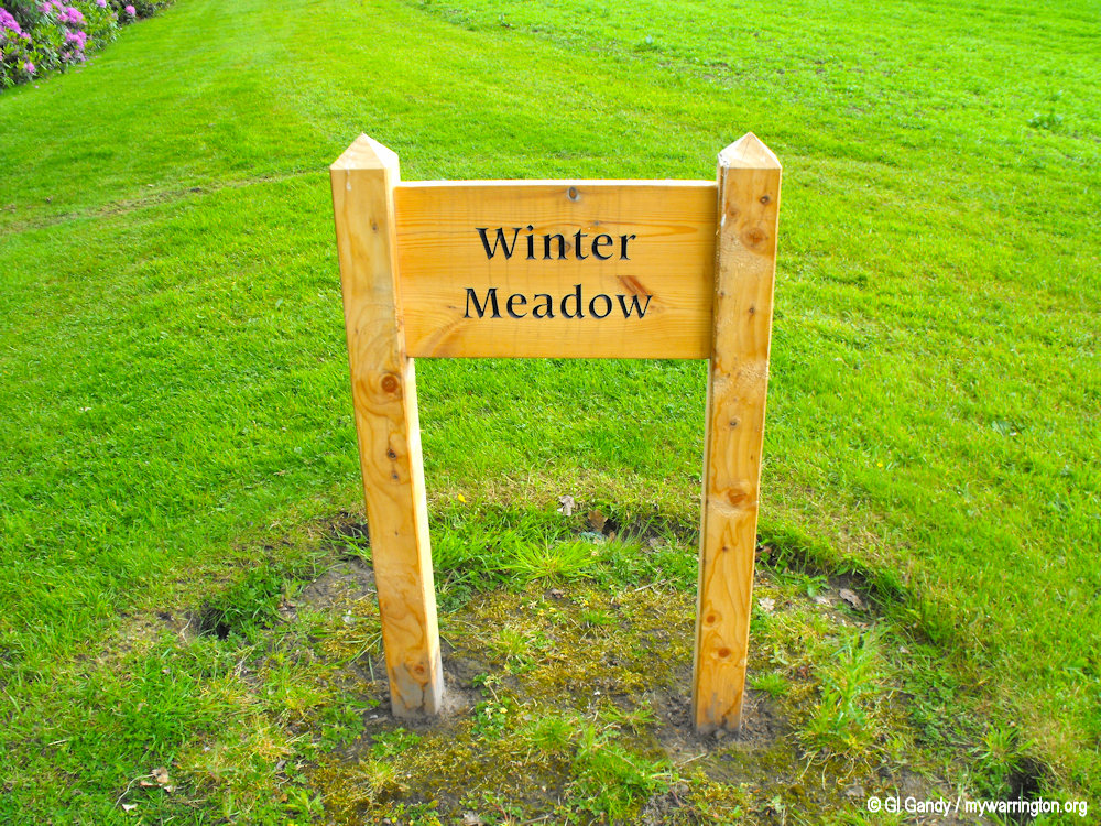
Walton Lea Crematorium
Walton Lea Crematorium is located off Chester road, with pedestrian access off Walton Lea Road. It was dedicated by Bishop of Chester, Dr G. Ellison on 14 April 1962 and officially opened on 15 April 1964, primarily to serve the people of Warrington and Runcorn.
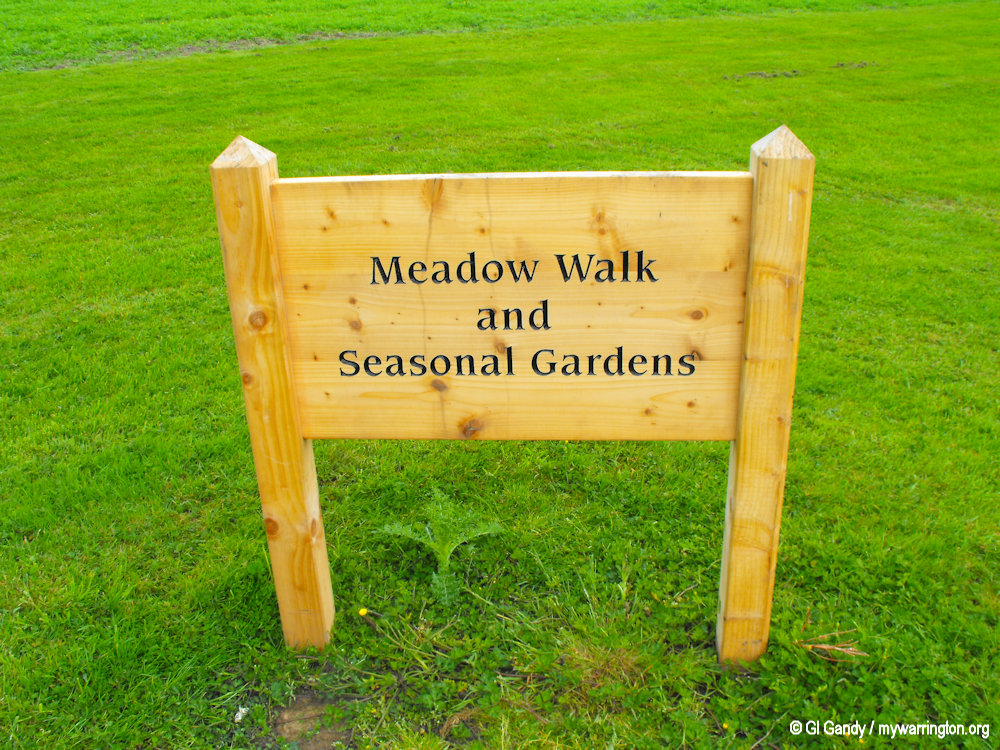
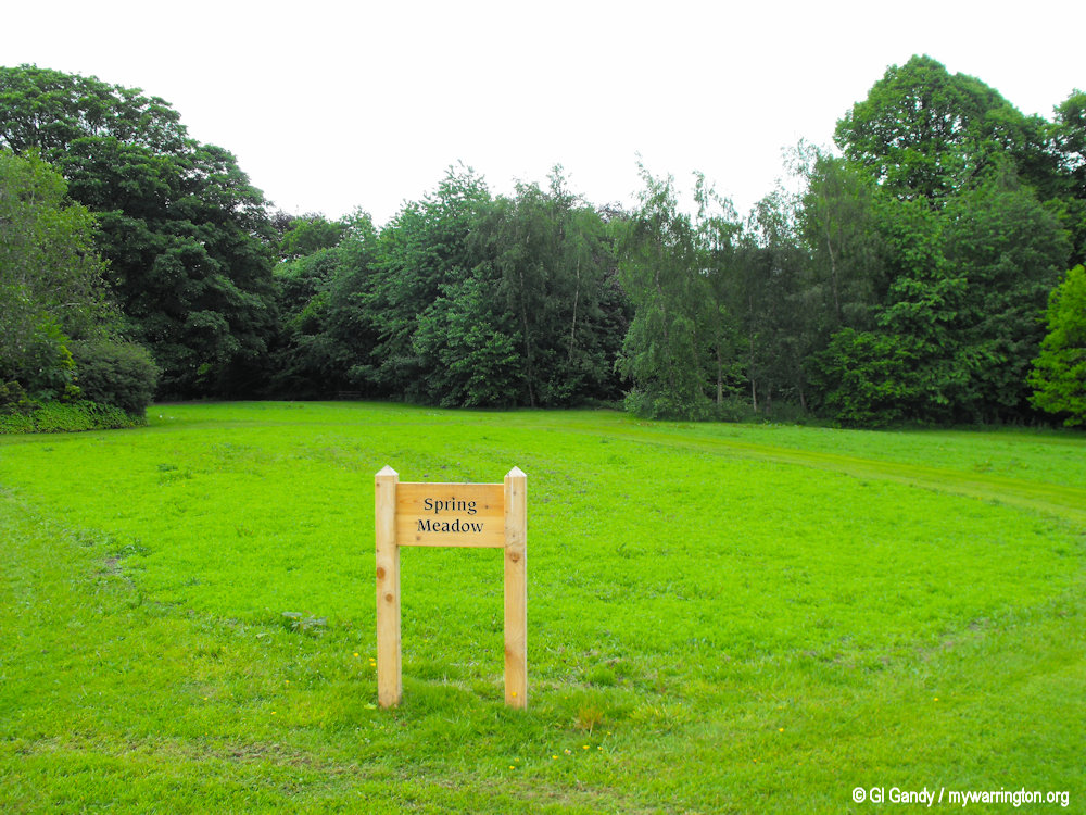
Within its grounds you can view four meadows (named after each season of the year) where cremated remains can be scattered rather than be given a plot number on the main lawn.
For details of services available see the Warrington Borough Council website.
My photos below were taken on 20 May 2011.
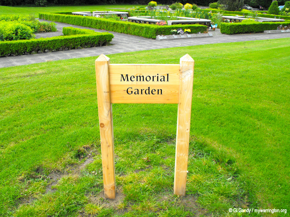
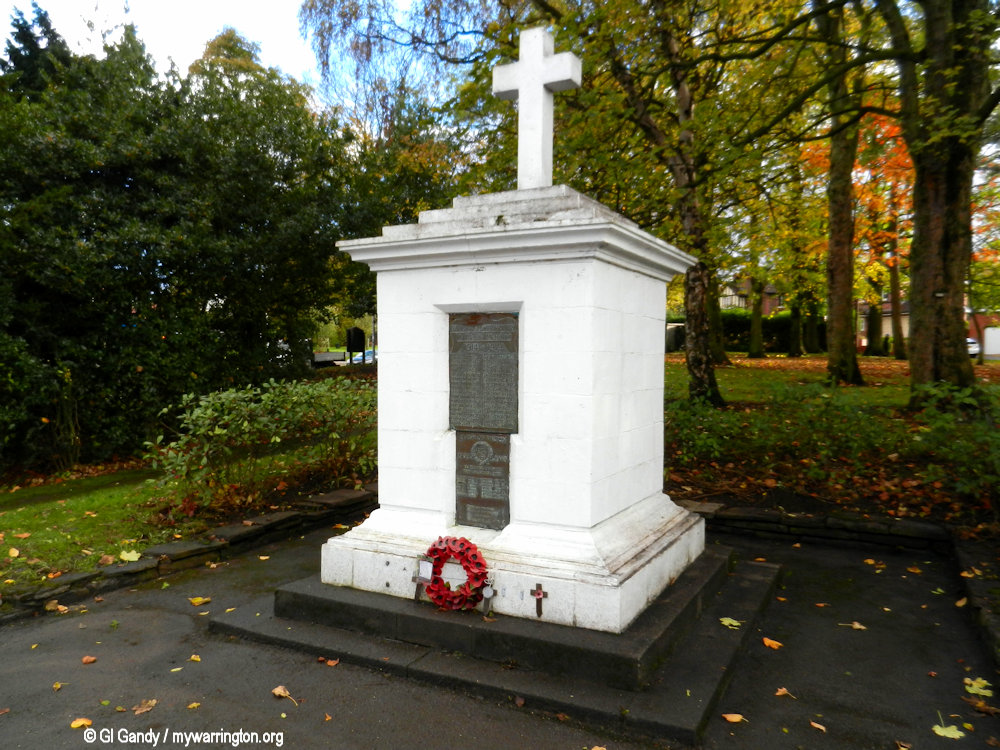
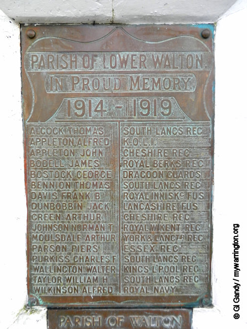
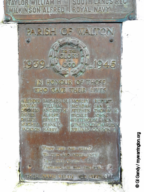
Walton War Memorial
The war memorial in Walton was dedicated in November 1922 to commemorate the residents of the parish killed in the First and Second World Wars, with names from both conflicts displayed. The memorial lists 22 names from the First World War and 8 names from the Second World War.
Originally located in a central position after the end of the war, it was moved several times before its current location in the landscaped gardens opposite the Stag Inn on Chester Road.
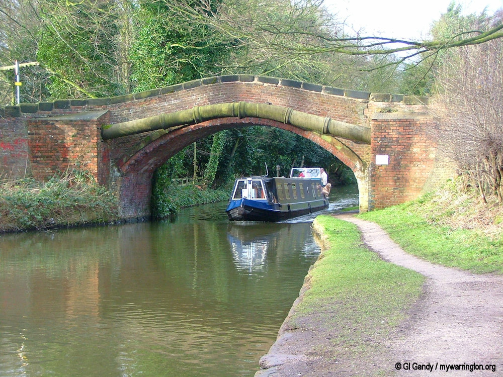
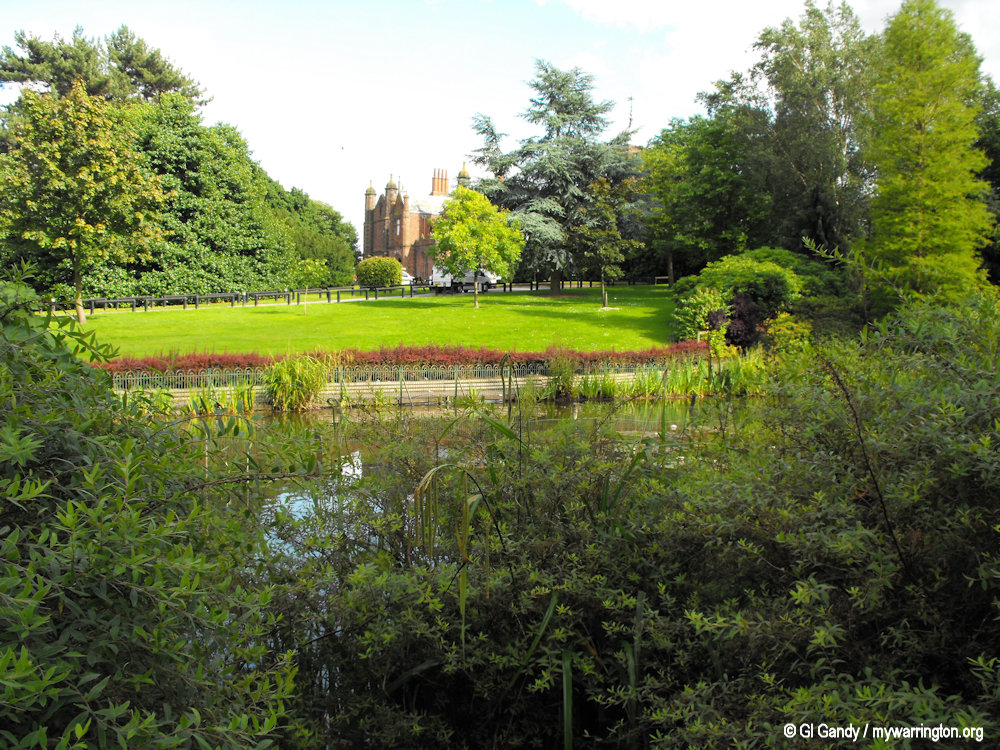
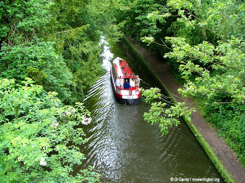
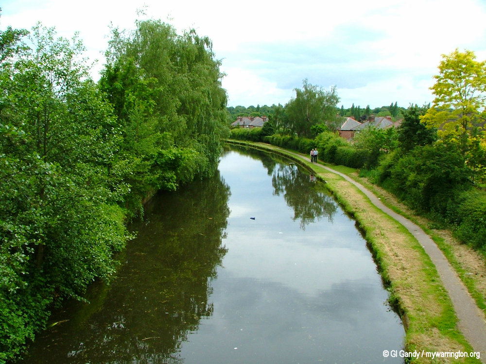
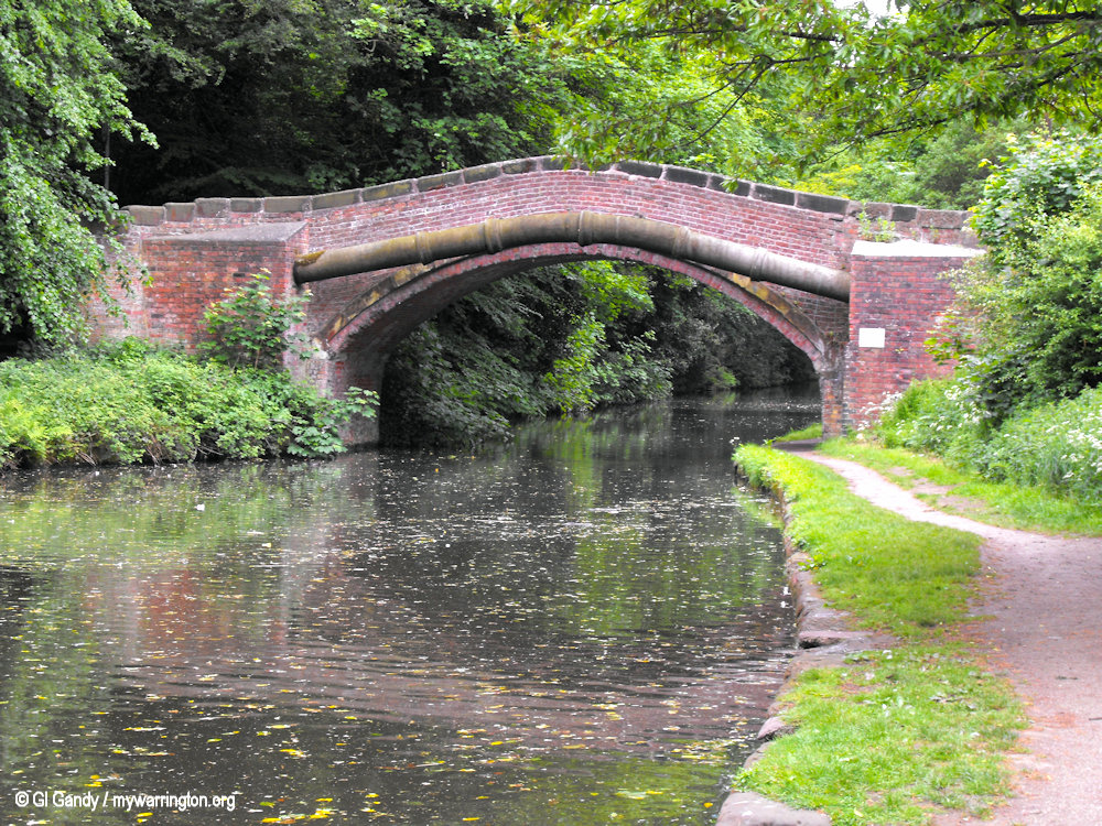
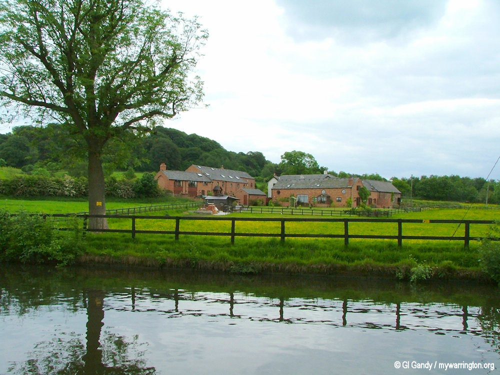
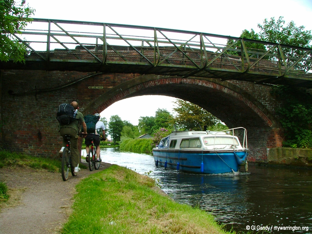
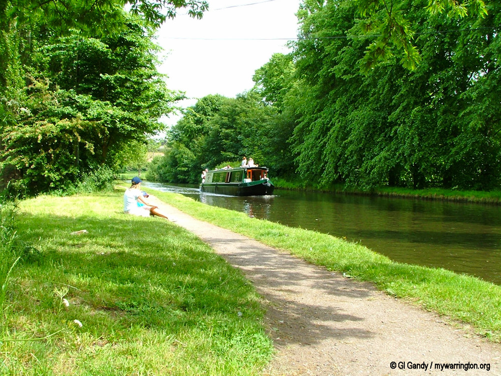
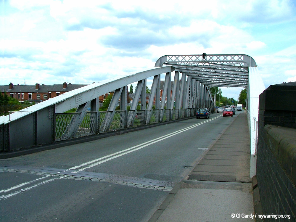
Bridgewater Canal
The Bridgewater Canal was opened in stages from 1761 on its journey from Worsley to Runcorn. It was later extended to Leigh. It flows alongside Walton Hall Gardens in the Walton area.
Read a more detailed history of the canal in On the Waterfront.
Pub Life
There are two pubs in the Walton area, one in Upper Walton and one in Lower Walton. The Upper Walton venue is the Walton Arms which opened in the 1880s. In September 2025 it officially reopened as a new Italian restaurant, having been closed for a refit. Restaurant chain Pesto runs it and it is known as Pesto at The Walton Arms.
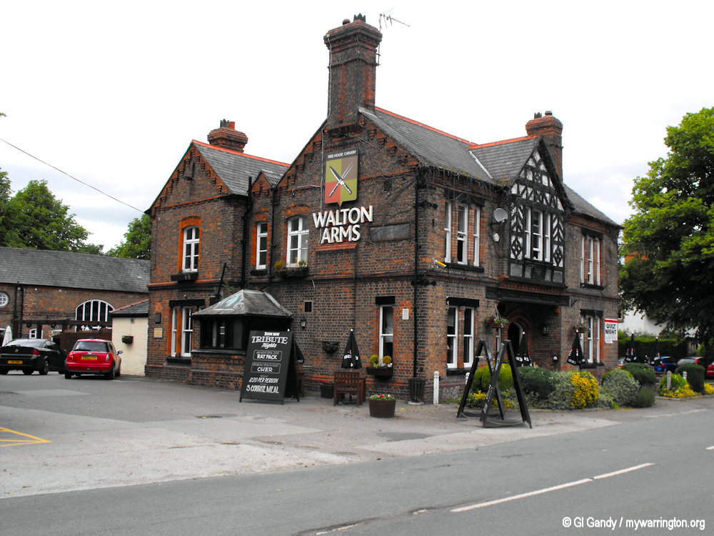
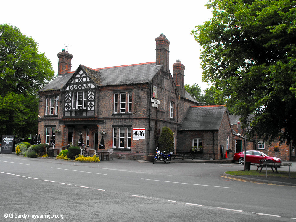
Photos of the Walton Arms taken on 20 May 2011.
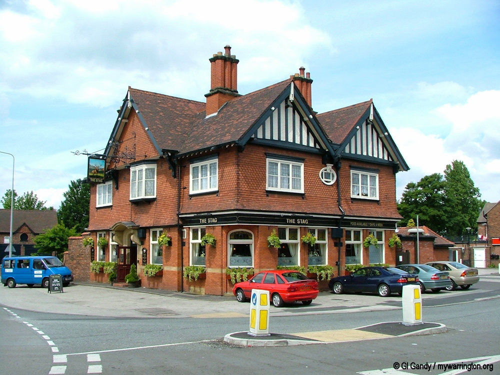
The Stag Inn, a pub located on Chester Road in Lower Walton, Warrington, was originally a significant transport hub in the area, linking to turnpike roads and the Bridgwater Canal. The building was rebuilt and moved approximately 20 yards to the east around 1910 to make way for the new Chester Road, which included a swing bridge over the canal. More recently, in 2016, the pub launched its own micro-brewery, known as The Stag at Walton. Maps dating back as far as 1888 show a bowling green alongside the public house, when there was very little other development in the locality. The bowling green is now used as an outdoor seating area.
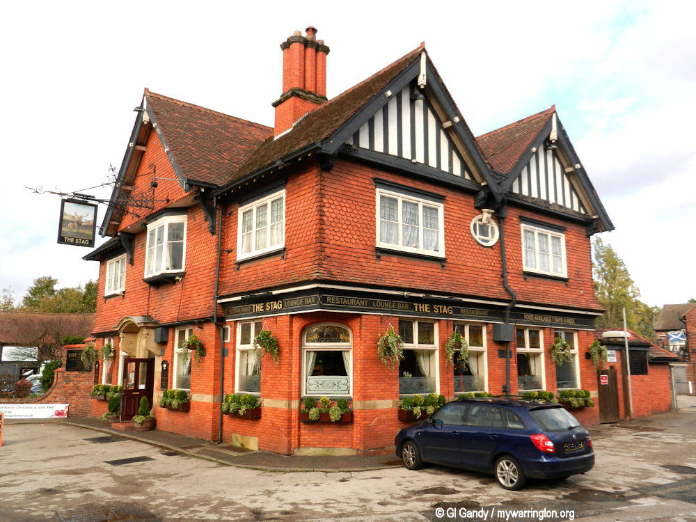
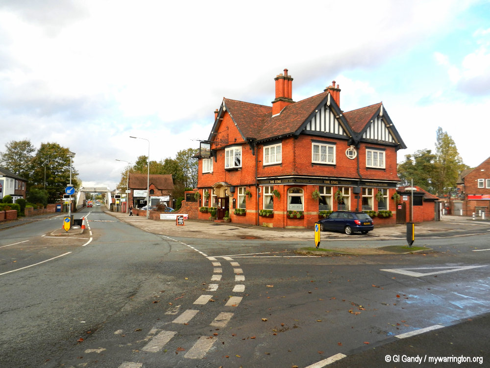
Photos of the The Stagg Inn taken on 7 November 2013.
The swing bridge over the Manchester Ship Canal can be seen in the distance of the second image.
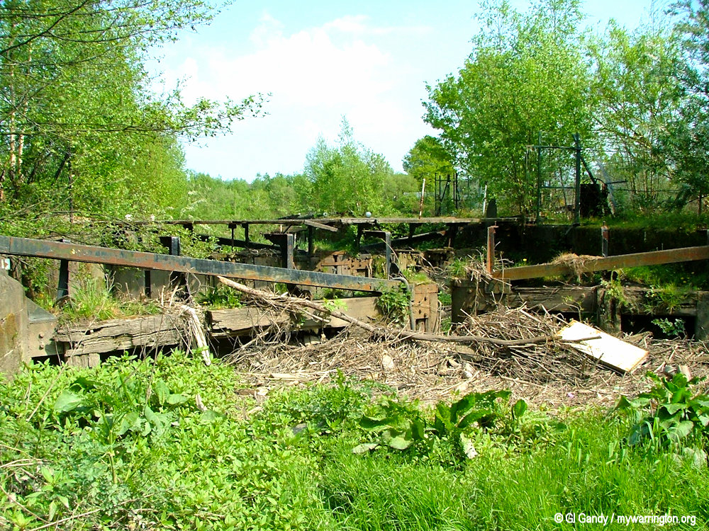
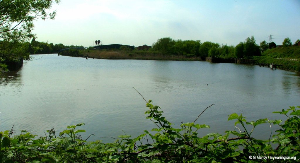
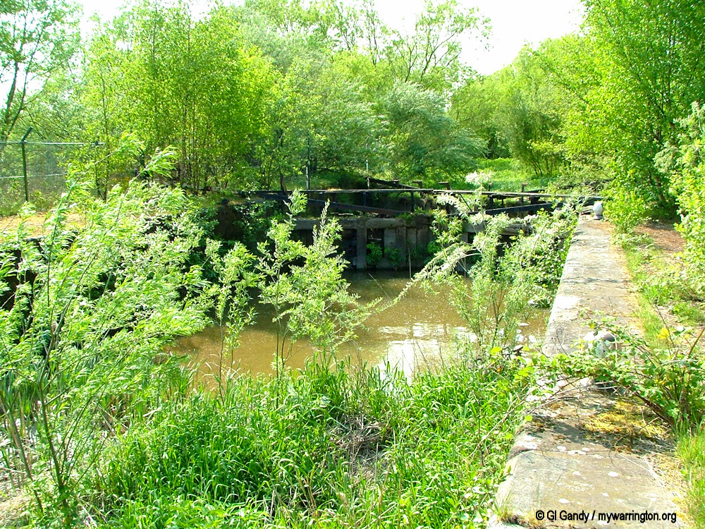
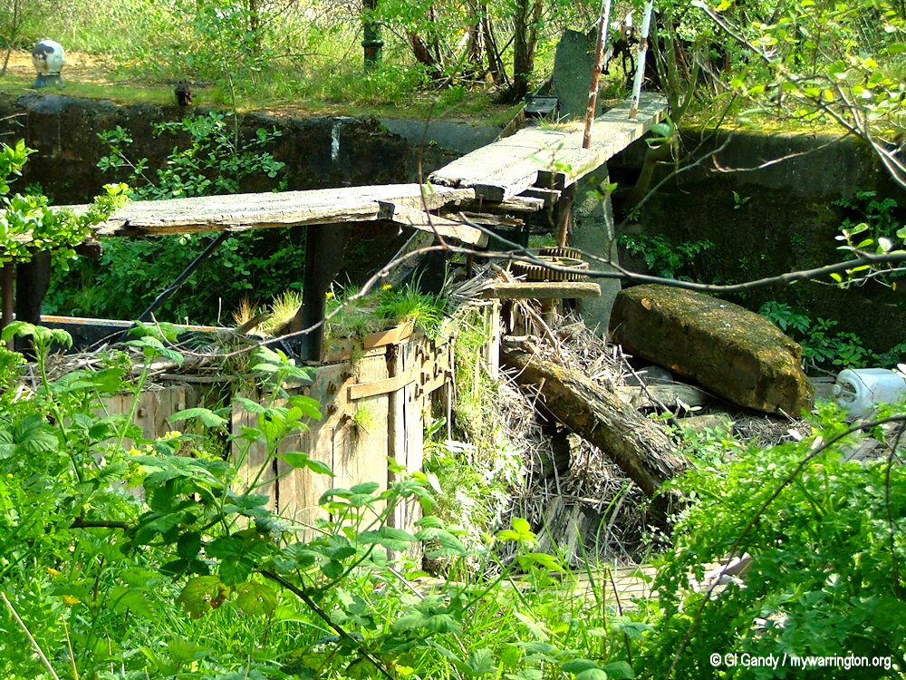
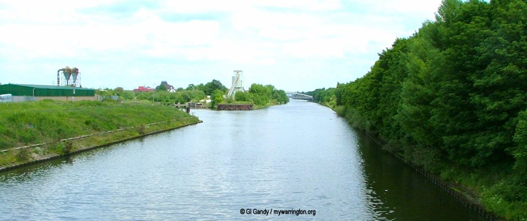
Walton Lock
Walton Lock is a channel of water that linked the Manchester Ship Canal with the River Mersey. It is now deralict, but was very busy in its heyday. In 1998 a feasibility study into reopening the lock for use by pleasure boats. The three-year study considered proposals to clean up the neglected lock which has been closed to navigation since the early 1980s and provide a pleasant public open space with footpaths.
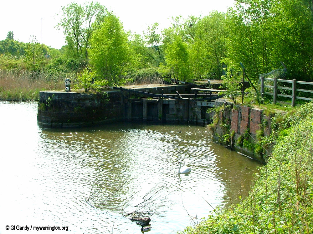
The next stage was to look at the potential for flooding the lock to canal level for navigational use. At the time of writing (September 2025) no further progress has been made.
The image here shows the stretch of water between the canal and river. However, beyond the lock gate itself seen in the top right of the scene the channel is no longer in water, as can be seen in the following three photos.
Walton Lock in the top right of this image on 28 Apr 2007
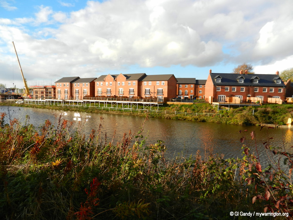
The next two photo shows Walton Lock in the distance. The first was taken on 31 May 2004, with the second taken on 7 November 2011 during construction of the apartments.
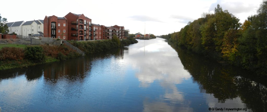
The next two photos show the apartments from a different angle on the same date, 7 November 2011, with the Chester Road swing bridge over the Manchester Ship Canal at Walton on 31 May 2004.
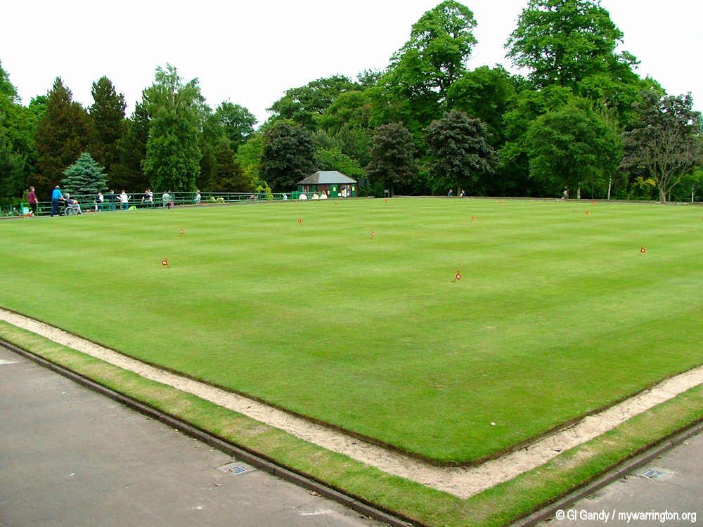
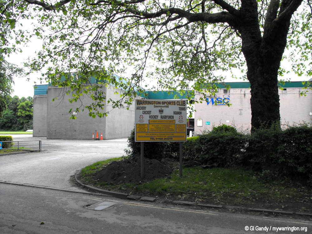
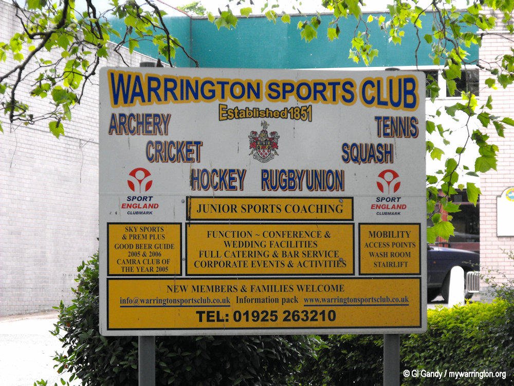
Warrington Sports Club
The club has its origins in the grounds of Bank Hall (Warrington’s town hall today) in 1852 where Lancashire played its first ever cricket match. With a period of time on Arpley Meadows, other sports areas were added but eventually the site was sold and the club moved to its current location in Walton lea Road. Read more on the Warrington Sports Club website.
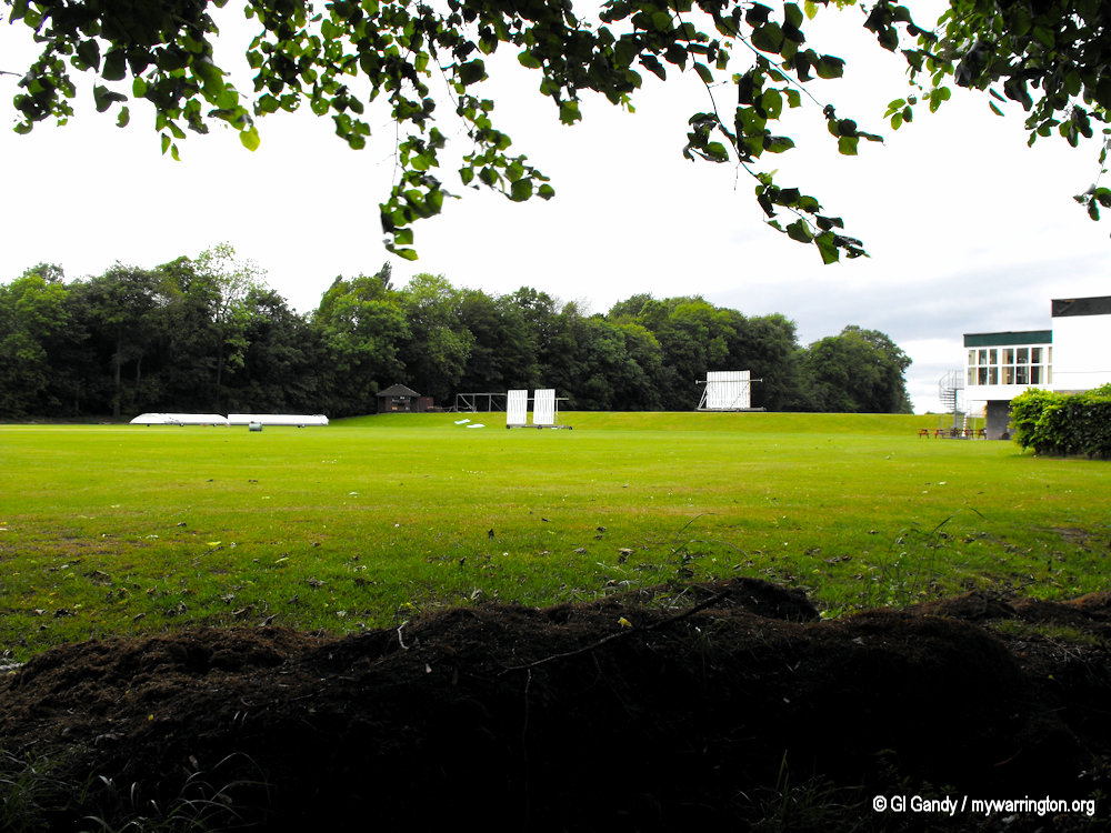
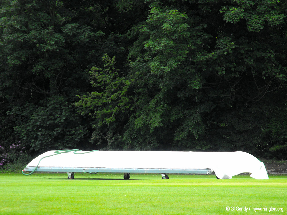

The cricket pitch and pavilion at Walton Lea Road.
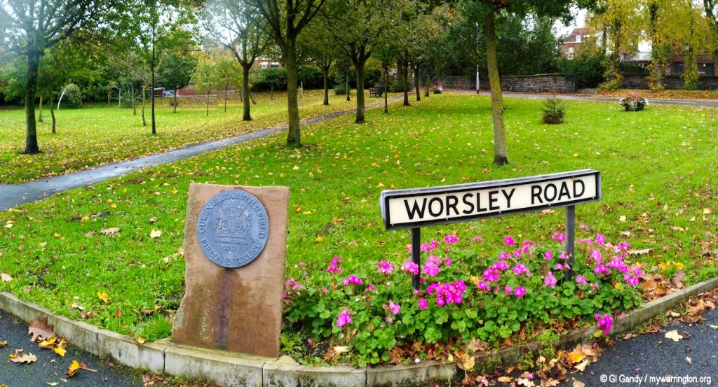
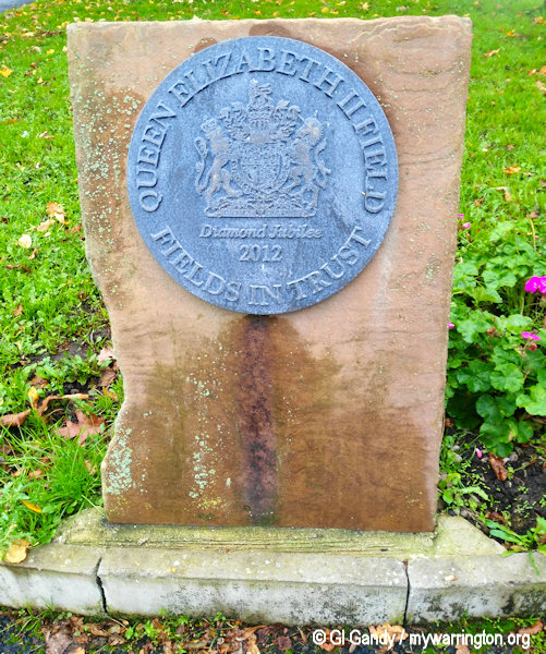
Queen Elizabeth II Fields in Trust 2012
In 2012, to celebrate the Queen’s Diamond Jubilee, Fields in Trust launched the Queen Elizabeth II Fields Challenge to protect 2,012 recreational spaces by the year 2013.
The initiative was inspired by the legacy of the King George V Playing Fields, which were established to commemorate the late king.
The programme sought to create a living legacy of protected green spaces across the UK, with a specific focus on sports fields and playgrounds, and received support from the SITA Trust for improvements.
The programme successfully protected 1,392 parks and green spaces, although this was fewer than the initial 2,012 target.
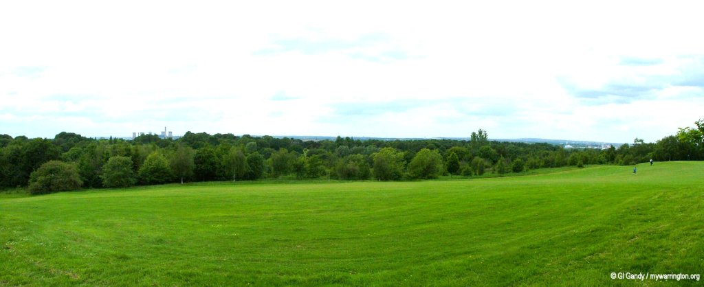
In the Walton district land alongside Worsley Road opposite The Stag Inn was nominated and awarded. My photos: 21 October 2018.
King George V Post Box
On the subject of King George V, there is a post box built into the wall on Walton New Road from the reign of the king.
On a British post box, GR is a royal cypher that stands for Georgius Rex, meaning King George in Latin, and indicates the post box was installed during the reign of a King George. Simple “GR” cyphers, without a Roman numeral, are generally from the reign of King George V (1910–1936).
If a Roman numeral is present, such as “GR VI,” it signifies a post box from the reign of King George VI (1936–1952). Therefore the one in Walton is dedicated to King George V.
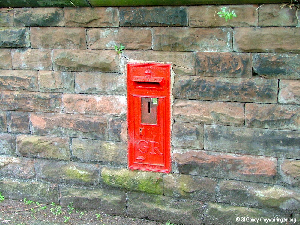
Walton New Road George V post box on 31 May 2004
A Final Walkabout

