Whittle Hall is part of Great Sankey and close to Chapelford and the Omega Development Site (formerly RAF Burtonwood). The estate originally consisted of Whittle Hall Farm and its surrounding fields. And that is where we pick up the story of the hall itself. A branch of the Rixton family settled here as did the family of Whethull or Whittle in the 14th century.
Many thanks to Ian Miller and his team from Salford University for permission to use these notes on the mywarrington website.
Introduction
This document has been prepared by Salford Archaeology within the Centre for Applied Archaeology, University of Salford and authored by Graham Mottershead, Simon Hinchliffe Date: September 2016.
The purpose of this report was due to a house developer wishing to build homes on the site of the former Whittle Hall. As is often required, an archaeological survey was carried out once the existing buildings were demolished. And of course it is great research material for the mywarrington website!
Historical Background
There are no documented prehistoric, Roman or early medieval finds from the study area and there is very little evidence from the surrounding area. The origins of Whittle Hall are poorly understood; however it is entered onto the Cheshire Historic Environment Record (HER 564/2) as the probable manor house of Great Sankey.
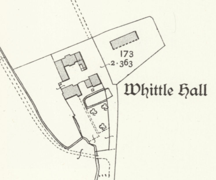
Whittle Hall from the OS 25 inch map of 1905.
See the National Library of Scotland side by side map for comparison views of the area today.
It is believed to have belonged to the Legh family in the 15th century and is recorded to have comprised ‘rooms, kitchen, stable, barn…with orchards and three gardens with a hundred acres of land lying in 14 fields enclosed together with hedges and ditches’. It was passed to Sir Thomas Tyldesley, then onto the Irelands of Bewsey and their successors.
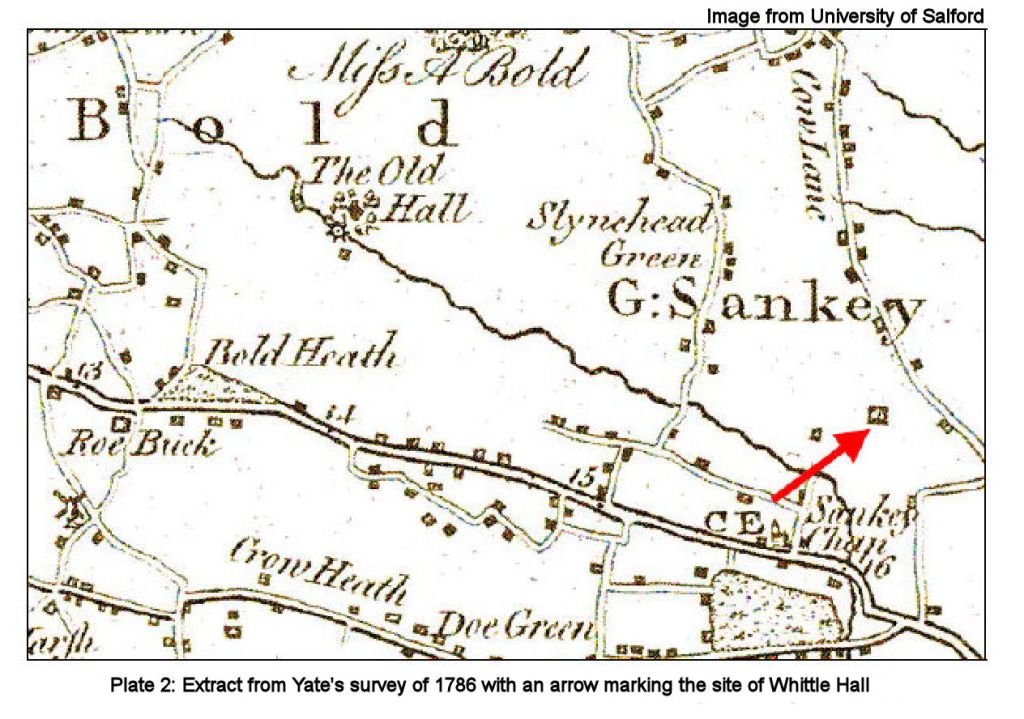
The earliest survey of Lancashire is provided by William Yates’ Survey of the County Palatine of Lancaster, printed in 1786 which shows a building in the approximate location of Whittle Hall. However, in contrast to other hall sites in the vicinity such as Barrow Hall, Whittle Hall is not named on Yates’ map. This suggests that it was not a significant building and may not have had a moat.

The next available map of the area is provided by Hennet’s survey of Lancashire, which was printed in 1830. This map was produced at a scale that was too small to analyse individual buildings, although Whittle Hall is identified and seemingly comprised a small group of buildings.
The site is first depicted in detail on the Ordnance Survey 6” to 1 mile map of 1849, which identifies Whittle Hall as a historic site, and depicts several blocks of buildings arranged loosely around a central courtyard, typical of a post-medieval farmstead. An L-shaped range forming the south-western part of the farm complex provided residential accommodation, with the barn occupying the northern side of the courtyard. Two smaller buildings may have been livestock pens.
The census returns confirm that these buildings were in use as a farm, with the Kelsall family living here and farming the land during the late 19th century. The farm is shown to have been set in a rural landscape, surrounded by enclosed fields and was accessed via a drive to the south. A smaller track leads northwards from the central courtyard, presumably providing access to the fields to the north. The Ordnance Survey map also marks a ‘draw well’ (ie a deep well from which water is lifted by bucket on a rope). There is no documentary evidence to firmly support any suggestion that Whittle Hall was encompassed by a moat.
The Ordnance Survey 25” to 1 mile map of 1890 show the farmhouse and adjacent cottage occupying the footprint shown on the earlier mapping, although extensions have been added to the barn on the northern side of the farm. The same configuration of buildings is shown on the 1907 and 1928 mapping, with the exception of another building added to the north-east.
Changes were limited to the addition of two small structures against the eastern wing of the large barn and the addition of a new drive which approached the south side of the farm from Whittle Hall Lane. Further, the farm complex continued to expand up to the mid-20th century, and several new structures are shown on the Ordnance Survey map of 1962. Several of these survived at the time of the survey of 2016, and comprised single-storey animal sheds.
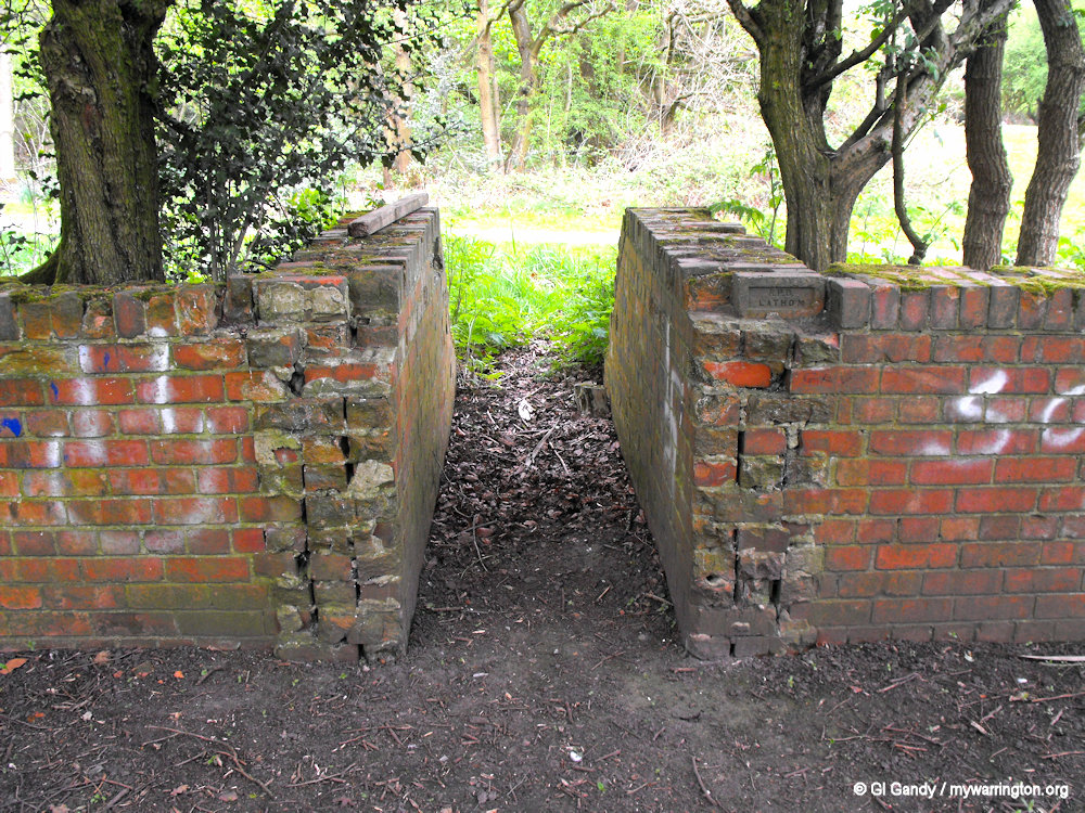
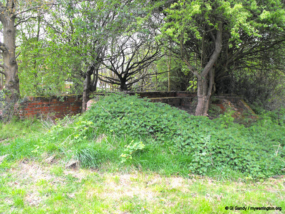
The site retained a rural location until the second half of the 20th century when most of the area was developed for housing. The building to the north-east was demolished and subsumed within this development. The farm complex was demolished in July 2016 following the completion of the historic building investigation (SA 2016).
There are no nationally designated sites within the study area, nor does it lie in or within 100m of a conservation area. However, the farm, now demolished, is included in Warrington Borough Council’s local heritage list.
Read the full report and see photographs at the Salford University website.
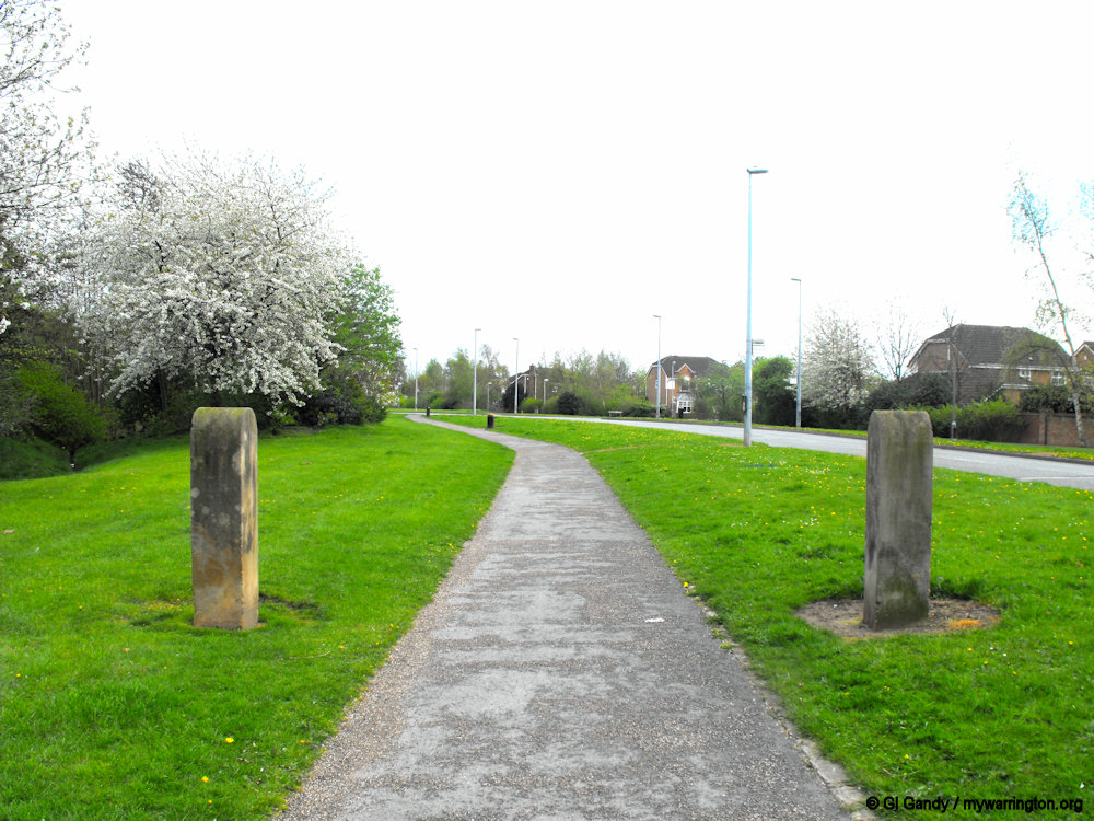
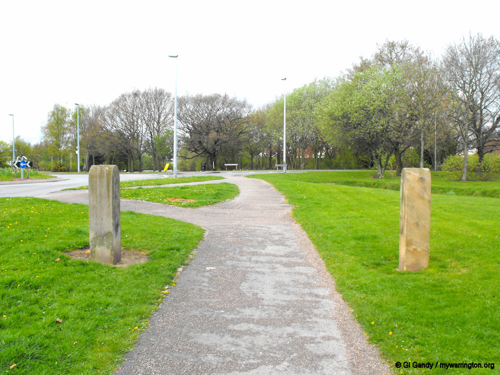
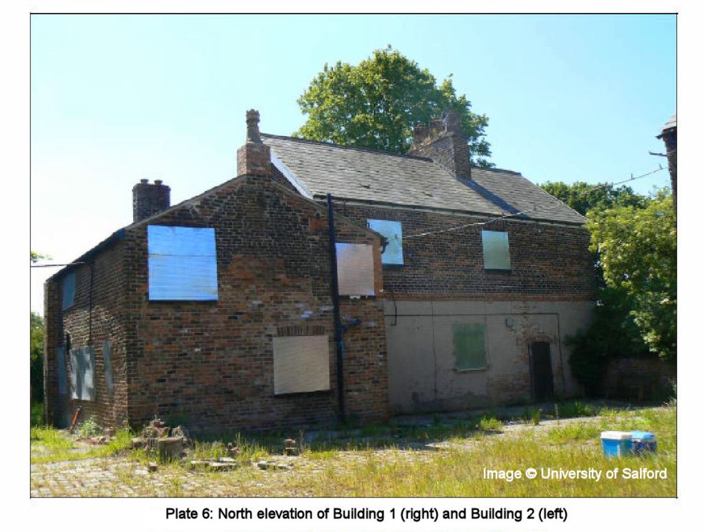
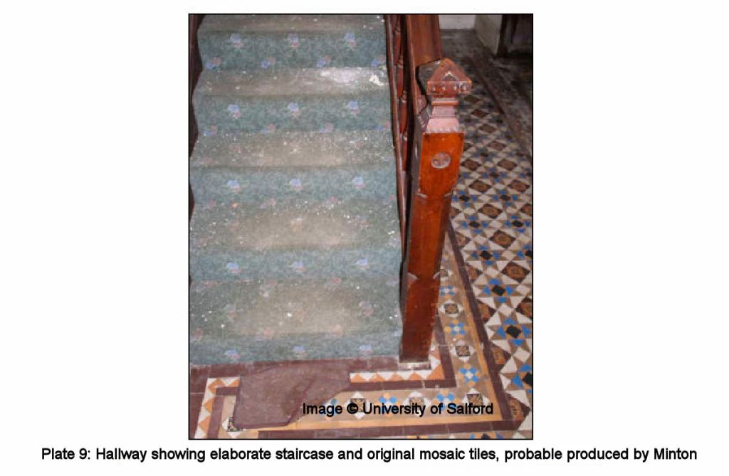
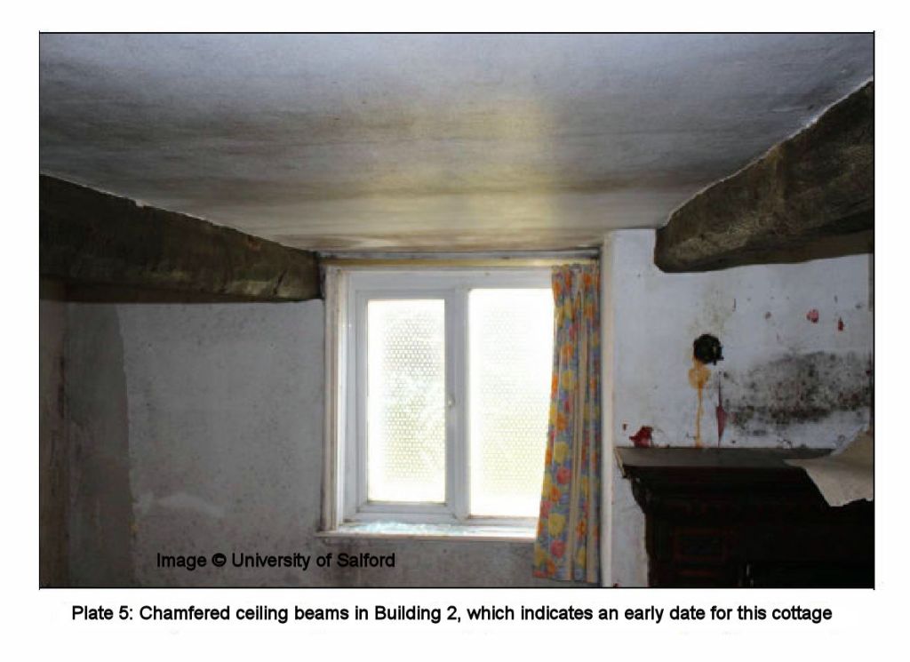
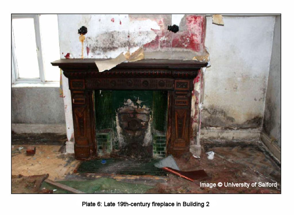
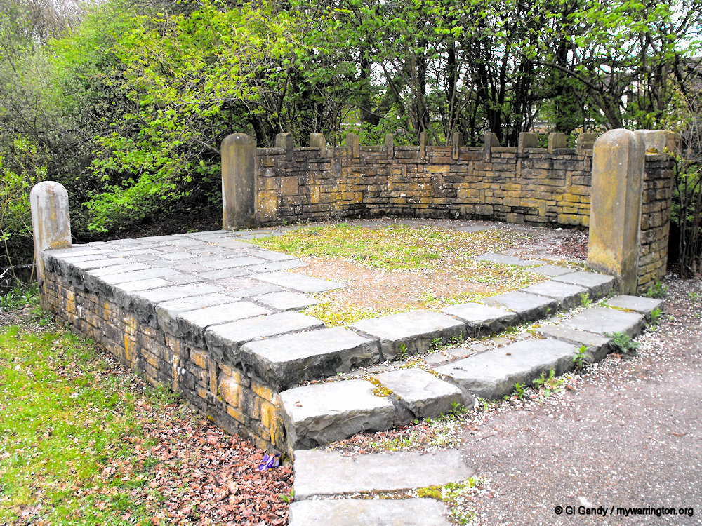
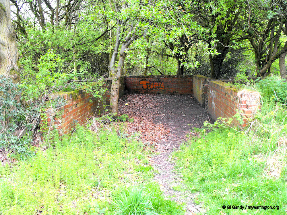
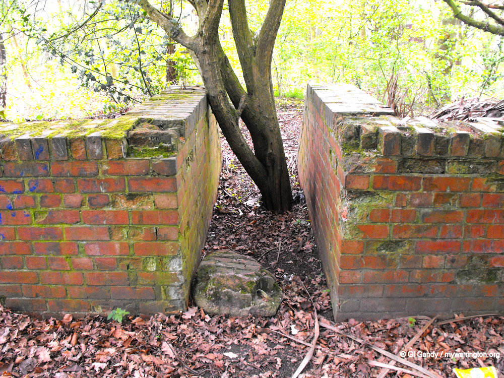
Remains of the original hall can be seen in the photos below.
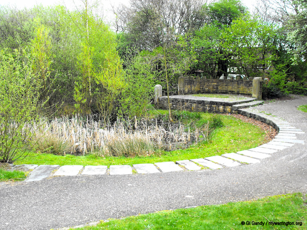
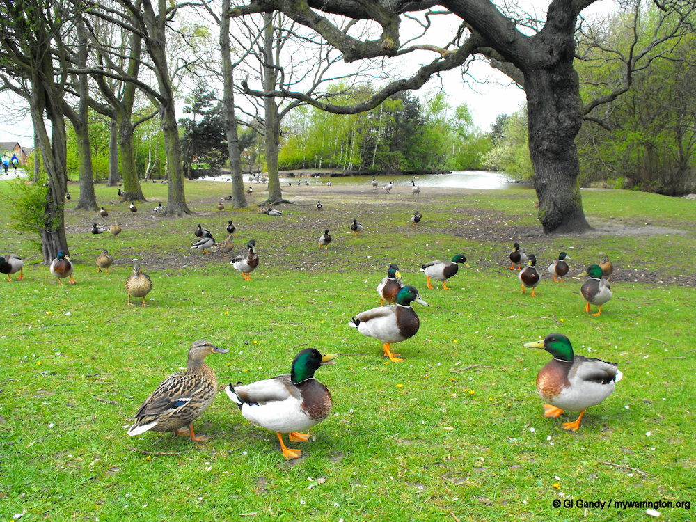
One popular location in the modern area of Whittle Hall is Duck Pond on Wensleydale Close.

The area of Whittle Hall contains the community centre, football fields and a playground and was formerly part of “Site 2” airmen’s living area on the giant RAF Burtonwood. The estate is bordered by the linear park, which contains a stream and open areas, and which separates the estate from Great Sankey. Landscaped footpaths by the housing estate add to the attractiveness of the district.