

Contents
- Introduction
- Woolston History
- Martinscroft History
- Woolston and Martinscroft War Memorial
- Woolston Hall
- Woolston Milepost
- Wildlife
- The New Cut Heritage and Ecology Trail
- Wolston Greyhound Track
- Woolston Lido
- Church Life
- School Life
- Pub Life
- Woolston Grange Industrial Estate
- Wolston Library and Woolston Community Hub
- A Final Walkabout

Introduction
In 1870-72, John Marius Wilson’s Imperial Gazetteer of England and Wales described Woolston like this:
WOOLSTON-WITH-MARTINSCROFT, a township in Warrington parish, Lancashire; 2 ½ miles E by N of Warrington. Acres, 1,444. Real property, £2,950. Pop., 496. Houses, 97. There are chapels for Wesleyans and Roman Catholics.
GB Historical GIS / University of Portsmouth, History of Woolston, in Warrington and Lancashire | Map and description, A Vision of Britain through Time.
URL: http://www.visionofbritain.org.uk/place/11051
Date accessed: 16th November 2025

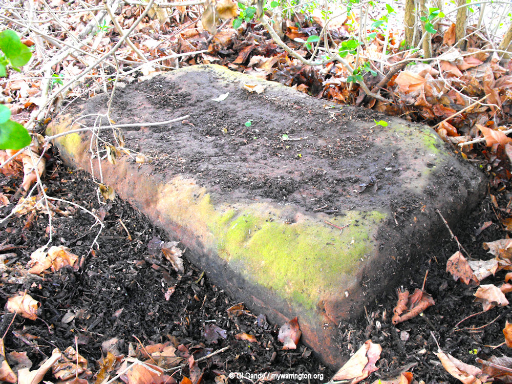
The history books tell us there is a gatepost from an old school and a horse stepping stone hidden in the bushes at Martinscroft Green. I didn’t locate them on the day of my visit, but I guess the mounting stone would have looked something like this one in the first photo, which is located at 26–30 Welsh Row in Northwich, Cheshire (photo licensed by Espresso Addict under the Creative Commons Attribution-Share Alike 4.0 International, 3.0 Unported, 2.5 Generic, 2.0 Generic and 1.0 Generic license). The second image is a stone hidden in the bushes but unlikely (in my non-expert opinion) to be a mounting stone. This one measures approx three feet by two feet by one foot).
Woolston is a civil parish in east Warrington. The population – 451 in 1921 – now stands at 6,937 (2011 Census). It lies on the north banks of the River Mersey and Manchester Ship Canal, with its eastern boundary at Brook Lane Rixton over the M6 motorway. The western boundary is at Bruche and the northern boundary is Longbarn. The localities of Paddington and Martinscroft are within Woolston’s parish boundaries.
In the township pack available at Warrington library it says the total area of Woolston and Martinscroft is 1,566½ statute acres, of which Woolston proper has 1,225 acres. The township lies wholly upon red sandstone. In the early 20th century the inhabitants are entirely employed in agricultural labour and basket making.
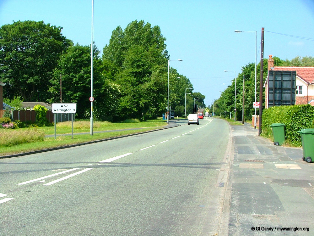
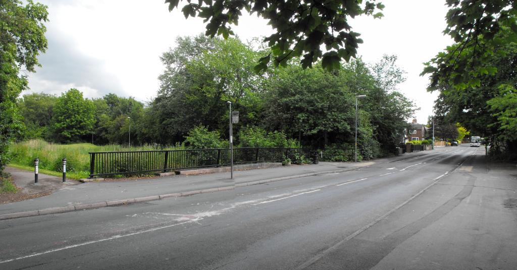
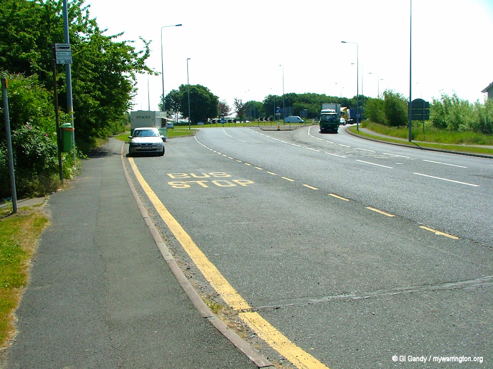
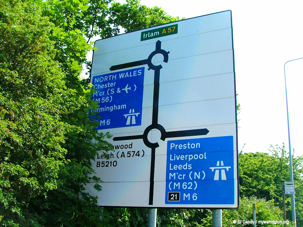
Turning off the M6 at Woolston junction the road sign tells us it is three miles to Warrington town centre (9 June 2006).
Woolston History
In 1094 Woolston and neighbouring Poulton were gifted to the abbey of St Peter of Shrewsbury by Count Roger of Poitou, and passed – probably by purchase – to the lord of Makerfield around the reign of Henry II (he reigned 1133-1189). From this date Wolston was held by a number of free tenants as of the barony of Makerfield. The names of those existing between 1175 and 1182 are recorded in a charter of Ralph, abbot of Shrewsbury, who granted them land in Woolston Eyes, now a nature reserve, for a yearly rent.
In the 12th century the name was made up of two parts, “Wulfes” or “Wulfsiges”, a personal name, followed by “tun”, meaning Wulfes or Wulfsiges Town, the town belonging to Wulfes or Wulfsiges. The district was known as Ulfiton around 1147 and Wilfiton 1175-82.
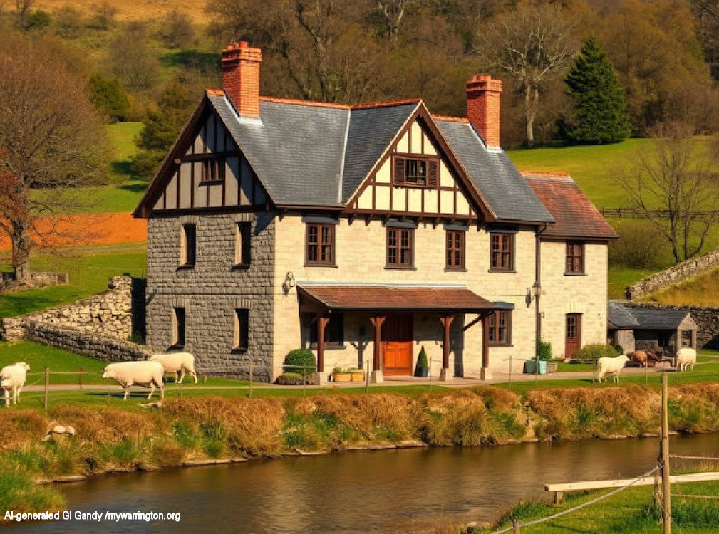
My AI-generated image of a manor house in the countryside (November 2025).
In 1292 two-thirds of the manor were held by Robert de Woolston with the remaining third owned by Richard de Moston, lord of Poulton. In 1326 and 1332 we see the names of Richard and Robert de Martinscroft as two of the owners of the land along with Richard de Woolston and Simon, son of Robert, Henry le Wolf and John de Hepay. In the 14th century we see the names John and Elizabeth Hawarden as freeholders in Poulton and Woolston. They had a son called Thomas and also a grandson of the same name and after a series of court cases and other disputes in the 15th and 16th centuries the manor passed over to Alexander Standish and his family, where it remained until March 1870 when it was sold to John Bennett. The Southworth family also owned the manor of Woolston in the 15th century.
See British History Online for a more detailed report.
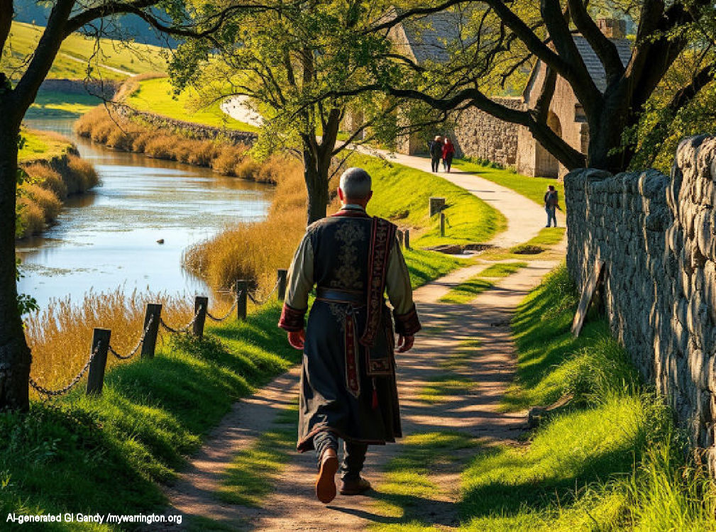
My AI-generated scene showing a Medieval nobleman walking along a country Lane (November 2025).
A description of the land reads:
The flat country is divided into fields with rather meagre hedgerows and scanty trees. The alluvial and sandy soil appears fertile, yielding good crops of potatoes and turnips, oats, wheat, and clover, whilst many a marshy corner is devoted to the cultivation of osiers for the manufacture of potato hampers and ‘skips’. In the north of the district, there is a considerable patch of moss land and here too there is a good deal of clay in the surface soil. By the river, there are moist pastures. The inhabitants are entirely employed in agricultural labour and basket making.
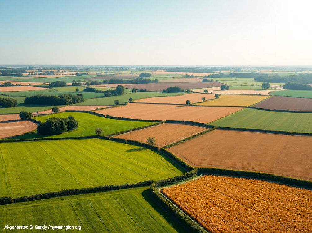
My AI-generated scene showing flat fields in the countryside.
Up to the last decade of the nineteenth century, Woolston and its immediate area was a township called “Woolston with Martinscroft” in the ancient parish of Warrington, which was itself part of West Derby Hundred.
From the middle to the end of the nineteenth century, it was part of Warrington rural sanitary district and Warrington Poor Law Union.
In 1894, Woolston with Martinscroft joined the newly formed Warrington Rural District as a civil parish, where it remained until 1933. There was a boundary change to the civil parish in 1885 when the county boundary between Lancashire and Cheshire was adjusted: it gained part of Thelwall civil parish from Cheshire. See Council Fax for more information on the different administrations in the town.
Manchester Road from Martinscroft looking towards town centre (9 June 2006).
A complex set of boundary changes occurred in 1933, involving the county boundary with Cheshire: the civil parish gained part of Lymm ancient parish, the district exchanged areas of land with Grappenhall ancient parish and also exchanged areas of land with Thelwall civil parish, all in Cheshire.
Finally, and again in 1933, the civil parish of Woolston with Martinscroft was abolished and parts used to create the civil parishes of Croft and the modern-day civil parish of Woolston, both in Lancashire. This new civil parish of Woolston was formed from parts of the old Woolston with Martinscroft civil parish, as explained above, and also part of Culcheth civil parish.
The district remained in Warrington rural district until the local government reforms of 1974, which created the borough of Warrington and was administered by Cheshire. Woolston with Martinscroft is now administered under Warrington unitary authority, which was created in 1998.
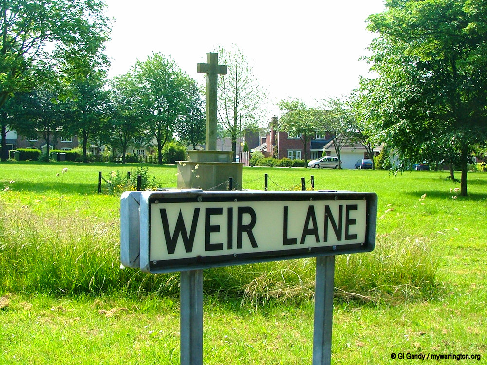
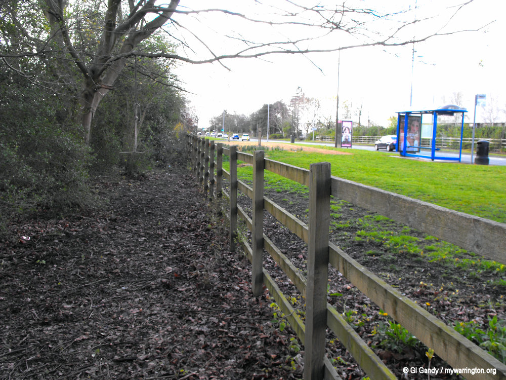
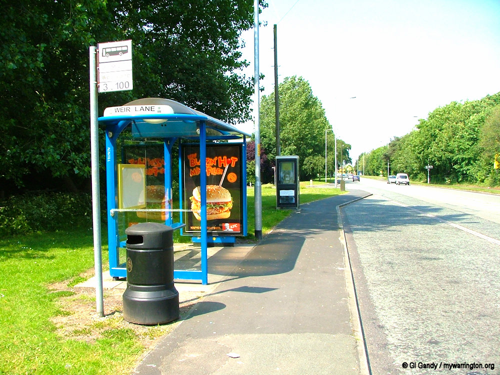
Weir Lane in Martinscroft leads to the weir on the River Mersey (photo taken 9 June 2006).
Some information from Wikipedia.
Martinscroft History
Gilbert de Martinscroft held land here in the time of Edward I, and Richard his son was one of the largest contributors here to the subsidy of 1326. By his wife Agnes, daughter of John de Shaw, he had issue two daughters, Godith and Margery, who with their husbands were claiming a messuage and lands here in 1346 against Robert, son and heir of the said Richard de Martinscroft, and Richard’s widow, Margery de Edgeworth.
Richard Houghton, Ellen Hawarden, Adam Hawarden, and Richard Bruch, as landowners in Woolston, contributed to a subsidy in Mary’s reign. The only freeholder recorded in 1600 was Alexander Standish. Sir Peter Legh and Ralph Standish were the landowners paying to the subsidy in 1628, in Poulton and Woolston. Richard Booth was, in 1653, allowed to contract for two-thirds of his estate sequestered for his recusancy. Richard Booth and William Caldwell, reedmaker, as ‘Papists,’ registered small estates in 1717.

My AI-generated scene of a family enjoying a meal in their garden in medieval times. Any resemblance to any person living or dead is purely coincidental.
A family named Willme resided at Martinscroft in the seventeenth and eighteenth centuries; one of them, John Willme, who died in 1767, was a mathematician and astrologer.
The land-tax returns of 1787 show that Edward Standish, Henry Pickering, and a Mr Strickland were the chief owners of the soil.
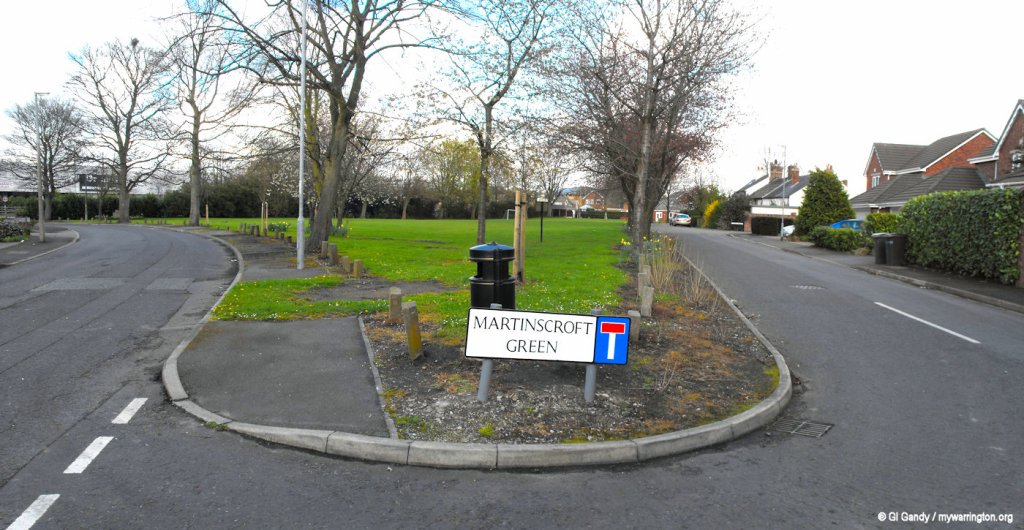
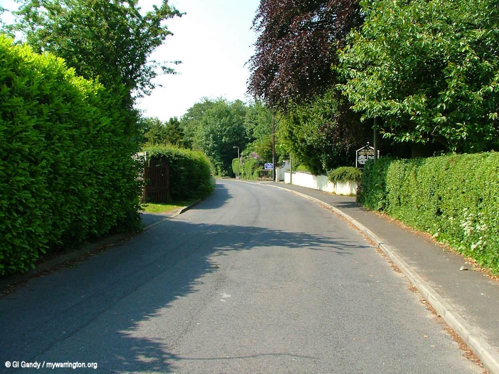
Martinscroft Green photographed on 10 April 2012.
It is rumoured that Battery Lane in the village got its name from where Oliver Cromwell stored his weapons during his visit in the civil war. Gilbert de Martinscroft held the manor during the reign of Edward I, who reigned from 1239 to 1307 with his son Richard de Martinscroft mentioned in 1326.
The village green was once the home of a school and a pub. Evidence of this is hidden in the trees where you can find a gatepost from the school and horse mounting steps which stood outside the pub.
Martinscroft Green is the village green and is also a popular place for recreational activities. The village has recently been enlarged by new housing estates and the building of a hotel, although it has a few old cottages still along the village green.
Retrieved from Wikipedia
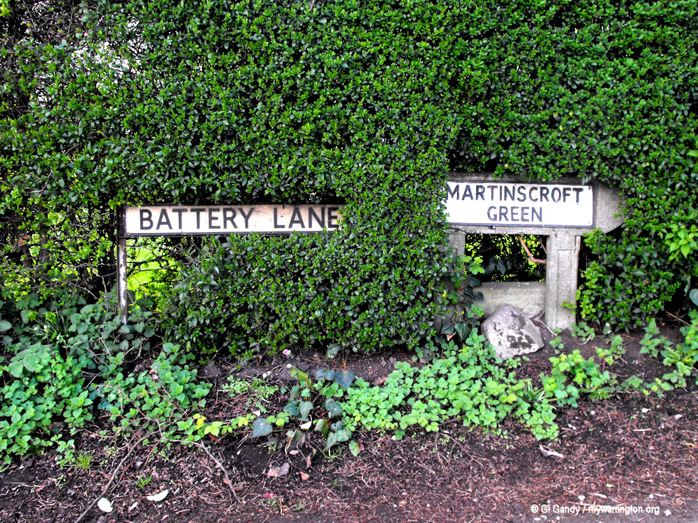
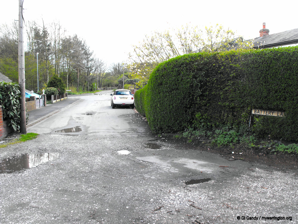
Battery Lane alongside Martinscroft Green (photo taken 10 April 2012).
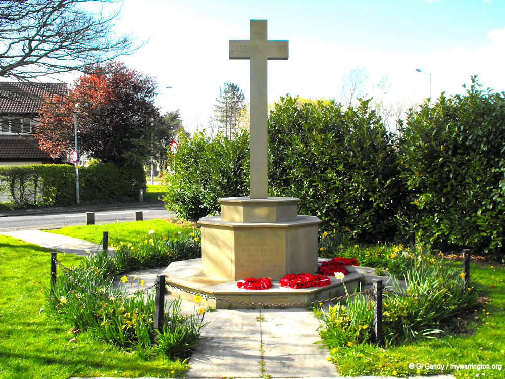
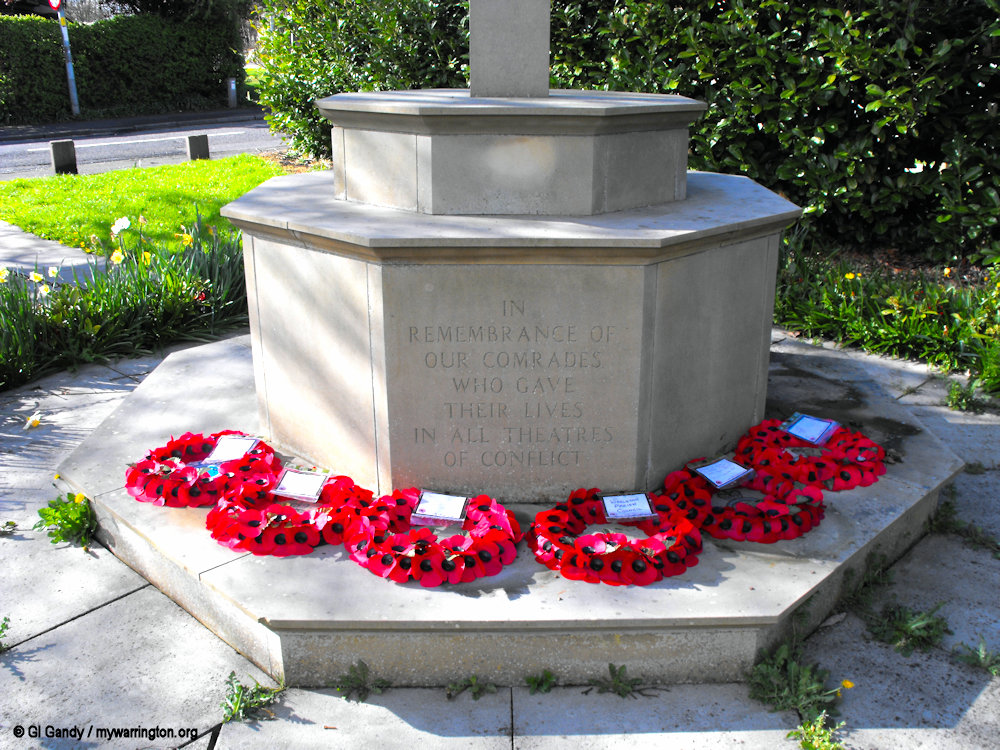
Woolston and Martinscroft War Memorial
Woolston and Martinscroft War Memorial was unveiled on 1 November 1987. There are no names of the fallen, just a memorial to all those who sacrificed their lives in all theatres of conflicts.
Woolston Hall
Woolston Hall was a historic manor with origins dating to the 13th century when the Woolston family lived there. Over time, it was owned by the Hawarden and Standish families and was later used as a centre for Catholic worship, with a priest residing there from 1677 to 1831.
The original hall was built in the 13th century and was home to the Woolston family until the 15th century.
By the 15th century, it was owned by the Hawarden family and later passed to the Standish family through marriage in 1575.
The hall became an important centre for Catholic worship. From 1677 to 1831, a series of English Benedictine priests resided there, serving the local Catholic community.
A domestic chapel was located at the hall, and it was noted that Catholic children were christened there, as reported in 1777.
After being turned into a farmhouse, the hall was eventually demolished in 1947 or 1948 to make way for housing developments and the Woolston County Primary School, located on what is now Greenfield Close.
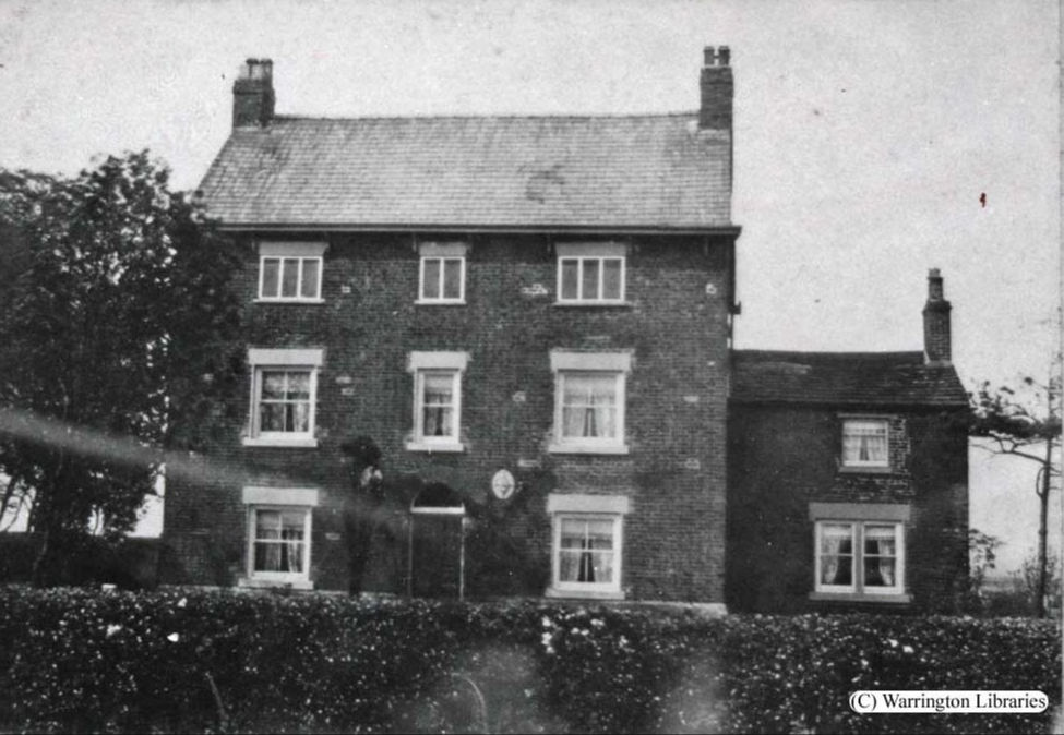
Woolston Hall (used with permission from Warrington Library and Museum)
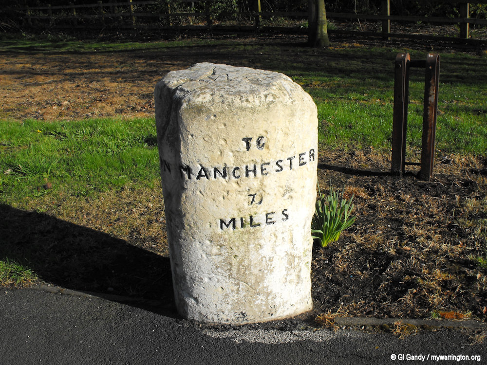
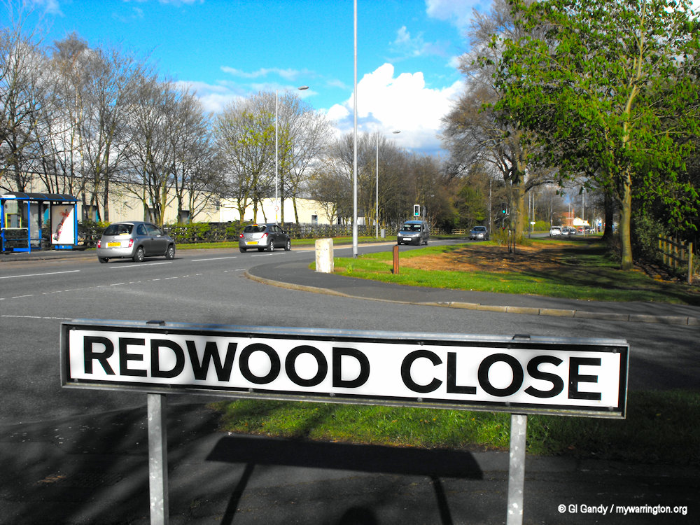
Woolston Milepost
The milepost probably dates from the late 18th or early 19th century and is marked on the 1848/9 Ordnance Survey map. It is a physical marker of the area’s transport history and the development of turnpike roads.
The milepost is a Grade II listed monument, situated on the south side of the A57 by Redwood Close. It is a whitewashed, triangular stone with a flat top and a straight back.
The lettering on the post indicates distances to nearby towns:
“TO WARRINGTON 3 MILES” on the left face.
“TO MANCHESTER 16 MILES” on the right face.
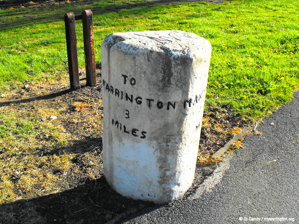
Woolston Milepost on the A57 by Redwood Close (10 April 2012).
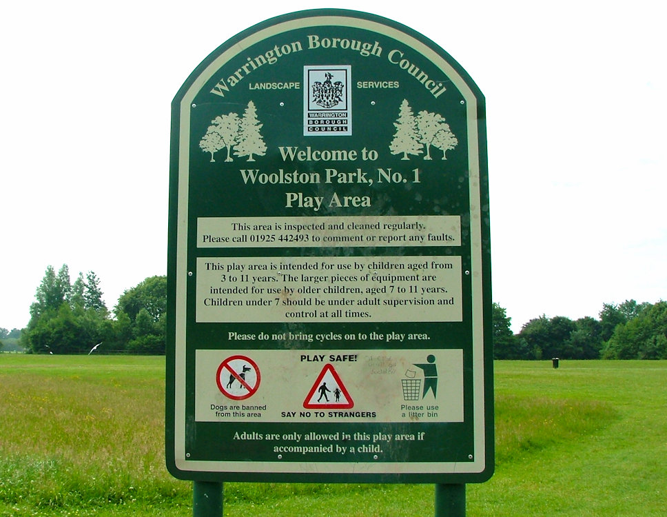
Wildlife
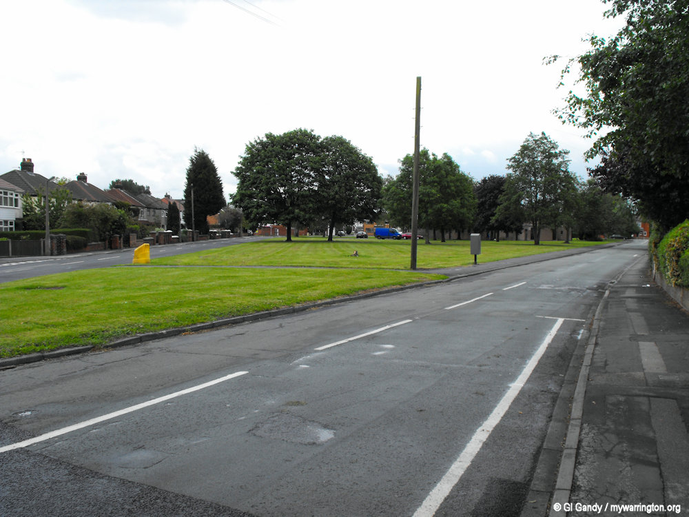
The area has two main areas of interest to nature lovers: Woolston Park (which opened on 28 September 1977) and Woolston Eyes Nature Reserve – a Site of Special Scientific Interest (profiled in Warrington Green). The Woolston Eyes Conservation Group (WECG) is a registered charity which set up in 1979 and manages the rich and varied wildlife of the historical canal dredging deposit grounds with the agreement of the Manchester Ship Canal Company, owners of the land.
The highest point is on the Woolston Eyes (two man-made areas formed by large embankments of dredging waste). The lowest point is the marshland formed by the dereliction of the mile-long Woolston New Cut Canal and Woolston Old Canal. Woolston has plenty of waterways including the aforementioned canals, the new cut of the River Mersey and the Manchester Ship Canal.
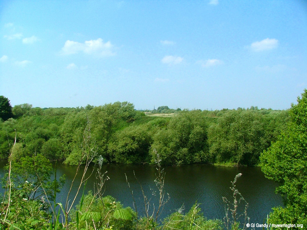
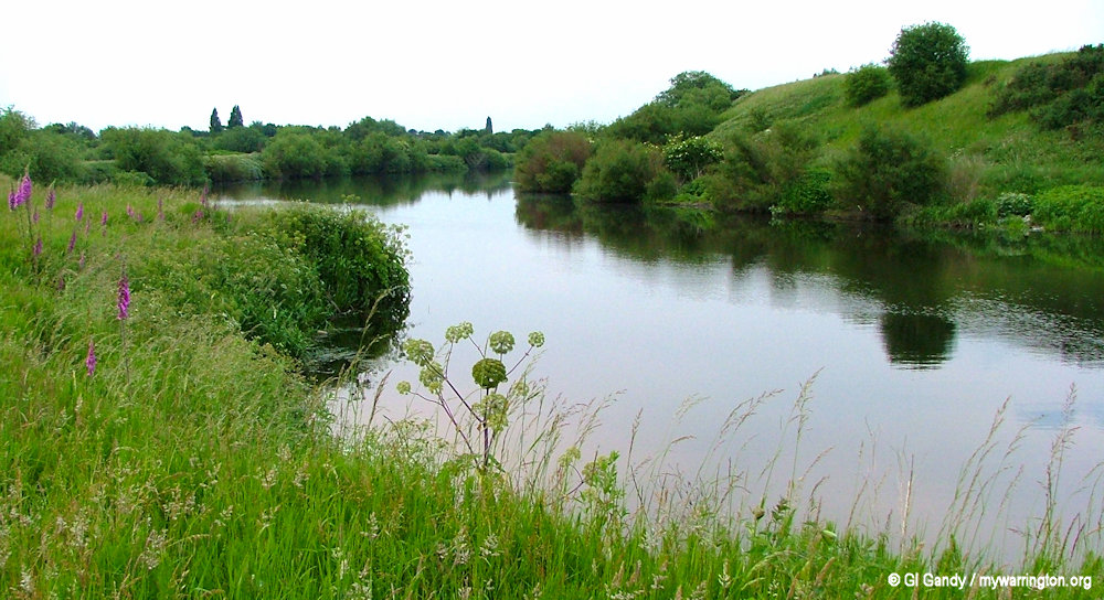
River Mersey from Woolston Eyes Nature Reserve. The Mersey, which means boundary river separates Lancashire from Cheshire. This scene looks towards town centre with the Parish Church of St Elphin in the distance (9 June 2006).
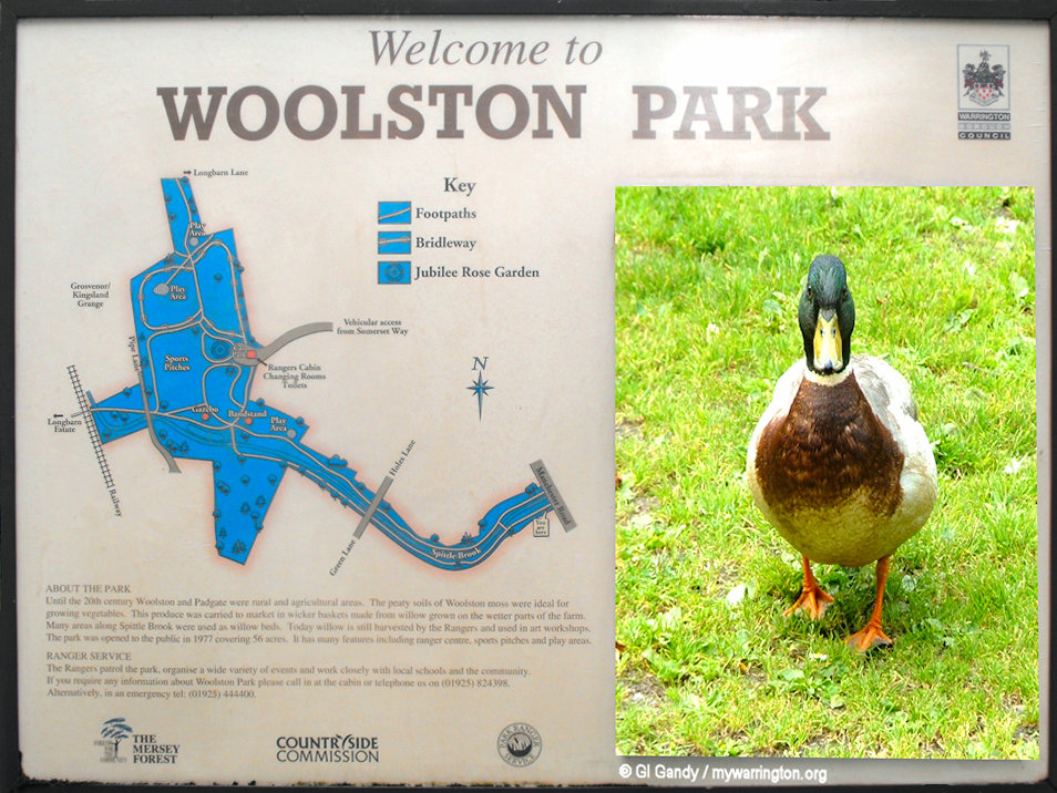
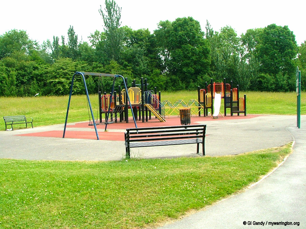
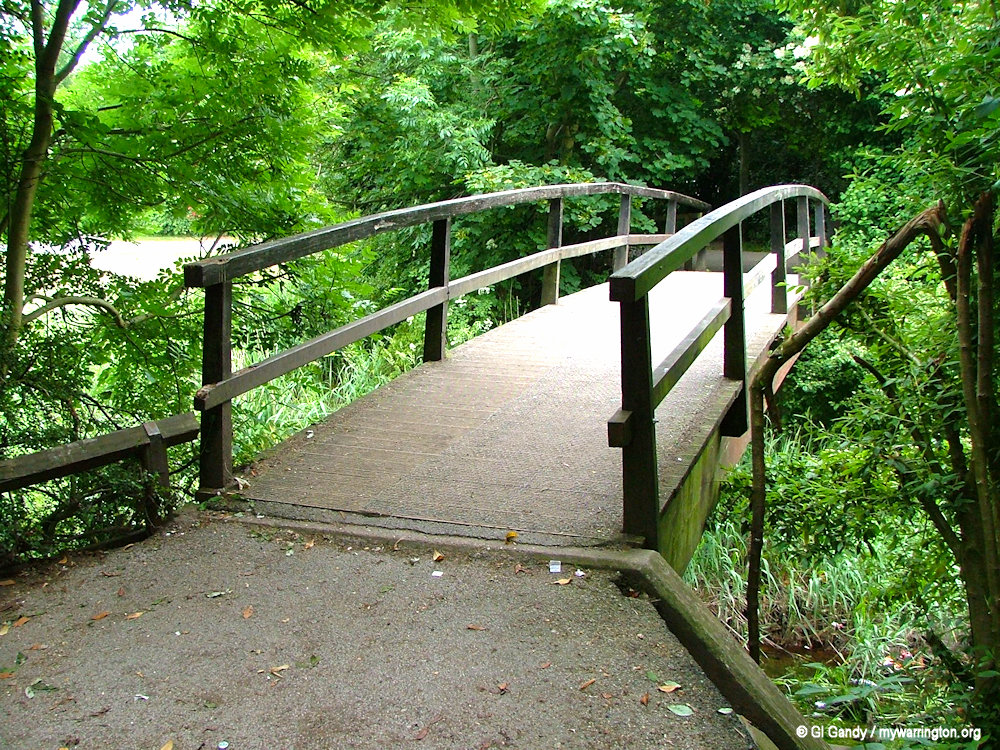
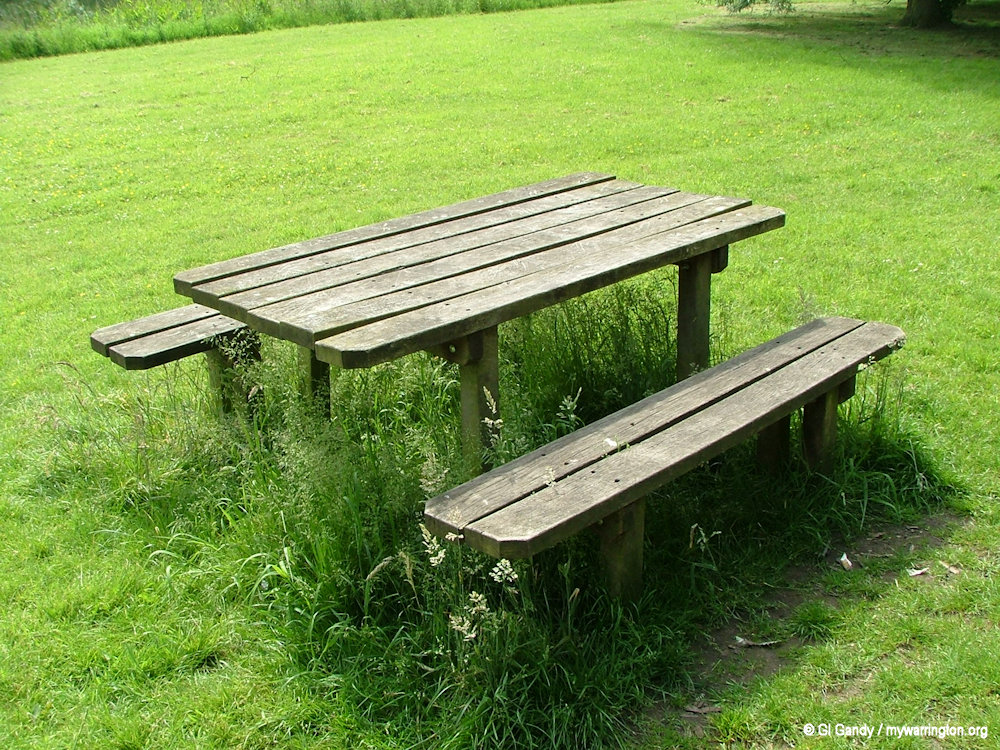
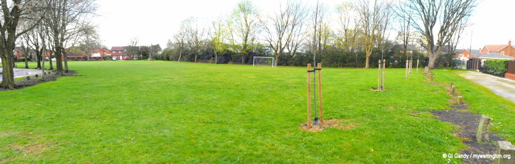
Scenes of Woolston Park
The New Cut Heritage and Ecology Trail
The New Cut Heritage and Ecology Trail is an ongoing project to enhance a valuable group of local open spaces. The linear footpath runs alongside Woolston New Cut Canal. The first Woolston Cut was opened in 1721 and then a new cut was built 1821 to allow boats to avoid the twists and turns of the Mersey in this area of Wolston. The footpath runs from Paddington Bank off Kingsway up to Weir Lane, Woolston (where it joins with Woolston Eyes). Paddington Meadows is alongside the trail. See Warrington Green for more on Paddington Meadows.
River Mersey by Paddington Meadows (17 June 2006)
Wolston Greyhound Track
Woolston was the location of one of two greyhound race tracks in the town. The more established one was found in the district of Arpley half a mile south west of Warrington town centre (see Arpley Meadows for the story of that one). The more unfamiliar greyhound track, described in this section, was found roughly two miles further east and was known as the Woolston Greyhound Track.
Its first meeting came on 12 September 1934, having developed on grazing land that separated the New Cut Canal, and the old Lido 42 open air swimming pool. The Woolston track was of a U-shaped affair, as it had just two bends, and due to the limited land space that it had been built on, had made it virtually impossible to complete the circuit.
Distances and operations still remain a mystery, but its brief spell as a flapping track came to an end in 1937. The original site of the venue lies roughly one and a half miles west of Junction 21 on the M6, with its foundations now covered by an industrial estate, with The Plumb Centre, Howdens and other small units now pinpointing its once location.
See the Greyhound Racing Times website for a map of the track’s location. Sadly, I don’t have any photos of the Woolston track. Many thanks to Anthony Haworth for his assistance with this report.
Woolston Lido
Woolston Lido, an open air swimming pool, opened on 19 May 1934 and was located where the council depot is today, off Hawthorne Avenue. A Warrington-Worldwide discussion gives the following interesting information.
I remember doing a story on a campaign to get Woolston Lido re-opened.
That, I think, would be sometime in the mid-to-late 1960s. I went to the site with a photographer (I was on the Lancashire Evening Post (Post and Chronicle) at the time). We took pictures of the pool, which was disused and empty and had been so for some time. We also borrowed (from someone, I can’t recall who) some pictures of the Lido in its hey day when it was packed with swimmers. It looked more like Blackpool than Woolston.
The site was at that time owned by Walter Farrington, local businessman, county councillor and licensee of the Noggin Inn at Risley. I seem to recall it was largely used as a caravan site.
So, somewhere in the archives of the Lancs Evening Post there should be a story and picture that would shed some light.
From DS
I remember the Morris Dancers who used to practice there and I also remember a caravan park at the rear of the Lido.
From Sandra Kindon (Nee Hanagan)
I grew up at the Lido. The freezing cold water, the terrifying high board, the cold concrete changing rooms, the frogs and leaf infested pool and the one penny jam butties from the back window of the restaurant, will live forever in my memory.
From Eric Caddy
My mum used to take me to the Lido in 1936/39. In those day’s it was one of the places to be seen in Warrington, with a bar and café parents could have a drink, sunbath or swim while keeping a eye on the kid’s. At that time Peter Kane the featherweight Champion of the world frequented the place which gave it a certain excitement.
From Eric
We used to do Morris dancing in the hall. I was a mascot and we had tambourines and shakers. I think the man that ran it was Mr Wright and the frogs in the swimming pool and the caravans were always in my memory from 1959. My mum used to go dancing at the Lido in the 1940’s.
From Christine Watters
A real old post just discovered. Lived in Woolston, Barnfield Rd. 1946 to 1951. Great friends with Shirley Jones who’s father owned the lido. They lived adjacent to the lido in a big detached house on Manchester Rd. Lost touch with her and others over the years. Happy memories spent at the lido. Went to Oakwood Avenue Girls School.
From Doreen Cook nee Hardman
Church Life
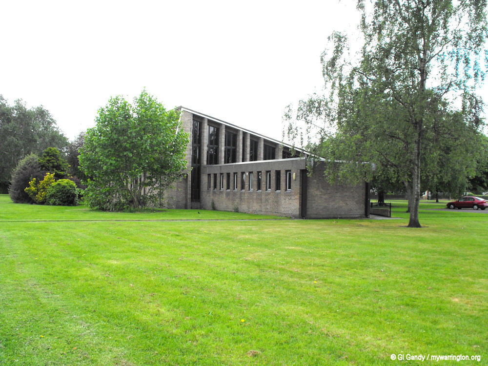
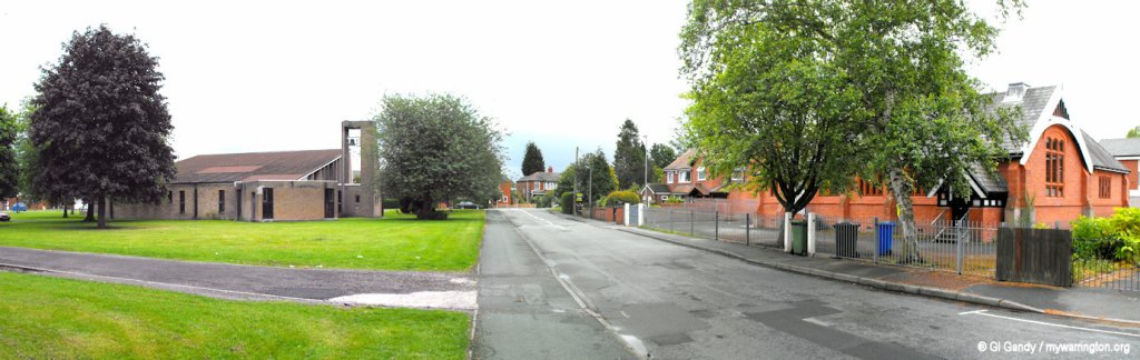
Church of The Ascension
In 1649 a commission set up by Cromwell’s parliament to survey the parishes and churches throughout the country decided that a church should be built within Woolston to serve the parishes of “Wilgreave, Martinscroft, Woulston, Fearneheade” as well as parts of “Poulton and Winwicke” At this time the people of the Woolston area would attend Warrington’s Parish church St. Elphins, the oldest church in the town.
The current church was consecrated on 7 May 1970 and is run by the Church of England. The church services had previously being held in the Mission Hall, which still stands across the road on Warren Lane. The Mission served Woolston as a school, a parish hall and a church for many years before ground was broken on the dedicated building we see today.
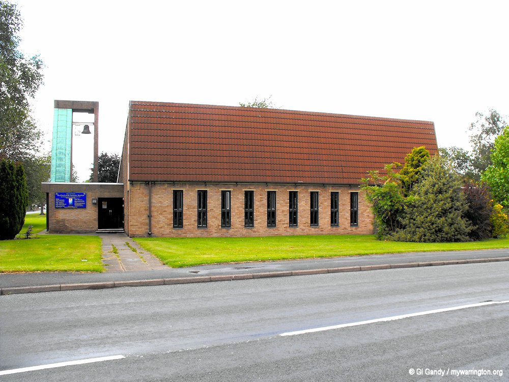
The Church of the Ascension on Warren Drive (8 June 2011).
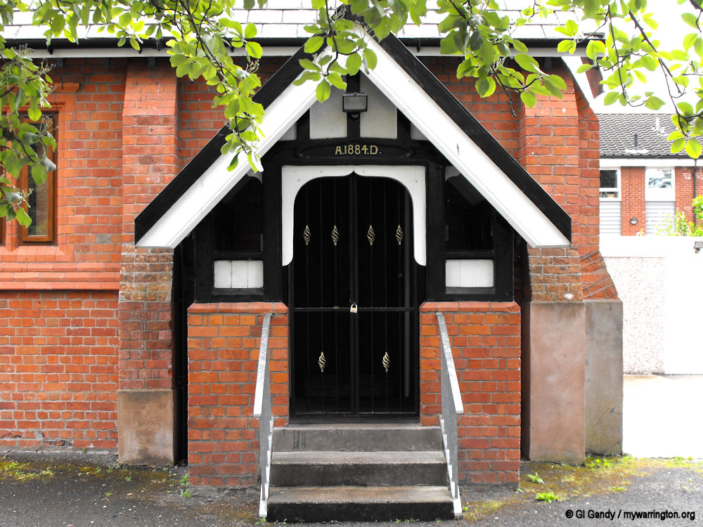
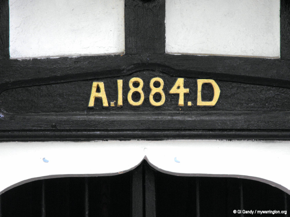
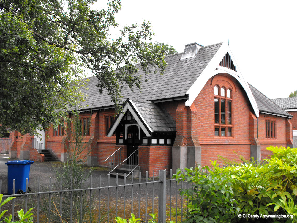
The Mission was built in 1884 and is seen here on 8 June 2011.
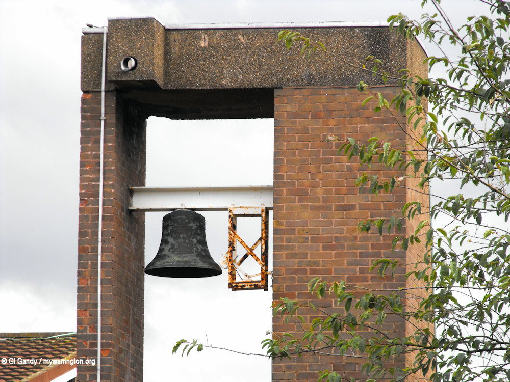
Another view of the building and a close-up of the church bell (8 June 2011).
The current church building on the left with the Mission building on the right of Warren Lane (8 June 2011).
St Martin’s Methodist Church
St Martin’s Methodist Church is on Gig Lane in Woolston. The current building opened on 8 February 1975, but the church history takes us back to 1827. St Martin’s originally served the largely farming community of Martinscroft and was formerly known as Martinscroft Methodist Church.
As the congregation grew so did the need for a chapel and a building was erected on the original site in Martinscroft. When the chapel fell on hard times decades later the church was forced to close for a short period in the 1880s.
In 1900 the new church was constructed using part of the shell of the old building. A pipe organ was donated and installed in 1937.
The building was compulsory purchased in 1972 to make way for the new Woolston Grange industrial estate and a new building was constructed on Gig Lane where it stands to this day.
St Martin’s Methodist Church on 8 June 2011.
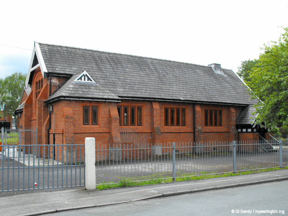
St Peter and St Michael Catholic Church, Martinscroft
The parish church of St Peter and St Michael was built in 1834 on Weir Lane in Martinscroft. It opened in 1835 and is now Grade II listed. The building has three stained glass windows and seating for 200 parishioners. The church has a graveyard and also features a memorial garden with plaques dedicated to former members of the community.
Read a detailed history of Roman Catholicism in Woolston and Martinscroft on the church website.
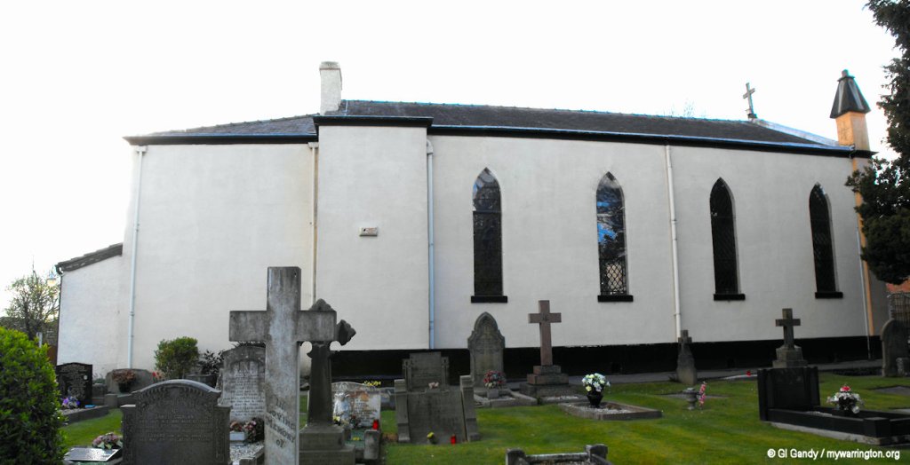
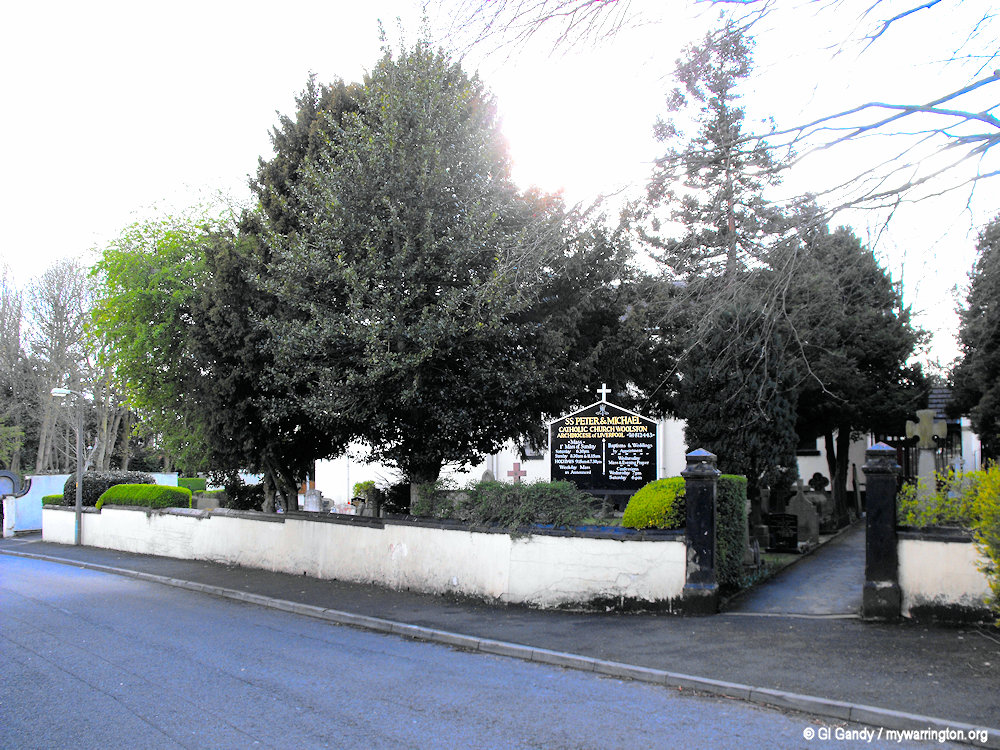
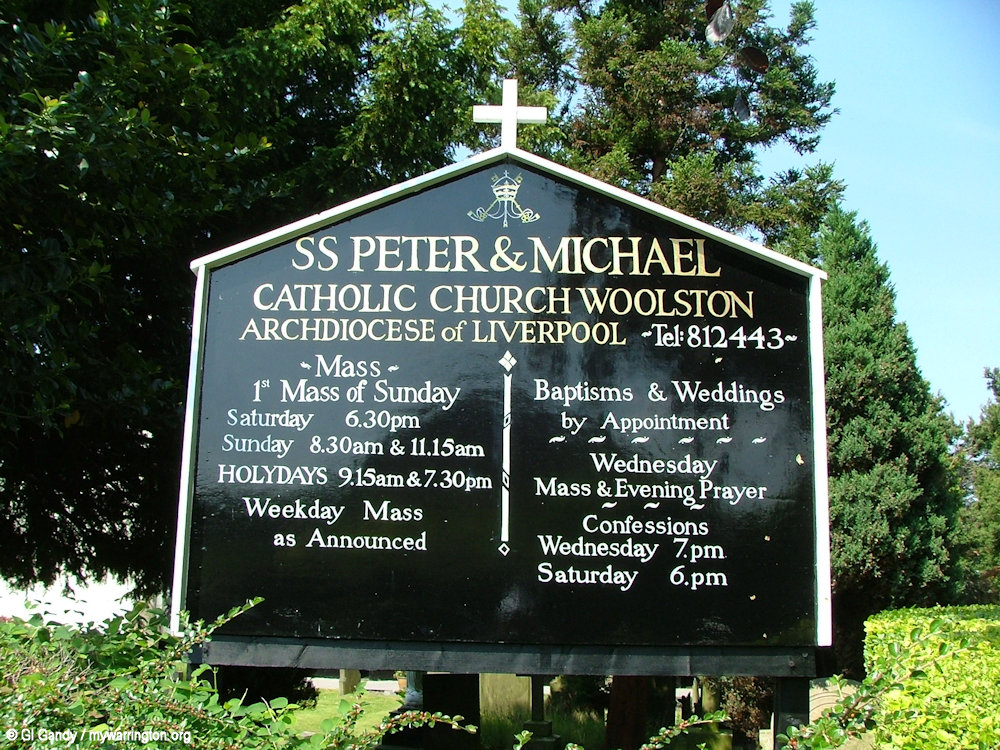
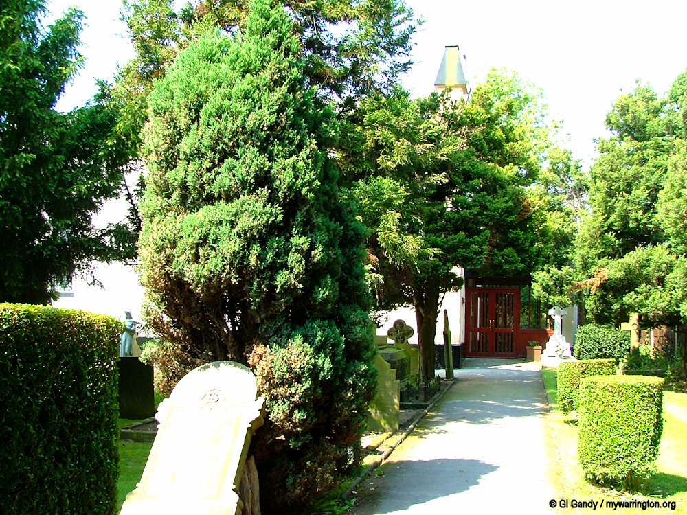
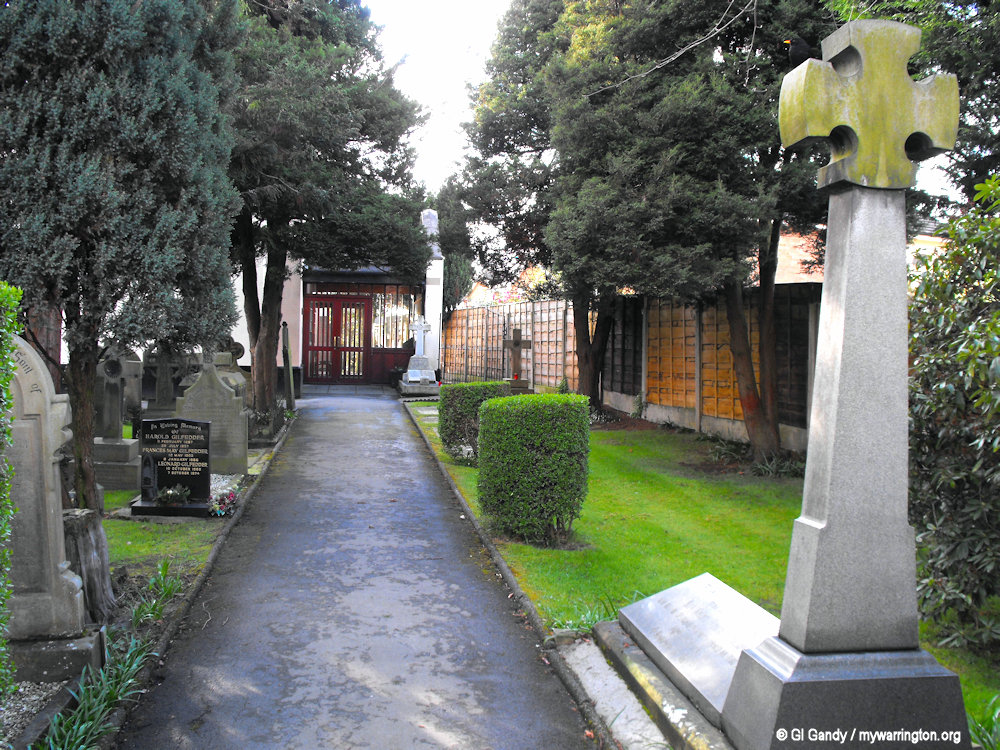
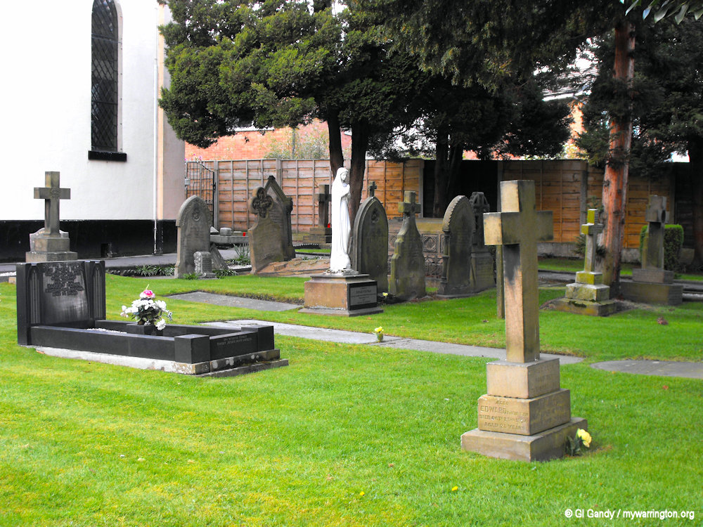
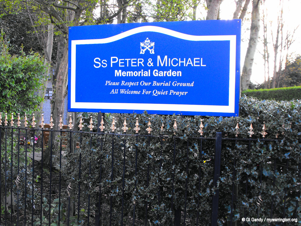
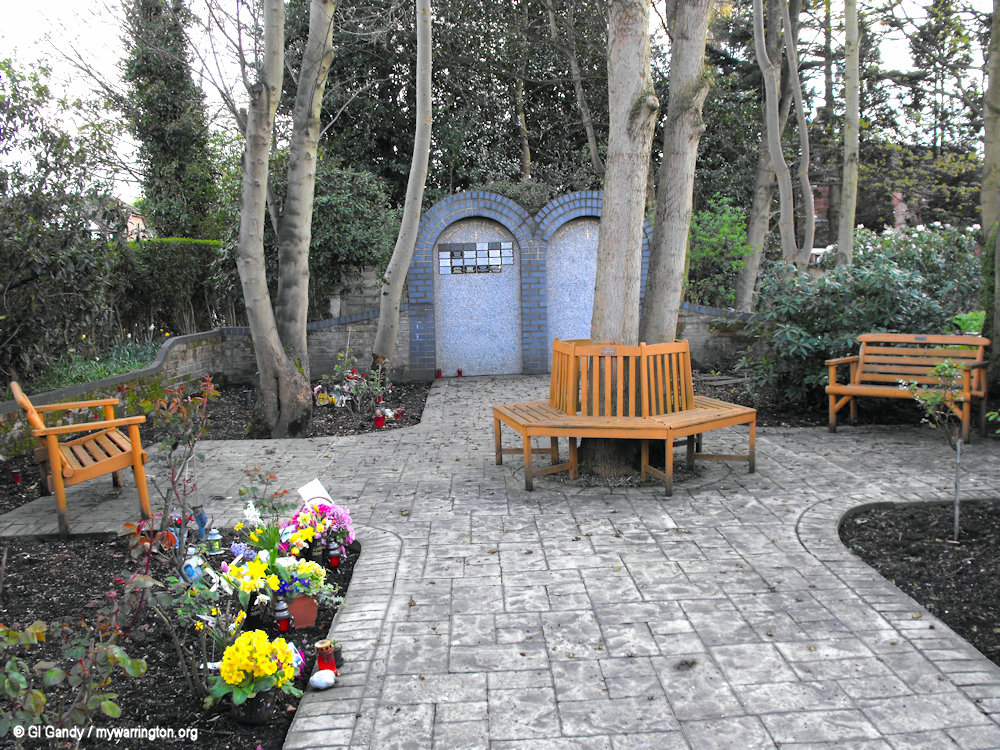
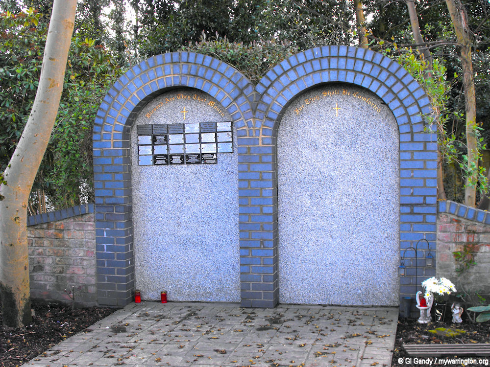
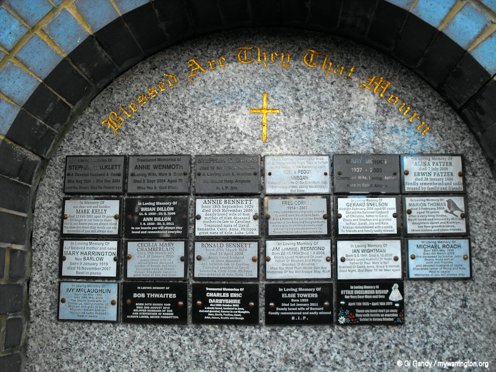
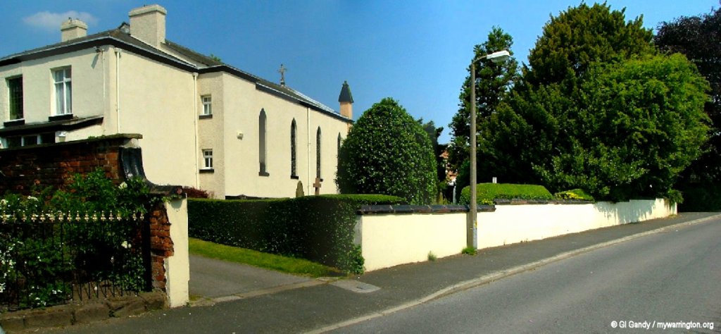
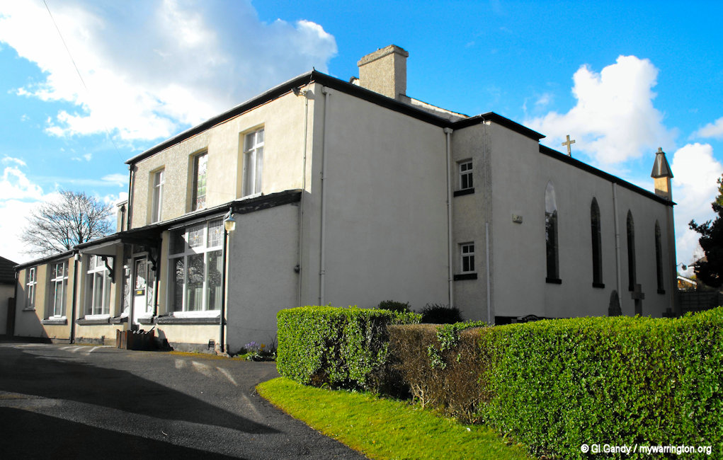
All photos of St Peter and St Michael Catholic church were taken on 10 April 2012.
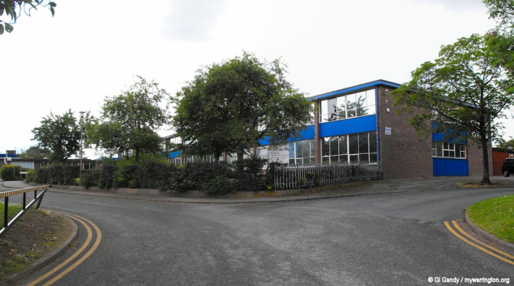
School Life
Woolston Brook School is on Holes Lane. Woolston Brook is a small, specialist school for children and young people aged 7-16 with social, emotional and mental health needs. The school provides an inclusive environment where all learners are cared for, valued and respected.
Woolston Learning Village opened in December 2014 on Holes Lane, bringing together Fox Wood School and Green Lane Community Special School. It caters for children aged 4-19 with special educational needs and disabilities on one site, with shared use of state-of-the-art specialist resources. The campus also provides new specialist teaching space for Woolston 6th Form College, which educates and supports students aged 16-19 who have a range of additional needs including severe learning difficulties, complex learning difficulties and profound and multiple learning difficulties.
Woolston Community Primary School has space for 238 pupils. The original school building opened on 10 October 1954 and was demolished in 2014 when a new school was built on the same site. There is a designated provision for children aged 7-11 with autism.
King’s Leadership Academy Warrington (Warrington’s first Free School) opened its doors to its first Year 7 pupils in 2012 and is close to Woolston Park. The school is the brainchild of Sir Iain Hall (previous career in working with failing schools in the US and the emergence of the Charter School system in the US). But the school did not have an easy run with the council. The council refused to allow them to use the former Woolston High school building and it (the council) had run-ins with the Government. Read more in the Warrington Guardian.
St. Peter’s Catholic Primary School has connections with the highly rated St Peters & St Michaels Church. Despite the school being one of the newer schools in the area, they still boast the best results from both Key stage 1 and Key stage 2 in the Woolston area.
Woolston Church of England Primary School opened on 17 April 1972 on Epping Drive and cost £84,000 at the time (£1.4 million at 2025 prices). Their website says they seek to provide a warm, welcoming environment rooted in Jesus’ teaching, ‘I am the Light of the World’ (John 8: 12)’.
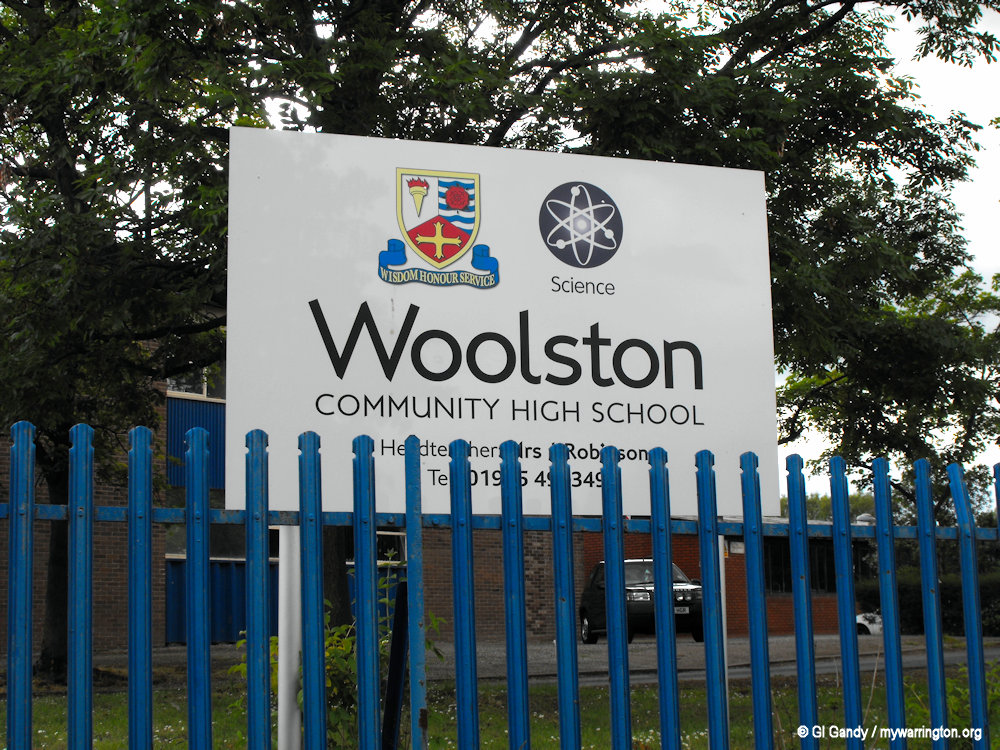
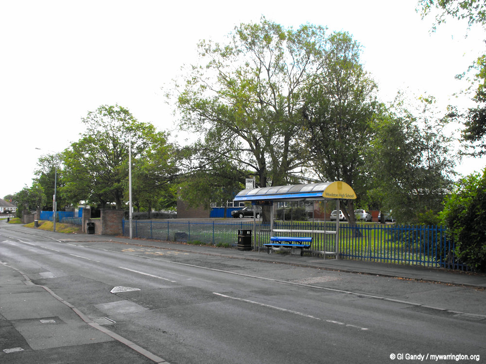
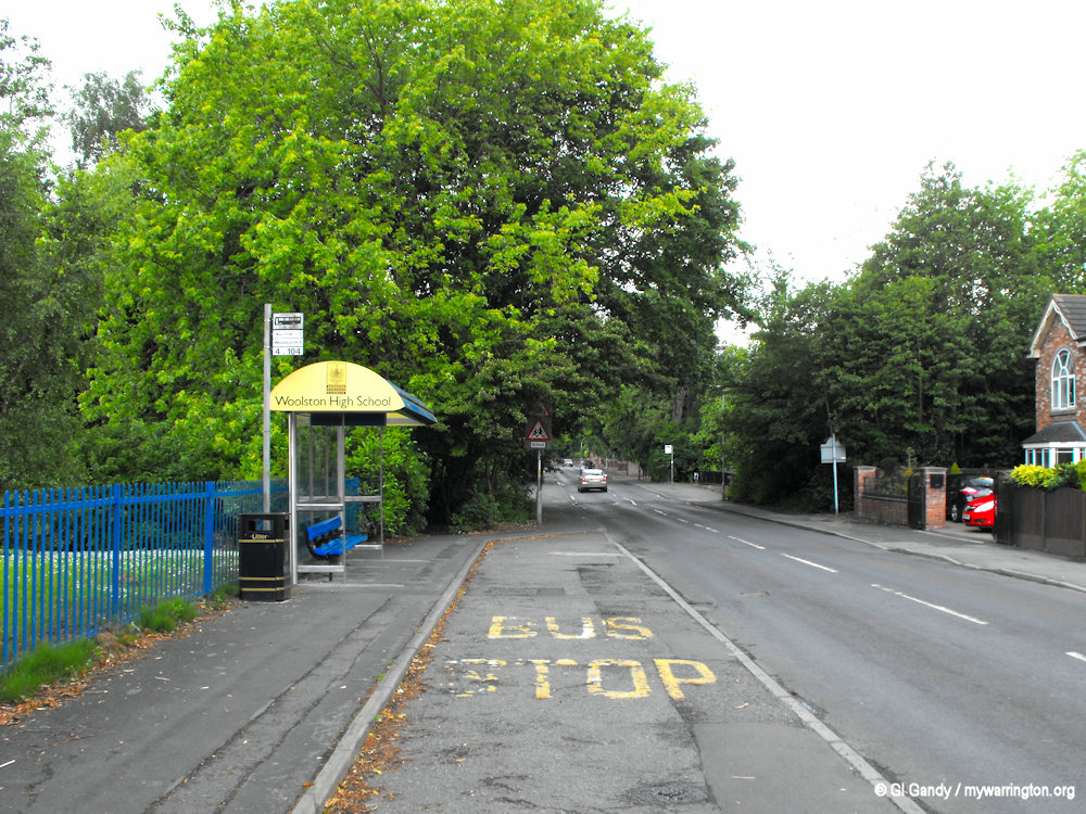
Secondary education was provided by Woolston Community High School from 1959 until 2012 when it was closed by the council. The council announced the closure to the media on 5 March 2008.
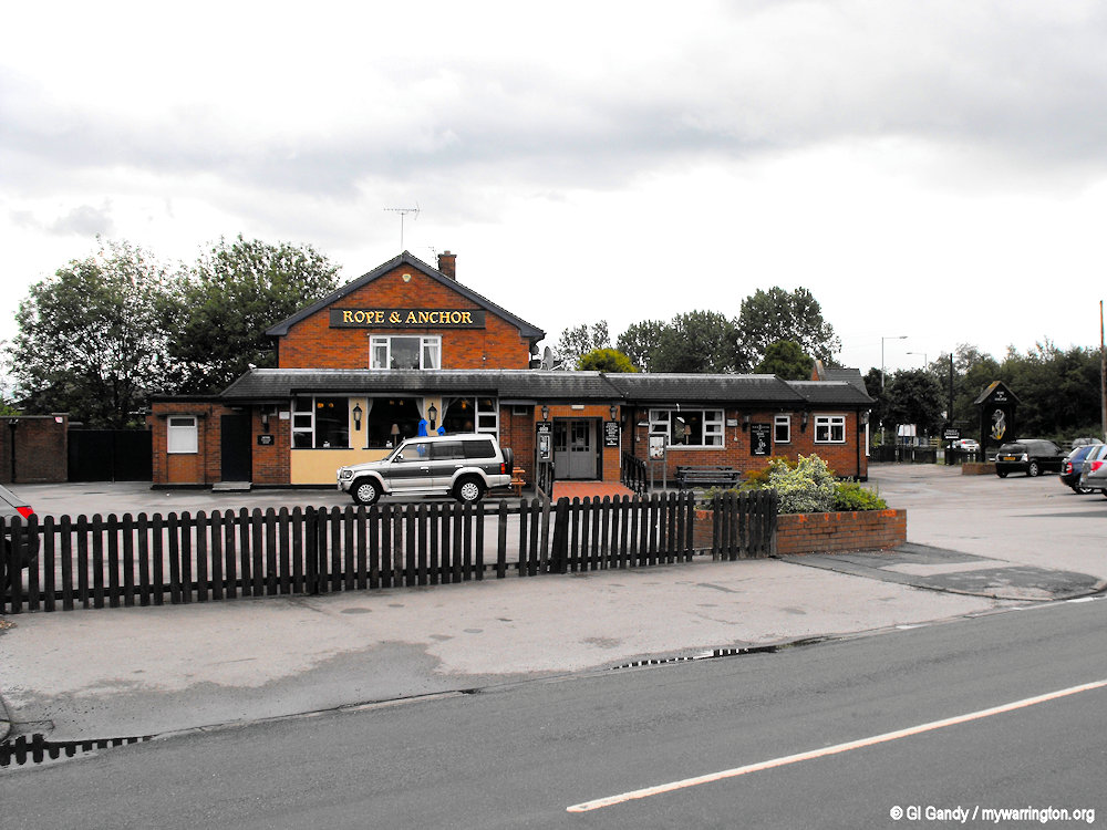
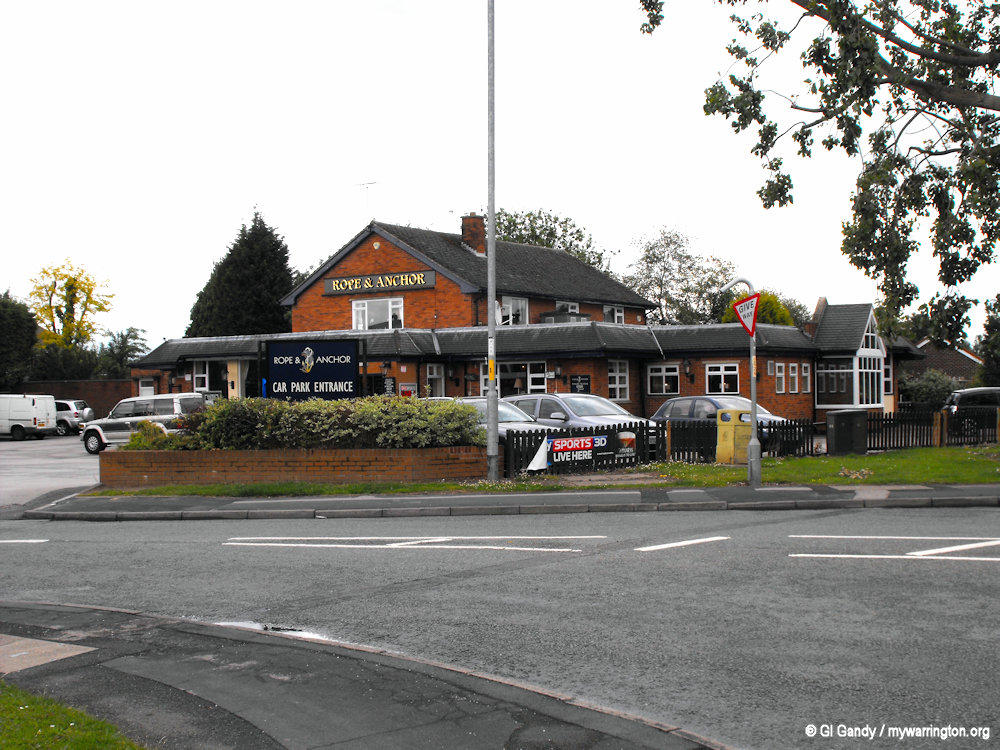
Pub Life
The Rope and Anchor pub is on Manchester Road. There are old photos of the original pub on the Croft Local History Facebook page.
Across the district the New British Legion officially opened in Wigshaw Lane, Woolston on 9 September 1986. It is now known as Culcheth Village Club.
Woolston Grange Industrial Estate
Warehouse units cover a large area of the district. The largest by far is the “Grange”, for which building work started in September 1972. It stands next to the M6 motorway with the M62 and M56 motorways close by. Cold Shield Windows Ltd on the Grange Estate in February 1979, becoming the 100th firm opened in Warrington New Town. One of the biggest warehouses on the site was a Safeway distribution depot that was taken over by Morrisons in January 2006, and then taken over by Iceland in mid-2006. In 2007, this was outsourced to DHL, while still continuing to serve Iceland.
There is also an industrial estate to the south called the “New Cut Industrial Estate”. This features a large pipe work fabrication business (WH Capper) and several small offices and smallholdings. It is also one of the locations for one Warrington Borough Council depots. The industrial estate gets its name from the canal that borders it and the “new cut” of the River Mersey.
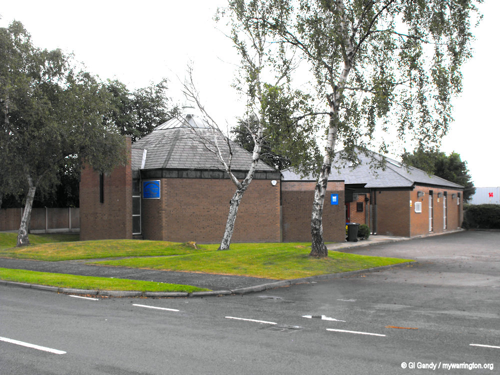
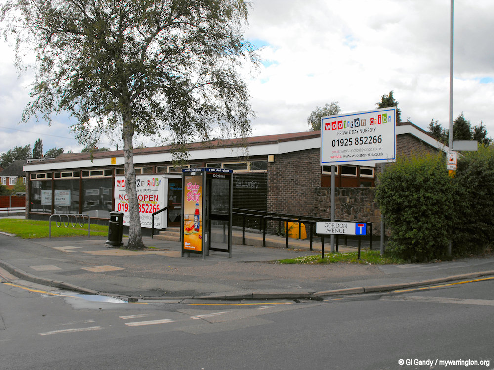
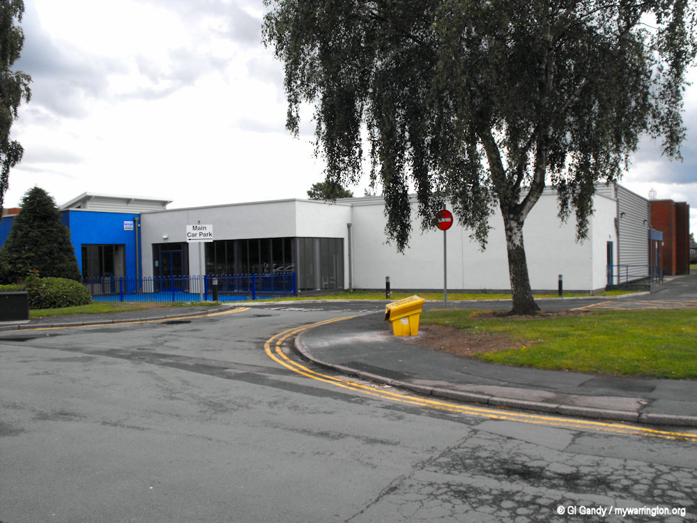
Wolston Library and Woolston Community Hub
Woolston library is now housed in Woolston Hub (formerly known as Woolston Leisure Centre) on Hall Road. The old library building opened on 18 September 1968 on Gordon Avenue, and when the library moved to the hub the old building was used by Woolston Cribs Nursery at the time of my photo on 8 June 2011. From 2012 it was occupied by Wind in the Willows Childcare until financial pressures forced it to close in July 2025 after 13 years of trading.
Woolston Community Hub opened on 1 July 1975. However, at the time of writing (November 2025) locals were fighting Warrington Borough Council’s plans to close the centre due to the high cost of repairs. See the Warrington Guardian for more.
A Final Walkabout
In April 2016, Prince Edward visited Cheshire for a cooking competition where pupils from Woolston High School were “crowned the winners”.
Also, Garden Court Holiday Inn in Woolston was opened by former TV sports presenter Des Lynam on 6 September 1989.
