Penketh windmill on Stock Lane, courtesy of Warrington Museum.
Introduction
In 1870-72, John Marius Wilson’s Imperial Gazetteer of England and Wales described Penketh like this:
PENKETH, a township in Prescot parish, Lancashire; on the Sankey canal, the Warrington and Runcorn-Gap railway, and the river Mersey, at Fidler’s ferry, 3½ miles W S W of Warrington. It has a station on the railway, a post-office under Warrington, a brewery, Quaker and Wesleyan chapels, and a national school. Acres, 1,048. Real property, £3, 117. Pop. in 1851, 679; in 1861, 784. Houses, 141.
GB Historical GIS / University of Portsmouth, History of Penketh, in Warrington and Lancashire | Map and description, A Vision of Britain through Time.
URL: http://www.visionofbritain.org.uk/place/10751
Date accessed: 23rd December 2019
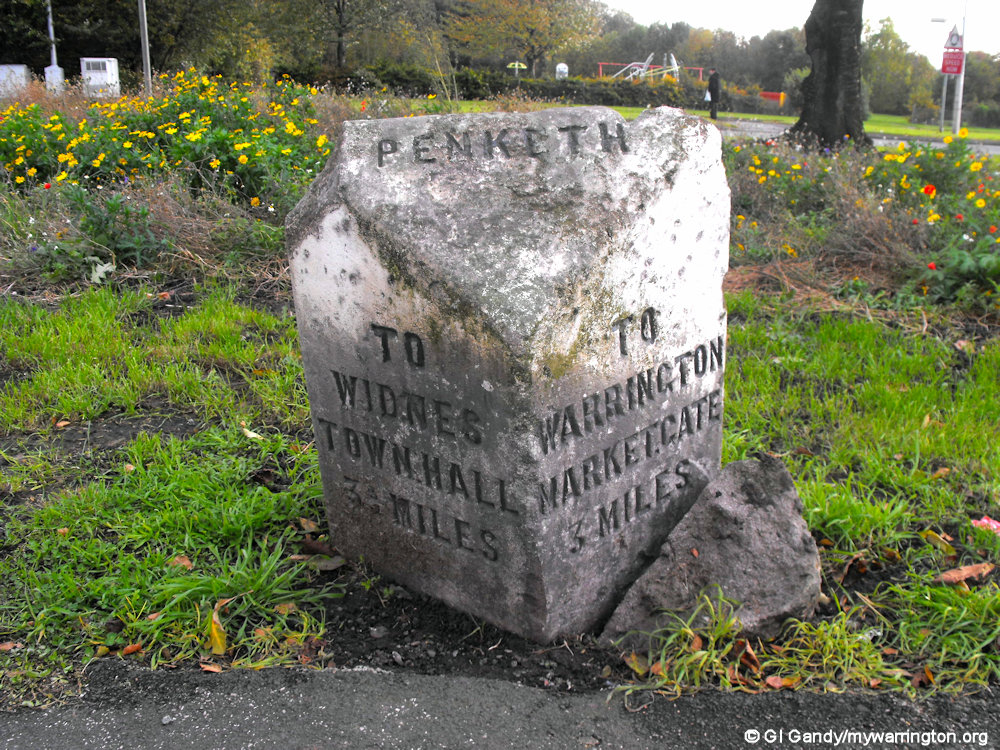
Milestone on Warrington Road (photo 27 Oct 2010).
I am grateful to Penketh.com and Mary Ross from Friends of Penketh Library for assistance and permission to use extracts from their notes.
Back in Time
Penketh is a civil parish located two miles to the west of Warrington town centre. The emblem/badge of Penketh is three kingfishers.
Penketh was originally part of Prescot parish but became a chapelry and then a separate parish. It grew due to the crossing over the Mersey at Fiddler’s Ferry and the building of the Sankey (St Helens) Canal.
The area was mainly rural and agricultural until well into the 20th century, though a tannery and shipyard were established in the 19th century.
Until the major local government reorganisation of 1974, Penketh was part of Warrington Rural district and administered by Lancashire County Council.
The name Penketh comes from two Celtic words – ‘Pen’ meaning ‘end or edge’ and ‘coed’ meaning ‘woods’, Burtonwood being the wood. Penketh was also a hamlet of Great Sankey.

The Coat of Arms of the Penketh family “Argent, three popinjays Azure, sometimes with a chevron between them (Three kingfishers on a silver background)” was recorded as being present in a window of the Warrington Friary. Nowadays there are only two representations of the coat of arms of Penketh; one was taken from the window of the Warrington Priory and the arms with the white chevron was taken from Warrington Parish Church.
A family called Penketh lived at Penketh Hall from around 1216 to 1624, one of whom was Thomas Friar Penketh who was Head Hermit at The Friary in Warrington town centre. This is the same Friar Penketh who is mentioned in William Shakespeare’s play Richard III. The Friar Penketh pub on Barbauld Street is built on the site of the friary.
One of the first mentions of the Penketh family was William de Penketh who was witness to a charter in 1240. In 1242 Roger de Sankey held the twentieth part of a knight’s fee here under the heirs of Emery le Boteler. In 1280 Gilbert and Robert Penketh became joint lords of the manor of Penketh.
In 1624 Richard Penketh sold Penketh Hall to Thomas Ashton this was the demise of the Penketh family as they lost their wealth and the title of lord of the manor. The land later transferred to Lord Lilford. See also the British History Online website.
Penketh Hall is located at the bottom of Hall Nook and is now the farmhouse of Ditchfield’s Farm.

The original Penketh Hall is now Ditchfield Farmhouse (photo taken 26 Aug 2025)

Penketh.com tells us that a few hundred years ago Penketh was located on part of the London to North Western Carriageway.
Penketh was thought of as running from the Red Lion on Penketh Road to the Crown and Cushion, on the corner of Warrington Road and Stocks Lane. The village stocks were situated outside the Wesleyan Chapel on Stocks Lane opposite the Crown and Cushion.
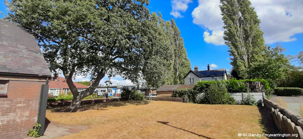
In the 1860s there were about one hundred acres of waste or common land, called the Greystone Heath and Doe Green. There was an agreement in 1868 to break up Greystone Heath covering 100 acres to give 90 acres to commercial use, Six acres for recreation ground and five acres for a cemetery. Now all that remains of Greystone Heath is Greystone Recreation Ground, Withinshaw Recreation Ground on Warrington Road towards the roundabout and Penketh Cemetery. Greystone Road originally ran between Warrington Road Great Sankey (A57) and Warrington Road Penketh (A562). The section between Great Sankey and Meeting Lane is now St. Mary’s Road.
Greystone Rec, above, is where Penketh Carnival takes place each summer. Greystone Lodge, which still stands on the the corner of Meeting Lane and Greystone Road as a private residence, was built in 1878 and is named after Greystone Heath. (photo taken 27 October 2010).


Greystone Rec as seen in August 2025 (1st and 2nd image). The third image shows Heath Cottage, built in 1880 on Heath Road. Greystone Heath was bound by Warrington Road, Greystone Road and Heath Road. On the OS map you can see properties named Heatherlea, Bleak House, Ivy Cottage, Greystone Villas, West View and Highfields. There were no other properties on the heath and you if you are familiar with the village you can get an idea of how big it was when you compare the Recreation Ground with the heath itself.
Around 1800-1850 the inhabitants of Penketh were mainly employed as bakers (the Baker family occupied one of Penketh’s windmills just off Stocks Lane), cabinet makers and cobblers (the Gandy’s were a large cobbling family exporting shoes to the United States; my grandad’s cousin was Doug Gandy who had a shop in Mersey Street in the town centre). Other trades included brewers (at the local Penketh Brewery), or boatmen and hauliers on the Mersey and the Sankey Canal.

Tannery Lane road sign on 19 Apr 2012.
Penketh Tannery
The tannery started out as Penketh brewery in 1860. However, the Parker family, who were Methodist abstinence teetotallers and became owners of the business, changed its use. Tannery Lane was originally called Brewery Lane and changed when the brewery became a tannery.
The Penketh Tanning Company Limited at the time this was the major employer in Penketh and the surrounding area. The tannery supplied all the amenities that the workers needed including housing, canteens, a bath house, football pitches, bowling green and a dance hall.
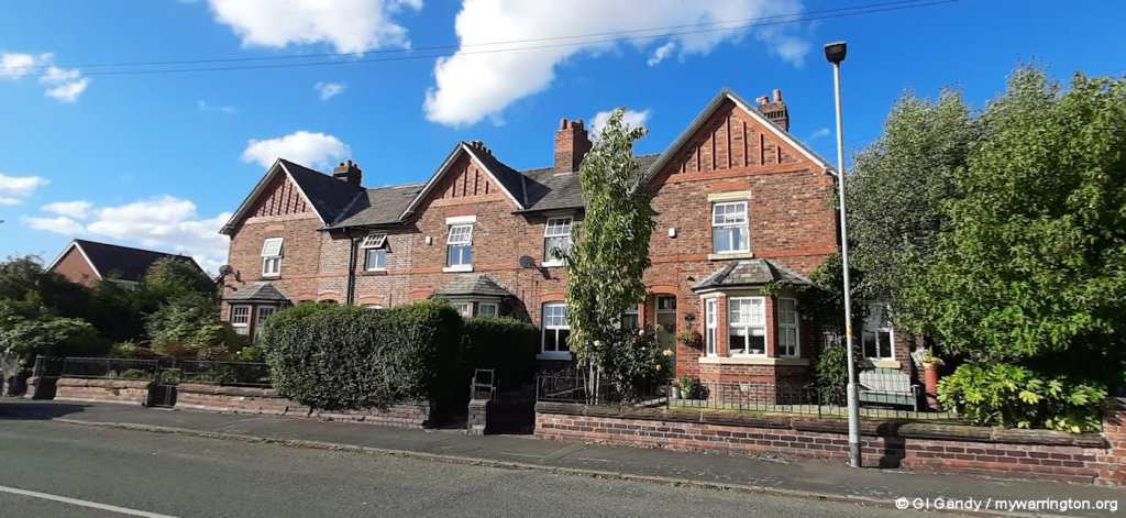
if you walk along Tannery Lane past the houses of Roeburn Way, you will come to a row of five cottages. These were homes for tannery workers and had their own allotment gardens. You’ll notice that the first in the row (no.37) has a small extension to the side. This cottage was occupied at one time by Mrs Richardson.
Across the road and further down from the cottages is a building (now Newspaper House) which housed offices on the ground floor and a lab upstairs – the window on the extreme left to be precise. Mrs Richardson used to cater for the office workers and the extension created space in her cottage for a large rectangular dining table; a rather homely canteen.
A fire in 1923 destroyed the central block of the tannery in which 75 of its 250 employees worked but it was rebuilt and a foundation stone was laid by Mrs Withinshaw.
The whole works covered an area of eight acres but the company owned around 30 acres of land and to this company Penketh owed its growth.
The firm provided homes for its employees and it looked after their social welfare. The tannery buildings were demolished and the site cleared in 1996/97 to make way for the modern houses you can see today.
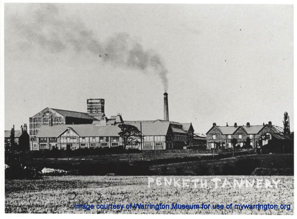
Penketh Tannery. Image used with permission from Warrington Museum.
Tannery Lane as seen on 19 Apr 2012
The tannery workers cottages with the small dining room extension on the right by the lamppost (as seen on 26 August 2025).
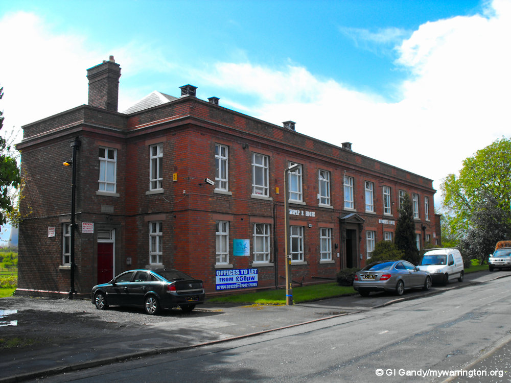
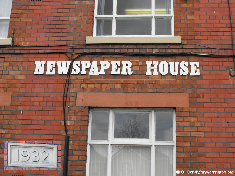
Newspaper House on Tannery Lane (19 April 2012)
The building above (known as Newspaper House at the time of my photo) was built in 1932. It housed the offices of Penketh Tannery, with labs upstairs.
The name Newspaper House is connected to the time when newspaper proprietor Eddy Shah had his base there for his Messenger Group newspaper publications in the 1980s and 1990s. Shah owned the Warrington Guardian at one time and also produced the national Today colour newspaper from 1986 to 1995. His printworks was at Winwick Quay. Read more of his profile in Warrington People.
I am also informed that Boultings used that building before moving to their present location in Chapel Road.

Tannery Lane at its junction with Widnes Road on 19 Apr 2012.
Information on Penketh Tannery and Newspaper House compiled with assistance from Mary Ross at Friends of Penketh Library, with a credit to the late Peter Rutherford.


Church Life
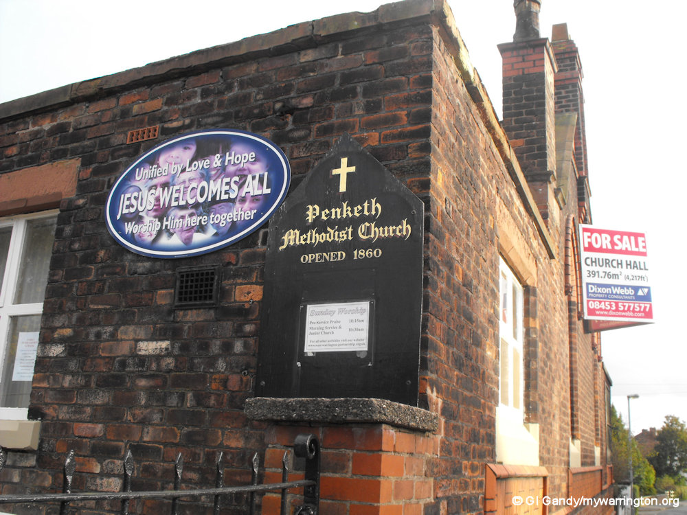
Penketh Methodist Church
Part of the parish of Prescot, with its Chapel of Ease at Sankey, Penketh had no Methodist chapel or society, although there was, of course, a society in Warrington.
However even at this early date, it seems there was at least one connection with Methodism: preachers had passed through the village and had been guests at the Gandy household. The first Methodist church in the district was located at the junction of Stocks Lane and Warrington Road, which opened on 30 May 1819.
Many alterations to the building have been undertaken over its lifetime. Gas was installed soon after it came to the district in 1891, with electricity following in 1926.

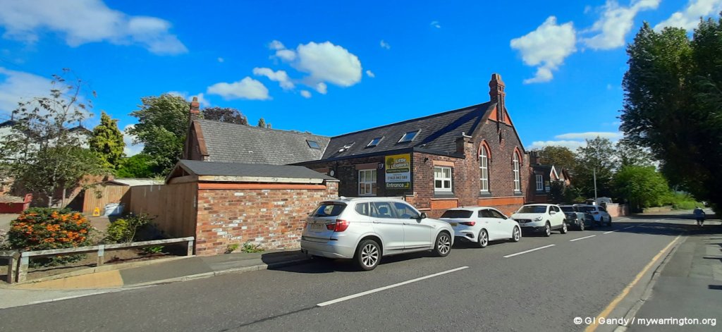
The 1860 building, now used by Little Explorers Nursery (photo taken 27 October 2010).
The Sunday School appears to have been formed in the early days, before the first Chapel, and was probably held in the farm which was used for services. Nothing is known of these early days except that William Gandy, a cobbler, was its superintendent until at least 1839 and that the children had an annual treat. An old register dated 1841 records that the classes were divided into “Bible”, “Testament” and “Spelling”.
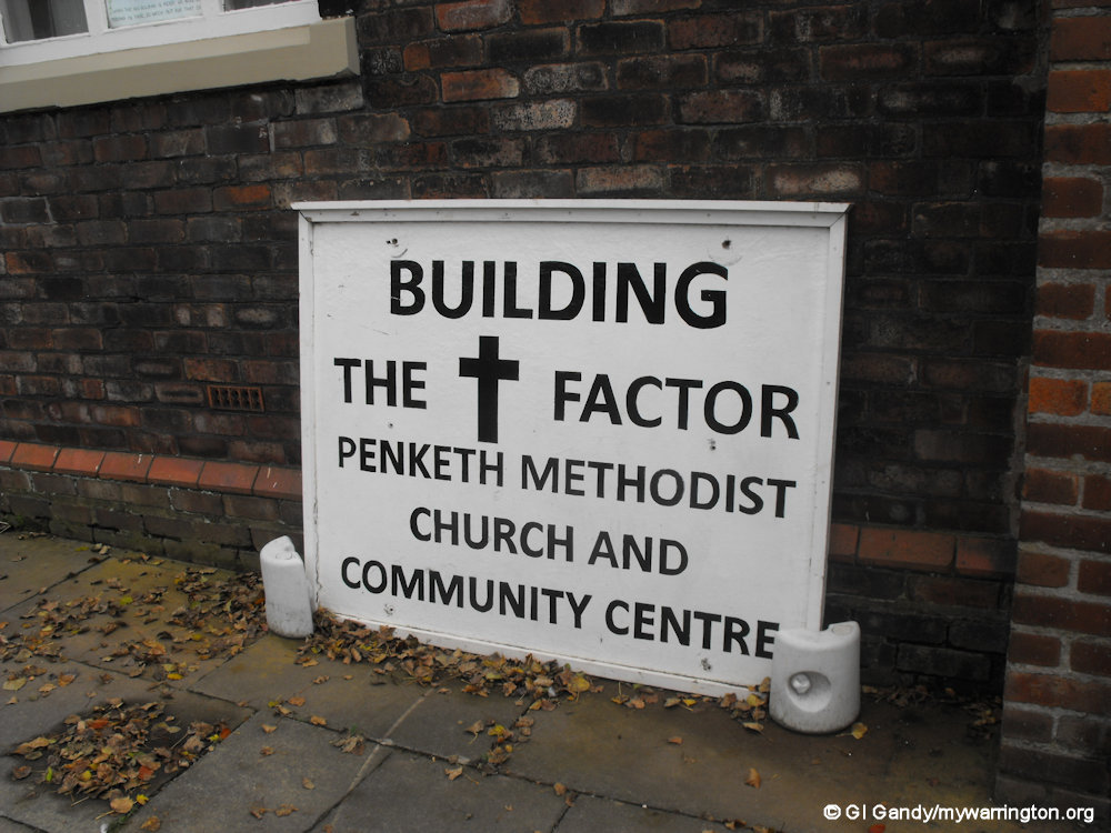
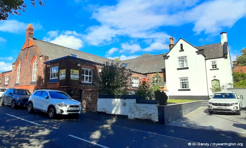
Penketh Methodist Church was rebuilt on Chapel Road and formally opened on 22nd November 1860 (the foundation stone being laid on 5th July 1860). That building is now Little Explorers Nursery.
A new church building incorporating the Olive Tree Community Centre opened in March 2011 alongside the old building. It was paid for with local fundraising and grants.
Another view of the 1860 building when it was up for sale (photo taken 27 October 2010).

More photos of the 1860 building (taken 10 October 2010).
More images of the older building in its new life as Little Explorers Nursery.

Little Explorers Nursery on Chapel Road (photos taken 26 August 2025
Below are images of the new building, which opened for worship in March 2011.


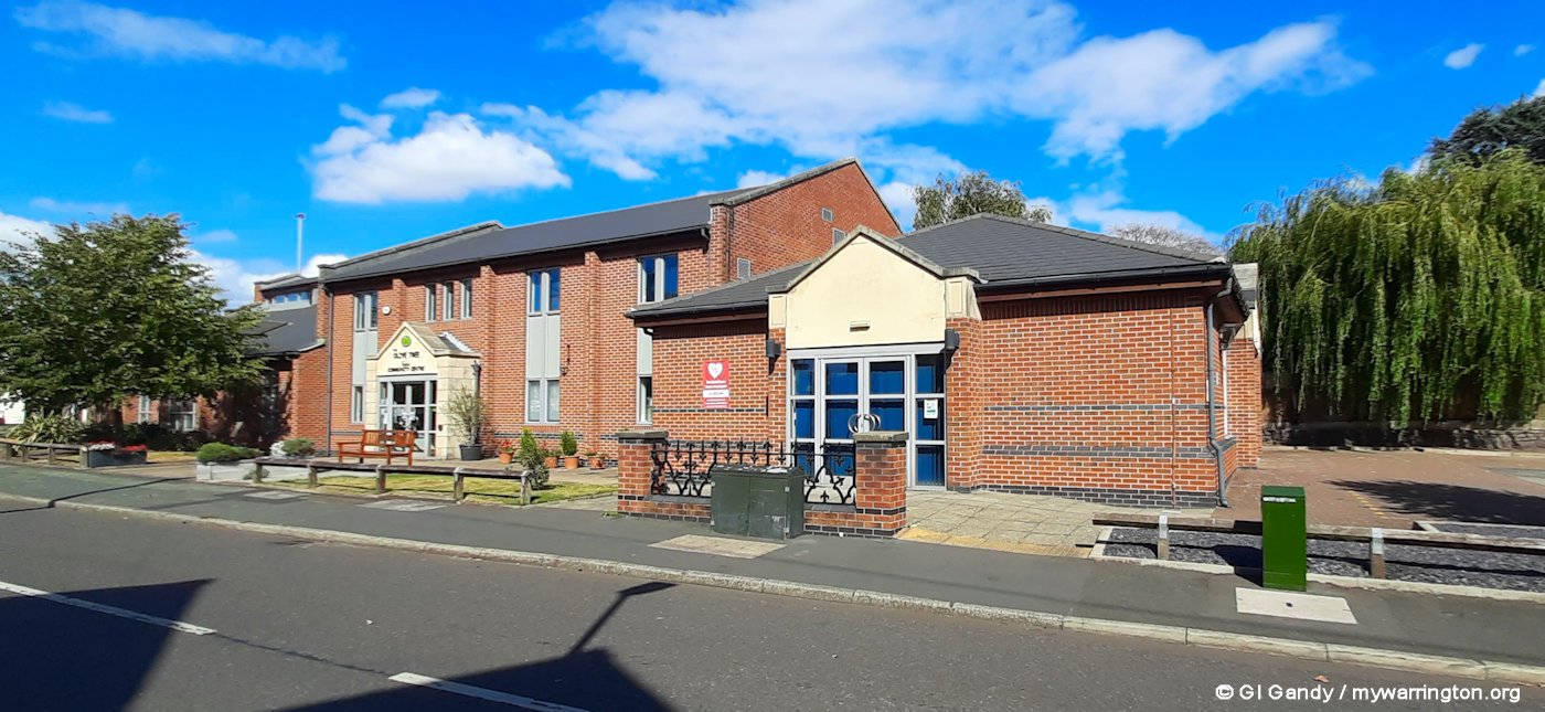

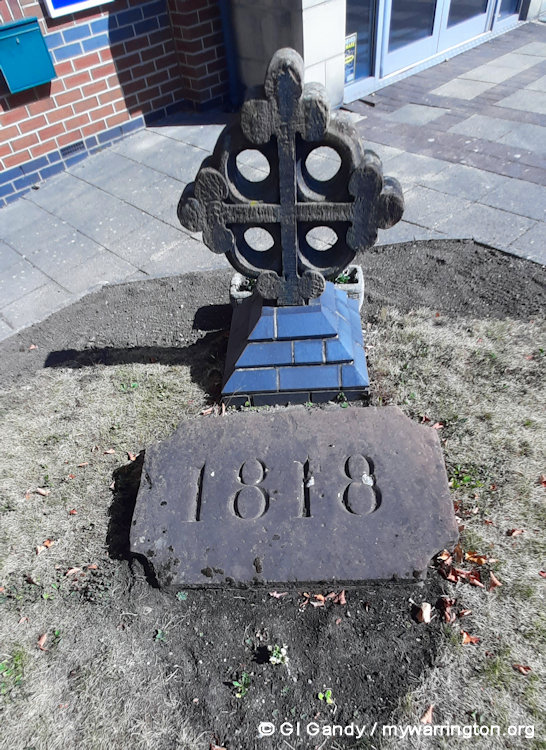

The current building under construction on 27 October 2010 (1st photo) and how it looks today (from all other images taken 26 August 2025, including the 1818 date stone from the original Stocks Lane chapel)
You can read a detailed history of Penketh Methodist Church on Penketh.com.
St Paul’s (Church of England)
St Paul’s Church of England, which also run the Oaks Centre on Stocks Lane, is built on the site of an earlier church of 1889.
The building in my first photo was dedicated on 29 July 1971. St Paul’s Church, Penketh became a separate parish on 3 January 1978. The congregation now worships in a modern building on Warrington Road, which was opened on 6 October 2019.
The Oaks Centre was originally Penketh Primary School until it was taken over by St Paul’s Church. The school was in use between 1908 and 1995.
The building in the photo is the original from 1971 and has now been replaced by a modern building on the same site.
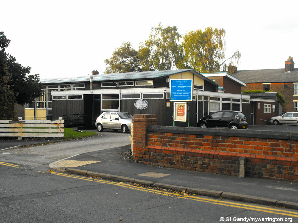
The original 1971 building, as seen on 27 October 2010
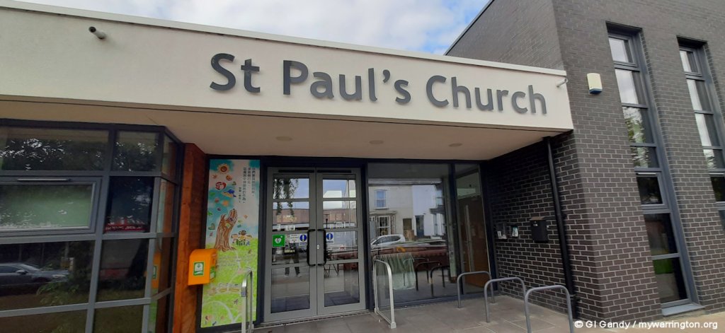
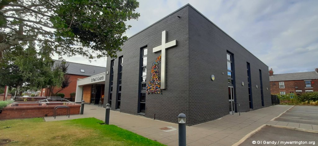
The replacement St Paul’s Church on the same site, which opened for worship on 6 October 2019. My photos were taken on 26 August 2025
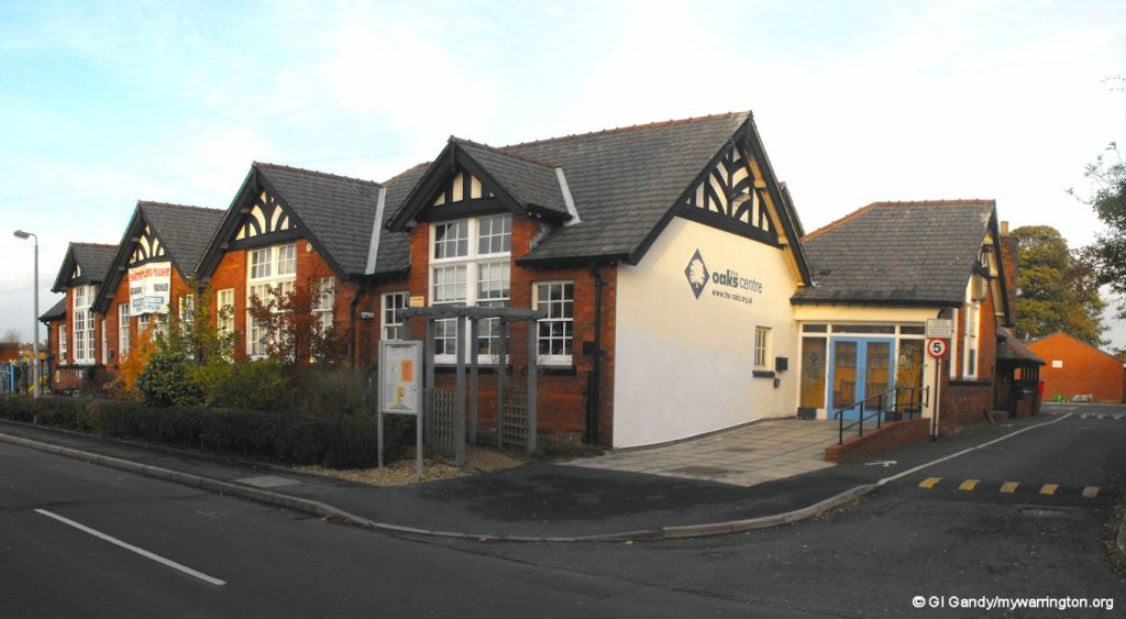

The Oaks Centre on Stocks Lane (27 October 2010)
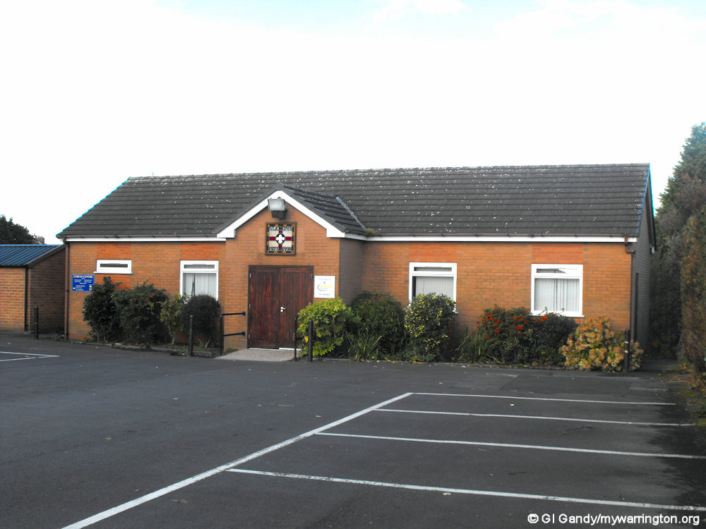
St Joseph’s Catholic Church
St Joseph’s Catholic Church is on Meeting Lane. The foundation stone was laid on 23 September 1923. Father Lonergan became the first resident priest in 1926. Extensions to the buildings were constructed in the later years.
The parish centre alongside the church can accommodate 180 people in the function room for events. See a timeline on their history here.

St Joseph’s Church, as seen on 10 October 2010.
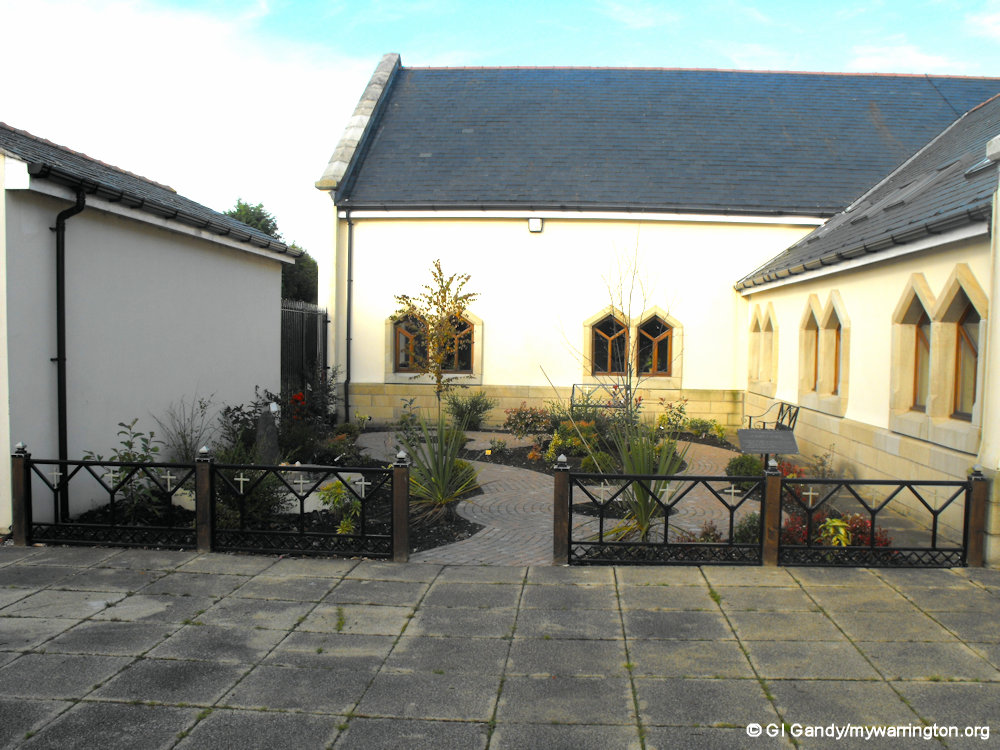
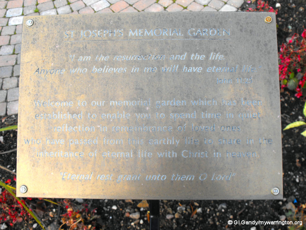
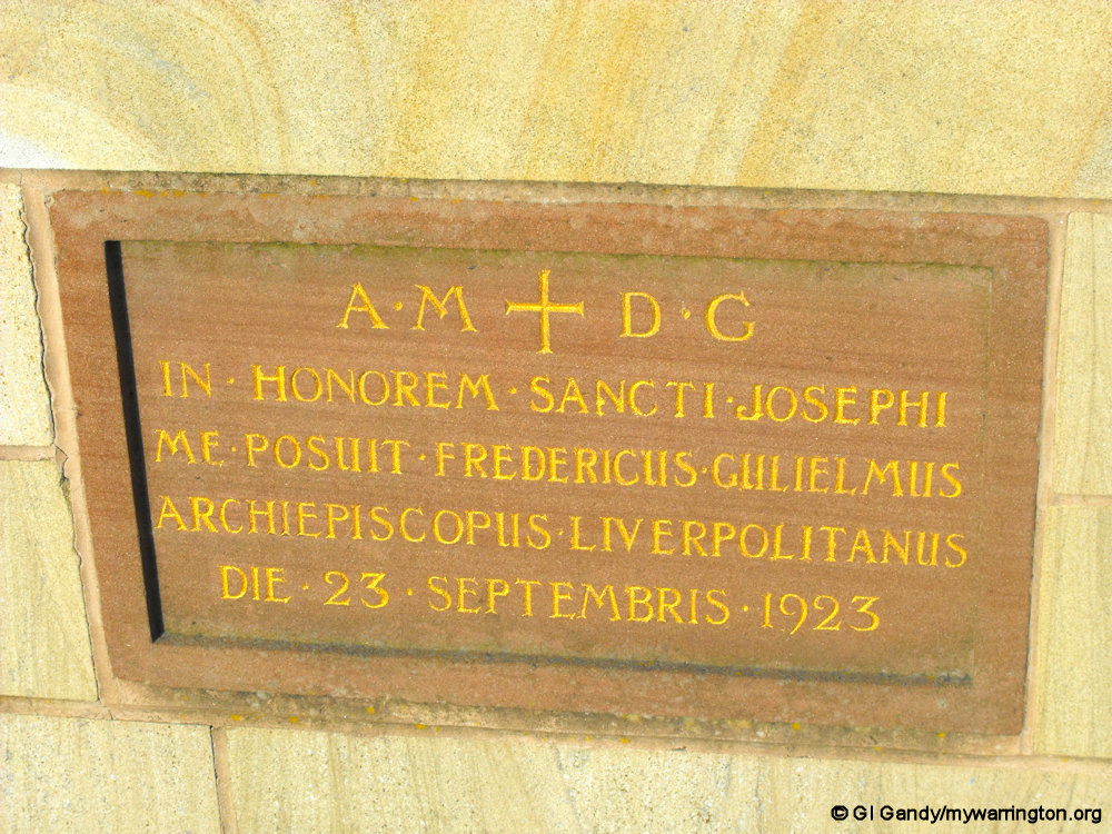


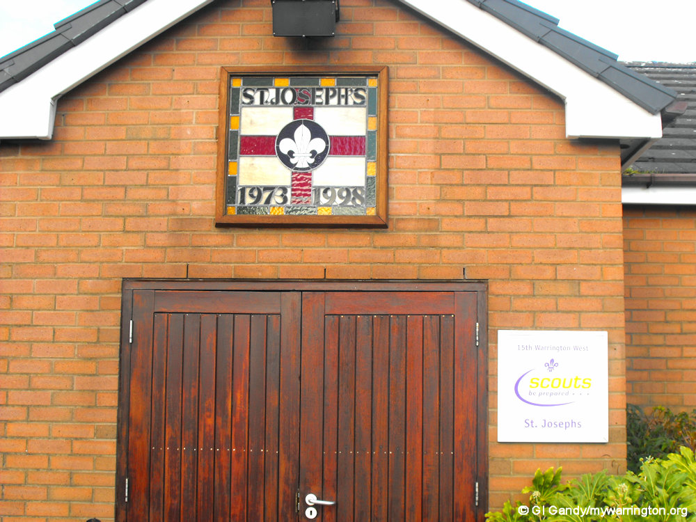


Views of St Joseph’s memorial garden, foundation stones, Scouts hut and parish centre (27 October 2010).
Quakers
Quakers, also known as the Society of Friends, are a Christian denomination that emerged in 17th-century England. They are known for their emphasis on direct, personal experience of God, equality and peace. Quakers believe in the “inner light,” the idea that God can speak directly to individuals without the need for clergy or rituals.
The Penketh Quakers were well represented in the village at one time. Their meeting house is the present Meeting Lane Community Centre on Meeting Lane. The original building had been established in 1671 and was licensed in 1689. It was rebuilt in 1736. I worked at the community centre in the 1980s when I was involved in community day care for the elderly.
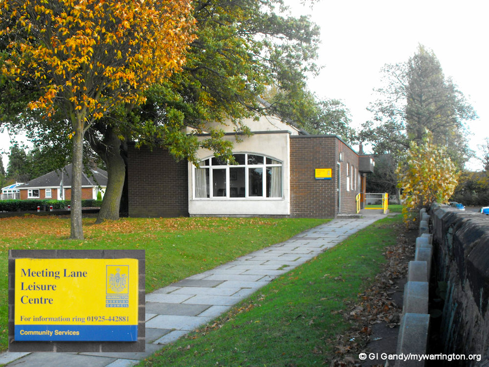
Meeting Lane Community Centre on 27 October 2010.

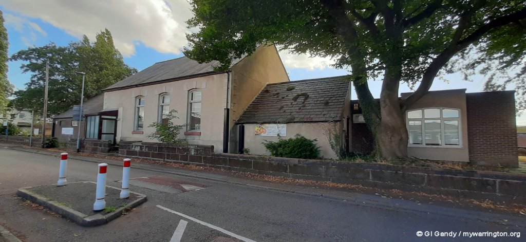
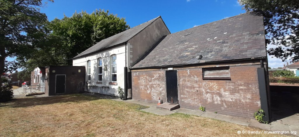

More images of Meeting Lane Community Centre as seen on 26 August 2025
School life
Quaker School
Next to the Meeting House on Meeting Lane was a Quaker school. Joseph Edmondson had been a teacher at the Quaker school. A Quaker named Gilbert Thompson had started a school in 1687, one of the earliest to have a recognised existence, probably at Barnes farm in Great Sankey (now demolished but it was close to Barnes Close and Barnes Bridge); he moved his school into the new building five years later. Children were sent to Penketh from all over the country, some becoming industrialists and physicians. Many were abolitionists, who campaigned for an end to the slave trade. Abraham Darby II, one of the most important figures in the Industrial Revolution, whose son built the Iron Bridge in Shropshire, attended this school with his brothers and sisters in the 1700s, only going home for the summer holidays.

Penketh Meeting House (on the left of the photo) with the Quaker school, which was established in the 17th century. The school was started by Gilbert Thompson who married the daughter of William Barnes of Barnes farm in Sankey, where George Fox preached twice. The school in Meeting Lane kept going for 191 years, finally being taken down in 1878. Greystone Lodge was built in 1878 next to the site of the original Penketh school in the same year the school was demolished. The copyright for the photo is unknown.
Information on the school from Mary Ross at Friends of Penketh Library.
Another early school in Penketh was The Friends School on Stocks Lane, which was founded in 1834. The road opposite, now called Friends Lane, was named as Dirty Lane on the OS Six Inch map of 1888-1915.
Methodist School
The school was built on Chapel Road in 1862, along with the schoolmaster’s house. The buildings were located next to the Methodist chapel and are still standing today. James Watson had been appointed as head teacher at the school in 1873.
It is known that at least five former pupils of this school lost their lives in the First World War and James Watson would have known each one. Whether the school master’s house was James Watson’s first home in Penketh is not clear, but the house’s first occupant was Benjamin Hobson, who is responsible for ‘Recollections and History of Penketh’ that can be found on the Penketh.com website.
Benjamin He was described as Chapel and School Keeper but he had many roles throughout his life in Penketh: upholsterer at the Garnett Cabinet works, Registrar of Births, Marriages and Deaths, agent for the local Friendly Society (a form of bank and insurance company) and in later life he had the intriguing title of Vaccine Officer. But he also held that most feared position, amongst children at any rate, of School Attendance Officer.
The former Wesleyan school and schoolmaster’s house next to the former Methodist church, as seen on 26 August 2025.
You can see another residence of James Watson when we get to the Chapel Road section of this page.
Primary Schools
There are four primary schools in the area.
St Joseph’s Catholic Primary
The original school was formerly opened on 16 November 1952. David Forrest’s A Warrington Chronology has addition information saying a St Joseph’s RC primary school opened to pupils on Walton Avenue, Penketh, on 22 August 1963, with an official opening on 14 September 1963.

Image: Google Maps
St Vincent’s Catholic Primary
Two schools are next to each other on Finlay Avenue. The first is St Vincent’s Catholic Primary School. The school opened to pupils on 10 January 1972.

Penketh South Primary
The second school on Finlay Avenue is Penketh South Primary School. The current building dates to 1985 with a nursery opening in 2007.

Penketh Primary Academy
Penketh Primary Academy on Coniston Avenue was originally known as Penketh Community Primary School (a feeder school for Penketh High School). The school converted to an academy in 2016 and is part of the Warrington Primary Academy Trust.

Image: Google Maps
Penketh High School
Penketh High School is a secondary school on Heath Road. It is a co-educational, non-denominational academy school for 11 to 16-year-olds. It converted from comprehensive to academy status in April 2013. In April 2018, Mr. John Carlin, one of the youngest headteachers in the United Kingdom, took the role of headteacher at Penketh.
The school has a partnership with Kwadeda High School in South Africa, who helped to produce a feature film called The Opportunity. This film was targeted at teenage audiences, to make them aware of HIV, drugs and other problems, that are high risk factors in South Africa. Read a report in the Warrington Guardian.

Pub Life
The Ferry Tavern
The current Ferry Tavern building dates back to 1762 when it became the first licenced pub in the district.
It was known as The Ferry Inn until it reopened after a fire in 1993.
You can read more on the Ferry Tavern on the Fiddler’s Ferry page where you can find out why it is so named.

The Ferry Tavern on 19 Apr 2012
The Red Lion
The Red Lion is on the corner of Warrington Road and Chapel Road. The original building dated to 1777. The old pub was demolished to make way for the modern dual carriageway. Also demolished were a pair of houses, a shop and house, a garage owned by Dick Edwards (Red Lion Auto’s) a butchers shop and a row of houses. The tenants of these houses had to get their drinking water from a pump at the rear.
The Red Lion is a very popular pub name due to its strong connection with British heraldry. It is often linked to the coat of arms of John of Gaunt, a powerful figure in the 14th century, and King James I, who became monarch of both Scotland and England.
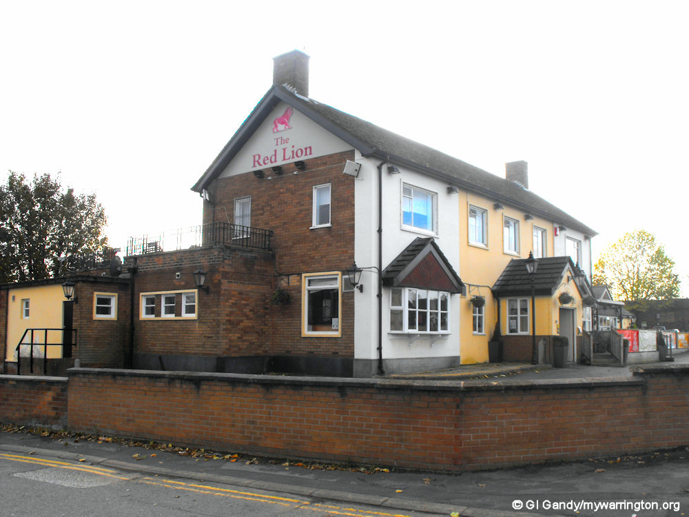


The Red Lion pub on Warrington Road (first three photos taken 27 October 2010, fourth one on 27 August 2025).
The Sportsmans Arms
The Sportsmans Arms dated back to 1846. The historic Warrington Road building closed as a public house in 2017, despite a lengthy campaign by residents to halt its closure.
Being part of Burtonwood Breweries during its lifetime, The Sportsmans Arms serves many quality lagers as well as the local Burtonwood bitter.
It was demolished in November 2024 to make way for a 56-apartment block, which will include a lodge, manager’s office, a reception area, communal facilities and guest suites.
The apartment block will be called Hobsons Lodge in honour of Benjamin Hobson.
A prominent local historian, Hobson served the community in the early 20th century and held the role of registrar of births, deaths, and marriages. Read more in the Warrington Guardian.
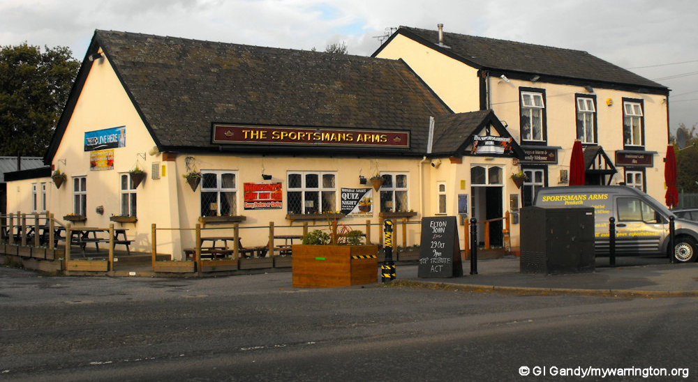
The Sportsmans Arms (27 October 2010)

Hobsons Lodge under construction (26 Aug 2025)
Close to the new development and opposite the Red Lion pub is Albion Villa which was built in 1877.
Warrington Road was a single carriageway until the mid-1960s when some buildings were demolished to make way for the dual carriageway of today. Before that time the village was a much quieter place.

Albion Villa in my photo from 27 Aug 2025
The Crown & Cushion
The Crown & Cushion is on Farnworth Road. There is a photo of the original building on Penketh.com.
There is a small beer garden to the rear of the building, but unfortunately there are no children’s play facilities.
My photo was taken on 21 June 2016.


Farnworth Road is the original route through the village connecting to Warrington Road before the dual carriageway was built in the 1960s. The properties here were built, left to right, in 1826 and 1912.
Around the Village
Honiton Way / Meeting Lane
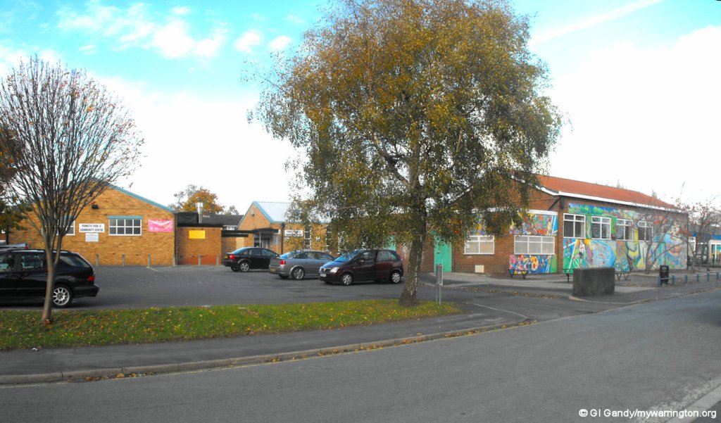
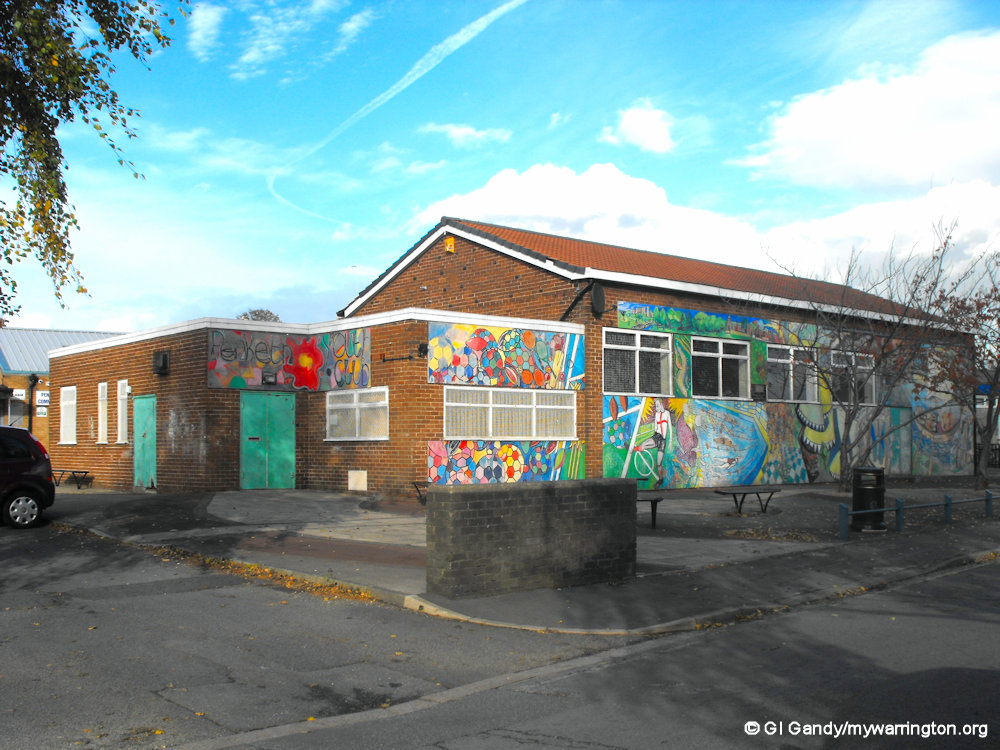
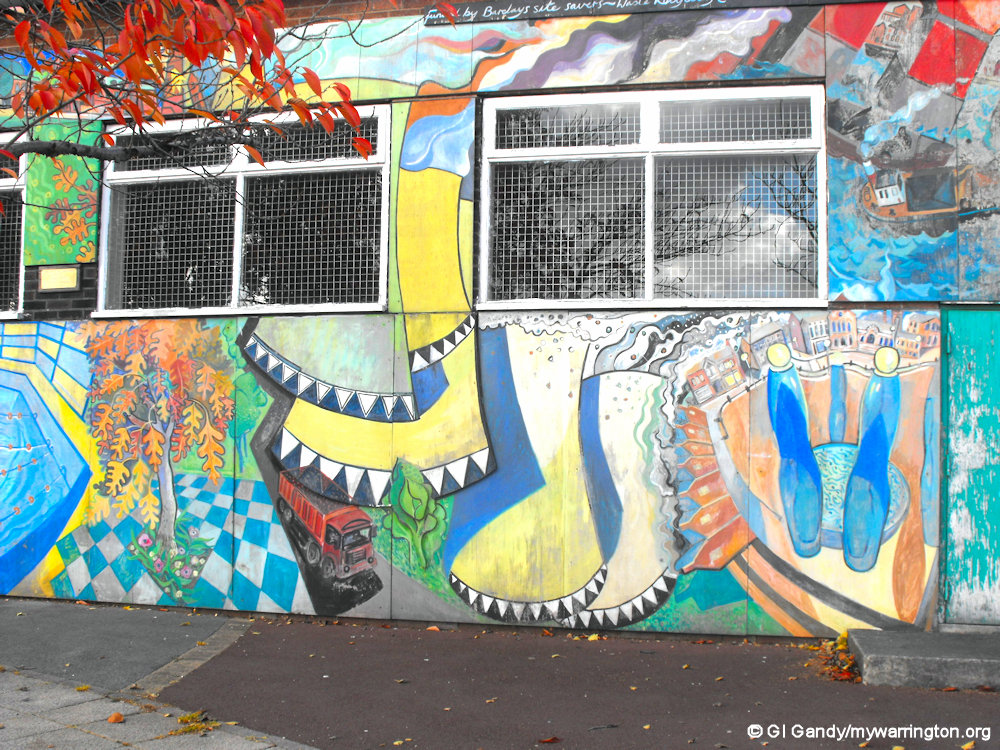
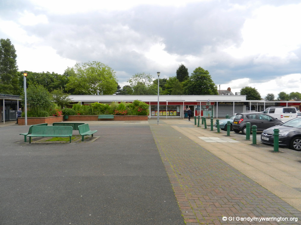
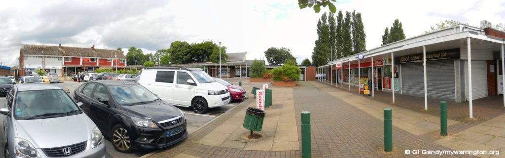
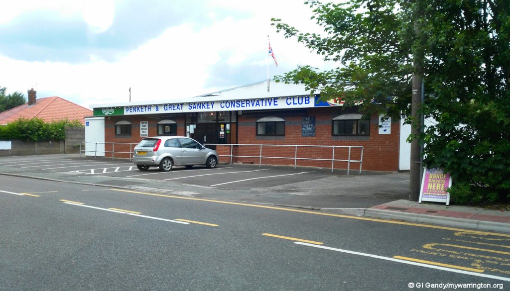
On Honiton Way you will find Penketh Pool and Community Centre, Penketh Youth Centre, Penketh Library, a war memorial outside Heathside home, Penketh Health Centre and Honiton Square shopping area, which is the location of the Post Office inside the Spar shop. On Meeting Lane you will find the Penketh and Sankey Conservative Club and the police station. The police station moved from Liverpool Road, Great Sankey, on 18 March 2013.


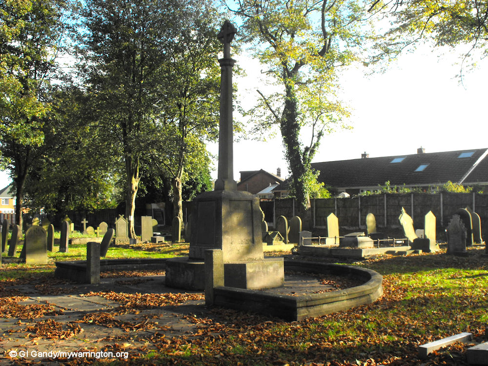
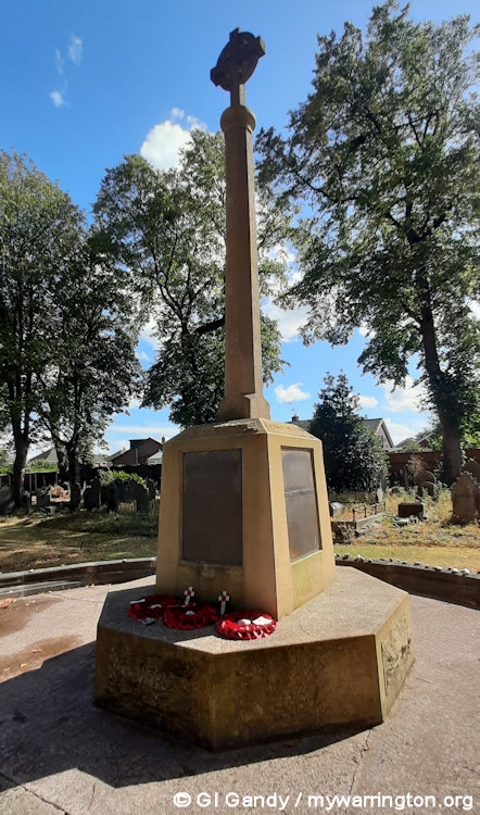
St Mary’s Road Cemetery
St Mary’s Cemetery is managed and cared for by volunteers from the Friends of St Mary’s Cemetery. In the grounds you will see some Commonwealth War Graves.
The Commonwealth War Graves Commission and its charity arm, the Commonwealth War Graves Foundation, is a worldwide organisation caring for war graves at 23,000 locations in more than 150 countries and territories. They commemorate almost 1.7 million individuals, ensuring that all the Commonwealth men and women who died during both World Wars are remembered in a manner befitting their sacrifice.
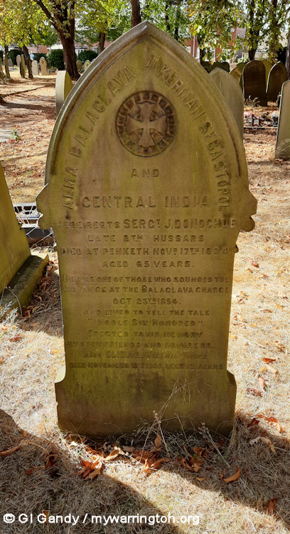
In the cemetery on St Mary’s Road there is a memorial to Sergeant J. Donoghue, who was one of the buglers at the Charge of the Light Brigade in the Battle of Balaclava on 25 October 1854. Read a bit more about him in the Lest We Forget page.
My photos were taken on 27 October 2010 and 26 August 2025.


Warrington Road
Warrington Road became a dual carriageway in 1965 as part of the preparation for Fiddler’s Ferry Power Station. Until then, the road was no wider than Chapel Road is today. Sadly, we lost some nice buildings, including the original Red Lion pub.
As you enter the village from the east along Penketh Road you cross over Whittle Brook, which is the name for a modern housing estate and district of Sankey.
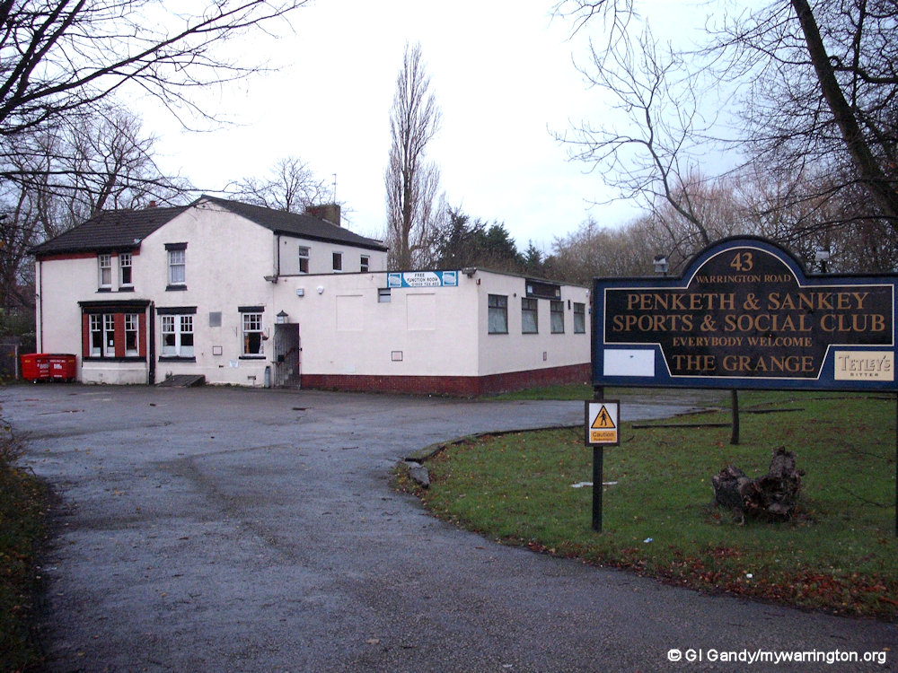
The first building on the right is Oliver’s Restaurant and Fagin’s Wine Bar. It was previously Penketh and Great Sankey Social Club at the time of my first photograph.
But even further back in time it was a private residence called Penketh Grange.

Whittle Brook at the boundary of Penketh and Great Sankey on Warrington Road (photo taken on 8 Dec 2011)

The Manna House
As we travel further along Warrington Road we come across The Manna House. This was originally a school opened in 1862 and was built by John Naylor and commissioned by Robert Gaskell in memory of Robert’s daughter, Margaret Anna who died aged 8 in 1859 of an ulcerated throat and John’s son, James, who died the following year from TB, aged 13. The school was closed in 1908 and since then the Manna House building has been used for many other purposes including a tea room and a meeting house. Until 18 May 2025 it was used as a function room for hire. A planning application was submitted to Warrington Borough Council in April 2025 to convert the building into a residential property.

The Manna House, Warrington Road, Penketh (26 Aug 2025)
Robert Gaskell’s brother, William, was a minister at the Unitarian Church in Cairo Street, Warrington, and was married to Elizabeth Gaskell, author of North and South and Cranford. Susan’s brother, Philip Carpenter, also a minister at Cairo Street, was a social reformer and campaigned to alleviate unemployment and ill health due to poor sanitation in the working classes. He believed that education should be available to all, men, women and children and not just the rich. He opened the (recently demolished) Industrial school in Cairo Street. Susan’s sister, Mary, also campaigned for social reform. She opened ragged schools and reformatories for ex-offenders and fought for women’s rights to higher education, supported women’s suffrage and the anti slave trade movement. Coming from such an active and principled family it is little wonder the Gaskells should want to contribute to the education of the children of Penketh, though this education came at a price – one penny a week.

The Manna House, Warrington Road, Penketh (31 Oct 2010)
Penketh House
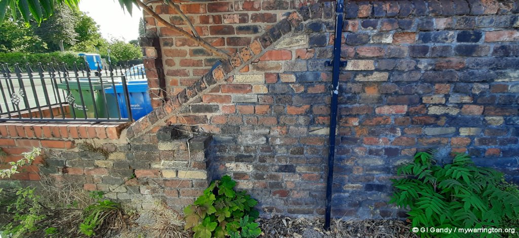
The Gaskell family lived in Penketh House, which was demolished in the 1930s. It was located on the corner of Greystone Road and Warrington Road. The family left the area soon after the school was built, going to live in Weymouth, Dorset, possibly to safeguard the family’s health.
Part of the western boundary wall can be seen at the side of O’Neill’s car park. A gatepost remains in Greystone Road, at the entrance to the passageway to Broad Oak Avenue. Robert and Susan did return to the area, to be buried alongside their eldest daughter in St Mary’s churchyard.
The images right and below show the gatepost and the boundary wall on 27 August 2025


Penketh Gardens
Directly opposite The Manna House is Penketh Gardens. On 2 June 2022 it was the location of a community event celebrating the Platinum (70th) Jubilee of Her Majesty Queen Elizabeth II.
The Warrington Guardian reported on the event, organised by Penketh Parish Council, which culminated in the lighting of the specially commissioned beacon to celebrate the Jubilee.
There was live music, a magician and face painting. The 15th Warrington West St Joseph’s Scouts provided refreshments.
At 9.30pm bagpiper, Dave Anwyl, played ‘Diu Regnare’ followed by bugler, Steve Higham, who played ‘Majesty’ announcing the imminent lighting of the four-metre high beacon, which took place at 9.45pm.
My first visit to the gardens was on 25 August 2025, the date my photos were taken.
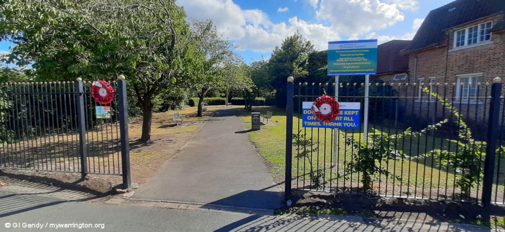

Penketh Gardens (25 August 2025)


Withinshaw Recreation Ground
The land for Withinshaw Recreation Ground on Warrington Road was donated by the Withinshaw family to the people of Penketh, thus keeping the name of the one-time owners of Penketh Tannery alive in the village.

Penketh Tennis Club
Penketh Tennis Club is located on Hall Nook. Originally there were three grass courts on the site. The first courts were installed in the 1920s.
The courts belonged to Southlands, which was a grand mansion, the home of Mr. and Mrs. Aitken. After Mr. Aitkin died, the house was given to the Salvation Army and used as an elderly person’s home. For more on the tennis club’s history, see their website.

Well Lane
On Well Lane is the property called Greenway. This house and the one attached to it (round the corner in Poplar Avenue) was once called Brookside, the home in 1871 of Robert Garnett Jnr, a furniture maker, his wife and family, including his daughter Helen. Robert, a teetotaller, was unhappy that Penketh had a brewery so it is said he acquired it and closed it down.
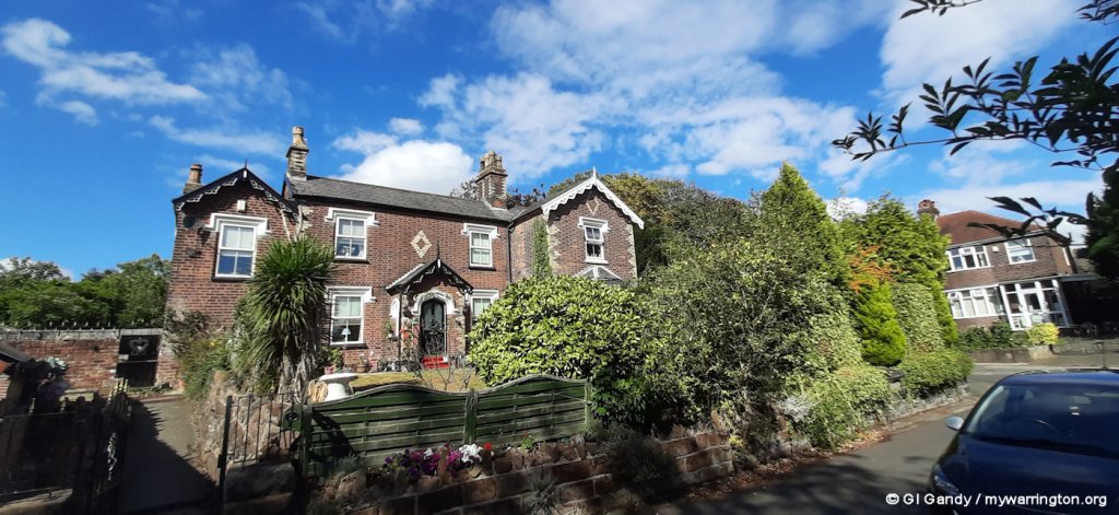
Greenway, Formerly Brookside (seen on 26 Aug 2025)
A young Scot, Charles Edward Parker, 25, along with his uncles William and Edward Walker, took over the site and formed the Penketh Tanning Co. Ltd. in 1882. This was a momentous time for Penketh, and for Helen Garnett, who became Mrs Parker in 1886.

Another view of the former Brookside (behind the trees unfortunately) with Well Lane and Poplar Avenue in the foreground – as seen on 26 Aug 2025
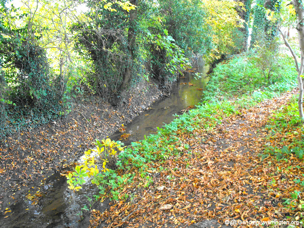
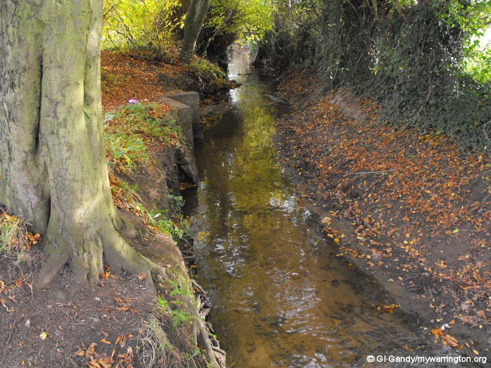
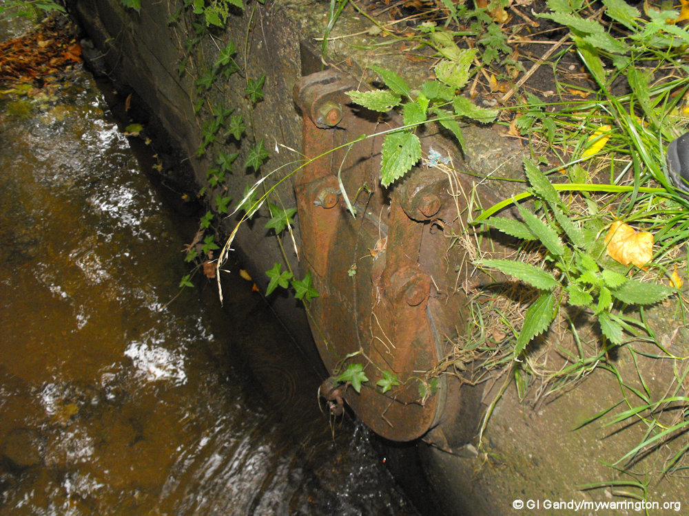
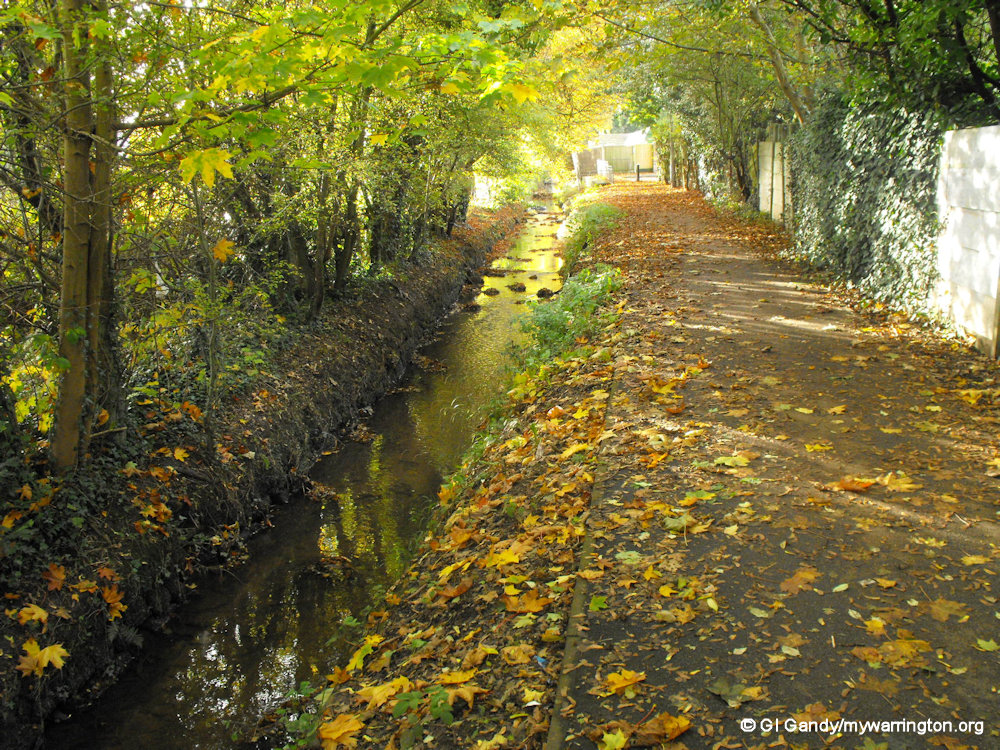
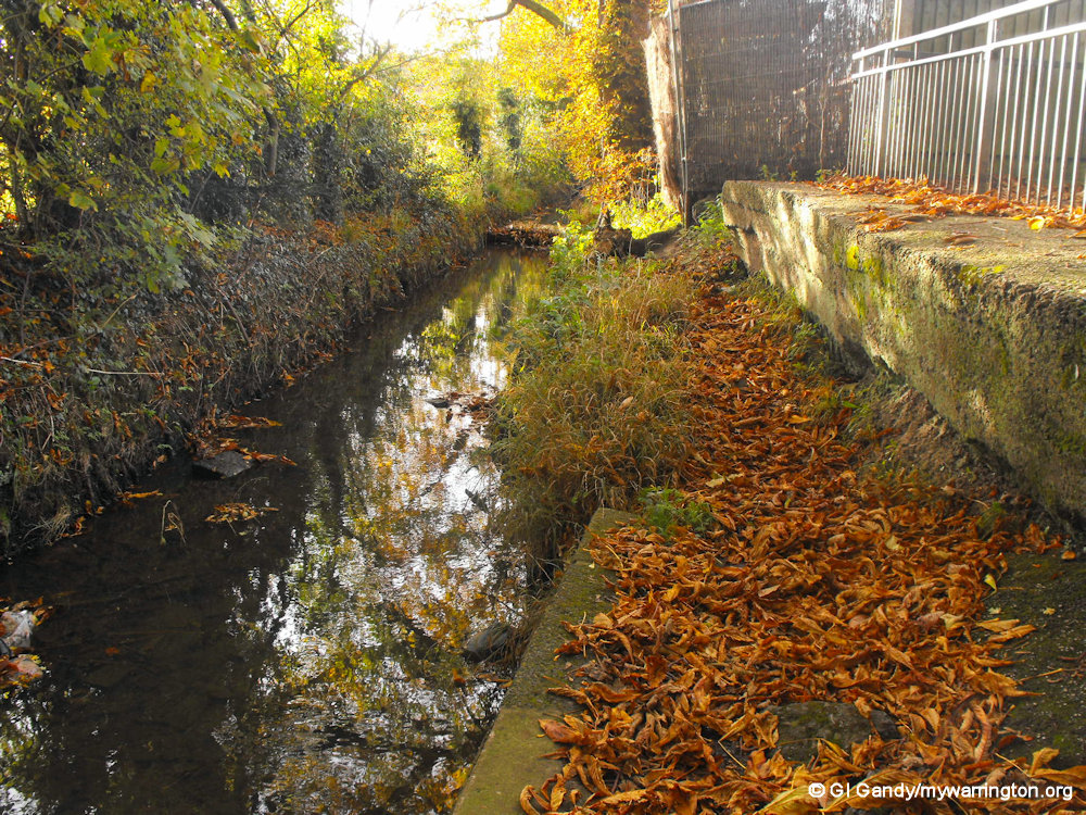
Get in touch with nature by taking a walk along Penketh Brook by Well Lane. My photos were taken on 27 October 2010.


Chapel Road
We have already looked at Penketh Methodist Church, after which Chapel Road gets its name.
As we walk further along from Well Lane around the bend in the road we come to Heathfield, formerly Greystone House, which by 1901 was the home of John Gibson Withinshaw, born in Newcastle under Lyne, who at 29 was Managing Director of the Tannery. Continuing around the bend we pass Ditchfield Road (with Finlay Avenue off it to reach St. Vincent’s and Penketh South primary schools).

Heathfield, formerly Greystone House, home of John Gibson Withinshaw (photo 27 August 2025)
Next door to Heathfield past Ditchfield Road is The Mount, a house built in 1888.
The Mount, seen on 27 Aug 2025
On the opposite side of the bend, we can see Halton View and further along the road, almost opposite the white Greystone Cottage, there is a pair of semi detached houses (built in 1888).
The one on the left bearing the name Fir Bank, which was the name of the whole building when it was a single dwelling. In 1891 this was the home of James Watson, his wife and eight of their children. Ten years earlier, the Watsons had lived at Halton View.
James had been appointed as head teacher at the Wesleyan school further along Chapel Road that we saw earlier, situated next door to the Olive Tree car park, in 1873. The school was built in 1862, along with the school master’s house.
Fir Bank (left) and Halton View (behind the lamppost) on 27 Aug 2025

Halton View on 27 Aug 2025
Continue along Chapel road, we pass Greystone Cottage in what was once part of Cobblers Square.
Members of the Gandy family lived on the Square and were shoemakers before the Tannery opened.
See Cobbler’s Square on the National Library of Scotland OS map.
This family has an interesting story that you’ll find at www.gandyfamily.se/the-village-of-penketh.
And yes, I am related to the family. There were two strands of the Gandy family, one from Lancashire and the other from Cheshire. I believe I am from the Lancashire strand, having been born in Warrington.
If I remember correctly, Doug Gandy from the Mersey Street shop was my grandad’s cousin, but I have not gone into it in any detail so far. It is in my schedule!

Location of Cobbler’s Square, now occupied by modern housing (my photo 27 Aug 2025)

A view of Highfield, a house built in 1893 opposite Falmouth Drive. (my photo 27 August 2025)
Back to the opposite side of the road, past Falmouth Drive, and you will reach Vine House. The original house, Vine Cottage, is long gone; this replacement being built in the 1920’s. It was once the home of Robert Garnett’s father. By 1891, Charles Parker was living here, with his wife, Helen and their daughter Helen Mary.
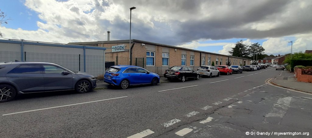
Next door, on the site now occupied by BGEN, the current name for Boultings, was Garnett’s cabinet works, which, by 1909 had changed its function and title to the Penketh Leather Manufacturing Co. (originally part of the tannery company) producing leather soles. There were cottages for the workers opposite the building.

Vine House, built in the 1920s to replace Vine Cottage. The house was in use as Springwood Nursery until July 2023. Thanks to the current owner for permission to step onto his land to take the photo (27 August 2025).
Joseph Leigh, who lived on Warrington Road (near to the Co-op), worked his way up through the tannery to become managing director of what was known for a long time as The Cutting Shop.
The Boulting Group started out in 1918 and have extensive experience delivering mechanical and electrical engineering services plus instrumentation and electrical control systems to various industrial sectors. At one time they occupied what became known as Newspaper House on Tannery Lane. Read more in Grace’s Guide.
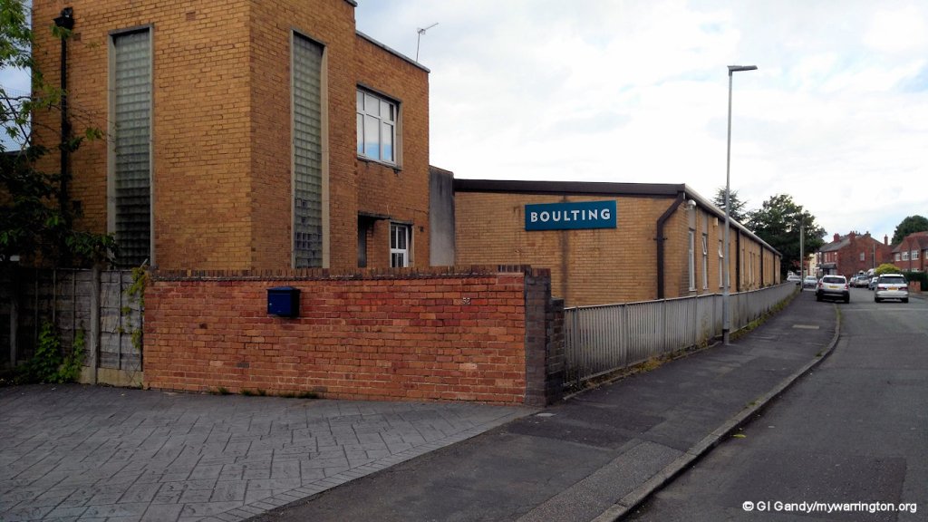
Boulting Group, now BGEN on Chapel Road (photo taken 21 Jun 2016)

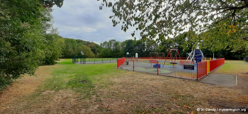
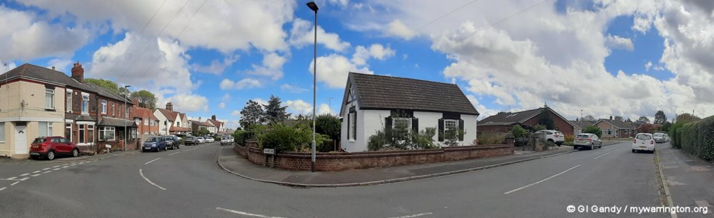
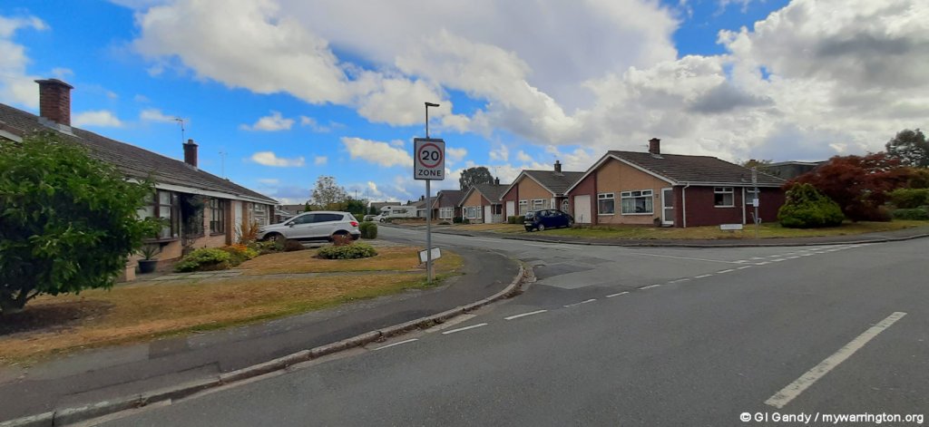
The Park
The Park can be accessed from two directions. One is from the A562/A5080 roundabout. The second point of entry is from Station Road at its junction with Chapel Road. Walk into the Park from Station Road and imagine only the old houses here along two sides of a large ‘square’. By the 1930’s 35 houses, including the bungalows (built in 1931), had been built for the tannery workforce, some with two bedrooms and no bathroom but others with three bedrooms and a bathroom.
The beams in the central block of houses to your right are iron, (some rivets are visible) produced by Dorman Long, the company that built the Runcorn and Sydney Harbour Bridges. Some still have original features, wood wall panelling and parquet floors. Each had a small yard and an allotment garden. The first to be built, by 1890, were those houses now numbered 25-35, originally 1-11 and named Park View; and what a park!
On the area bounded by the houses were three tennis courts, two lawn and one hard court. There was a cricket pitch and a retired railway carriage was brought in as a pavilion and changing room facility. The jewel in the crown was a dance hall and social club, complete with sprung floor, perfect in later years for Penketh ladies to dance with the American servicemen stationed at Burtonwood.
Behind the houses on the north side of The Park was a reservoir (one yard houses a pump for this) which doubled up as a swimming pool; the bowling green and nature reserve remain.
The bowling green is now owned by Penketh Bowling Club. Their website tells us there has been a bowling green at Penketh Park for over 100 years. It was once part of the many sports facilities provided by the tannery.
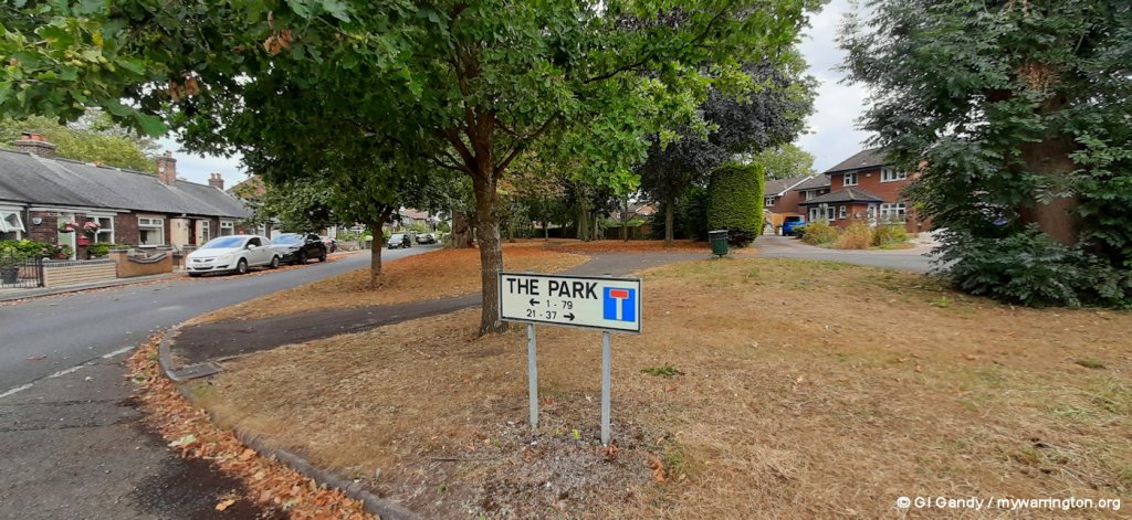
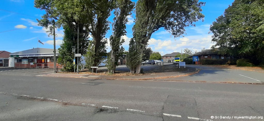
The Park from the roundabout end on 26 August 2025
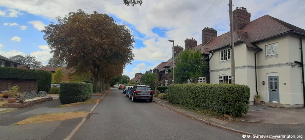
The Park from Station Road end on 26 August 2025

Penketh Bowling Club is at the north-western corner of The Park close to the dual carriageway and roundabout. Seen here on 26 Aug 2025.
Station Road
As we come to the end of Chapel Road and arrive at Station Road, on the left you will see a white building. This was originally Day Star, a school which provided education for around 40 workers’ children but was also used for evening lectures and meetings. Also, while the new Wesleyan Methodist church and school were being built further up Chapel road, it was used for Sunday services and Sunday school.
Day Star refers to Venus, literally ‘Light-bringer’ often used in a religious context.

The former Day Star school on 27 Aug 2025, in use today as a private residence.
Panoramic view of Chapel Road (left), the former Day Star school (centre) and Station Road (27 Aug 2025)
Further along Station Road, just visible in the panoramic view above, you will notice new houses on the left past the vehicles.
As you walk along Station Road you approach Radlett Close on your left. The land now occupied by housing was once a football and rugby pitch. This was for the use of the tannery workers, one of the recreational facilities provided for the staff.
Walking further along Station Road, opposite Rothay Drive, you will come to the wall surrounding Briarfield. In the 1920’s John Withinshaw’s son, Hubert, who became the tannery’s general manager and eventually managing director, lived here.
Radlett Close, location of the football and rugby field (27 Aug 2025)
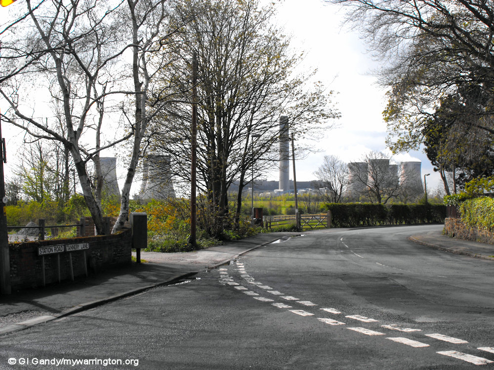
As we approach its junction with Tannery Lane, Station Road bears off to the left to the site of the Fiddler’s Ferry and Penketh railway station on the Garston and Warrington Railway (G&WR) which was opened by the St Helens Canal & Railway Company on 1 February 1853. On 4 August 1853 the G&WR changed its name to the Warrington and Stockport Railway (W&SR). The line was also used to transport coal to Fiddler’s Ferry Power Station until that electricity generating station closed on 31 March 2020.
The power station site will be redeveloped once the demolition programme is completed. Four of the eight towers were demolished on 3 December 2023.
There are plans by the government to reopen the railway line as an express route from Liverpool to Manchester Airport. A date for that has not been set.
Station Road also leads to Fiddler’s Ferry Yacht Haven and the Ferry Tavern public house. Read more details about the railway line in Making Tracks.
Across the road from the stationmaster’s house is Woof Woof Meadow, a dog-training facility.

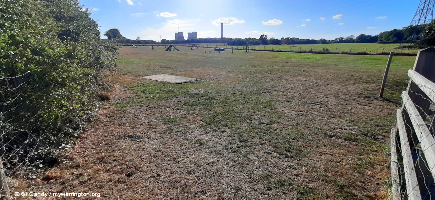
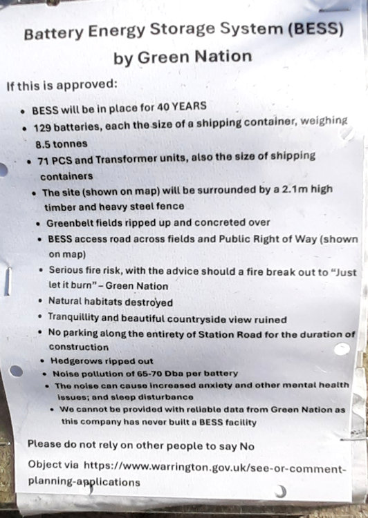
At the time of writing, there was a campaign by locals opposing a Battery Energy Storage System (BESS) on land close to Station Road.
A planning application is now with Warrington Borough Council and the date for objections closed on 25 August 2025.

The original stationmaster’s house is now a private residence (photo taken 19 Apr 2012)

Back to the junction of Station Road and Tannery Lane. A low stone wall surrounding Roeburn Way is all that remains of a house known as Penketh Lodge, which by 1901 was the home of Charles and Helen Parker and their children. Needless to say, the tannery owners and managers employed many local people as domestic servants, gardeners and grooms at their beautiful houses.


All that remains of Penketh Lodge is the boundary wall.
The land behind it is now occupied by modern housing on Roeburn Way.
My photos were taken on 27 August 2025.
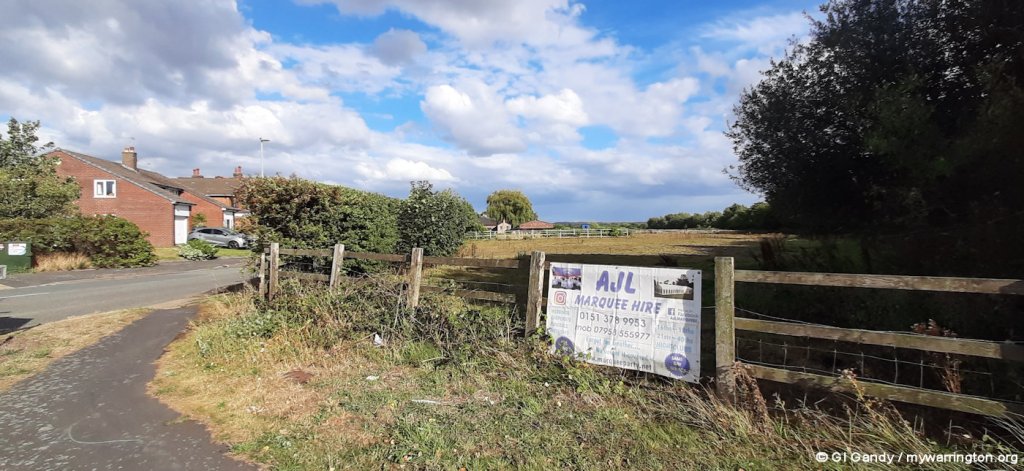
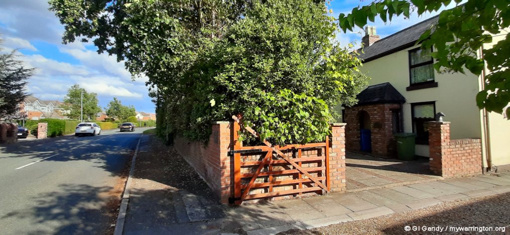
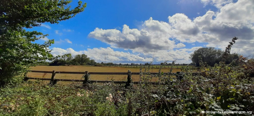
Way Out West
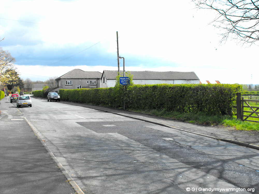
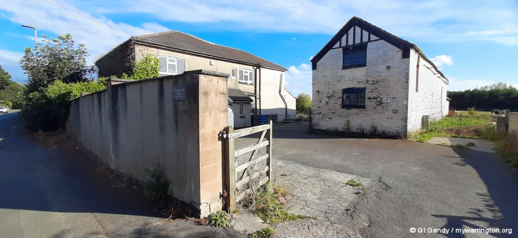
To finish off in Penketh, let’s have a look at some photos from the extreme west of Penketh. In fact we go into Cuerdley because Penketh Fire station (which opened on 2 February 2017) is between True-Fit Golf Centre and the former Fiddler’s Ferry Power Station. There are also a couple of farms along Tannery Lane and Widnes Road.


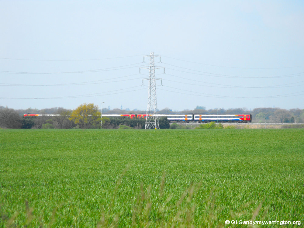
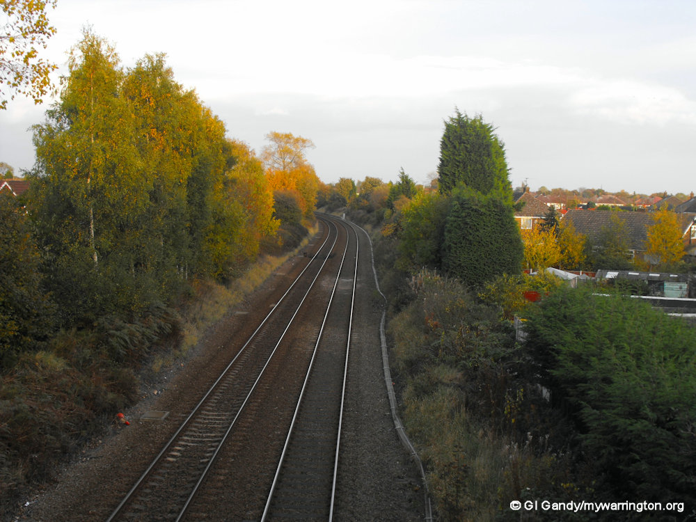
Another railway close to the village is the Cheshire Lines Committee railway line, which opened in 1873. It is currently used by Northern Trains, East Midlands Railway and TransPennine Express companies.

Don’t forget Penketh.com for even more on the village history. Find out, for instance, which business used the site of the Co-op on Warrington Road before Kwik Save. See where Penketh Windmill used to stand. Learn where the original Penketh fire station was located. Discover where the village post office once stood. And that’s just for starters.
See also Friends of Penketh Library. They are also on Facebook.
Penketh Parish Council has old photos of the village.
Doe Green
Doe Green lies between Cuerdley and Penketh by the roundabout junction of the A562 and A5080. A group of farms in the area includes Clock Lane Farm, Fowl Farm, Brook Farm, Brook House Farm and Woods Croft Farm.
There is a sports ground to the north of the dual carriageway, west of the roundabout, accessed from Beach Avenue off Cuerdley Road. The sports ground is home to Penketh United Football Club. The boundary point of Warrington, St Helens, and Halton districts is the railway bridge on Farnworth Road (A5080 to Liverpool).

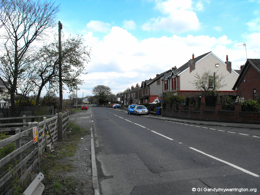
Cuerdley Road (left) and Farnworth Road (photos taken 19 Apr 2012).